UTOPIA
Queens
Geographic Setting
Bounded by Union Turnpike to the south, Utopia Parkway to the west, 73rd Avenue to the north, and 188th Street to the east, Utopia forms a small, serene residential enclave in central Queens, nestled between Fresh Meadows to the east, Pomonk and Hillcrest to the west, and Jamaica Estates just beyond its southern border. Though modest in size, Utopia’s name and origins give it an outsized symbolic resonance—a neighborhood born from the literal pursuit of an ideal community.
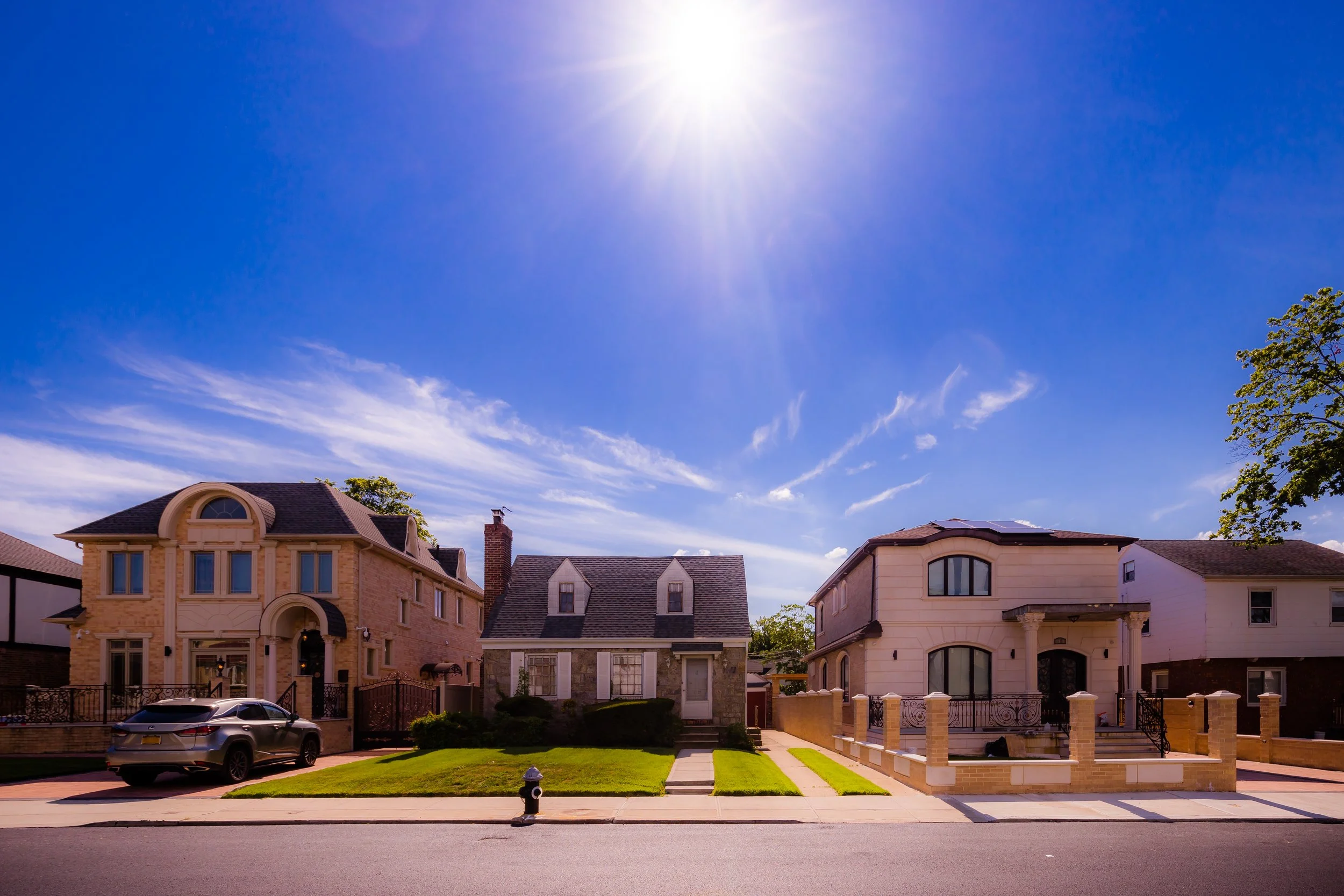
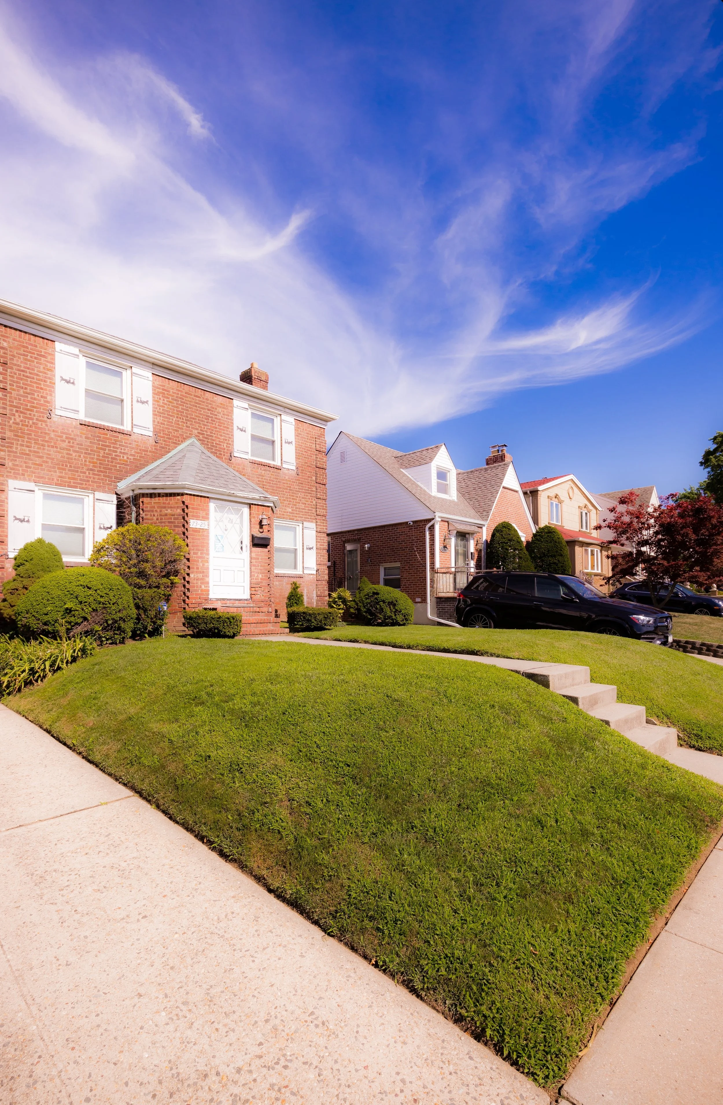
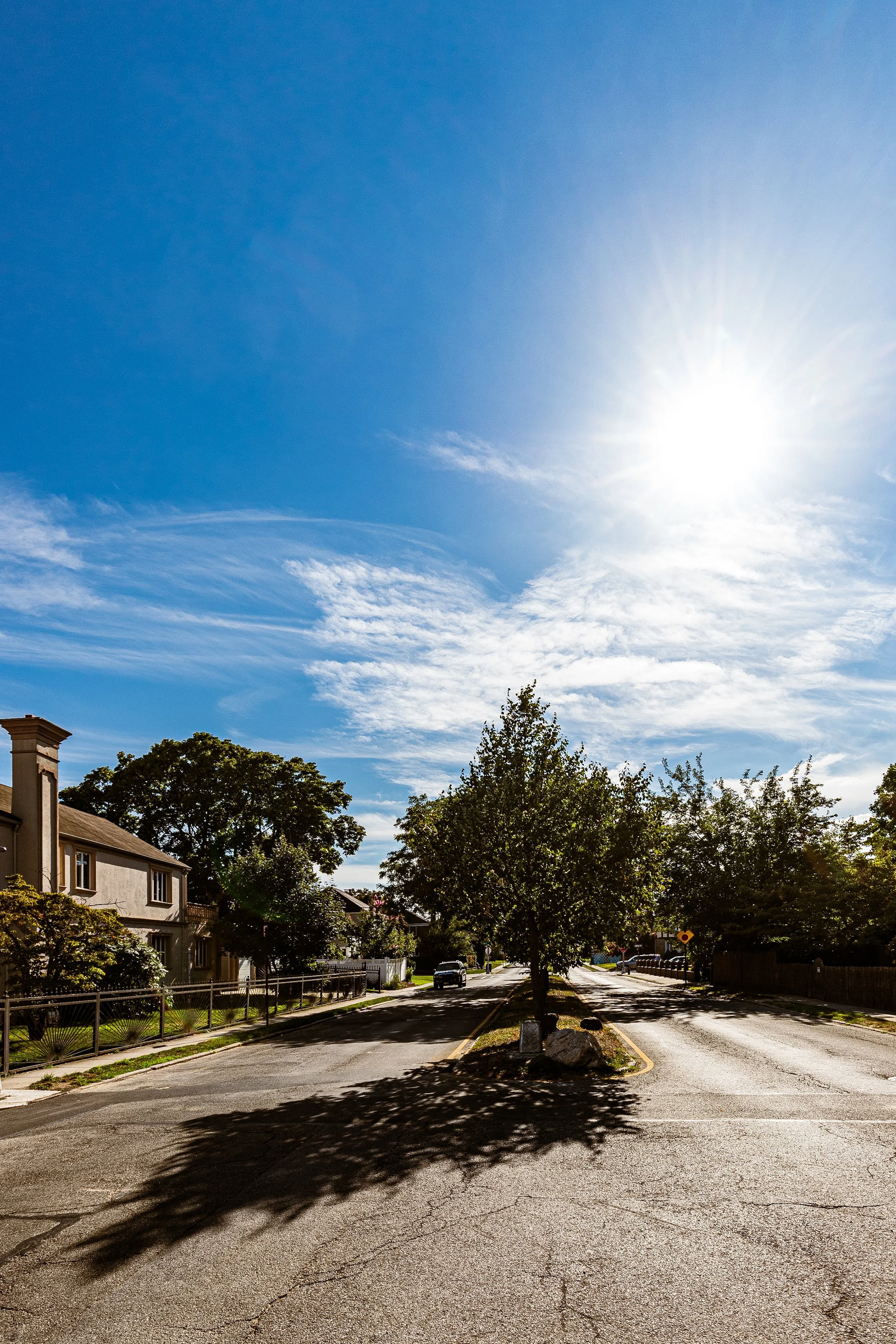
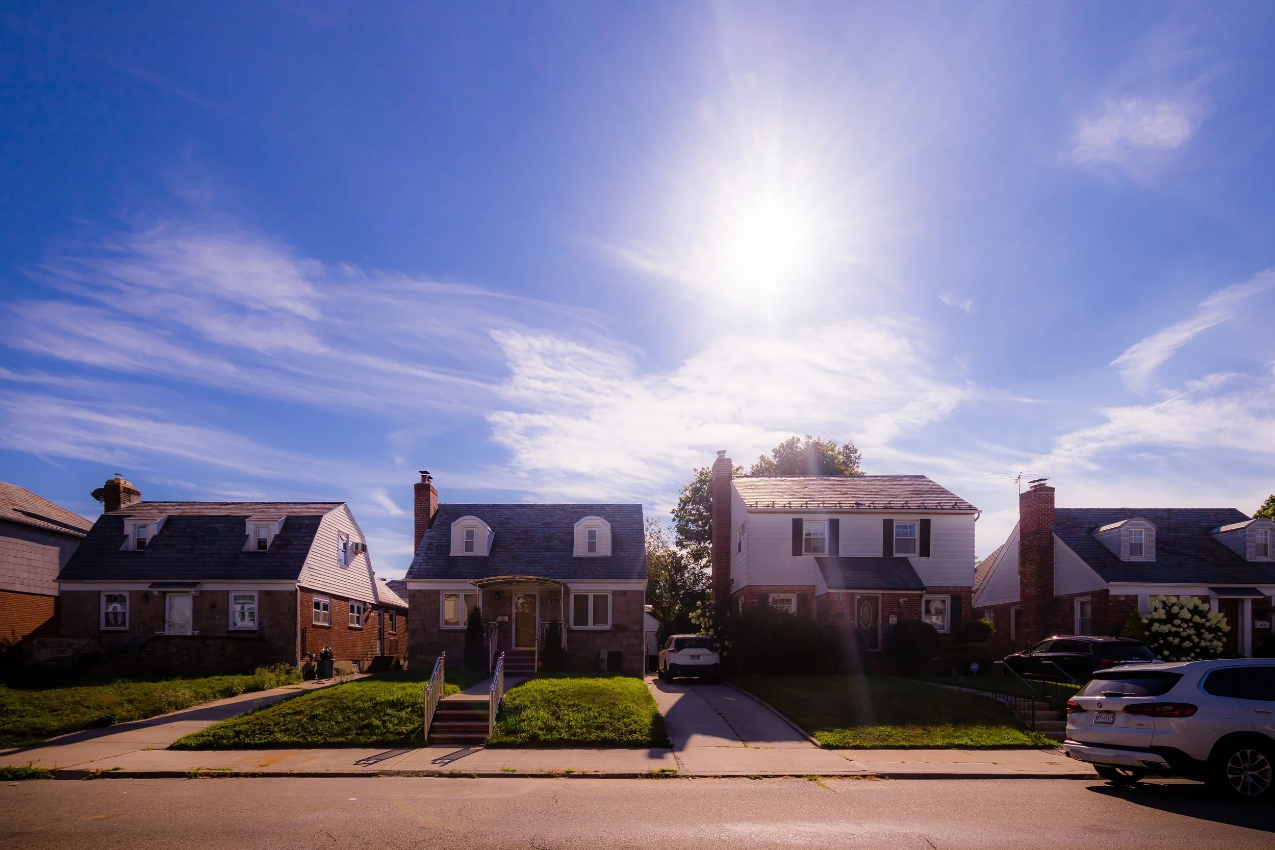
Today, the area is characterized by tree-lined streets, single-family brick and Tudor-style homes, and well-kept lawns, arranged along a gentle grid that slopes toward Union Turnpike. The neighborhood’s main spine, Utopia Parkway, bisects it from north to south, linking it to Kissena Park to the north and Jamaica Estates to the south, while nearby St. John’s University and Queens College lend a collegiate influence. The quiet streets—73rd Avenue, 75th Avenue, and 77th Avenue—reflect the mid-20th-century suburban ideal: privacy, stability, and close-knit community life within the orbit of New York City.
Though its borders overlap with those of neighboring Fresh Meadows, Utopia retains a distinct identity, one rooted in its unusual history and the enduring symbolism of its name.
Etymology and Origins
The name “Utopia” traces back to a visionary but unrealized social experiment of the early 20th century. In 1903, a group of Jewish social reformers and intellectuals—many affiliated with cooperative housing and labor movements—conceived plans for a utopian farming community in this part of central Queens. Their goal was to create a self-sustaining, egalitarian settlement where working families could live affordably, cultivate the land, and share in the fruits of communal labor.
The plan, dubbed the Utopia Land Company Project, called for the development of cooperative farms, schools, and common facilities, but it collapsed before construction began—undone by financial difficulties and the challenges of transforming the area’s remote, unpaved farmland into a habitable settlement.
Although the dream faded, the name endured. Utopia Parkway, the principal road envisioned for the project, was built in the following decades and gave its name to the surrounding area. The parkway’s name—half tongue-in-cheek, half nostalgic—became a permanent reminder of the original utopian ideal that never came to fruition. By the 1930s, when residential development began in earnest, the area’s developers and new homeowners inherited that legacy of aspiration, even if its socialist underpinnings had long since been replaced by middle-class suburban ideals.
The Neighborhood
Early 20th Century: The "Black Stump" Era
Before it was Utopia, this land was known to locals as Black Stump. The name originated in the colonial era, referring to a literal charred tree stump that served as a boundary marker between the towns of Flushing and Jamaica.
Throughout the early 1900s, the area within the 73rd Avenue and Union Turnpike boundaries remained stubbornly rural. While Western Queens was being rapidly transformed by the subway, Utopia was a place of truck farms and nurseries. The most significant landmark of this era was the Black Stump School, a modest wooden schoolhouse that stood near the current intersection of Utopia Parkway and Jewel Avenue. It was the only center of civic life for miles, serving the children of Dutch and English farmers who still worked the soil.
Infrastructure began to catch up in the late 1920s. The paving of Union Turnpike—which had previously been a dirt toll road—and the widening of Utopia Parkway signaled the end of the agricultural era. These roads were the precursors to the residential boom, turning a remote "Black Stump" into a reachable destination for the growing middle class.
Mid 20th Century: The Gross-Morton Era
The physical identity of Utopia as we know it today was forged in the post-World War II years. Between 1940 and 1955, the Gross-Morton Park Corporation took over large tracts of the former Utopia Land Company holdings.
Gross-Morton was a prolific developer that specialized in the "Queens Dream"—sturdy, brick-and-stone homes that felt permanent and prestigious. They marketed Utopia as a refined alternative to the dense apartment blocks of Forest Hills. During this era:
Utopia Playground was established in 1942. This three-acre park on 73rd Avenue and 177th Street became the neighborhood's social heart, offering a place for the "Baby Boomer" generation to congregate.
St. John’s University moved its main campus to the western edge of Utopia Parkway in 1955. This transformed the neighborhood from a simple bedroom community into a major institutional hub, drawing professors and administrators to purchase homes in the immediate area.
The "Blue Ribbon" Schools: The establishment of P.S. 188 (The Kingsbury School) on 211th Street (just east of the border) and P.S. 173 created an academic reputation that would sustain property values for decades.
By 1960, the neighborhood was fully built out, characterized by high-pitched rooflines, detached garages, and a sense of quiet prosperity.
Utopia Photographic Video
Late 20th Century: Stability and Cultural Influence
In the 1970s and 80s, while many New York City neighborhoods faced the "urban crisis" of rising crime and middle-class flight, Utopia remained remarkably resilient. Its geographical isolation—being miles from the nearest subway station—became its greatest asset. It offered a level of safety and suburban quietude that was increasingly rare within the five boroughs.
Demographically, the neighborhood began to evolve. The original Jewish and Italian populations were joined by a surging Asian American middle class, primarily families of Chinese, Korean, and South Asian descent. These new residents were attracted by the same "Utopian" ideals of the 1905 founders: homeownership, safety, and elite public education.
Culturally, the neighborhood’s unique "outer borough suburban" vibe was immortalized in 1999 by the band Fountains of Wayne on their acclaimed album, Utopia Parkway. The songs captured the bittersweet, relatable essence of life in the residential grids of Queens—waiting for the express bus, the hum of the lawnmowers, and the specific beauty of the tree-lined parkway.
21st Century: The Era of "Mansionization"
Today, Utopia is one of the most sought-after residential enclaves in the city. The primary narrative of the 21st century has been the physical transformation of the housing stock. Because Utopia’s lots are traditionally larger than those in Flushing or Jamaica, the neighborhood has seen a wave of "mansionization."
The modest 1,500-square-foot brick Capes of the 1940s are increasingly being replaced by 4,000-square-foot custom-built residences. These modern homes often feature:
Mediterranean and Contemporary Styles: Grand stone facades, wrought-iron gates, and multi-story foyers.
High-Tech Integration: Smart-home systems and advanced security, reflecting the neighborhood's status as a high-income pocket.
Multi-Generational Living: Many of the new builds are designed with separate suites for aging parents, a reflection of the cultural values of the neighborhood’s diverse population.
The commercial corridor along Union Turnpike has also reached its zenith, featuring a sophisticated mix of long-standing staples like the Utopia Bagels (frequently cited as the best in the city) alongside modern pharmacies, specialty grocers, and high-end medical offices.
Utopia Photo Gallery
Architecture & Atmosphere
To walk the streets of Utopia today is to see a timeline of American residential architecture.
The Original Tudors: On the blocks closest to 188th Street, you will find beautiful brick Tudors with slate roofs and stained-glass windows, remnants of the high-end 1930s craftsmanship.
The Gross-Morton Bricks: The "bread and butter" of the neighborhood—sturdy, red-brick single-family homes with dormer windows and side driveways.
The Modern Titans: The newer, limestone-clad mansions that represent the neighborhood's current wealth.
The Atmosphere: Utopia feels significantly different from the rest of Queens. There is a perceptible "hush" that begins as soon as you turn off Union Turnpike into the residential grid. The proximity to Cunningham Park means that the air feels cooler and cleaner, and the "Parkway" itself provides a grand, scenic vista that is unmatched in the borough. It is a neighborhood where people still know their neighbors, where lawns are meticulously edged, and where the pace of life slows down significantly.
Spirit & Legacy
The spirit of Utopia is one of attainment. It is a neighborhood for those who have "made it" but still value the grit and connection of New York City. Its legacy is the ultimate fulfillment of the 1905 dream: while the cooperative socialist experiment failed, the goal of creating a "Garden City" for the middle class was achieved through decades of careful development and community pride.
Utopia remains a testament to the fact that you can find a suburban sanctuary within the city limits. It is a neighborhood that has managed to remain exclusive without being gated, and quiet without being stagnant. For over a century, it has lived up to its name, providing a stable, beautiful, and "Utopian" backdrop for generations of New Yorkers.
New York City
Use this custom Google map to explore where every neighborhood in all five boroughs of New York City is located.
The Five Boroughs
One of New York City’s unique qualities is its organization in to 5 boroughs: Manhattan, Brooklyn, Queens, The Bronx, and Staten Island. These boroughs are part pragmatic administrative districts, and part vestiges of the region’s past. Each borough is an entire county in New York State - in fact, Brooklyn is, officially, Kings County, while Staten Island is, officially Richmond County. But that’s not the whole story …
Initially, New York City was located on the southern tip of Manhattan (now the Financial District) that was once the Dutch colony of New Amsterdam. Across the East River, another city was rising: Brooklyn. In time, the city planners realized that unification between the rapidly rising cities would create commercial and industrial opportunities - through streamlined administration of the region.
So powerful was the pull of unification between New York and Brooklyn that three more counties were pulled into the unification: The Bronx, Queens, and Staten Island. And on January 1, 1898, the City of New York unified two cities and three counties into one Greater City of New York - containing the five boroughs we know today.
But because each borough developed differently and distinctly until unification, their neighborhoods likewise uniquely developed. Today, there are nearly 390 neighborhoods, each with their own histories, cultures, cuisines, and personalities - and each with residents who are fiercely proud of their corner of The Big Apple.


