ALBEMARLE
Brooklyn
Geographic Setting
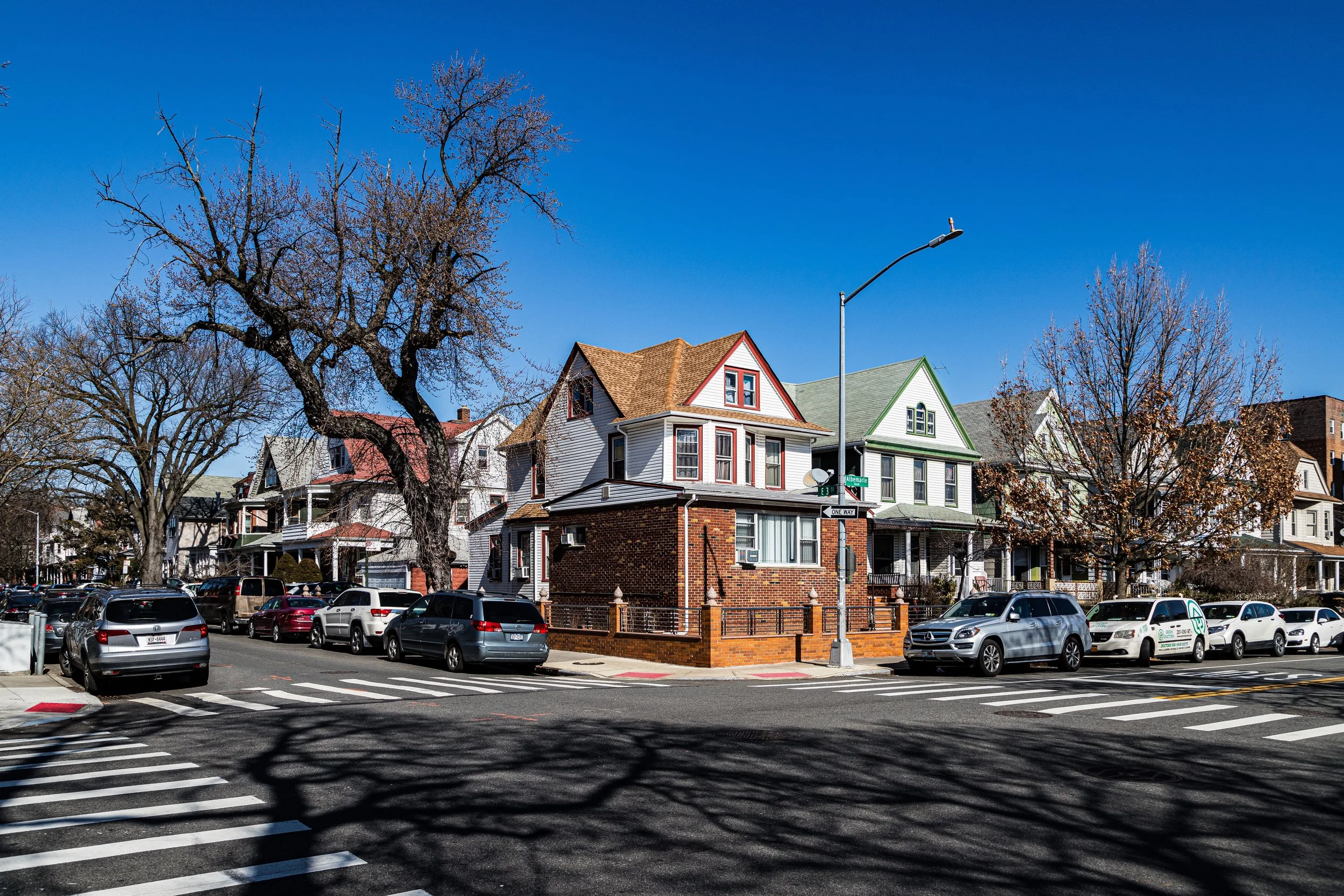
Bounded by Dahill Road to the west, Caton Avenue to the north, Coney Island Avenue to the east, and Church Avenue to the south, Albemarle forms a quiet, triangular pocket within central Brooklyn—an interstitial yet distinctive neighborhood situated between Kensington, Flatbush, and Prospect Park South. It is named for Albemarle Road, the tree-lined boulevard that cuts east–west through its northern tier, setting the tone for the area’s mix of early 20th-century domestic architecture, leafy streets, and small-scale urban rhythm.
Though sometimes subsumed into greater Kensington in contemporary maps, Albemarle possesses a local character of its own—residential, ethnically diverse, and imbued with a sense of neighborhood continuity rare in modern Brooklyn. Its streetscape transitions gracefully from single-family frame and limestone houses north of Beverley Road to modest apartment buildings and storefronts along Church Avenue. The Culver Line trench and F train running beneath McDonald Avenue form a soft western border, while Coney Island Avenue to the east marks a corridor of markets, mosques, and bakeries that reflect the area’s enduring role as a crossroads of Brooklyn’s immigrant life.
Etymology and Origins
The name “Albemarle” derives from Albemarle Road, itself christened in the late 19th century during the suburbanization of Flatbush. The term likely honors George Monck, 1st Duke of Albemarle (1608–1670), a Restoration-era English nobleman after whom many American streets and counties were named. The road was part of the Flatbush Development Company’s ambitious plan to create a network of landscaped boulevards connecting the rural remnants of old Flatbush to the expanding urban grid of Brooklyn after the Consolidation of 1898.
In this plan, Albemarle Road was designed as a “residential avenue of dignity”—broad, tree-shaded, and set with detached houses that would appeal to the city’s growing middle class. The name “Albemarle” soon became shorthand for the surrounding blocks between Church and Caton Avenues, a quiet residential enclave within the larger matrix of Kensington’s late-Victorian expansion.
The Neighborhood
19th Century: From Rural Flatbush to Streetcar Suburb
Until the 1870s, the land that would become Albemarle remained part of the old Town of Flatbush, characterized by Dutch farmsteads, orchards, and grazing fields. The arrival of streetcar lines along Church Avenue and Coney Island Avenue—and later, the Culver Railroad (1875)—opened the area to development. With Prospect Park (1867–1873) already established nearby, the district was ideally positioned to attract Brooklyn’s first generation of suburban commuters.
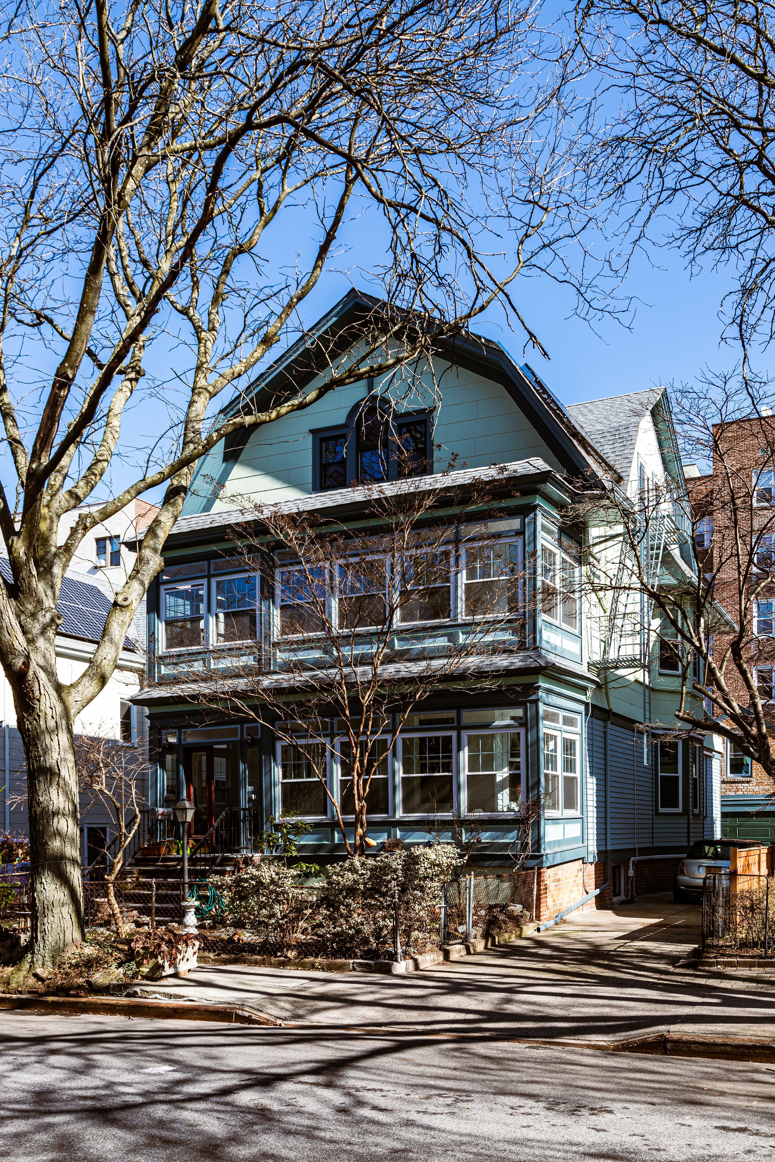
Developers laid out streets with generous setbacks, planted elms and sycamores, and built detached wood-frame houses in a blend of Queen Anne, Shingle, and Colonial Revival styles. The Flatbush Malls—grassy medians modeled after the garden suburbs of Boston—extended westward through Albemarle and its adjoining neighborhoods, reinforcing the area’s semi-rural grace. Early residents were middle-class professionals—clerks, teachers, and small business owners—who sought cleaner air and quieter streets than those of downtown Brooklyn.
By the 1890s, the opening of nearby Ocean Parkway and the Brooklyn Bridge (1883) connected the area more directly to Manhattan, hastening Albemarle’s transformation from farmland to full-fledged residential district.
Early 20th Century: A Neighborhood of Homes and Harmony
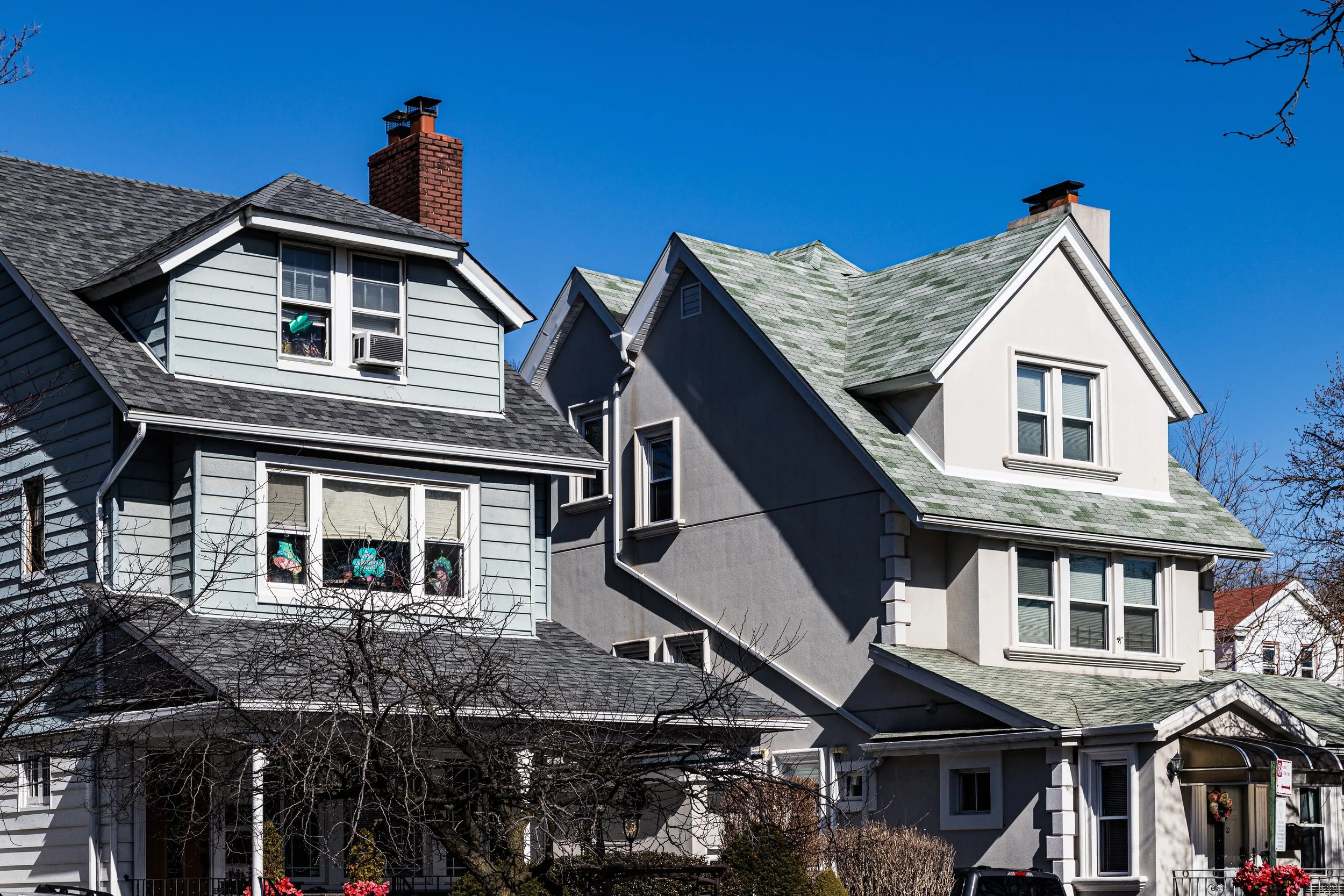
The early 1900s brought steady, deliberate growth. Developers like Dean Alvord, who also built Prospect Park South, influenced Albemarle’s aesthetic: broad lots, low density, and architect-designed houses with porches and gardens. Though smaller and more modest than its ornate neighbor to the north, Albemarle shared its ethos of suburban civility within city limits.
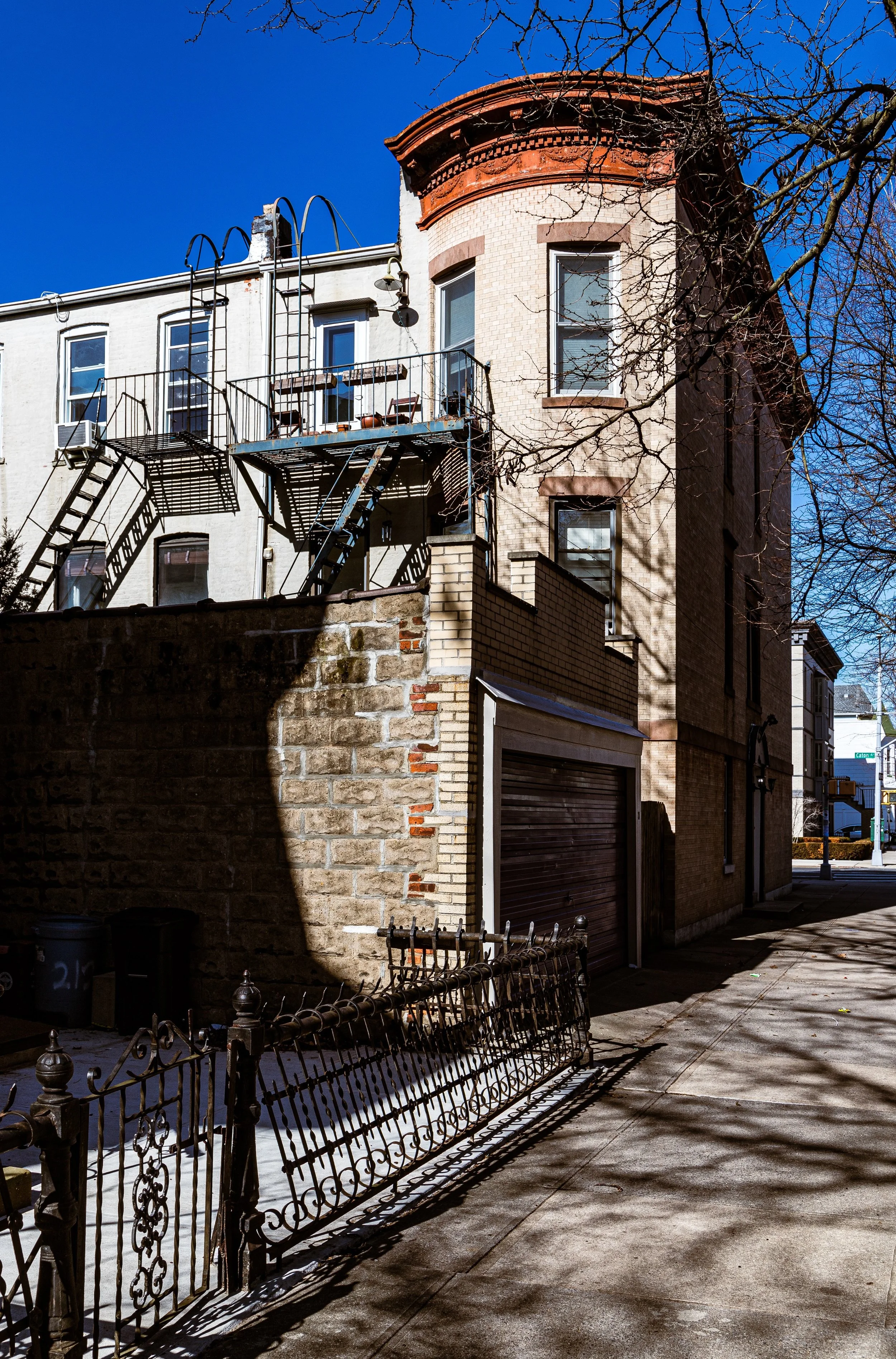
The completion of the BMT Brighton Line (now the Q train) to nearby Beverley and Church Avenues in 1919 reinforced the neighborhood’s accessibility and value. Rowhouses and small apartment buildings began to fill in along East 5th through East 8th Streets, introducing a denser yet harmonious urban rhythm. Houses of worship and corner shops followed—Catholic, Protestant, and Jewish congregations all found footholds, creating a patchwork of faith and fellowship.
By mid-century, Albemarle was a microcosm of Brooklyn’s postwar ideal: stable, family-oriented, and architecturally cohesive, its quiet side streets shaded by maples and lined with tidy stoops. The nearby Prospect Expressway, completed in the 1950s, altered access patterns but left Albemarle’s internal calm largely intact.
Albemarle Photographic Video
Mid–Late 20th Century: Immigration and Adaptation
From the 1950s through the 1980s, Albemarle absorbed successive waves of newcomers—first Jewish and Italian families moving from older Brooklyn neighborhoods, followed by Caribbean, Latin American, and South Asian immigrants. The transformation of Coney Island Avenue into a multicultural commercial artery reflected these changes: kosher bakeries stood beside halal butchers, and sari shops joined Caribbean takeout counters.
Despite economic turbulence in the 1970s citywide, Albemarle remained comparatively stable. Its cooperative apartment houses along East 8th Street and well-built limestone rowhomes maintained high occupancy, while local civic associations—often overlapping with those of Kensington—helped preserve tree cover and prevent large-scale rezoning. The Albemarle-Kenmore Terrace Historic District, though small, achieved designation in 1978, recognizing the area’s distinct architectural coherence and early 20th-century charm.
Throughout this period, neighborhood schools and parks served as cultural anchors. The quiet courtyards and leafy sidewalks retained a sense of continuity even as languages and customs diversified around them.
21st Century: Quiet Diversity and Urban Renewal
Today, Albemarle remains one of central Brooklyn’s most livable and quietly cosmopolitan neighborhoods. Its population includes South Asian, Caribbean, Eastern European, and Latin American families alongside descendants of older Brooklyn households—a reflection of New York’s layered migrations. Along Church Avenue, bodegas, Bangladeshi cafés, and Polish markets coexist beside new coffee shops and childcare centers. On side streets, early 20th-century homes—some meticulously restored, others modestly altered—maintain a sense of residential continuity that resists overdevelopment.
Transportation improvements, including upgrades to the F and Q lines and B35 bus routes, have made Albemarle more connected than ever, while proximity to Prospect Park and Greenwood Cemetery preserves its open-space heritage. Ongoing discussions about zoning and preservation emphasize maintaining its low-rise character and garden blocks amid the pressures of citywide growth.
Albemarle Photo Gallery
Spirit and Legacy
Albemarle’s legacy is one of enduring domestic tranquility amid diversity—a neighborhood that has evolved with Brooklyn while keeping its human scale intact. From the farm fields of Flatbush to the family porches of the 1920s, from German grocers to Bangladeshi cafés, its story is one of continuity through quiet change.
New York City
Use this custom Google map to explore where every neighborhood in all five boroughs of New York City is located.
The Five Boroughs
One of New York City’s unique qualities is its organization in to 5 boroughs: Manhattan, Brooklyn, Queens, The Bronx, and Staten Island. These boroughs are part pragmatic administrative districts, and part vestiges of the region’s past. Each borough is an entire county in New York State - in fact, Brooklyn is, officially, Kings County, while Staten Island is, officially Richmond County. But that’s not the whole story …
Initially, New York City was located on the southern tip of Manhattan (now the Financial District) that was once the Dutch colony of New Amsterdam. Across the East River, another city was rising: Brooklyn. In time, the city planners realized that unification between the rapidly rising cities would create commercial and industrial opportunities - through streamlined administration of the region.
So powerful was the pull of unification between New York and Brooklyn that three more counties were pulled into the unification: The Bronx, Queens, and Staten Island. And on January 1, 1898, the City of New York unified two cities and three counties into one Greater City of New York - containing the five boroughs we know today.
But because each borough developed differently and distinctly until unification, their neighborhoods likewise uniquely developed. Today, there are nearly 390 neighborhoods, each with their own histories, cultures, cuisines, and personalities - and each with residents who are fiercely proud of their corner of The Big Apple.


