
NEW DORP BEACH
Staten Island
Geographic Setting
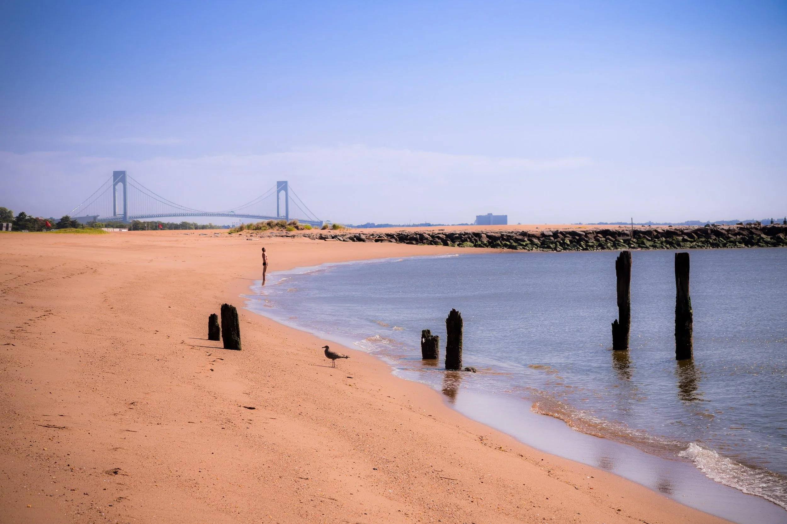
Bounded by Tysens Lane to the southwest, Hylan Boulevard to the northwest, Bancroft Avenue to the northeast, and the Raritan Bay to the southeast, New Dorp Beach forms one of Staten Island’s most distinctive coastal neighborhoods—a tranquil stretch of shoreline framed by dunes, marshlands, and the rhythmic pulse of the sea. Sitting just southeast of New Dorp proper and west of Midland Beach, the area occupies the southeastern corner of Staten Island’s East Shore, where narrow residential lanes descend toward a broad, windswept beach that looks across the bay toward Sandy Hook, New Jersey.
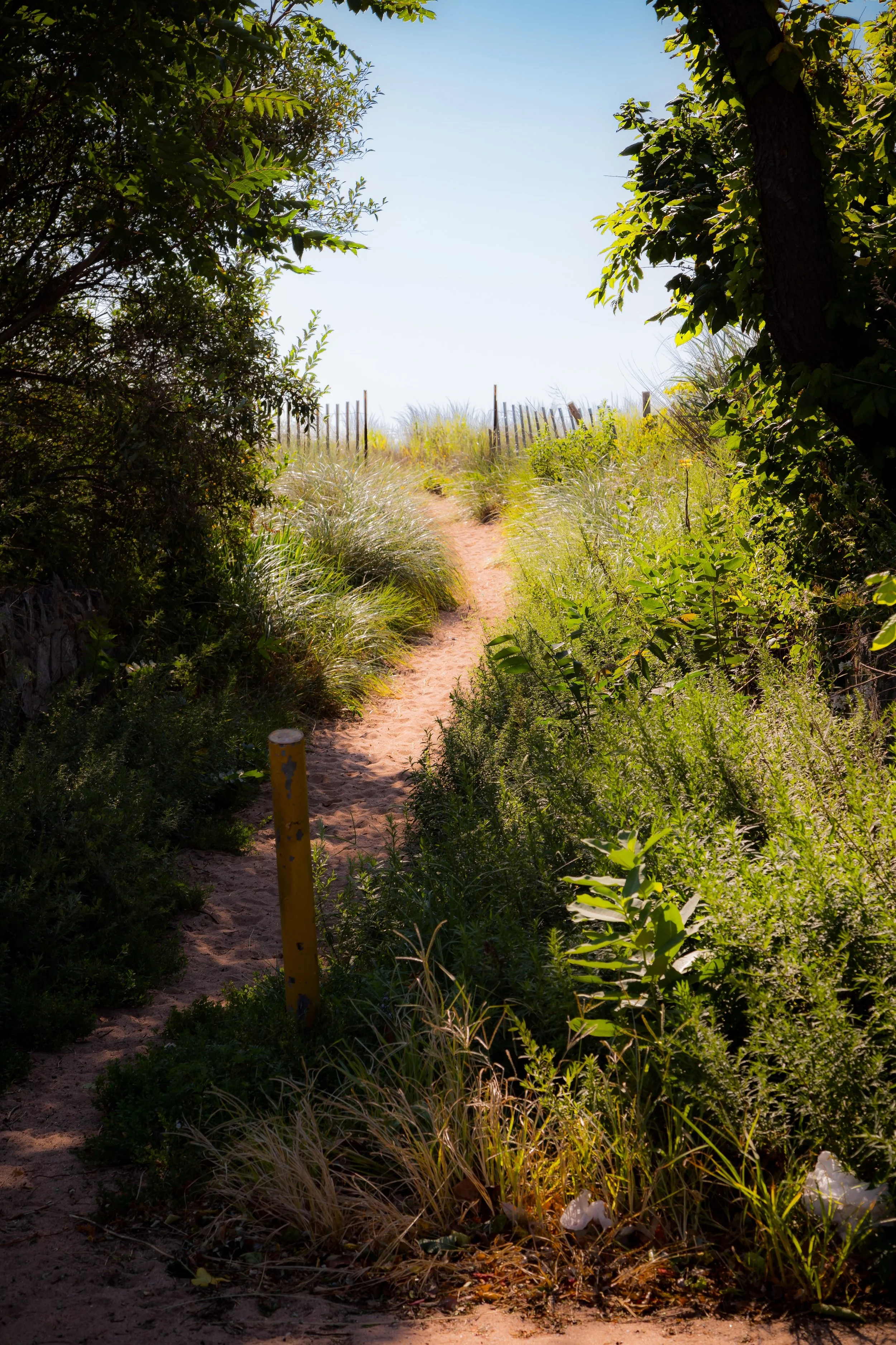
The geography of New Dorp Beach reflects both beauty and vulnerability: it is a landscape shaped by the sea’s proximity, where the sound of gulls and the scent of salt air define daily life. The inland edge—anchored by Hylan Boulevard and the New Dorp Beach Bluebelt wetlands—transitions into a dense grid of modest homes and beach cottages, many rebuilt or elevated in recent years. Toward the bay, open sand and meadow-like dunes form one of Staten Island’s most unspoiled stretches of waterfront. The combination of seaside quiet, suburban intimacy, and resilient community spirit makes New Dorp Beach one of the island’s most characteristic coastal enclaves.
Etymology
The name New Dorp Beach extends directly from its inland parent settlement, New Dorp—itself derived from the Dutch Nieuw Dorp, meaning “New Village.” The “Beach” suffix distinguishes the shoreline section from the upland community that grew along Richmond Road. Early developers in the 19th century adopted the term to market the area’s proximity to the Raritan Bay and to position it as part of Staten Island’s emerging East Shore resort belt, alongside South Beach, Midland Beach, and Oakwood Beach.
The name reflects both heritage and geography: it preserves the Dutch colonial roots of Staten Island’s earliest European settlers while emphasizing the neighborhood’s identity as a coastal retreat—a “new village by the water,” where life has always been defined by its dialogue with the sea.
The Neighborhood
Origins through the 19th Century
The land that would become New Dorp Beach was originally part of the agricultural tract established by 17th-century Dutch and French Huguenot settlers in New Dorp Village, inland along Richmond Road. The coastal area remained sparsely populated for nearly two centuries, its low-lying terrain devoted to salt hay farming, clamming, and fishing. The Raritan Bay’s tidal creeks—some still visible in the modern Bluebelt system—provided both livelihood and natural drainage.
By the mid-19th century, as transportation improved and Staten Island developed as a leisure destination for Manhattan residents, the beachfront began to attract attention as a summer colony. Wealthy New Yorkers built seasonal cottages along the dunes, while working-class families erected modest bungalows that could be reached by ferry and horse-drawn carriage. Bathhouses, boarding houses, and small docks soon dotted the shore, transforming the once-rural coastline into a seasonal village.
In 1860, the opening of the Staten Island Railway, with a station at nearby New Dorp, brought easy access from St. George and the Manhattan ferries. New Dorp Beach quickly joined the East Shore’s expanding network of seaside communities, each defined by its own rhythm of tide, leisure, and neighborhood familiarity.
Early 20th Century: From Summer Colony to Suburban Shoreline
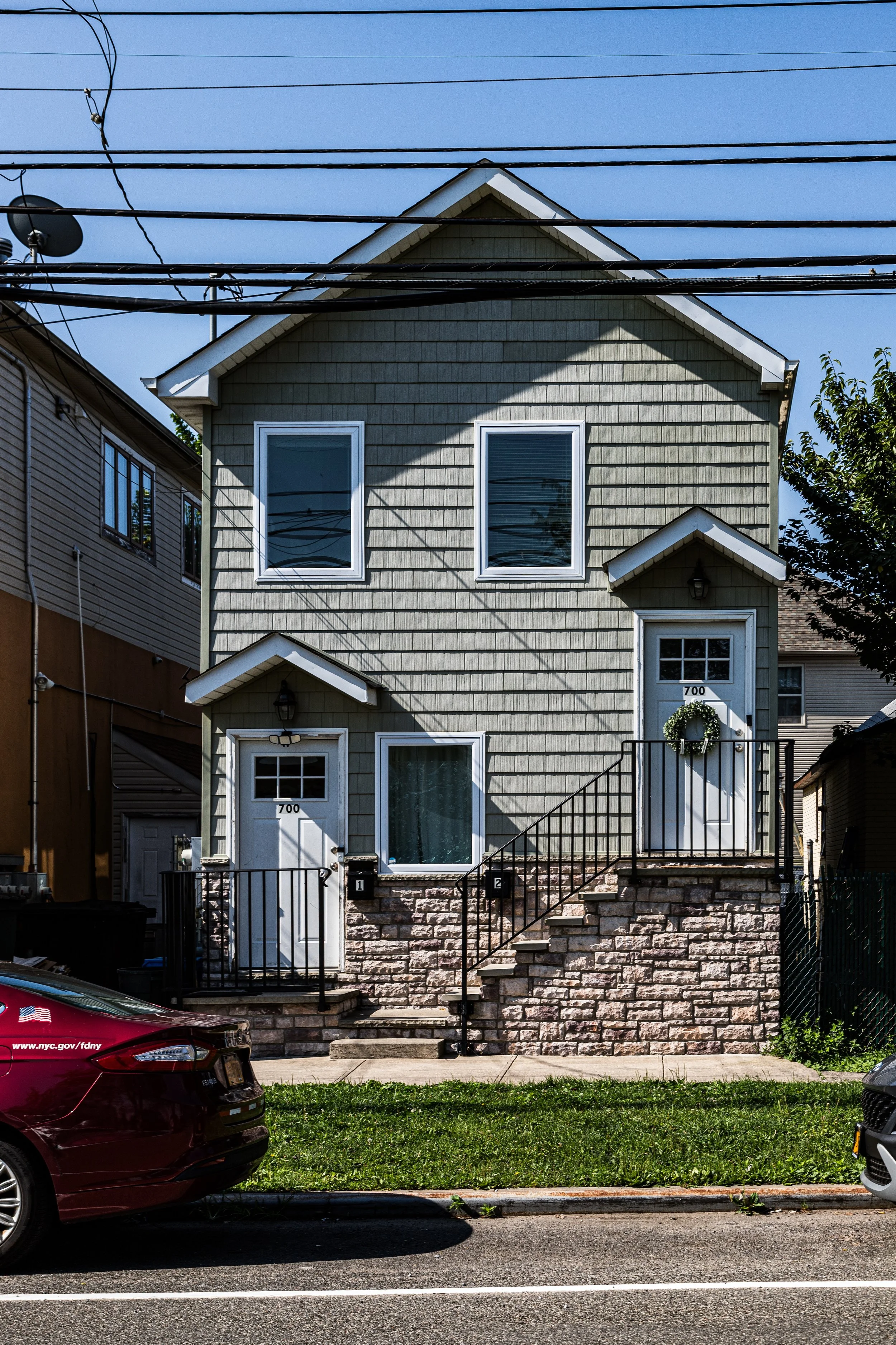
By the early 1900s, New Dorp Beach had evolved into a full-fledged residential and resort district. Rows of wooden cottages, many elevated on pilings, lined streets with names like Tysens Lane, Marine Way, and Cedar Grove Avenue, forming a lively seasonal community. The neighborhood’s proximity to New Dorp Village made it particularly appealing for families seeking both recreation and stability; summer bungalows gradually gave way to permanent homes as Staten Island’s population grew.
In 1919, the nearby Miller Field was established on land donated by the Vanderbilt family as one of the first U.S. Army Air Corps bases, introducing both modern infrastructure and new employment opportunities. The field’s long runways and hangars symbolized the modern age rising beside a landscape still marked by dunes and tidal pools.
During the interwar years, the construction of Hylan Boulevard improved year-round access to the East Shore, and New Dorp Beach solidified its identity as a mixed community of working-class families, veterans, and summer residents. The bay remained a playground for fishing, swimming, and boating, while local shops and taverns gave the neighborhood a self-contained, village-like atmosphere. Its streets, narrow and informal, echoed the improvisational nature of a community built gradually, one cottage and one generation at a time.
New Dorp Beach Video Coming Soon
Mid–Late 20th Century: Suburbanization, Storms, and Steadfastness
Following World War II, Staten Island entered a period of explosive suburban growth, but New Dorp Beach retained its smaller scale and seaside intimacy. The postwar era saw modest infill development and the renovation of older cottages into year-round homes. Its residents—many descendants of early families—formed tight-knit social networks centered on neighborhood associations, churches, and nearby schools.
Yet the area’s coastal location made it vulnerable to natural forces. Repeated hurricanes and nor’easters in the mid-20th century damaged homes and eroded the shoreline, prompting the city to implement flood control and dune restoration projects. The 1964 opening of the Verrazzano-Narrows Bridge brought a wave of newcomers from Brooklyn and beyond, accelerating Staten Island’s urbanization while increasing traffic along Hylan Boulevard.
Despite these pressures, New Dorp Beach remained distinct from the denser inland districts. Its modest homes, narrow streets, and proximity to open space fostered a sense of independence. Community members resisted large-scale redevelopment and fought for environmental preservation, culminating in the creation of portions of the Bluebelt wetlands system, which now serves as a model for natural stormwater management and ecological conservation across Staten Island.
21st Century: Resilience and Renewal by the Sea
In the 21st century, New Dorp Beach has come to symbolize both the fragility and the fortitude of Staten Island’s coastal communities. The devastation of Hurricane Sandy (2012) left an indelible mark: dozens of homes were destroyed or severely damaged, and the shoreline was redrawn by storm surge. In the aftermath, residents and city agencies embarked on a long process of rebuilding and reimagining the neighborhood’s relationship to the sea.
Reconstruction efforts have emphasized elevation, sustainability, and community planning. Many homes were rebuilt on raised foundations, while others were relocated or replaced by open green space. The New Dorp Beach Bluebelt—a network of wetlands, ponds, and drainage basins—has become a cornerstone of resilience, absorbing stormwater and protecting against future flooding. These environmental improvements coexist with civic pride: murals, community gardens, and beach cleanups reflect a neighborhood united by both hardship and hope.
Today, New Dorp Beach remains largely residential, with a blend of restored bungalows, postwar homes, and contemporary builds. The shoreline, now protected by dunes and wetlands, has regained its natural beauty, serving as both parkland and buffer. From sunrise fishermen to evening walkers along the water’s edge, life in New Dorp Beach continues to revolve around the simple yet profound presence of the sea.
New Dorp Beach Photo Gallery
Spirit and Legacy
The spirit of New Dorp Beach is defined by endurance—of people and of place. It is a neighborhood that has lived the full arc of Staten Island’s coastal history: from Dutch farmland to Victorian resort, from postwar suburb to climate-resilient community. Its legacy lies in the quiet perseverance of its residents, who have faced the sea’s power not with retreat but with restoration.
In its name—New Village by the Beach—endures a centuries-old promise of renewal. The sound of waves, the gulls over Miller Field, and the sight of rebuilt homes against the horizon all speak to a community that continues to adapt while preserving its soul.
New York City
Use this custom Google map to explore where every neighborhood in all five boroughs of New York City is located.
The Five Boroughs
One of New York City’s unique qualities is its organization in to 5 boroughs: Manhattan, Brooklyn, Queens, The Bronx, and Staten Island. These boroughs are part pragmatic administrative districts, and part vestiges of the region’s past. Each borough is an entire county in New York State - in fact, Brooklyn is, officially, Kings County, while Staten Island is, officially Richmond County. But that’s not the whole story …
Initially, New York City was located on the southern tip of Manhattan (now the Financial District) that was once the Dutch colony of New Amsterdam. Across the East River, another city was rising: Brooklyn. In time, the city planners realized that unification between the rapidly rising cities would create commercial and industrial opportunities - through streamlined administration of the region.
So powerful was the pull of unification between New York and Brooklyn that three more counties were pulled into the unification: The Bronx, Queens, and Staten Island. And on January 1, 1898, the City of New York unified two cities and three counties into one Greater City of New York - containing the five boroughs we know today.
But because each borough developed differently and distinctly until unification, their neighborhoods likewise uniquely developed. Today, there are nearly 390 neighborhoods, each with their own histories, cultures, cuisines, and personalities - and each with residents who are fiercely proud of their corner of The Big Apple.


