PELHAM GARDENS
The Bronx
Geographic Setting
Bounded by East Gun Hill Road to the northeast, Stillwell Avenue to the southeast, Pelham Parkway to the south, and The Esplanade to the west, Pelham Gardens lies within the northeastern Bronx, an orderly and verdant neighborhood defined by tree-lined streets, manicured lawns, and a quiet residential rhythm that reflects its name. Framed by parkways, hospitals, and open green space, it is one of the Bronx’s most suburban-feeling enclaves—an area where detached homes and tidy sidewalks coexist within reach of major urban arteries.
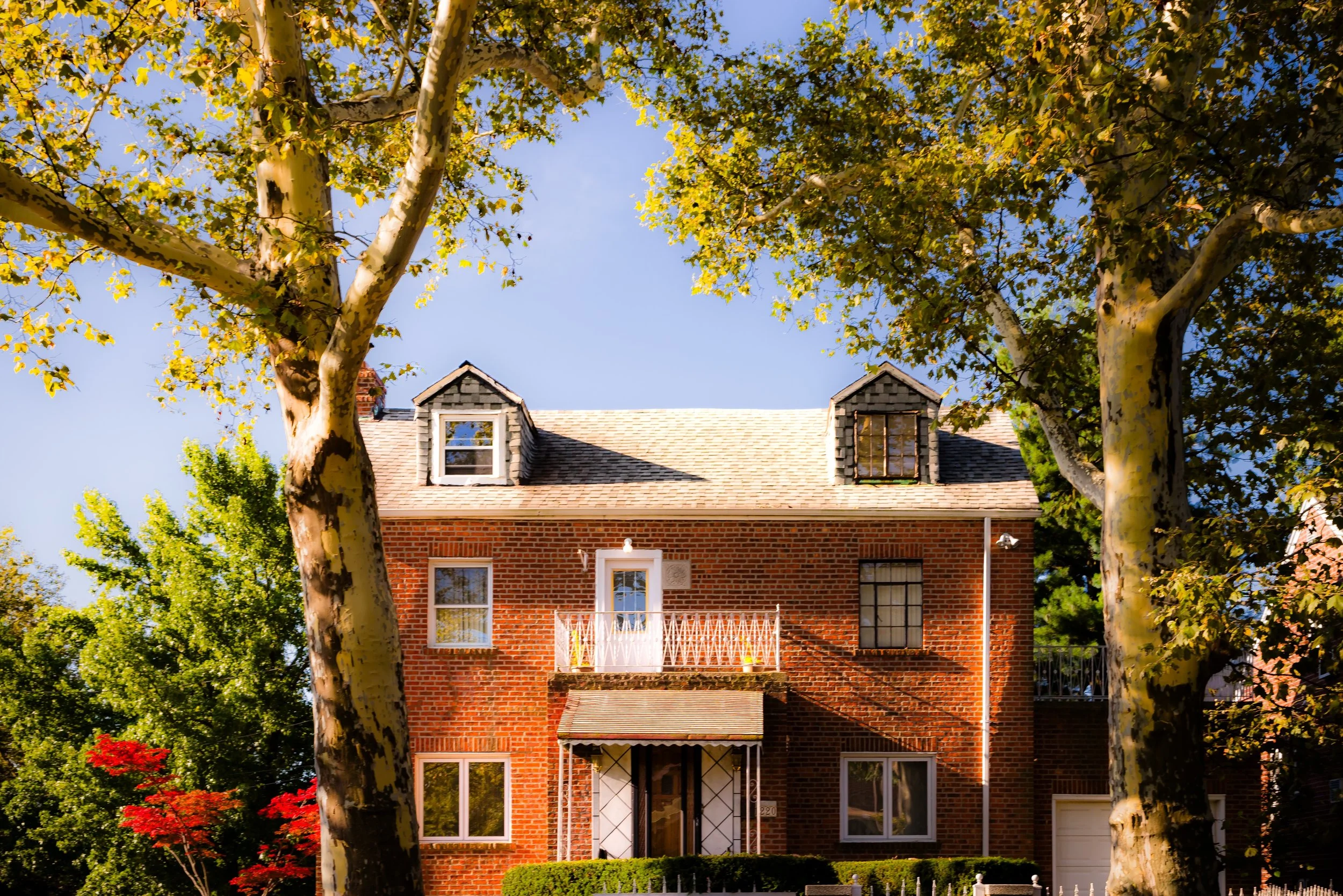
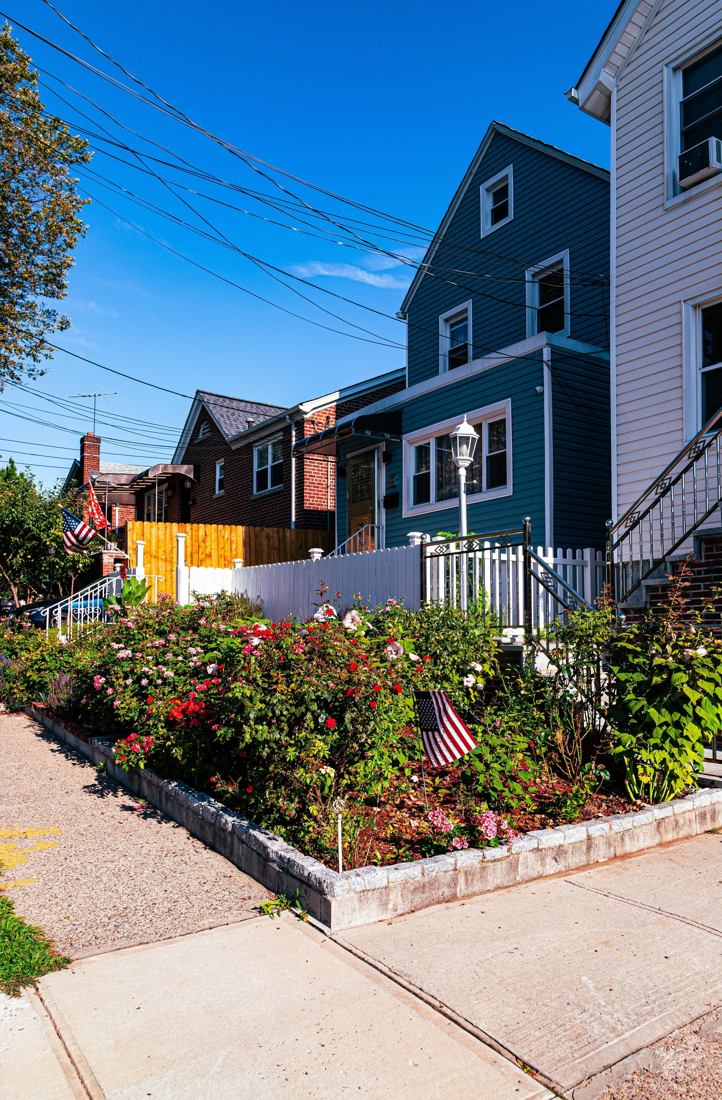
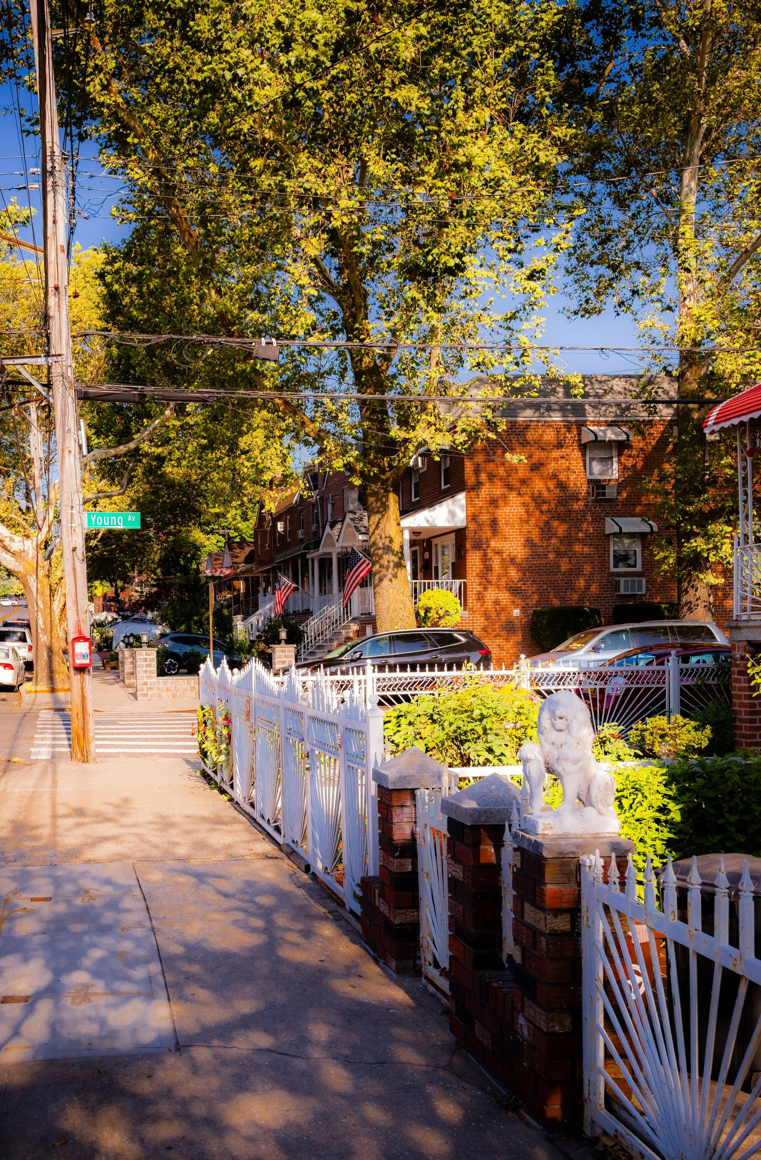
The neighborhood’s interior is a harmonious grid of brick and stucco single-family houses, two-family homes, and occasional small apartment buildings, most constructed between the 1930s and 1950s. Streets such as Laconia Avenue, Narragansett Avenue, and Fenton Avenue carry little through traffic, preserving the calm of an area long prized for its residential stability. To the west, The Esplanade serves as a defining green corridor—an elongated, landscaped promenade that separates Pelham Gardens from neighboring Allerton and Morris Park, while Pelham Parkway, to the south, provides both a scenic border and swift access to the Bronx River Parkway and I-95.
The neighborhood’s major institutions—Albert Einstein College of Medicine, Jacobi Medical Center, and Calvary Hospital—lie just beyond its boundaries, bringing both employment and an enduring sense of civic purpose. With Pelham Bay Park to the east and Bronx Park to the west, Pelham Gardens is both geographically and spiritually defined by green space—an enclave that lives up to its name in the most literal sense.
Etymology
The name “Pelham Gardens” reflects both geography and aspiration. The “Pelham” refers to the nearby Pelham Parkway and Pelham Bay Park, themselves named after Thomas Pell’s 17th-century manor of Pelham, which once encompassed much of the northeastern Bronx and southern Westchester. The “Gardens” portion was coined by early 20th-century developers eager to evoke suburban tranquility, healthfulness, and modern domesticity—hallmarks of the interwar “garden suburb” movement that swept across New York City’s outer boroughs.
Together, the words suggested a promise: a residential district that combined the accessibility of the city with the serenity of the countryside. It was a name meant to attract families seeking stability and greenery within reach of Manhattan—a promise that, remarkably, the neighborhood has kept.
The Neighborhood
Origins through the 19th Century
Long before rows of Tudor-style homes and cul-de-sacs appeared, the land that became Pelham Gardens was part of the agricultural hinterland of Pelham Manor and Westchester Township. In the 18th and 19th centuries, the area’s fertile soil supported orchards and market farms, while small lanes—ancestors of Stillwell Avenue and Gun Hill Road—connected scattered farmsteads to the old Boston Post Road. The annexation of the eastern Bronx into New York City in 1895 opened the area to urban planning but, for decades, it remained largely rural, overshadowed by the growing industrial centers of West Farms and Tremont.
The creation of Pelham Parkway (1897–1908) as part of the Bronx’s grand park system—linking Bronx Park to Pelham Bay Park—was the area’s turning point. Designed as both a transit route and scenic promenade, the Parkway established the framework for future suburbanization. Developers soon recognized the surrounding land’s potential for middle-class housing, particularly as the Bronx River Parkway and subway extensions connected the borough to Manhattan and Westchester.
By the dawn of the 20th century, advertisements described the “Pelham Garden Tract” as “a suburban oasis within the city,” previewing the modern neighborhood’s defining identity.
Early 20th Century: Planned Suburbia and Postwar Promise
The transformation of Pelham Gardens unfolded primarily between 1930 and 1960, when builders capitalized on improved infrastructure and the automobile age to create a planned, low-density community. The grid north of Pelham Parkway was laid out with deliberately broad streets, shallow front lawns, and uniform lot sizes—a conscious departure from the tenement-lined blocks of the South Bronx.
Early homes blended Tudor Revival, Cape Cod, and Colonial styles, featuring pitched roofs, bay windows, and private driveways. Many were marketed to civil servants, teachers, and veterans, offering a suburban quality of life within city limits. The establishment of Jacobi Medical Center (opened 1955) and the nearby Albert Einstein College of Medicine cemented the neighborhood’s middle-class status, drawing healthcare professionals and academics who sought proximity to work in a tranquil environment.
The Pelham Parkway served not only as a scenic border but as a unifying green spine for recreation and transportation, while East Gun Hill Road evolved into a convenient commercial corridor of groceries, bakeries, and service businesses. Through the mid-century decades, Pelham Gardens emerged as one of the Bronx’s most desirable addresses for those seeking ownership, privacy, and greenery—qualities reinforced by vigilant civic groups and low turnover.
Pelham Gardens Video Coming Soon
Mid–Late 20th Century: Stability Amid Urban Change
During the 1970s, as many Bronx neighborhoods suffered from arson and disinvestment, Pelham Gardens remained remarkably stable. Its relative isolation—bounded by major parkways and low-density zoning—shielded it from the era’s worst upheavals. Most homes were owner-occupied, and community associations such as the Pelham Parkway Neighborhood Association maintained active watch over zoning, traffic, and park maintenance.
The population began to diversify during this period, as Italian-American, Irish-American, and Jewish families were joined by Caribbean, Hispanic, and South Asian homeowners, drawn by the area’s safety and proximity to major employers like Jacobi Hospital. The neighborhood’s strong institutions—public schools, churches, synagogues, and small local parks—reinforced its continuity even as the Bronx around it transformed.
By the 1980s, Pelham Gardens was widely regarded as a model of residential resilience: tidy, stable, and civic-minded, a reminder of the Bronx’s capacity for endurance and self-renewal.
21st Century: Diversity, Renewal, and Enduring Character
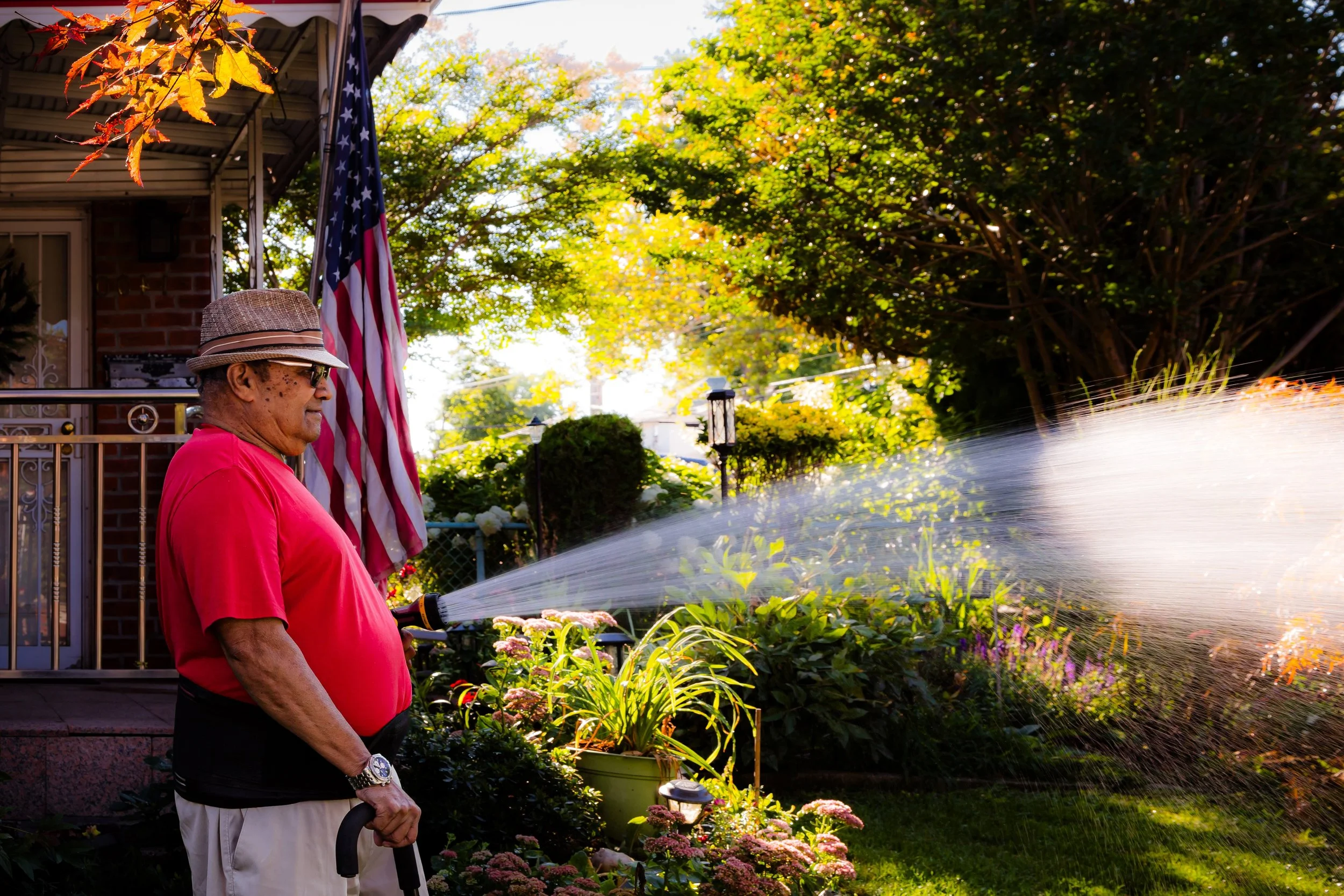
In the 21st century, Pelham Gardens has retained its suburban texture while becoming one of the Bronx’s most ethnically diverse neighborhoods. Today, the area is home to a vibrant mix of Italian, Caribbean, Hispanic, Jewish, and South Asian families, united by shared investment in homeownership and community pride. The streets remain immaculately kept—front gardens neatly trimmed, flags and seasonal decorations marking each block’s individuality.
Civic engagement continues through local associations and Community Board 11, which advocates for responsible development and preservation of green space. The nearby Hutchinson Metro Center, a major commercial and healthcare hub, has brought economic vitality while spurring infrastructure improvements along Eastchester Road and Pelham Parkway South.
The Pelham Parkway Greenway, recently refurbished with new trees, lighting, and walking paths, links residents to the Bronx’s vast park network—from Bronx Park and the New York Botanical Garden to Pelham Bay Park and the waterfront. Despite gradual modernization, Pelham Gardens remains a low-rise sanctuary defined by domestic stability and quiet streets where families have lived for generations.
Bowery Photo Gallery
Spirit and Legacy
The spirit of Pelham Gardens is one of cultivated calm—a place where urban life yields to greenery, and where the Bronx reveals its most pastoral side. Its legacy lies not in grandeur or density, but in constancy: the steady hum of lawnmowers, the chatter of neighbors on driveways, the scent of lilacs along The Esplanade in spring.
New York City
Use this custom Google map to explore where every neighborhood in all five boroughs of New York City is located.
The Five Boroughs
One of New York City’s unique qualities is its organization in to 5 boroughs: Manhattan, Brooklyn, Queens, The Bronx, and Staten Island. These boroughs are part pragmatic administrative districts, and part vestiges of the region’s past. Each borough is an entire county in New York State - in fact, Brooklyn is, officially, Kings County, while Staten Island is, officially Richmond County. But that’s not the whole story …
Initially, New York City was located on the southern tip of Manhattan (now the Financial District) that was once the Dutch colony of New Amsterdam. Across the East River, another city was rising: Brooklyn. In time, the city planners realized that unification between the rapidly rising cities would create commercial and industrial opportunities - through streamlined administration of the region.
So powerful was the pull of unification between New York and Brooklyn that three more counties were pulled into the unification: The Bronx, Queens, and Staten Island. And on January 1, 1898, the City of New York unified two cities and three counties into one Greater City of New York - containing the five boroughs we know today.
But because each borough developed differently and distinctly until unification, their neighborhoods likewise uniquely developed. Today, there are nearly 390 neighborhoods, each with their own histories, cultures, cuisines, and personalities - and each with residents who are fiercely proud of their corner of The Big Apple.


