MIDDLE VILLAGE
Queens
Geographic Setting
Located near the geographical center of Queens, Middle Village lies on a broad, gently undulating plain bordered by Maspeth to the west, Rego Park to the north, Glendale to the south, and Elmhurst to the east. It is bounded approximately by Woodhaven Boulevard, Eliot Avenue, Metropolitan Avenue, and Cooper Avenue, with Juniper Valley Park forming its lush green heart. Its name, appropriately, refers to its historic position midway between Williamsburg, Brooklyn, and Jamaica, Queens—a convenient midpoint along the old stagecoach route that once followed Metropolitan Avenue.
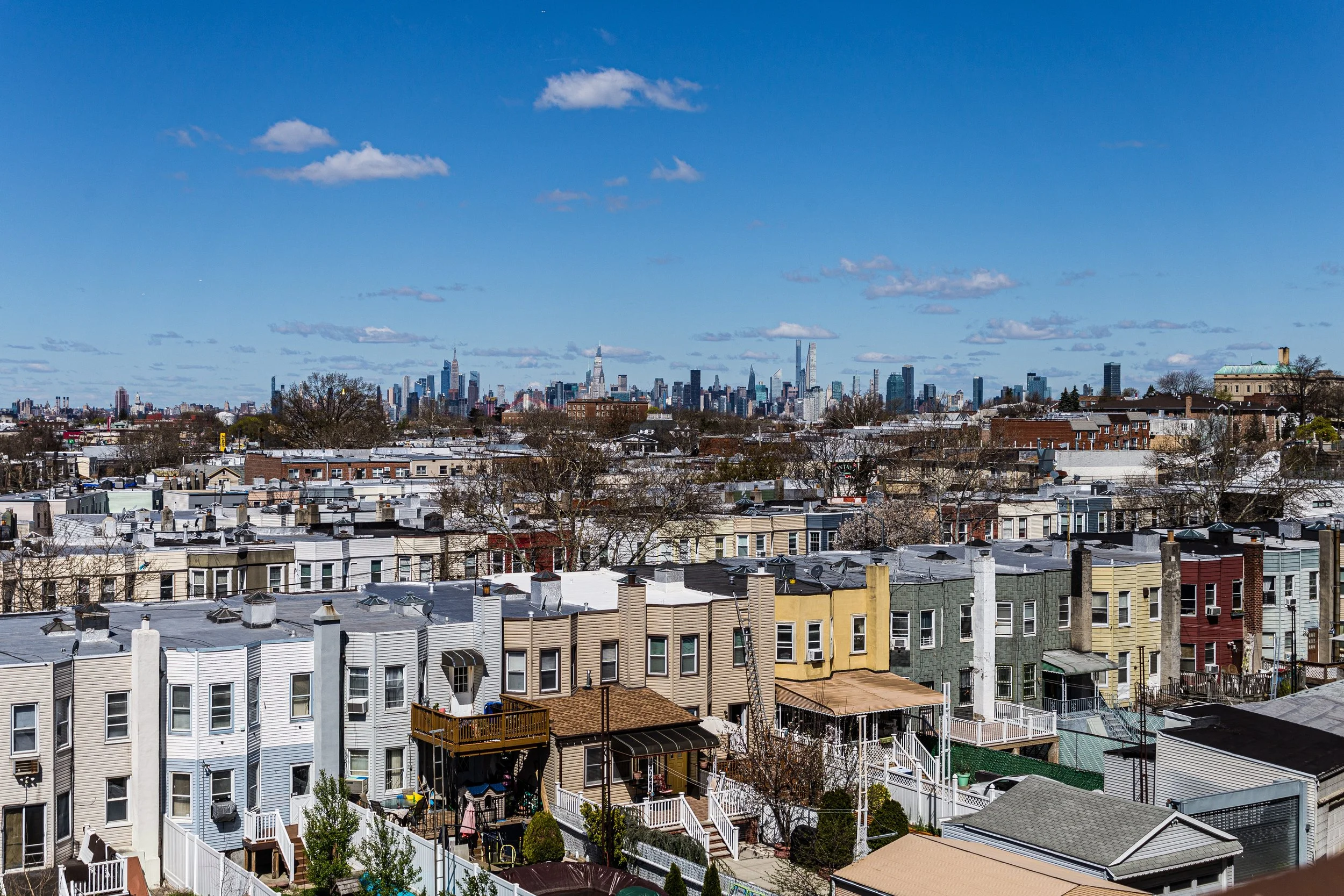
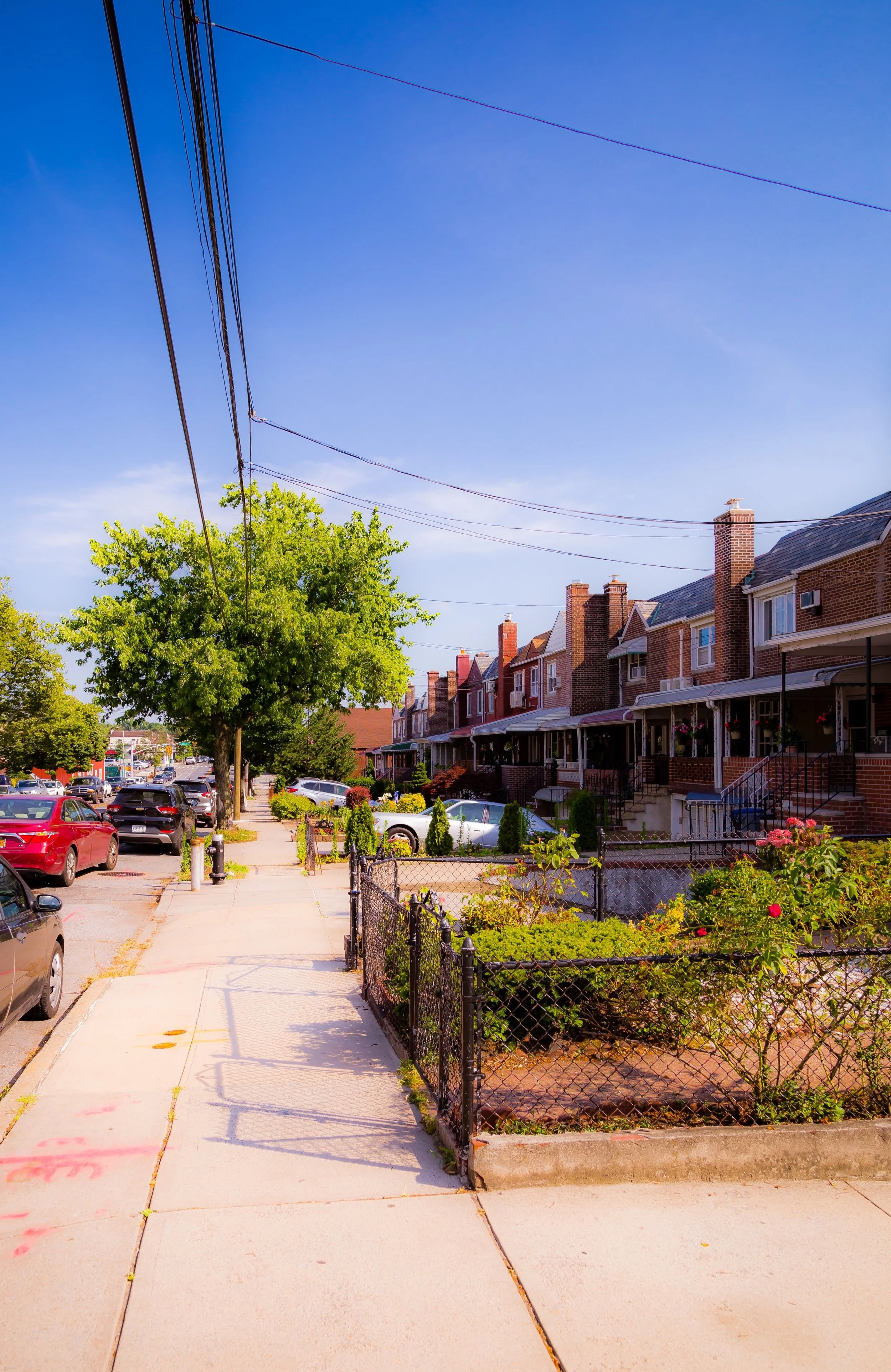
The landscape today is distinctly suburban in form: long blocks of brick rowhouses and semi-detached homes, tree-lined streets with manicured front gardens, and corner shops that give the neighborhood an almost small-town rhythm. The spires of Our Lady of Hope Church rise above the rooftops, while beyond, the vast lawns of Lutheran All Faiths Cemetery and St. John Cemetery form solemn boundaries that have shaped the neighborhood’s geography for more than a century.
Etymology and Origins
The name “Middle Village” appears as early as Middle Village Road in colonial maps from the 18th century, describing a waystation between the towns of Newtown (Elmhurst) and Jamaica. By the mid-1800s, a small farming hamlet of the same name had grown along the turnpike that is now Metropolitan Avenue, serving travelers and local farmers who raised produce for Manhattan markets.
The area’s fertile soil, open fields, and access to nearby cemeteries made it a natural location for truck farming, floriculture, and funeral-related trades. When Lutheran Cemetery (now All Faiths Cemetery) was established in 1852, followed by St. John Cemetery in 1879, the neighborhood’s identity became intertwined with those expansive burial grounds. Florists, stonemasons, and carriage operators clustered nearby, and small inns and taverns catered to visitors. The rhythm of funerals and flower carts became part of daily life.
The Neighborhood
19th Century: From Farmland to Village
During the latter half of the 19th century, Middle Village was a quiet agricultural community of German and Dutch descent, producing vegetables, dairy, and flowers for the city’s markets. The arrival of the Williamsburg & Jamaica Turnpike Company stage line (later Metropolitan Avenue) and, by the 1890s, the Brooklyn trolley line, linked the area more closely to Brooklyn, spurring modest suburban development.
Wood-frame cottages and small farms lined Dry Harbor Road and Metropolitan Avenue, while the Caldwell Hotel (built 1850s) served as a local landmark. Churches and schools soon followed—Trinity Lutheran Church (1851) and Our Lady of Hope (established 1929) becoming key anchors of community life. Despite proximity to cemeteries, Middle Village developed a reputation as peaceful, orderly, and family-oriented—a retreat from urban congestion.
Early–Mid 20th Century: The Making of a Middle-Class Enclave
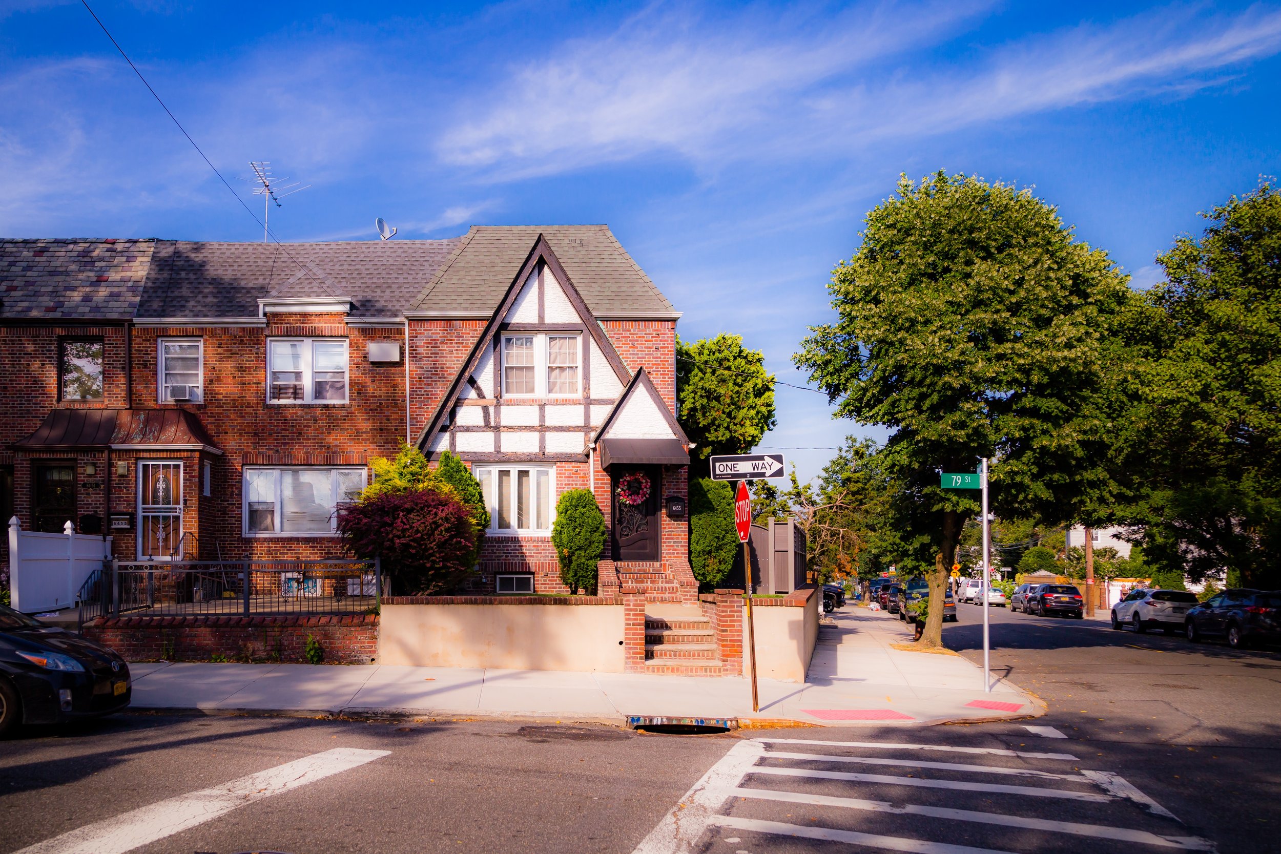
The early 20th century brought suburbanization. With the extension of trolley and bus lines, the area attracted first- and second-generation immigrants—especially German, Italian, and Irish families seeking affordable homeownership. Developers built rows of modest brick and stucco houses between Eliot Avenue and Metropolitan Avenue, many featuring small lawns and private garages—amenities rare elsewhere in New York.
The most transformative project was Juniper Valley Park, created in the 1930s on former swampy land purchased by the city through Robert Moses’ Parks Department. Once drained and landscaped, the park’s 55 acres became the neighborhood’s heart—a green expanse of ballfields, playgrounds, and tree-shaded paths that reshaped local life. Around the same time, P.S. 128 opened (1939), serving the growing population.
After World War II, returning veterans fueled another wave of construction. Entire blocks of brick rowhouses appeared along Eliot Avenue, Dry Harbor Road, and 69th Street, creating one of Queens’ most cohesive middle-class landscapes. Each home featured small front gardens, and many were built by local contractors—some veterans themselves—who lived in the neighborhood they constructed. Ownership rates soared, and the community’s stable, family-centered ethos took deep root.
Middle Village Video Coming Soon
Late 20th Century: Continuity and Community
By the 1960s and 1970s, Middle Village had come to symbolize postwar Queens respectability—a place of tidy lawns, strong parish ties, and neighborly familiarity. Its population was predominantly white and Catholic, with many families tracing their roots to southern Europe. Civic associations and parish groups flourished, and Our Lady of Hope School became a focal point for local education. Small businesses thrived along Metropolitan Avenue—butcher shops, bakeries, and Italian delicatessens that formed the social glue of the community.
Even as much of New York City faced decline, Middle Village remained remarkably stable. Residents credited this to homeownership, vigilant civic associations, and the enduring appeal of Juniper Valley Park as a public commons. The Juniper Park Civic Association, founded in 1938, became one of the city’s most active community organizations, lobbying for zoning protections, playground improvements, and infrastructure maintenance.
During the late 20th century, demographic change arrived gradually: new homeowners of Polish, Irish, Greek, and later Asian and Latino heritage joined long-established families, sustaining the same culture of maintenance and pride.
21st Century: Preservation of Character
Today, Middle Village remains a quintessential Queens success story—prosperous, diverse, and deeply residential. The streets are lined with restored postwar homes, many still occupied by the children or grandchildren of the original owners. The neighborhood’s institutions—Our Lady of Hope Church, Trinity Lutheran, and the Juniper Valley Park baseball leagues—remain as central as ever.
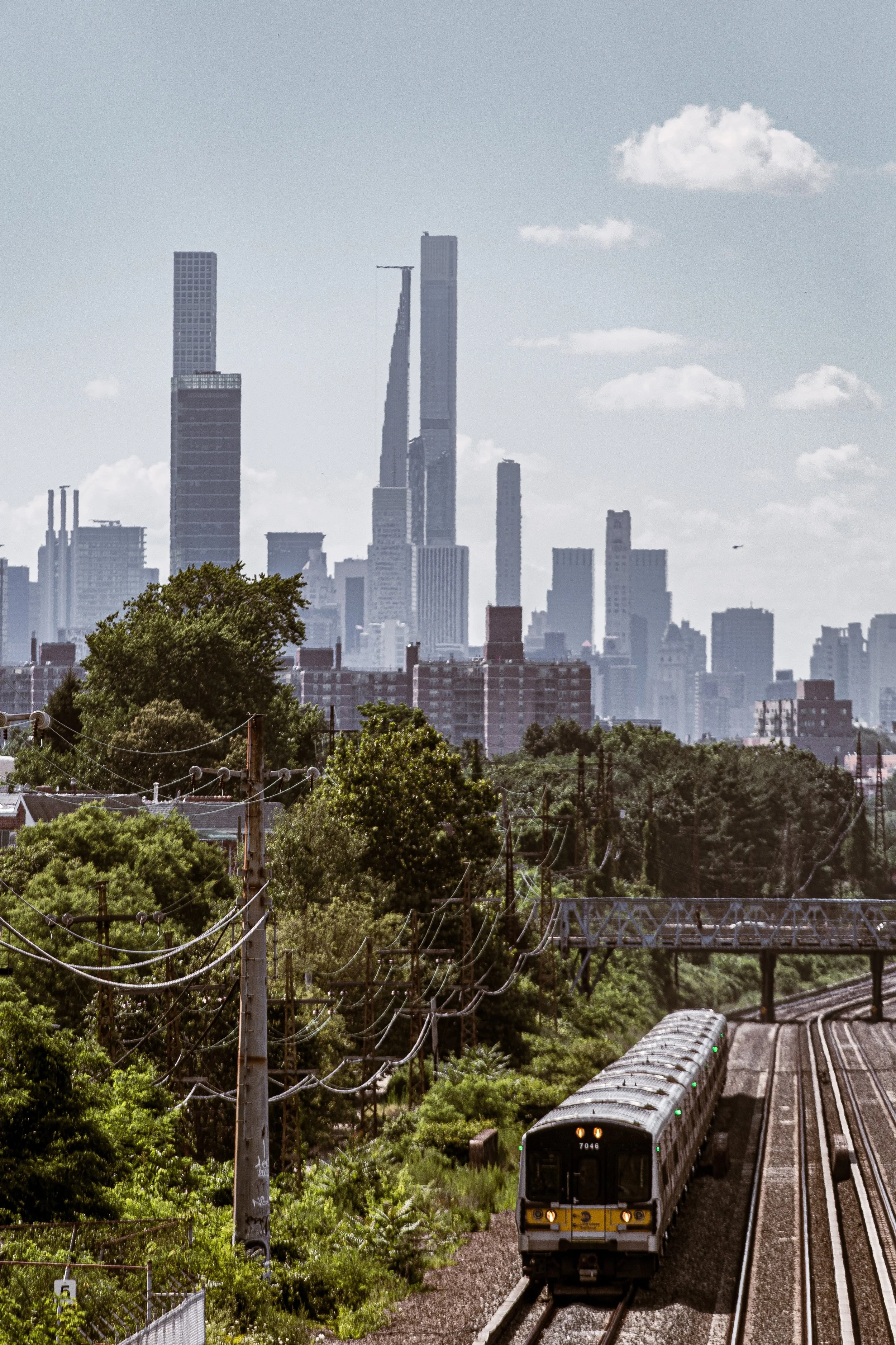
Despite its modest scale, Middle Village’s civic engagement is outsized: residents continue to rally around zoning issues, traffic calming, and park stewardship. The Metropolitan Avenue shopping corridor, anchored by family-run stores and cafés, retains a human scale rarely found in modern urban planning. Beneath the steady roar of planes bound for JFK or LaGuardia, daily life unfolds much as it has for generations—quiet, predictable, and proudly maintained.
Middle Village Photo Gallery
Spirit and Legacy
Middle Village’s enduring strength lies in its name: a place both literal and symbolic “in the middle”—between old and new, city and suburb, work and rest. Its cemeteries and parklands provide both physical boundaries and moral anchors, reminding residents of continuity and care. Here, the rhythms of daily life—school drop-offs, church bells, the crack of bats in Juniper Park—define a community more by presence than change.
New York City
Use this custom Google map to explore where every neighborhood in all five boroughs of New York City is located.
The Five Boroughs
One of New York City’s unique qualities is its organization in to 5 boroughs: Manhattan, Brooklyn, Queens, The Bronx, and Staten Island. These boroughs are part pragmatic administrative districts, and part vestiges of the region’s past. Each borough is an entire county in New York State - in fact, Brooklyn is, officially, Kings County, while Staten Island is, officially Richmond County. But that’s not the whole story …
Initially, New York City was located on the southern tip of Manhattan (now the Financial District) that was once the Dutch colony of New Amsterdam. Across the East River, another city was rising: Brooklyn. In time, the city planners realized that unification between the rapidly rising cities would create commercial and industrial opportunities - through streamlined administration of the region.
So powerful was the pull of unification between New York and Brooklyn that three more counties were pulled into the unification: The Bronx, Queens, and Staten Island. And on January 1, 1898, the City of New York unified two cities and three counties into one Greater City of New York - containing the five boroughs we know today.
But because each borough developed differently and distinctly until unification, their neighborhoods likewise uniquely developed. Today, there are nearly 390 neighborhoods, each with their own histories, cultures, cuisines, and personalities - and each with residents who are fiercely proud of their corner of The Big Apple.


