BOERUM HILL
Brooklyn
Geographic Setting
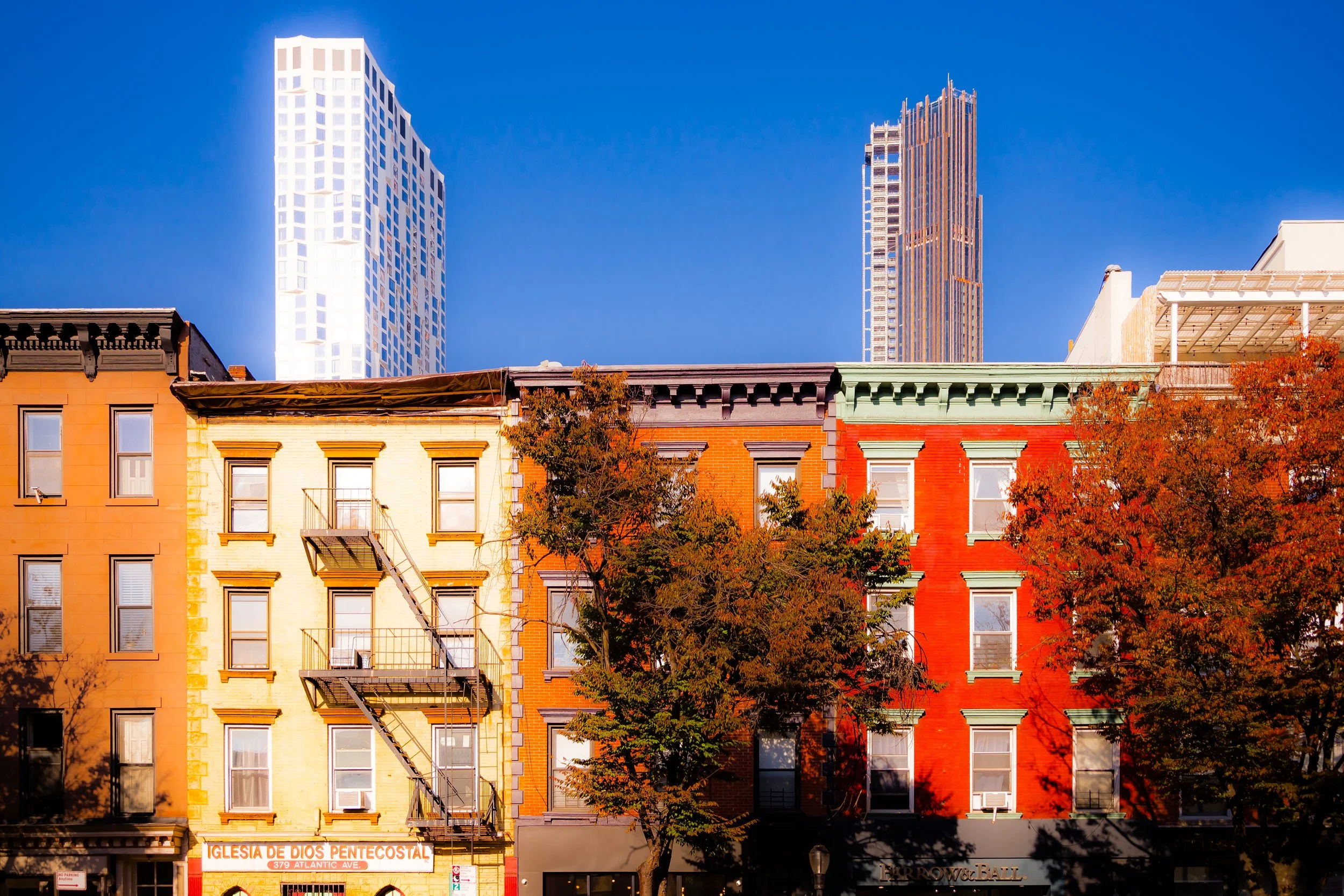
Bounded by Baltic Street to the south and Schermerhorn Street to the north, and stretching from Court Street to Fourth Avenue, Boerum Hill occupies a small but strikingly cohesive portion of northwestern Brooklyn—a district where tree-lined streets, 19th-century rowhouses, and human-scale storefronts create one of the borough’s most harmonious urban landscapes. It sits between the commercial bustle of Downtown Brooklyn to the north and the brownstone calm of Cobble Hill and Park Slope to the south and east, acting as a bridge between Brooklyn’s mercantile core and its residential heart.
Within these few blocks, architectural rhythm defines the place: continuous rows of Greek Revival, Italianate, and Neo-Grec brownstones line Dean, Bergen, and Wyckoff Streets, their façades adorned with cast-iron railings and bracketed cornices. Along Smith Street and Court Street, cafés and boutiques occupy restored 19th-century storefronts that hum with neighborhood life. Atlantic Avenue marks the neighborhood’s southern rim with a mix of antique shops, Middle Eastern bakeries, and design studios—a corridor that has long served as both commercial artery and cultural crossroads. Despite its proximity to one of New York’s busiest transit hubs at Atlantic Terminal, Boerum Hill maintains a distinctly intimate atmosphere, defined less by movement than by craft, continuity, and community.
Etymology and Origins
The name “Boerum Hill” links the neighborhood to Brooklyn’s colonial roots. It honors the Boerum family, descendants of Willem Jacobse Van Boerum, a Dutch farmer whose 17th-century holdings extended from today’s Gowanus Canal north toward Fulton Street. The area’s terrain—once gently sloping farmland—was incorporated into the City of Brooklyn grid during the early 1800s. By the 1840s, as shipyards and factories expanded along the nearby East River, streets like Dean, Pacific, and Wyckoff were lined with brick rowhouses built for artisans and clerks employed in the waterfront trades.
The term “Boerum Hill” itself did not come into common use until the 1960s, when local preservationists and real-estate agents adopted it to rebrand what was then known as North Gowanus. The “Hill,” while more aspirational than literal—since the neighborhood’s elevation barely rises above 50 feet—signaled a desire to highlight its brownstone charm and distinguish it from the industrial grit of adjacent Gowanus.
The Neighborhood
19th Century: From Farmland to Rowhouse Brooklyn
Between 1840 and 1880, Boerum Hill developed rapidly as part of Brooklyn’s great brownstone expansion. Builders erected graceful three- and four-story houses in Greek Revival and Italianate styles, each with high stoops, iron fences, and carved lintels. These were homes for the city’s upwardly mobile working class—craftsmen, ship carpenters, and clerks who sought proximity to both the docks of Red Hook and the commercial bustle of Fulton Street.
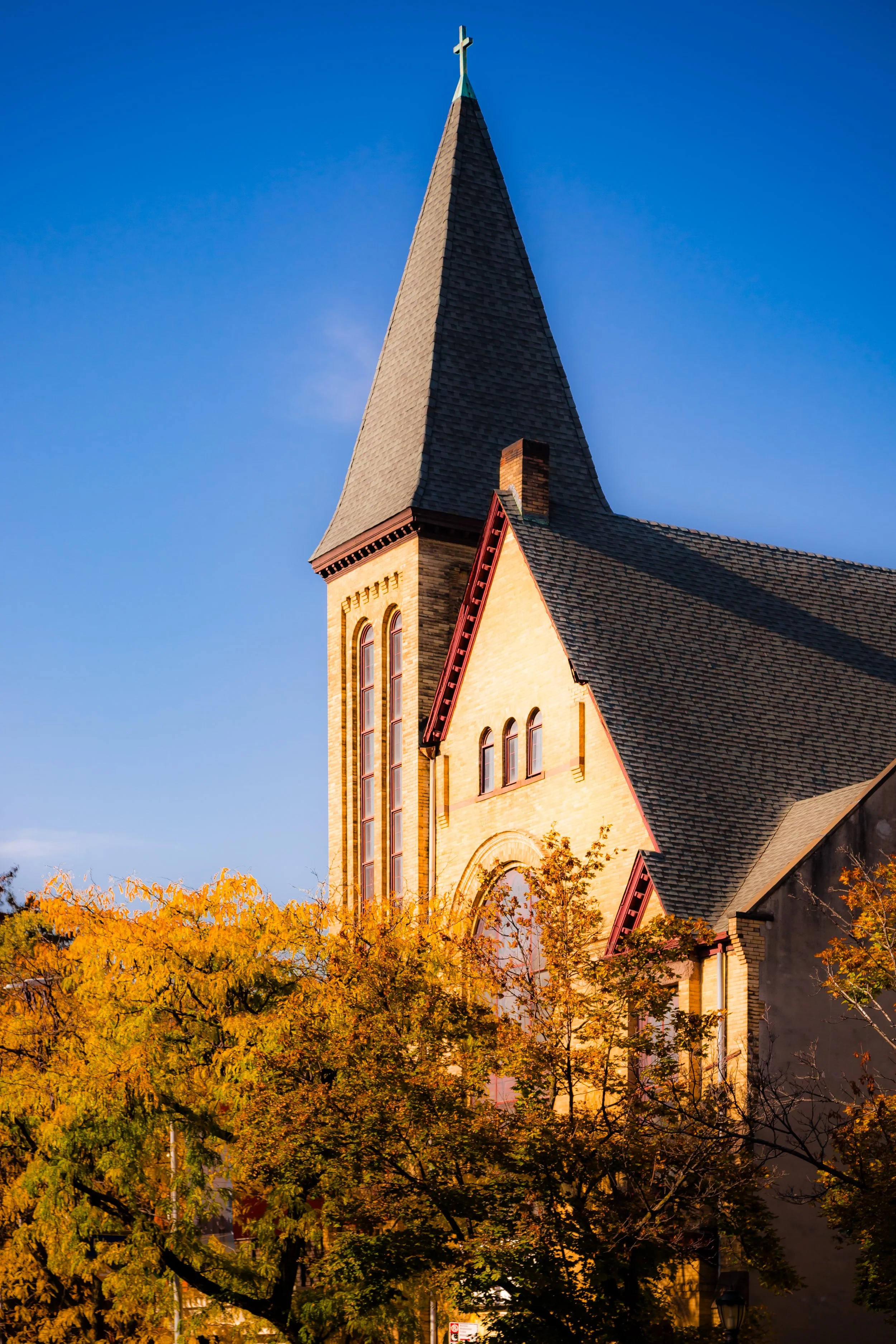
Churches such as St. Paul’s Episcopal (1849) on Clinton Street and Strong Place Baptist (1858) anchored the community spiritually and architecturally. On Atlantic Avenue, commerce flourished: groceries, carriage works, and small manufacturers clustered near the freight yards. The neighborhood’s layout—intimate blocks and narrow sidewalks shaded by elm and maple—encouraged sociability, while its modest but dignified architecture reflected the aspirations of a newly urban middle class.
By the end of the century, Boerum Hill was a mature, self-contained district—a mix of residential serenity and industrial vitality, typical of 19th-century Brooklyn’s layered urban fabric.
Early–Mid 20th Century: Immigration and Decline
The early 1900s brought waves of immigration that reshaped Boerum Hill’s demographics. Irish, Italian, and Syrian families filled the brownstones vacated by earlier owners, while Atlantic Avenue became the heart of Brooklyn’s Lebanese and Arab-American community. The corridor’s distinctive markets, bakeries, and cafés—many still operating today—gave the area its multicultural texture.
The opening of the Fourth Avenue subway (R train) in 1915 and proximity to the Long Island Rail Road terminal made the neighborhood accessible but also vulnerable to economic shifts. The Depression, coupled with postwar suburban flight, led to disinvestment. By the 1950s, many homes had been subdivided into rooming houses, and local factories shuttered as shipping declined. Yet even during this period, Boerum Hill retained the bones of its beauty: tree-lined streets, intricate brownstones, and a human scale that would later become its salvation.
Boerum Hill Photographic Video
Late 20th Century: Preservation and Revival
The modern revival of Boerum Hill began in the 1960s–1970s, when artists, preservationists, and young families—drawn by affordable brownstones—began restoring neglected properties. Local historian Helen Buckler and neighbors organized civic efforts to protect the area’s architecture and redefine its image, formally christening it “Boerum Hill.” In 1973, the Boerum Hill Historic District was designated by the Landmarks Preservation Commission, covering more than 250 buildings of 19th-century vintage.
During these decades, Smith Street and Atlantic Avenue evolved into cultural corridors—first with antique dealers and Arab grocers, later with design studios and restaurants. The restoration wave extended beyond architecture to community identity: block associations planted trees, organized stoop sales, and fostered an ethos of stewardship that would define Boerum Hill’s civic pride.
By the 1990s, the neighborhood’s blend of preservation and proximity made it a model for the broader “Brownstone Brooklyn” renaissance. Artists’ lofts gave way to boutiques, but the district retained its commitment to scale and continuity.
21st Century: A Neighborhood in Balance
Today, Boerum Hill represents one of New York’s most successful experiments in small-scale urban preservation. Its rows of restored brownstones coexist with new infill buildings designed to echo their proportions. On Smith Street, long known as “Restaurant Row,” culinary innovation mingles with everyday commerce. Atlantic Avenue remains a cultural corridor, home to the Atlantic Antic, one of Brooklyn’s oldest street festivals, and to a continuing Arab-American presence that preserves the avenue’s historical soul.
Though gentrification has raised property values and shifted demographics, Boerum Hill’s essential texture remains: stoops adorned with flower boxes, children playing on Wyckoff Street, and neighbors pausing to talk beneath mature trees. The proximity of Barclays Center and Downtown Brooklyn’s high-rises has not erased the neighborhood’s calm center; instead, Boerum Hill endures as a living reminder of how an urban district can evolve without losing its scale, memory, or grace.
Boerum Hill Photo Gallery
Spirit and Legacy
Boerum Hill’s legacy is craftsmanship and continuity—a neighborhood that embodies Brooklyn’s 19th-century urban ideal while accommodating 21st-century life. Its brick and brownstone façades tell stories of artisans and immigrants, preservationists and visionaries. The survival of these streets owes as much to community vigilance as to architectural merit: Boerum Hill’s residents have long understood that a neighborhood’s beauty lies not in grandeur but in proportion, care, and daily human presence.
New York City
Use this custom Google map to explore where every neighborhood in all five boroughs of New York City is located.
The Five Boroughs
One of New York City’s unique qualities is its organization in to 5 boroughs: Manhattan, Brooklyn, Queens, The Bronx, and Staten Island. These boroughs are part pragmatic administrative districts, and part vestiges of the region’s past. Each borough is an entire county in New York State - in fact, Brooklyn is, officially, Kings County, while Staten Island is, officially Richmond County. But that’s not the whole story …
Initially, New York City was located on the southern tip of Manhattan (now the Financial District) that was once the Dutch colony of New Amsterdam. Across the East River, another city was rising: Brooklyn. In time, the city planners realized that unification between the rapidly rising cities would create commercial and industrial opportunities - through streamlined administration of the region.
So powerful was the pull of unification between New York and Brooklyn that three more counties were pulled into the unification: The Bronx, Queens, and Staten Island. And on January 1, 1898, the City of New York unified two cities and three counties into one Greater City of New York - containing the five boroughs we know today.
But because each borough developed differently and distinctly until unification, their neighborhoods likewise uniquely developed. Today, there are nearly 390 neighborhoods, each with their own histories, cultures, cuisines, and personalities - and each with residents who are fiercely proud of their corner of The Big Apple.


