BELLAIRE
Queens
Part of an ongoing project to walk and photograph every neighborhood in New York City, this page explores Bellaire through history, fieldwork, and photography.


Map
Geographic Setting
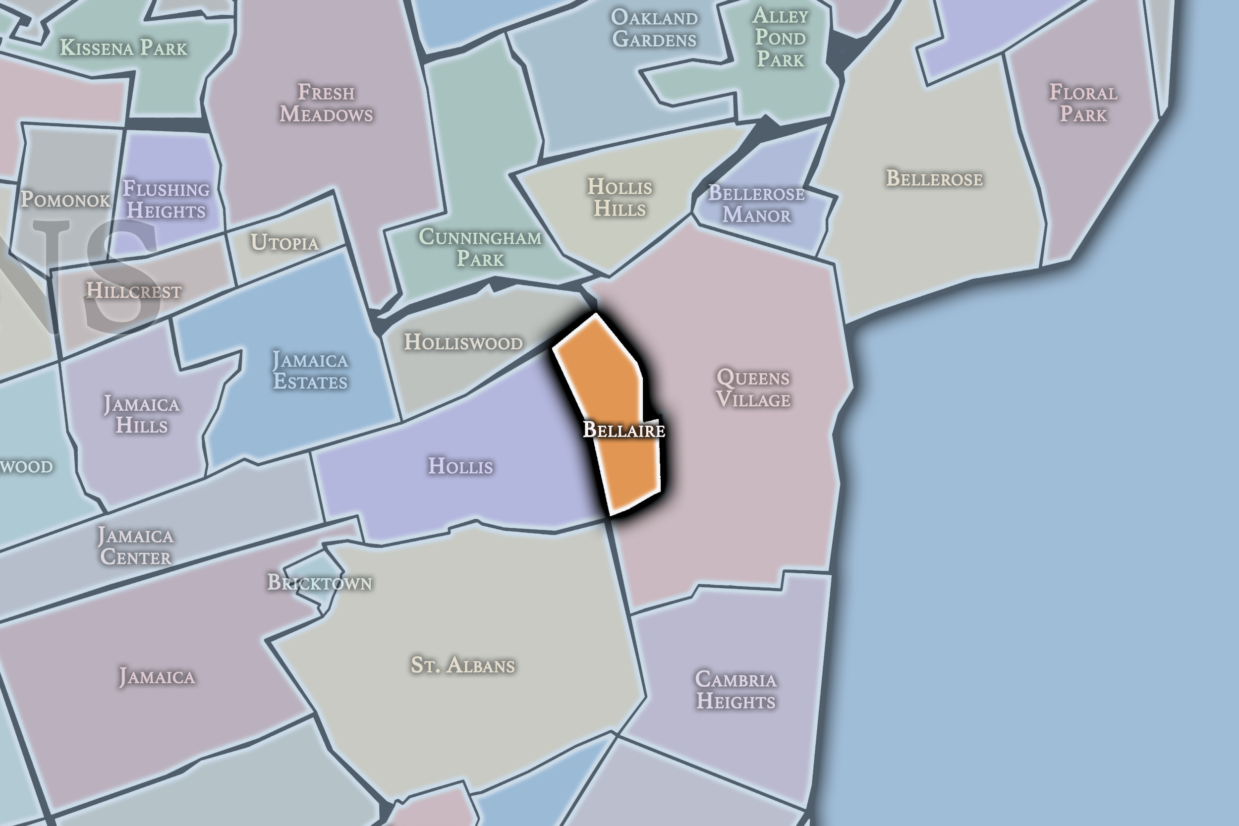
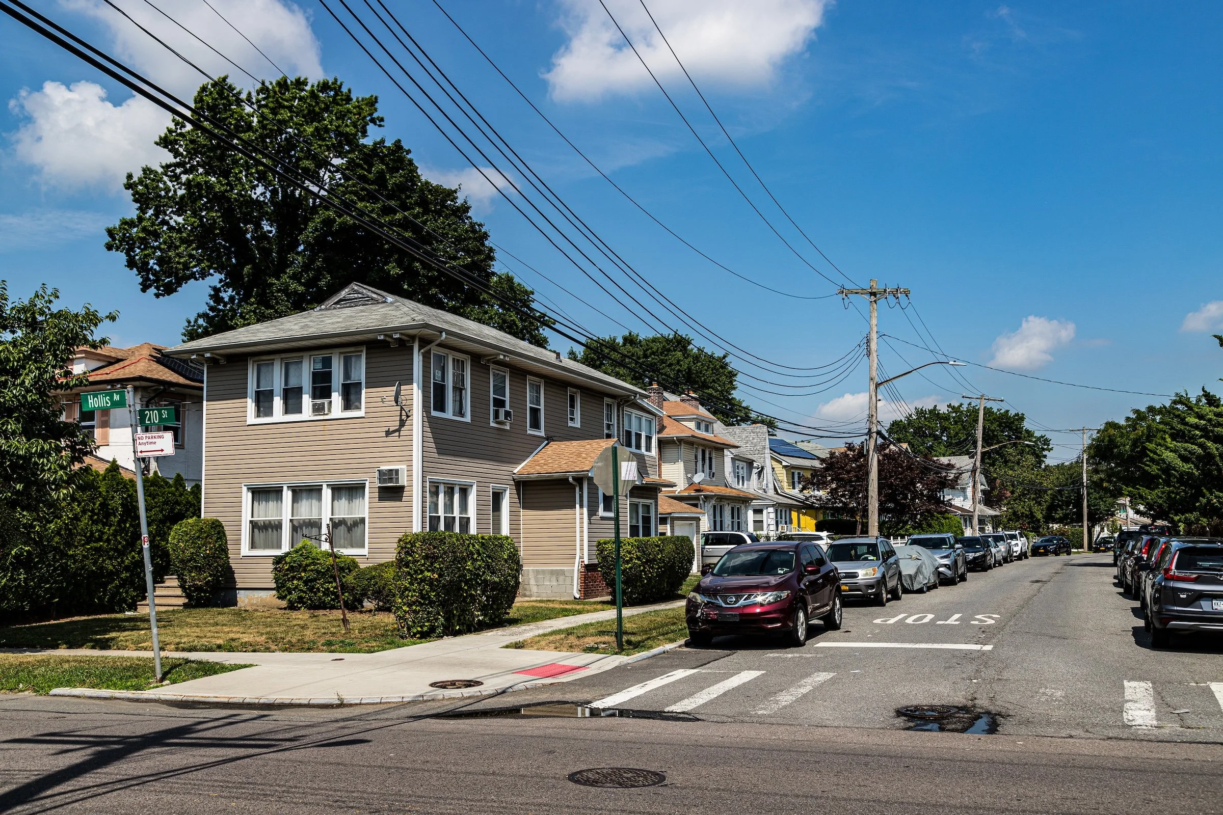
Bounded by Hollis Avenue to the south, Francis Lewis Boulevard to the west, Hillside Avenue to the north, and Hollis Court Boulevard and 212th Street to the east, Bellaire occupies a compact, residential stretch of eastern Queens between Hollis, Queens Village, and Cambria Heights. Nestled within the greater Jamaica Plain, its landscape reflects the borough’s early-20th-century suburban ideal: low-rise brick and frame houses, tree-lined sidewalks, and a rhythm of quiet streets where gardens, porches, and driveways dominate the view.
The neighborhood’s grid rises gently from south to north, with Francis Lewis Boulevard serving as its major western artery and Hollis Avenue connecting it westward toward Jamaica and eastward toward Bellerose. Within these boundaries, the streets are lined with detached and semi-detached homes—Tudor, Colonial, and Cape Cod in style—built largely between the 1920s and 1950s. Bellaire Playground, a small but well-loved park near 212th Street, provides a green heart to the community, while nearby Bellaire Station on the Long Island Rail Road (Hollis line) historically anchored the area’s identity as a commuter suburb. Today, while the station itself no longer bears the Bellaire name, its memory lingers in local topography and civic pride.
Identity
Etymology and Origins
The name “Bellaire” is of early-20th-century origin, likely chosen by real estate developers to evoke beauty and elevation—literally “beautiful air.” It echoed the era’s marketing trend of bucolic suburban branding, in which “-aire” or “-dale” suffixes suggested pastoral charm within reach of the metropolis. Bellaire began as part of the old Town of Jamaica, whose farmland was subdivided in the years following New York City’s consolidation in 1898. The extension of transit—first trolleys and later the Long Island Rail Road—made this section of eastern Queens a promising frontier for middle-class residential development.
Before subdivision, the area was a mix of woodlots, small truck farms, and open meadows worked by descendants of Dutch and English settlers. The arrival of the Jamaica & Hempstead Turnpike (Hillside Avenue) in the 19th century established the first east–west corridor, and by the early 1900s, developers promoted Bellaire as a “modern village” with paved roads, electricity, and easy rail access to Manhattan. Its relative elevation and breezy air made it particularly attractive during an age when urban living still carried associations of congestion and pollution.
Neighborhood Identity
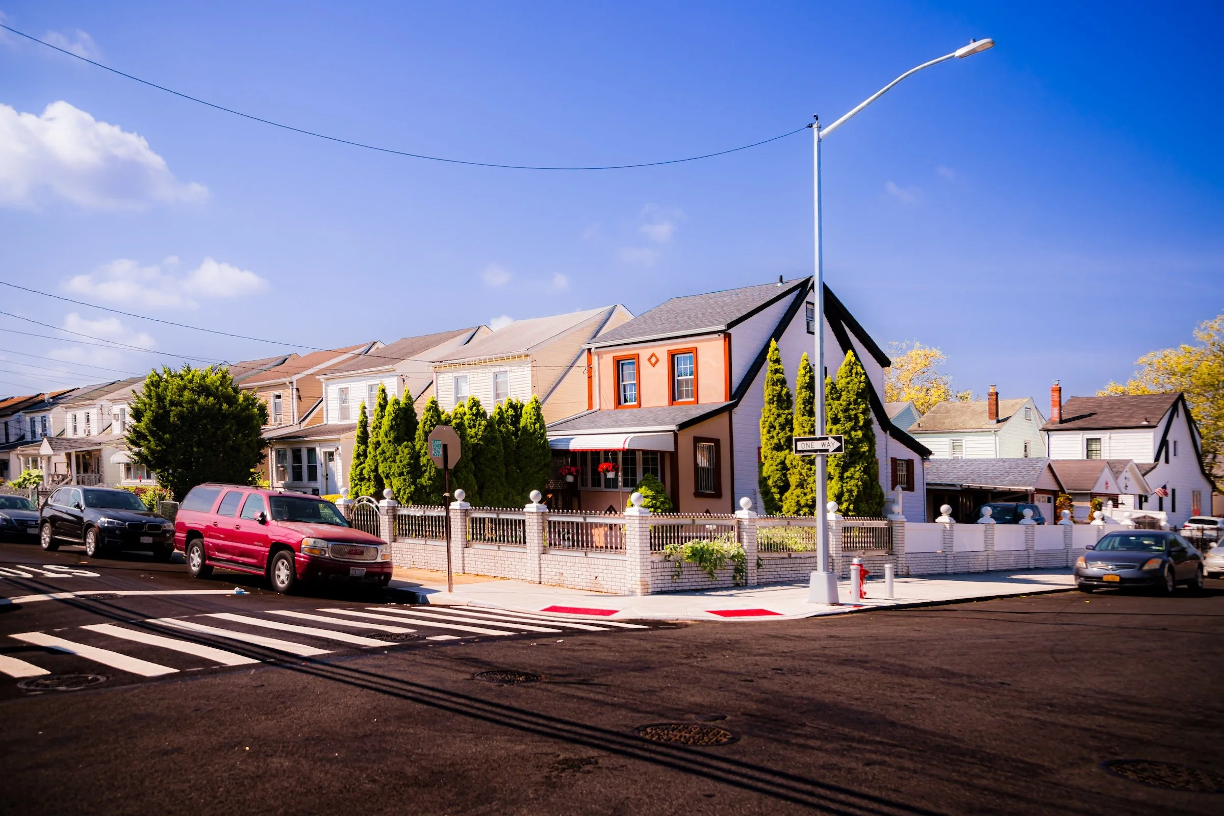
Bellaire is a compact residential enclave in eastern Queens whose identity rests in quiet continuity rather than commercial bustle. Tucked between Hollis, Queens Village, Cambria Heights, and the major corridors of Francis Lewis Boulevard, Hollis Avenue, and Hillside Avenue, it has long functioned as a modest commuter suburb defined by homeownership, local schools, civic pride, and a close-knit middle-class character.
What distinguishes Bellaire is the steadiness of its scale and rhythm. Its streets are lined with detached and semi-detached houses, small lawns, porches, driveways, and mature trees, creating a neighborhood that feels orderly, settled, and quietly self-contained even within the wider motion of eastern Queens. The result is a place shaped less by spectacle than by maintenance, familiarity, and the enduring appeal of a residential landscape built for everyday life.
Visual Identity
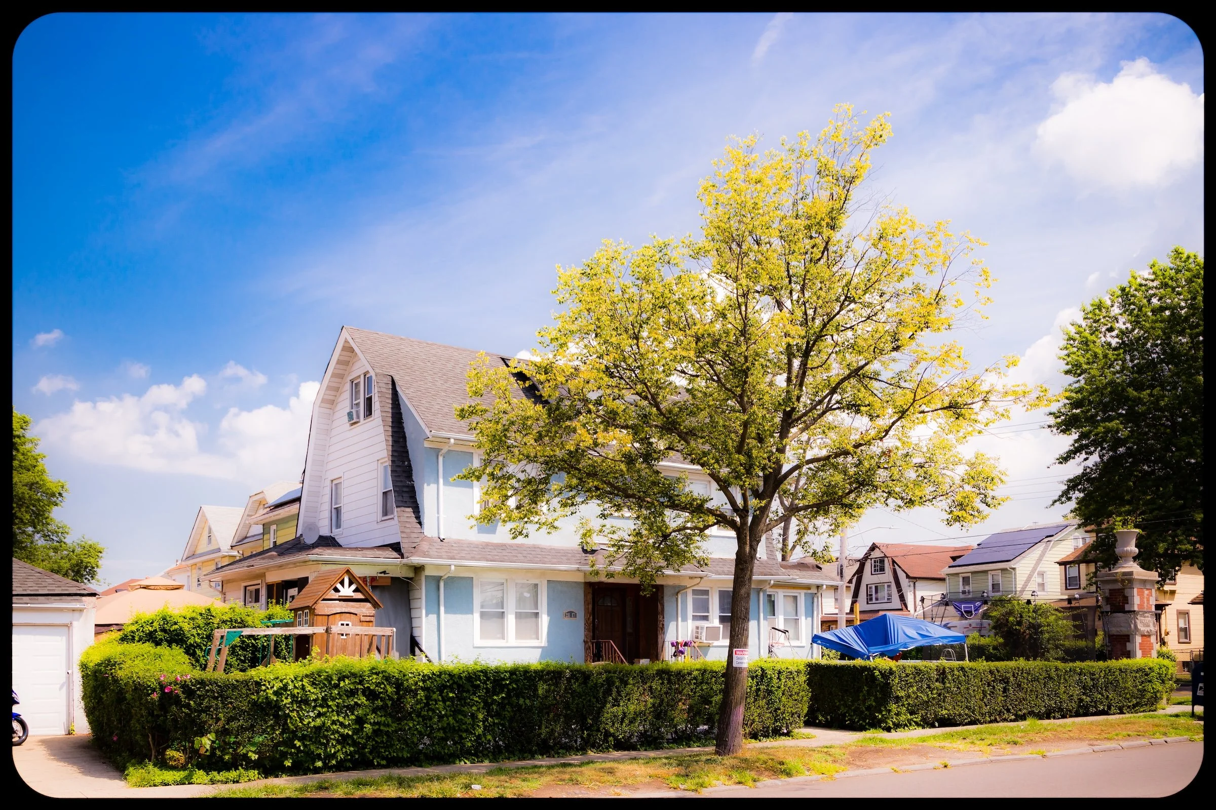
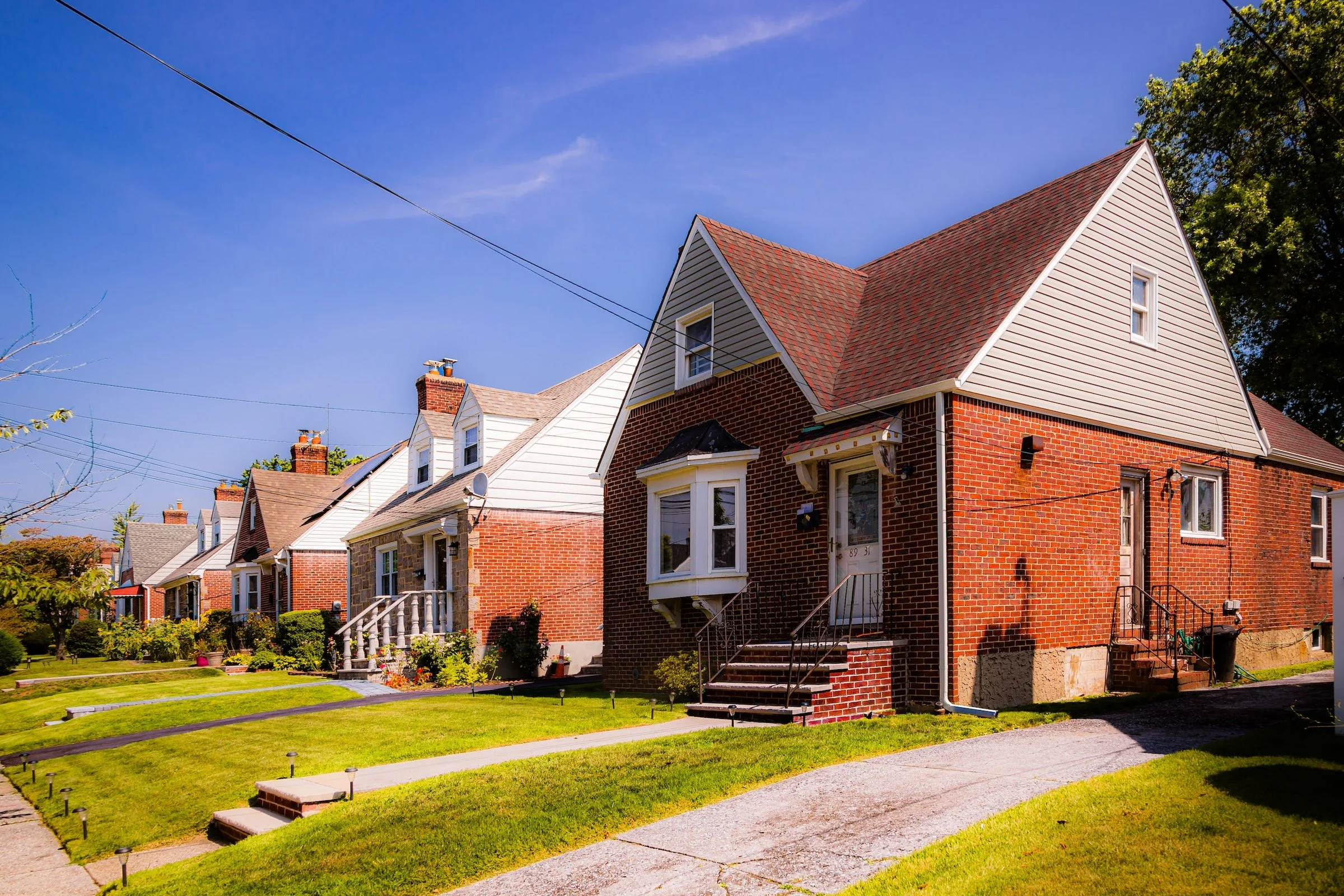
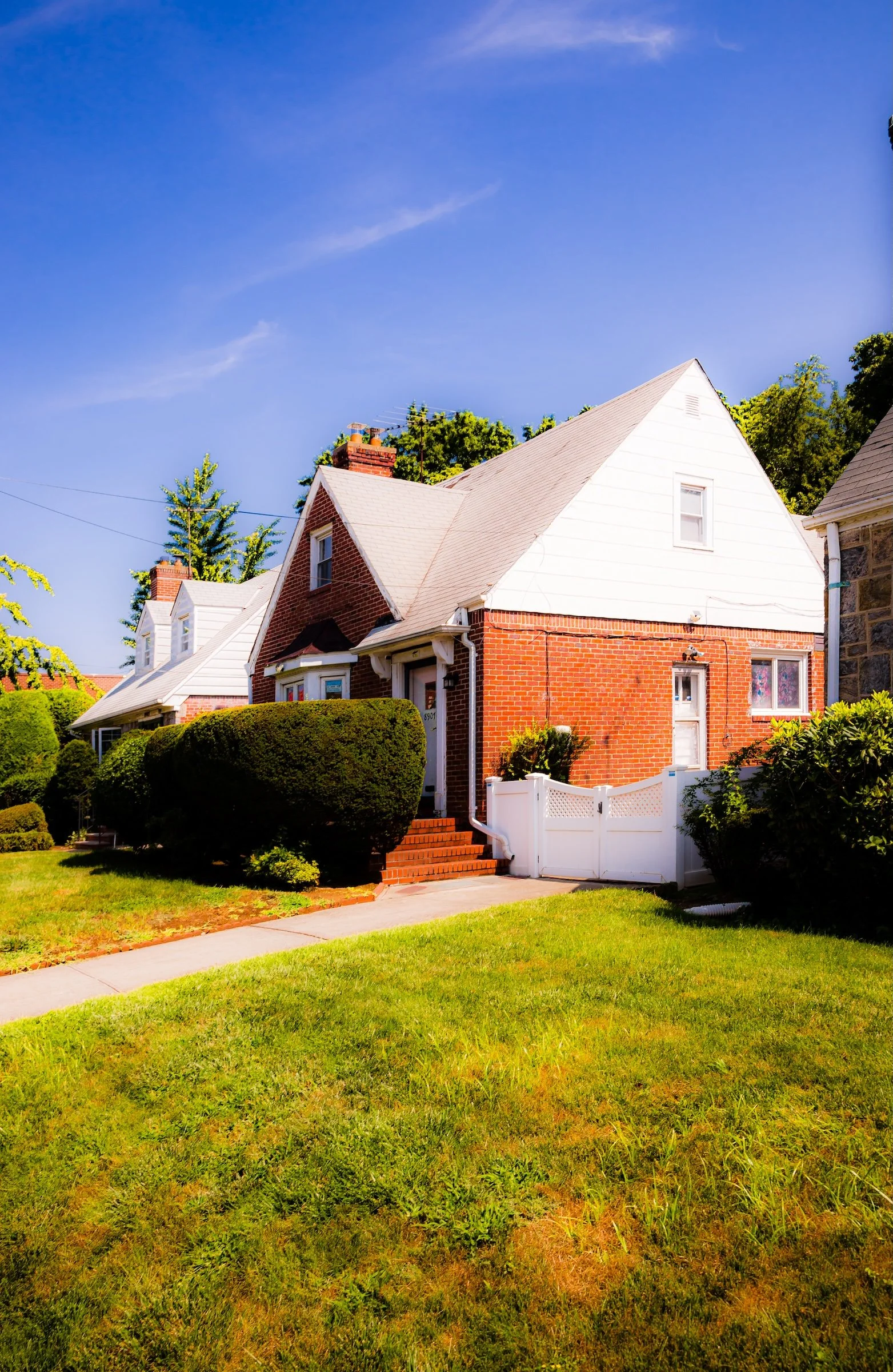
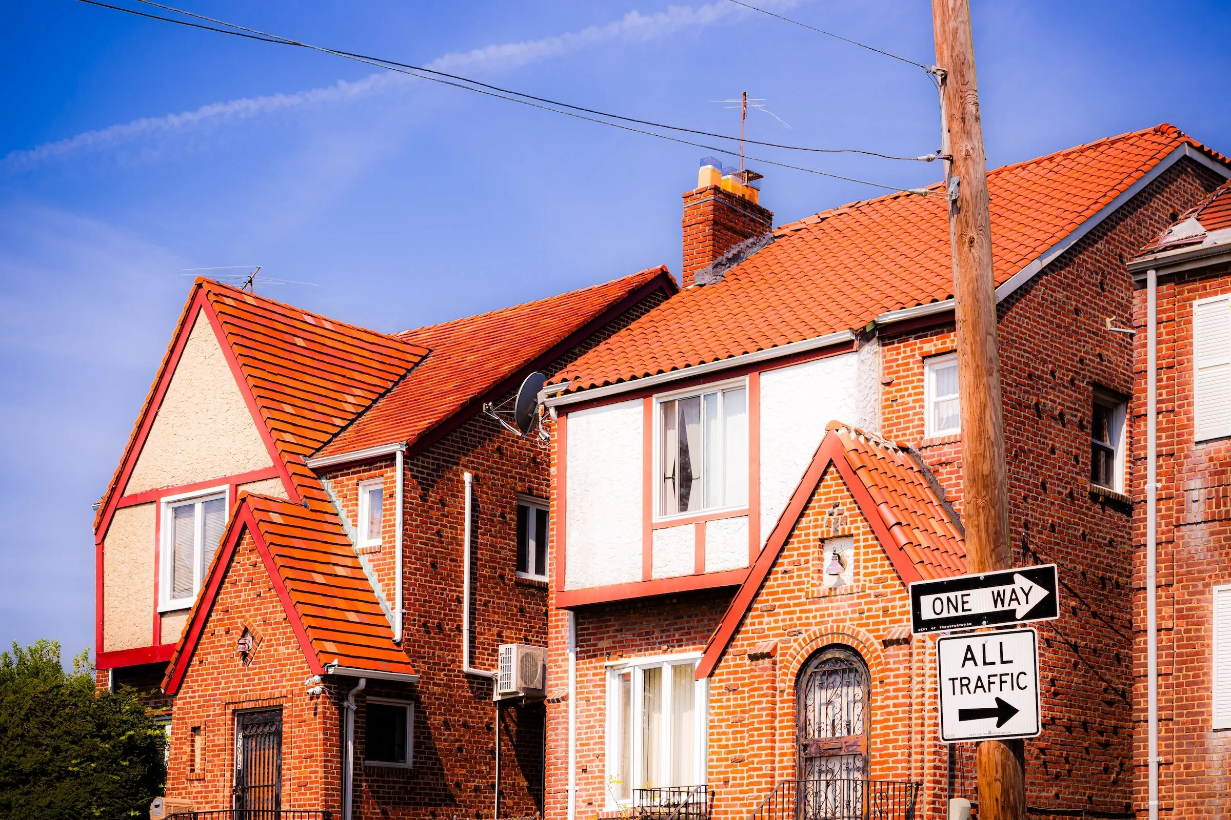
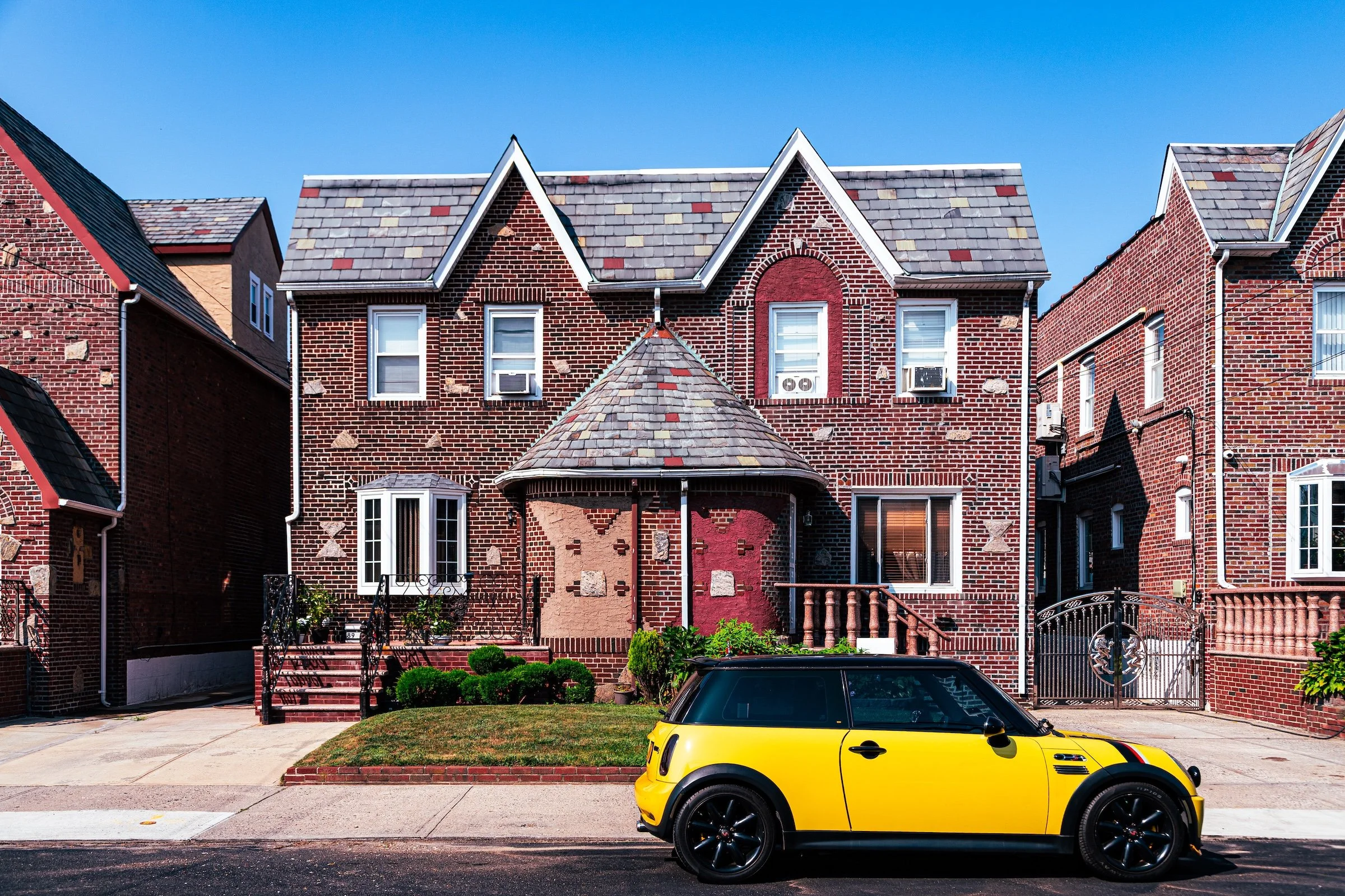
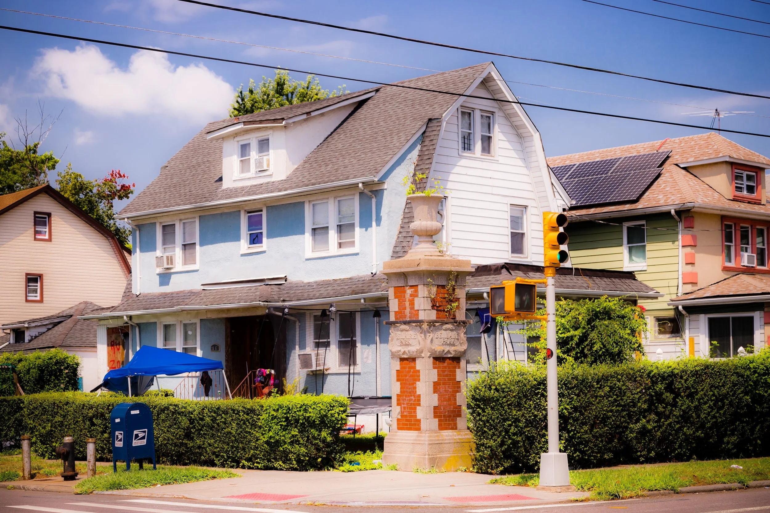
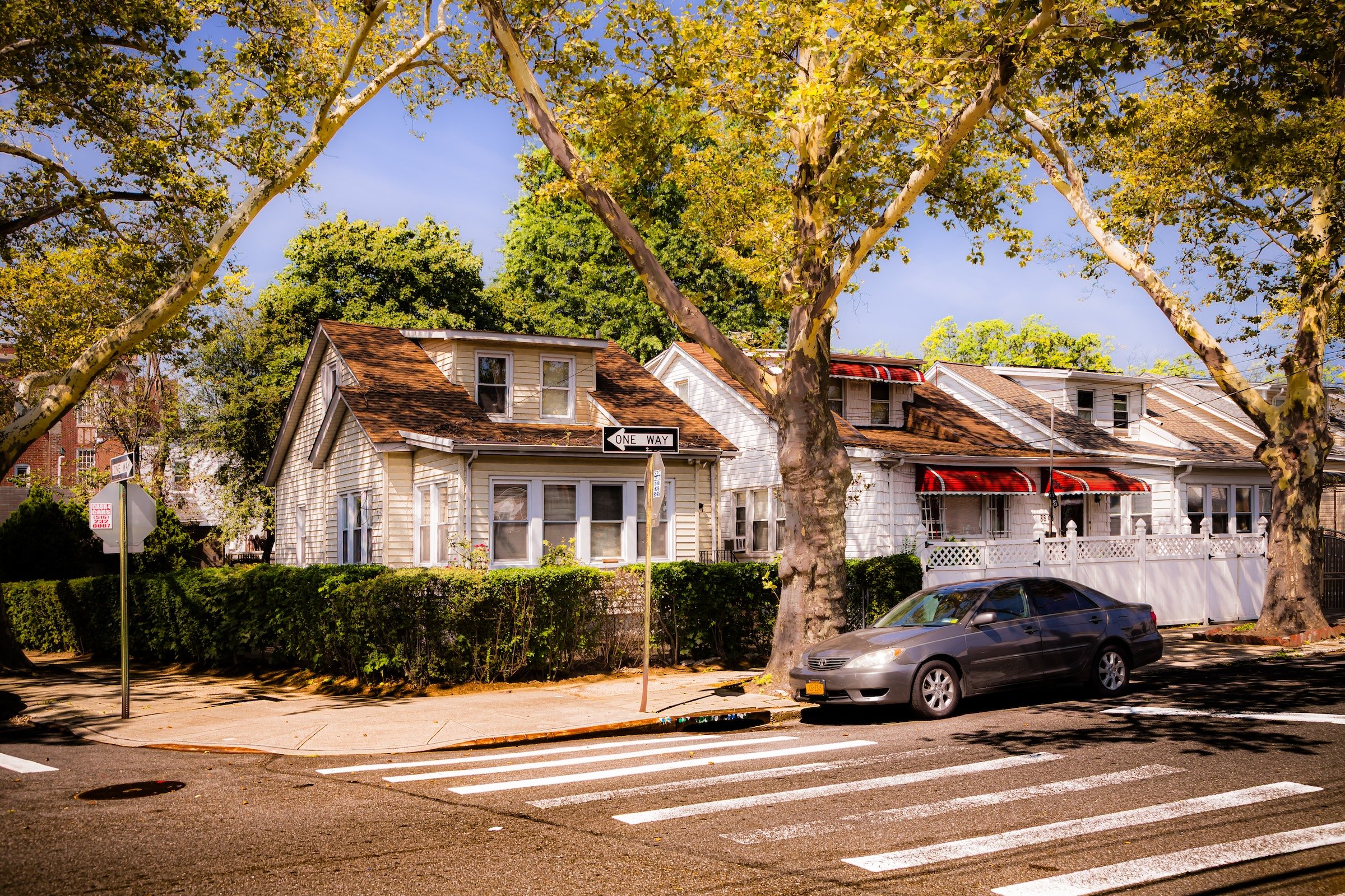
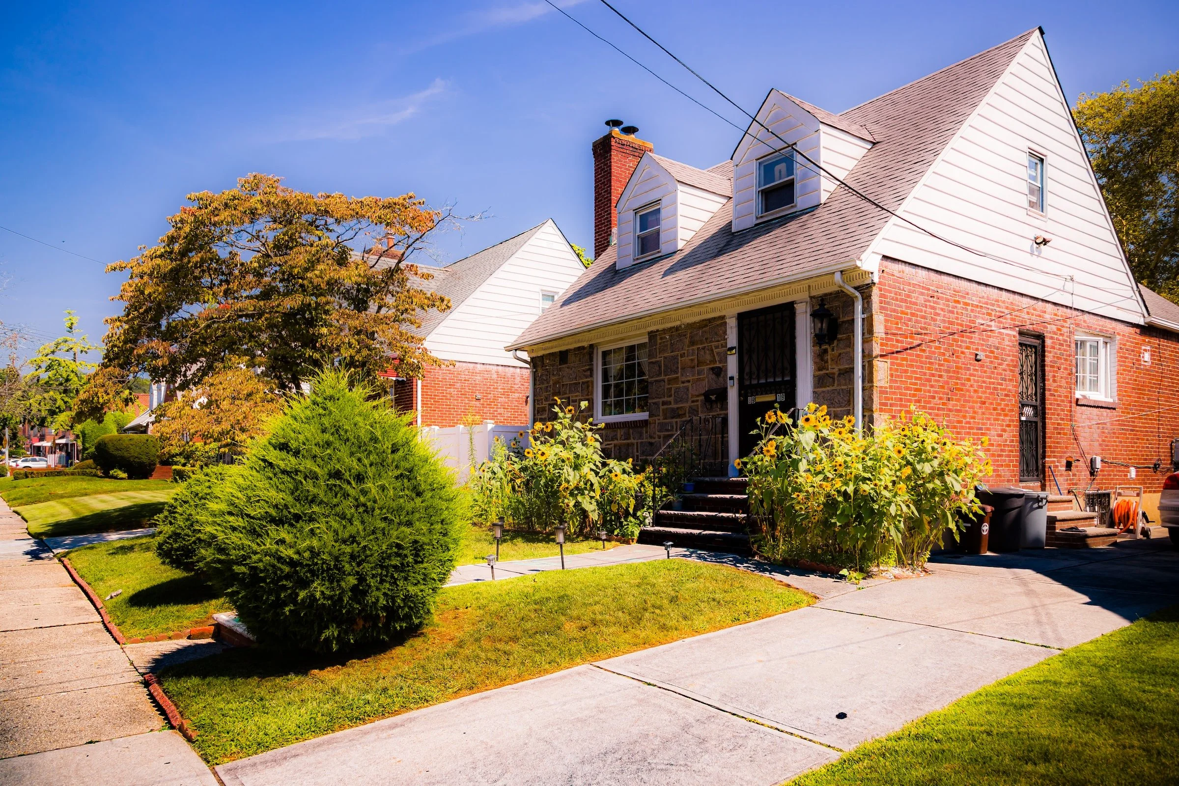
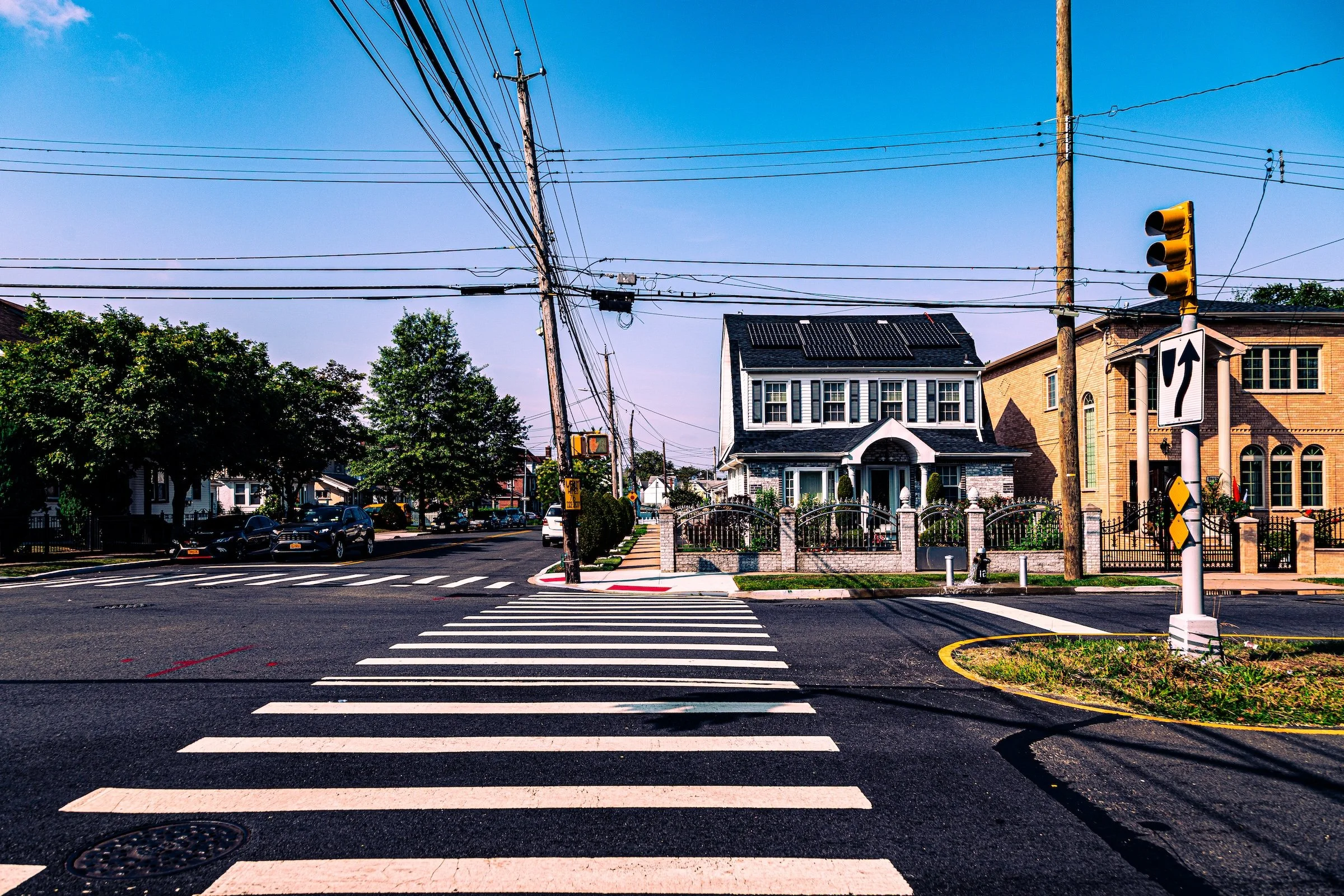
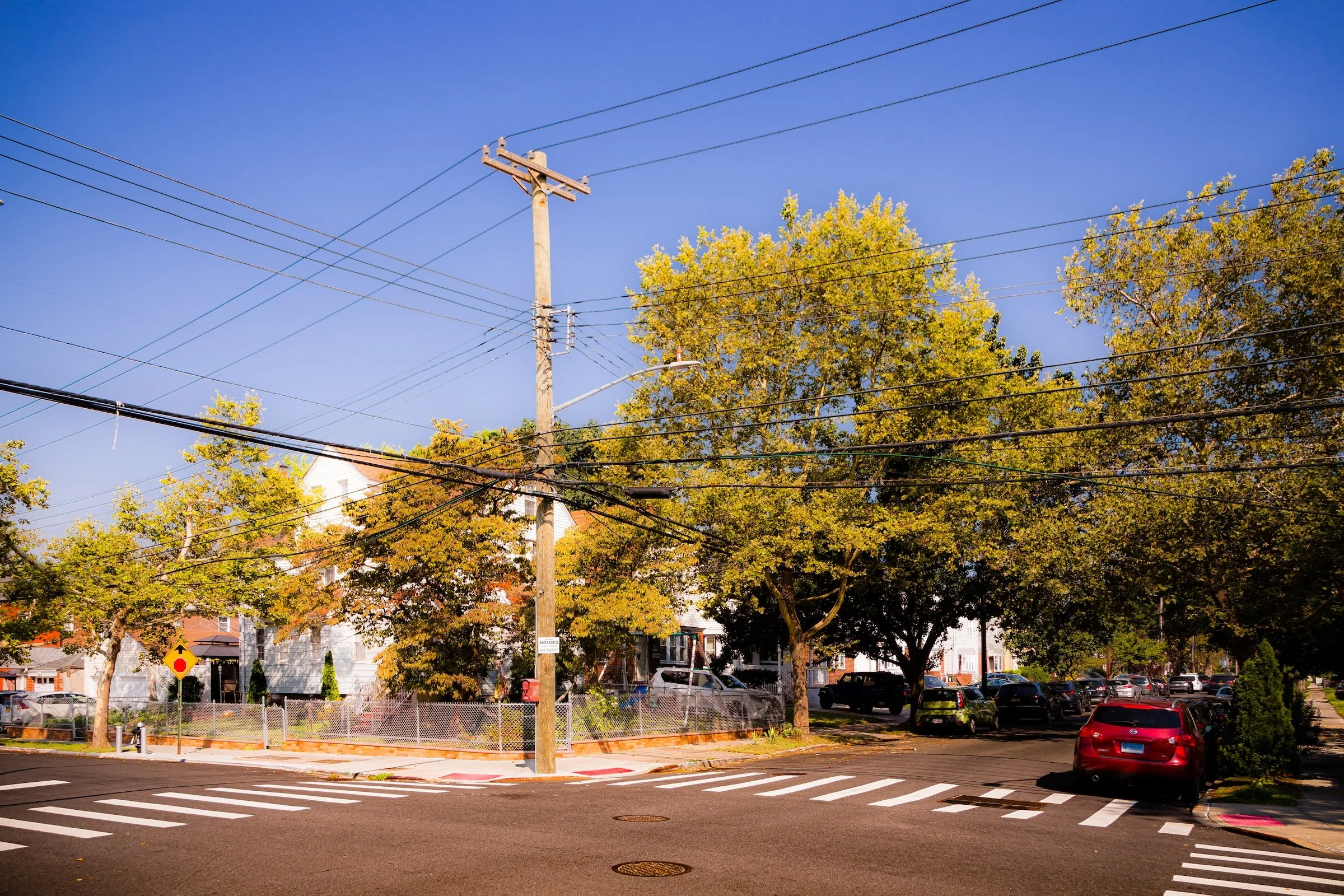
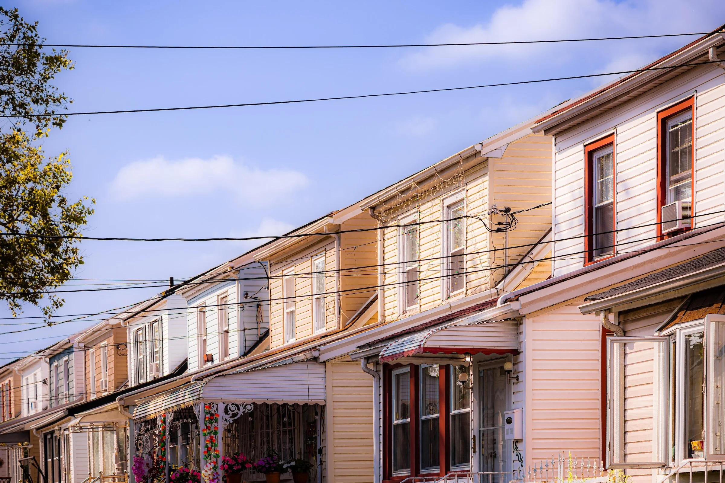
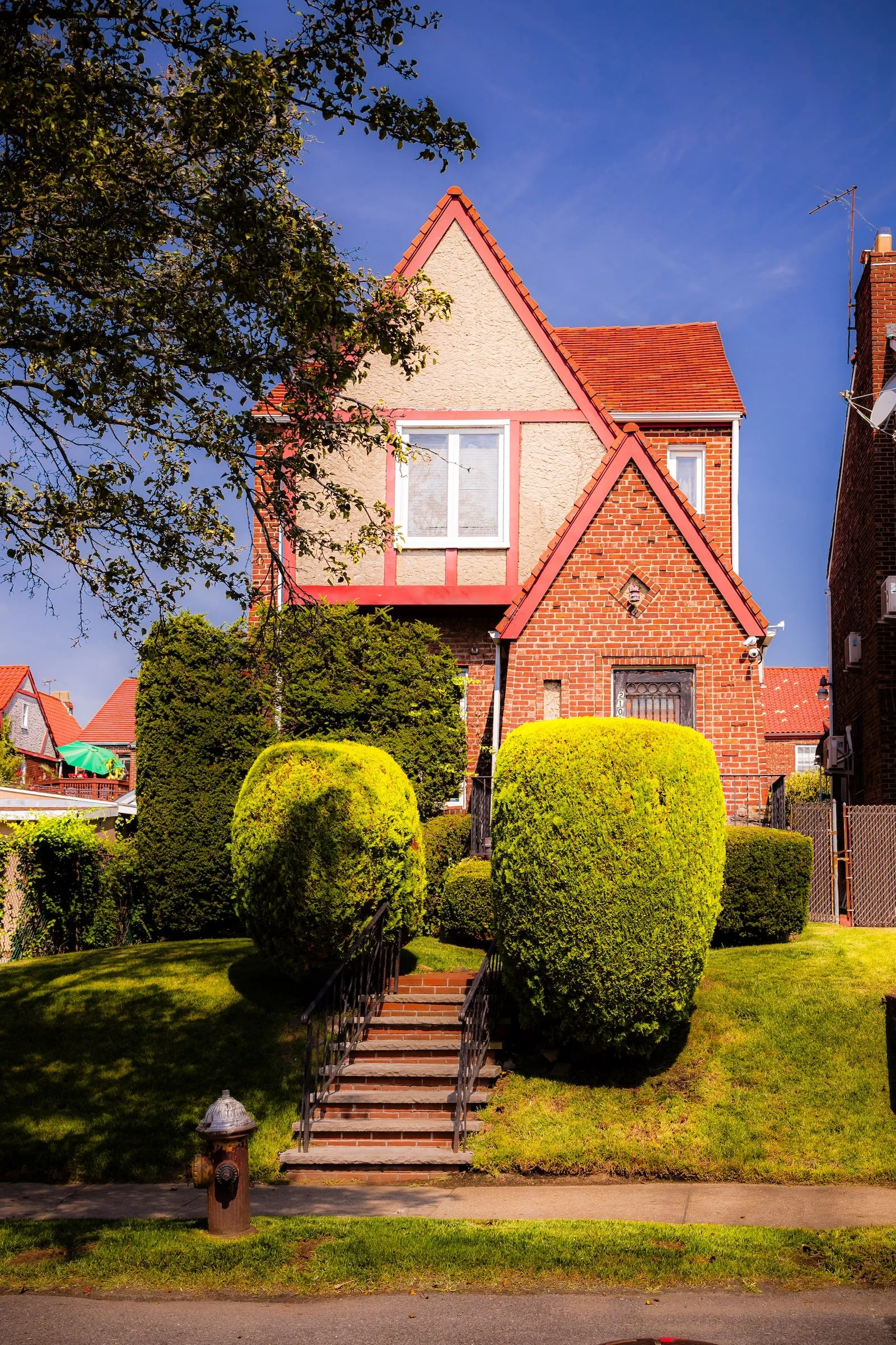
Bellaire’s visual identity is rooted in the repetition of house form, setback, and street rhythm. Tudor gables, brick Colonials, Cape Cod roofs, duplexes, hedges, and fences recur from block to block, producing a streetscape that feels composed not through grandeur but through consistency. In your contact sheet, that consistency comes through clearly: rows of peaked roofs, tidy façades, clipped lawns, and bright sidewalks give the neighborhood a sense of visual order that is both suburban and distinctly Queens.
What gives Bellaire its particular look is the tension between variety and cohesion. The houses differ in style, detail, and proportion, yet they share a common scale and cadence, so the neighborhood never feels fragmented. Sunlight sharpens brickwork, stucco, rooflines, and window frames, while the broad blue sky and open residential streets lend the blocks an airy clarity. Bellaire does not rely on landmark architecture; its character emerges through accumulation — the repeated geometry of domestic form, the modest elegance of well-kept homes, and the quiet shimmer created when light moves across brick, siding, and hedges.
History
Early 20th Century: A Suburban Ideal Emerges
By the 1910s, Bellaire’s grid had begun to take shape. The Bellaire Station—a stop on the Long Island Rail Road’s Main Line between Hollis and Queens Village—opened circa 1905, offering direct commuter service to Long Island City and, later, Pennsylvania Station. Around the station, developers erected neat rows of wood-frame and stucco houses designed for teachers, clerks, and small business owners—an early example of planned suburban housing in Queens.
Advertisements in New York newspapers touted Bellaire as “The High Ground of Queens,” emphasizing both its altitude and its healthful environment. The neighborhood’s earliest homes were built in the Arts and Crafts and Colonial styles, with small porches, bay windows, and gabled roofs. Paved sidewalks and uniform street trees reflected the influence of “garden city” principles that guided much of Queens’ interwar development. Churches, corner groceries, and schools soon followed, knitting the community into the wider fabric of Jamaica and Queens Village.
Mid-20th Century: Growth, Diversity, and Continuity
The 1930s through 1950s marked Bellaire’s full maturation as a residential neighborhood. The construction of Francis Lewis Boulevard and improvements to Hollis Avenue integrated it more tightly into the borough’s growing road network. Many original frame houses were replaced or expanded with brick Colonials and Tudors, typical of the post-Depression revival styles seen across Queens.
During these decades, Bellaire attracted a diverse cross-section of New Yorkers seeking stability and access to good schools. The population included Jewish, Italian, Irish, and German families, later joined by African-American and Caribbean households migrating eastward from Jamaica and Brooklyn after World War II. The Bellaire Civic Association, formed mid-century, worked to maintain neighborhood quality, organize block events, and advocate for local improvements such as park upkeep and traffic safety.
The closing of the Bellaire LIRR Station in the late 1970s marked a symbolic shift, as commuter patterns increasingly favored automobile travel. Yet the area retained its residential serenity: low-rise homes with yards, quiet streets, and a sense of enclosure defined by its bounded grid. Local churches—St. Gerard Majella Roman Catholic Church and various Protestant congregations—served as enduring anchors of community life.
Late 20th Century: Resilience in a Changing Borough
Through the 1970s–1990s, Bellaire reflected both the challenges and resilience of eastern Queens. Citywide fiscal crises and demographic transitions affected surrounding neighborhoods, but Bellaire remained largely stable thanks to strong homeownership and engaged residents. The community’s modest size and relative isolation from major commercial strips helped preserve its small-town feel. Home values, while modest compared to Bayside or Bellerose, remained strong due to the neighborhood’s reputation for safety, greenery, and civic pride.
In the 1980s and 1990s, Bellaire’s population became increasingly international, welcoming new immigrants from the Caribbean, South Asia, and Latin America. This diversity infused the area with cultural richness visible in local shops and church congregations, even as its streetscape remained unmistakably suburban. Many families undertook careful renovations, modernizing interiors while maintaining the traditional façades that give the neighborhood its cohesive charm.

21st Century: Quiet Continuity and Renewed Identity
In the 2000s and 2010s, Bellaire entered the new century as a calm, middle-class enclave amid the dynamism of eastern Queens. Its housing stock—solid brick homes with lawns and driveways—remains the backbone of the community, prized by residents for space, privacy, and accessibility. The Bellaire Playground continues to serve as the neighborhood’s gathering place, while schools and local civic groups sustain intergenerational engagement.
Though Bellaire lacks the retail bustle of larger districts, nearby Hollis Avenue and Hillside Avenue provide convenient access to stores and restaurants, and the Francis Lewis Boulevard corridor connects it seamlessly to regional arteries and expressways. Increasingly, younger families are rediscovering Bellaire as a pocket of affordability within commuting distance of Manhattan, drawn by its tranquility and established sense of place.
The area’s demographic mosaic continues to evolve—West Indian, South Asian, African-American, and Latino residents now share the tree-lined blocks once dominated by European immigrants. Yet the neighborhood’s essential character—quiet streets, tidy lawns, and civic pride—remains constant. Its low-rise landscape stands as a living record of the early 20th-century promise of homeownership in Queens.
Spirit and Legacy
Bellaire endures as one of those Queens neighborhoods whose legacy lies less in singular events than in the survival of a particular residential ideal. Developed in the early twentieth century and sustained through decades of demographic change, it has remained a neighborhood of modest aspiration: a place where brick houses, front gardens, churches, schools, and civic associations together shaped a stable and deeply lived-in community.
What gives Bellaire its lasting spirit is this combination of humility and care. Its streets do not announce themselves loudly, yet they preserve a strong sense of human scale, neighborly continuity, and visual coherence. That persistence matters. In a borough constantly remade by growth and movement, Bellaire still reads as a landscape of settled domestic life, where the promise of homeownership, privacy, and quiet dignity remains visible in the texture of the blocks themselves.
Photography
Bellaire is a bucolic neighborhood, featuring wide avenues, tree-lined streets and plenty of stand-alone homes. There are some pockets of attached and duplex houses and commercial storefronts on major thoroughfares. These Lexicon strategies can help you get the most out of your explorations of Bellaire:
Corner Angles - Wide-angle compositions in which triangular forms created by streets, buildings, shadows, or perspective anchor the image with tension and geometric clarity.
Crosswalk Cadence - Street photography in which crosswalk markings create rhythm, structure, and movement across the frame.
Painting With Light - A way of seeing in which natural sunlight turns ordinary scenes luminous, atmospheric, and almost painterly.
The Power of Lines - Photography in which strong linear elements guide the eye and give the image its underlying structure and direction.
The Wraparound - Compositions in which a curving or enclosing element, such as a corner, porch, façade, or street edge, draws the eye around the frame and deepens the sense of space.
Of course, these are just the beginning - and hardly the only ways to see Bellaire. I encourage you to experiment and find your own personal Photographic Lexicon.
Through The Lens
If you visit Bellaire, these ideas can help inspire your own photography.
Bellaire Video Coming Soon
Bellaire Photo Gallery
Bellaire Field Notes
-
Field Note: August 5, 2023 | 09:32 AM
Conditions: 80°F | Humidity: 54%.
Field Note: Documenting Bellaire at the midday peak, the 11.2 mph winds provided a necessary counterpoint to the rising heat. The drying air resulted in a "stark" visual quality, making the sturdy Tudor-style brickwork of the residential rows appear especially prominent against the cloudless sky.
Bellaire shimmered in the high morning sun, with light catching the steep gables of the local Tudors and illuminating impeccably kept lawns. There is a deep, relaxing stillness here that feels a world away from the rest of the borough.
Other neighborhoods visited:

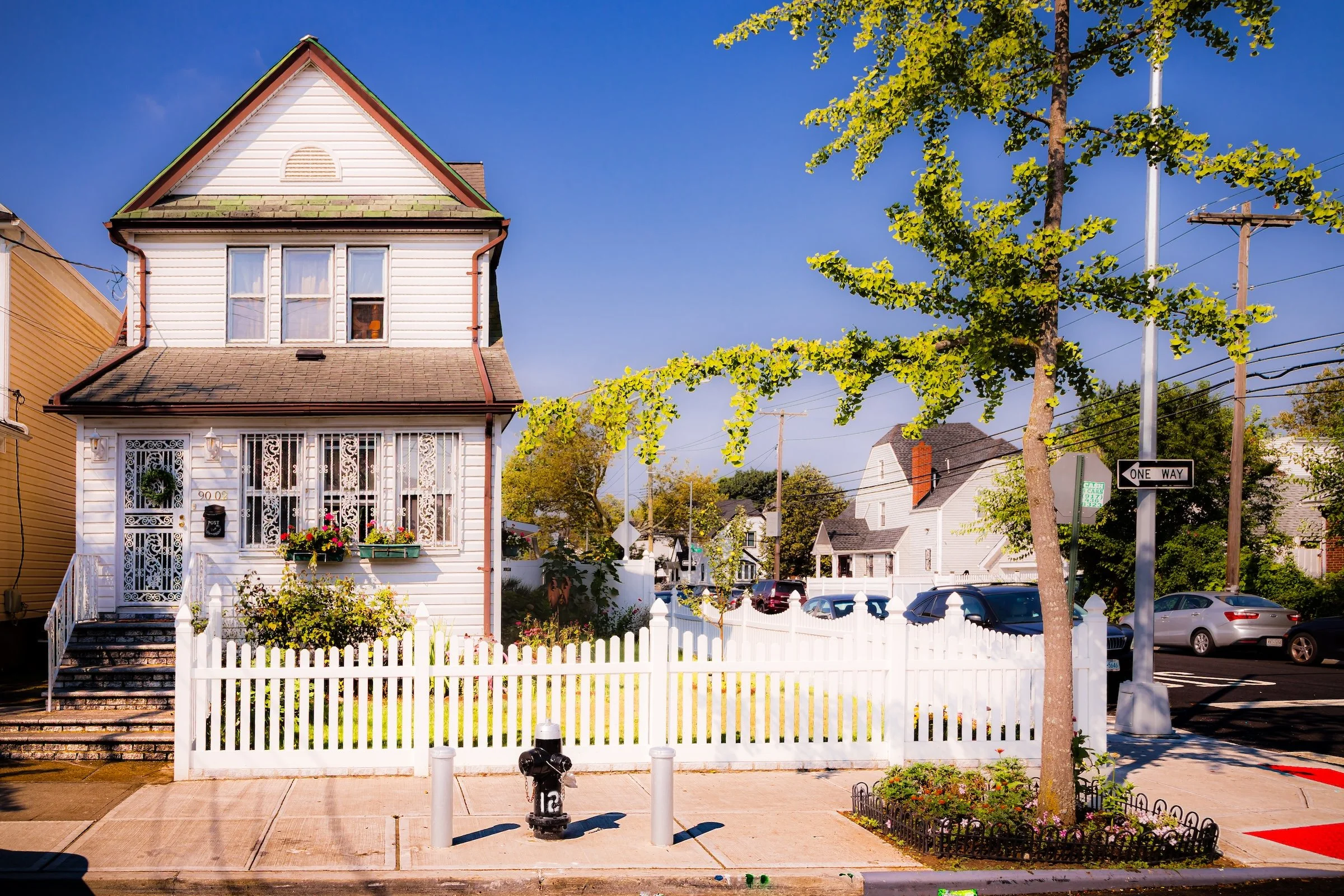
90-02 211th - Click To Purchase Print
Crossing 208th At 90th - Click To Purchase Print

208th Street Duplex - Click To Purchase Print
Windows On 207th - Click To Purchase Print
210-15 89th - Click To Purchase Print
Use this custom Google map to explore where every neighborhood in all five boroughs of New York City is located.
The Five Boroughs
One of New York City’s unique qualities is its organization in to 5 boroughs: Manhattan, Brooklyn, Queens, The Bronx, and Staten Island. These boroughs are part pragmatic administrative districts, and part vestiges of the region’s past. Each borough is an entire county in New York State - in fact, Brooklyn is, officially, Kings County, while Staten Island is, officially Richmond County. But that’s not the whole story …
Initially, New York City was located on the southern tip of Manhattan (now the Financial District) that was once the Dutch colony of New Amsterdam. Across the East River, another city was rising: Brooklyn. In time, the city planners realized that unification between the rapidly rising cities would create commercial and industrial opportunities - through streamlined administration of the region.
So powerful was the pull of unification between New York and Brooklyn that three more counties were pulled into the unification: The Bronx, Queens, and Staten Island. And on January 1, 1898, the City of New York unified two cities and three counties into one Greater City of New York - containing the five boroughs we know today.
But because each borough developed differently and distinctly until unification, their neighborhoods likewise uniquely developed. Today, there are nearly 390 neighborhoods, each with their own histories, cultures, cuisines, and personalities - and each with residents who are fiercely proud of their corner of The Big Apple.


