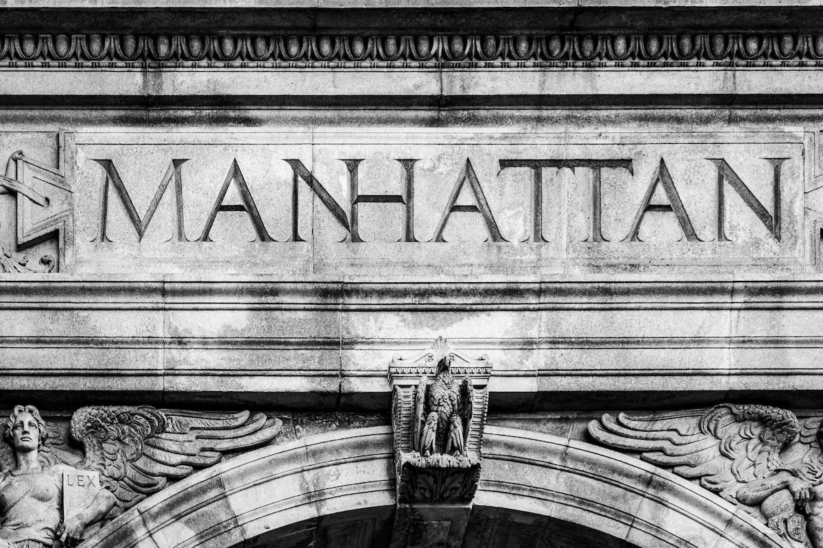
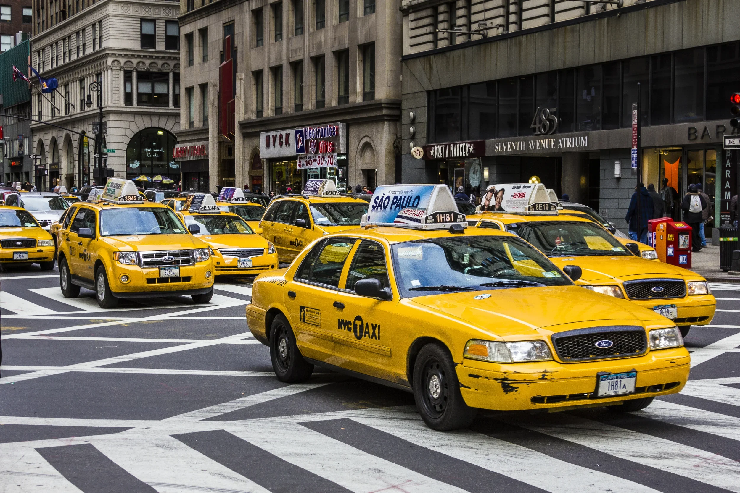
MANHATTAN
Part of an ongoing project to walk and photograph every neighborhood in New York City, this page explores Manhattan through maps, borough identity, history, and photography.

The Maps
Geographic Setting
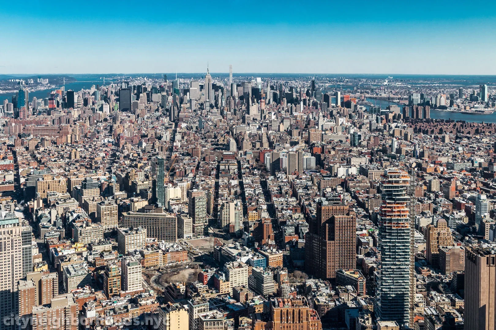
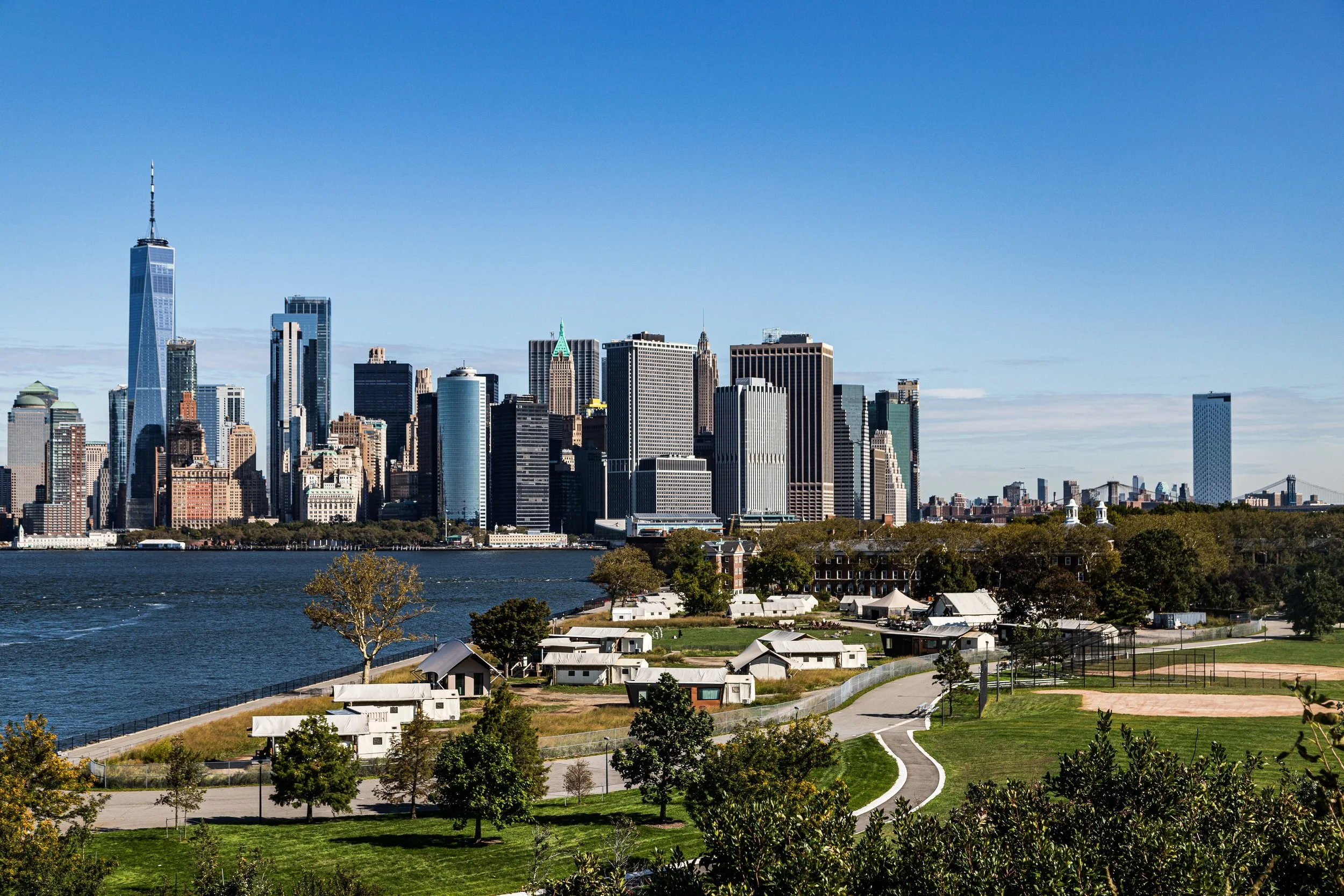
The island of Manhattan, long regarded as the beating heart of New York City, stretches thirteen and a half miles from the Harlem River in the north to the Battery in the south, flanked by the Hudson River to the west and the East River to the east. Its width varies—from barely a half-mile at its southern tip to over two miles in the north—its shoreline once a natural contour of coves, marshes, and inlets, now reshaped by centuries of human ambition. The island’s backbone is granite—Manhattan schist—a resilient bedrock that has literally and symbolically supported the rise of its world-famous skyline.
From the salt breezes of Battery Park to the bluffs of Inwood Hill, Manhattan holds within its narrow frame the full range of the city’s topography and temperament: tidal flats and forest remnants, ancient ridges and engineered parks, skyscrapers and tenements, boulevards and cobbled lanes. It is both a natural formation and an artifact—an island remade by centuries of vision, commerce, and migration.
Manhattan Identity
Borough Identity
Manhattan is one of the world’s most recognizable urban landscapes, yet its identity extends far beyond the skyline alone. It is a borough of compression and contrast: glass towers and brownstone rows, ceremonial avenues and intimate side streets, financial districts and village-like enclaves, monumental institutions and everyday neighborhood rituals. Vertical, concentrated, and in constant motion, Manhattan feels both globally symbolic and intensely local, shaped as much by quiet textures and lived routines as by spectacle and scale.
What distinguishes Manhattan is not simply density or fame, but concentration: of capital, culture, architecture, memory, and competing ideas of what the city is meant to be. Its neighborhoods are not merely districts within a central core, but distinct worlds shaped by commerce, immigration, geography, artistic life, and reinvention.
The name “Manhattan” derives from the Lenape word “Mannahatta,” often translated as “island of many hills.” To the Lenape, who inhabited the island for millennia before European arrival, it was part of a vast network of waterways and hunting grounds stretching across the region they called Lenapehoking. Its forests teemed with game; its shores yielded clams, fish, and oysters; and its hills—today leveled or buried beneath streets—offered vantage and refuge.
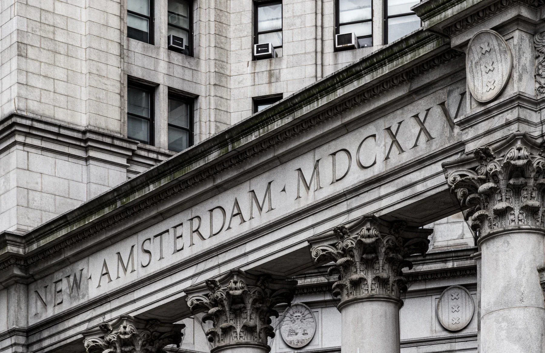
In 1626, Dutch traders of the Dutch West India Company established the settlement of Nieuw Amsterdam at the island’s southern tip, purchasing the land—according to colonial legend—for goods valued at 60 guilders. While the transaction’s details remain apocryphal, the moment marked the beginning of Manhattan’s transformation from Lenape homeland to European colony.
Etymology and Origins
The Visual Identity of Manhattan
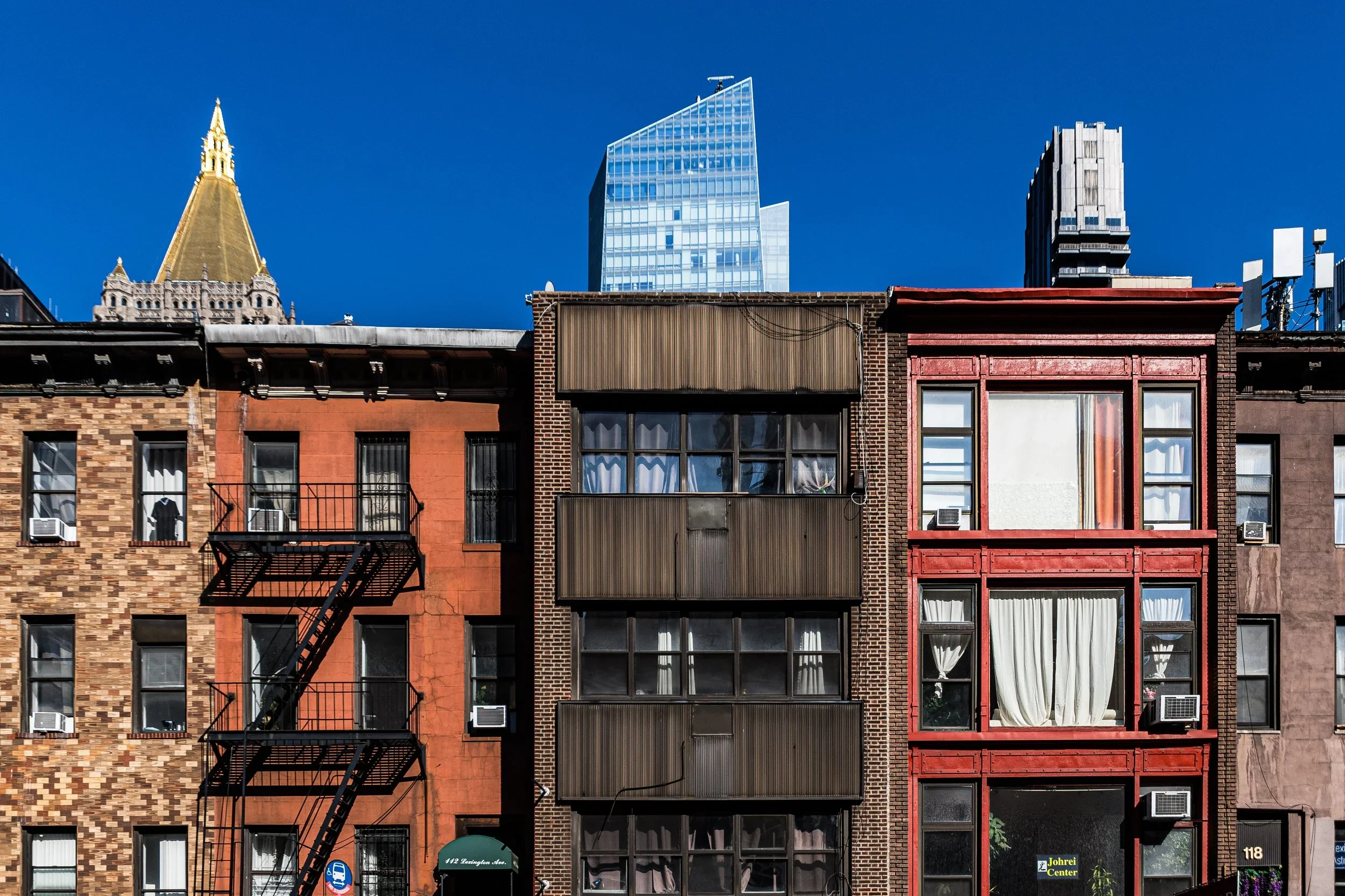
Manhattan’s visual language is one of repetition and interruption. Facades rise in ordered lines, windows stack into grids, towers frame the sky, and avenues pull the eye forward with cinematic force. Yet that regularity is constantly broken by diagonals, older street patterns, sudden gardens, ornamental detail, scaffolding, steam, reflections, and the human improvisations that animate the built environment.
It is a borough where mercantile streets, tenement blocks, Beaux-Arts grandeur, postwar office towers, public housing, waterfront esplanades, and contemporary glass construction coexist in dense and often startling proximity. Manhattan is both designed and accumulated, monumental and intimate, polished and improvised.
-
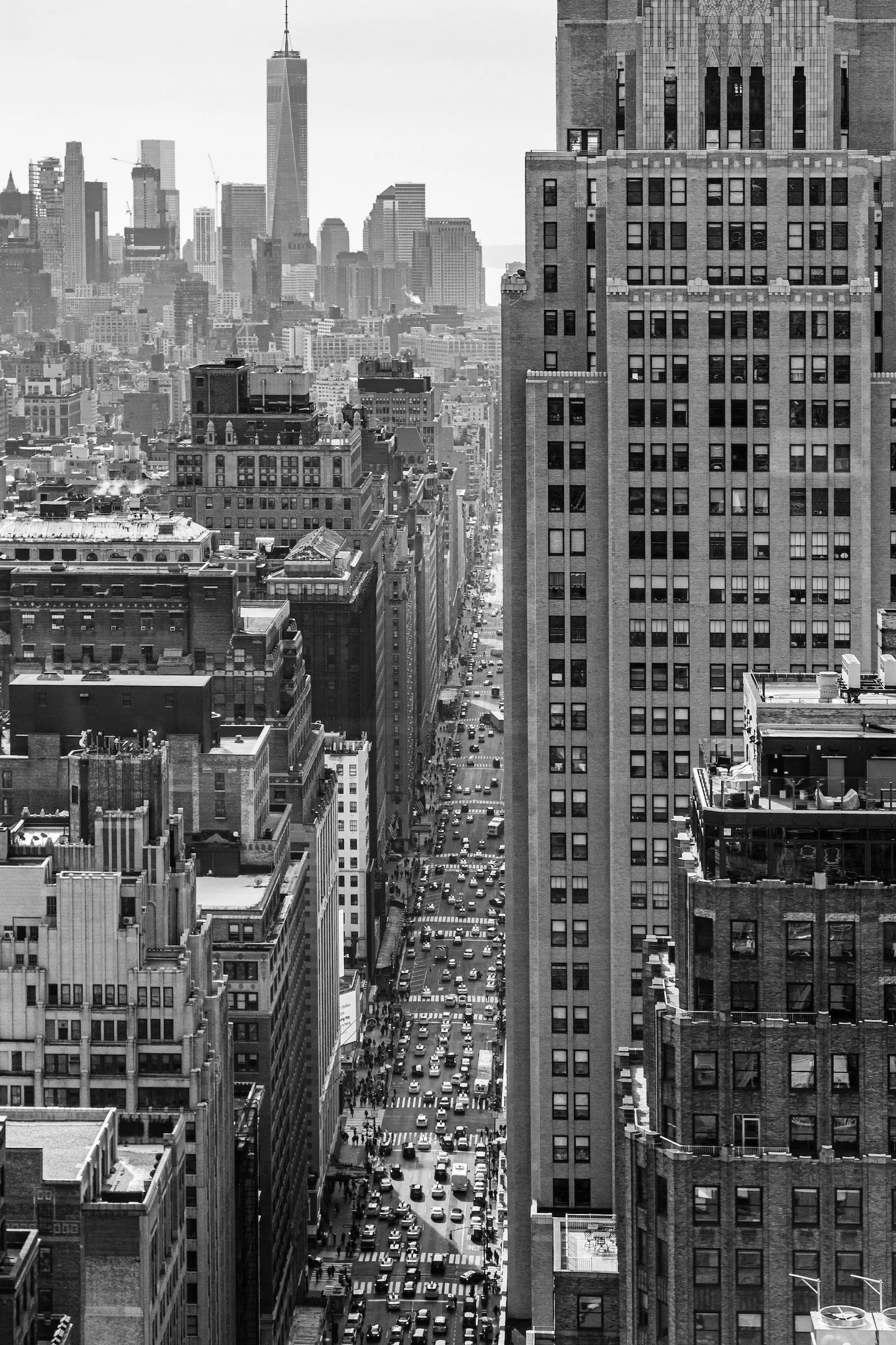
Depth and Distance
-
Repetitions & Patterns
-

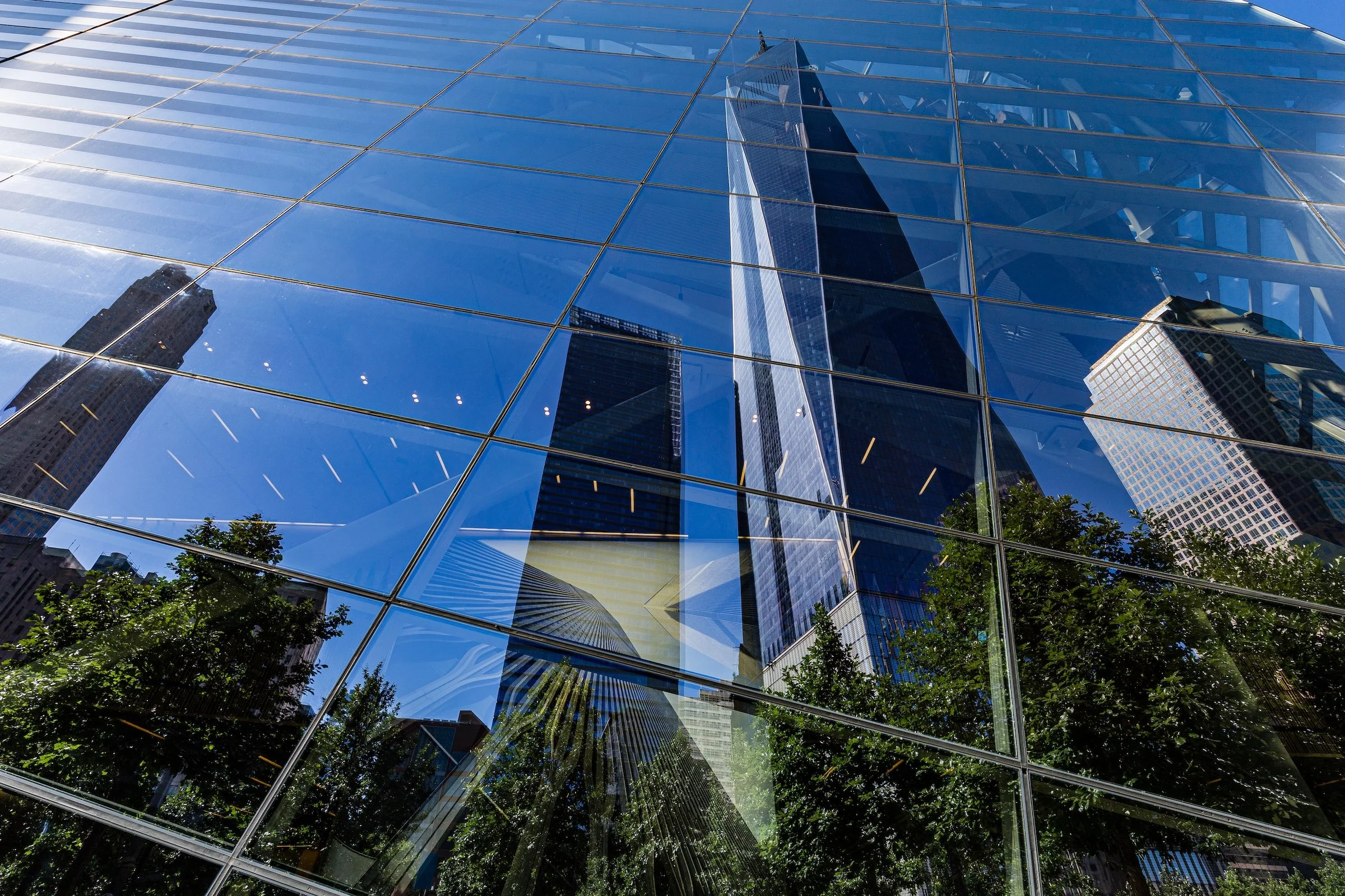
A City of Reflections
-
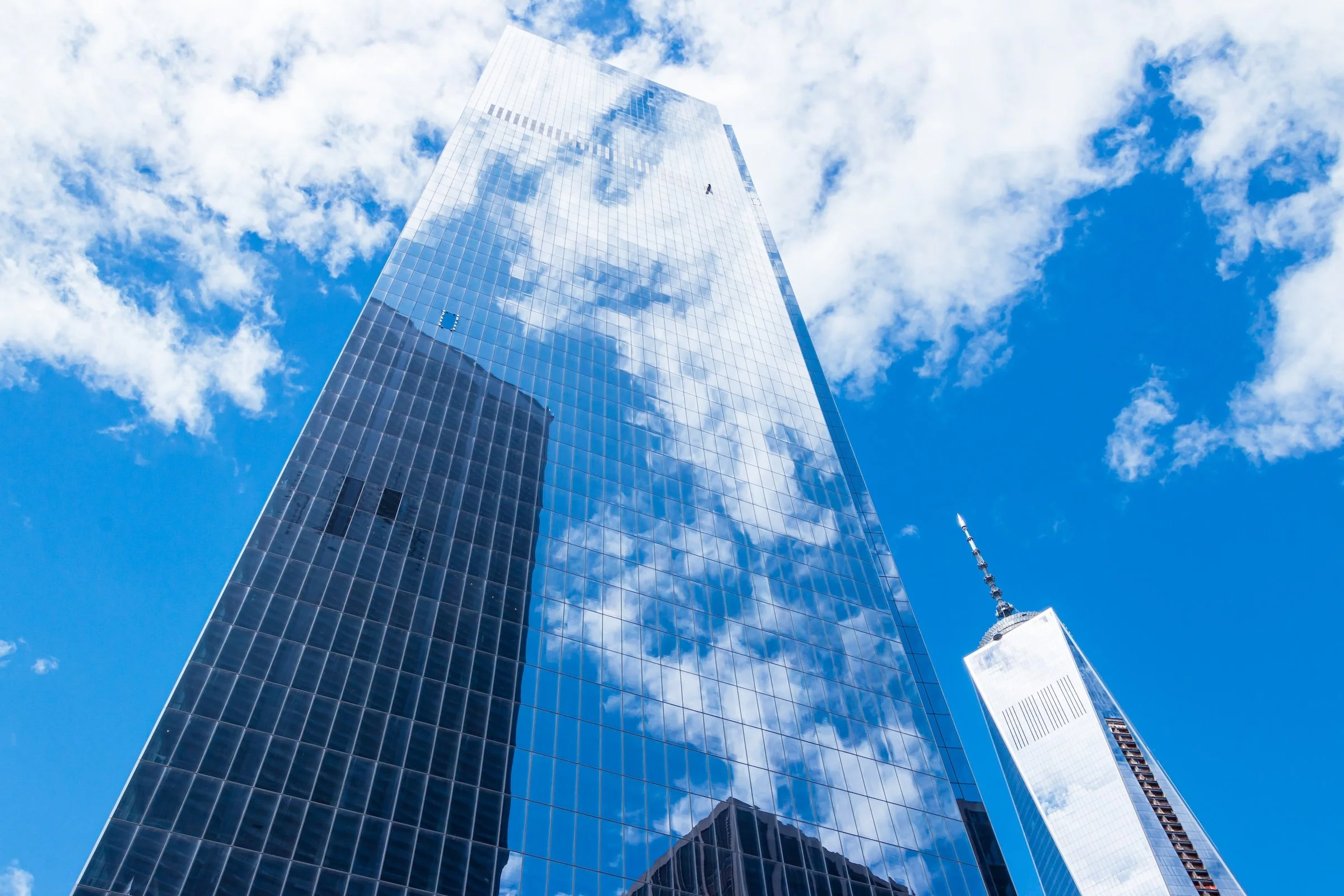
Scraping The Sky
-
Urban Canyons
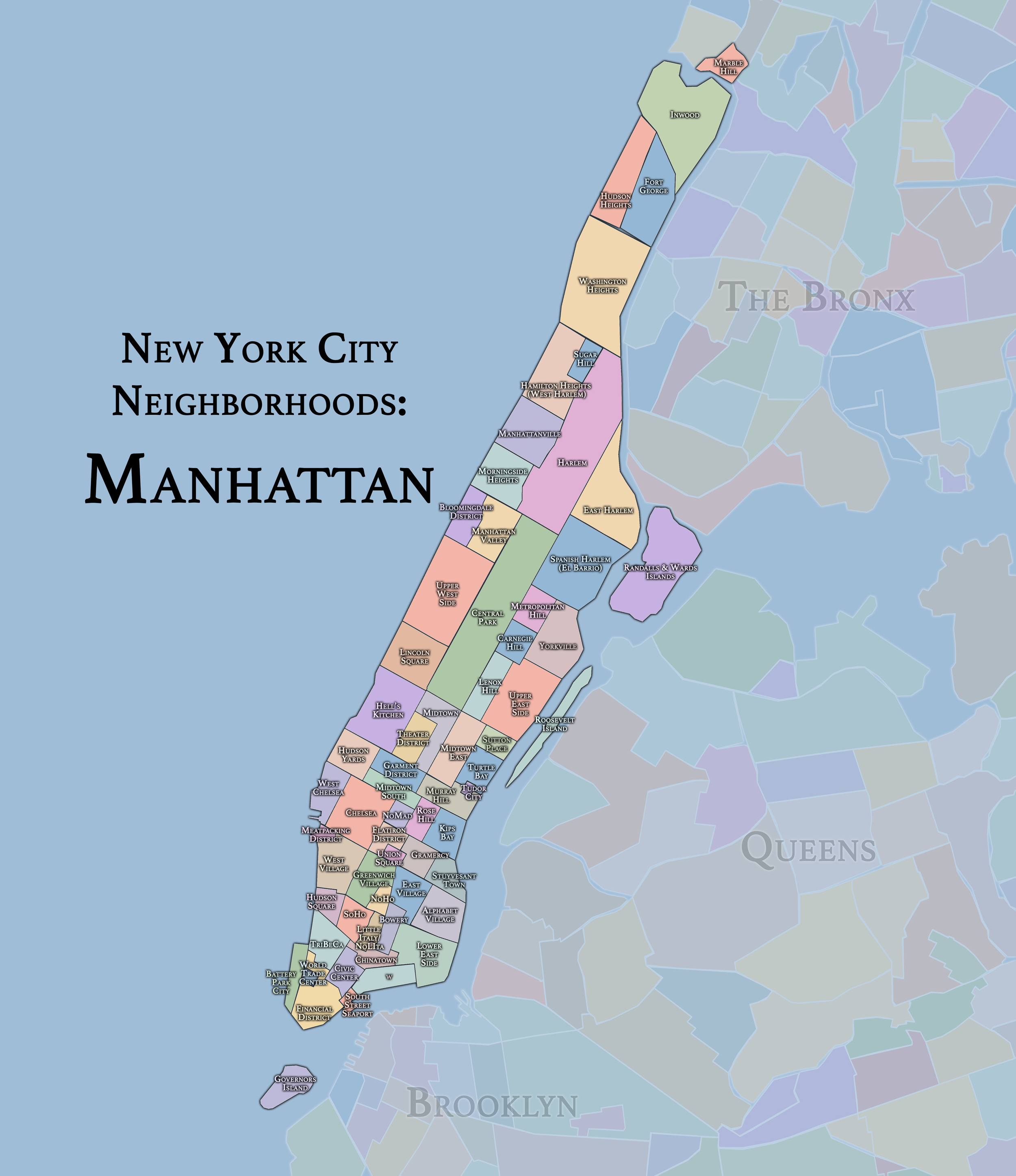
The Neighborhoods
Manhattan: where financial districts, theatrical corridors, brownstone enclaves, institutional centers, and newly built skylines reveal a borough in constant reinvention. Explore the neighborhoods:
-
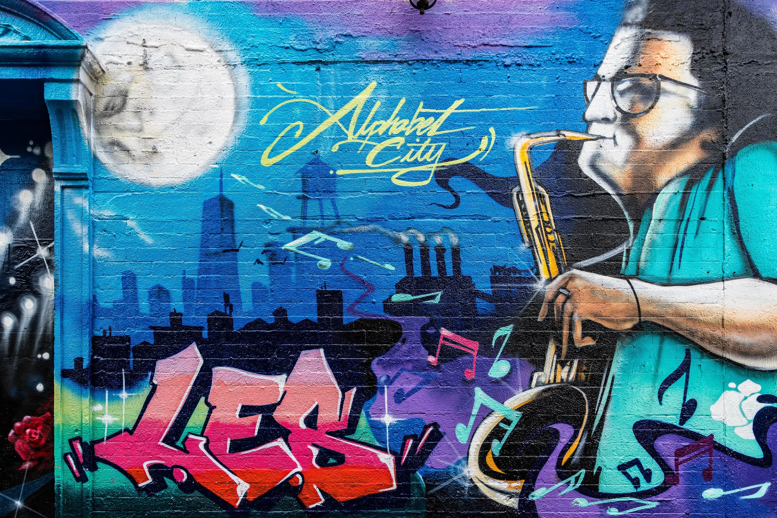
Often considered to be part of the East Village, Manhattan's Alphabet City is a neighborhood with a rich, unique, and sometimes troubled history.
-
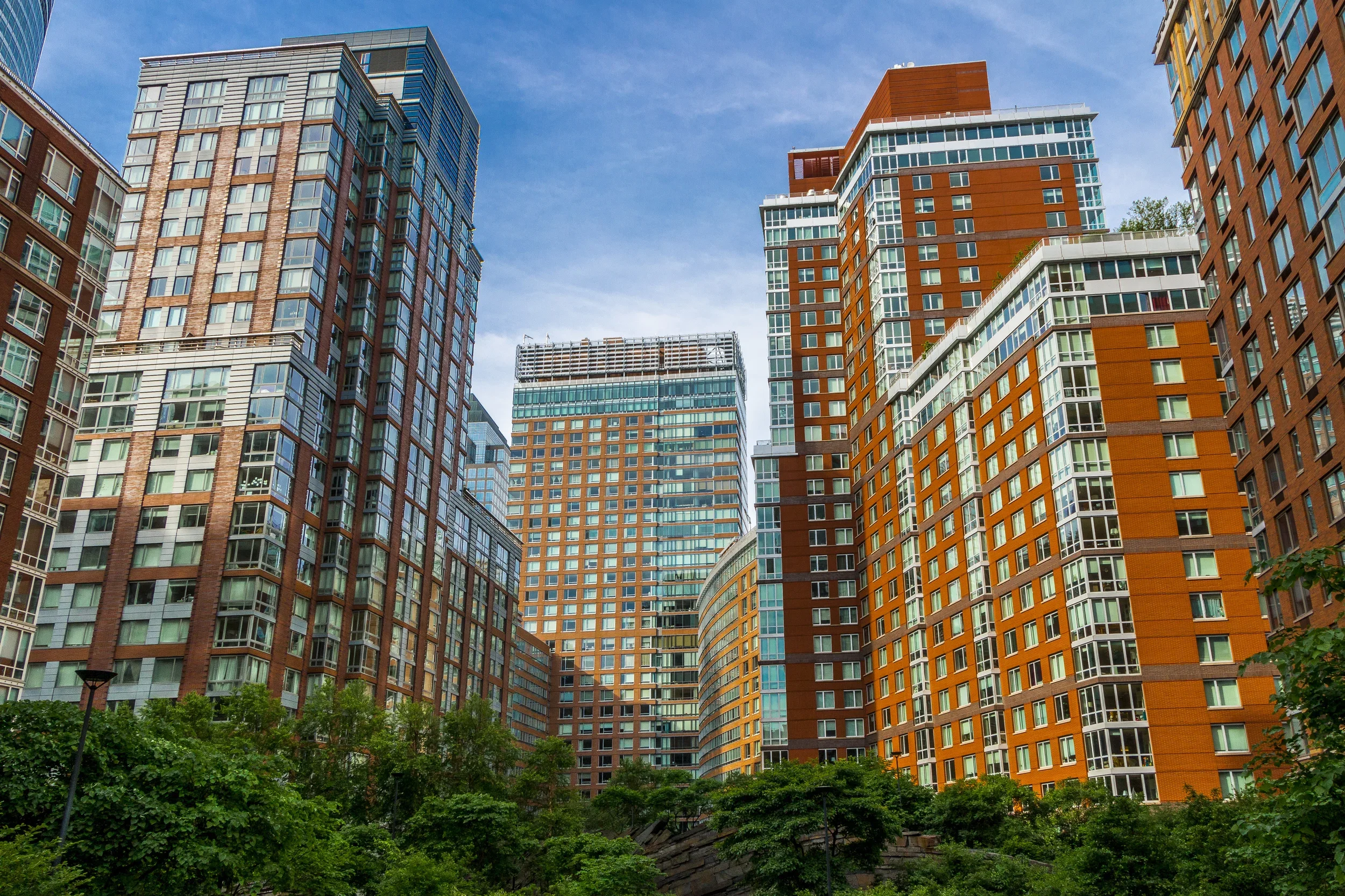
Nestled against the Financial District and the World Trade Center site, Battery Park City is a modern, secluded, upscale neighborhood, located along the Hudson River.
-

While it is still technically part of the Upper West Side, Manhattan's Bloomingdale District takes its name from its original Dutch settlers.
-
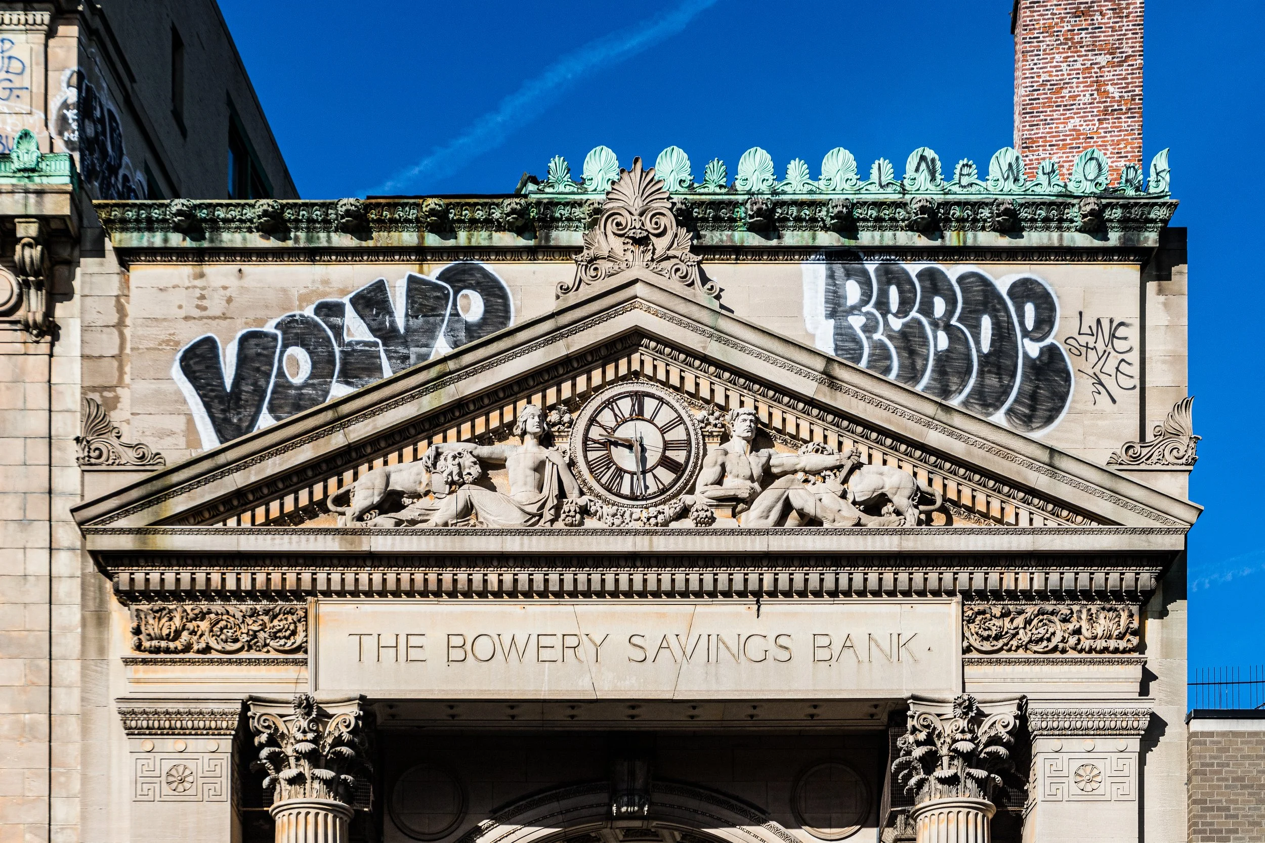
The Bowery is bounded by the Lower East Side to the east, Chinatown to the South, NoLIta to the west and the East Village to the north.
-

Often considered part of Manhattan's Upper East Side, Carnegie Hill is a quiet, affluent neighborhood located between East 86th and East 96th streets, Third Avenue and Fifth Avenue (Central Park).
-
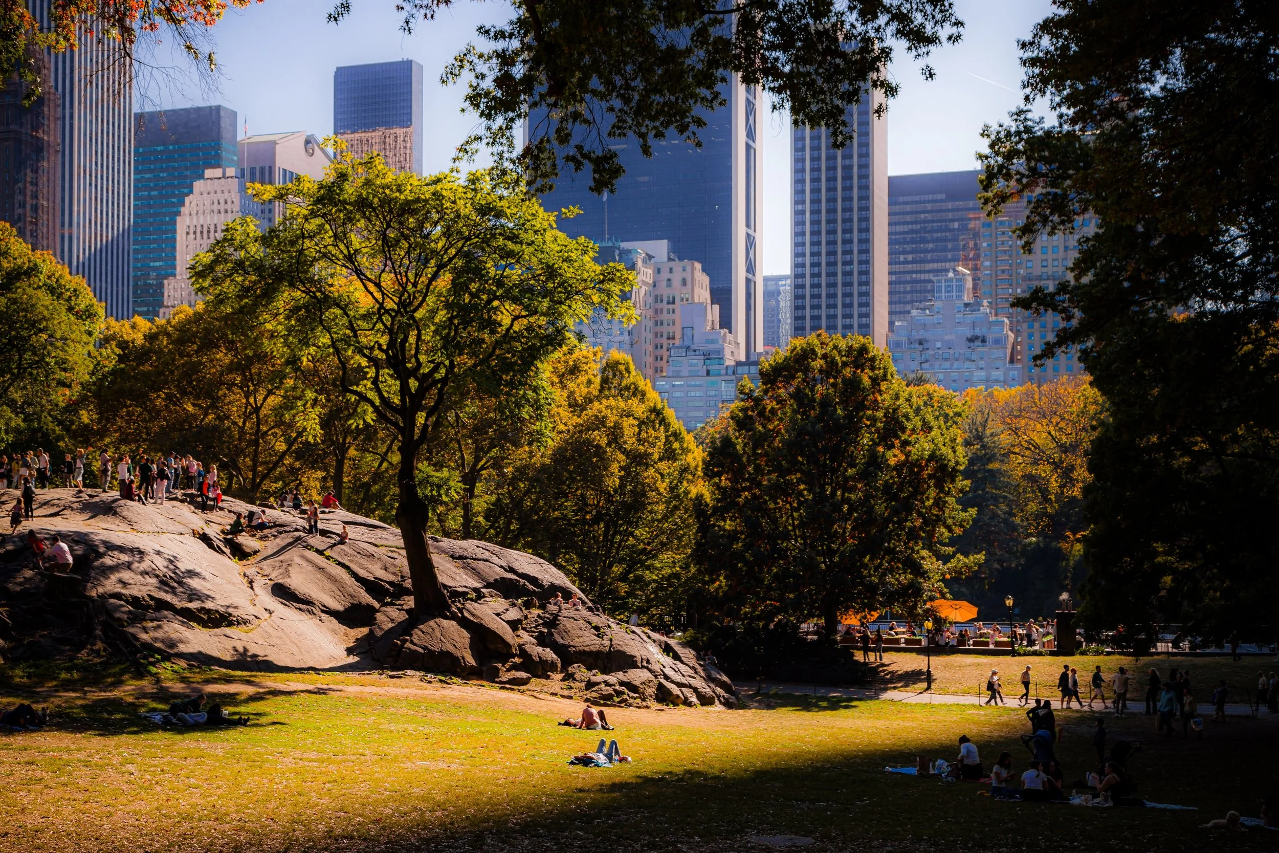
The emerald jewel of New York City, Central Park remains a priceless slice of (immaculately designed) nature, at the very heart of Manhattan.
-
Chelsea is an expansive west side neighborhood that includes brownstones, row houses, art galleries, warehouses, and much of The Highline.
-

Chinatown is an old, and ever-expanding enclave in Lower Manhattan. Beyond its hectic tourist center is a vibrant, densely populated neighborhood.
-
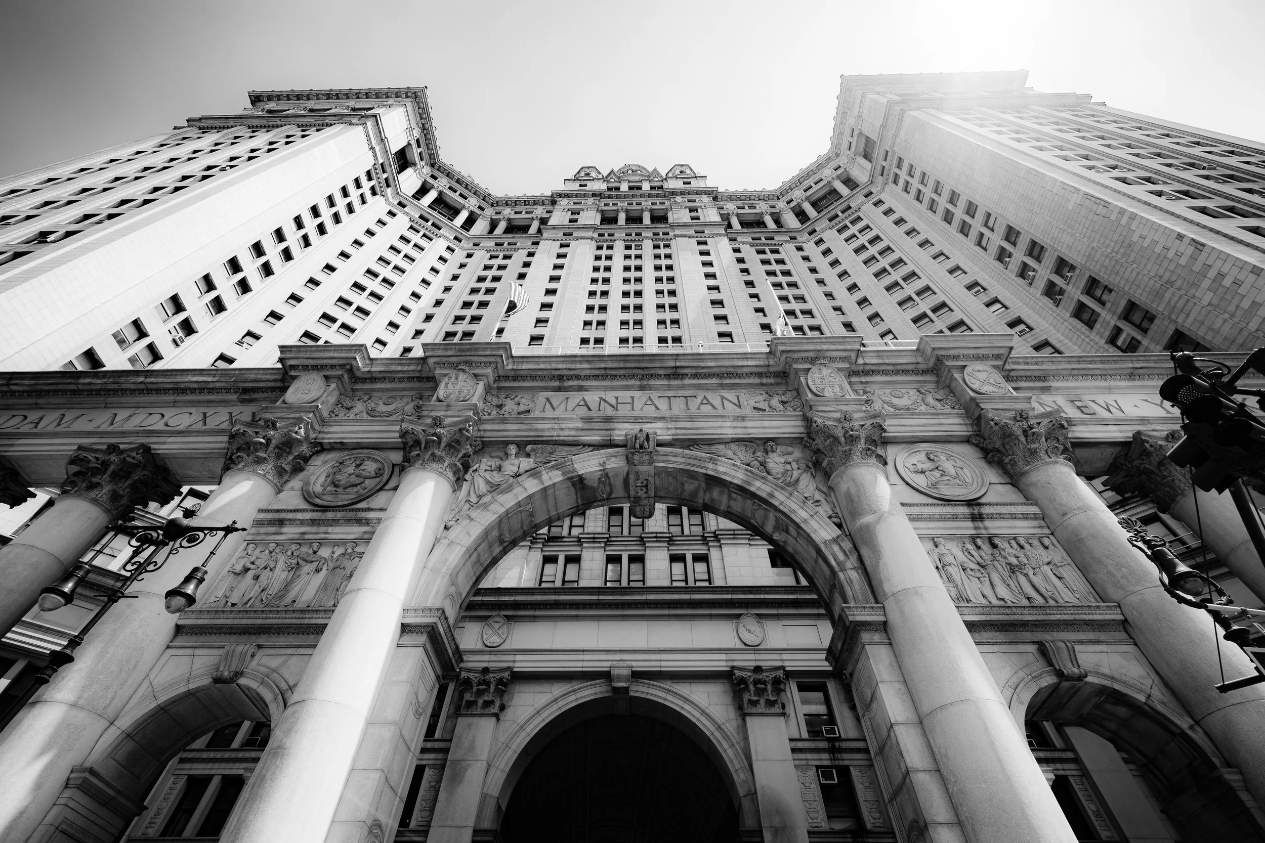
The heart of New York City's government, Civic Center not only contains City Hall, but also a collection of courthouses and federal buildings - some of which were (ironically, no doubt) built over the lawless Five Points district.
-

East Harlem is a working-class neighborhood, populated with the highest concentration of public housing in New York City.
-
Home to the incomparable St. Marks Place, the East Village has long incubated the counterculture that drives the progressive trends of the city itself.
-
DescripBetween Madison Avenue and Sixth Avenue from West 30th to West 34th Streets, the Empire District (Tenderloin) is Midtown’s bright central band: a dense mesh of offices, hotels, retail gravity, and older commercial blocks that feel perpetually “on.”tion goes here
-
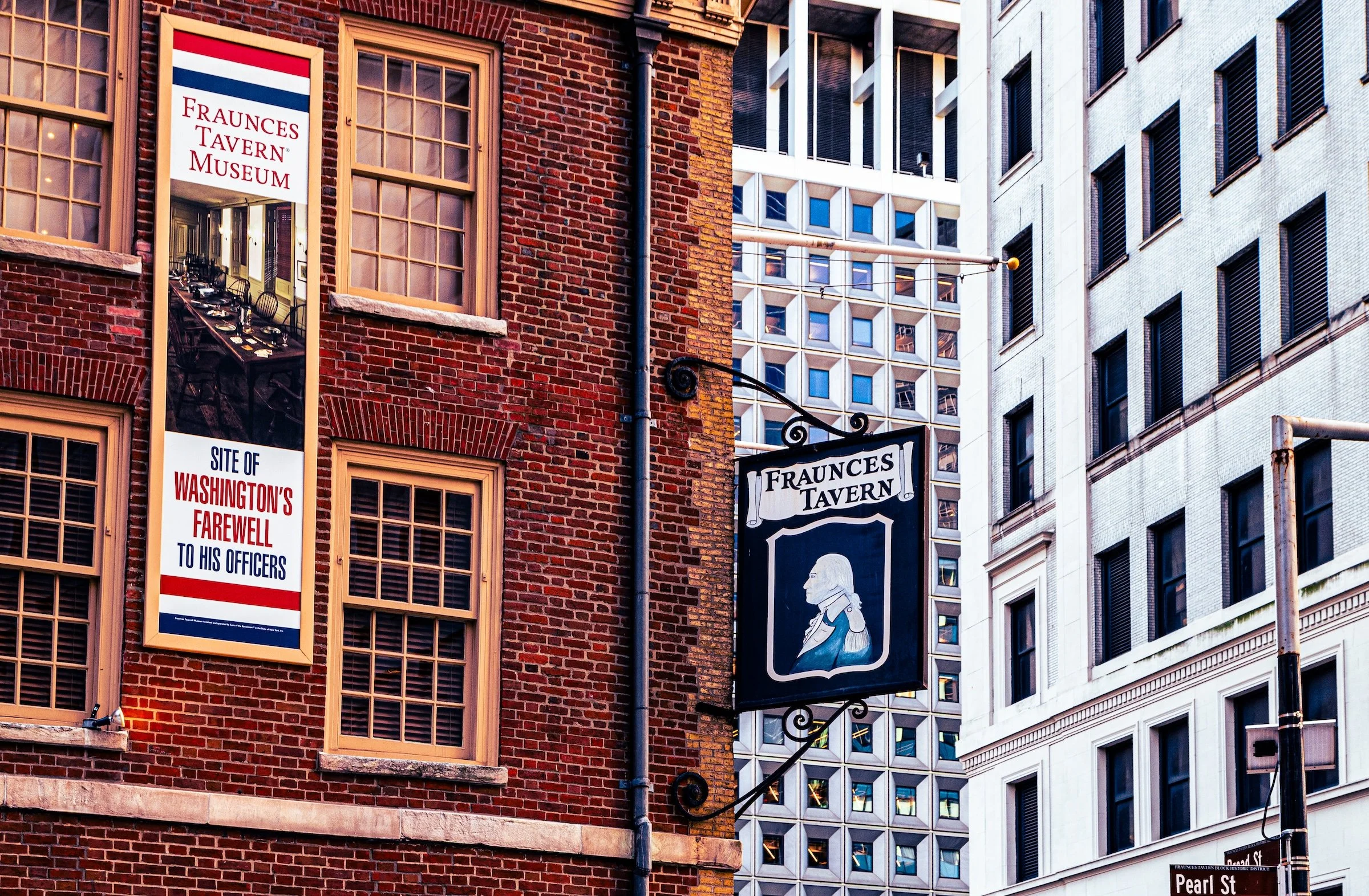
One of the oldest and most historic sections of New York City, the Financial District is a juxtaposition of classic architecture, cramped streets, and soaring, modern office buildings - all dedicated to one thing:
Commerce.
-

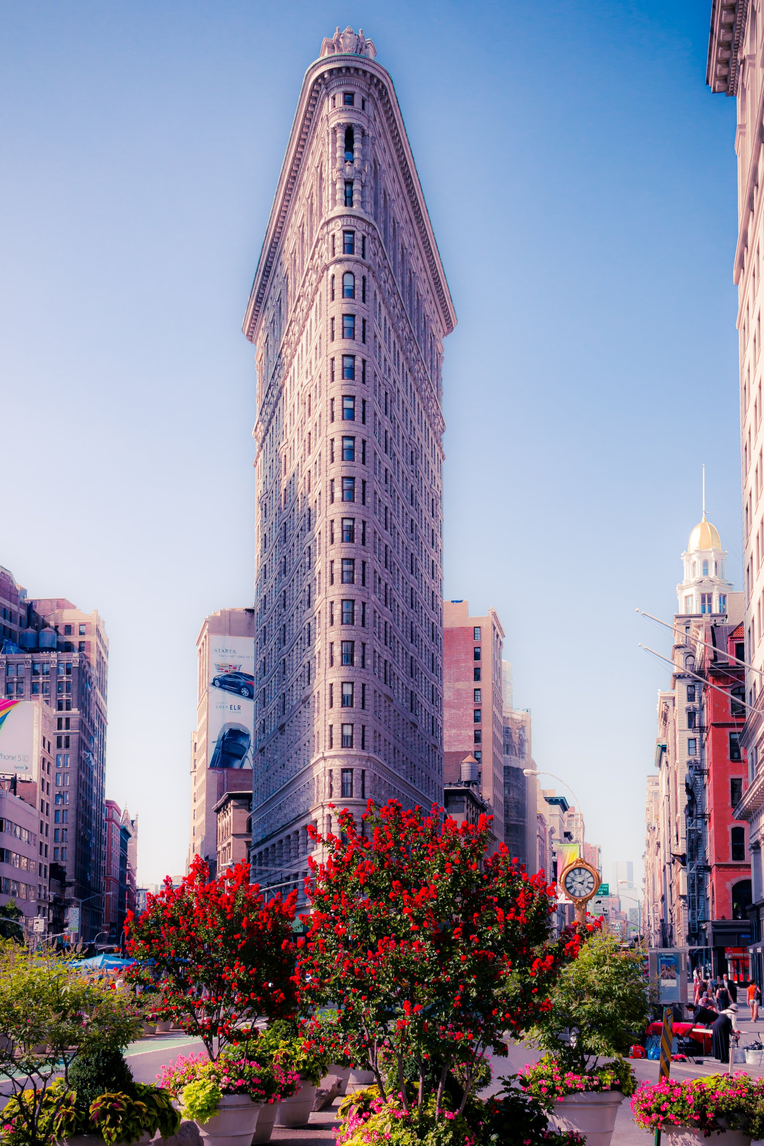
Taking its name from the iconic Flatiron Building at its northern limits, Flatiron is a classic and historic New York City neighborhood featuring Union Square and what was once known as the Ladies' Mile shopping district.
-
Far to the north of the island of Manhattan is the scenic, hilly, and working-class neighborhood of Fort George. Stretching north from West 181st street to Dyckman Street, and west from Broadway to the Harlem River, Fort George is best known for how remarkably un-flat its winding streets are.
-
Just south of the Theater District and Times Square is the Garment District (also known as the Fashion District) - a historic and gritty neighborhood featuring classic New York City shopping, architecture and skyscrapers.
-
Governors Island is located in New York Harbor, between Manhattan to the north, Staten Island to the south, and Brooklyn to the east.
-
Historic. And Gothic. Two words to describe an old, quiet, exclusive, neighborhood on the east side of Manhattan.
-
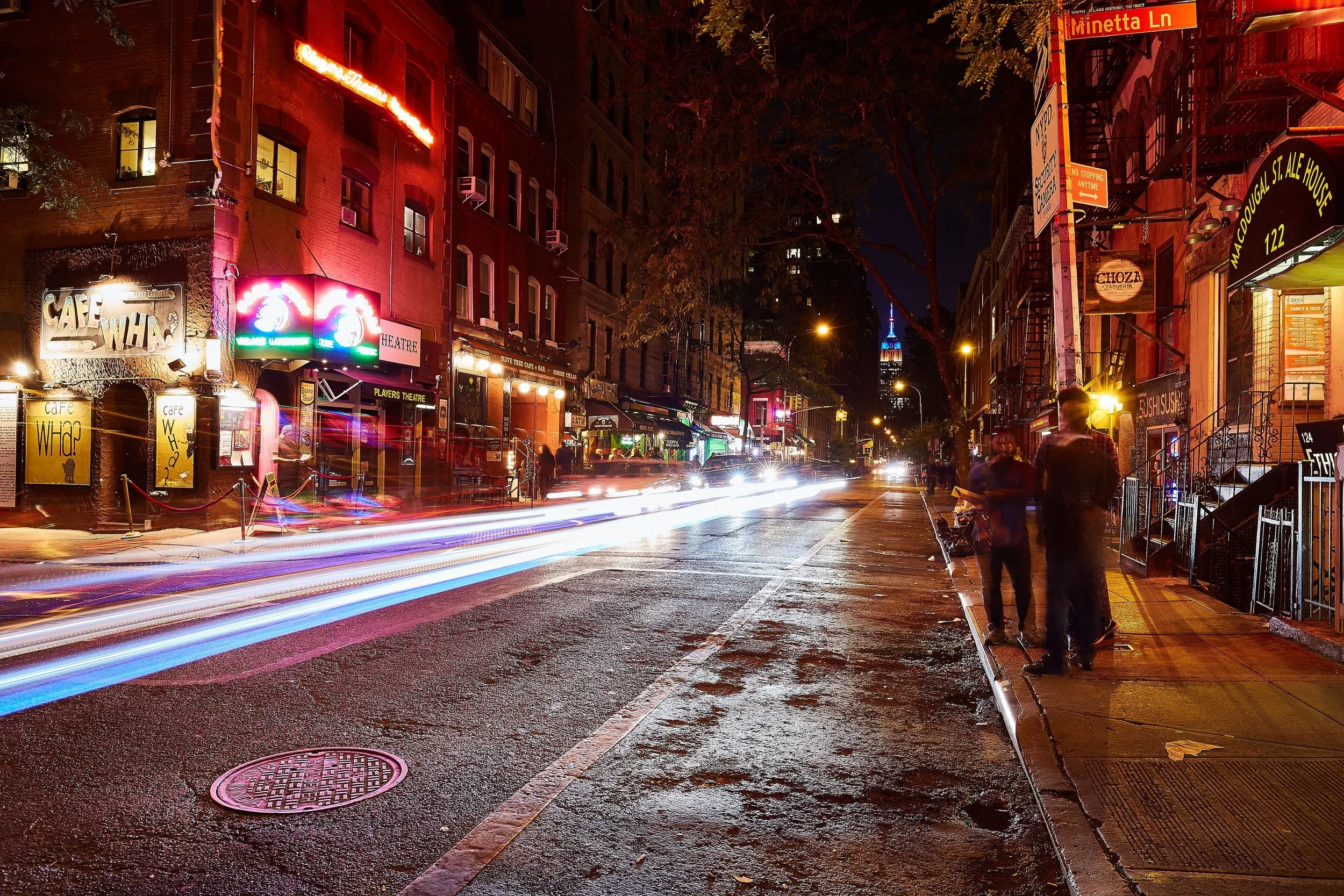
Greenwich Village is a tale of two neighborhoods - one featuring a vibrant series of nightclubs, cafés and restaurants, the other dedicated to New York University.
-
Once home to the estate of Alexander Hamilton (known as Hamilton Grange) this neighborhood, at one time, was considered an affluent extension of Harlem.
-
Harlem is an expansive, historic, and irreplaceable part of New York City. Its influence over the culture - from art to social awareness - cannot be overstated.
-
Hell's Kitchen (also known as Clinton) is the colorful name for the gritty, residential and (formerly) industrial neighborhood to the west of the glittering lights of Broadway, Times Square and Midtown.
-
Located far to the north of the island, the idyllic Hudson Heights neighborhood is a bit like the roof - or, perhaps the penthouse - of Manhattan.
-
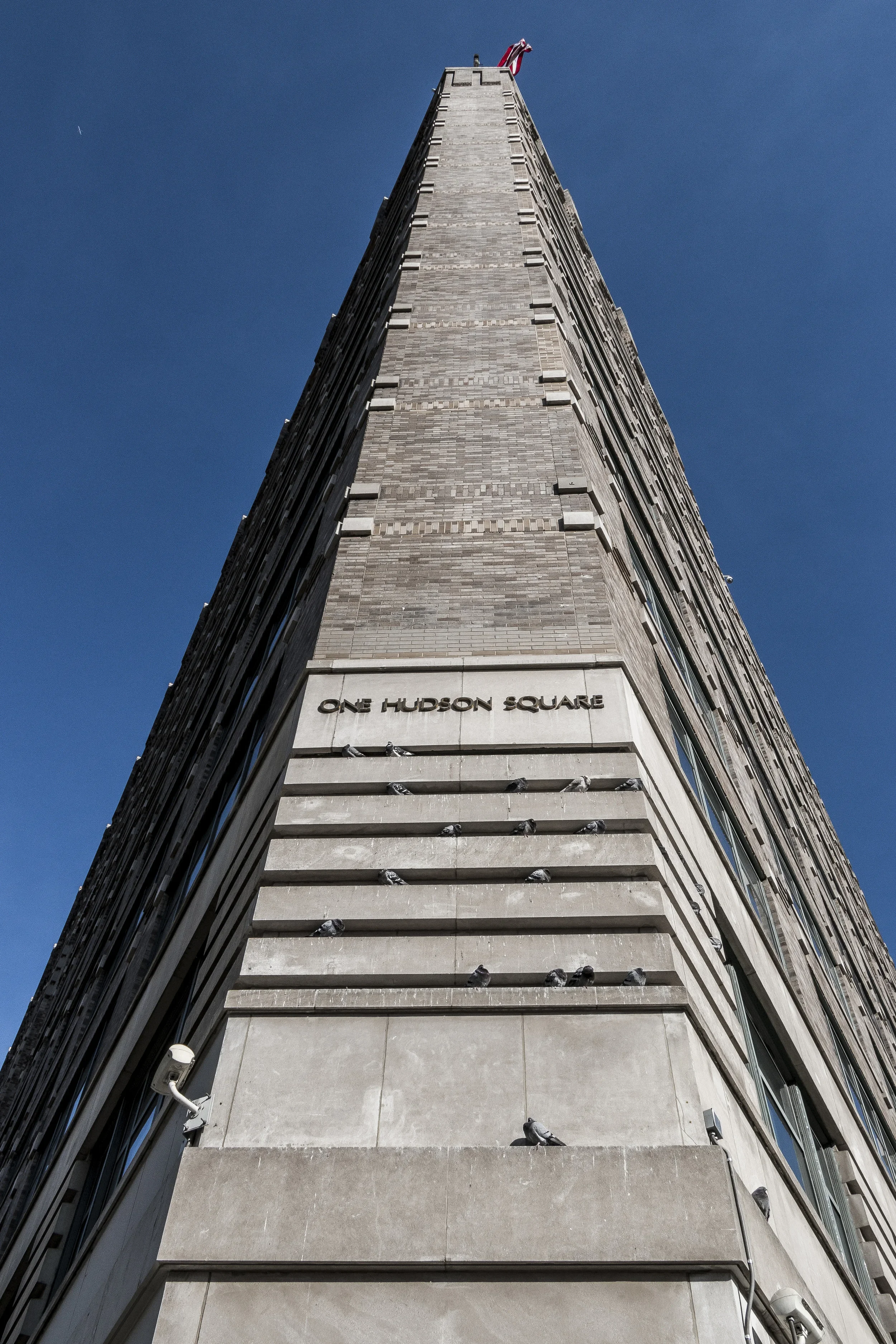
An off-shoot of SoHo, Hudson Square is an almost-forgotten, formerly industrial section of Manhattan's West Side.
-
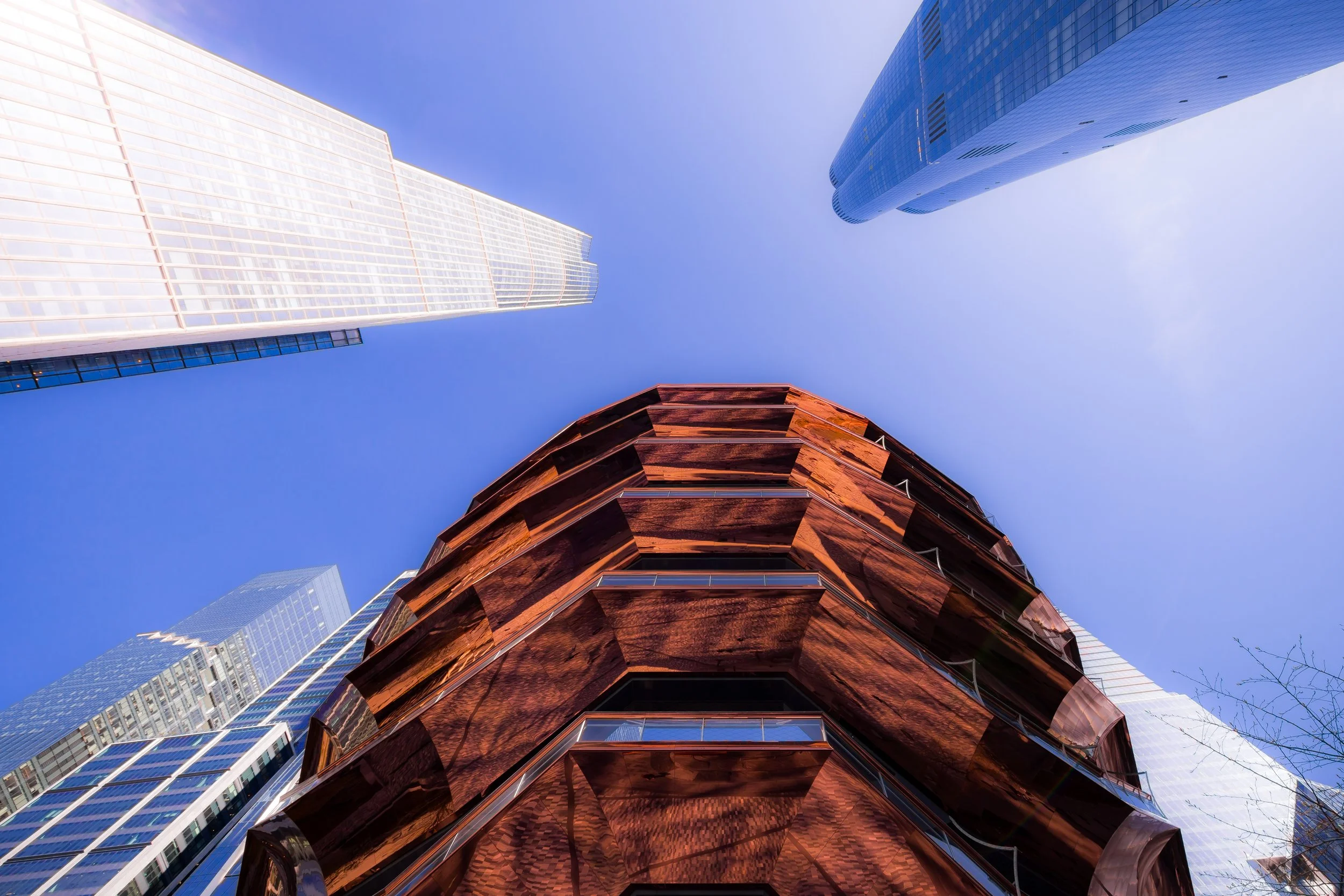
The newest and one of the most ambitious construction projects in the history of New York City is creating the modern, gleaming neighborhood of Hudson Yards from the ashes of what was once the southern part of Hell's Kitchen.
-
At the northern most tip of the island of Manhattan is the neighborhood of Inwood - a juxtaposition of beautiful parks, sleepy residential streets, and industrial rail and auto yards.
-

On the east side of Manhattan is Kips Bay - a bustling neighborhood dominated by hospitals and the various shops, markets, restaurants and cafés to cater to the workers and medical staff.
-
First in a series of hills along Central Park East, Lenox Hill is an upscale neighborhood that features Bloomingdale's Department Store to the south, and rows of brownstones to the north.
-
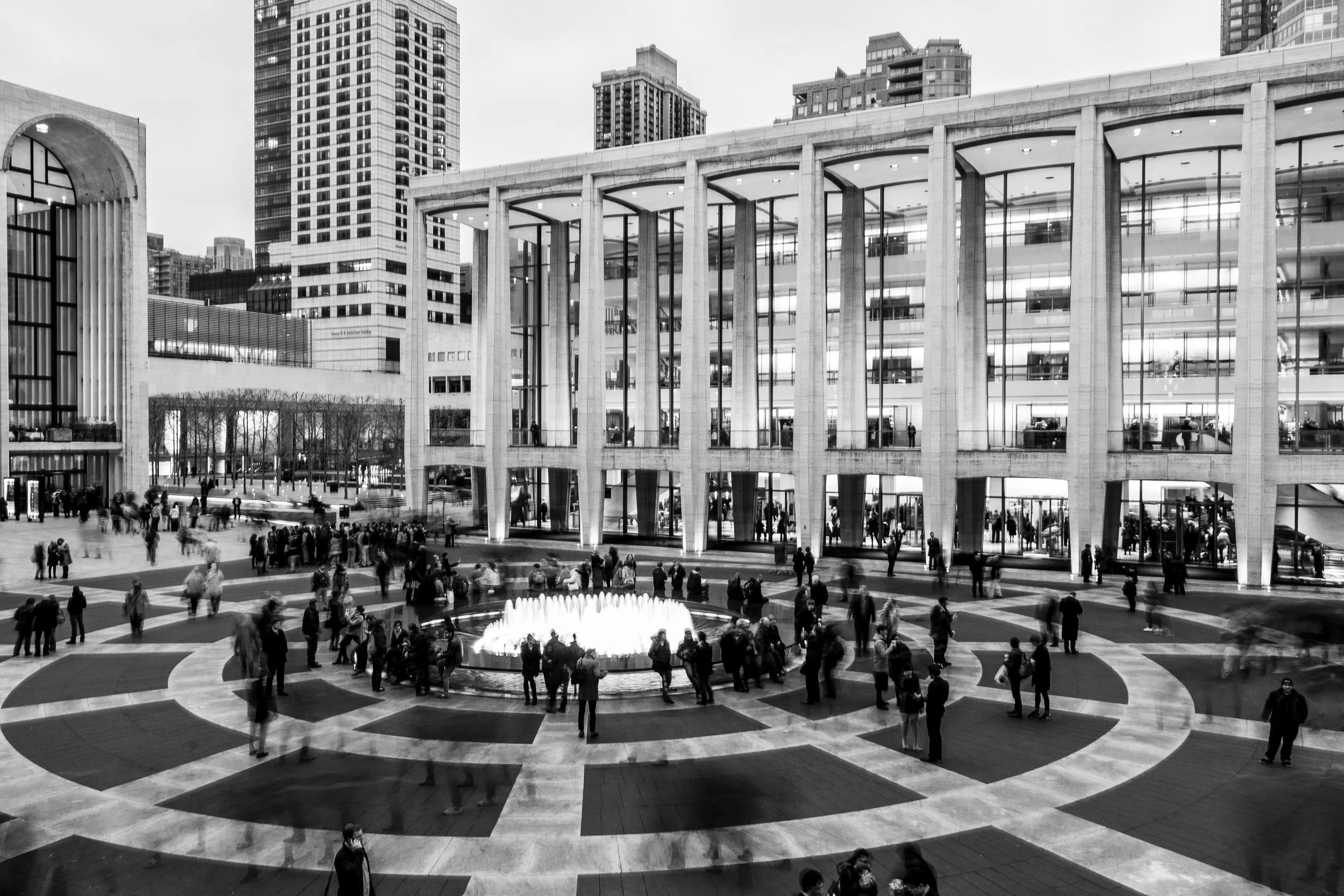
At the heart of Lincoln Square is, of course, Lincoln Center. But this Upper West Side neighborhood is also home to Fordham University, public housing, and towering residential high rises.
-

Although Little Italy has been steadily shrinking, just to its north a new neighborhood, known and NoLIta (North of Little Italy) is forging a vibrant collection of cafés, restaurants and shops. Together, they form a compelling mix of old and new, at the heart of Lower Manhattan.
-

Home of tenements, street artists, and trendy nightclubs, the Lower East Side remains notorious as it ever has.
-
Manhattan Valley is a part of the Upper West Side that was once also know as the Bloomingdale District. As part of attempts to revitalize the neighborhood, the area was rechristened and today Manhattan Valley features its own distinct identity.
-

Manhattanville, formerly West Harlem, is a working-class neighborhood with a rich history dating back to its Dutch heritage.
-
Marble Hill has the distinction of being the only Manhattan neighborhood that is NOT on an island. Instead, Marble Hill is on the mainland, surrounded by The Bronx neighborhoods of Spuyten Duyvil, Kingsbridge Heights, and Kingsbridge.
-
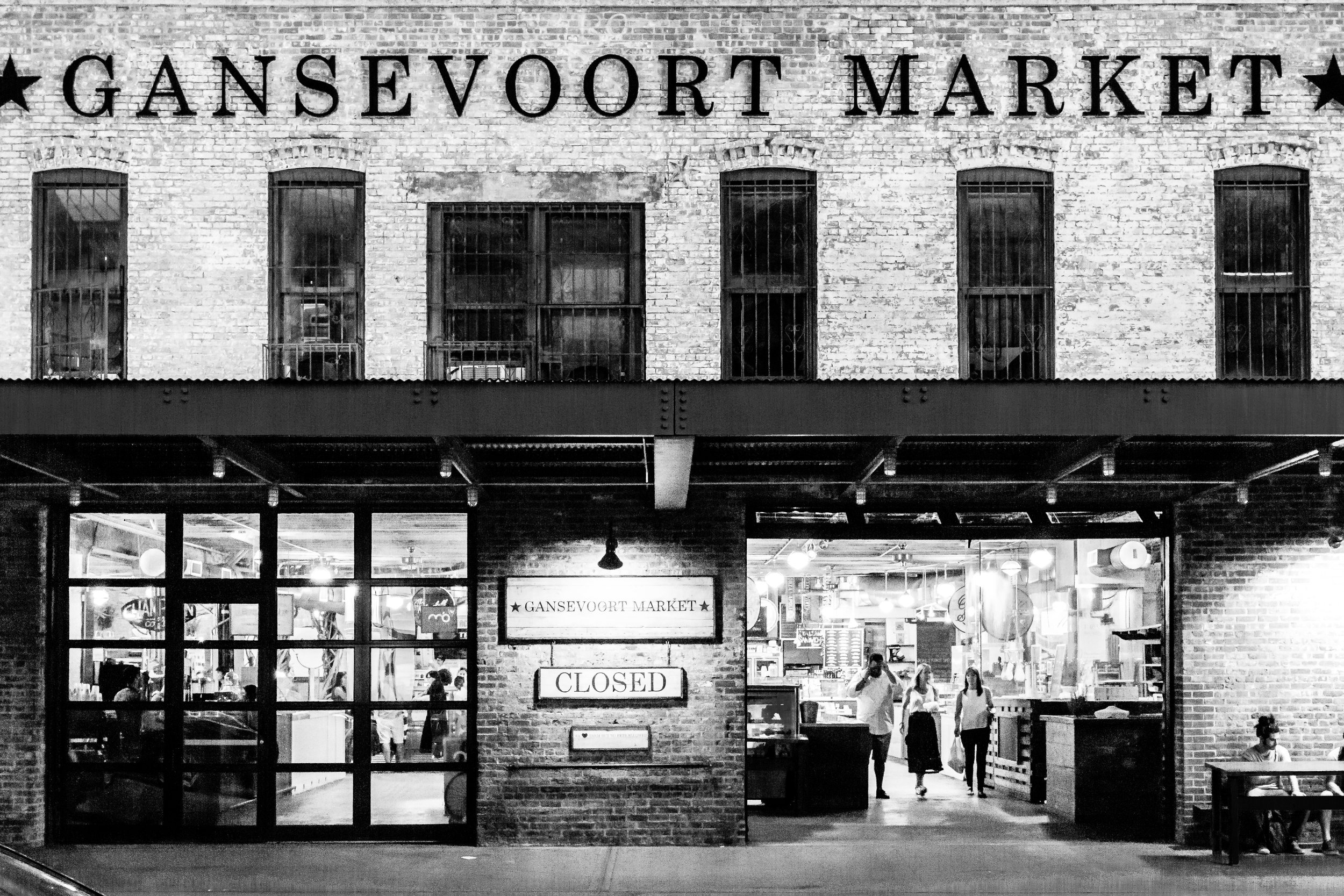
Once dedicated solely to the business of packing, shipping and delivering meat, the Meatpacking District is now even more well-known for its upscale dining and shopping.
-
In an almost-forgotten corner of the Upper East Side rests the quaint neighborhood of Metropolitan Hill - which takes its name from the world famous Metropolitan Museum of Art on its western border.
-

At the very heart of Manhattan is Midtown - a neighborhood defined almost by what it is not (Times Square, Midtown East, Garment District) as it is defined by what it is: a gleaming testament to urban progress.
-

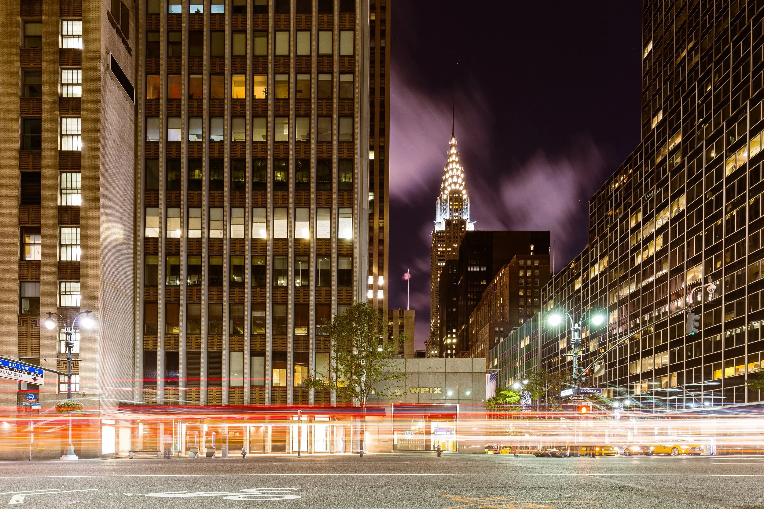
If Midtown is new and gleaming, Midtown East is the zenith of Manhattan's glamour - from Madison Avenue to Park Avenue and the Chrysler Building.
-
Midtown South is the Old World of Manhattan, where the once-wondrous (and now dingy) Pennsylvania Station resides along with Madison Square Garden, Greeley Square and Korea Town.
-
Between West 110th Street and West 126th Street, from the Hudson River to Morningside Avenue is the neighborhood of Morningside Heights - almost synonymous with Columbia University.
-
Part ritzy midtown, with towering condos, and part old-time New York with 19th century buildings, Murray Hill spans two worlds.
-
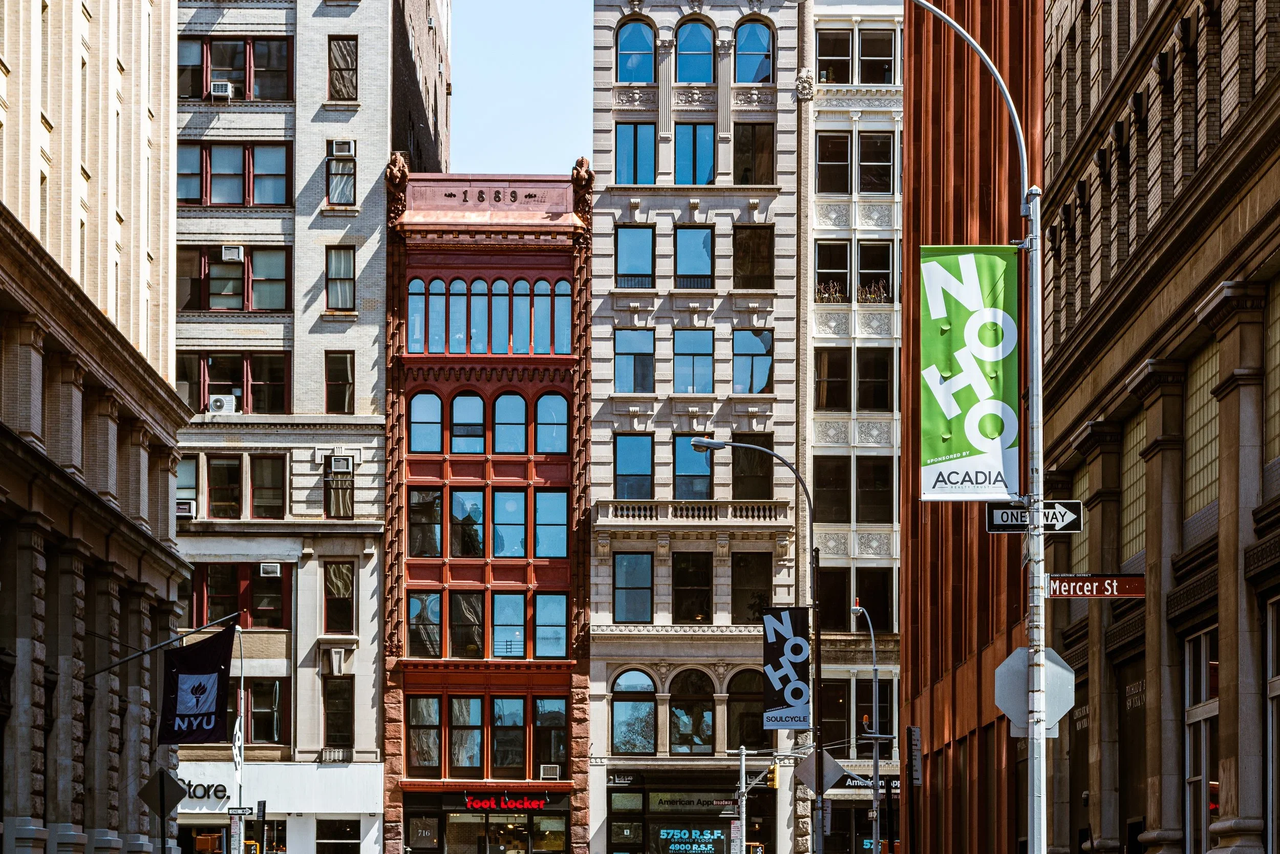
One of Manhattan's "newer" neighborhoods, NoHo (North of Houston Street) is a sliver revival, centered on Bond Street, and anchored by Astor Place.
-
Another attempt at creating a new neighborhood with a new identity is NoMad (North of Madison Square Park). Much of this area has been searching endlessly for an identity - other than one of trinket shops. Which makes the adopted name of this oft-over-looked district quite apt.
-
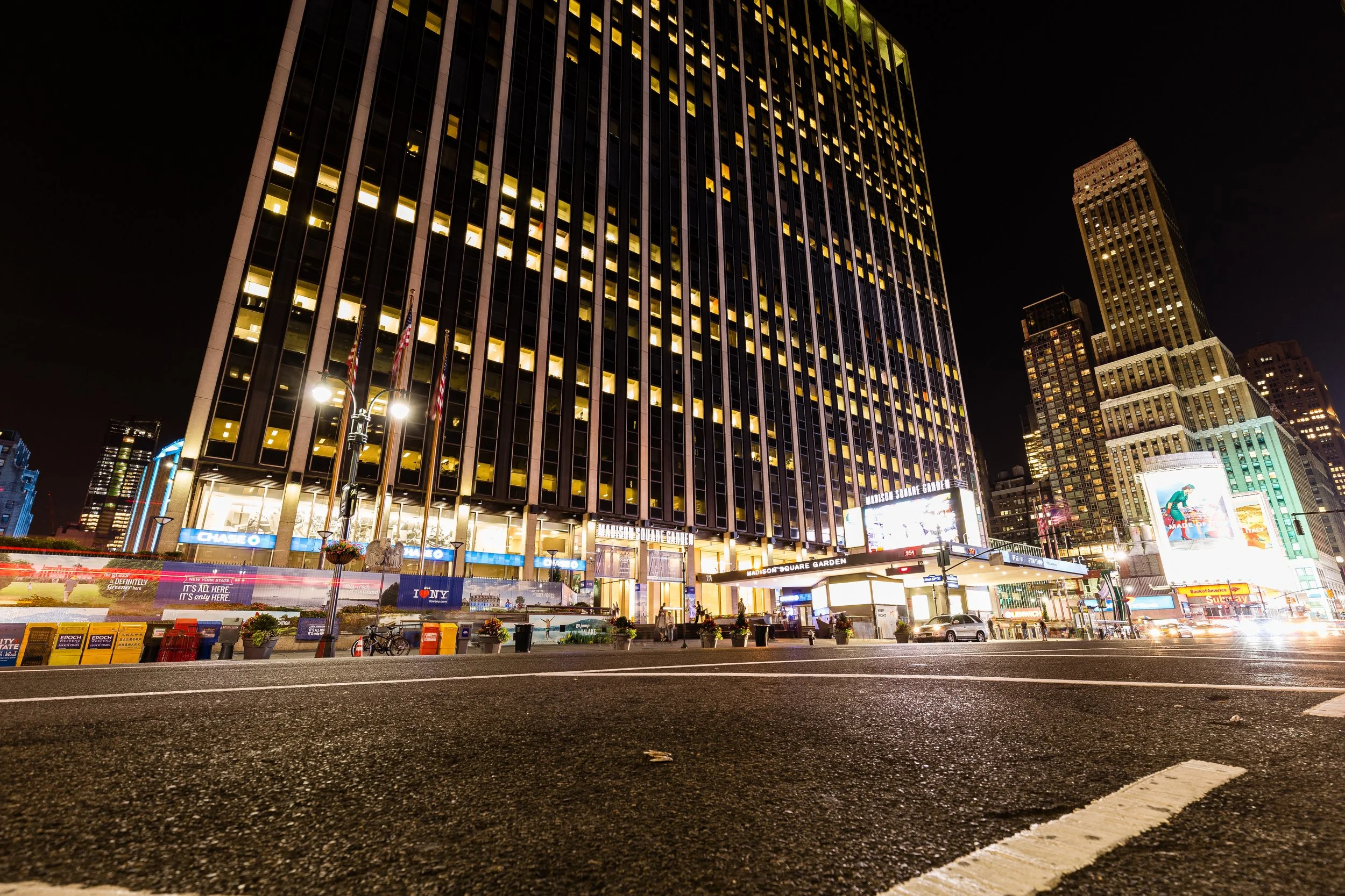
Stretched from Sixth Avenue west to Ninth Avenue between West 30th and West 34th Streets, the Penn District forms a thick, infrastructural belt of Midtown—one built around motion. Its center of gravity is Pennsylvania Station, with Madison Square Garden perched above the tracks and concourses, compressing an astonishing amount of civic throughput into a few blocks.
-
While not technically on the island of Manhattan, Randalls and Wards Islands are a destination for recreation, as well as the anchor point for the Triboro (RFK) Bridge. To the west, across the Harlem River, are Spanish Harlem and East Harlem, Manhattan. Port Morris of The Bronx is north, beyond the Bronx Kill. To the east are Astoria and Ditmars Steinway, Queens, over the East River.
-
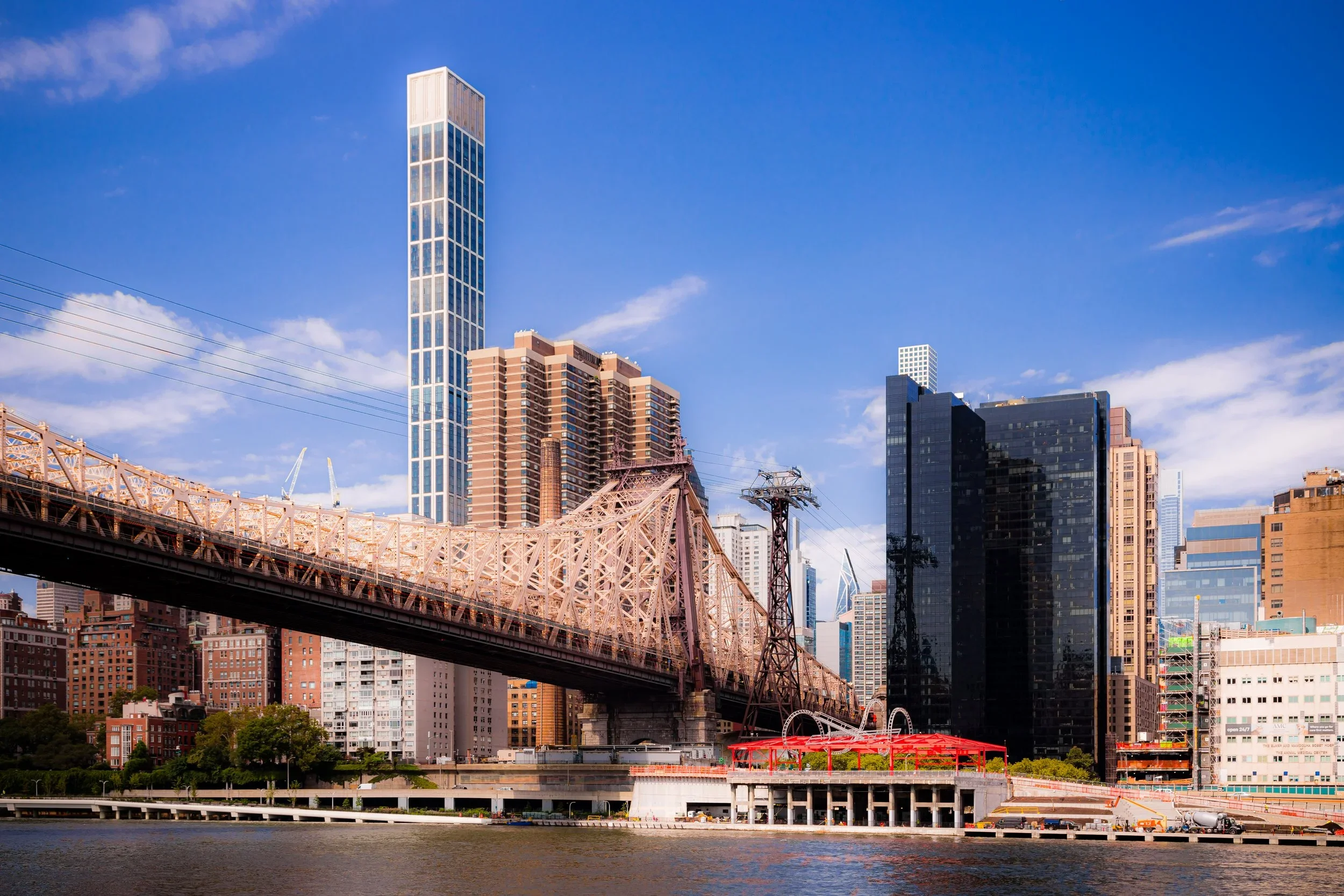
While not technically on the island of Manhattan, Roosevelt Island contains scenic views of the city (and Queens) while boasting its own unique attractions and quiet community.
-
Rose Hill is an old neighborhood with an old neighborhood name - one that has fallen into disuse. But the personality of the neighborhood just to the east of Madison Square Park is still befitting of the nostalgic name.
-
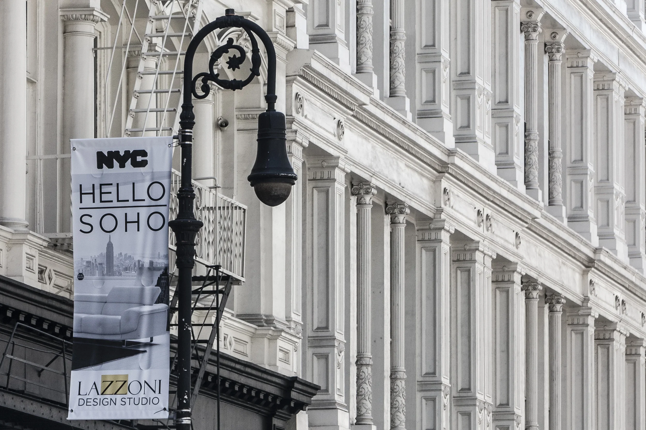
SoHo (which stands for South of Houston Street), resides between 6th Avenue and Lafayette Street, Canal Street and Houston Street. Many of the buildings in this district have cast-iron facades - their columns and collonades lending a classic flair to the neighborhood. Inside these former warehouses there is a wide array of high-fashion stores and upscale dining.
-
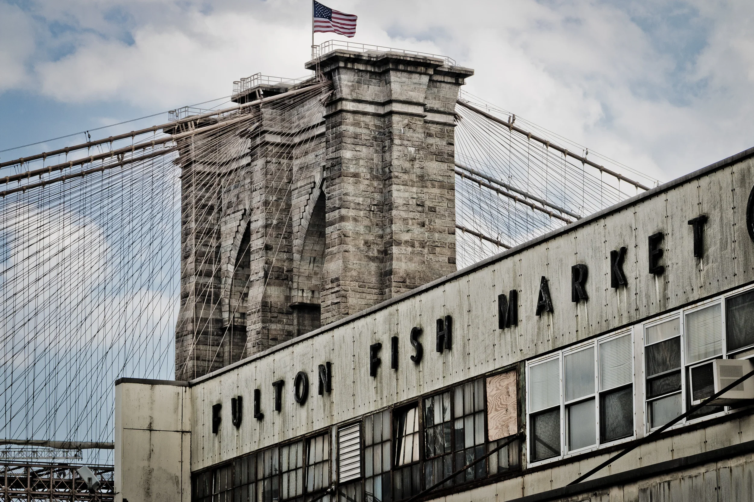
A cross between the Financial District and Two Bridges, South Street Seaport is slowly being revitalized into a trendy destination - the Meatpacking District of Lower Manhattan.
-

North of the Upper East Side is the rich, vibrant, working-class neighborhood of Spanish Harlem (nicknamed El Barrio by its predominantly Spanish-speaking residents).
-
Stuyvesant Town, and its sister complex Peter Cooper Village, represent a massive (and comfortable) cooperative housing complex on Manhattan's East Side.
-

Famously immortalized by the song, "Take the 'A' Train," Sugar Hill boasts beautiful mansions on quiet, tree-lined streets, overlooking the northern reaches of Harlem.
-
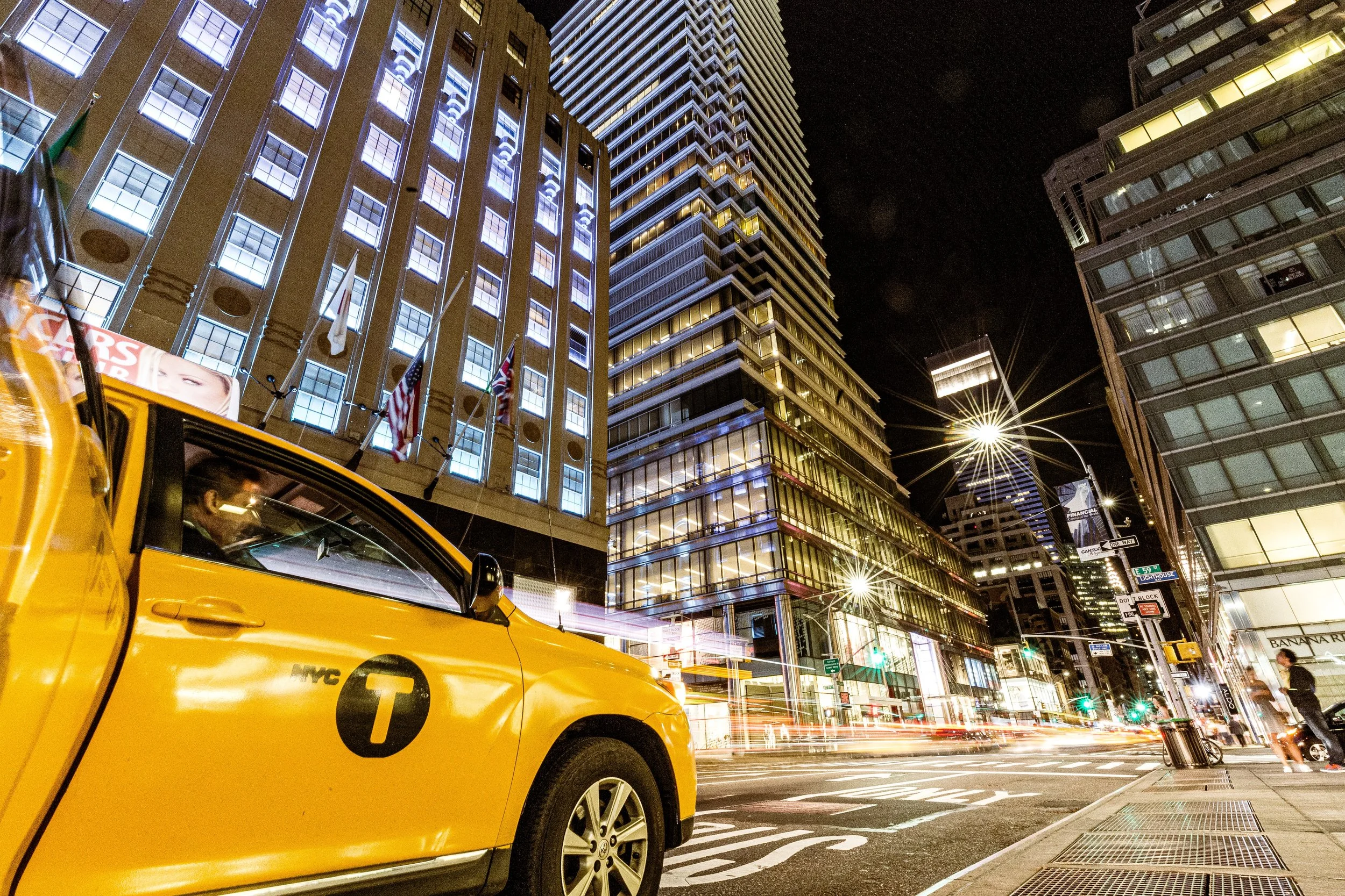
Sutton Place, which takes its name from an exclusive riverside enclave, can be a quiet neighborhood on the east side of Manhattan. And yet, it also borders Midtown East and enjoys an overflow of business, skyscrapers and energy. This gives Sutton Place a unique feel.
-
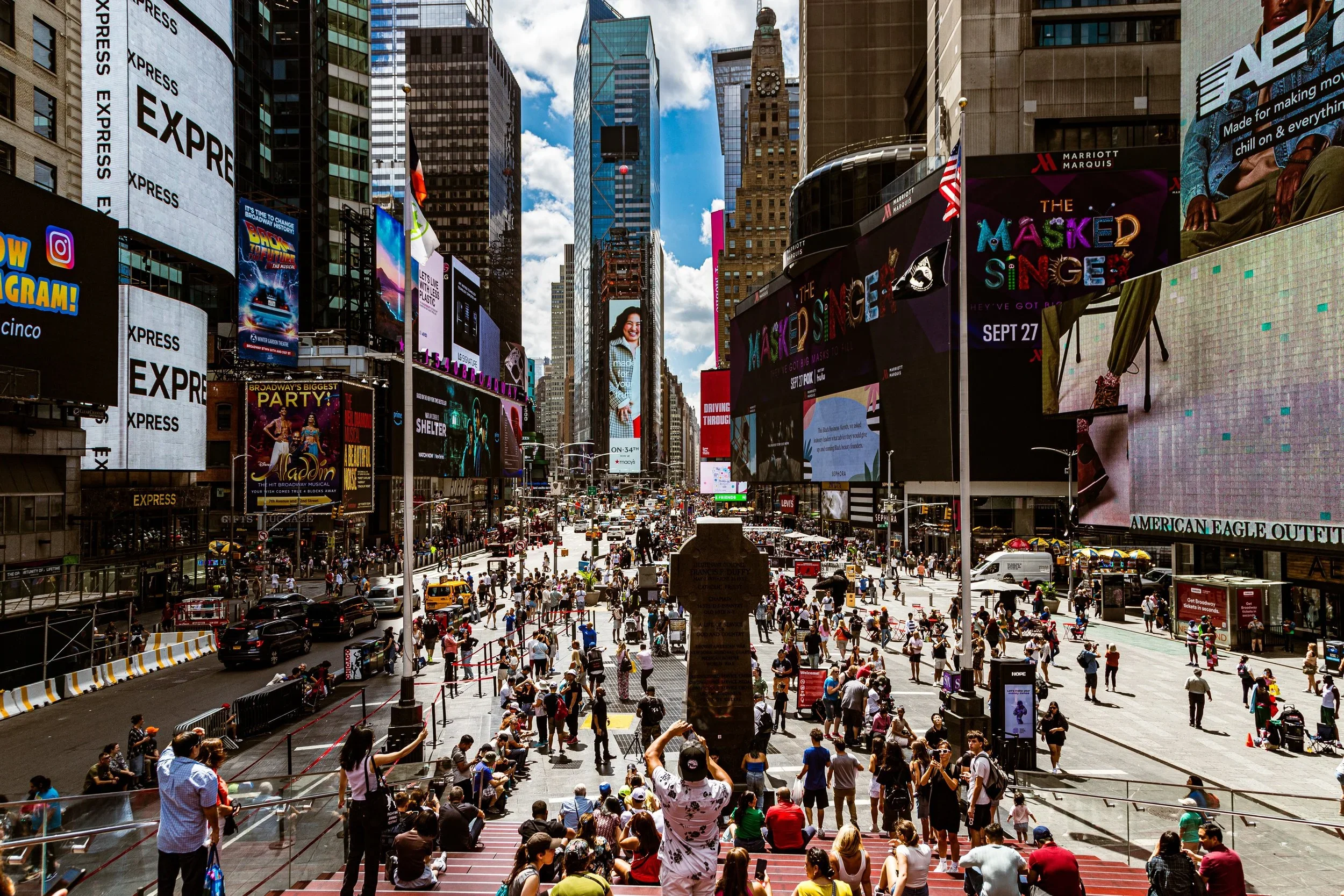
It may be true that the Theater District and Times Square need no introduction. Certainly, there are few more famous, or more visited, places in the world. Bright lights. Big city. Big crowds. Big celebrations.
Big Apple in all its glitzy glory.
-
TriBeCa (named for the Triangle Below Canal Street) is a trendy, mostly residential neighborhood featuring classic and iconic New York City architecture.
-
On the eastern side of Manhattan, surrounded by Turtle Bay and Murray Hill is the almost-hidden micro-neighborhood of Tudor City.
-
Host to the United Nations and surrounding office towers, Turtle Bay is also home to classic buildings, upscale dining, and exclusive hotels.
-
Two Bridges resides in the shadows between the Brooklyn Bridge and Manhattan Bridge. This working-class neighborhood is far from the bright lights and bustle of the Big Apple. And that suits its residents just fine.
-
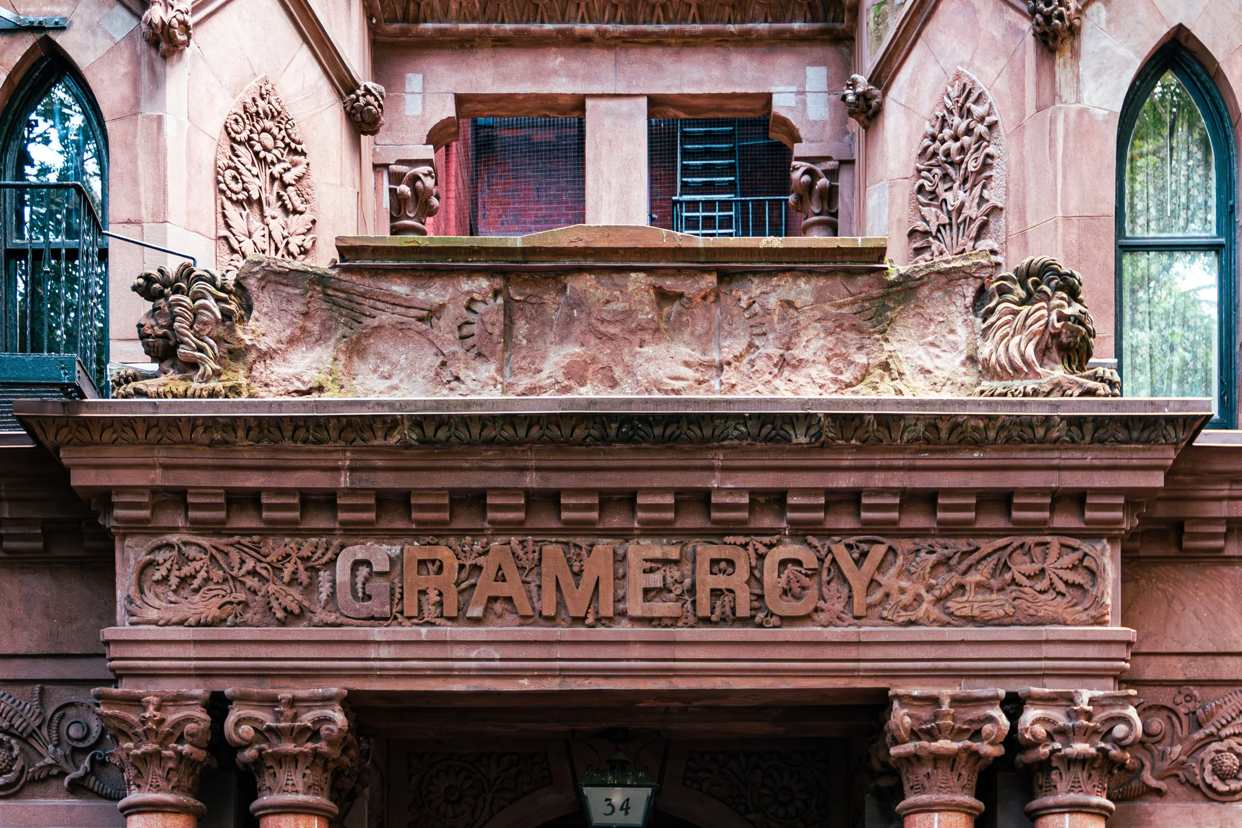
Union Square is a bustling commercial, social, and residential hub in Manhattan. To its west and north is the Flatiron District; Gramercy is to the north and east; To the south are the East Village and Greenwich Village.
-
The entire region of Manhattan, east of Central Park is referred to, simply, as the Upper East Side. Even taking into account the many separate, distinct districts in the area, the Upper East Side remains an expansive, scenic section of New York City.
-
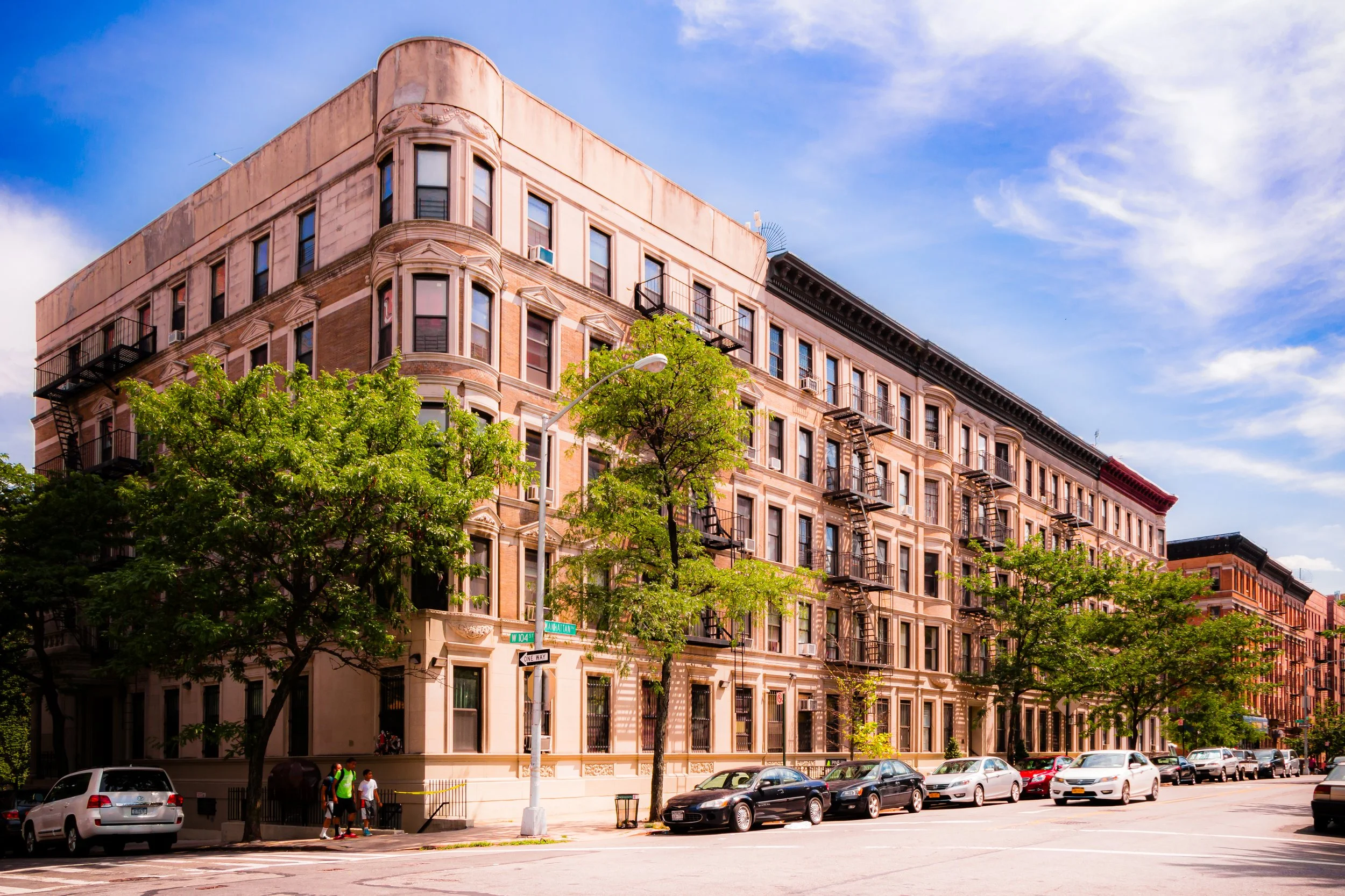
Expansive, scenic, and (mostly) exclusive, the Upper West Side is one of the largest and mostly uniform neighborhoods in New York City.
-

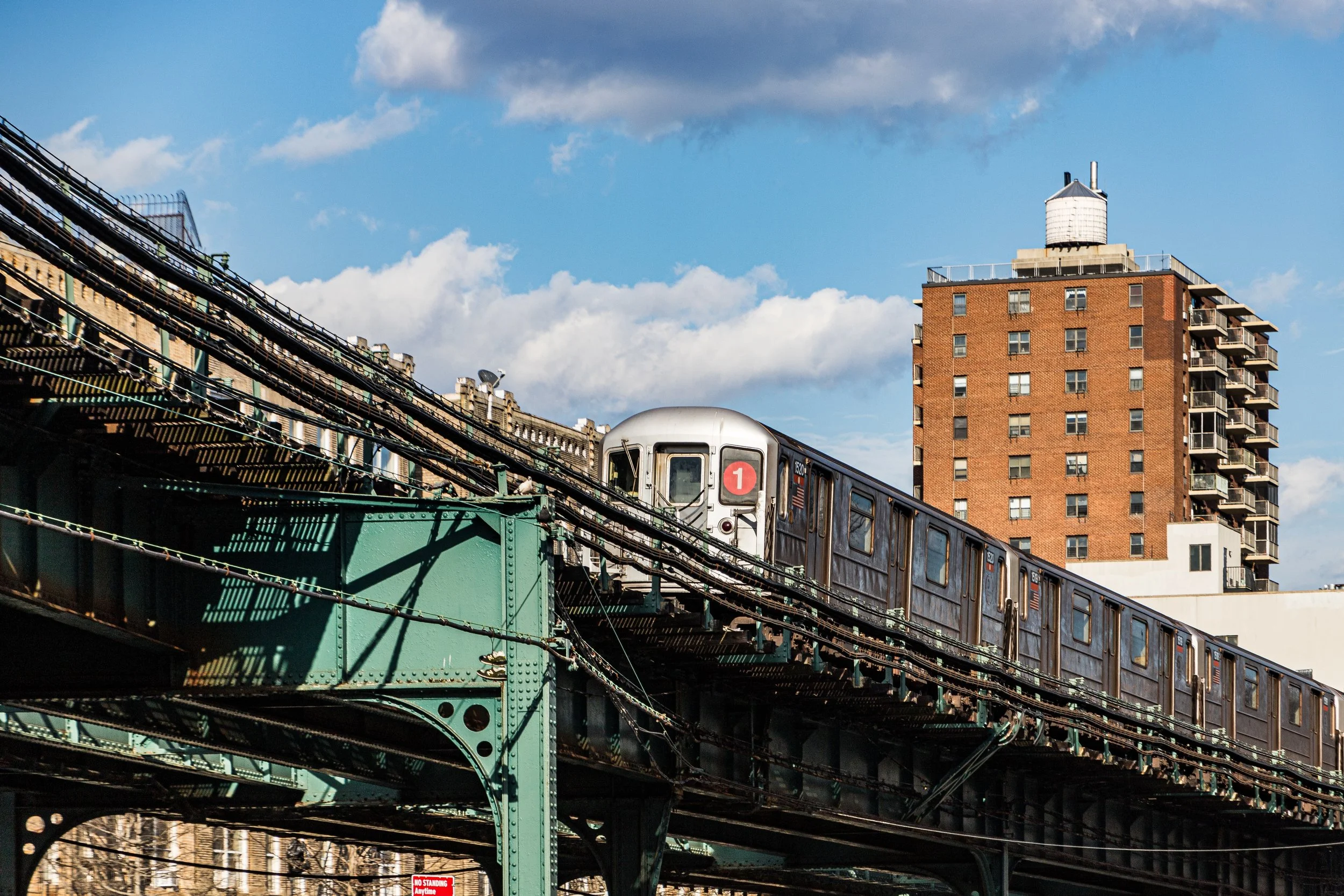
Far to the north of Manhattan, anchored by the George Washington Bridge, resides the densely-populated neighborhood of Washington Heights.
-

To the west of 10th Avenue, from 14th to 30th Streets, is the eclectic neighborhood of West Chelsea. Formerly an industrial/warehouse district, this neighborhood is now home to many art galleries and features The Highline.
-
The West Village has a rich history influencing the progressive culture of New York City and America. Add to it the many, trendy cafés and shops, and the sleepy, winding residential streets and you have one of the most unique (and iconic) neighborhoods in Manhattan.
-
Located to the northwest of the Financial District is the Word Trade Center. Now in the midst of a massive rebuilding project, the site is part tourist attraction, part hub of commerce, and part memorial to one of the most tragic days in United States history.
-
Tucked between East 79th Street and East 96th Street, and between 3rd Avenue and the East River, is Yorkville - and old-timey, prosperous New York City neighborhood. It features a mixture of modern condos, classic row houses, and lush parks.
The History
The Dutch founded their town on principles of trade and tolerance, laying out narrow lanes around a fort that would become Battery Park and Broadway—once a Native trail, later the island’s defining thoroughfare. Nieuw Amsterdam, though small, was cosmopolitan from its inception, home to Dutch, English, African (both enslaved and free), Jewish, and Scandinavian residents. The street plan of lower Manhattan still retains echoes of that early settlement: the crooked lines of Pearl Street, Stone Street, and Broad Street remain as remnants of a 17th-century shoreline.
In 1664, the English seized the colony, renaming it New York in honor of the Duke of York. The island prospered under British rule, its harbor becoming one of the Atlantic world’s busiest ports. Yet the same harbor would witness rebellion: by 1776, when revolution swept the colonies, Manhattan was both strategic prize and battleground. The Battle of Harlem Heights, fought along what is now Morningside Heights, secured George Washington’s retreat northward; the city itself, captured by the British, became a loyalist stronghold until the war’s end.
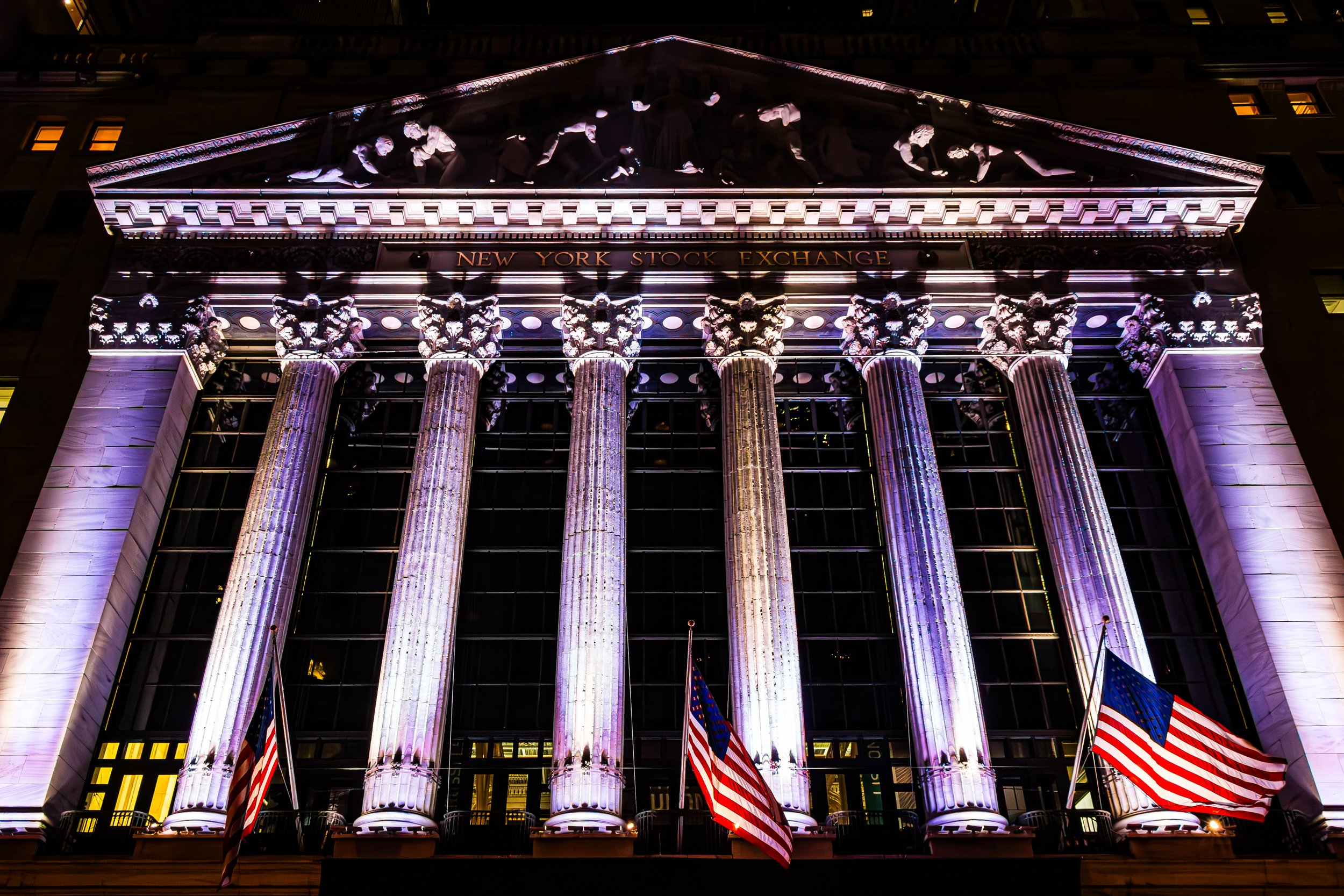
When peace came, New York emerged as the young nation’s first capital. In 1789, George Washington took the oath of office at Federal Hall on Wall Street—a moment that made Manhattan both the seat of government and a symbol of the new republic’s ambition.
17th–18th Century: From Nieuw Amsterdam to British New York
19th Century: Grid, Growth, and Greatness
The 19th century reshaped Manhattan utterly. The Commissioners’ Plan of 1811 imposed a rational grid of avenues and streets upon the island’s rolling terrain, flattening its hills and filling its marshes to create the rectilinear city we know today. The plan—astonishing in its foresight—extended northward from Houston Street to 155th Street, envisioning an urban order that could accommodate millions.
Immigration transformed the population. The Irish fleeing famine, Germans escaping revolution, and later Italians, Jews, and Eastern Europeans all poured into Lower Manhattan’s tenements. The Five Points, Lower East Side, and Little Italy became crucibles of urban struggle and cultural creation. Meanwhile, commerce surged along the waterfronts; wharves at the South Street Seaport teemed with masts and cargo, and Wall Street evolved into the nation’s financial core.
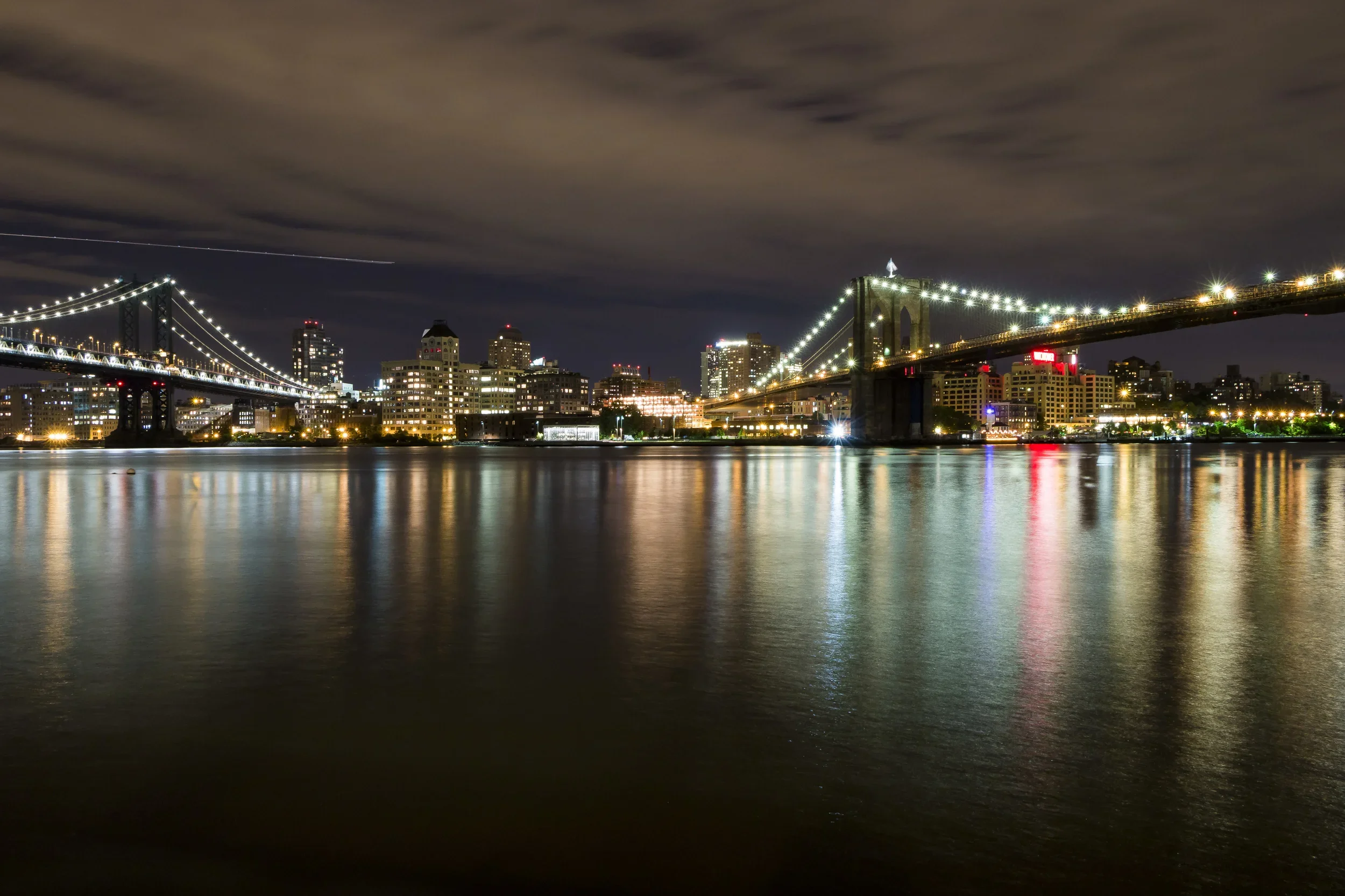
The mid-century saw monumental civic works: Central Park, designed by Frederick Law Olmsted and Calvert Vaux, opened in 1858 as the world’s first major landscaped urban park, offering an egalitarian refuge “for all the people.” Uptown, institutions such as Columbia College and the Cathedral of St. John the Divine rooted intellectual and spiritual life in northern Manhattan. Bridges—the High Bridge (1848) and later the Brooklyn Bridge (1883)—knit the island more tightly to the mainland and neighboring boroughs.
By century’s end, the skyline began to rise. The Flatiron Building (1902) and Singer Tower (1908) heralded an age of steel and verticality, transforming the island’s silhouette into a global emblem of progress.
Early–Mid 20th Century: Metropolis and Modernity
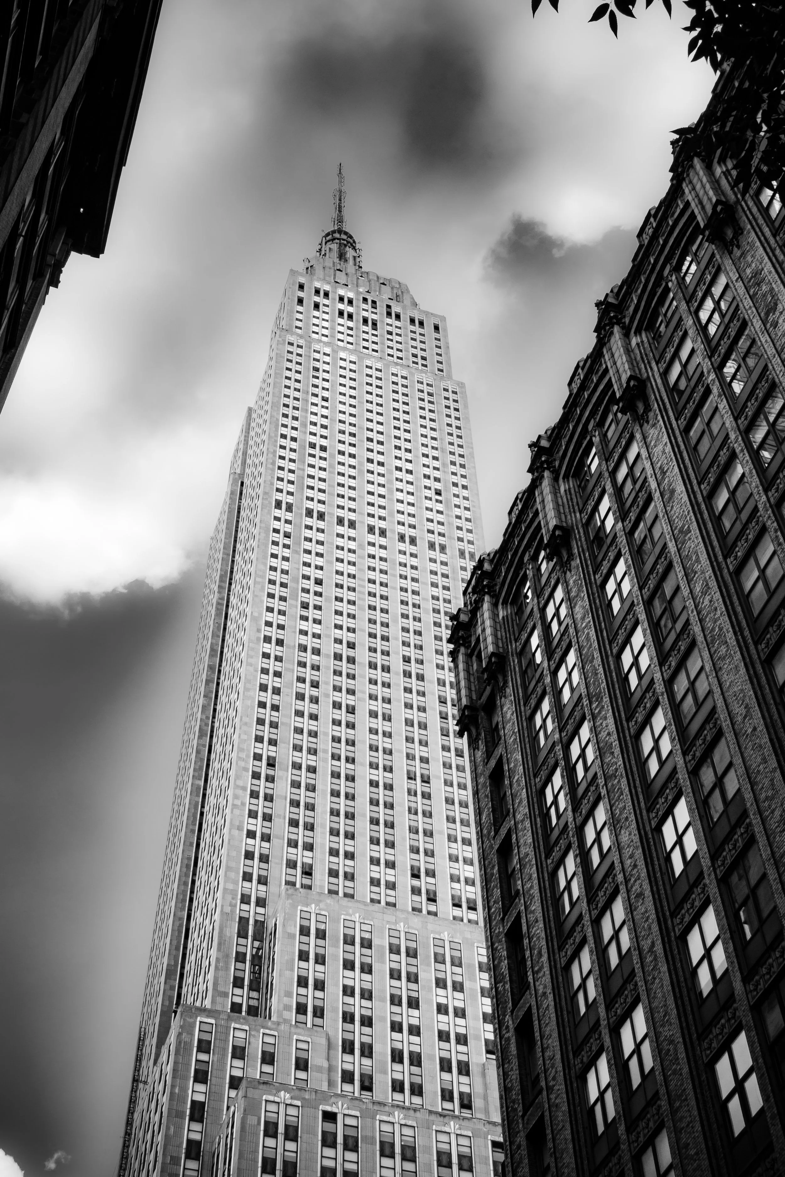
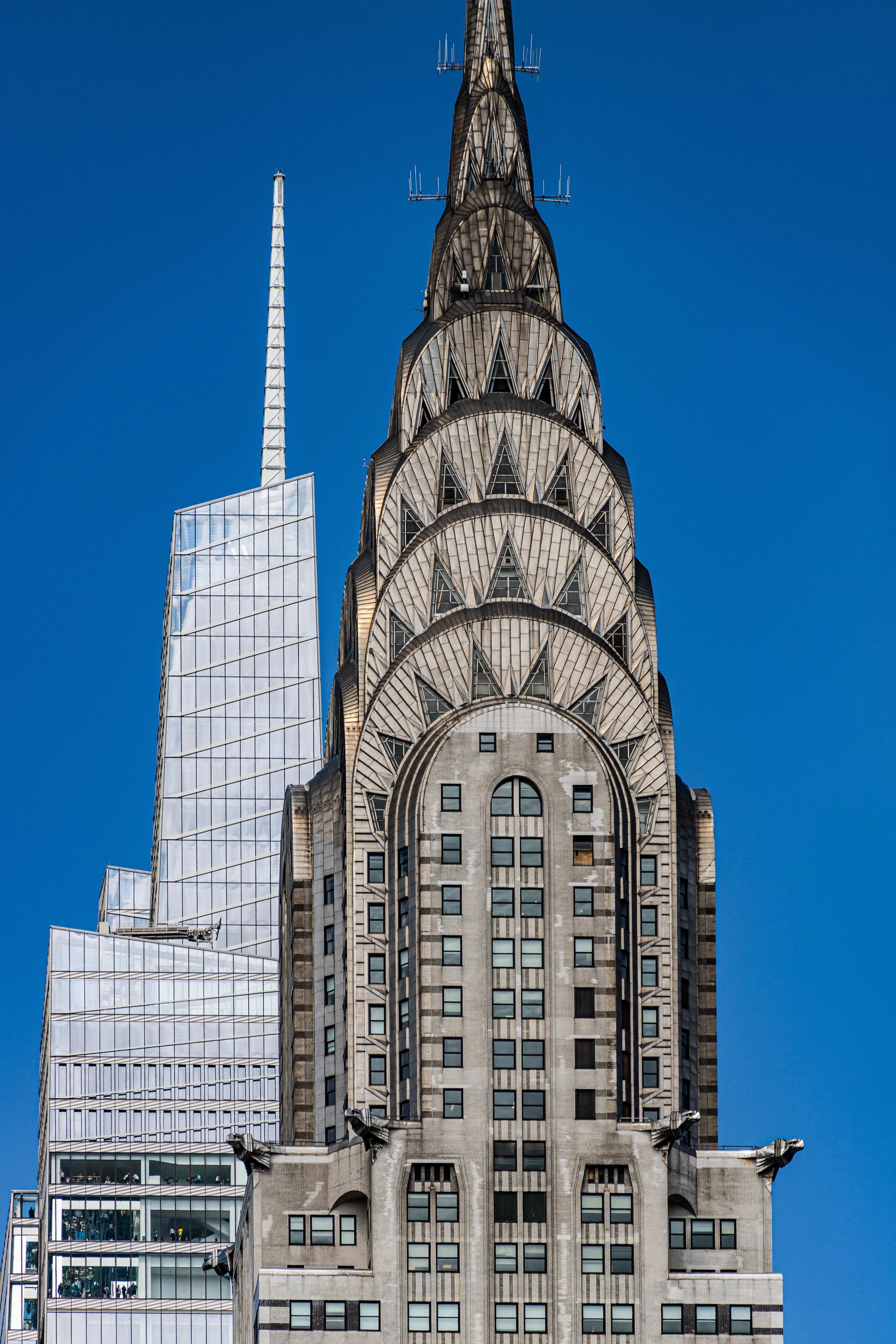
The 20th century made Manhattan the modern world’s capital. The consolidation of the five boroughs in 1898 positioned the island as the city’s commercial and cultural nucleus. Times Square blazed with electric light, Harlem pulsed with the rhythms of the Renaissance, and Wall Street dictated the pace of world finance. The Empire State Building (1931) and Chrysler Building (1930) rose as Art Deco cathedrals to ambition, while the Rockefeller Center (1933–1939) embodied the optimism of civic modernism amid the Depression.
Yet this era also brought struggle and transformation. The Great Depression deepened urban poverty even as the New Deal reshaped public life through infrastructure and art. The Second World War turned Manhattan’s ports and factories into engines of production, and the postwar boom that followed ushered in an age of prosperity—and urban pressure.
Urban planner Robert Moses built highways and bridges that connected Manhattan to the outer boroughs but also displaced communities in the process. Neighborhoods like the Lower East Side, San Juan Hill, and West Harlem faced waves of renewal and demolition, while skyscrapers proliferated in Midtown. The United Nations Headquarters (completed 1952) gave the East River a new symbol of global aspiration.
Late 20th Century: Decline, Creativity, and Renaissance
The 1970s brought crisis: fiscal collapse, crime, and disinvestment threatened Manhattan’s vitality. Yet in the same years, creativity flourished. SoHo’s cast-iron lofts became studios for artists who would redefine contemporary art. In Greenwich Village, music, poetry, and activism reshaped American culture. The Harlem Renaissance’s legacy persisted through civil rights and jazz, while the East Village birthed punk and performance art.
The 1980s–1990s marked a resurgence. Wall Street soared, neighborhoods gentrified, and preservationists fought to save architectural treasures from the wrecking ball. The establishment of historic districts—Greenwich Village, Ladies’ Mile, Upper West Side, and others—ensured the survival of 19th-century streetscapes even as new towers rose. The Battery Park City development reimagined the lower waterfront, creating a model of mixed-use urban design.
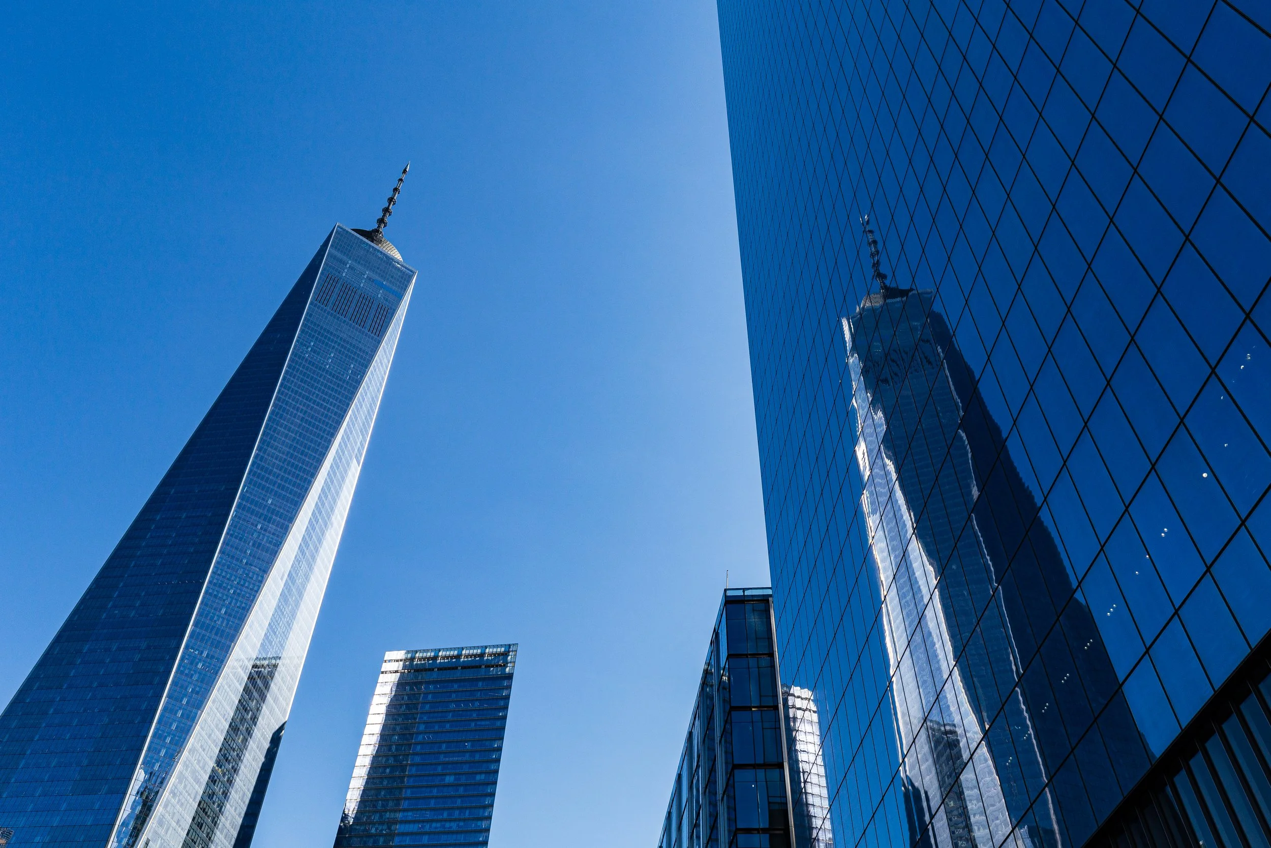
Then came September 11, 2001—the darkest day in the island’s modern history. The destruction of the World Trade Center scarred Manhattan and the nation, yet the decade that followed witnessed extraordinary resilience. The new One World Trade Center, completed in 2014, now stands as both memorial and beacon—its spire gleaming above a city that rebuilt itself from grief.
21st Century: Continuity and Reinvention
In the present century, Manhattan remains the stage upon which New York’s—and the world’s—dramas unfold. Its population surpasses 1.6 million residents, yet its daily life swells with millions more who come to work, study, and create. The High Line, an elevated park built atop an abandoned rail line (opened 2009), symbolizes the island’s capacity for reinvention—turning industrial relic into urban oasis. Downtown, the Hudson Yards megaproject represents a new skyline frontier, while uptown neighborhoods such as Washington Heights, Inwood, and East Harlem pulse with the energy of immigrant cultures and renewed community pride.
Environmental restoration has reconnected Manhattan to its waterfronts; ferry routes, bike paths, and greenways now trace the island’s perimeter. The Harlem River Greenway and Battery Park Esplanade offer the rare experience of circumnavigating the island on foot—an echo of its natural wholeness rediscovered.
Yet through all its reinventions, Manhattan’s essence endures: density as vitality, diversity as identity, and reinvention as survival. The same forces that once leveled hills and lifted towers still shape it—commerce, creativity, migration, and resilience.
Spirit and Legacy
Manhattan’s legacy is that of the ever-rising island—the meeting point of geography and imagination. From Lenape hunting ground to colonial port, from industrial powerhouse to global capital, it has continually remade itself while preserving its myth. Its very ground—granite, layered with centuries of human endeavor—embodies endurance.
The Photography
Visual Rhythm
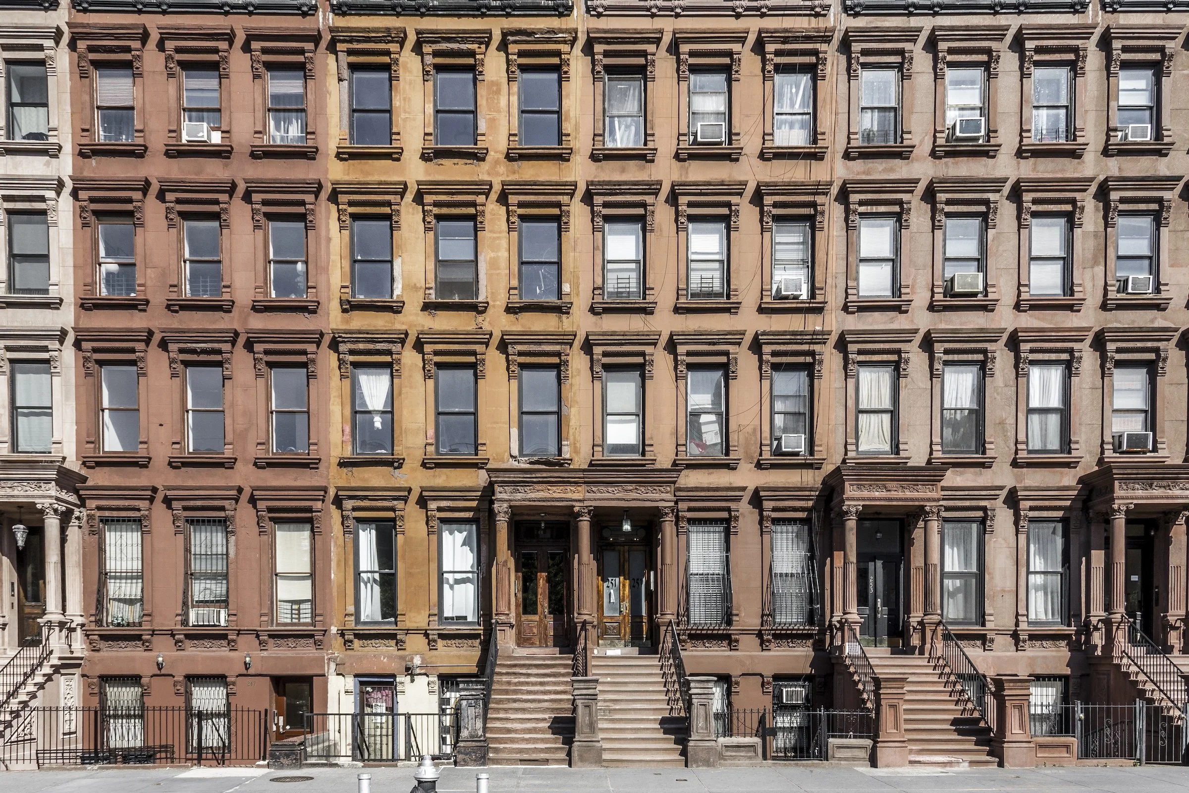
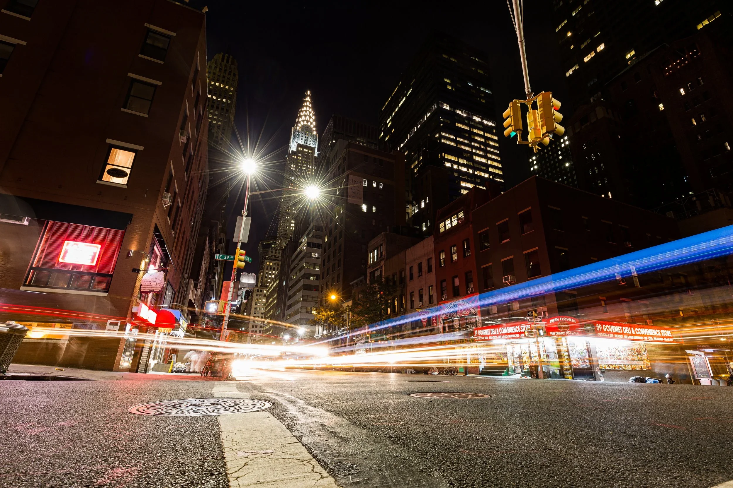
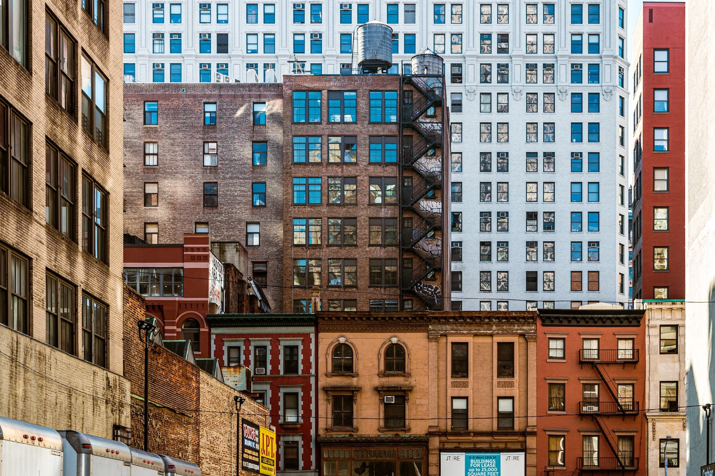
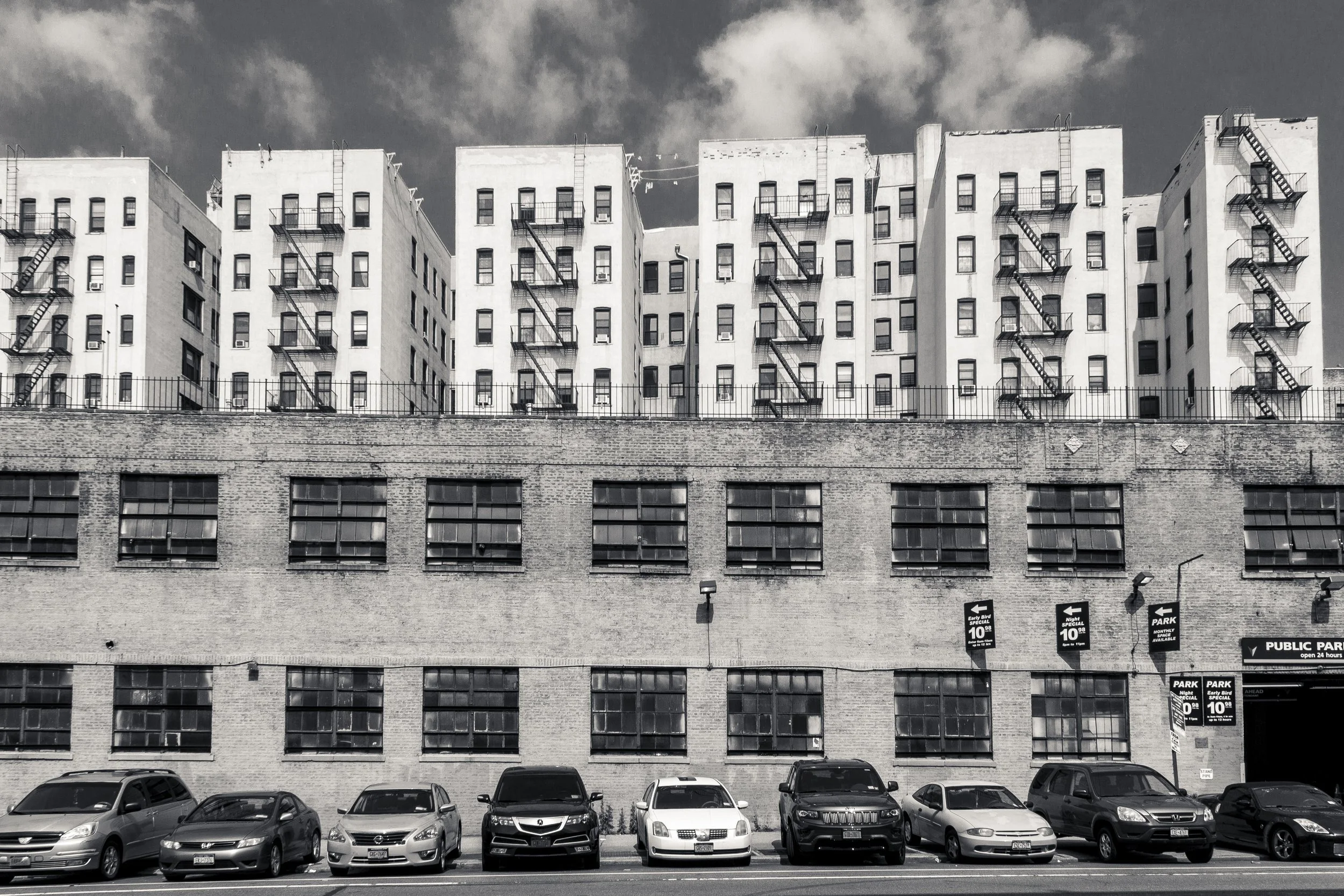
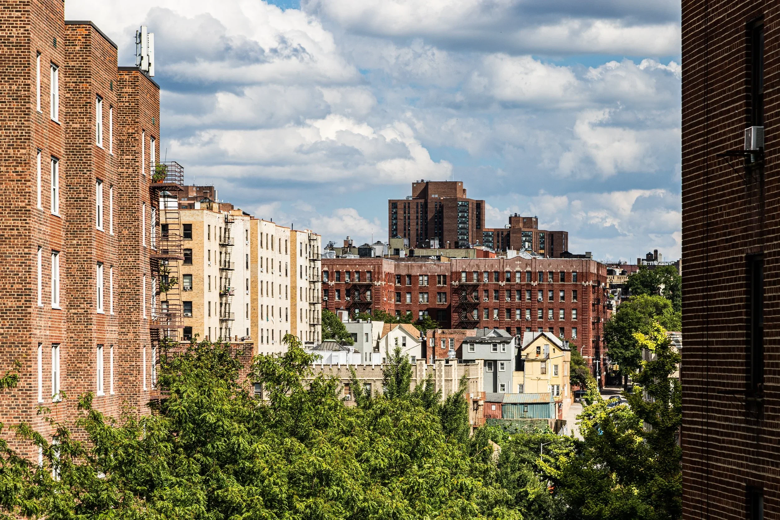
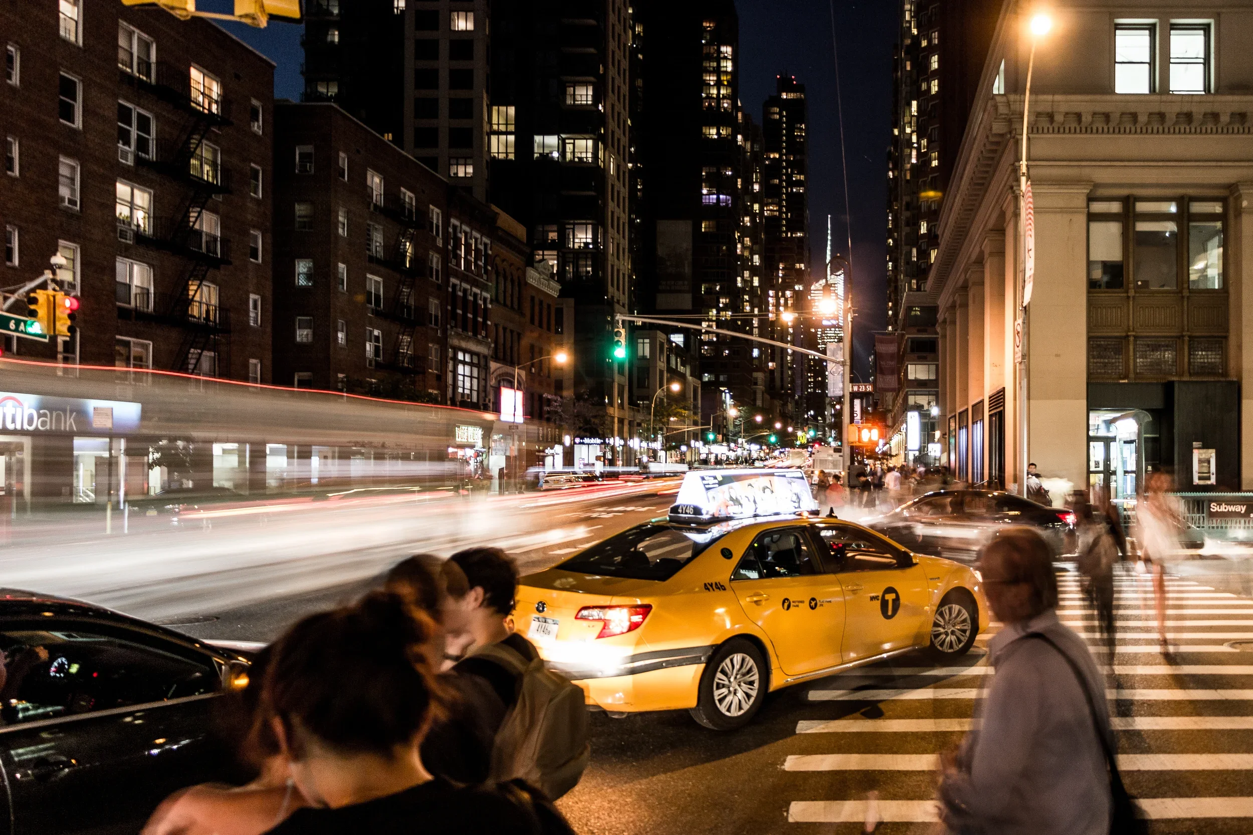
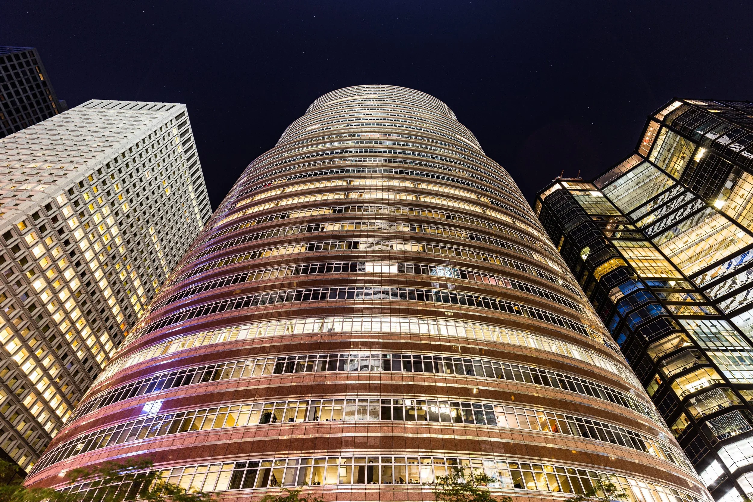
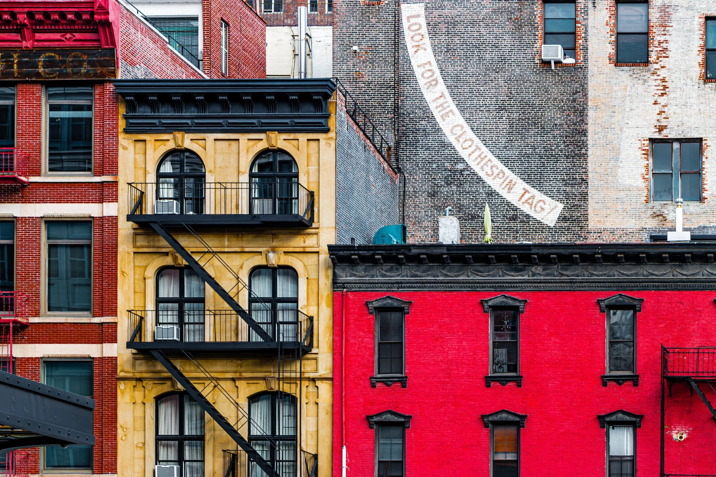
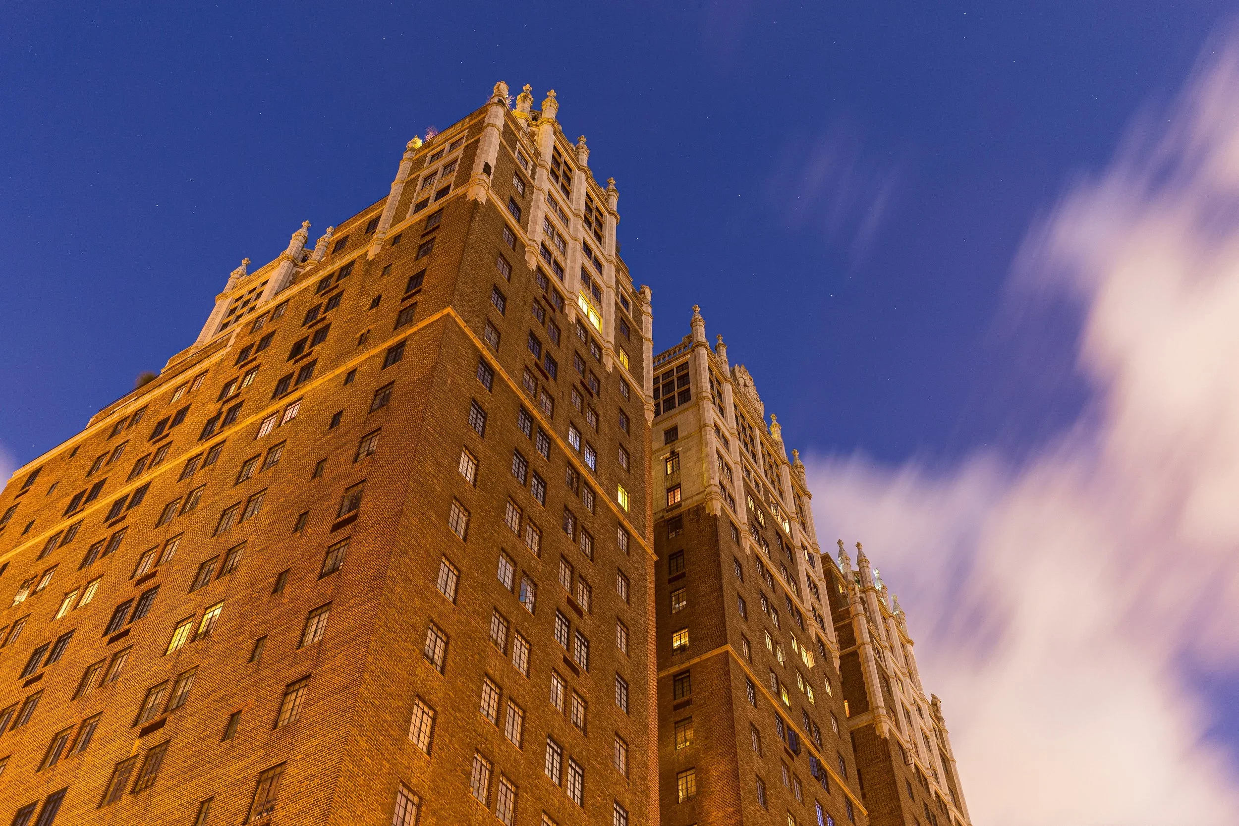
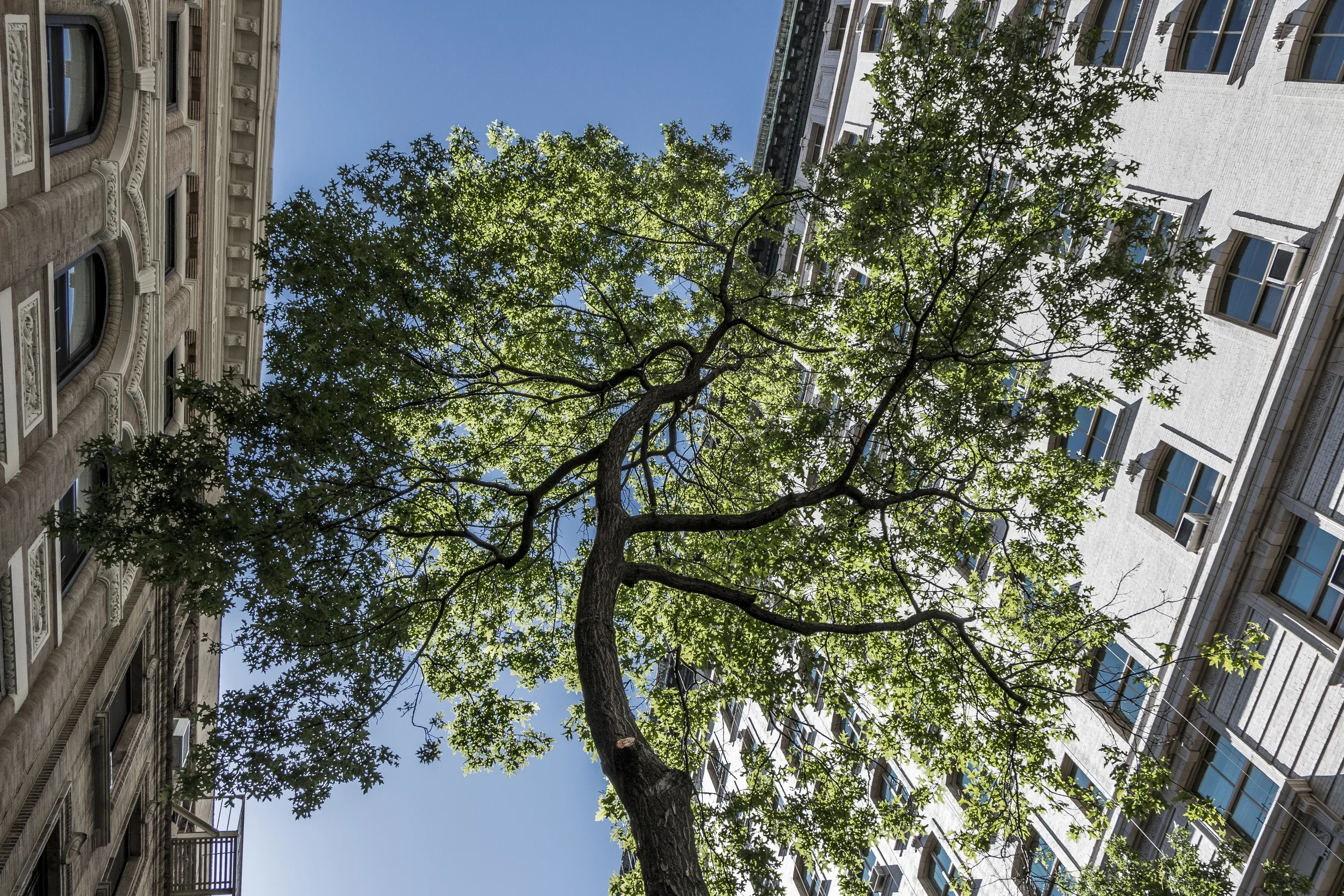
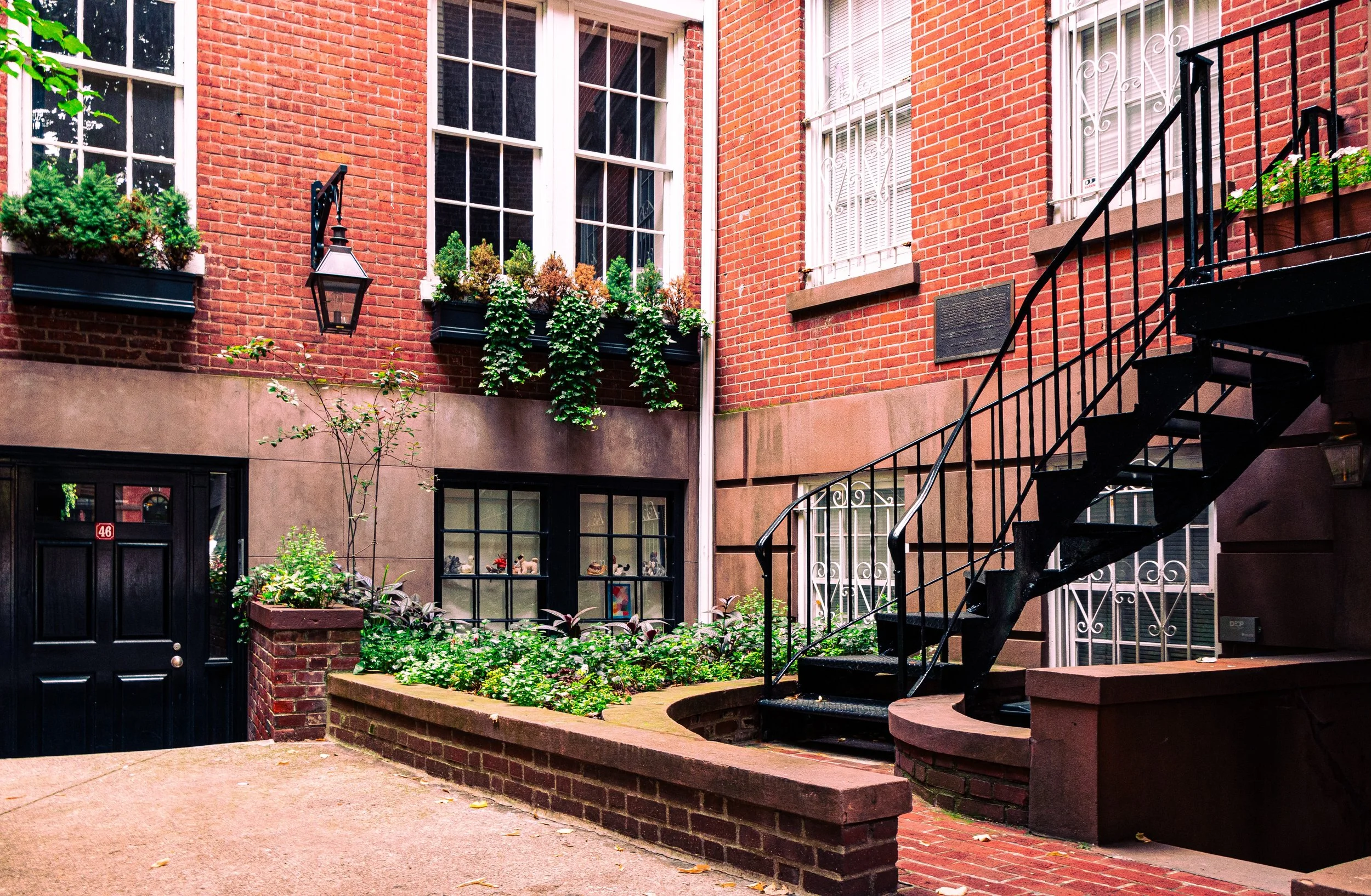
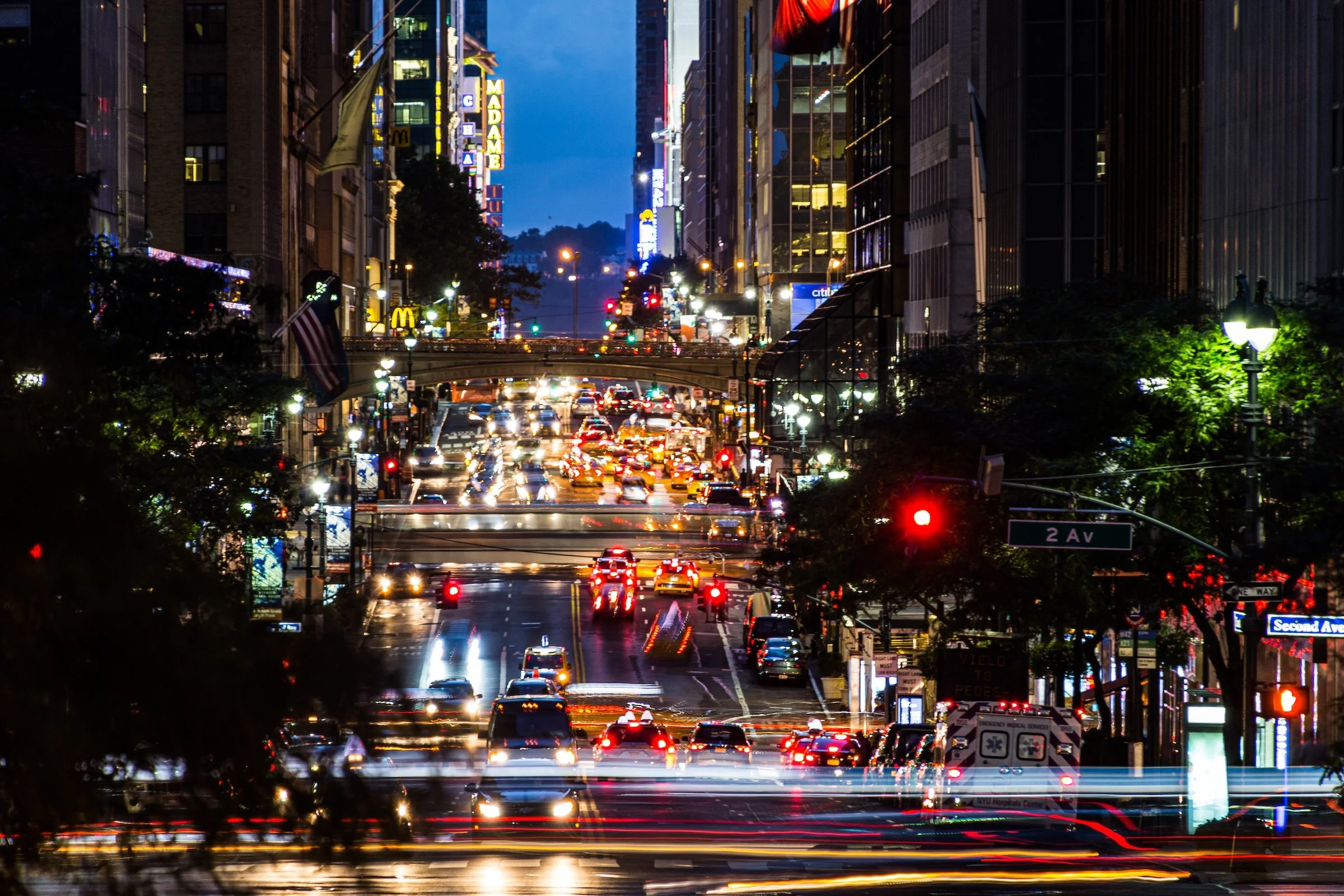
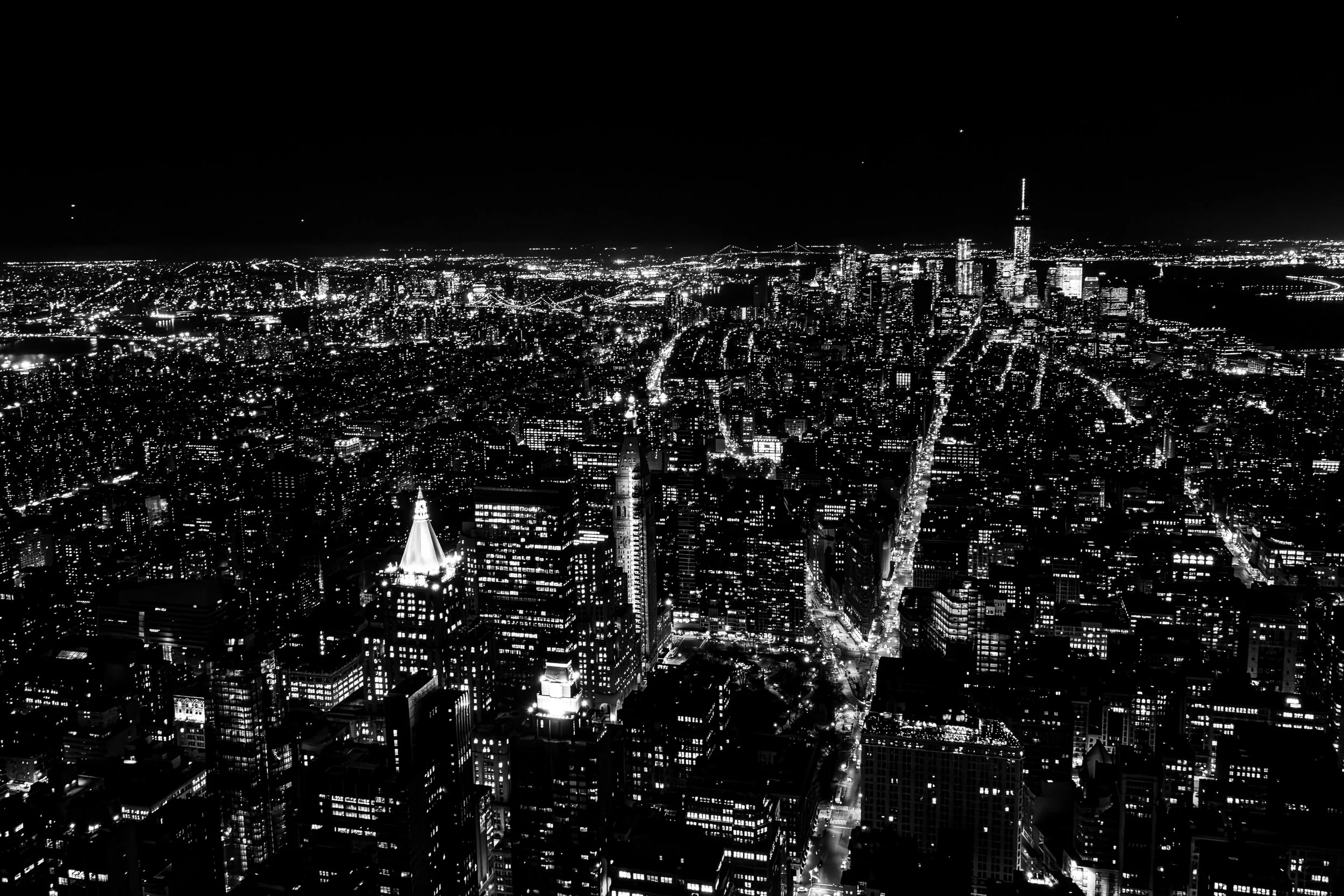
Manhattan is a borough of compression, velocity, and visual accumulation. To photograph it is to work within a landscape where architecture, infrastructure, commerce, memory, and daily life are pressed tightly together, often within the same block. Towers rise beside tenements, civic facades give way to loading docks and scaffolding, and long avenues suddenly break into quieter residential streets, pocket parks, or fragments of an older city still holding its ground.
Photographically, Manhattan is defined not only by scale but by concentration. Light is reflected, interrupted, and redirected by glass, steel, stone, and shadow. Buildings crowd the frame. Streets create corridors of movement. Repetition appears in windows, fire escapes, setbacks, and facades, while interruption arrives through signage, ornament, steam, foliage, traffic, scaffolding, murals, and the constant improvisation of urban life. Even in its calmer neighborhoods, Manhattan rarely feels still; it feels charged, layered, and in dialogue with itself.
These photographs trace that range. Some focus on Manhattan’s vertical drama and engineered spectacle; others attend to neighborhood texture, architectural detail, quieter residential edges, institutional gravitas, or the distance and perspective offered by waterfronts, bridges, and skyline views. Taken together, they present Manhattan not as a single icon, but as a borough of overlapping worlds: monumental and intimate, ceremonial and improvised, global in image yet deeply local in experience.
Through the Lens
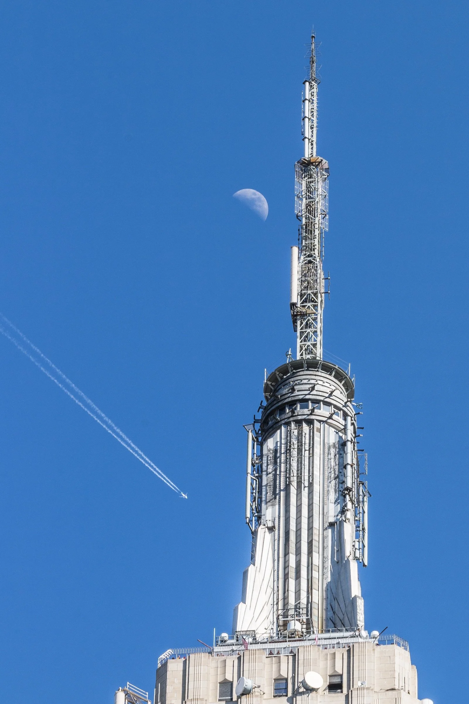
Photographing Manhattan means learning how to work with density. The borough repeatedly asks the eye to move upward, downward, and along sharply defined lines of force: avenues, facades, bridges, corridors, stairways, canyons of glass and masonry. Verticality is everywhere, but Manhattan’s visual power does not come from height alone. It comes from the way height interacts with compression, repetition, interruption, and human movement.
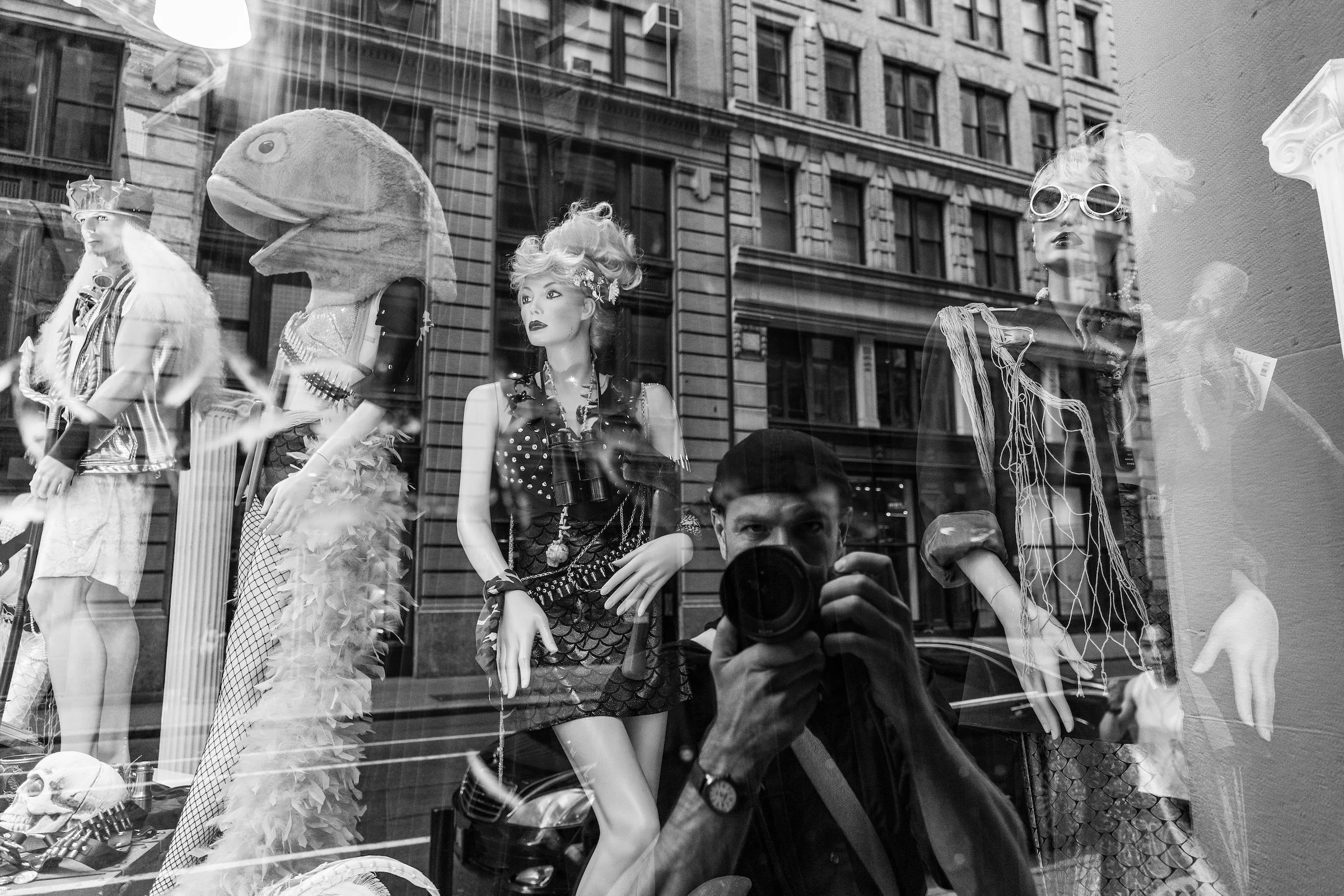
Again and again, Manhattan reveals itself through juxtaposition. A gleaming tower rises above an older streetscape. A monumental civic building sits near a row of walk-ups. Brownstone blocks and cast-iron facades coexist with reflective curtain walls and newly built forms. Some parts of the borough feel theatrical and self-announcing, especially where commerce, tourism, and spectacle gather. Other parts feel more inward and observant, shaped by stoops, cornices, trees, courtyards, side streets, and the accumulated textures of long habitation.
There is also a distinctly Manhattan relationship between order and disruption. The grid imposes structure, repetition, and forward momentum, but the life within it is full of interruptions: neon, scaffolding, murals, detours, shadows, signs, crowds, steam, and sudden flashes of color or stillness. This tension gives Manhattan much of its photographic energy. The borough is rarely only one thing at a time. It is polished and worn, historic and provisional, ceremonial and improvised, often within the same frame.
To photograph Manhattan, then, is not simply to document landmarks or skyline views. It is to pay attention to how the borough performs itself through pattern, pressure, contrast, and scale — and to how, beneath that larger spectacle, neighborhood character persists in details both ordinary and precise.
Visual Highlights
This selection reflects several of Manhattan’s defining photographic qualities: upward views framed by towers and sky, facades arranged in strict rhythm, richly layered streetscapes, skyline perspectives from afar, bridges and waterfront edges, civic and institutional architecture, neighborhood signage, and moments where dense urban form gives way to quieter texture or human scale.
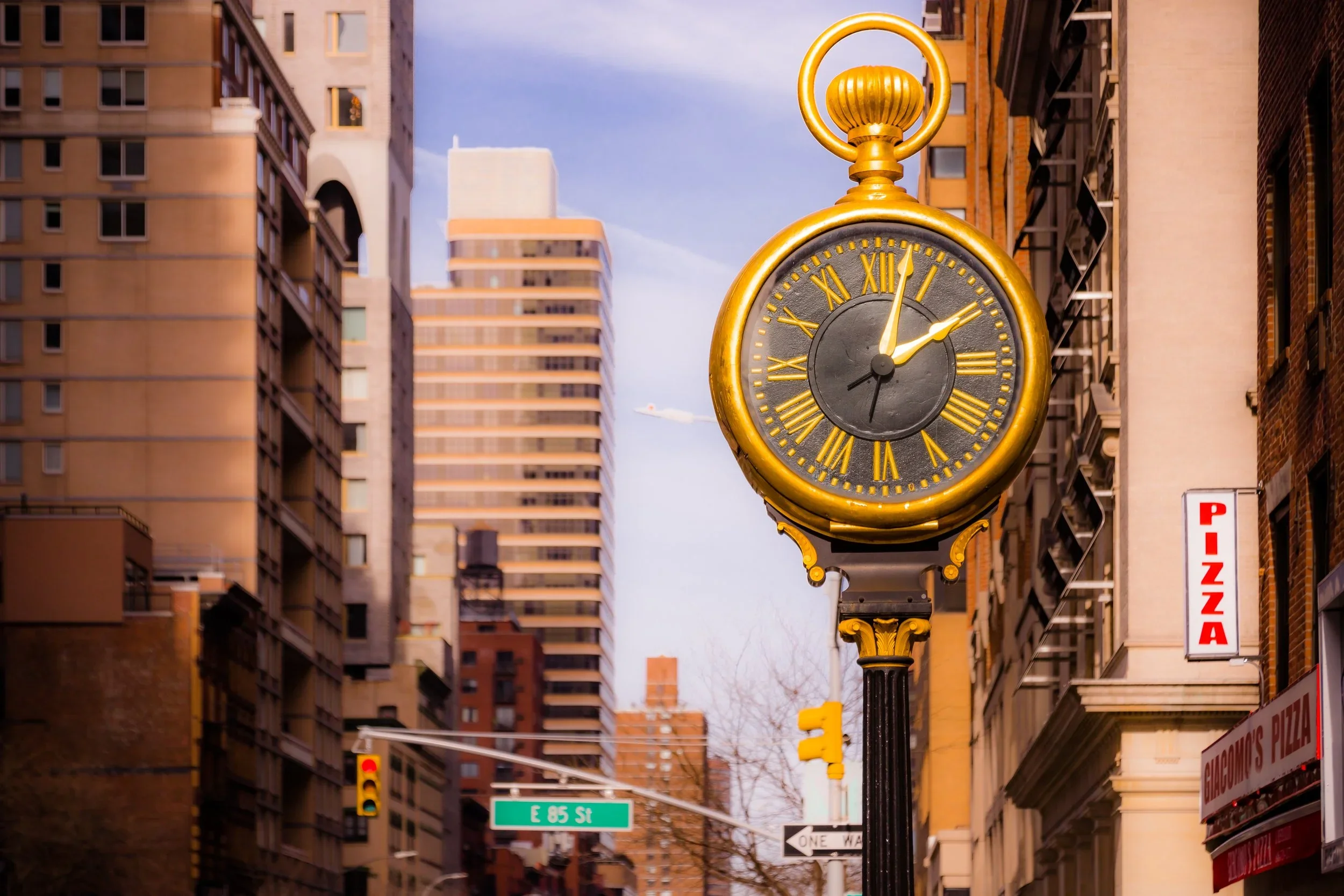
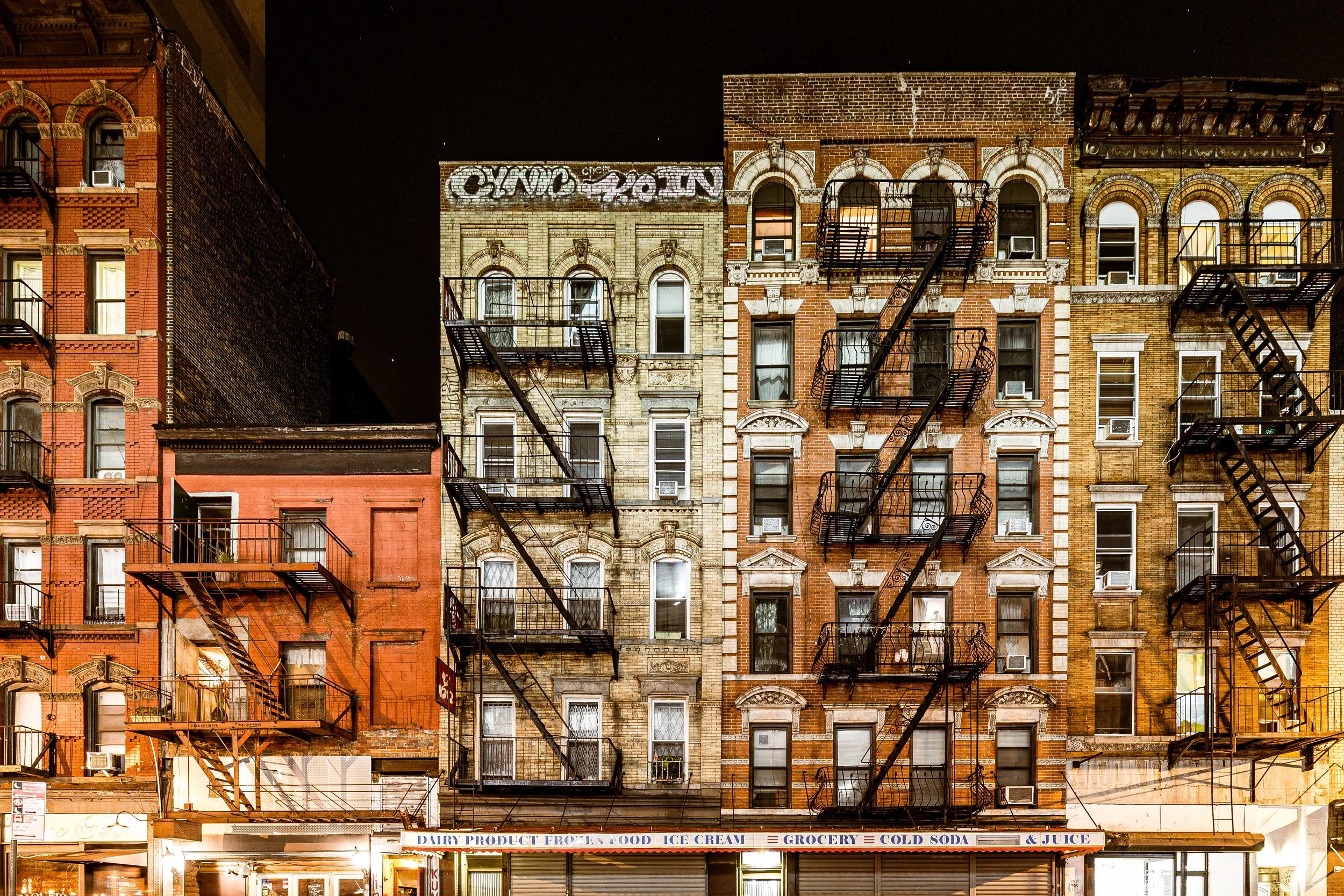
Some images emphasize Manhattan’s monumental presence — its skyline, its infrastructure, its dramatic corridors of height and light. Others focus on the borough at closer range: window grids, cornices, brickwork, murals, streetside details, and residential blocks that hold their own distinct visual identity within the larger city. Together, these photographs suggest a borough whose power lies not only in its icons, but in the interplay between spectacle and detail, order and improvisation, grandeur and intimacy.
Fieldwork Across the Borough
These photographs are part of an ongoing effort to document Manhattan through repeated walks, revisits, and close attention to both its celebrated landmarks and its everyday urban fabric. Rather than isolating only the monumental or the instantly recognizable, this work approaches Manhattan as a lived borough: one of neighborhood distinctions, architectural layers, shifting light, patterned facades, public space, commercial energy, and persistent local character.
As this archive continues to grow, this section will expand to include fuller photographic logs, neighborhood-based highlights, seasonal returns, and more detailed visual pathways through the borough. Over time, it will serve not only as a gallery of selected work, but as an evolving record of how Manhattan looks, feels, and changes when encountered on foot and over time.
Lexicon Connections
Several recurring visual strategies and motifs emerge naturally across these Manhattan photographs and connect closely to the broader Photographic Lexicon.
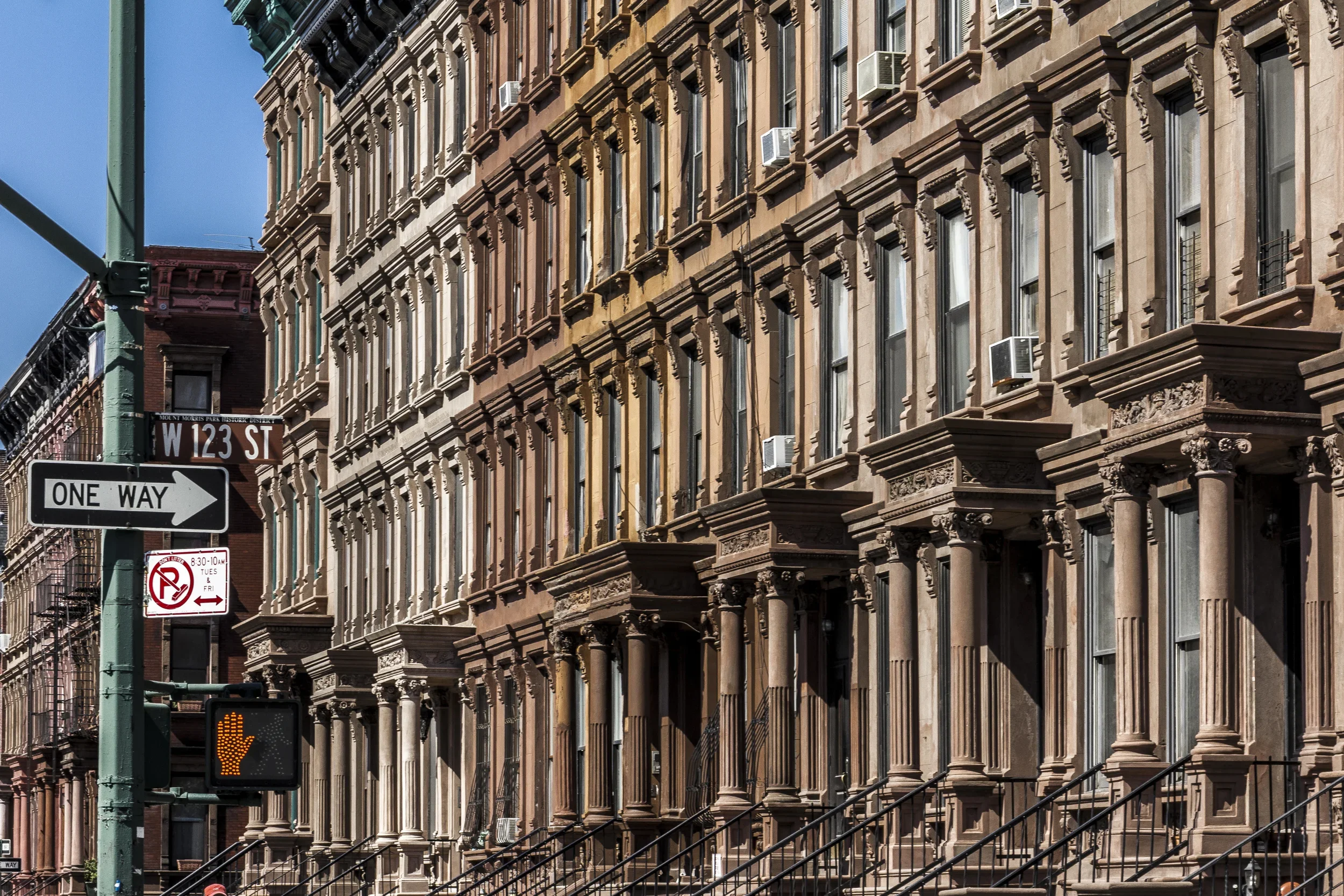
Repetitions & Patterns are everywhere in Manhattan: stacked windows, gridded facades, setbacks, colonnades, railings, fire escapes, and the disciplined rhythm of the built environment. In Manhattan especially, repetition often becomes part of the borough’s emotional register, conveying intensity, scale, and order.
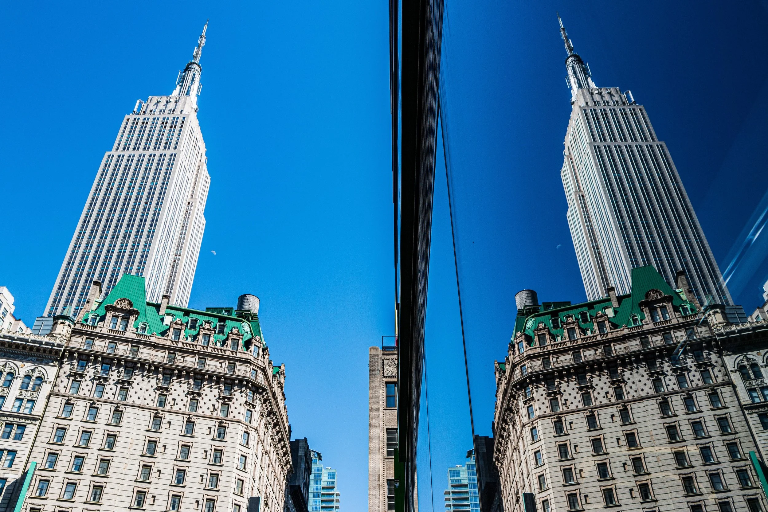
Sky Dramatic appears in the many upward-facing views where towers meet open blue, cloud formations, or nighttime illumination. Manhattan’s architecture often seems to pull the sky into the composition, turning even a narrow street into a stage for vertical drama.
Receding Planes is visible in images where foreground, midground, and background build upon one another: bridge structures before skyline views, streets before towers, rooftops before distant clusters, or close architectural details set against a larger urban field. Manhattan rewards this kind of stacked seeing.
Custom Framing emerge through arches, transit structures, windows, underpasses, streets opening between towers, and those accidental visual thresholds the borough produces so readily. Manhattan often presents itself as a city viewed through apertures.
Urban Canyon is especially relevant here, in the long corridors created by avenues, side streets, and tightly massed high-rises. Light, shadow, and perspective intensify within these spaces, producing one of Manhattan’s most recognizable visual conditions.
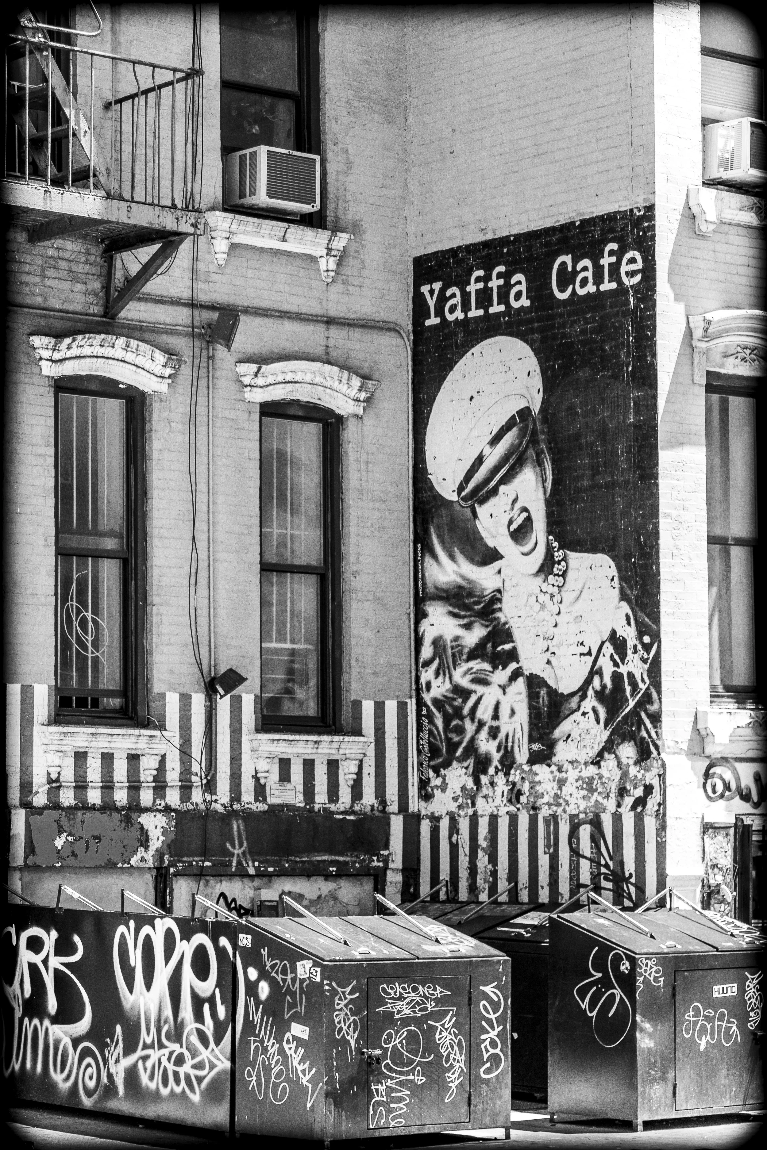
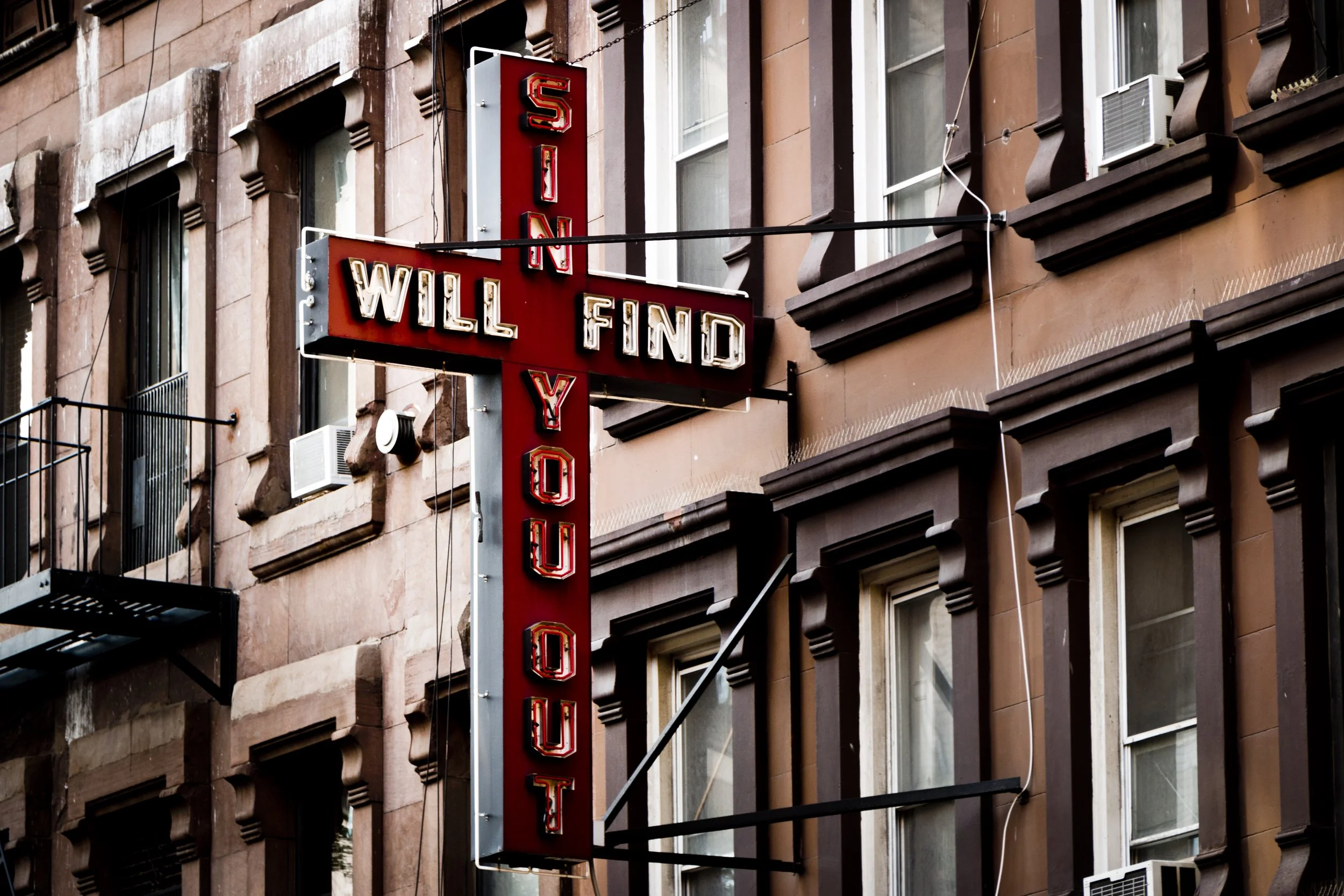
Chromatic City appears in murals, storefronts, signage, decorative facades, lit interiors, painted surfaces, and those flashes of warmth or eccentricity that interrupt the borough’s steel, glass, and masonry discipline.
Reflected City can also be felt in many Manhattan scenes, where glass towers, polished facades, and shifting light create layers of doubling, glare, transparency, and distortion.
As this section evolves, these visual threads can be linked more directly to individual Lexicon entries, helping connect Manhattan’s borough-wide photographic character to the broader visual language of CityNeighborhoods.
Manhattan Neighborhoods In Photographs
The Five Boroughs
Use this custom Google map to explore where every neighborhood in all five boroughs of New York City is located.
The Five Boroughs
One of New York City’s unique qualities is its organization in to 5 boroughs: Manhattan, Brooklyn, Queens, The Bronx, and Staten Island. These boroughs are part pragmatic administrative districts, and part vestiges of the region’s past. Each borough is an entire county in New York State - in fact, Brooklyn is, officially, Kings County, while Staten Island is, officially Richmond County. But that’s not the whole story …
Initially, New York City was located on the southern tip of Manhattan (now the Financial District) that was once the Dutch colony of New Amsterdam. Across the East River, another city was rising: Brooklyn. In time, the city planners realized that unification between the rapidly rising cities would create commercial and industrial opportunities - through streamlined administration of the region.
So powerful was the pull of unification between New York and Brooklyn that three more counties were pulled into the unification: The Bronx, Queens, and Staten Island. And on January 1, 1898, the City of New York unified two cities and three counties into one Greater City of New York - containing the five boroughs we know today.
But because each borough developed differently and distinctly until unification, their neighborhoods likewise uniquely developed. Today, there are nearly 390 neighborhoods, each with their own histories, cultures, cuisines, and personalities - and each with residents who are fiercely proud of their corner of The Big Apple.


