
STATEN ISLAND
Part of an ongoing project to walk and photograph every neighborhood in New York City, this page explores Staten Island through maps, borough identity, history, and photography.

The Maps
Geographic Setting
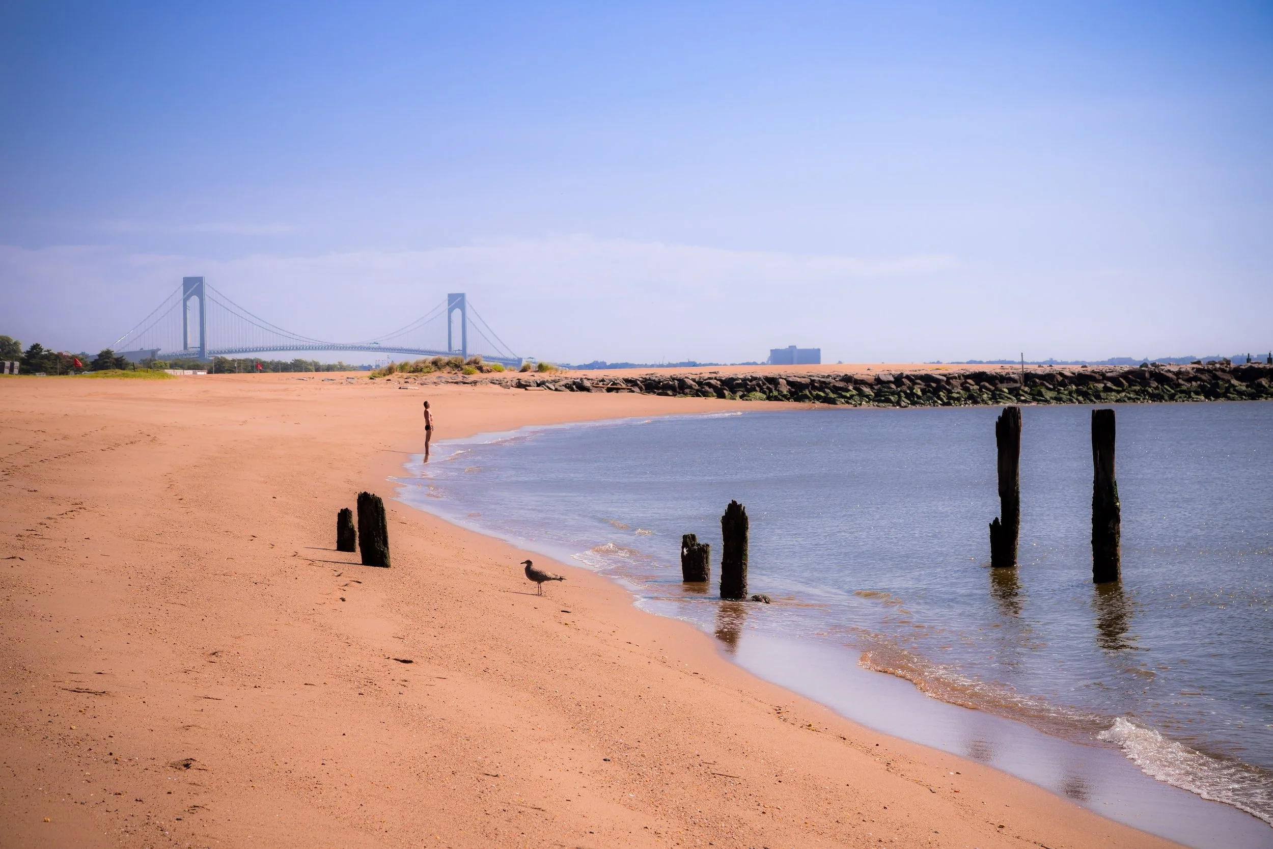
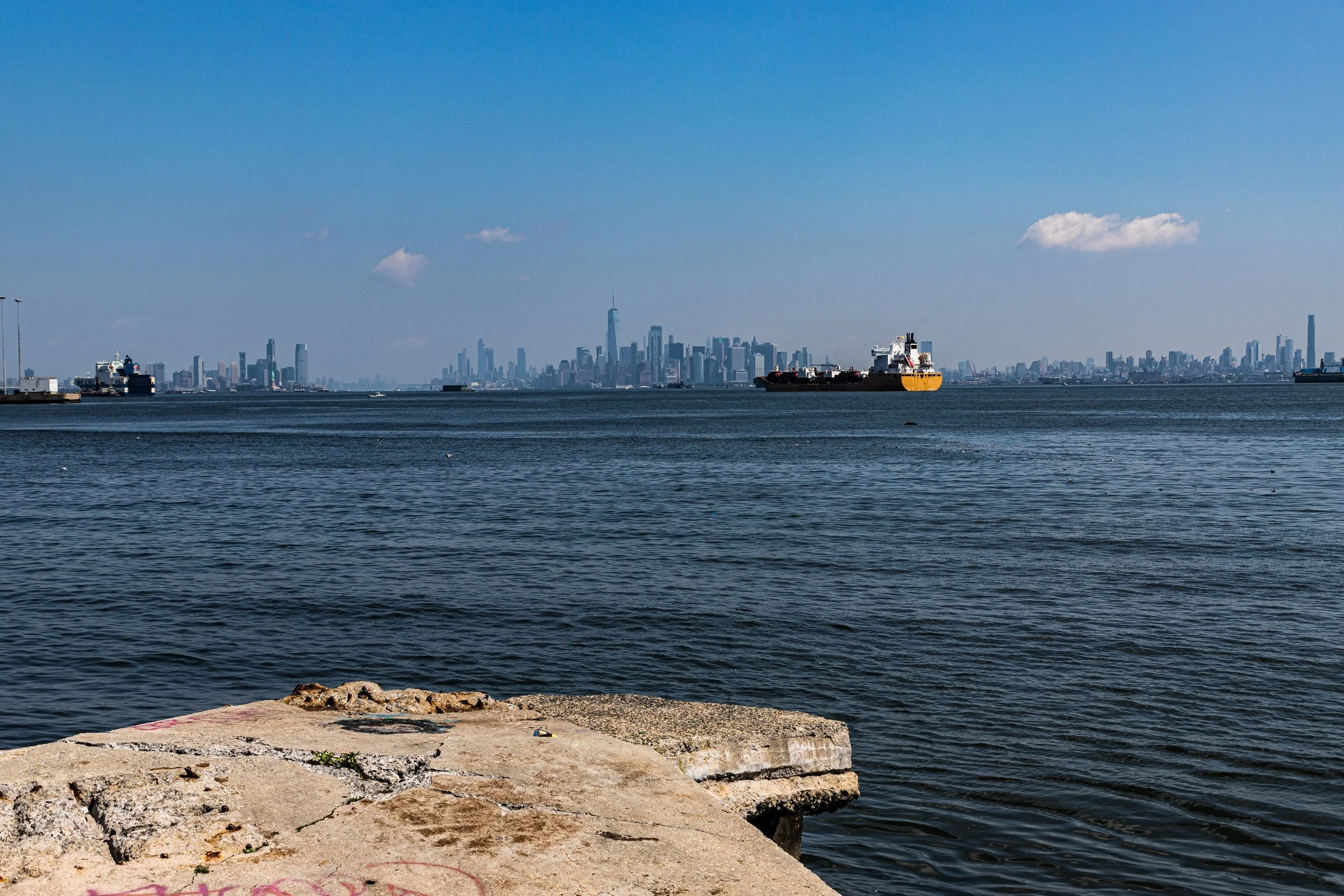
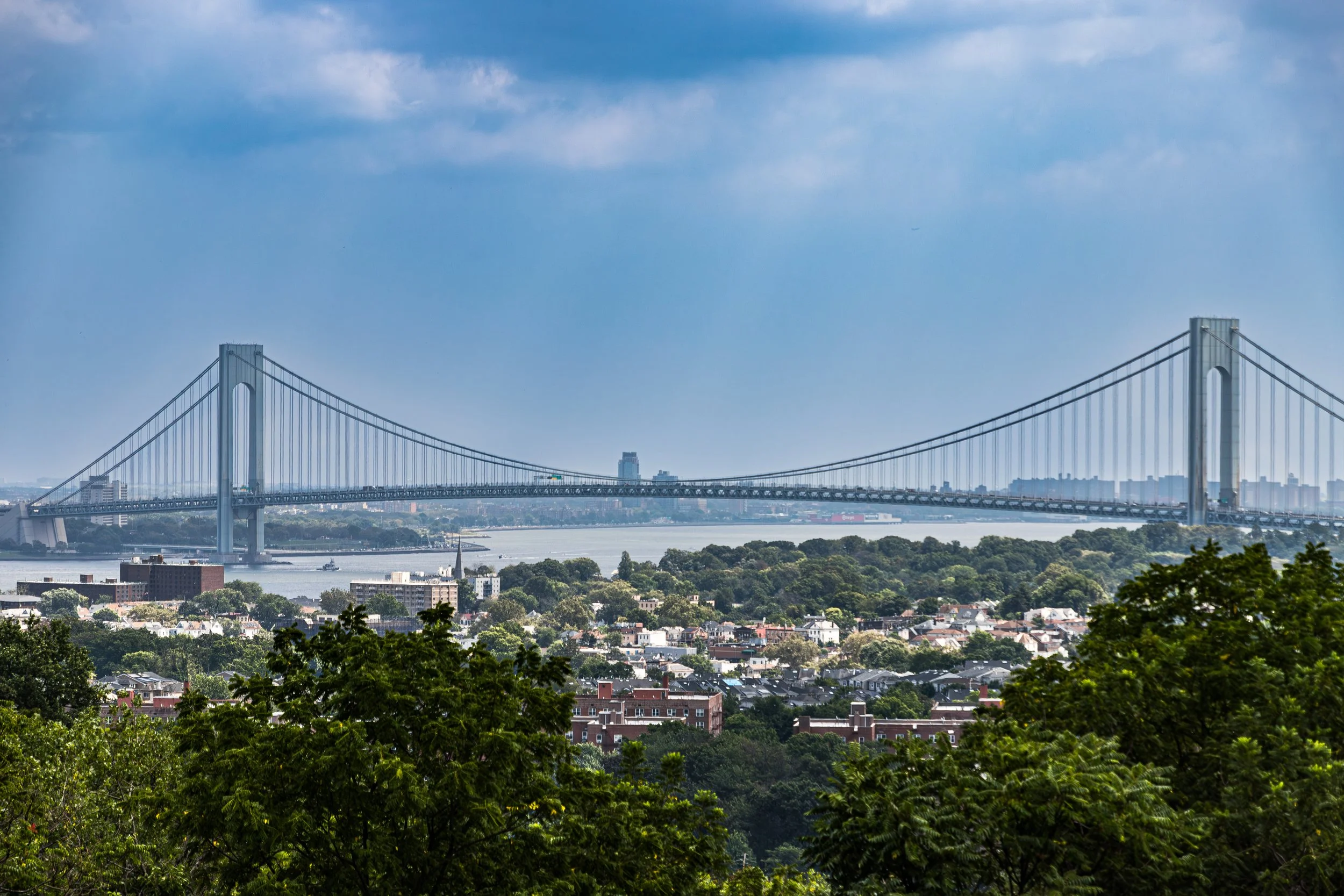
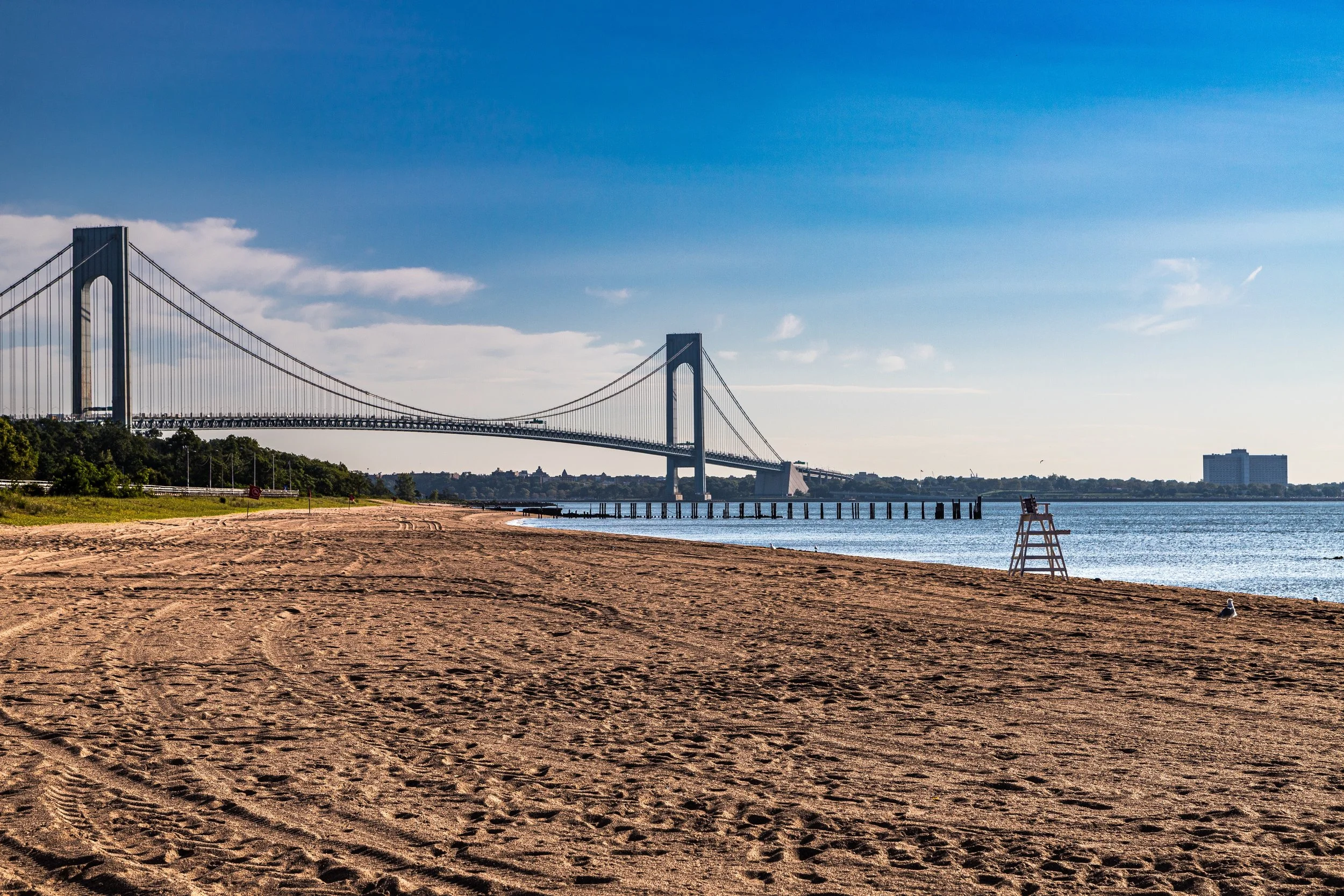
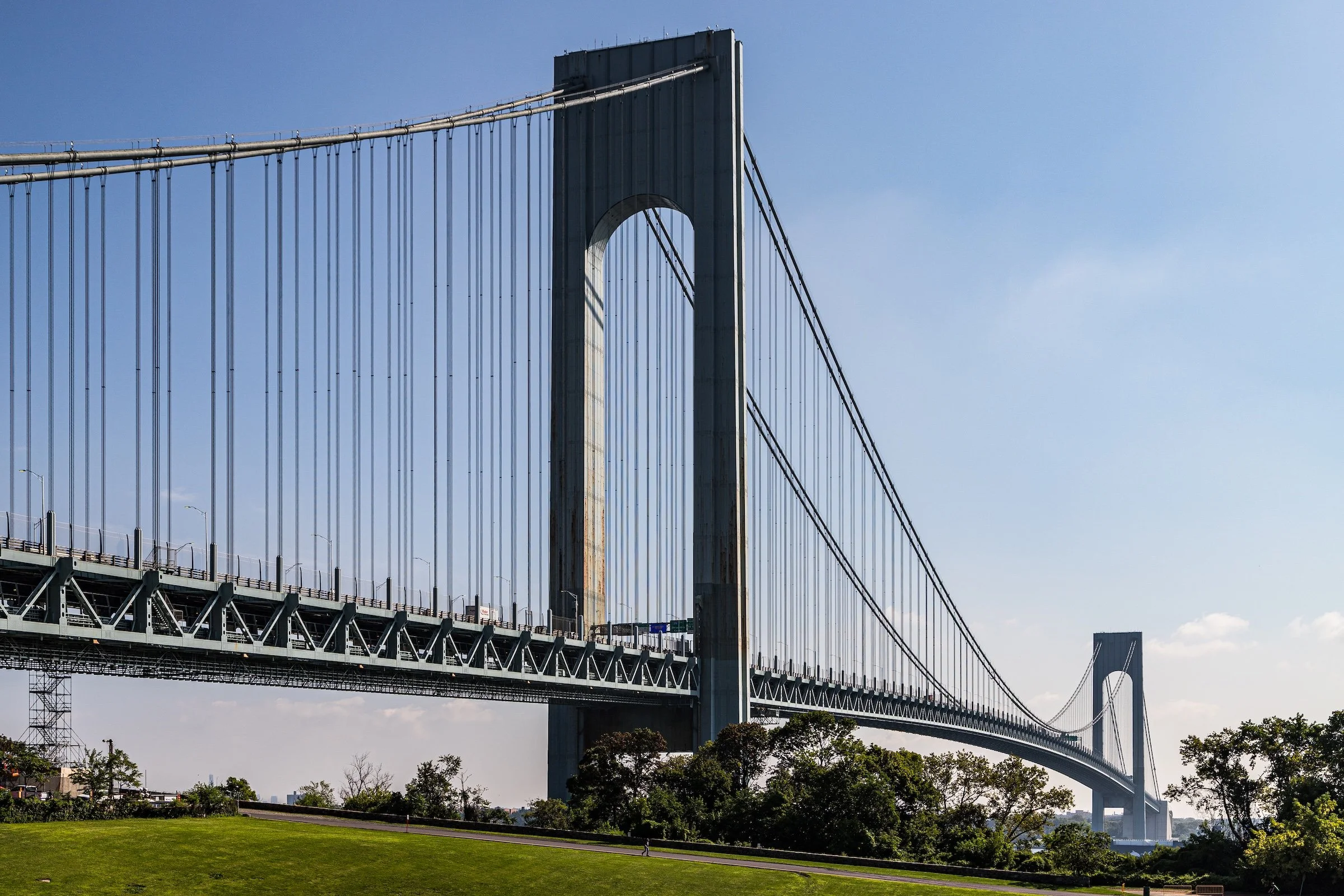
Separated from the rest of New York by New York Harbor, the Arthur Kill, and the Kill Van Kull, Staten Island forms the city’s southwesternmost borough—an island of rolling hills, wetlands, and waterfronts that spans nearly 60 square miles. To its west lies New Jersey, connected by the Goethals Bridge, Outerbridge Crossing, and Bayonne Bridge; to the east, the Verrazzano-Narrows Bridge (1964) links it to Brooklyn. Within these boundaries, Staten Island’s landscape is at once rural and urban: forests and tidal marshes in the center, harbors and neighborhoods along the shore, and open stretches of parkland that preserve its original topography better than any other borough.
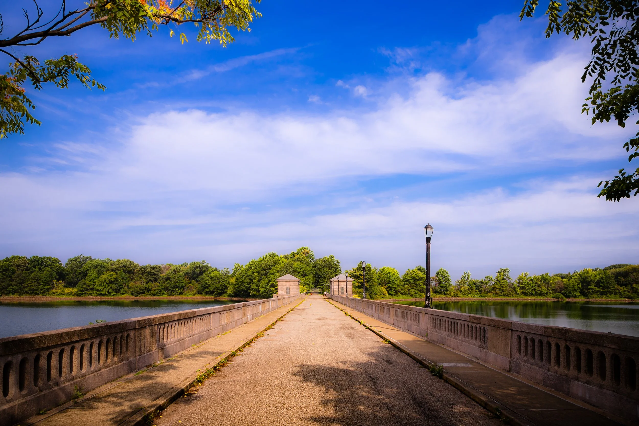
The borough’s terrain rises from the flat lowlands of Arden Heights and New Springville to the crest of Todt Hill, at 410 feet the highest natural point on the Atlantic seaboard south of Maine. Its hills command sweeping views of the harbor and Lower Manhattan. The island’s parks—Clove Lakes, Silver Lake, LaTourette, Blue Heron, and the emerging Freshkills Park—together form a vast greenbelt that defines its identity as “the borough of balance,” where the natural and urban coexist in rare equilibrium.
Staten Island Identity
Borough Identity
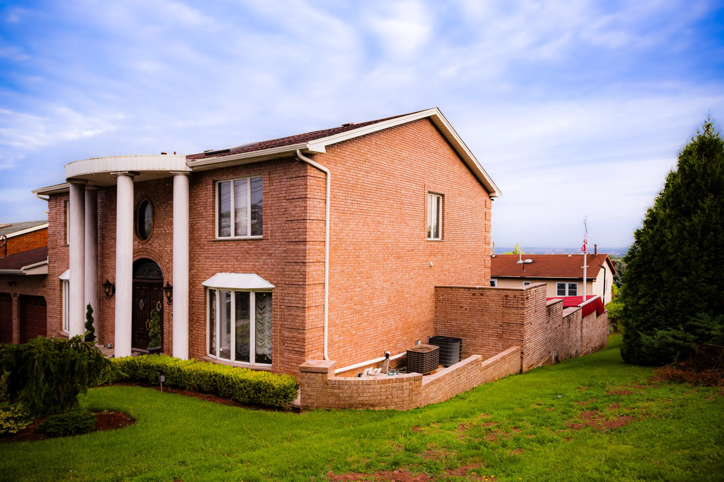
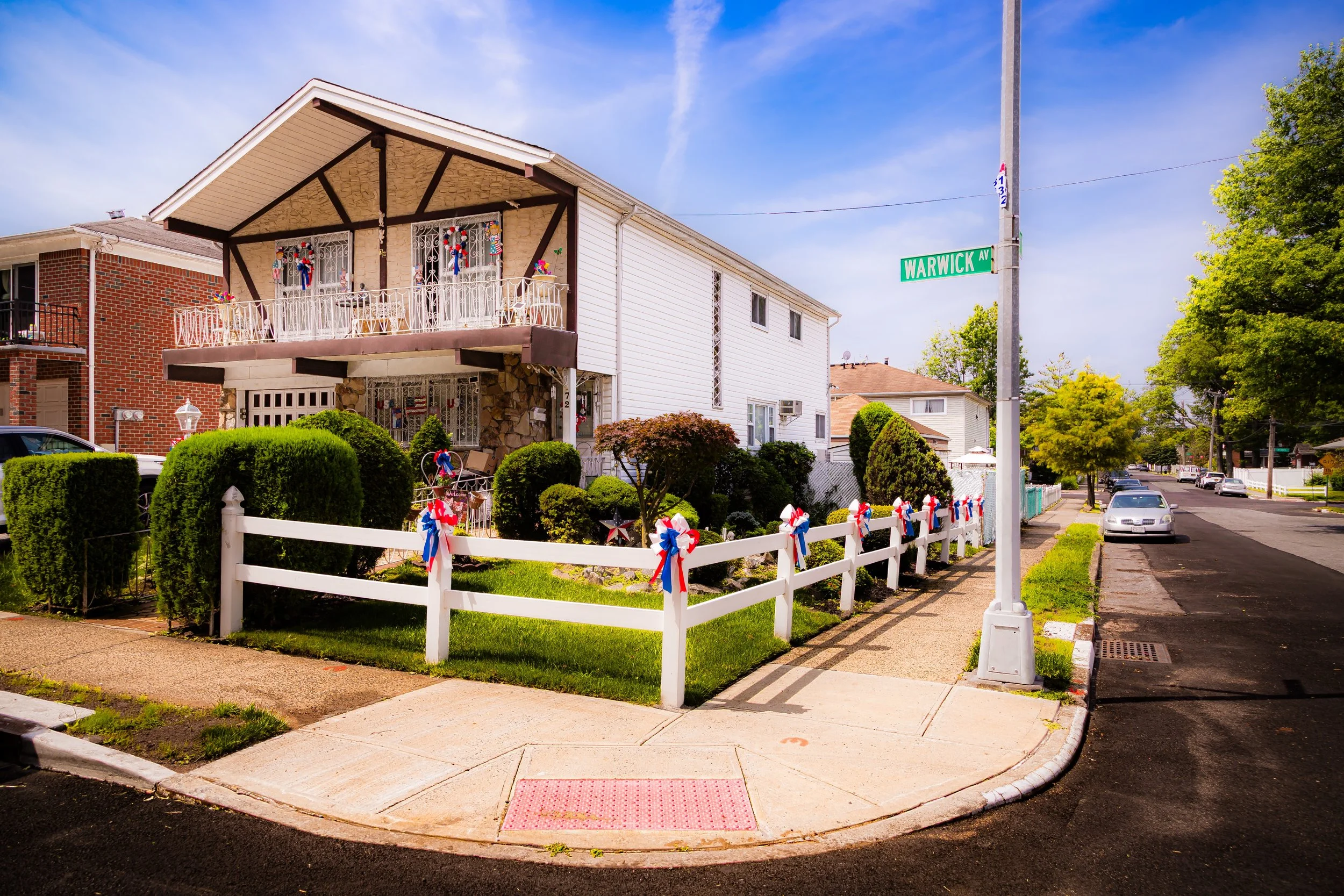
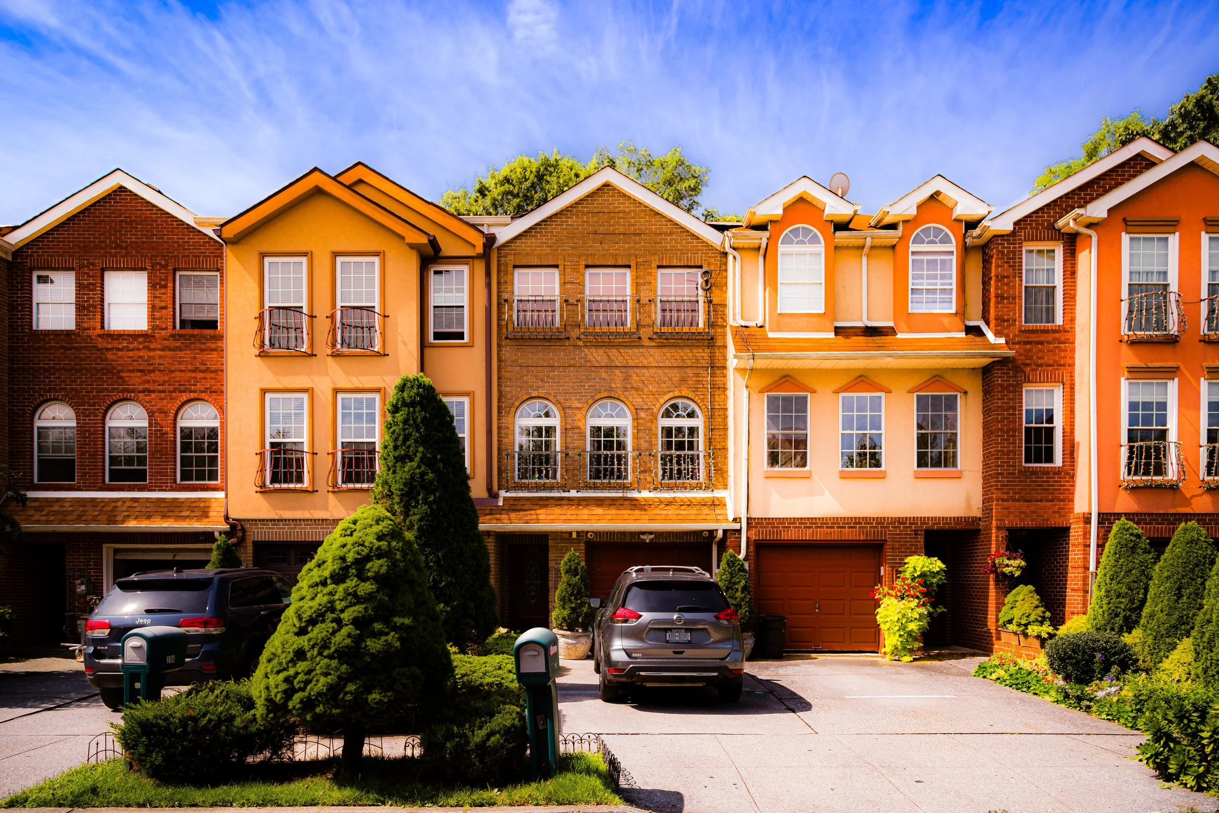
Staten Island possesses one of New York City’s most distinct and spatially varied identities: a borough of wooded hills, shoreline communities, civic corridors, village-like centers, detached-home districts, and broad protected landscapes. More removed than the other boroughs, and less shaped by continuous urban density, Staten Island is defined by separation, with neighborhoods formed as much by topography, distance, and memory as by any single borough-wide core.
What distinguishes Staten Island is the close relationship between urban life and open land. Residential streets, commercial corridors, religious institutions, parks, shorelines, marshes, and wooded slopes all contribute to a borough that feels dispersed, local, and deeply place-bound. To move through Staten Island is to encounter a borough of strong neighborhood identity, shifting terrain, and unmistakable physical presence.
The name “Staten Island” was bestowed by Dutch explorers in the 1620s—Staaten Eylandt, “Island of the States”—in honor of the Dutch Parliament, the Staten-Generaal. Before that, the island was known to the Lenape people as Aquehonga Manacknong, “the high ground beyond the trees.” It was a place of seasonal camps, shellfish harvesting, and sacred gathering.
The first recorded European landing occurred in 1609, when Henry Hudson, sailing under the Dutch flag, anchored off its shores. Permanent settlement followed later, with Cornelis Melyn establishing a small colony in the 1640s, though conflicts with Indigenous peoples and the island’s relative isolation delayed lasting growth. When the English seized New Netherland in 1664, Staten Island became part of the Province of New York, divided into manors and townships that would form its enduring neighborhoods—Castleton, Southfield, Northfield, and Westfield.
Etymology and Origins
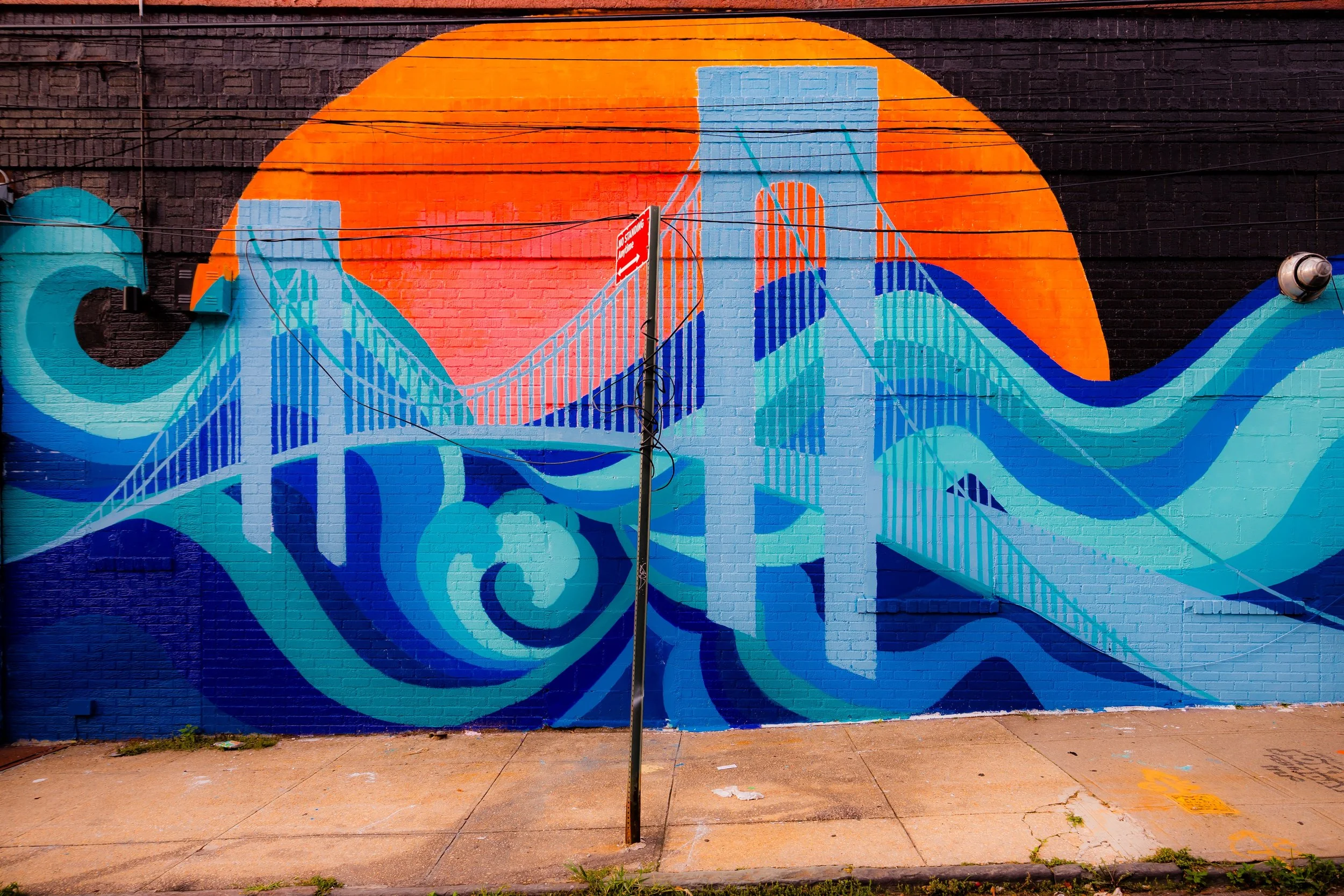
The Visual Identity of Staten Island
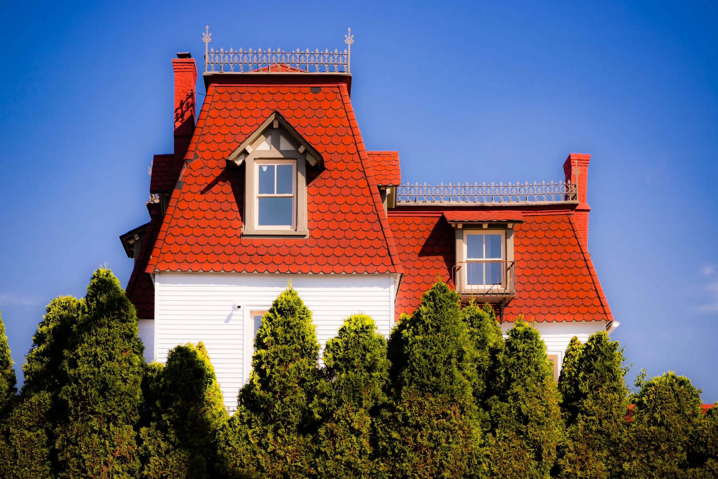
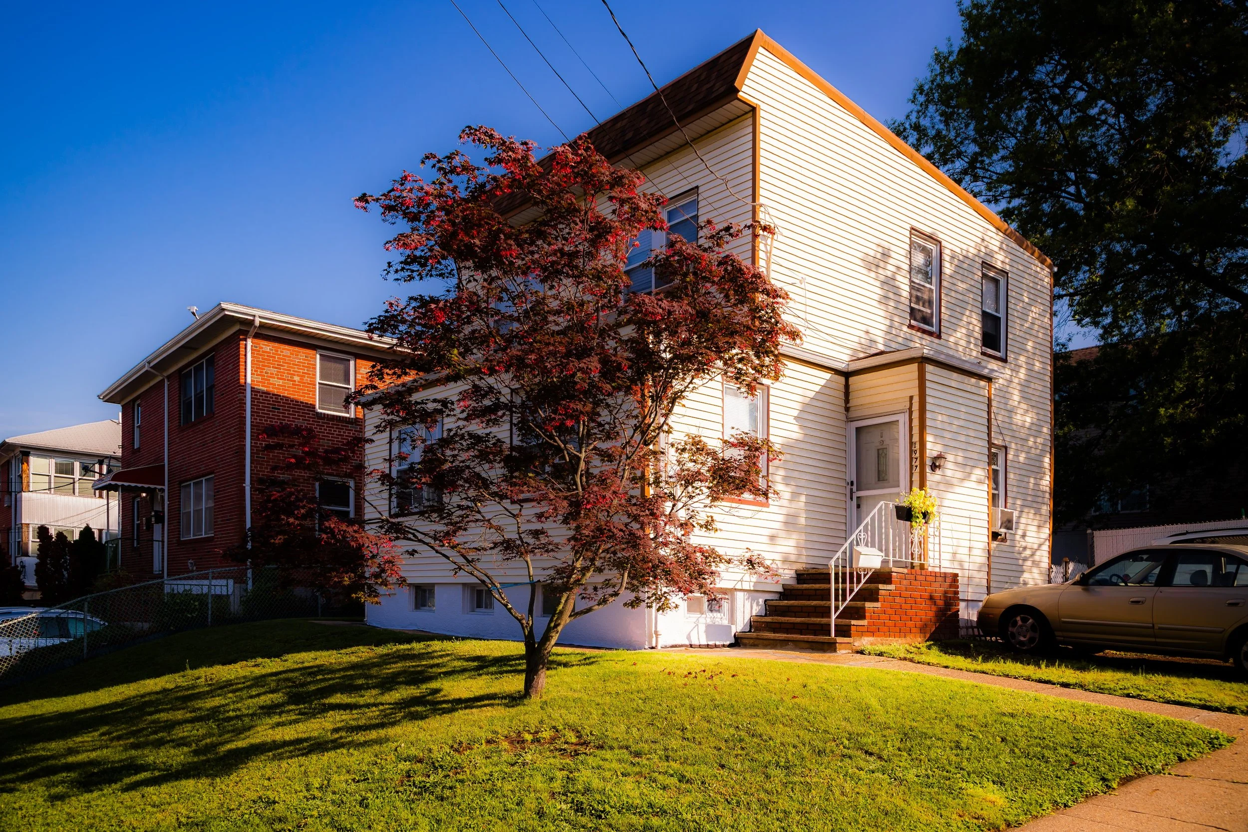
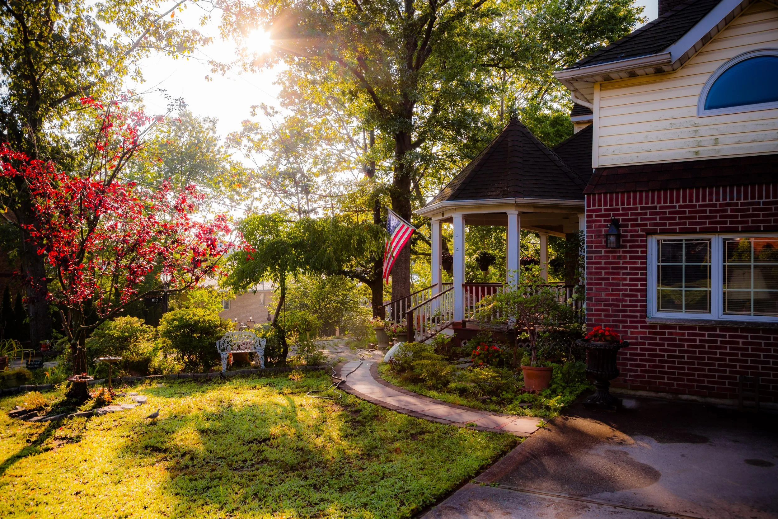
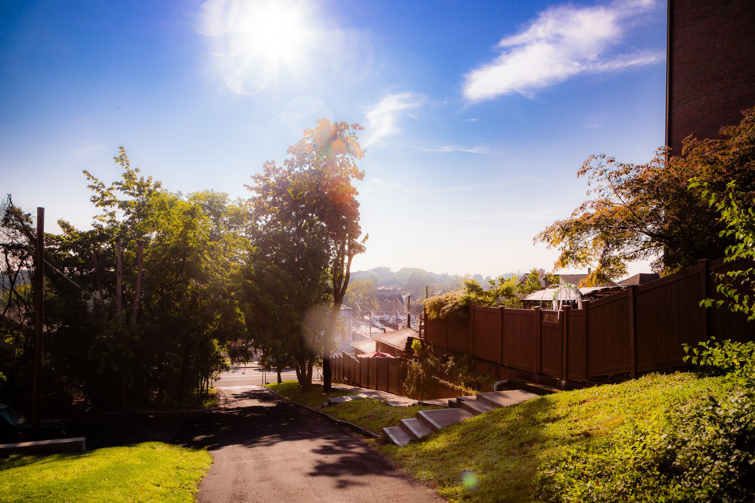
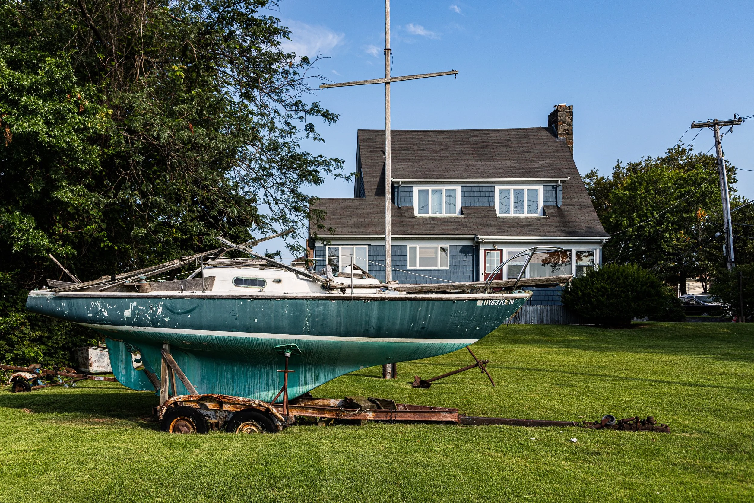
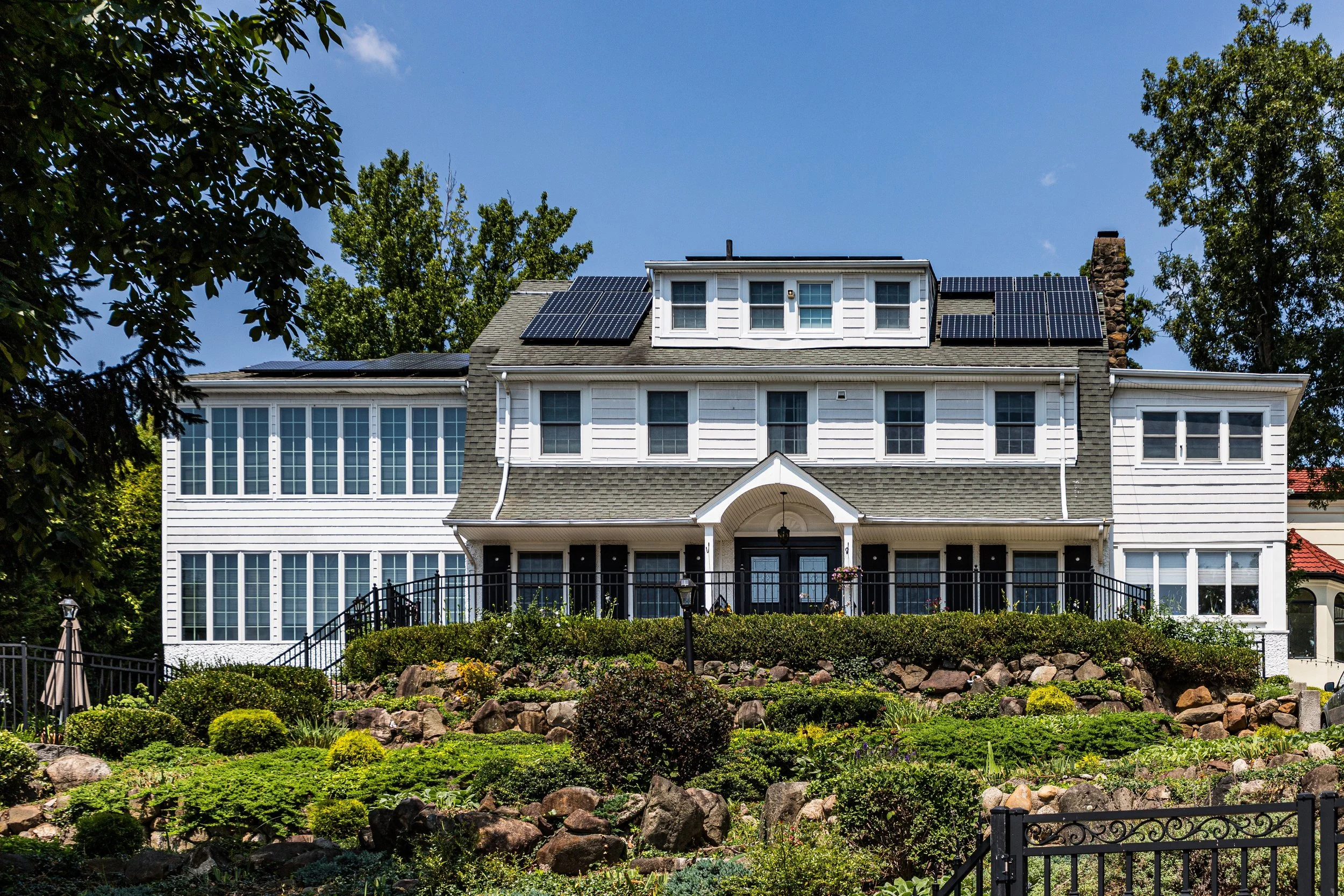
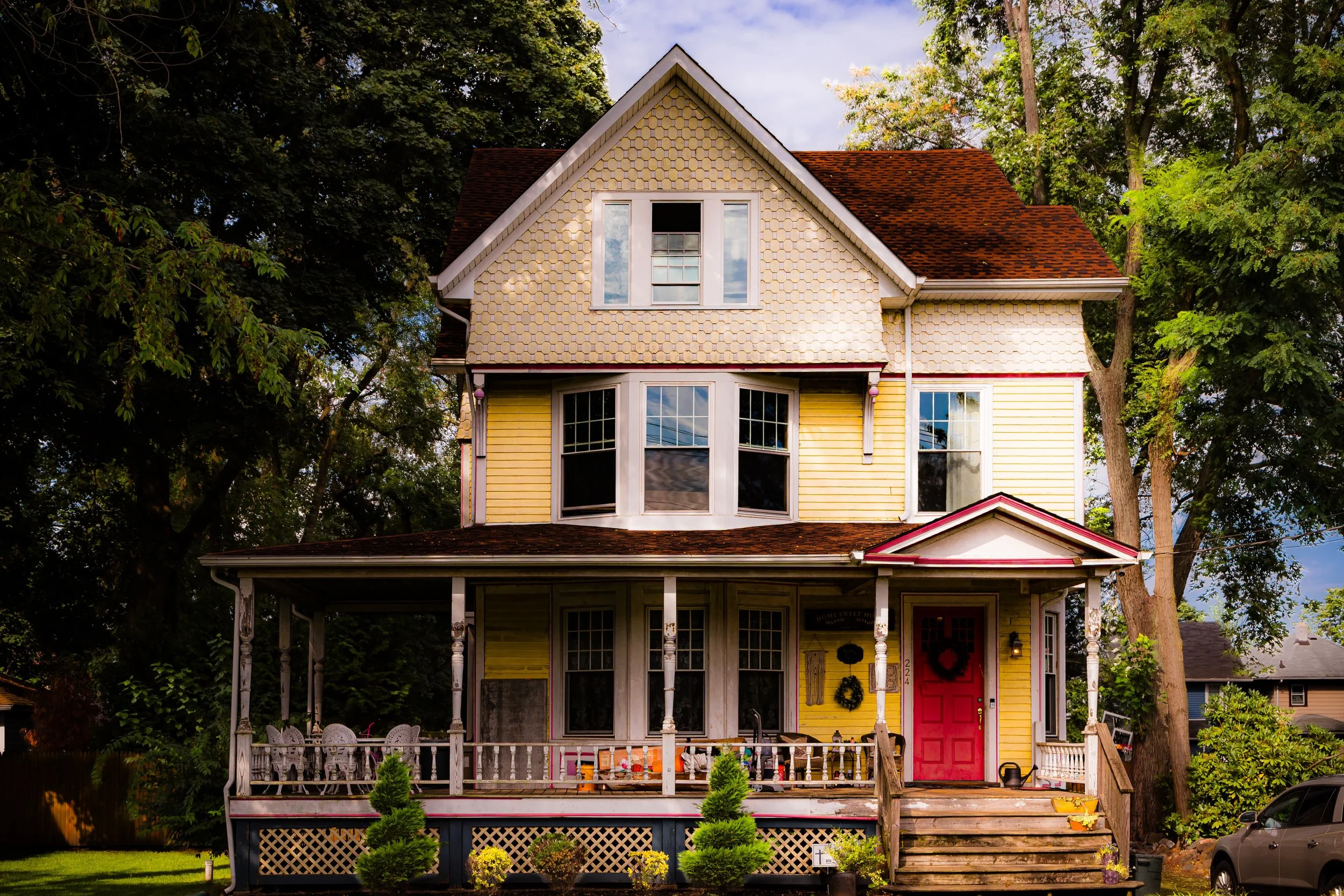
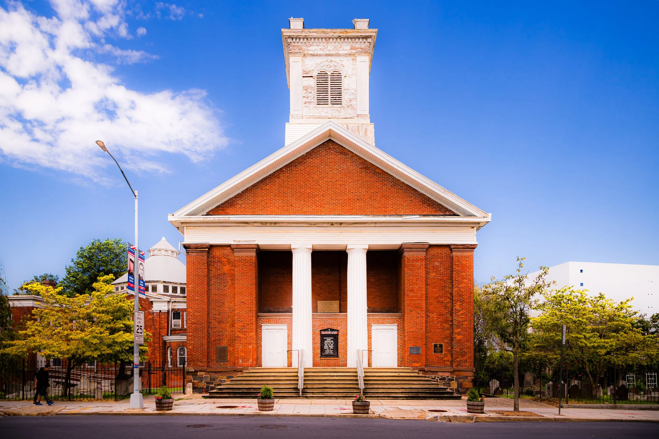
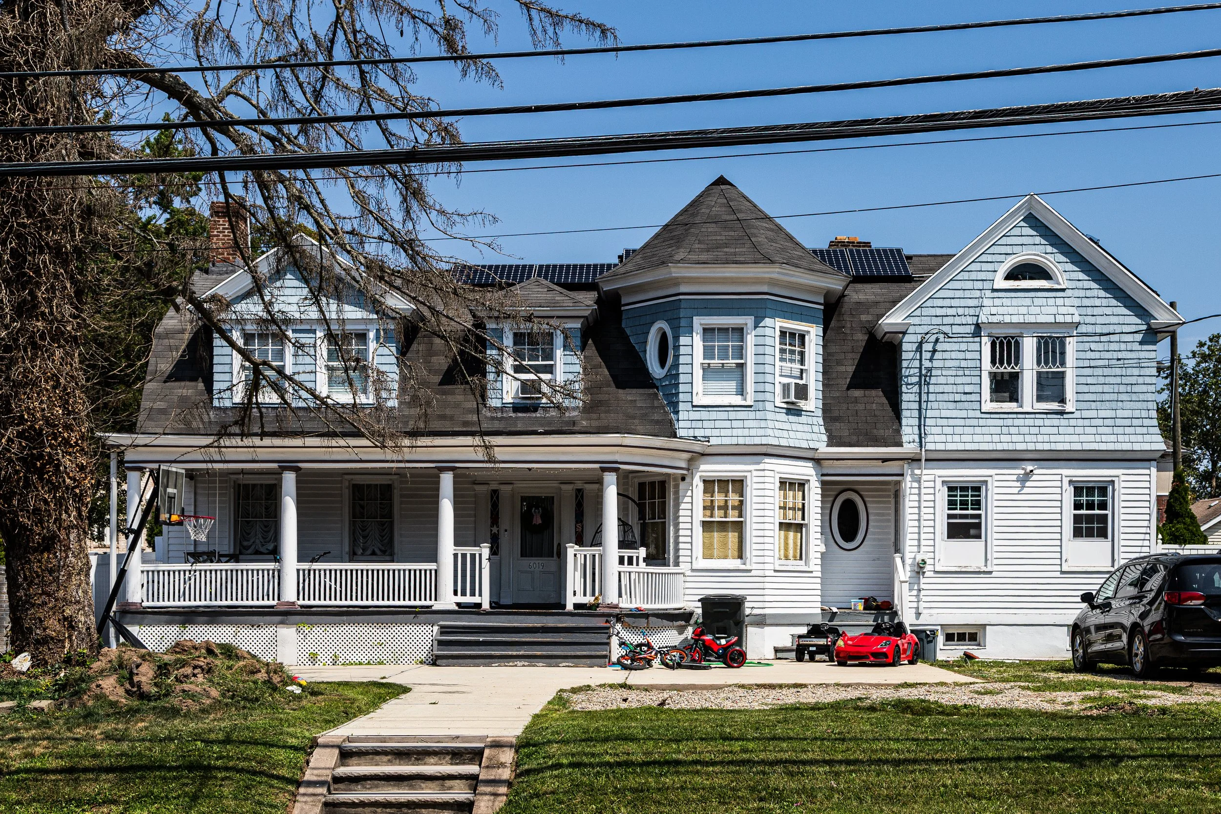
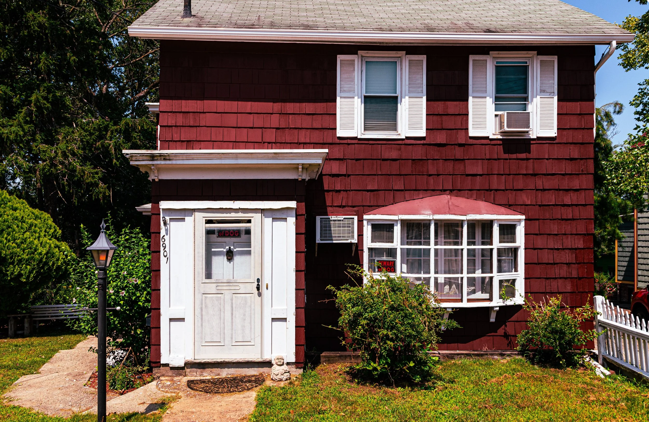
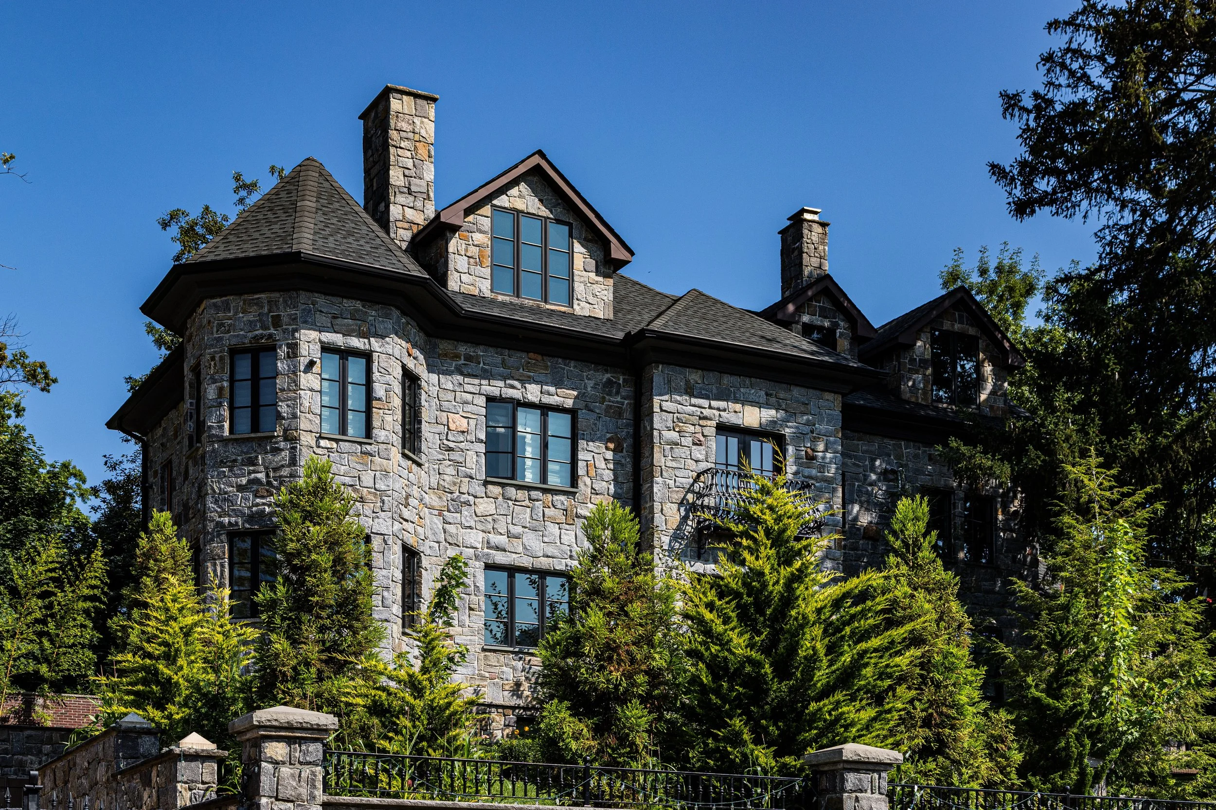
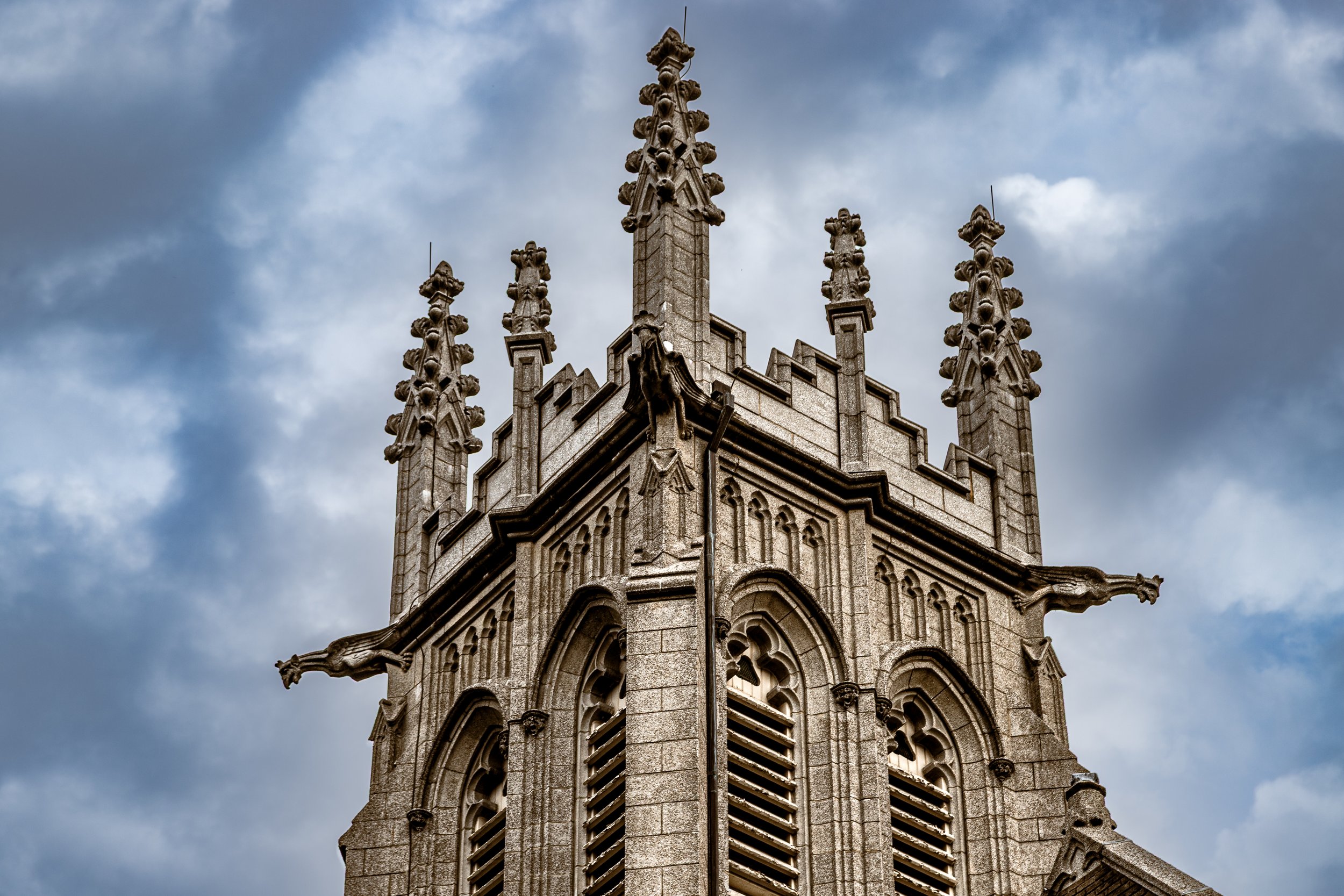
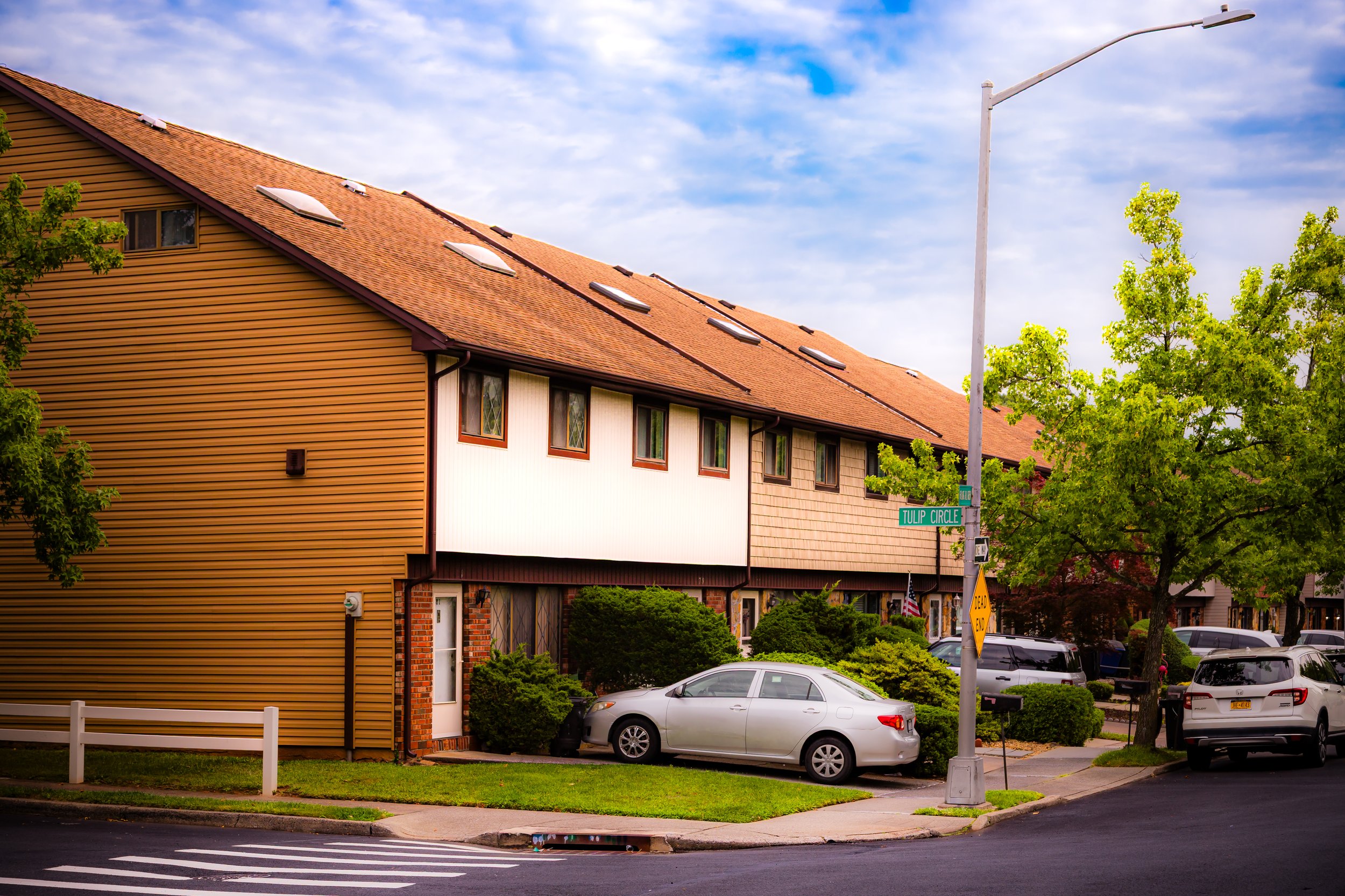
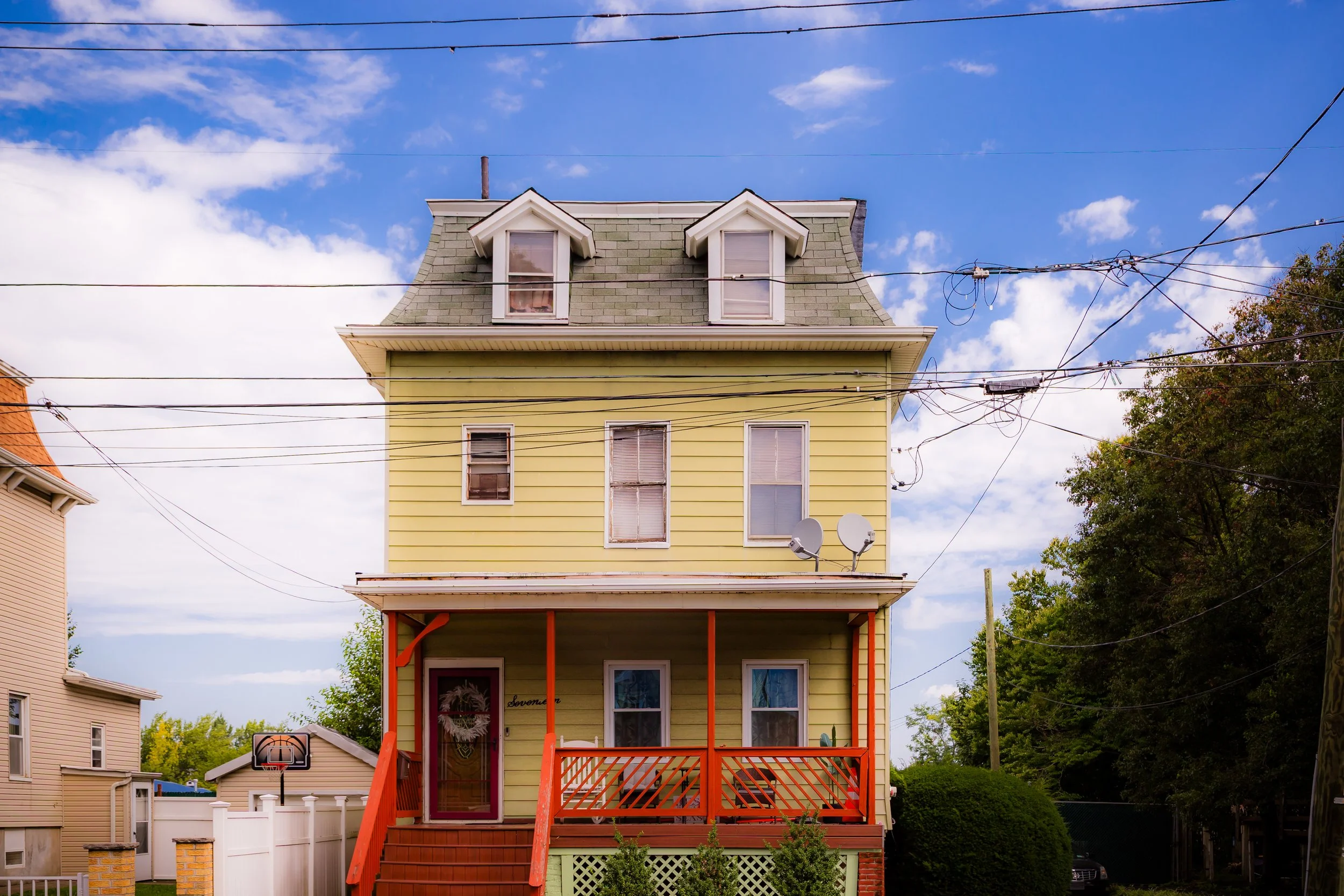
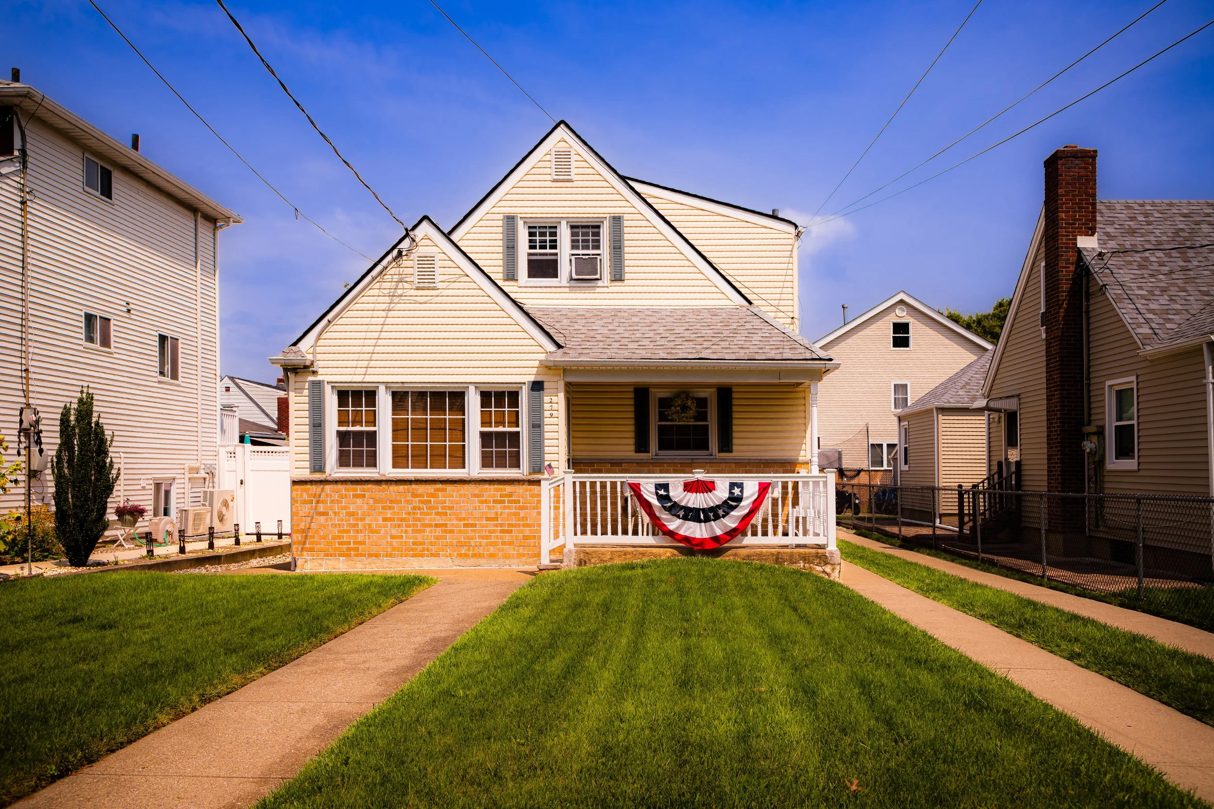
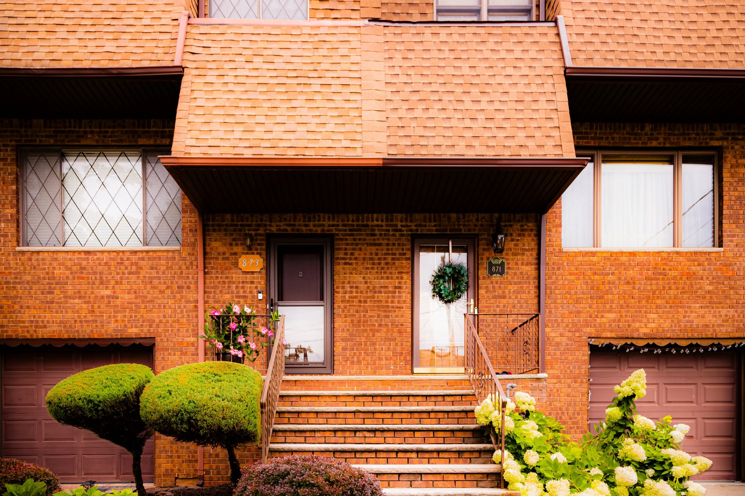
Staten Island has a visual language shaped by terrain, distance, and interruption. It is a borough of hills and ridgelines, marshes and shorelines, detached homes and apartment clusters, civic buildings and neighborhood commercial strips, wooded roads and open sky. Across the borough, porches, fences, retaining walls, church facades, quiet streets, industrial edges, parks, cemeteries, and waterfronts create a built environment that feels broken into distinct local rhythms rather than gathered into one continuous urban field.
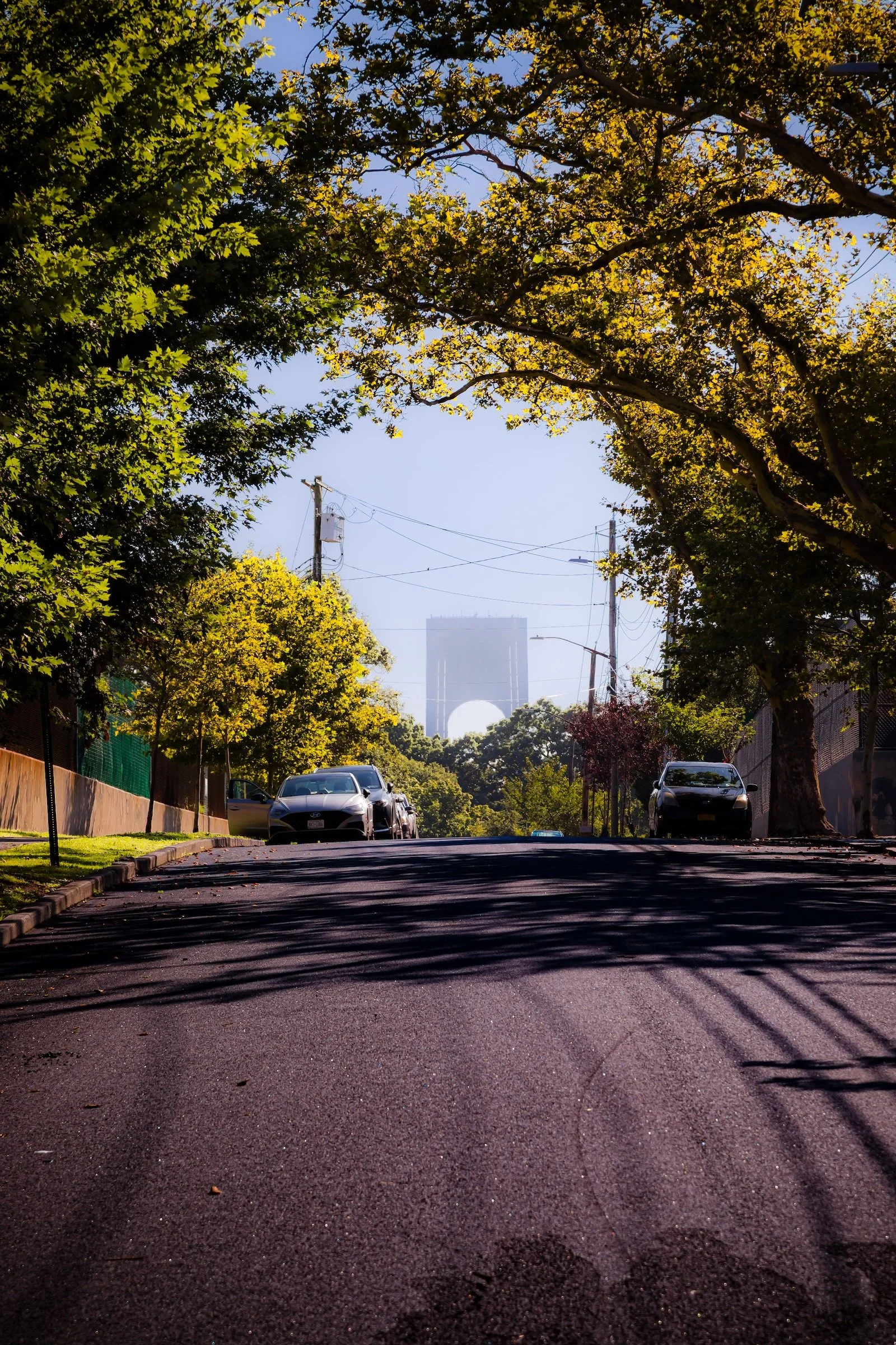
This movement between enclosure and openness is one of Staten Island’s defining visual qualities. Leafy residential streets give way to harbor views, marshland, broad roads, and long sightlines, while siding, brickwork, utility lines, mature trees, signage, and changing light soften the borough’s larger spaces with texture and local character. Staten Island is visually quieter than the other boroughs, but no less layered: its identity emerges through the interplay of neighborhood texture, shoreline distance, and the persistent presence of the landscape.
-
Horizons
-
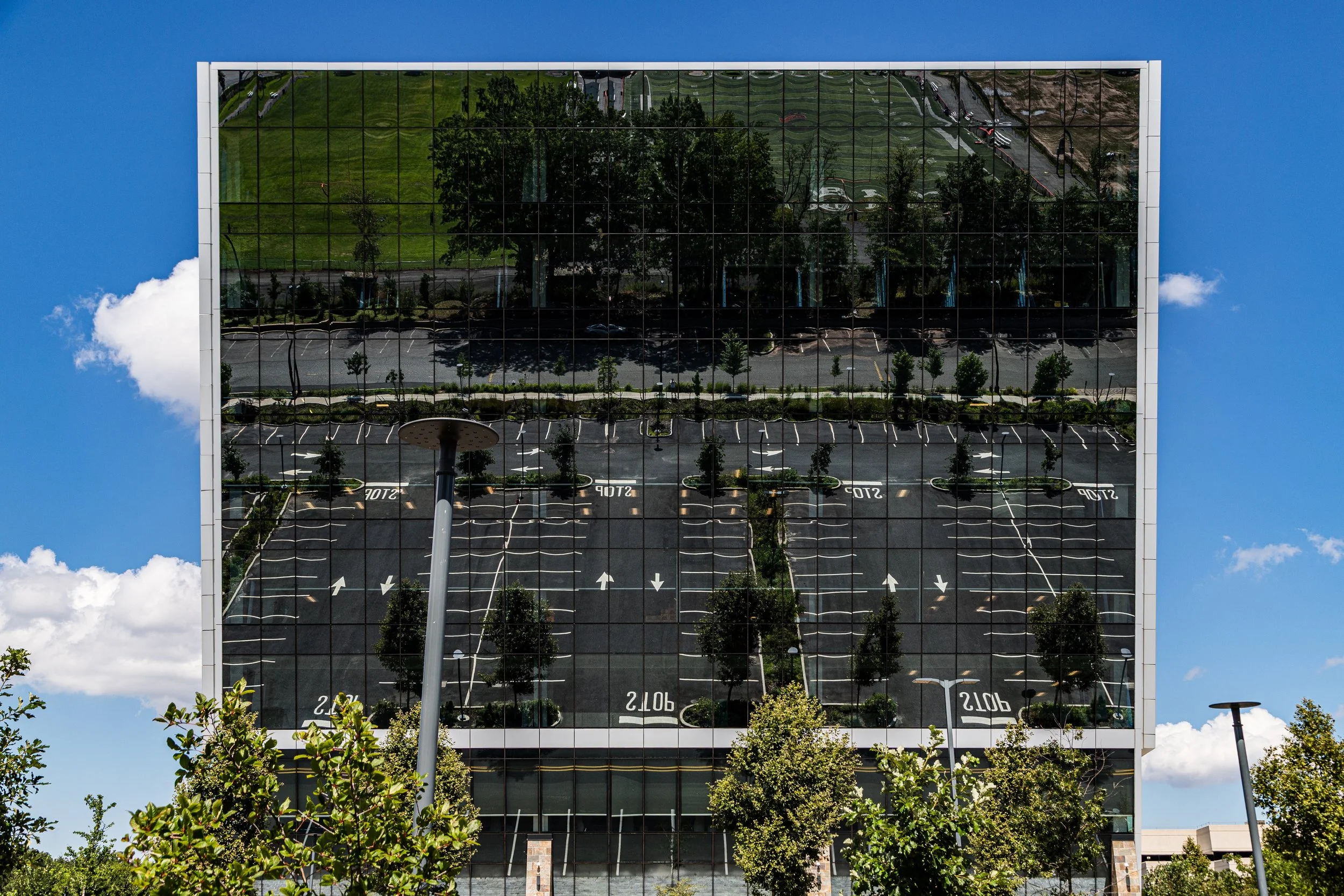
Painted Cityscapes
-
Patterns & Repetitions
-

Streaming Sunlight
-
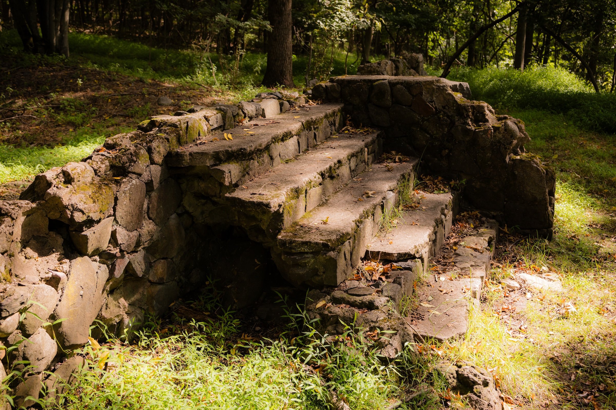
Urban Archeology
The Neighborhoods
Staten Island: where shoreline villages, wooded hills, detached-home neighborhoods, and quiet civic centers reflect a borough shaped by distance, landscape, and strong local identity. Explore the neighborhoods:
-
Bounded by Bertram Avenue to the west, Drumgoole Road and the Korean War Veterans Parkway to the north, Annadale Road to the northeast, Arden Avenue to the east, and the Raritan Bay to the south, Annadale occupies a tranquil stretch of Staten Island’s southeastern shoreline.
-

Bounded by Arthur Kill Road to the northeast, Drumgoole Road and the Korean War Veterans Parkway to the south, Heenan and Belfield Avenues to the west up to Vespa Avenue, then east to Arden Avenue and north along Arden back to Drumgoole Road, Arden Heights occupies a gentle rise within Staten Island’s South Shore.
-
Bounded by Harbor Road to the east, Forest Avenue and South Avenue to the southeast, Goethals Road to the south, and the Kill Van Kull to the west and north, Arlington forms Staten Island’s northwesternmost neighborhood—a place shaped equally by water, industry, and working-class resilience.
-
Bounded by the Staten Island Expressway to the northeast, Tompkins Avenue to the east, McClean Avenue to the south, Linwood Avenue to the west, Hylan Boulevard to the northwest, and Fingerboard Road to the north, Arrochar lies at the southeastern foot of Staten Island, nestled between Fort Wadsworth and South Beach.
-

Bounded by Hylan Boulevard to the southeast, Keegans Lane to the southwest, Amboy Road to the northwest, and Currie Avenue to the east, Bay Terrace occupies a tranquil and well-kept stretch of Staten Island’s South Shore. Situated between Great Kills to the west and Oakwood to the northeast, the neighborhood lies on gently rolling land that slopes toward the Lower New York Bay.
-
Bounded by the Staten Island Expressway to the north, Felton Street and Graham Avenue to the east, Victory Boulevard to the southeast, Travis and South Avenue to the south, and the Arthur Kill to the west, Bloomfield occupies the far northwestern quadrant of Staten Island.
-
Bounded by Victory Boulevard to the southeast, Jersey Street to the southwest and west, Crescent Avenue to the northwest, Belmont Place to the northeast, and St. Marks Place to the east, Brighton Heights occupies one of the most historic and elevated sections of St. George on Staten Island’s North Shore.
-

Bounded by Felton Street and Graham Avenue to the west, the Staten Island Expressway to the north, Willowbrook Park and the intersections of Victory Boulevard and Richmond Avenue to the east, and the rising meadows of Freshkills Park to the southwest, Bull’s Head sits near the literal and figurative crossroads of Staten Island.
-
Castleton Corners is bounded by Jewett Avenue to the west, Forest Avenue to the north, Clove Lakes Park to the east along Brookside Avenue and Royal Oaks Road, a southeast corner defined by Victory Boulevard and Slosson Avenue, the Staten Island Expressway to the south, and a southwest corner formed by Victory Boulevard and Lester Street.
-
Bounded by St. Luke’s Avenue to the northeast, the West Shore Expressway to the east, the Outerbridge Crossing to the south, and the Arthur Kill to the west, Charleston occupies the southwesternmost corner of Staten Island
-
Bounded by the Staten Island Railway to the south, Osgood Avenue to the west, Vanderbilt Avenue to the north, and The Narrows to the east, Clifton occupies one of Staten Island’s most historic and topographically dynamic settings—an upland terrace overlooking the harbor approach between Staten Island and Brooklyn.
-

Clove Lakes Park occupies the deep glacial valley that stretches through Staten Island’s North Shore, bounded roughly by Victory Boulevard to the south, Forest Avenue to the north, Martling Avenue and Clove Road to the east, and Slosson Avenue and Royal Oak Road to the west.
-
Bounded by Richmond Road to the west, the Staten Island Expressway to the north, Mosel Avenue to the east, Gateway Drive to the southeast, and West Fingerboard Road to the south, Concord lies at the base of Staten Island’s northeastern hills, where the island’s oldest inland roads meet the busy modern arteries leading to the Verrazzano-Narrows Bridge.
-

Bounded by Richmond Road to the northwest, Old Town Road to the north, Quintard Street to the northeast, Mascon and Laconia Avenues to the east, and Jefferson Avenue to the south, Dongan Hills lies along the lower slopes of Staten Island’s central highlands—where the island’s hills descend toward the coastal plain of the South Shore.
-
Bounded by Medford Avenue and Rome Avenue to the north, Richmond Road to the east, Gorge Road to the southwest, and Reeds Basket Willow Swamp Park to the west, Dongan Hills Colony occupies one of the most scenic and secluded elevations on Staten Island’s eastern slope.
-

Bounded by Altamont Street to the east, Richmond Road to the south, Rockland Avenue to the west, and the Staten Island Greenbelt to the north, Egbertville occupies a serene, wooded expanse near the geographic center of Staten Island.
-

Bounded by Drumgoole Road and the Korean War Veterans Parkway to the northwest, Arthur Kill Road to the north, Armstrong Avenue to the east, Raritan Bay to the south, and a western boundary comprised of Arden Avenue, Van Brunt Street, Rye Avenue, and Annadale Road, Eltingville stands at the heart of Staten Island’s South Shore
-
Bounded by the Staten Island Expressway to the north, Richmond Road to the east, Medford and Rome Avenues to the south, and Ocean Terrace to the west, Emerson Hill occupies one of Staten Island’s most distinguished natural elevations.
-
Situated at the southeastern tip of Staten Island where the Narrows connects the Upper and Lower New York Bays, Fort Wadsworth occupies one of the most strategic and scenic sites in New York City.
-
Stretching across 2,200 acres of Staten Island’s western heartland, Freshkills Park occupies the vast reclaimed landscape bounded generally by Victory Boulevard and the Staten Island Expressway to the north, Richmond Avenue to the east, the West Shore Expressway to the west, and Arthur Kill Road and Arden Avenue to the south.
-
Bounded by the Staten Island Expressway to the south, South Avenue to the west, Forest Avenue to the north, and Willow Road West to the east, Graniteville lies within Staten Island’s northwestern corridor—an area defined by its proximity to the island’s industrial spine yet rich in community life and natural features.
-

Bounded by Richmond Road to the northwest, Jefferson Avenue to the northeast, Hylan Boulevard to the southeast, and Bancroft Avenue to the southwest, Grant City occupies a pivotal stretch of Staten Island’s East Shore—nestled between Dongan Hills to the west and Midland Beach to the east.
-
Bounded by the Staten Island Expressway to the north, Fingerboard Road to the east, Hylan Boulevard to the southeast, Old Town Road to the south, Glendale Avenue to the southwest, and Gateway Drive and Mosel Avenue to the west, Grasmere occupies a serene, residential pocket on Staten Island’s northeastern slope.
-
Bounded by Armstrong Avenue to the west, Arthur Kill Road to the north, Corbin Avenue and Ocean View Cemetery to the east, Amboy Road to the southeast, Keegans Lane to the east, Great Kills Park to the southeast, and Raritan Bay to the south, Great Kills occupies a vast and varied landscape on Staten Island’s South Shore.
-

Great Kills Park spans nearly 580 acres along Staten Island’s southeastern shore, and is bounded by Hylan Boulevard to the northwest, New Creek and Oakwood Beach to the northeast, Raritan Bay to the south, and the Great Kills Harbor and Marina to the southwest, the park extends outward into the bay as a long, sandy peninsula enclosing Great Kills Harbor.
-
Grymes Hill is bounded by Van Duzer St to the east, Richmond Rd to the southeast, the Staten Island Expwy to the south, and a western boundary tracing Clove Rd north to Howard Ave, then north on Howard to Highland Ave, north on Highland to Arlo Rd, east on Arlo to Silver Mount Cemetery, north to Theresa Pl, east on Ada Pl to Howard Ave, and north again on Howard to the Staten Island Expwy.
-

Bounded by Ashworth Avenue to the north, Forest Hill Road to the east, Richmond Hill Road to the south, and Richmond Avenue to the west, Heartland Village lies at the geographical and symbolic center of Staten Island—an expansive residential community that epitomizes the borough’s postwar suburban transformation.
-

Bounded by Drumgoole Rd to the south, a western boundary running north along Marcy Ave and Alverson Ave, the West Shore Expwy to the north, and an eastern boundary following Huguenot Ave south to Rosedale Avenue, east on Rosedale to Everton Avenue, southeast on Everton to Heenan Avenue, and south on Heenan back to Drumgoole, Huguenot North lies at the western edge of Staten Island’s South Shore.
-

Bounded by Drumgoole Road and the Korean War Veterans Parkway to the north, Bertram Avenue to the east, the Raritan Bay to the south, and Cornelia and Woodhull Avenues to the west, Huguenot Park forms the southernmost portion of the greater Huguenot district on Staten Island’s South Shore—a tranquil, waterfront community that stretches from quiet inland streets to the open horizon of the bay.
-

LaTourette Park, also known as LaTourette Park and Golf Course, spans over 800 acres in the geographical heart of Staten Island, forming one of the central anchors of the Staten Island Greenbelt.
-
Bounded by Rockland Avenue to the east, Richmond Road to the south, and the forested expanse of LaTourette Park and Greenbelt to the west and north, Lighthouse Hill rises from Staten Island’s central highlands as one of the borough’s most scenic and storied neighborhoods.
-
Bounded by Kissel Avenue to the east, Henderson Avenue to the south, Bement Avenue to the west, and the Kill Van Kull to the north, Livingston occupies a graceful stretch of Staten Island’s North Shore—an area where tree-lined streets descend toward the waterfront, blending historic architecture with the maritime panorama of the Upper New York Bay.
-
Bounded by Bradley Avenue to the west, the Staten Island Expressway to the north, Todt Hill Road to the east, and LaTourette Park to the south, Manor Heights occupies a leafy upland in Staten Island’s central corridor, bridging the suburban plateau of Willowbrook and the forested rise of Todt Hill.
-

Bounded by the Dr. Martin Luther King Jr. Expressway (Route 440) to the west, the Staten Island Expressway to the south, Harbor Road to the east, and the Kill Van Kull to the north, Mariners Harbor anchors the northwestern tip of Staten Island—a district defined by its maritime heritage, industrial waterfront, and resilient working-class community.
-
Bounded by the Staten Island Expressway to the south, Victory Boulevard to the north, and Lester and Gower Streets to the east, Meiers Corners occupies a compact but historically significant section of Staten Island’s North-Central corridor.
-

Bounded by Seaview Avenue to the northeast, the Raritan Bay to the southeast, Bancroft Avenue to the southwest, and Hylan Boulevard and Laconia Avenue to the northwest, Midland Beach stretches along Staten Island’s southeastern shoreline.
-

Bounded by Jersey Street to the east, Brighton Avenue to the south, Lafayette Avenue to the west, and the Kill Van Kull to the north, New Brighton occupies a commanding stretch of Staten Island’s North Shore, overlooking the deep tidal waters that separate the island from Bayonne, New Jersey.
-
Bounded by Bancroft Avenue to the northeast, Hylan Boulevard to the southeast, Tysens Lane to the southwest, and Richmond Road to the northwest, New Dorp lies at the heart of Staten Island’s East Shore—one of its oldest, most historically layered, and culturally emblematic neighborhoods.
-

Bounded by Tysens Lane to the southwest, Hylan Boulevard to the northwest, Bancroft Avenue to the northeast, and the Raritan Bay to the southeast, New Dorp Beach forms one of Staten Island’s most distinctive coastal neighborhoods—a tranquil stretch of shoreline framed by dunes, marshlands, and the rhythmic pulse of the sea.
-
Bounded by Forest Hill Road to the southeast, Richmond Avenue to the west, and Richmond Hill Road to the north, New Springville lies at the geographic and commercial heart of Staten Island—an expansive mid-island neighborhood defined by its proximity to the Staten Island Mall, its adjacency to preserved parkland, and its pivotal role in the borough’s suburban transformation.
-
Oakwood lies along Staten Island’s southeastern shoreline, bounded by the Willowbrook Parkway to the northwest, Tysens Lane to the northeast, Great Kills Park to the southwest, and the Raritan Bay to the southeast.
-
Ocean Breeze Park occupies a stretch of Staten Island’s southeastern shoreline between Midland Beach and South Beach, bounded roughly by Quintard Street and Mason Avenue to the west, Father Capodanno Boulevard to the north, Seaview Avenue and the Franklin D. Roosevelt Boardwalk to the east, and Sand Lane and New Creek to the south.
-

Bounded by Richmond Road to the west, West Fingerboard Road to the northwest, Glendale Avenue to the northeast, the Staten Island Railway to the southeast, and Old Town Road to the south, Old Town lies along Staten Island’s northeastern shore at the base of the island’s central hills.
-

Bounded by Osgood Avenue to the northeast, Mosel Avenue to the southeast, the Staten Island Expressway to the south, Richmond Road to the west, and Vanderbilt Avenue to the northwest, Park Hill occupies a densely built hillside enclave on Staten Island’s North Shore, nestled between Tompkinsville, Stapleton, and Concord.
-

Bounded by Drumgoole Road and the Korean War Veterans Parkway to the north, Maguire and Woodvale Avenues to the east, Prince’s Bay to the south, and Richard Avenue to the west, Pleasant Plains occupies a serene and semi-rural expanse on Staten Island’s far South Shore.
-
Bounded by Clove Road to the east, Forest Avenue to the south, the Dr. Martin Luther King Jr. Expressway (Route 440) to the west, and the Kill Van Kull to the north, Port Richmond stands as one of Staten Island’s oldest and most historically significant neighborhoods.
-
Bounded by Drumgoole Road and the Korean War Veterans Parkway to the north, Chisholm Street and Cornelia Avenue to the east, Prince’s Bay to the south, and Woodvale Avenue to the west, Prince’s Bay occupies one of Staten Island’s most picturesque and historically resonant stretches of the South Shore.
-
Bounded by the Kill Van Kull to the north, Lafayette Avenue to the east, Castleton and Brighton Avenues to the south, and Pelton Avenue, Henderson Avenue, and Kissel Avenue to the west, Randall Manor occupies a leafy, elevated stretch of Staten Island’s North Shore overlooking the harbor.
-

Bounded by Richmond Road to the north, the Willowbrook Parkway (Korean War Veterans Parkway) to the east, Amboy Road to the southeast, Ocean View Cemetery to the southwest, Corbin Avenue to the west, and Arthur Kill Road to the northwest, Richmond Town lies at the geographic and historical heart of Staten Island.
-
Bounded by the Korean War Veterans Parkway to the north, Richard Avenue to the east, the Raritan Bay to the south, Page Avenue to the west, Mill Creek to the southwest, and the Kill Van Kull to the northwest, Richmond Valley occupies Staten Island’s southwesternmost corner—a quiet, low-lying region where suburban lanes, tidal wetlands, and wooded creeks meet the open waters of the bay.
-

Bounded by Nautilus Street and Fingerboard Road to the southeast, the Staten Island Expressway to the south, and the Staten Island Railway to the west, Rosebank lies at the northeastern edge of Staten Island’s East Shore, where the island slopes gently toward the Upper New York Bay and the towering span of the Verrazzano-Narrows Bridge.
-

Bounded by Alverson Avenue to the east, Woodrow Road to the south, and the West Shore Expressway to the west, Rossville lies within Staten Island’s southwest interior—a landscape of quiet streets, rolling woodlands, and broad open spaces that reveal the borough’s deep rural past even amid modern suburban growth.
-

Bounded by Drumgoole Road and the Korean War Veterans Parkway to the south, the West Shore Expressway to the west, Woodrow Road to the north, and Maguire Avenue to the east, Sandy Ground lies within the gentle lowlands of Staten Island’s southwestern interior, nestled between Rossville and Pleasant Plains.
-
Bounded by Wadsworth Avenue to the southeast, the Staten Island Expressway to the southwest, Fingerboard Road to the west, Nautilus Street to the northwest, and the Narrows to the northeast, Shore Acres occupies one of Staten Island’s most tranquil and scenic stretches along the island’s northeastern shoreline.
-
Bounded by Quintard Street to the west, Hylan Boulevard to the northwest, McClean Avenue to the north, Lily Pond Avenue to the northeast, and the Lower New York Bay to the southeast, South Beach stretches along one of Staten Island’s most storied shorelines.
-
Bounded by Quintard Street to the west, Hylan Boulevard to the northwest, McClean Avenue to the north, Lily Pond Avenue to the northeast, and the Lower New York Bay to the southeast, South Beach stretches along one of Staten Island’s most storied shorelines.
-
Bounded by Victory Boulevard to the south, then curving northward along St. Marks Place, Fort Place, and Belmont Place, continuing west on Crescent Avenue to Jersey Street, and reaching the Kill Van Kull to the northwest and the Lower New York Bay to the north and east, St. George stands as the historic and civic heart of Staten Island.
-
Bounded by Vanderbilt Avenue to the southeast, Van Duzer Street to the west, Clinton Street to the north, and the Narrows to the east, Stapleton unfolds along Staten Island’s northeastern waterfront as one of the borough’s oldest and most historically layered neighborhoods.
-
Bounded by Victory Blvd to the northwest, Cebra Avenue and St. Paul’s Avenue to the north, Clinton Street and Van Duzer Street to the southeast, and Occident Avenue and Louis Street to the southwest, Stapleton Heights rises dramatically above the harbor-facing lowlands of Stapleton, forming one of Staten Island’s most architecturally distinguished and historically intact hilltop neighborhoods.
-
Sunnyside is nounded by the Staten Island Expressway to the south, Slosson Avenue to the west, Victory Boulevard and Clove Road to Cheshire Place to the north, Highland Avenue to the northeast, Howard Avenue to the east, and Clove Road to the southeast.
-
Sunset Hill occupies one of the most picturesque ridges on Staten Island’s North Shore, bounded by Clove Road to the southwest, Forest Avenue to the north, and the Silver Lake Golf Course and Park to the southeast.
-
Bounded by Richmond Road to the southeast, Todt Hill Road to the west, the Staten Island Expressway to the north, Ocean Terrace to the northeast, and Dongan Hills Colony to the southeast, Todt Hill occupies the literal and figurative summit of Staten Island—and of NYC. Rising to an elevation of 410 feet above sea level, it is the highest natural point on the Eastern Seaboard south of Maine.
-
Tompkinsville is bounded, moving clockwise, by the Narrows to the northeast, Clinton Street to the northwest, St. Paul’s Avenue to the southwest, Cebra Avenue to the west, Victory Boulevard to the northwest, Woodstock Avenue and Glen Avenue to the north, Brighton Avenue and Jersey Street to the northeast, then Victory Boulevard and the Narrows to the east.
-
Bounded by Page Avenue to the east, the Raritan Bay to the south, and the Arthur Kill to the west, Tottenville occupies the southwestern tip of Staten Island—the southernmost point in both New York City and the entire state of New York.
-
Bounded by South Avenue to the north, Travis Avenue to the northeast, Freshkills Park to the east and south, and the Arthur Kill to the west, Travis–Chelsea occupies the inland western flank of Staten Island—a landscape defined by marshland edges, tidal creeks, and broad stretches of reclaimed meadow.
-
Bounded by the West Shore Expressway to the north, Arden Avenue to the northeast, Vespa Avenue to the southeast, Rosedale Avenue to the south, and Huguenot Avenue to the west, Village Greens occupies a carefully planned residential enclave within Staten Island’s southern interior, nestled between Arden Heights to the north and Huguenot to the south.
-
Bounded by Ridgewood Place and Bement Avenue to the east, Forest Avenue to the south, Clove Road to the west, and the Kill Van Kull to the north, with an extension eastward along Castleton Avenue to Ridgewood Place, West New Brighton lies at the historic and geographic heart of Staten Island’s North Shore.
-
Bounded by Forest Avenue to the north, Jewett Avenue to the east, Victory Boulevard to the south, and Willow Road East to the west, Westerleigh occupies a serene upland plateau near the heart of Staten Island’s North Shore.
-
Bounded by Ashworth Avenue and Latourette Park to the south, Richmond Avenue to the west, Victory Boulevard to the northwest, the Staten Island Expressway to the north, Bradley Avenue to the east, and Brielle Avenue to the southeast, Willowbrook occupies a broad, gently rolling plateau at the geographic center of Staten Island.
-
Bounded by Drumgoole Road and the Korean War Veterans Parkway to the south, Lenevar and Maguire Avenues to the west, Mason Boulevard to the north, and Marcy Avenue to the east, Woodrow lies in Staten Island’s southwestern interior between Huguenot to the east, Rossville to the north, and Sandy Ground to the west.
The History
Throughout the colonial era, Staten Island remained sparsely populated—its economy based on farming, timber, and oyster harvesting. Fertile soil supported wheat and corn fields; tidal creeks supplied abundant shellfish; and its proximity to New York Harbor gave farmers access to city markets. Settlers were primarily Dutch, English, and French Huguenot, their family names—Crocheron, Seguine, Britton, Corson, and Van Pelt—still visible on street signs and gravestones.
During the American Revolution, the island was occupied by British forces and served as a major staging ground for the Battle of Long Island (1776). The Conference House, at the island’s southern tip in Tottenville, hosted a failed peace negotiation between British Admiral Lord Howe and American representatives including John Adams and Benjamin Franklin. Staten Island’s farms and homes suffered greatly during the occupation, yet its role in the war gave it an indelible place in the national story.
By the century’s end, ferries and small ports connected the island more regularly with Manhattan and New Jersey, but it remained a rural outpost of quiet fields and harbor villages.
17th–18th Century: Farms, Forests, and the Revolutionary Frontier
19th Century: Rural Prosperity and Maritime Heritage
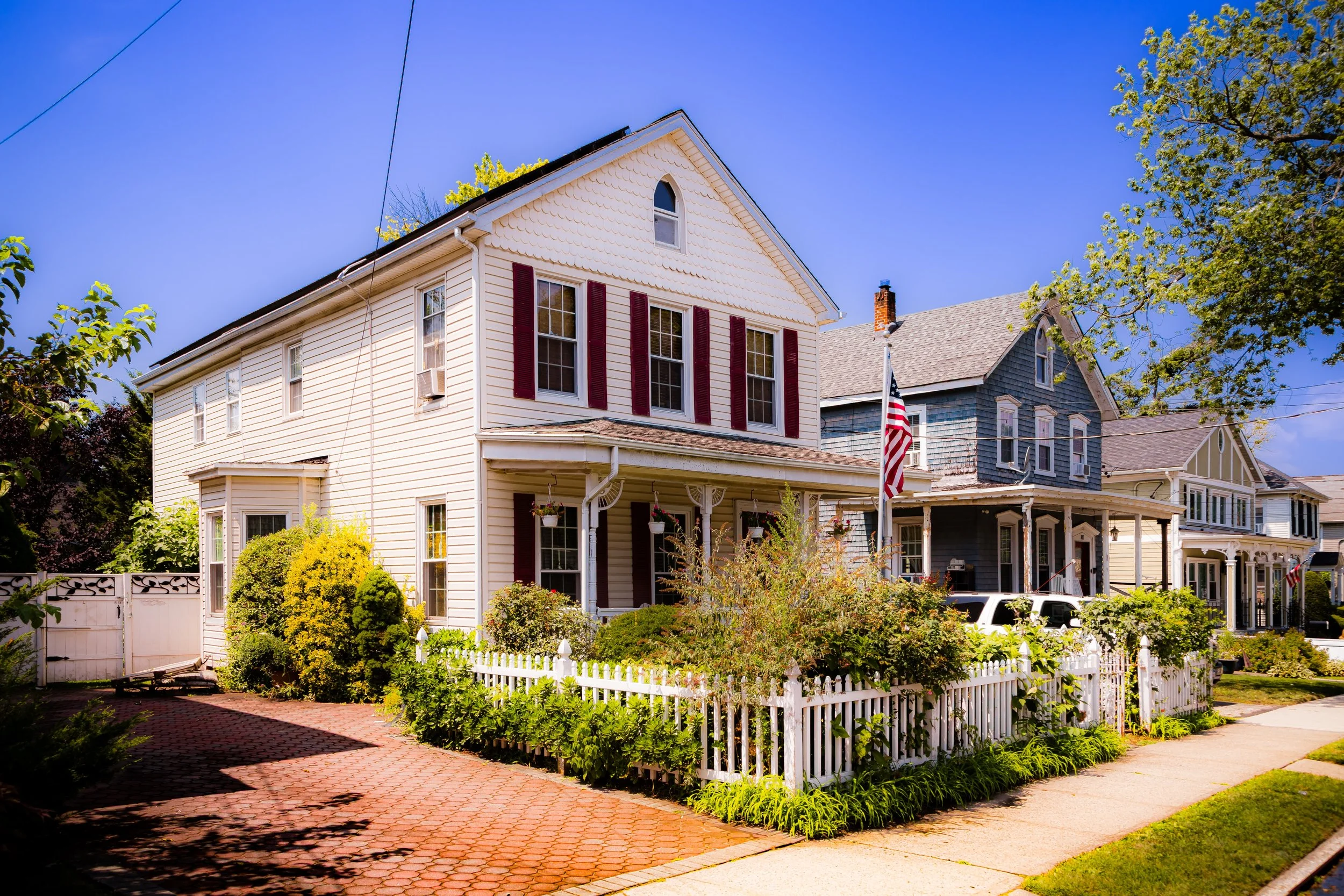
The 19th century was Staten Island’s pastoral prime. The north shore villages—St. George, Tompkinsville, and Stapleton—grew into genteel suburbs for Manhattan merchants, connected by the Staten Island Ferry (launched 1817) and the Staten Island Railroad (1860). Elegant homes rose along Staten Island’s North Shore hills, their verandas facing the harbor’s sweeping view.
Meanwhile, the island’s east and south shores retained their agricultural and maritime character. Prince’s Bay and Tottenville became centers of oyster harvesting, shipbuilding, and clamming; the island’s oysters were once considered the finest in the world. Quarries and kilns produced brick and stone, while shipyards at Mariners Harbor and Port Richmond supplied New York’s growing fleet.
Religious and social reform also found fertile ground here. The Sailors’ Snug Harbor (1833), built as a retirement home for aged seamen, became one of America’s first charitable institutions and remains an architectural jewel of Greek Revival design. Small hamlets like Richmondtown and Woodrow retained their colonial layout and churches, preserving a sense of time untouched by the modern age.
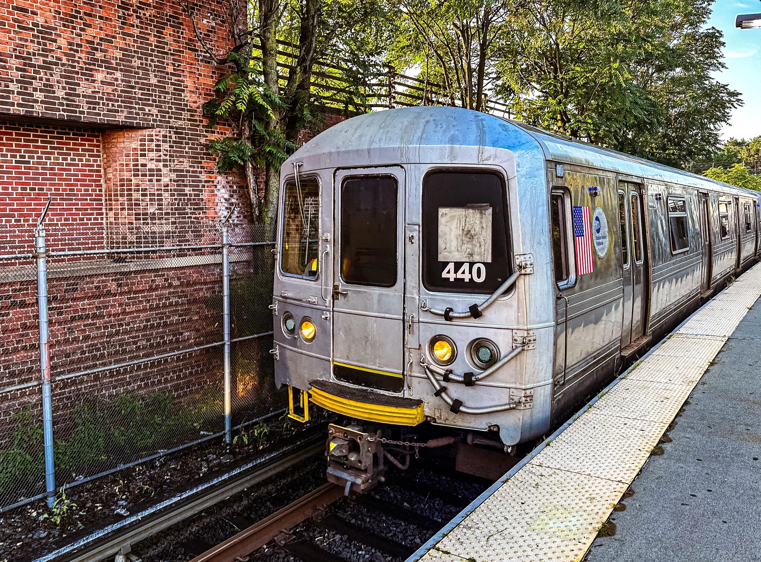
By the late 1800s, resorts appeared along the beaches of South Beach and Midland Beach, where boardwalks and pavilions drew summer visitors by the thousands. The Staten Island Rapid Transit connected the island’s length from St. George to Tottenville (1860–1867), binding its communities and foreshadowing its future as a commuter suburb.
Early–Mid 20th Century: The Borough Apart
Staten Island formally joined New York City in 1898, yet for much of the early 20th century it remained distinct—geographically isolated, politically independent in spirit, and slower to urbanize than its sister boroughs. Its villages gradually coalesced into suburban towns, while large tracts of forest, farmland, and open land persisted well into the century. Ferries remained the borough’s essential lifeline to Manhattan, reinforcing both its place within the city and its sense of separation from it.
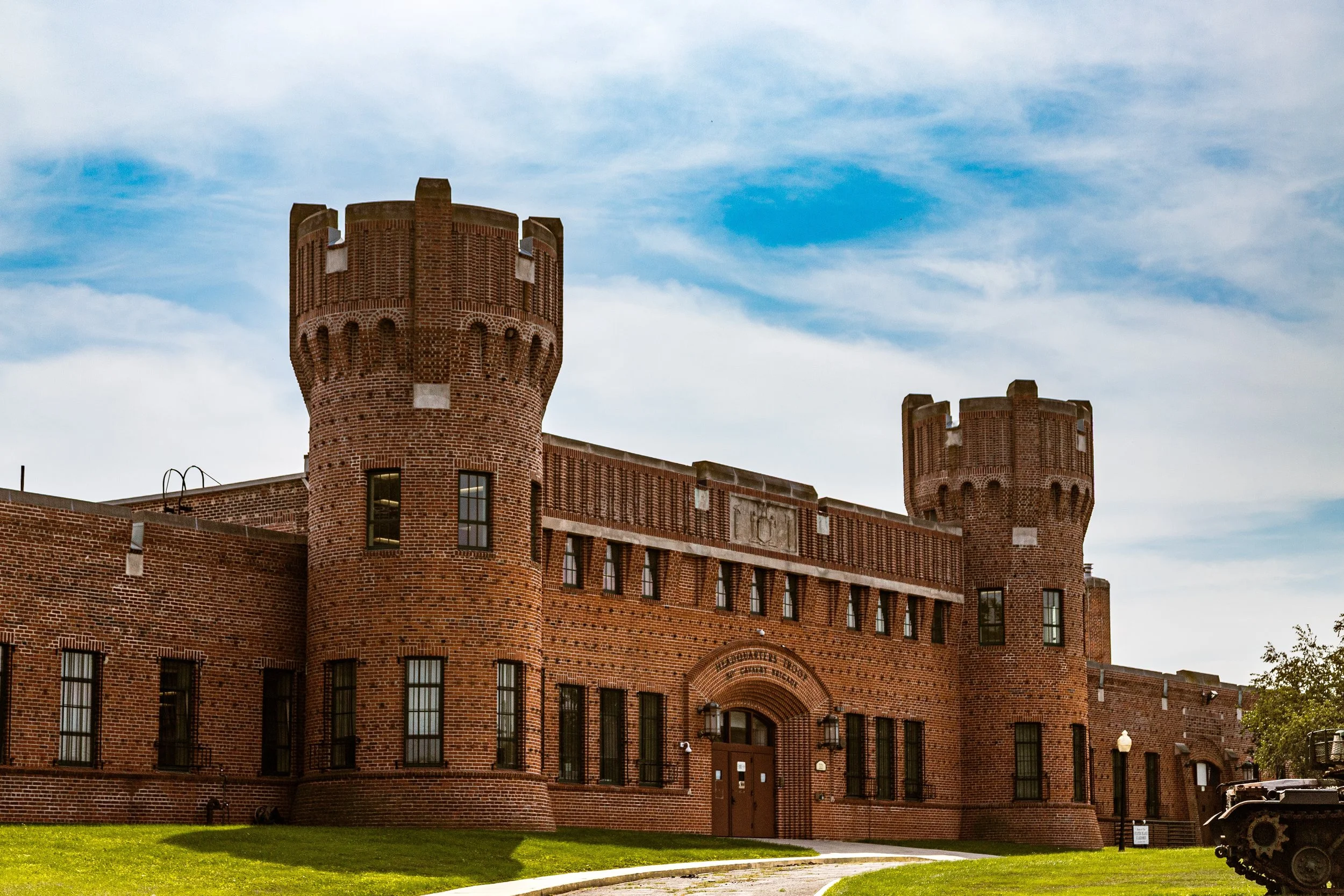
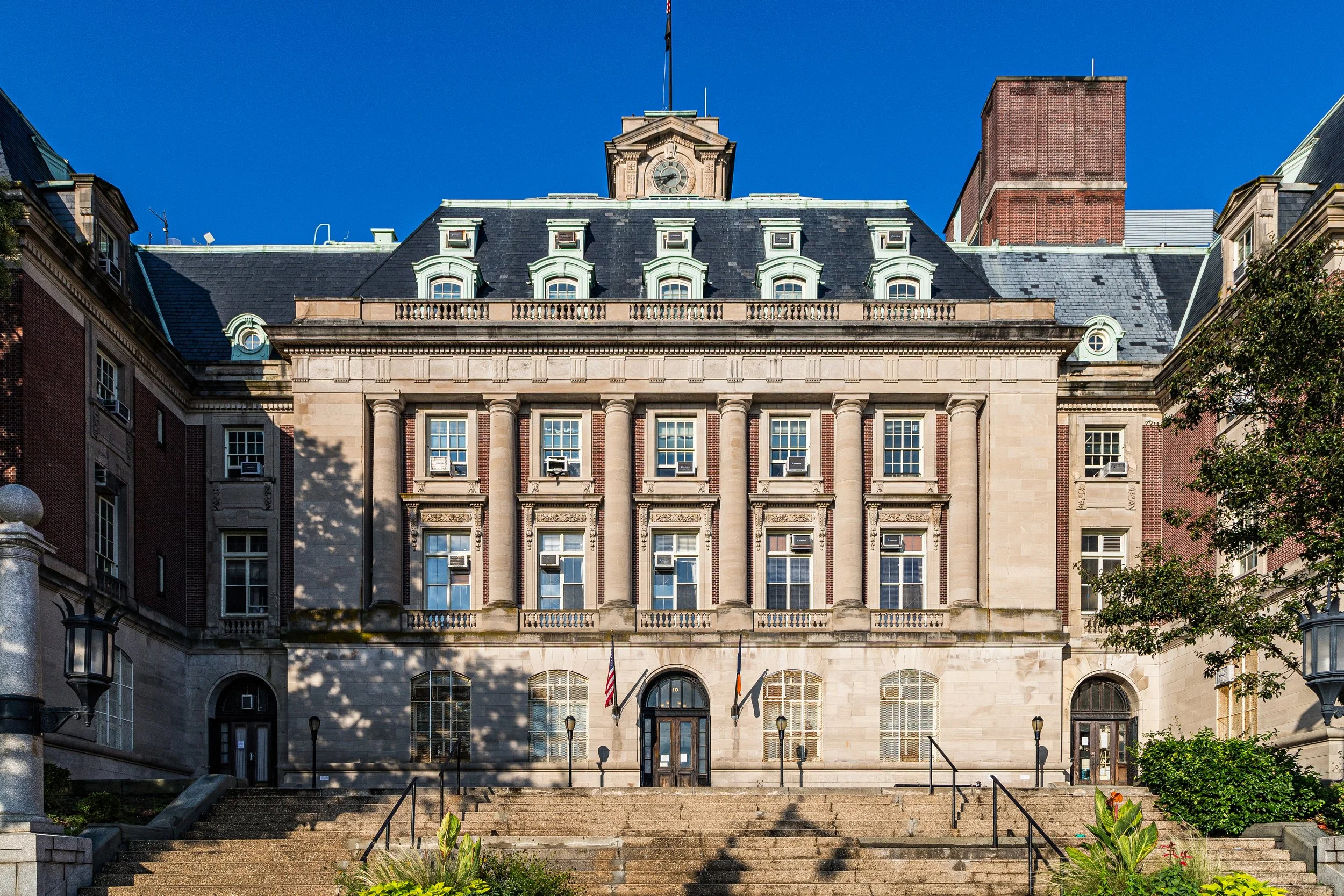
During the Great Depression, public works projects expanded parks, roads, schools, and civic institutions, giving Staten Island a more defined public identity. Borough Hall in St. George, the Staten Island Zoo, and improvements to transportation and neighborhood infrastructure helped strengthen civic life without erasing the borough’s quieter, more dispersed character. Village centers, shore communities, and inland green spaces still shaped daily experience in ways increasingly rare elsewhere in New York.
After World War II, development accelerated, but Staten Island remained the “borough apart.” New housing subdivisions, improved roads, and postwar growth began to reshape the landscape, especially along the east and south shores. Yet even as suburbanization advanced, the borough retained a physical and psychological distinctiveness rooted in distance, topography, and strong local attachment.
Late 20th Century: Bridge, Boom, and Backlash
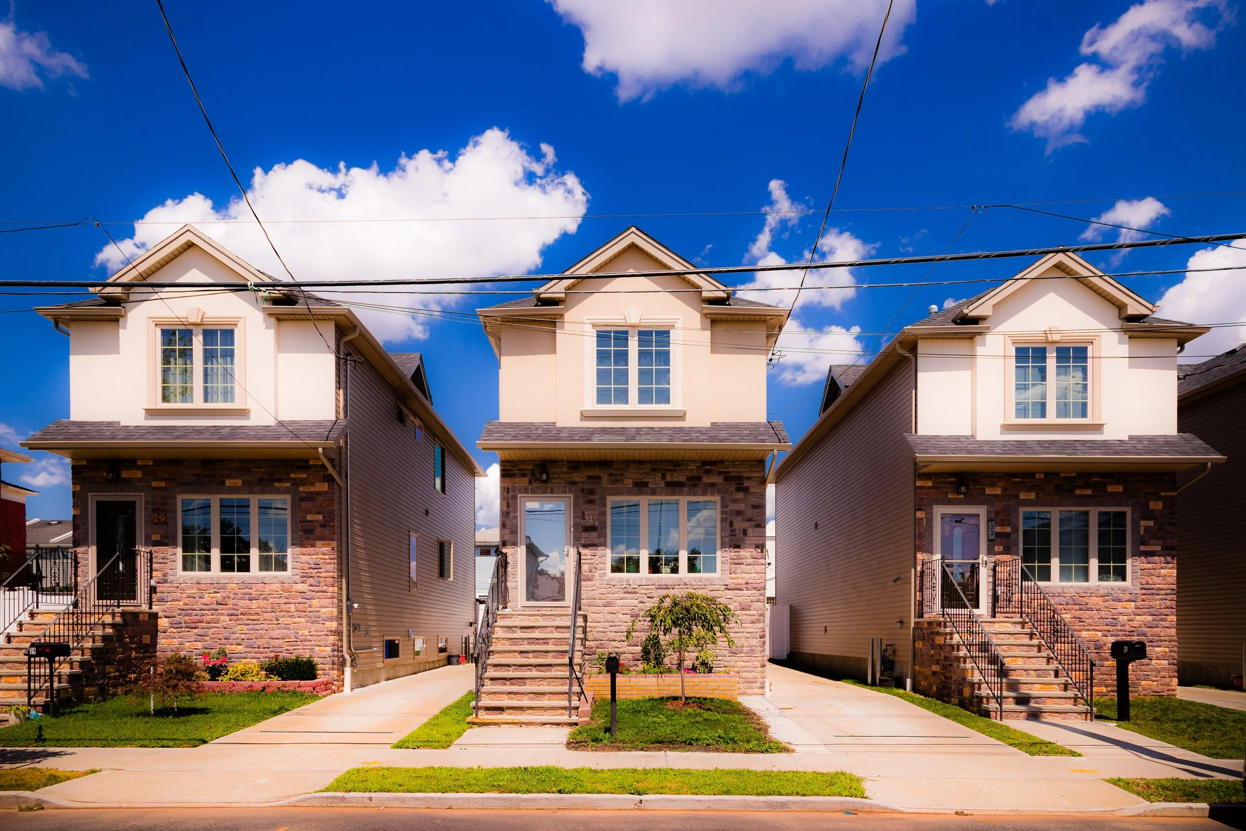
The opening of the Verrazzano-Narrows Bridge in 1964 marked a turning point in Staten Island’s modern history. For the first time, the borough was directly connected by road to Brooklyn and the rest of New York City, ending centuries of relative isolation. The bridge triggered a dramatic population boom and a wave of suburban development. Farmland gave way to subdivisions in New Dorp, Great Kills, Eltingville, and beyond; shopping centers expanded along Richmond Avenue; and Staten Island increasingly became a destination for families seeking space, homeownership, and a quieter alternative to the denser city.
This transformation came at a cost. The Fresh Kills Landfill, opened in 1948 as a supposedly temporary solution, expanded over the decades into a vast environmental scar. Its presence came to symbolize both the city’s dependence on Staten Island and its neglect of it. Rapid development, mounting traffic, and the burden of city infrastructure deepened the borough’s sense of grievance and sharpened its political distinctiveness.
By the 1980s and 1990s, Staten Island’s late-century identity was increasingly shaped by this tension between growth and resistance. Community groups, preservationists, and environmental advocates pushed back against overdevelopment and demanded greater recognition of the borough’s needs and character. Activism surrounding Fresh Kills, in particular, helped build the pressure that eventually led to the landfill’s closure in 2001, while broader civic movements reinforced Staten Island’s image as a borough deeply protective of its autonomy, neighborhoods, and remaining open land.
21st Century: Green Renewal and Modern Identity
In the 21st century, Staten Island has increasingly defined itself through renewal, preservation, and a reaffirmation of local identity. The Freshkills Park project—transforming 2,200 acres of reclaimed landfill into meadows, creeks, and trails—is one of the world’s largest ecological restorations. Alongside the Greenbelt, LaTourette Park, and Blue Heron Park, it underscores the borough’s enduring relationship to open land and ensures that more than one-third of Staten Island remains green.
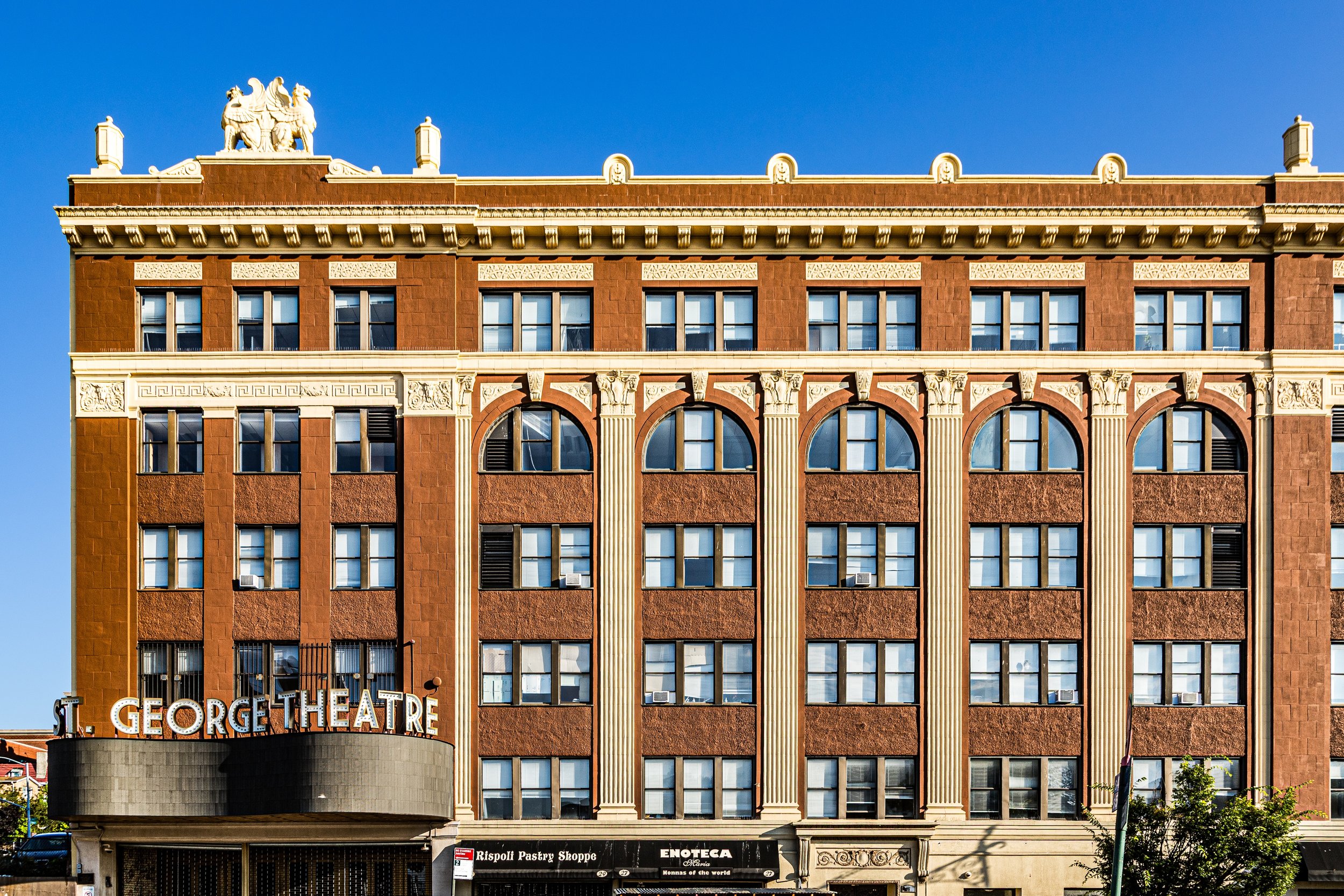
At the same time, Staten Island has continued to strengthen its cultural and civic centers. The Staten Island Ferry Terminal at St. George remains both gateway and gathering place, joined by institutions and attractions such as the Staten Island Museum, Empire Outlets, and the restored St. George Theatre. Snug Harbor Cultural Center continues to bridge maritime history and contemporary arts, while the College of Staten Island and the reimagined Willowbrook campus embody the borough’s capacity to transform difficult histories into spaces of education and public life.
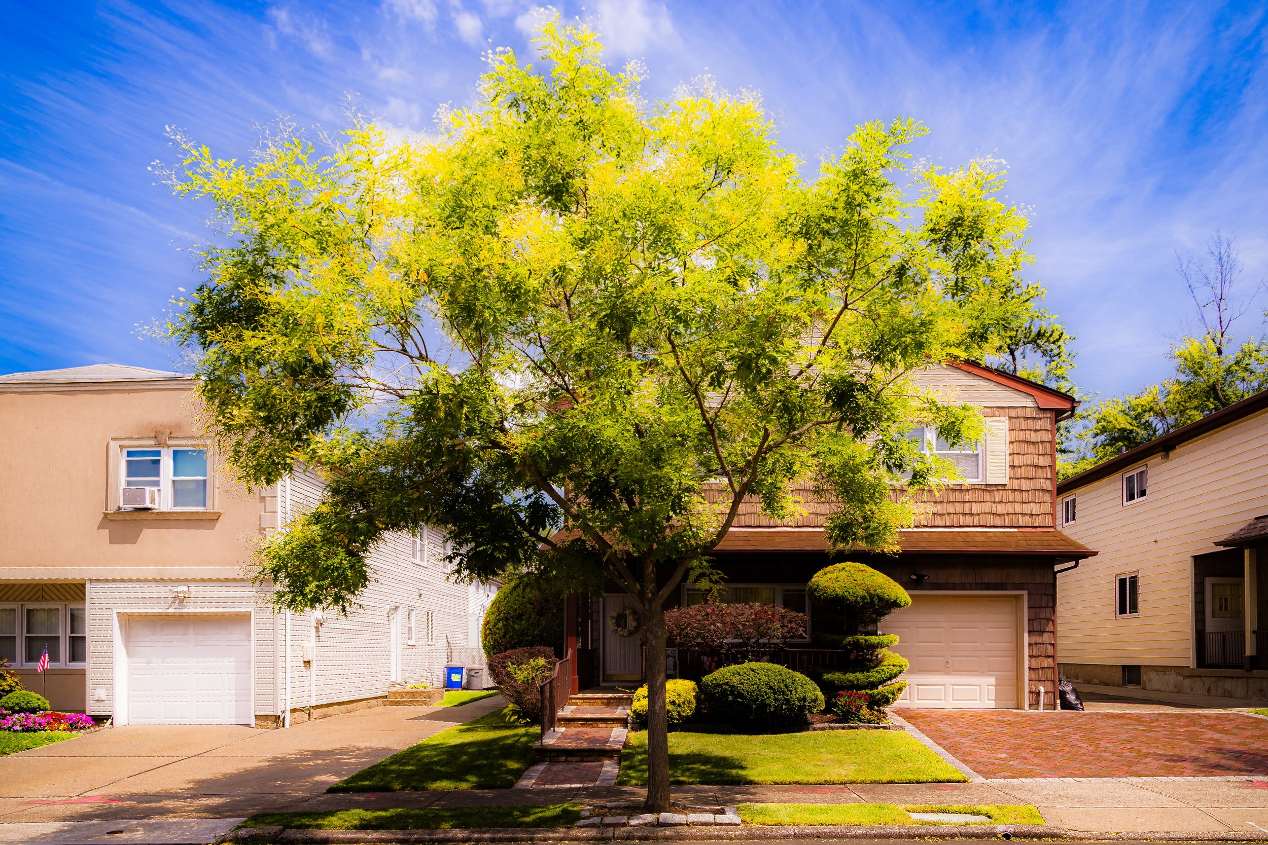
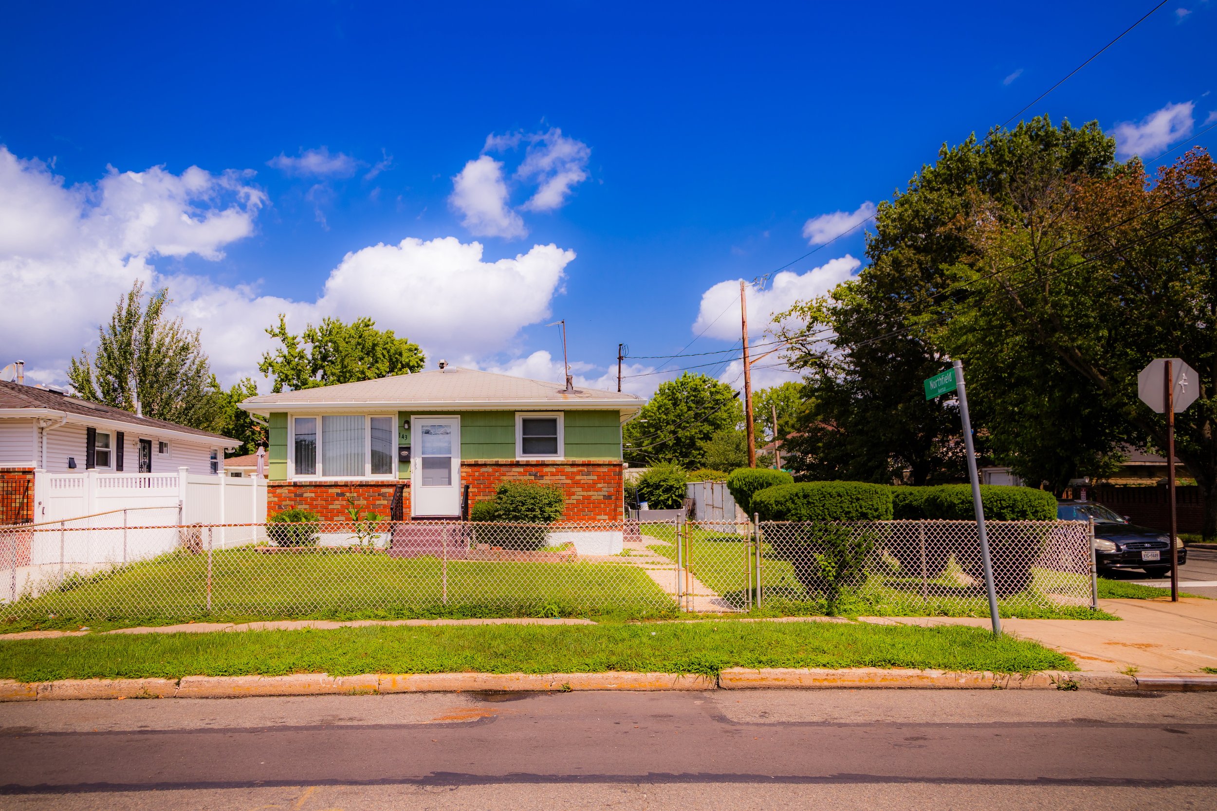
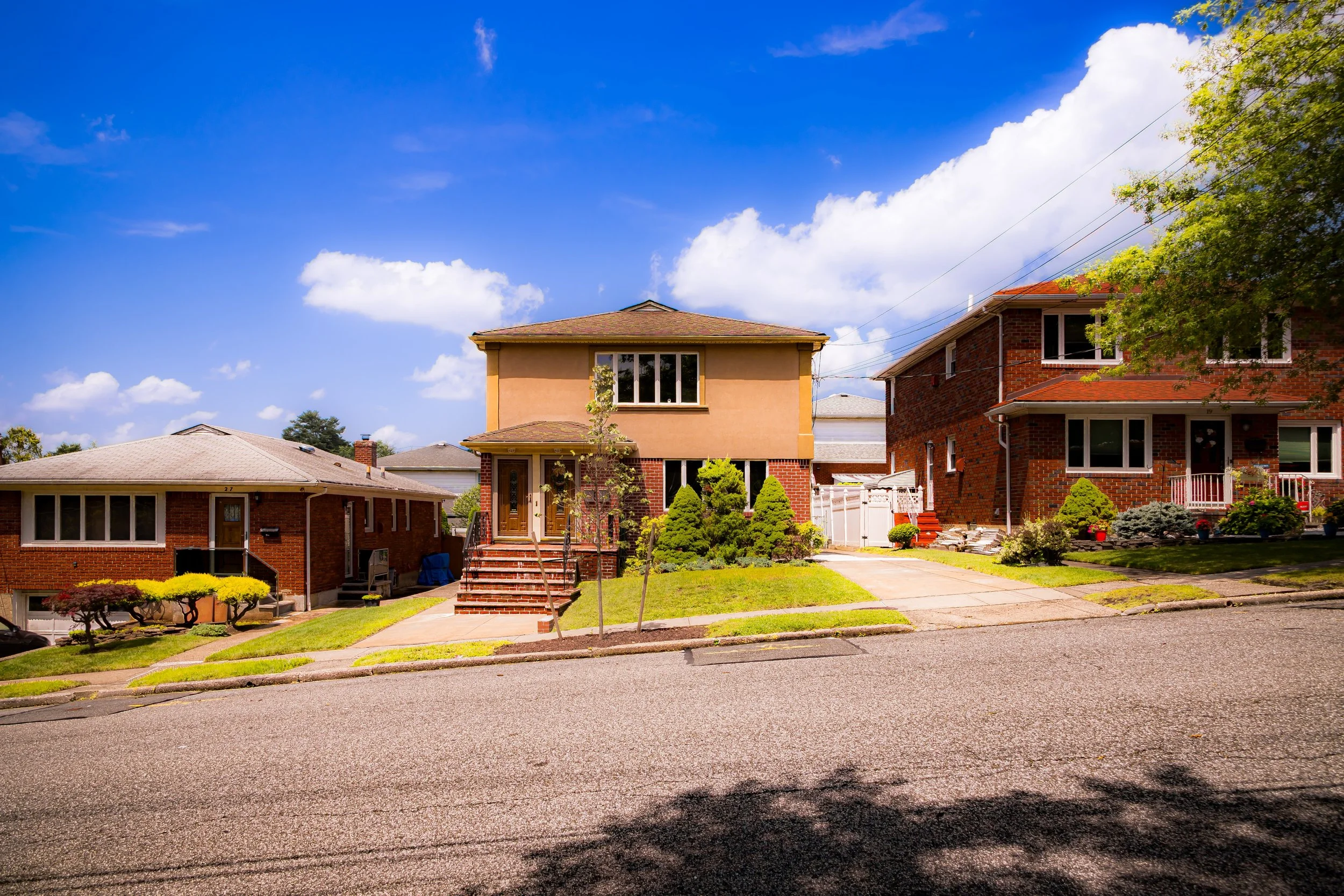
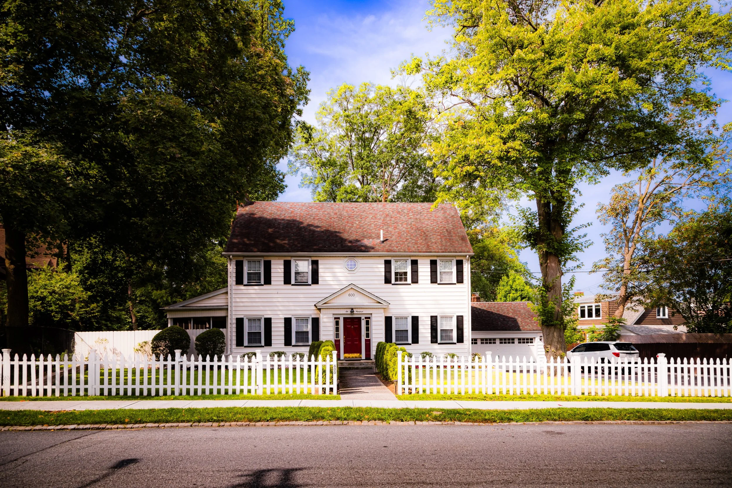
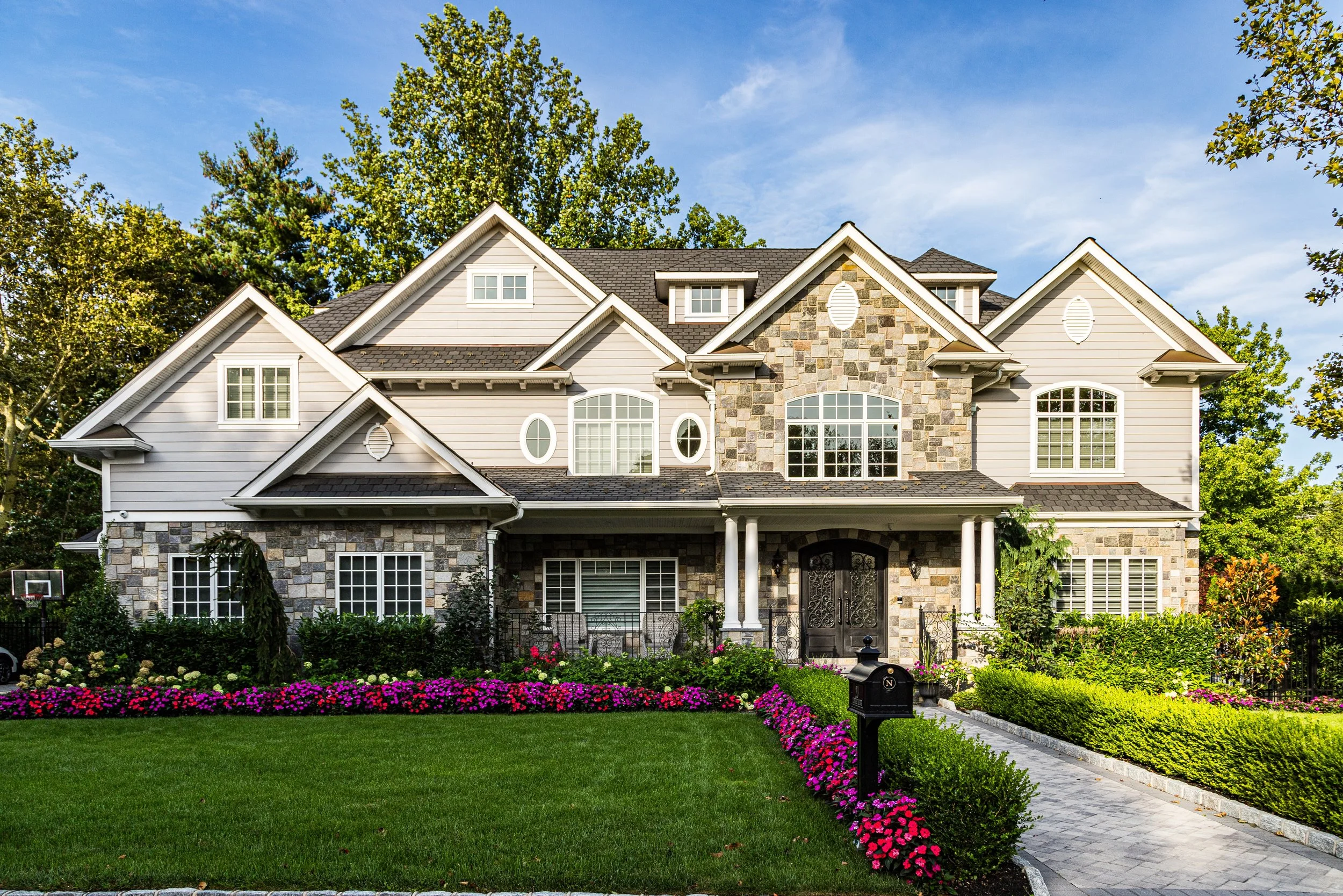
Residentially, Staten Island retains a suburban character rare in New York City. Detached homes, backyards, and quieter streets still define much of the borough, especially in the south, while neighborhoods such as Tottenville, Annadale, Huguenot, Westerleigh, Port Richmond, and St. George preserve distinct identities shaped by successive waves of immigration, including Italian, Irish, Polish, Sri Lankan, and Latin American communities. Today, Staten Island’s identity rests in that balance: greenery and neighborhood continuity, civic memory and cultural renewal, distance from the city’s center and deep belonging within it.
Spirit and Legacy

Staten Island’s legacy is endurance through preservation—a place where New York’s natural memory endures amid modernity. It has been the city’s farm, its refuge, its conscience, and its green lung. Its story is one of patient evolution: from Lenape hunting ground to Dutch colony, from oyster port to commuter suburb, from landfill to living park.
The Photography
Visual Rhythm
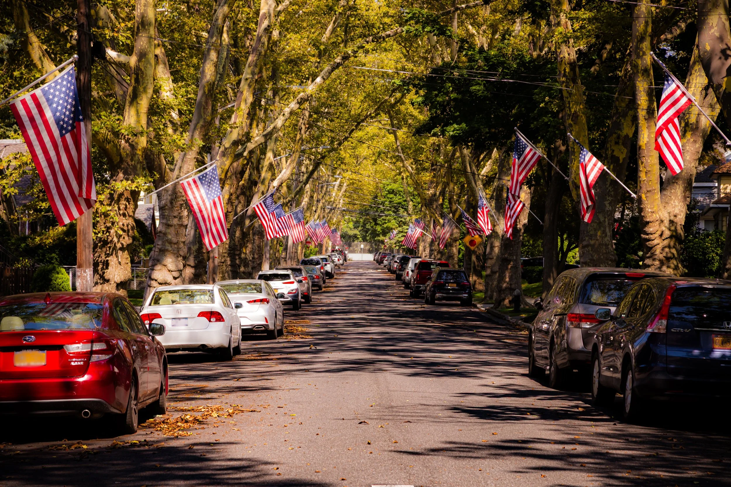
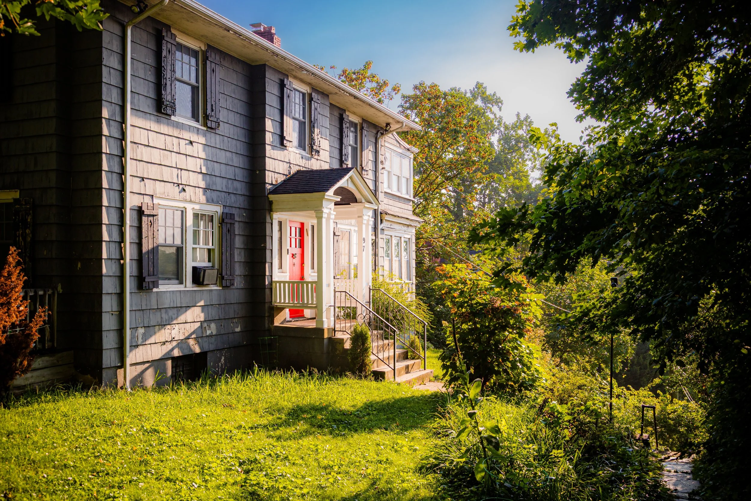
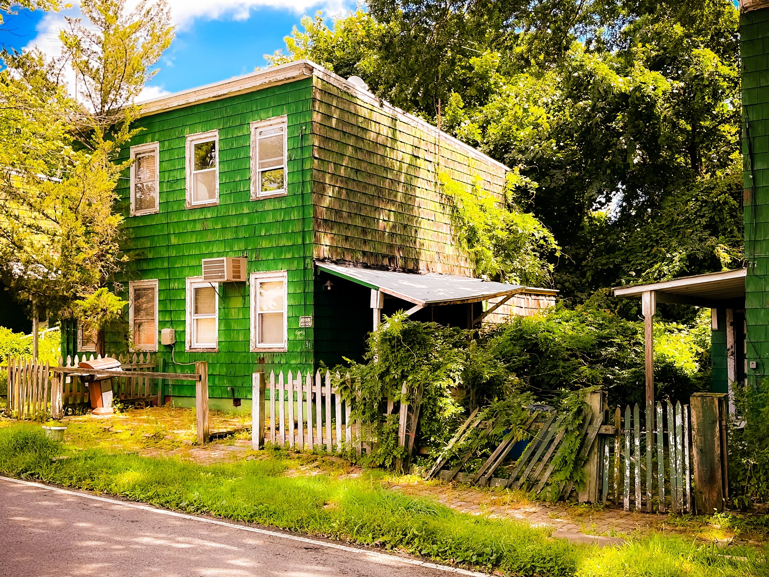
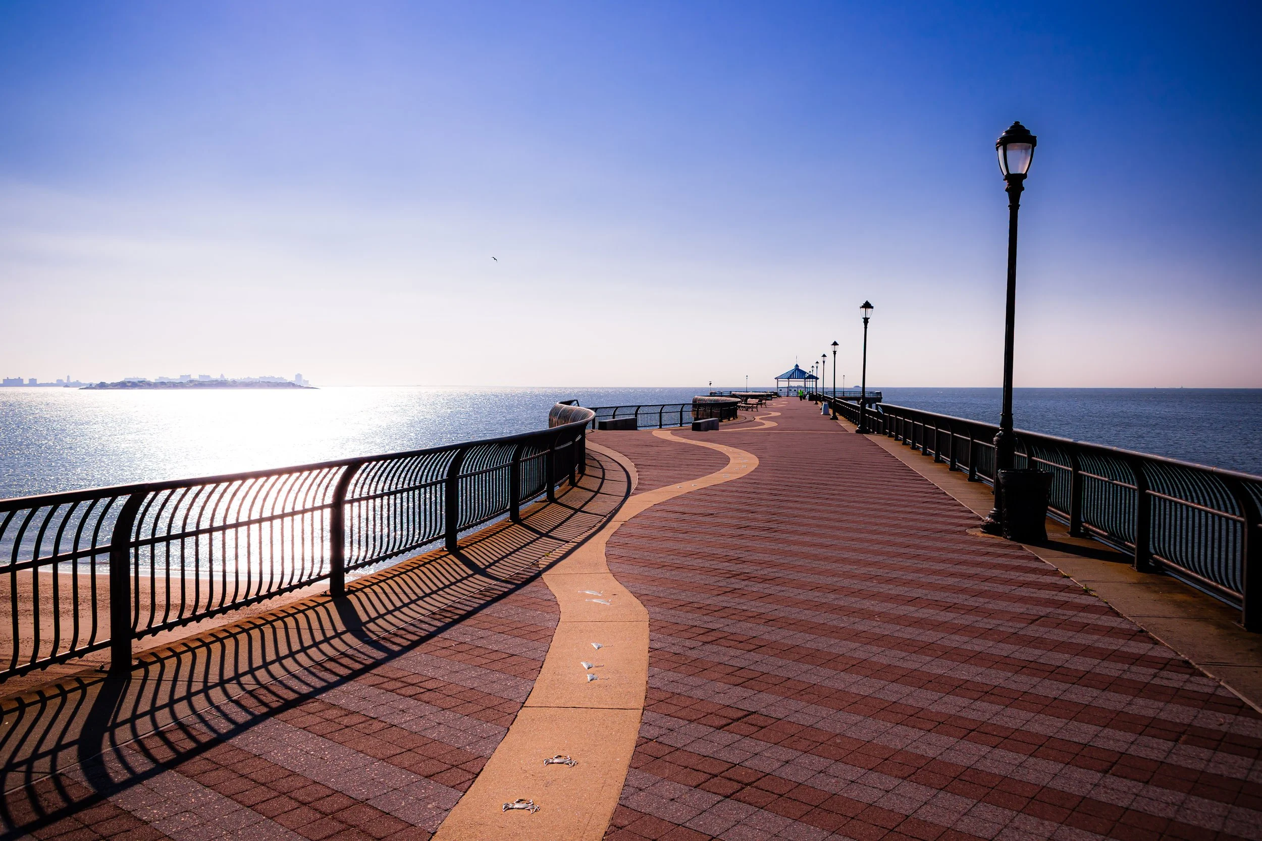
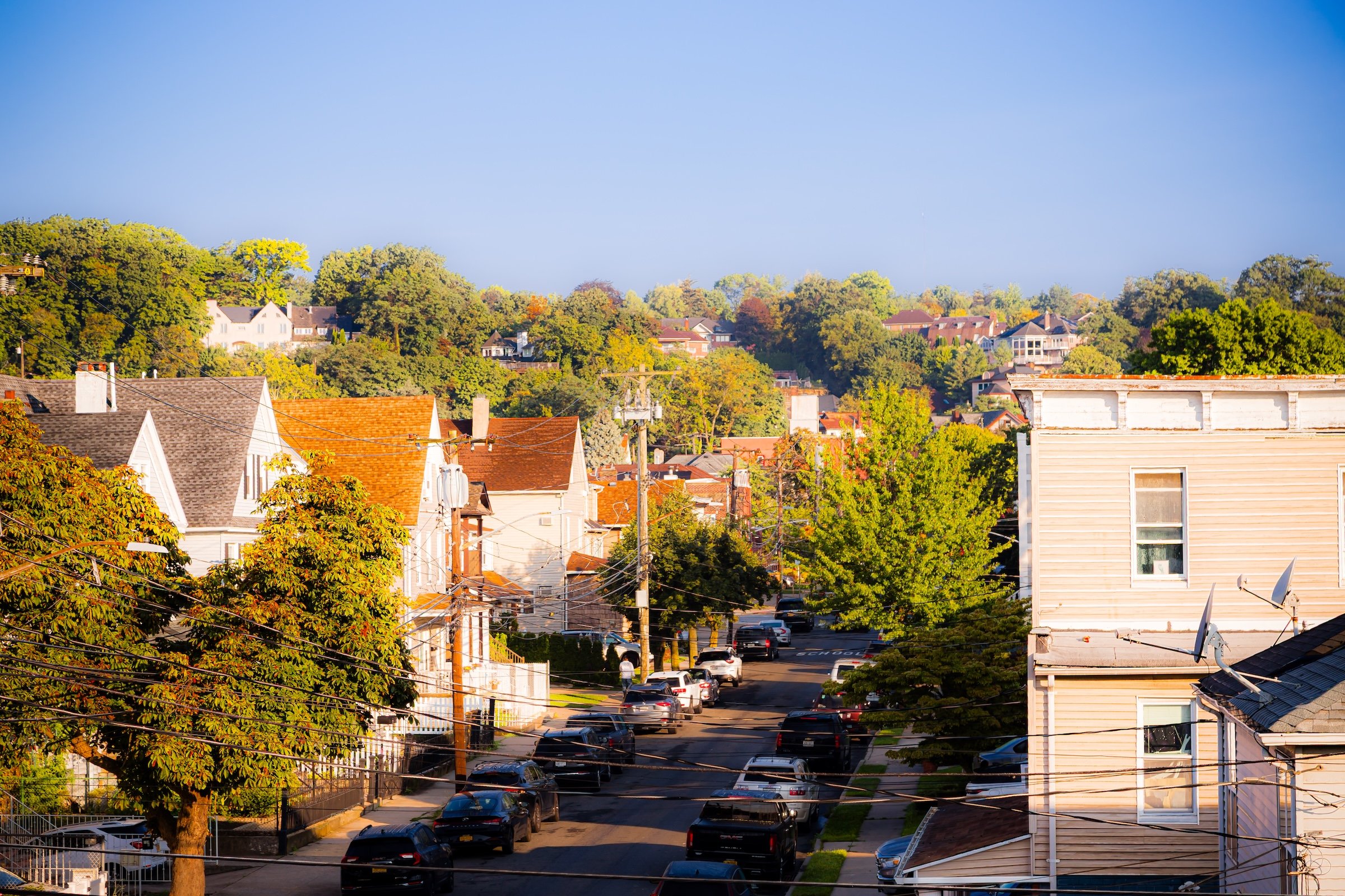
Staten Island is a borough of space, settlement, and shoreline. To photograph it is to move through a landscape where detached homes, village-like centers, civic buildings, beaches, marshes, wooded roads, church steeples, apartment clusters, and waterfront edges all exist within one broad and unusually varied field. More than any single landmark or skyline, Staten Island reveals itself through the interplay of neighborhood texture and environmental presence: houses set back from the street, roads curving with the land, open views toward water, and the persistent sense that the built borough remains in close conversation with the landscape around it.
Photographically, Staten Island is defined by shifts between enclosure and openness. One neighborhood may feel leafy, local, and domestic, shaped by porches, fences, mature trees, and low-rise houses; another may open abruptly toward marshland, harbor views, beaches, or broad civic corridors. In some places, the borough feels almost village-like, grounded in local institutions and residential continuity. In others, it becomes spatially expansive, with shoreline distance, open sky, and a quieter rhythm than any other part of New York City. This balance between habitation and release gives Staten Island much of its visual character.
These photographs trace Staten Island not as an afterthought to the rest of the city, but as a borough with its own distinct photographic temperament. Some images lean toward domestic streetscapes, porches, churches, and neighborhood landmarks; others toward wetlands, beaches, harbor views, historic houses, and the visual calm of less densely built environments. Taken together, they suggest a borough that is grounded, spacious, and deeply place-bound: one whose identity emerges through topography, memory, and the long coexistence of settlement and open land.
Through the Lens
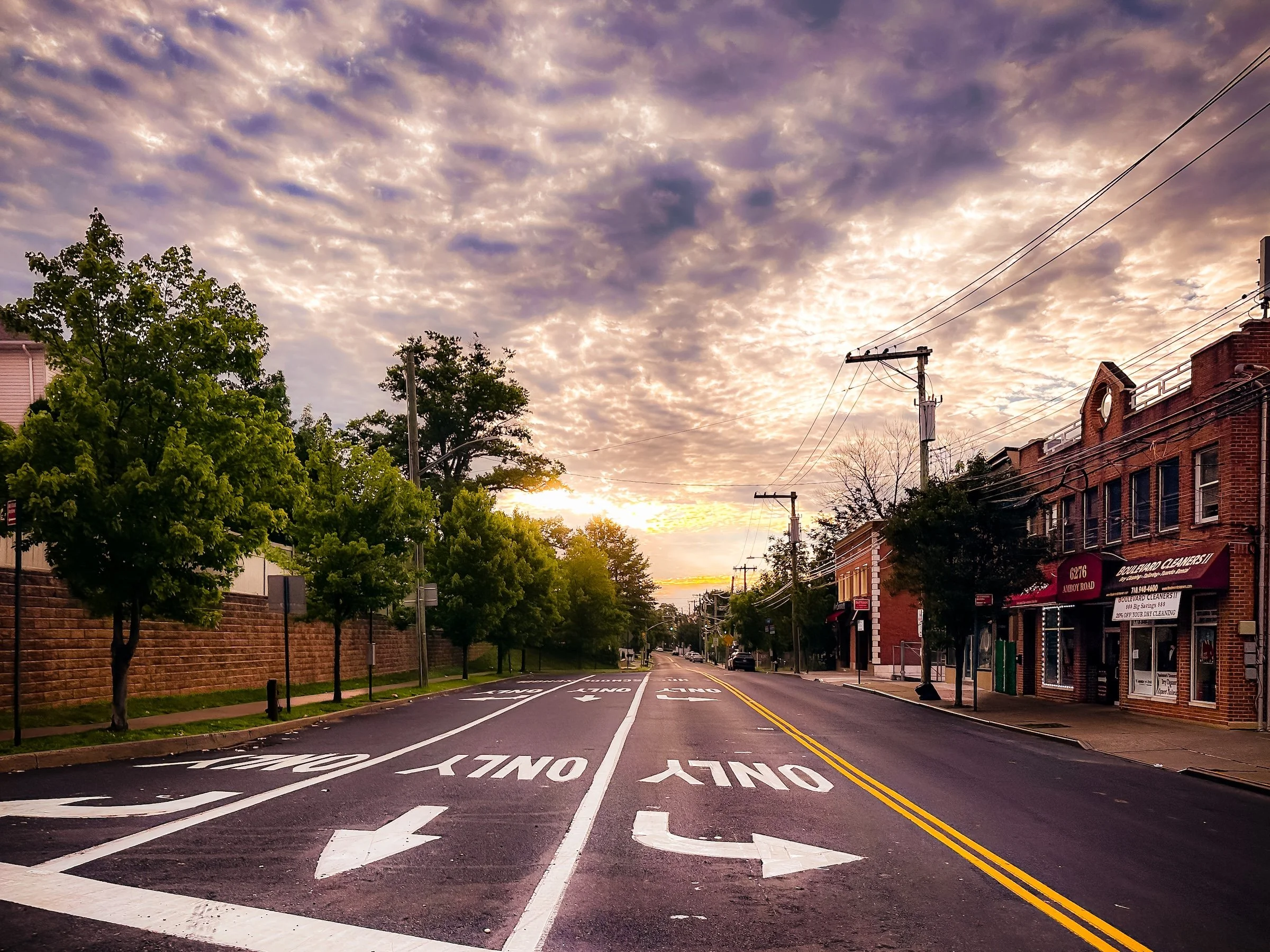
Photographing Staten Island means paying attention to quiet structure. The borough rarely insists on spectacle. Instead, it reveals itself through spacing, light, material, and the relationship between buildings and the land around them. Houses sit apart from one another. Streets curve or widen. Trees, lawns, marshes, beaches, and harbor views repeatedly interrupt the built environment. Even where the borough is more developed, there is often a sense of breathing room: space around buildings, distance beyond the street, sky above the frame.
Again and again, Staten Island invites a way of seeing rooted in continuity and interruption. Detached homes, porches, fences, churches, schools, neighborhood commercial corners, and civic buildings create a strong local texture, but these are constantly set against environmental presence: waterfronts, meadows, wooded edges, open roads, and changing seasonal light. The borough often feels less compressed than the rest of New York, and that difference shapes the photography. It rewards patience, atmosphere, and attention to modest details rather than constant visual overload.
There is also a strong sense of local identity in Staten Island’s built form. Historic houses, suburban development, village centers, apartment complexes, religious architecture, and waterfront remnants all coexist across the borough, but rarely in a uniform pattern. Instead, each part of Staten Island tends to feel self-contained, shaped by shoreline, slope, distance, and neighborhood memory. That gives the borough a photographic character that is less about dramatic collision and more about spatial rhythm, variation, and place.
To photograph Staten Island, then, is not simply to document a quieter borough. It is to notice how quiet itself becomes visual: in the spacing of homes, the openness of roads, the reach of the shoreline, the layering of trees and sky, and the way neighborhood life remains tied to the land beneath it.
Visual Highlights
This selection reflects several of Staten Island’s defining photographic qualities: detached homes and porches, village-like streets, civic and religious architecture, beaches, marshes, harbor views, wooded paths, neighborhood landmarks, and the broad sky that so often frames the borough’s streetscape. Some images emphasize settlement and local continuity — houses, churches, storefront corners, apartment clusters, and institutions. Others focus more on landscape presence: open water, shoreline distance, marshland, greenery, and the quieter spatial rhythm that distinguishes Staten Island from the city’s denser boroughs.
Taken together, these photographs suggest a borough of strong local identity and unusual physical openness. Staten Island appears here not as a peripheral version of the city, but as a place where domestic architecture, neighborhood memory, civic life, and environmental space remain visibly entangled.
Fieldwork Across the Borough
These photographs are part of an ongoing effort to document Manhattan through repeated walks, revisits, and close attention to both its celebrated landmarks and its everyday urban fabric. Rather than isolating only the monumental or the instantly recognizable, this work approaches Manhattan as a lived borough: one of neighborhood distinctions, architectural layers, shifting light, patterned facades, public space, commercial energy, and persistent local character.
As this archive continues to grow, this section will expand to include fuller photographic logs, neighborhood-based highlights, seasonal returns, and more detailed visual pathways through the borough. Over time, it will serve not only as a gallery of selected work, but as an evolving record of how Manhattan looks, feels, and changes when encountered on foot and over time.
Lexicon Connections
Several recurring visual strategies and motifs emerge naturally across these Staten Island photographs and connect closely to the broader Photographic Lexicon.
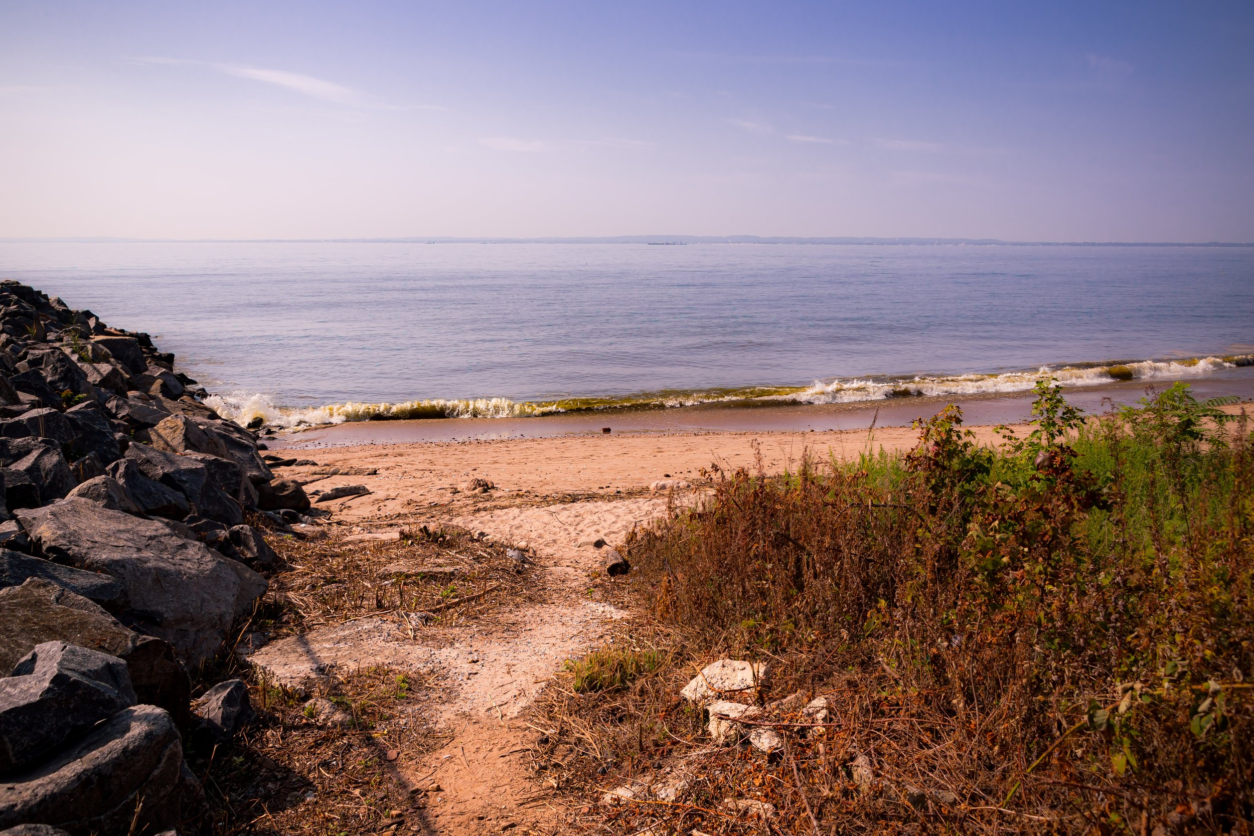
Shoreline Distance appears in beaches, harbor views, marshes, waterfront edges, and long sightlines across open water. Staten Island repeatedly opens outward, and that sense of release is one of its defining visual conditions.
Village Texture emerges in detached homes, porches, fences, civic buildings, church fronts, local commercial corners, and the modest architectural details that give many Staten Island neighborhoods their self-contained character. Here, texture often feels rooted in continuity, memory, and domestic scale.
Branches and Canopies is visible in leafy roads, shaded residential streets, parks, wooded paths, and the mature trees that soften much of the borough’s built environment. Staten Island’s greenery does not merely decorate the streetscape; it helps define it.
Open Sky and Quiet Roads appears in broad streets, low-rise blocks, open verges, road curves, and those moments when houses, utility lines, and trees are held beneath a wide field of light and atmosphere. Staten Island often feels visually shaped as much by what surrounds the street as by the street itself.
Settlement and Landscape emerges where homes meet marshes, village centers meet shoreline, churches rise from residential blocks, and built form remains visibly tied to slope, water, lawn, or open land. Staten Island often reveals itself through this coexistence rather than through density alone.
Taken together, these visual threads help define Staten Island as spacious, place-bound, and quietly distinctive: a borough of shoreline openness, neighborhood texture, tree cover, atmospheric distance, and the persistent interplay of settlement and landscape. As this section evolves, these motifs can be linked more directly to individual Lexicon entries, connecting Staten Island’s borough-wide photographic character to the broader visual language of CityNeighborhoods.
Staten Island Neighborhoods In Photographs
New York City
Use this custom Google map to explore where every neighborhood in all five boroughs of New York City is located.
The Five Boroughs
One of New York City’s unique qualities is its organization in to 5 boroughs: Manhattan, Brooklyn, Queens, The Bronx, and Staten Island. These boroughs are part pragmatic administrative districts, and part vestiges of the region’s past. Each borough is an entire county in New York State - in fact, Brooklyn is, officially, Kings County, while Staten Island is, officially Richmond County. But that’s not the whole story …
Initially, New York City was located on the southern tip of Manhattan (now the Financial District) that was once the Dutch colony of New Amsterdam. Across the East River, another city was rising: Brooklyn. In time, the city planners realized that unification between the rapidly rising cities would create commercial and industrial opportunities - through streamlined administration of the region.
So powerful was the pull of unification between New York and Brooklyn that three more counties were pulled into the unification: The Bronx, Queens, and Staten Island. And on January 1, 1898, the City of New York unified two cities and three counties into one Greater City of New York - containing the five boroughs we know today.
But because each borough developed differently and distinctly until unification, their neighborhoods likewise uniquely developed. Today, there are nearly 390 neighborhoods, each with their own histories, cultures, cuisines, and personalities - and each with residents who are fiercely proud of their corner of The Big Apple.


