SOUTH JAMAICA
Queens
Geographic Setting
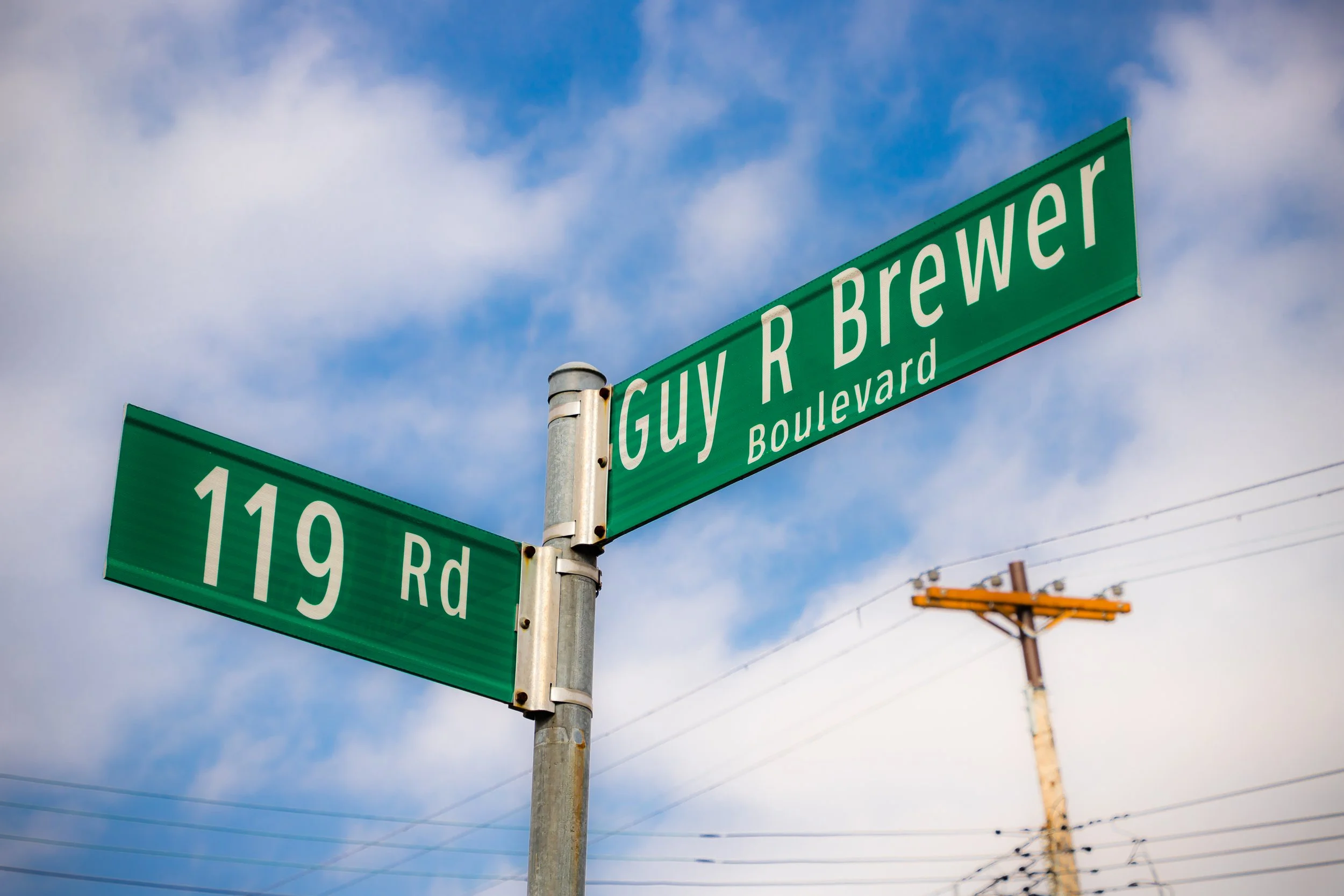
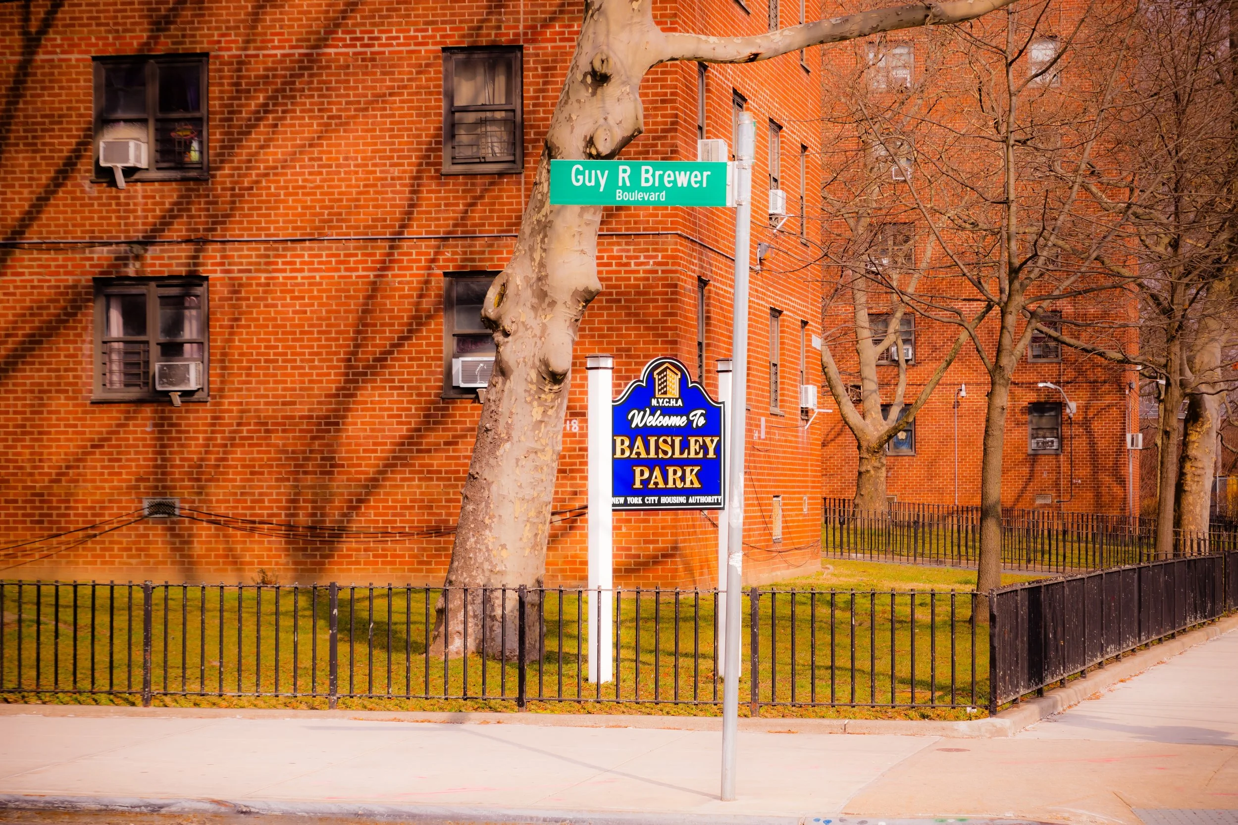
Bounded by the Van Wyck Expressway to the west, Linden Boulevard to the north, Merrick Boulevard to the northeast, Baisley Boulevard and Guy R. Brewer Boulevard to the southeast, and the Belt Parkway to the south, South Jamaica forms the sprawling southern expanse of the greater Jamaica district—a neighborhood defined by its deep roots in working-class life, community resilience, and evolving cultural identity.
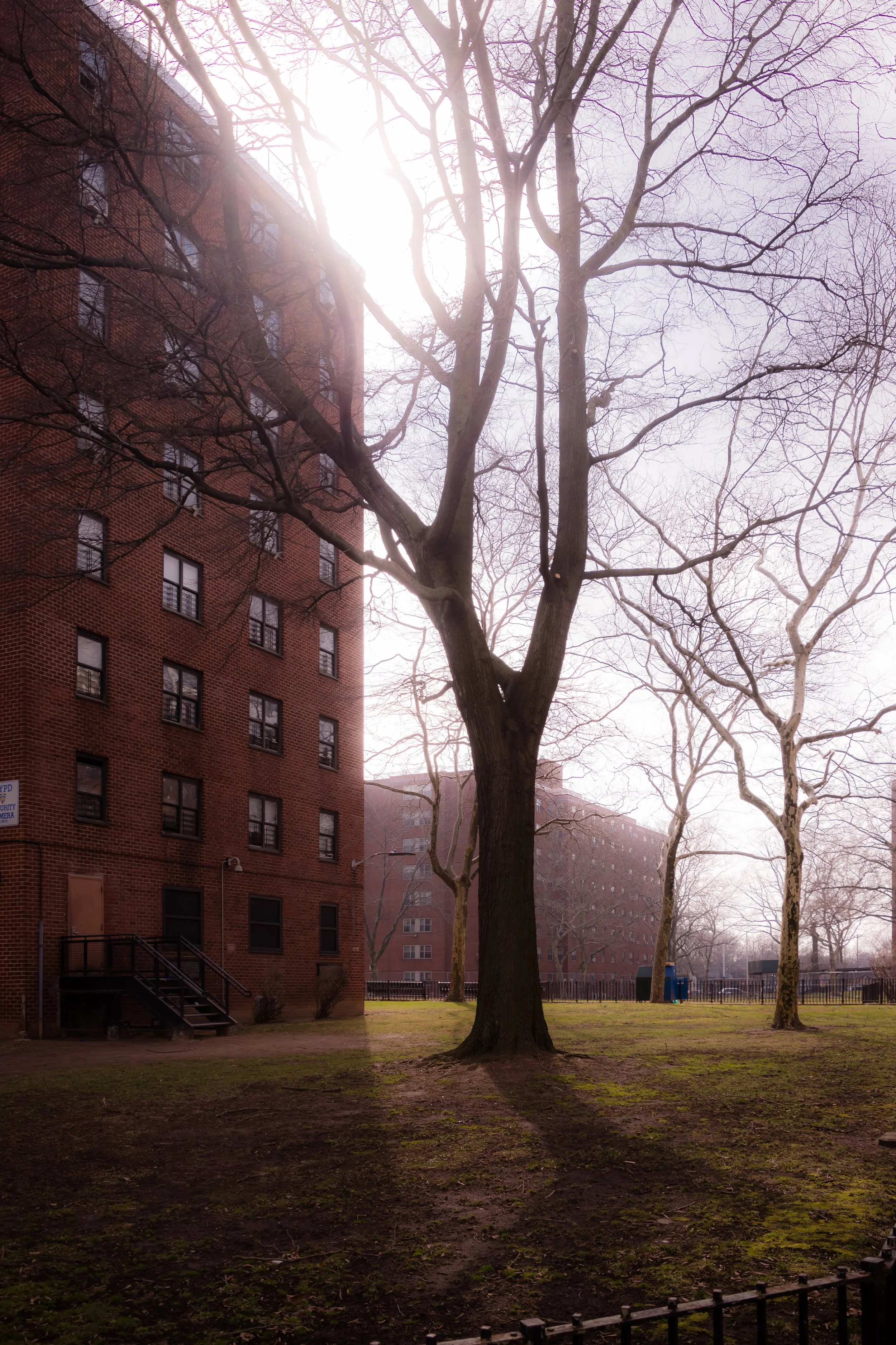
South Jamaica’s grid of tree-lined residential streets, brick rowhouses, and public housing complexes extends toward the open green spaces of Baisley Pond Park and Roy Wilkins Park, while commercial arteries such as Merrick Boulevard, Linden Boulevard, and Guy R. Brewer Boulevard serve as the lifeblood of local business and transit. The AirTrain to JFK Airport, visible just to the east, marks South Jamaica’s connection to the global gateway of Queens, while the nearby Belt Parkway and Van Wyck Expressway link the community to the rest of New York City.
Physically and historically, South Jamaica sits at the crossroads between urban density and suburban sprawl—a neighborhood of front stoops, block associations, and corner stores, where multi-generational families, newcomers, and small business owners form a community rooted in perseverance and pride.
Etymology and Origins
The name “South Jamaica” reflects the neighborhood’s origins as the southern portion of the historic Town of Jamaica, one of Queens’ oldest colonial settlements. “Jamaica” itself derives not from the Caribbean nation, but from the Lenape word Yameco, meaning “beaver,” a nod to the region’s abundant wildlife and waterways.
In the 17th and 18th centuries, the area was predominantly farmland and meadowland, part of the Beaver Pond tract that supported Dutch and English settlers. The landscape was defined by creeks, ponds, and wooded trails, with scattered homesteads and estates owned by families such as the Van Wycks and Remsens. By the mid-19th century, as the Long Island Rail Road expanded and Jamaica became a commercial hub, this southern fringe remained largely rural—a patchwork of small farms, nurseries, and unpaved roads stretching toward Jamaica Bay.
Urbanization arrived slowly in the late 19th and early 20th centuries, when developers subdivided farmland into residential plots for working-class families. The extension of trolley and bus lines down Merrick Boulevard and Rockaway Boulevard connected South Jamaica to Jamaica’s business district, attracting African-American migrants and Caribbean immigrants seeking homes and community away from Manhattan’s crowded tenements.
The Neighborhood
Early–Mid 20th Century: Working-Class Roots and Community Formation
By the 1920s and 1930s, South Jamaica had established itself as a predominantly residential neighborhood of modest one- and two-family homes, many built by local craftsmen and small developers. Its population was a diverse mix of European immigrants, African-Americans, and Afro-Caribbean families who worked in civil service, manufacturing, and domestic trades.
The Great Depression and World War II shaped the neighborhood’s growth, as federal housing programs and returning veterans spurred new construction. The 1940s saw the rise of public housing projects, including the South Jamaica Houses (1940)—one of the first federally funded housing complexes in Queens—and later, the Baisley Park Houses (1961). These developments provided stable, affordable housing but also introduced socioeconomic challenges that would define the postwar decades.
Despite periods of hardship, South Jamaica fostered a vibrant civic culture. Churches such as Mount Olivet Baptist Church and St. Benedict the Moor became cornerstones of community life, while local schools and block associations nurtured neighborhood pride. The proximity to Idlewild Airport (renamed JFK in 1963) created both employment opportunities and environmental challenges, as aircraft noise and flight paths became a fact of daily life.
Late 20th Century: Adversity, Activism, and Identity
The 1970s and 1980s brought significant changes to South Jamaica. Economic decline, disinvestment, and rising unemployment took their toll, as manufacturing jobs disappeared and city services faltered. Like many urban neighborhoods during this era, South Jamaica faced waves of crime and drug activity, particularly during the height of the crack epidemic. Yet even amid hardship, the neighborhood became a locus of grassroots activism and cultural expression.
Community leaders and clergy organized anti-drug coalitions and tenant associations, while local residents—particularly women-led groups—fought to preserve housing and restore public safety. The establishment of Roy Wilkins Park (named after the civil rights leader) in the 1980s provided a vital public green space and a new center for youth programming, cultural festivals, and community gatherings.
Culturally, South Jamaica gained national recognition as one of the birthplaces of East Coast hip-hop. The neighborhood produced several influential artists who helped define the sound and spirit of Queens in the late 1980s and 1990s, among them Run-D.M.C., LL Cool J, and 50 Cent, whose lyrics reflected the struggles and resilience of everyday life in South Jamaica. This creative legacy transformed the area into a touchstone of New York’s cultural map—its voices amplifying both hardship and hope.
South Jamaica Photographic Video
21st Century: Renewal and Resilience
In the 21st century, South Jamaica continues to evolve—shaped by both renewal and continuity. Public investment in infrastructure, affordable housing, and green spaces has gradually revitalized the area. The Jamaica NOW Action Plan, launched in 2015, brought economic development and transit improvements, while the AirTrain and JFK modernization projects expanded local employment opportunities.
Baisley Pond Park and Roy Wilkins Park now serve as community anchors—hosting farmers’ markets, concerts, and youth programs. New housing initiatives, from Habitat for Humanity infill projects to sustainable apartment complexes, have diversified the neighborhood’s housing stock. Longtime residents, many with deep generational roots, live alongside newcomers from the Caribbean, West Africa, and Latin America, reinforcing South Jamaica’s identity as one of Queens’ most multicultural working-class enclaves.
While challenges persist—economic inequality, public safety, and environmental concerns among them—South Jamaica’s civic life remains active and engaged. Block parties, church picnics, and local business associations continue to knit the community together in ways both familiar and forward-looking.
South Jamaica Photo Gallery
Spirit and Legacy
The spirit of South Jamaica is one of endurance and community self-definition. It is a neighborhood that has weathered economic cycles, social upheaval, and physical transformation without losing its core identity: a place of family, faith, and perseverance. Its broad boulevards, schoolyards, and parklands carry the stories of generations who built lives here—not through luxury or glamour, but through work, creativity, and pride of place.
New York City
Use this custom Google map to explore where every neighborhood in all five boroughs of New York City is located.
The Five Boroughs
One of New York City’s unique qualities is its organization in to 5 boroughs: Manhattan, Brooklyn, Queens, The Bronx, and Staten Island. These boroughs are part pragmatic administrative districts, and part vestiges of the region’s past. Each borough is an entire county in New York State - in fact, Brooklyn is, officially, Kings County, while Staten Island is, officially Richmond County. But that’s not the whole story …
Initially, New York City was located on the southern tip of Manhattan (now the Financial District) that was once the Dutch colony of New Amsterdam. Across the East River, another city was rising: Brooklyn. In time, the city planners realized that unification between the rapidly rising cities would create commercial and industrial opportunities - through streamlined administration of the region.
So powerful was the pull of unification between New York and Brooklyn that three more counties were pulled into the unification: The Bronx, Queens, and Staten Island. And on January 1, 1898, the City of New York unified two cities and three counties into one Greater City of New York - containing the five boroughs we know today.
But because each borough developed differently and distinctly until unification, their neighborhoods likewise uniquely developed. Today, there are nearly 390 neighborhoods, each with their own histories, cultures, cuisines, and personalities - and each with residents who are fiercely proud of their corner of The Big Apple.


