WEST FARMS
The Bronx
Geographic Setting
Bounded by the Bronx River to the east, the Cross Bronx Expressway to the south, Southern Boulevard to the west, and Bronx Park to the north, West Farms stands at the historical and geographical heart of the Bronx—a neighborhood both ancient in its origins and enduring in its character. Cradled within the meandering course of the Bronx River, the area forms part of the low-lying valley that once defined the borough’s agrarian core, where mills turned, farms prospered, and settlement first took root long before New York City’s consolidation.
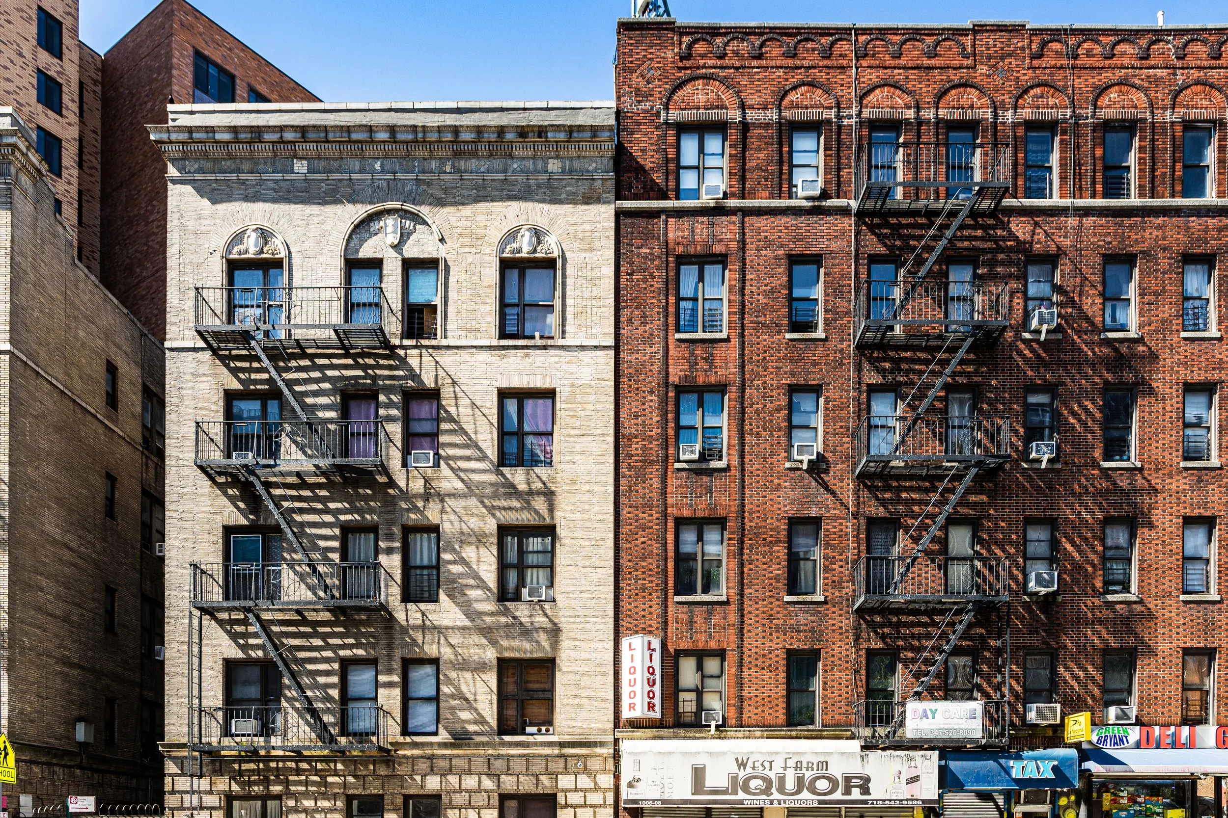
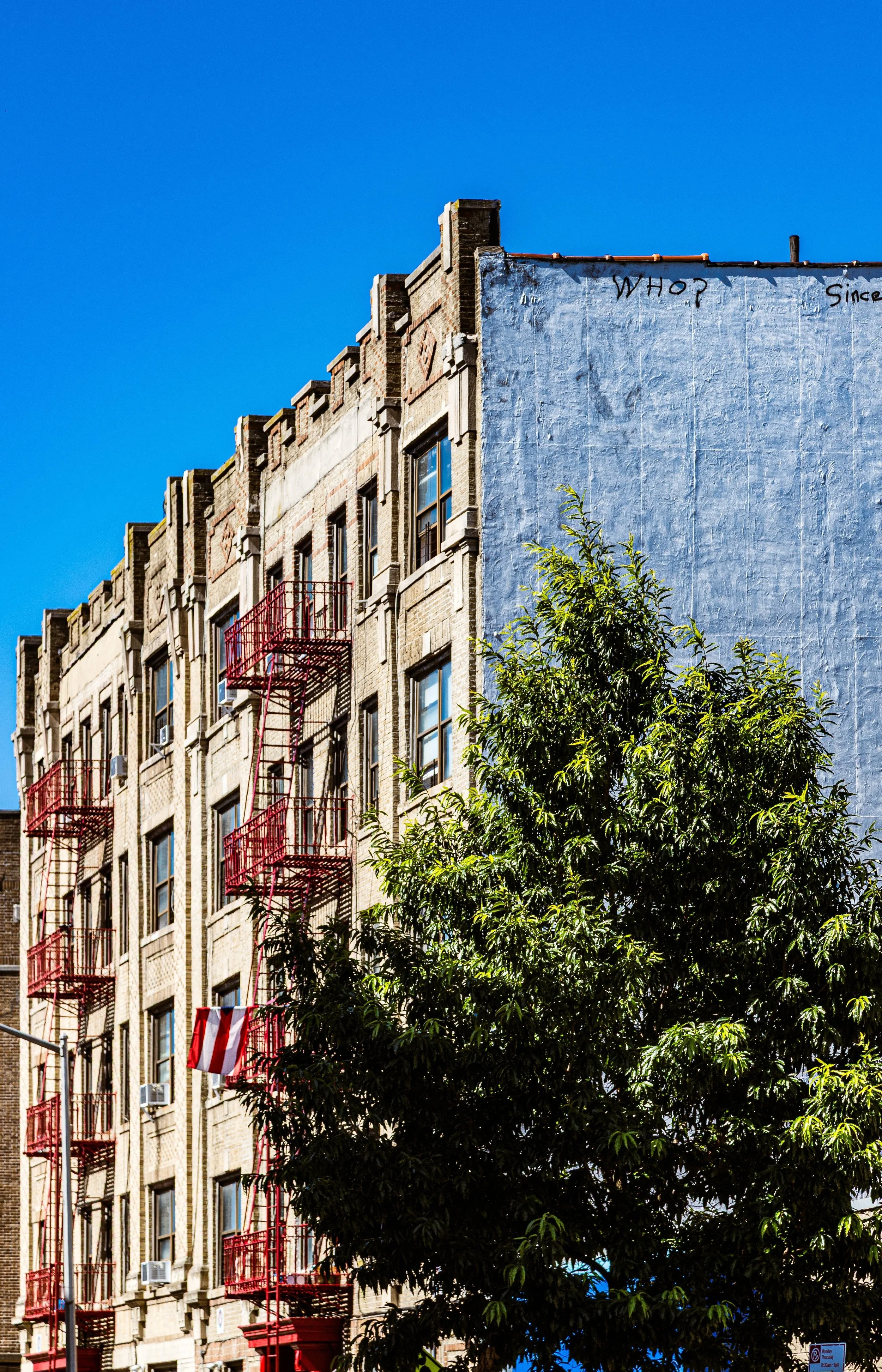
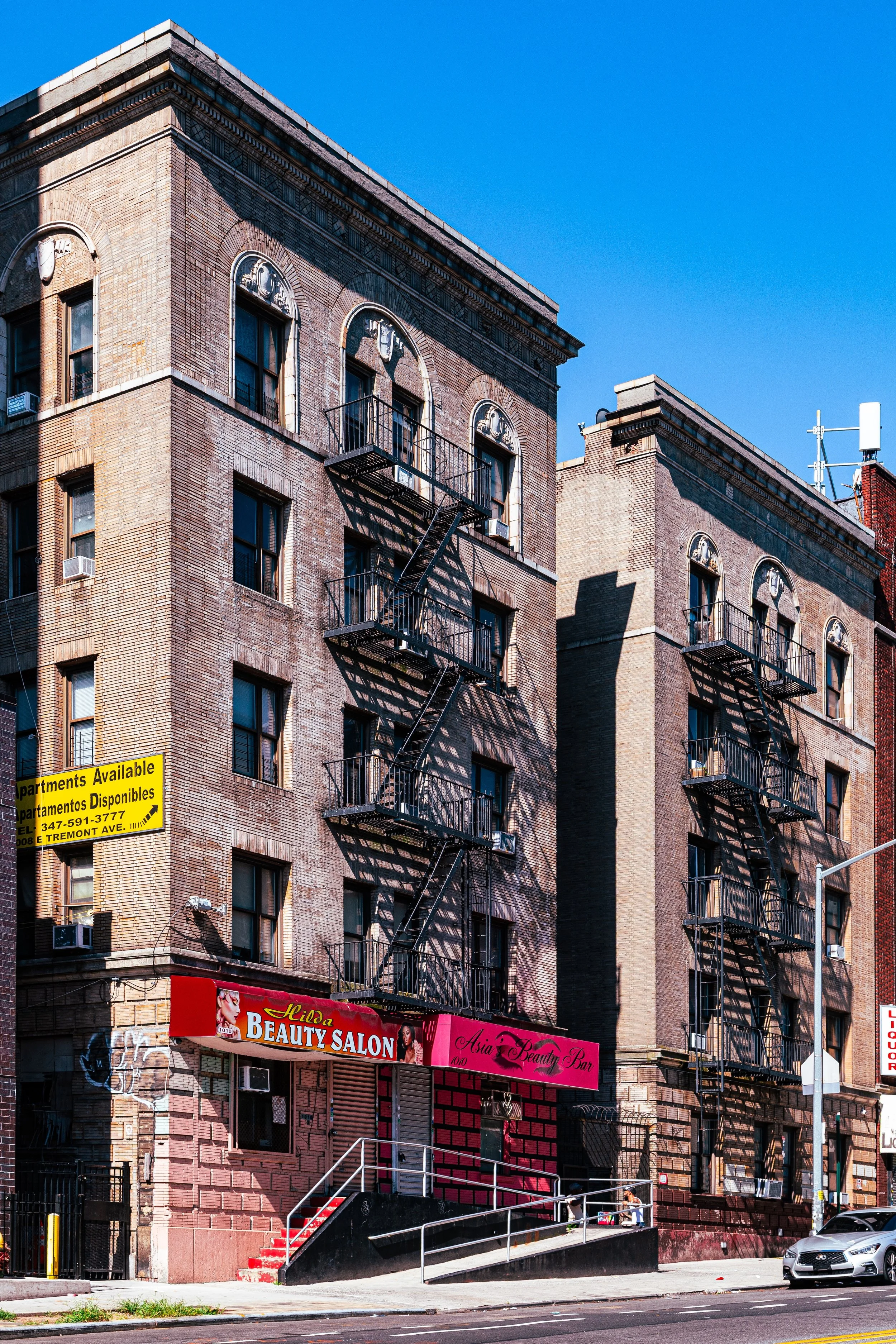
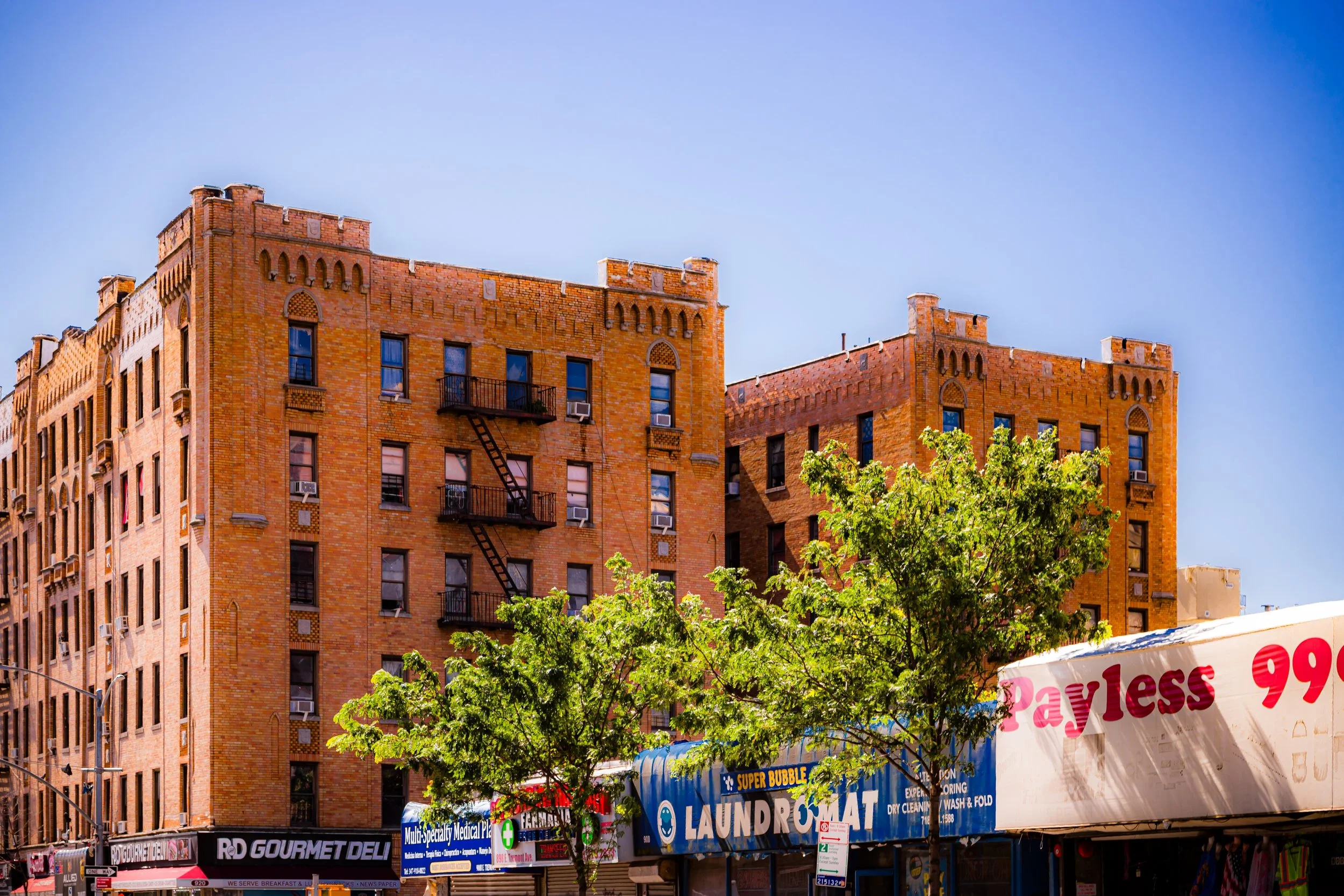
Today, West Farms remains compact and dynamic, framed by major transit arteries and public spaces that link it to the wider Bronx. The Cross Bronx Expressway and Bronx River Parkway define its southern and eastern perimeters, while East Tremont Avenue, Boston Road, and West Farms Road form its main internal corridors. The neighborhood’s architecture is a mosaic of brick walk-up apartment buildings, rowhouses, public housing developments, and new affordable housing complexes, interspersed with small shops, churches, and schools that reflect a long legacy of working-class resilience.
The Bronx River, once polluted and neglected, now restored through decades of activism, flows quietly along the neighborhood’s edge—an emblem of renewal. To the north, the green expanse of Bronx Park, home to the Bronx Zoo and New York Botanical Garden, underscores West Farms’ intimate connection to both nature and history.
Etymology
The name “West Farms” dates to the 17th century and refers to the western portion of the original Town of Westchester, then a separate municipality from New York City. Early Dutch and English settlers established farms and homesteads here along the fertile floodplains of the Bronx River, which served as both a natural boundary and a source of power for grist and sawmills.
The word “farms” was literal: this was once an agricultural district of fields, orchards, and livestock pastures that supplied New Amsterdam and, later, New York with produce and dairy. The “west” distinguished it from the older Eastchester settlements across the river. When the township was officially incorporated in the late 1600s, West Farms became both a civic designation and a landscape identity—one that endures, long after the farms themselves have vanished beneath the urban grid.
The Neighborhood
Origins through the 19th Century
West Farms holds the distinction of being one of the Bronx’s earliest and most historically significant settlements. Founded by Edward Jessup and John Richardson in 1666, it was part of a royal land grant that separated from the Town of Westchester to form an independent community. The fertile riverbanks and rolling meadows proved ideal for farming, and throughout the colonial era, West Farms supplied grain, vegetables, and timber to Manhattan via small riverboats that plied the Bronx River and Harlem River.
During the Revolutionary War, the area became a contested zone between British and American forces. Its strategic position between the Harlem River and the mainland made it a corridor of troop movements and skirmishes. After the war, the rural community rebuilt and prospered, with mills and small industries powered by the Bronx River.
By the mid-19th century, West Farms had evolved into a village of country estates, small farms, and modest homes. The opening of the Bronx River Railroad (1840s) and later the Third Avenue Elevated Line (1887) transformed the area into a desirable suburban retreat for those working in Manhattan. Elegant Victorian houses and narrow lanes reflected the aesthetic of a self-contained township—distinct from the denser industrial neighborhoods that would soon rise around it.
When the area was annexed by New York City in 1874, West Farms—along with Morrisania—became part of the city’s first Bronx acquisition north of the Harlem River, marking the beginning of the Bronx’s urban destiny.
Early 20th Century: Urbanization and Institutional Growth
The early 20th century brought rapid transformation. As new bridges, trolleys, and subways extended the city’s reach, West Farms transitioned from a pastoral village to a dense urban neighborhood. The construction of Boston Road and Southern Boulevard established vital north-south corridors, while the Bronx River Parkway (opened 1925) reshaped the river’s edge, channeling its waters and replacing millworks with landscaped parkland.
Residential development accelerated in the 1910s–1930s, with rows of tenement-style buildings and five-story brick apartments replacing older homes. Immigrant populations—Irish, Jewish, Italian, and later African-American—settled here, drawn by proximity to factories, transportation, and emerging commercial districts. Churches like St. Thomas Aquinas (founded 1909) and schools such as P.S. 67 anchored civic life.
The neighborhood also gained prominence as an institutional hub. The Bronx Zoo (1899) and New York Botanical Garden (1891) rose just north of the old village, turning the Bronx River Valley into one of the city’s great public landscapes. Together with the parkway, these projects reflected the early-20th-century movement to merge nature, recreation, and modern urban living—a philosophy deeply intertwined with West Farms’ identity.
West Farms Video Coming Soon
Mid–Late 20th Century: Decline and Resilience
By the 1950s–1970s, West Farms, like much of the South Bronx, faced severe economic and social upheaval. The construction of the Cross Bronx Expressway (1955–1972) cut through the southern edge of the neighborhood, displacing hundreds of residents and accelerating the cycle of urban decline. Many buildings fell into neglect or abandonment, and rising unemployment and disinvestment took a heavy toll.
Yet even in these hardest years, West Farms remained a place of community organization and endurance. Churches, tenant associations, and grassroots activists fought to preserve housing and public safety. The Bronx River Restoration Project, launched in 1974, began the long process of cleaning the once-polluted river, reclaiming it as a natural and civic asset. New cultural life flourished amid adversity—local murals, block parties, and music programs reflected the creativity that would define Bronx identity in the hip-hop era.
By the 1980s and 1990s, the tide began to turn. Community development corporations, notably the Mid-Bronx Desperadoes, led large-scale housing rehabilitation, turning abandoned lots into new affordable homes and apartments. West Farms slowly stabilized, its population diversifying with Puerto Rican, Dominican, African-American, and West African families, all contributing to the neighborhood’s rebirth.
21st Century: Revitalization and Urban Ecology
In the 21st century, West Farms has reemerged as a symbol of Bronx revitalization. A wave of new housing—such as the West Farms Redevelopment Project (2013–present), bringing thousands of affordable units—has transformed former industrial parcels into mixed-use, transit-accessible communities. The neighborhood’s proximity to the 2 and 5 subway lines, as well as major roadways, continues to make it a hub for commuters.
Environmental and civic restoration projects have reconnected the community to its river. The Bronx River Greenway, which now threads through West Farms, offers walking and cycling paths linking the neighborhood to Starlight Park, Concrete Plant Park, and Bronx Park—restoring the Bronx River to its role as a living artery. Local initiatives have also emphasized sustainability, youth engagement, and urban agriculture, drawing on the area’s agrarian heritage in a modern key.
Today, West Farms balances its dense urban core with surprising pockets of greenery, cultural pride, and architectural continuity. Though new developments rise along West Farms Road and East Tremont Avenue, the neighborhood retains a sense of rootedness born of centuries of adaptation.
West Farms Photo Gallery
Spirit and Legacy
The spirit of West Farms is one of persistence, reinvention, and place memory. It is a neighborhood that has witnessed the full arc of Bronx history—from colonial farmland to industrial suburb, from decline to renewal—each era layering new stories atop the old.
Its legacy is written in its geography: the Bronx River still winding as it did in the 1600s, the Cross Bronx Expressway roaring above the land that once fed a city, and the voices of generations who have refused to surrender their community to neglect.
New York City
Use this custom Google map to explore where every neighborhood in all five boroughs of New York City is located.
The Five Boroughs
One of New York City’s unique qualities is its organization in to 5 boroughs: Manhattan, Brooklyn, Queens, The Bronx, and Staten Island. These boroughs are part pragmatic administrative districts, and part vestiges of the region’s past. Each borough is an entire county in New York State - in fact, Brooklyn is, officially, Kings County, while Staten Island is, officially Richmond County. But that’s not the whole story …
Initially, New York City was located on the southern tip of Manhattan (now the Financial District) that was once the Dutch colony of New Amsterdam. Across the East River, another city was rising: Brooklyn. In time, the city planners realized that unification between the rapidly rising cities would create commercial and industrial opportunities - through streamlined administration of the region.
So powerful was the pull of unification between New York and Brooklyn that three more counties were pulled into the unification: The Bronx, Queens, and Staten Island. And on January 1, 1898, the City of New York unified two cities and three counties into one Greater City of New York - containing the five boroughs we know today.
But because each borough developed differently and distinctly until unification, their neighborhoods likewise uniquely developed. Today, there are nearly 390 neighborhoods, each with their own histories, cultures, cuisines, and personalities - and each with residents who are fiercely proud of their corner of The Big Apple.


