HOLLIS HILLS
Queens
Neighborhood Profile
Regarded as one of the most affluent and picturesque pockets of Eastern Queens, Hollis Hills is a tranquil enclave defined by its hilly terrain and proximity to Cunningham Park. Characterized by its large, custom-designed detached homes and a complete lack of commercial intrusion, the neighborhood offers an exclusive, nature-oriented lifestyle with a quiet, country-club feel.
Geographic Setting
Bounded by the Grand Central Parkway to the east and south, the Vanderbilt Motor Parkway to the north, and Cunningham Park to the west, Hollis Hills occupies one of the most picturesque and secluded corners of eastern Queens—a serene, tree-lined enclave perched atop gentle hills that overlook the green corridors of the borough’s parkway system. Distinguished by its winding streets, manicured lawns, and elegant single-family homes, Hollis Hills combines the atmosphere of a suburban village with the convenience of city access.
The neighborhood’s internal layout departs from the rigid grid of most of Queens: curving roads like Kingsbury Avenue, Hollis Hills Terrace, and Richland Avenue follow the contours of the land, reflecting the careful planning of a mid-20th-century suburban development. The Grand Central Parkway forms a natural boundary and sound buffer, enclosing Hollis Hills within a quiet crescent of greenery. To the west, Cunningham Park—one of Queens’ largest recreational landscapes—provides acres of forested trails, ballfields, and bikeways, while the Vanderbilt Motor Parkway, once a historic raceway and now a linear park and bicycle path, offers scenic connection northward toward Alley Pond Park.
Though administratively part of Fresh Meadows and Oakland Gardens, Hollis Hills maintains a distinct identity—affluent, peaceful, and community-minded—known for its beautiful homes, strong civic associations, and proximity to nature.
Etymology and Origins
The name “Hollis Hills” evokes both geography and continuity. It reflects the neighborhood’s rolling topography and its historical association with Hollis, the older railroad suburb to the southwest. The “Hills” designation was added by developers in the early 20th century to distinguish this newer, elevated section of eastern Queens, which was envisioned as a planned residential community surrounded by parks and parkways.
Before development, the land that became Hollis Hills consisted of wooded tracts and farmland within the old Town of Jamaica. In the early 1900s, the area remained largely rural, with portions owned by estates and nurseries. The construction of the Grand Central Parkway (1930s) and the transformation of the Vanderbilt Motor Parkway into a city-owned greenway effectively defined the neighborhood’s present boundaries, creating a naturally enclosed, semi-suburban pocket that appealed to developers seeking to attract prosperous New Yorkers fleeing the density of western Queens and Brooklyn.
The Neighborhood
Mid-20th Century: A Planned Suburban Enclave
Hollis Hills took shape in the 1930s through the 1950s, when the city’s rapid postwar expansion and highway construction brought new opportunities for residential planning. The neighborhood’s earliest houses were built in the Tudor Revival and Colonial Revival styles, with pitched roofs, brick façades, and decorative stonework that conveyed both craftsmanship and permanence. Later homes—especially those constructed after World War II—reflected the Cape Cod and Ranch-style designs of the era, often set on spacious lots with driveways and attached garages.
The development was marketed as an “exclusive residential community within city limits,” emphasizing tranquility, privacy, and park access. Its design followed the principles of the Garden City movement—curvilinear streets, natural landscaping, and architectural harmony. Strict zoning regulations ensured that Hollis Hills would remain almost entirely residential, with no high-rises or large commercial corridors intruding on its quiet aesthetic.
The Hollis Hills Civic Association, founded in the 1940s, quickly became a cornerstone of local governance and advocacy, maintaining high community standards and representing residents in zoning, traffic, and environmental matters. Churches and synagogues soon followed: Hollis Hills Jewish Center (est. 1949), now merged as Hollis Hills Bayside Jewish Center, became a spiritual and cultural anchor; American Martyrs Roman Catholic Church, just beyond the neighborhood’s edge, served another large portion of residents.
Late 20th Century: Community Strength and Preservation
Through the second half of the 20th century, Hollis Hills maintained remarkable stability. Its secluded geography—bounded by parkways and green space—shielded it from the urban transformations that reshaped other parts of Queens. Many of its original families remained for decades, and a tradition of neighborly involvement defined daily life.
As Queens grew more diverse in the 1970s and 1980s, Hollis Hills evolved as well, welcoming Jewish, Italian, Greek, and later South Asian, Chinese, and Korean-American families, all drawn by the area’s top-rated schools, spacious homes, and quiet ambiance. Yet, despite changing demographics, the neighborhood retained its distinctive suburban character: manicured lawns, tree-lined avenues, and an architectural continuity rarely seen in New York City.
The community’s institutions adapted gracefully to the times. The Hollis Hills Jewish Center remained a focal point for cultural events and civic meetings, while the Hollis Hills Civic Association continued to advocate for park maintenance, public safety, and traffic control along Union Turnpike and nearby Francis Lewis Boulevard. The proximity of Cunningham Park and Alley Pond Park encouraged a lifestyle centered on outdoor recreation, jogging, and cycling—an ethos that persists today.

Hollis Hills Video Coming Soon
21st Century: Prestige, Green Space, and Stability
In the 21st century, Hollis Hills stands as one of Queens’ most desirable residential enclaves—a model of urban-suburban balance. The neighborhood’s housing market remains strong, with well-preserved Tudor and Colonial homes commanding high values due to their size, craftsmanship, and location near major highways without the intrusion of commercial sprawl. The Vanderbilt Motor Parkway Trail and Cunningham Park Trailways have become part of a boroughwide green corridor that reinforces Hollis Hills’ reputation as a neighborhood of open skies and active living.
Community engagement remains high. Residents continue to participate in annual cleanups, neighborhood watch programs, and cultural events sponsored by local religious and civic organizations. Zoning protections have prevented overdevelopment, and efforts to preserve architectural integrity—especially among the older homes along Kingsbury and Richland Avenues—underscore the community’s pride in its heritage.
The area’s strong educational infrastructure, including access to P.S. 188Q (The Kingsbury School) and Francis Lewis High School, along with nearby parochial and private academies, reinforces its family-oriented appeal. Meanwhile, the Grand Central Parkway’s landscaped buffers and the expansive greenery of Cunningham Park ensure that even as traffic hums nearby, the heart of Hollis Hills remains tranquil.
Hollis Hills Photo Gallery
Through The Lens
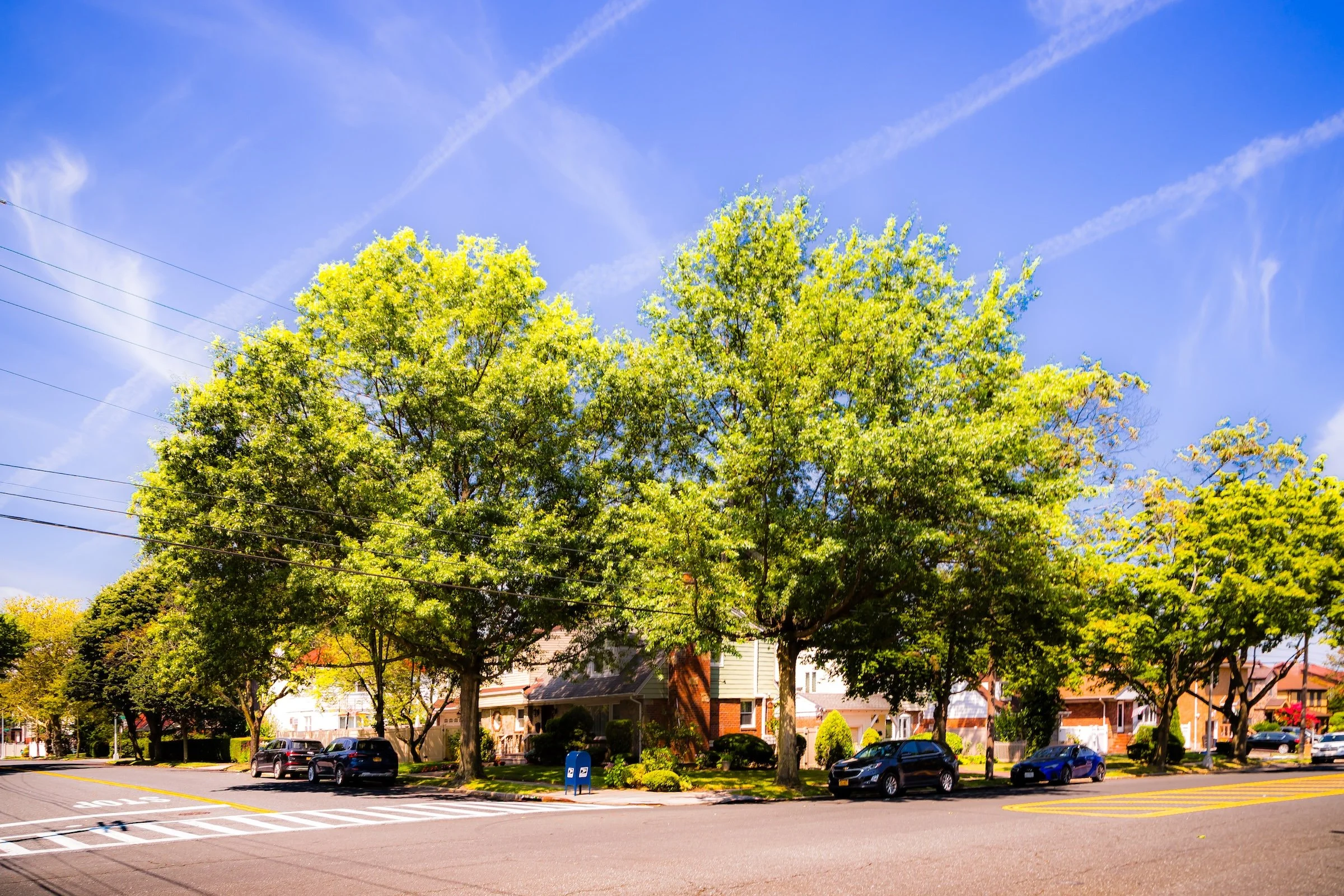
The Openness of Bell Boulevard While much of Bell Boulevard is known for its dense commercial activity, its origin in Hollis Hills preserves a legacy of spaciousness and quiet residential grandeur. During my 2023 documentation, I focused on how this wide corridor serves as a sun-drenched "spine" for the community's elevated landscape.
Photographer's Insight:
The Scale of the Sky: I sought to capture the "open sky" quality that defines this stretch of the boulevard. In “Bell At 86th,” the vast blue expanse and the way the sun catches the upper reaches of a massive, yellow-green tree emphasize the neighborhood's suburban, airy spirit.
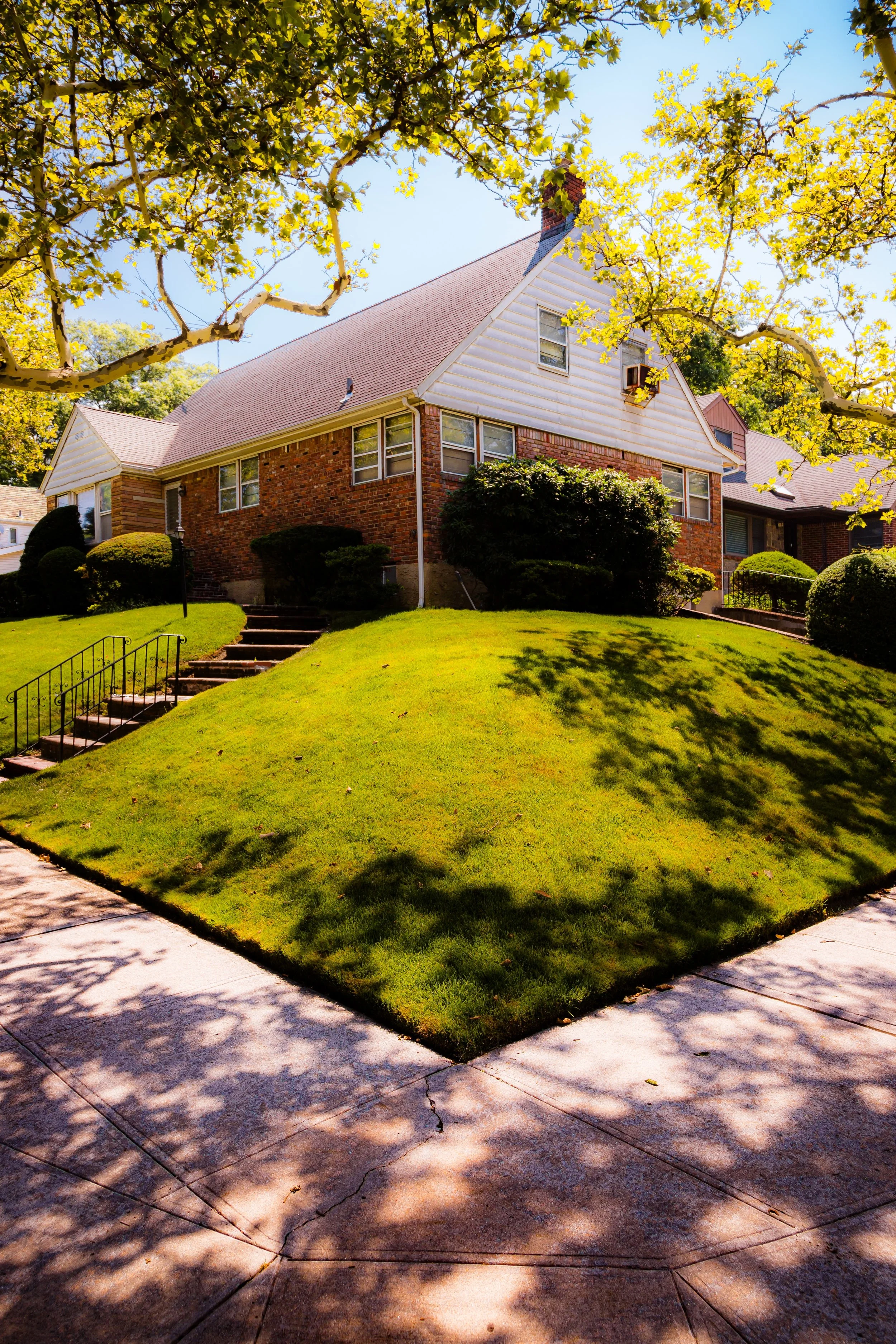
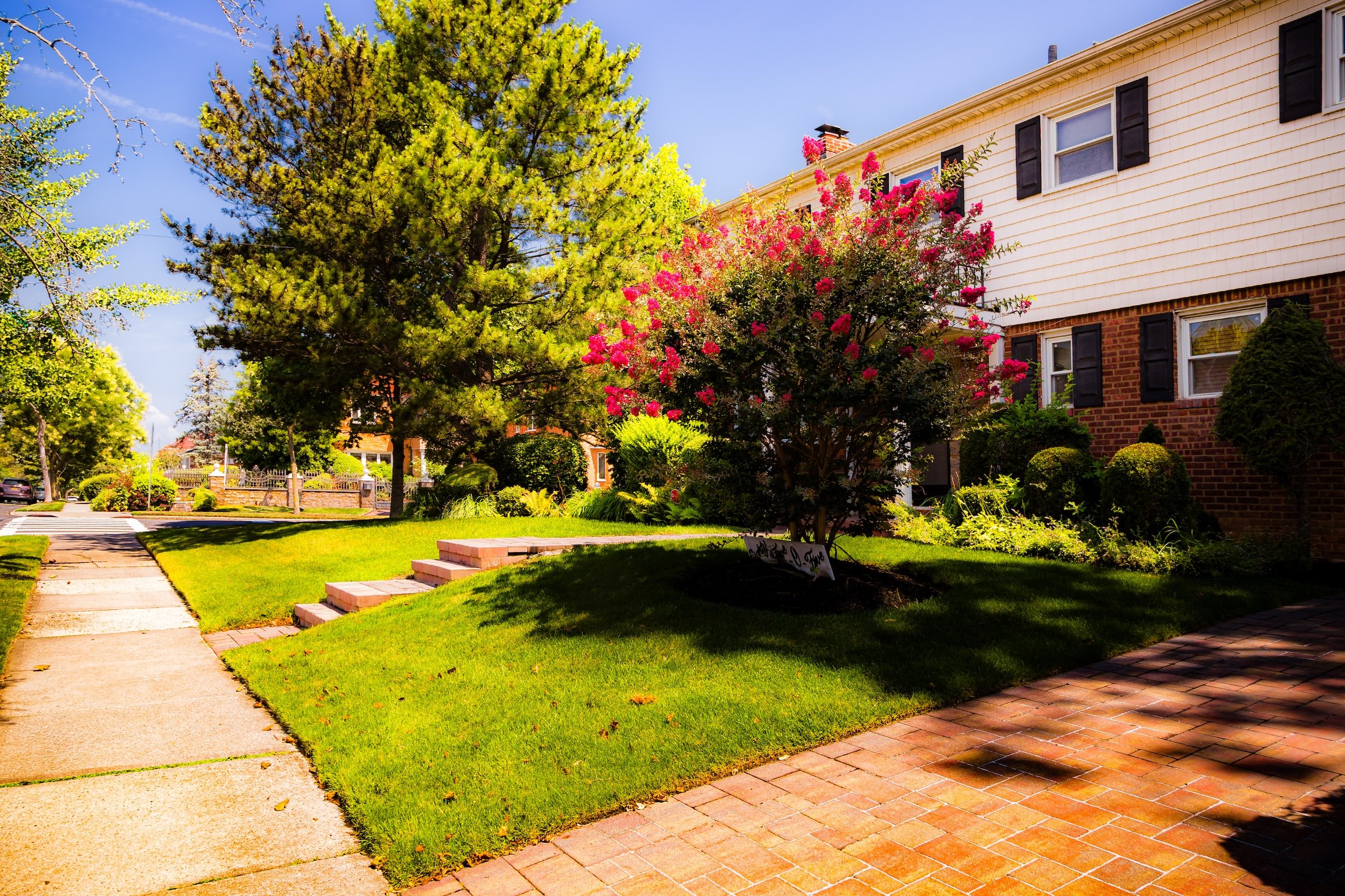
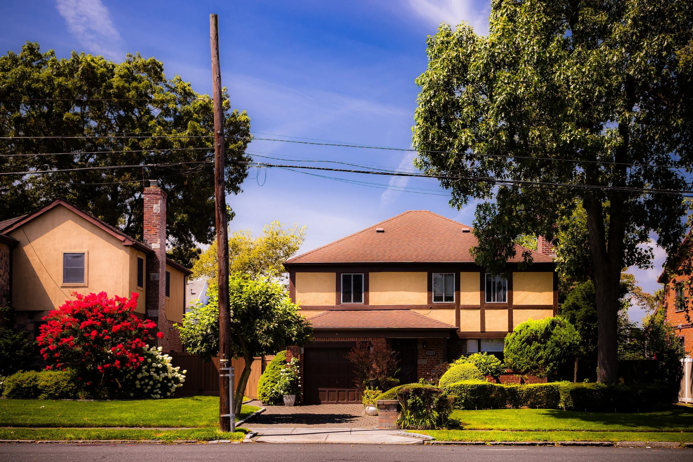
Architectural Lighting: The late-morning sun provided a perfect "key light" for the varied housing stock. I documented how the light plays across different textures—from the vibrant pink blossoms of a manicured garden (see “Bell Sidewalk”) to the classic brick and siding of a hillside home (see “Corner Portrait At 80-55 Bell”). These shots illustrate a legacy of meticulous stewardship that is a hallmark of the area.
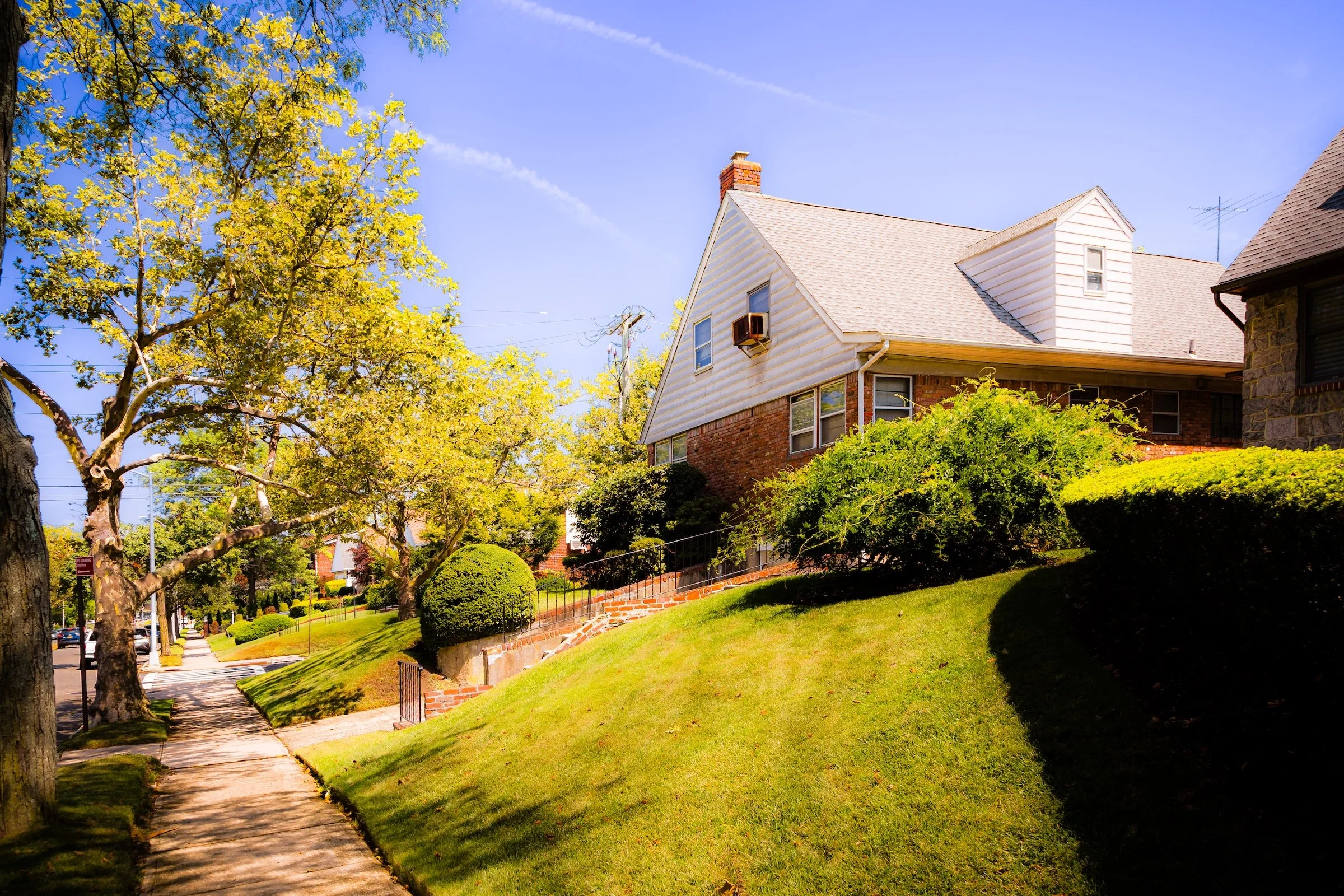
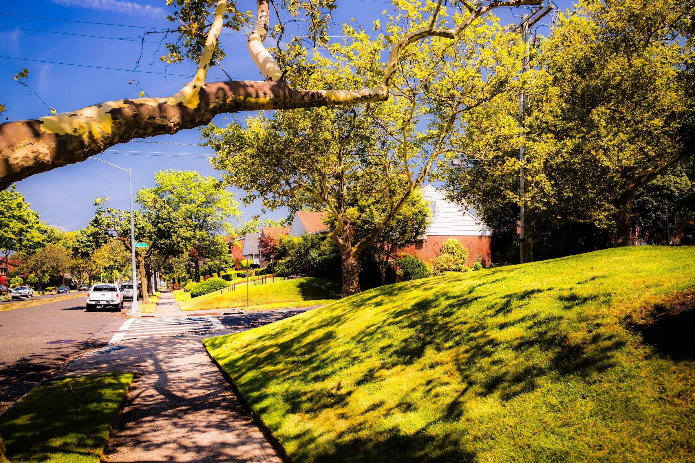
Elevated Perspectives: Because Hollis Hills lives up to its name, the changing elevation creates unique visual angles. Shooting from the sidewalk in “Tree Branch & Shade,” I captured how the sweeping shadows of mature trees stretch across the emerald-green lawns, creating a rhythmic pattern that guides the eye up toward the serene residential blocks above the boulevard.
Spirit and Legacy
Hollis Hills’ spirit is defined by harmony—between architecture and nature, tradition and adaptation, city and suburb. It embodies the 20th-century dream of a garden community within New York: a place where families could build lasting lives amid greenery and civic stability. The neighborhood’s name has always suited it perfectly—a crest of hills at the city’s edge, serene yet deeply connected to the borough that surrounds it.
Hollis Hills Field Notes
-
Field Note: August 5, 2023 | 1:20 AM
Conditions: 78°F | Humidity: 61%.
The atmosphere was transitioning into a drier, breezier state. This shift allowed for crisp, high-contrast shots of the manicured lawns and mid-century facades, with the brilliant August sunshine emphasizing the neighborhood's tranquil, suburban character.
Hollis Hills revealed a different side of Bell Boulevard, far removed from the commercial bustle found further north. Here, the boulevard’s wide lanes allow the sky to open up, and on this day, a brilliant late-morning sun cast everything in a high-contrast glow. I was struck by the "openness" of the landscape; the way the light saturates the rolling lawns and makes the suburban architecture feel almost cinematic (see “Tree Branch & Shade”).
Other neighborhoods visited:
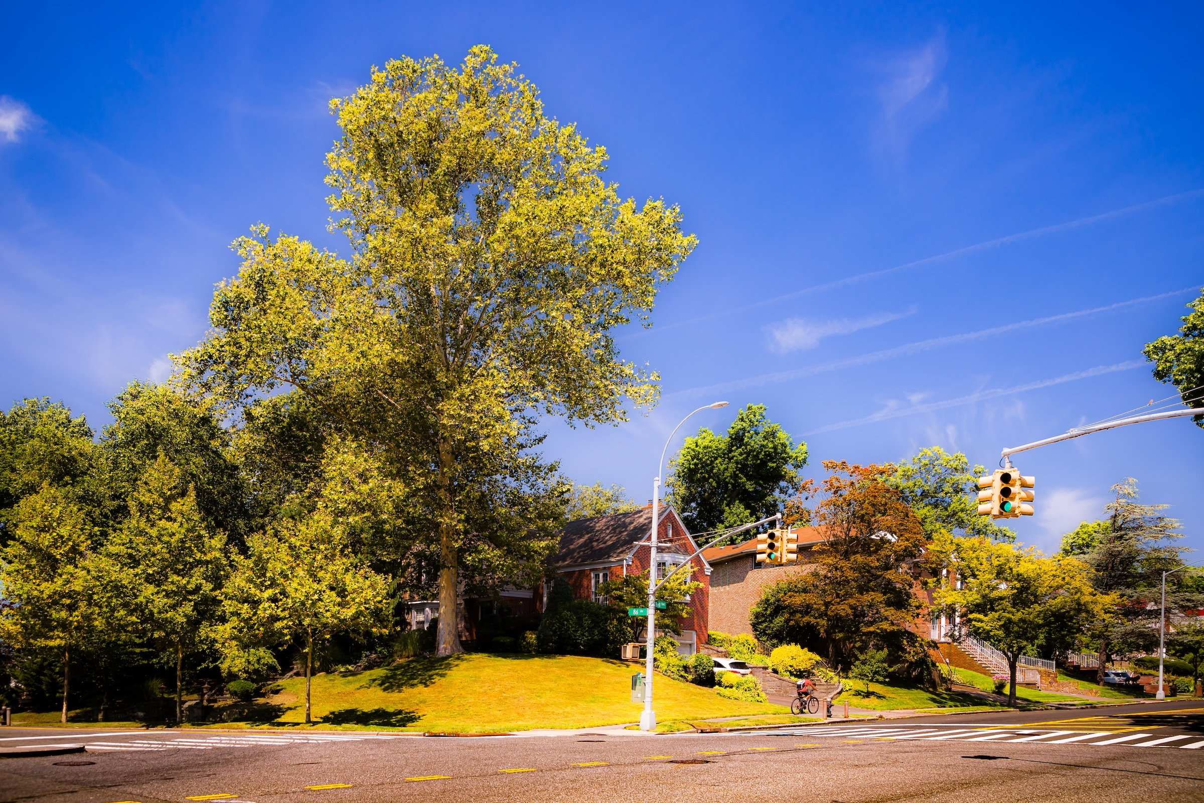
Bell At 86th - Click To Purchase Print
Bell Sidewalk - Click To Purchase Print
Tree Branch & Shade - Click To Purchase Print

Corner Portrait At 80-55 Bell - Click To Purchase Print
80-28 Bell - Click To Purchase Print
Use this custom Google map to explore where every neighborhood in all five boroughs of New York City is located.
The Five Boroughs
One of New York City’s unique qualities is its organization in to 5 boroughs: Manhattan, Brooklyn, Queens, The Bronx, and Staten Island. These boroughs are part pragmatic administrative districts, and part vestiges of the region’s past. Each borough is an entire county in New York State - in fact, Brooklyn is, officially, Kings County, while Staten Island is, officially Richmond County. But that’s not the whole story …
Initially, New York City was located on the southern tip of Manhattan (now the Financial District) that was once the Dutch colony of New Amsterdam. Across the East River, another city was rising: Brooklyn. In time, the city planners realized that unification between the rapidly rising cities would create commercial and industrial opportunities - through streamlined administration of the region.
So powerful was the pull of unification between New York and Brooklyn that three more counties were pulled into the unification: The Bronx, Queens, and Staten Island. And on January 1, 1898, the City of New York unified two cities and three counties into one Greater City of New York - containing the five boroughs we know today.
But because each borough developed differently and distinctly until unification, their neighborhoods likewise uniquely developed. Today, there are nearly 390 neighborhoods, each with their own histories, cultures, cuisines, and personalities - and each with residents who are fiercely proud of their corner of The Big Apple.


