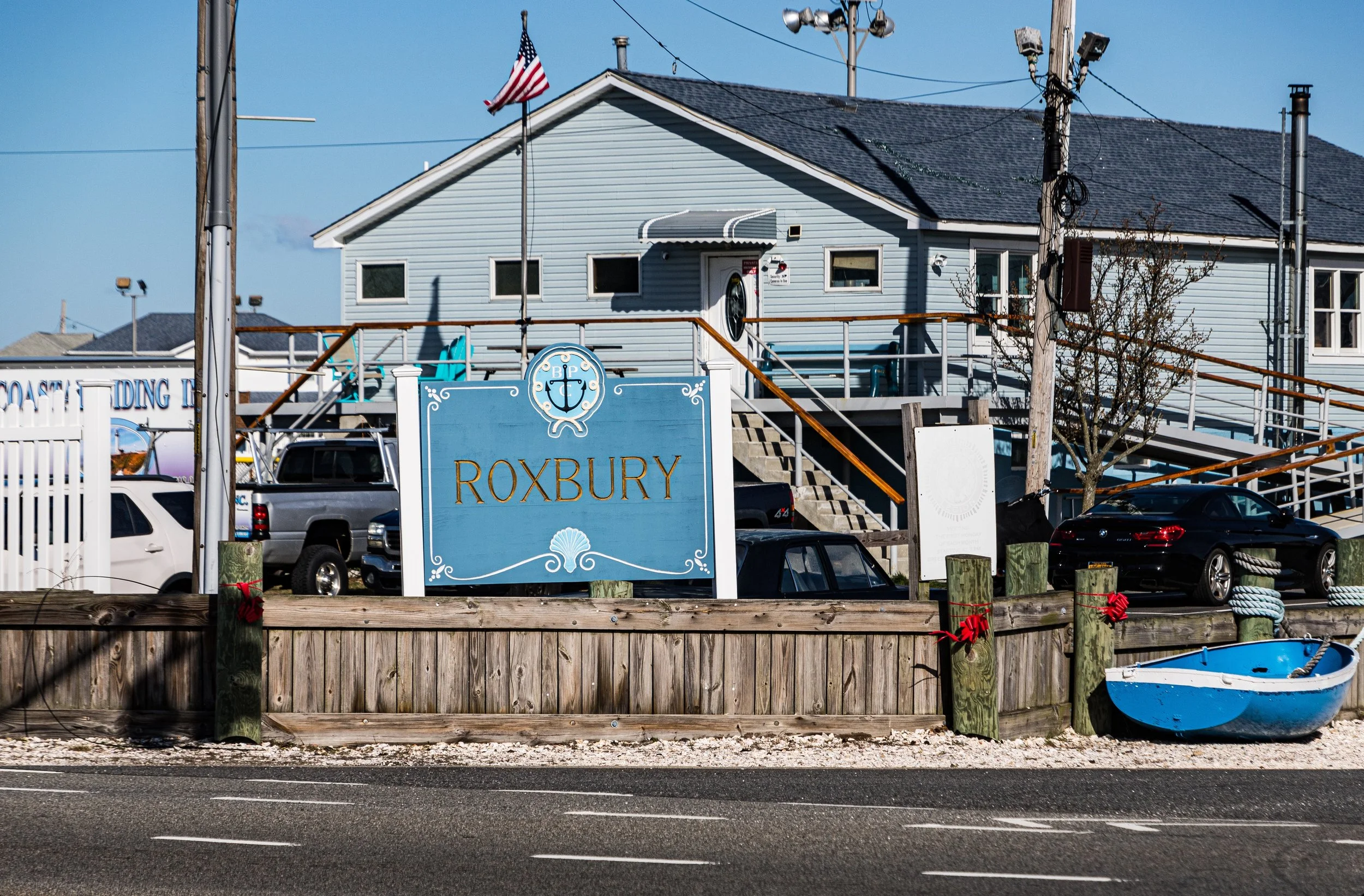
ROXBURY
Queens
Geographic Setting
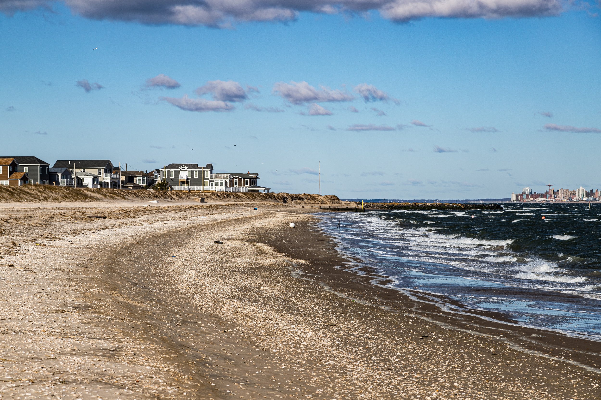
Tucked along the western reaches of the Rockaway Peninsula, Roxbury is one of New York City’s most secluded seaside enclaves. It lies between Fort Tilden to the west and Jacob Riis Park to the east, bordered by the Atlantic Ocean on the south and the Jamaica Bay inlet on the north. Enclosed within the Gateway National Recreation Area, the community occupies a narrow finger of land accessible primarily via Rockaway Point Boulevard, near Marine Parkway Bridge.
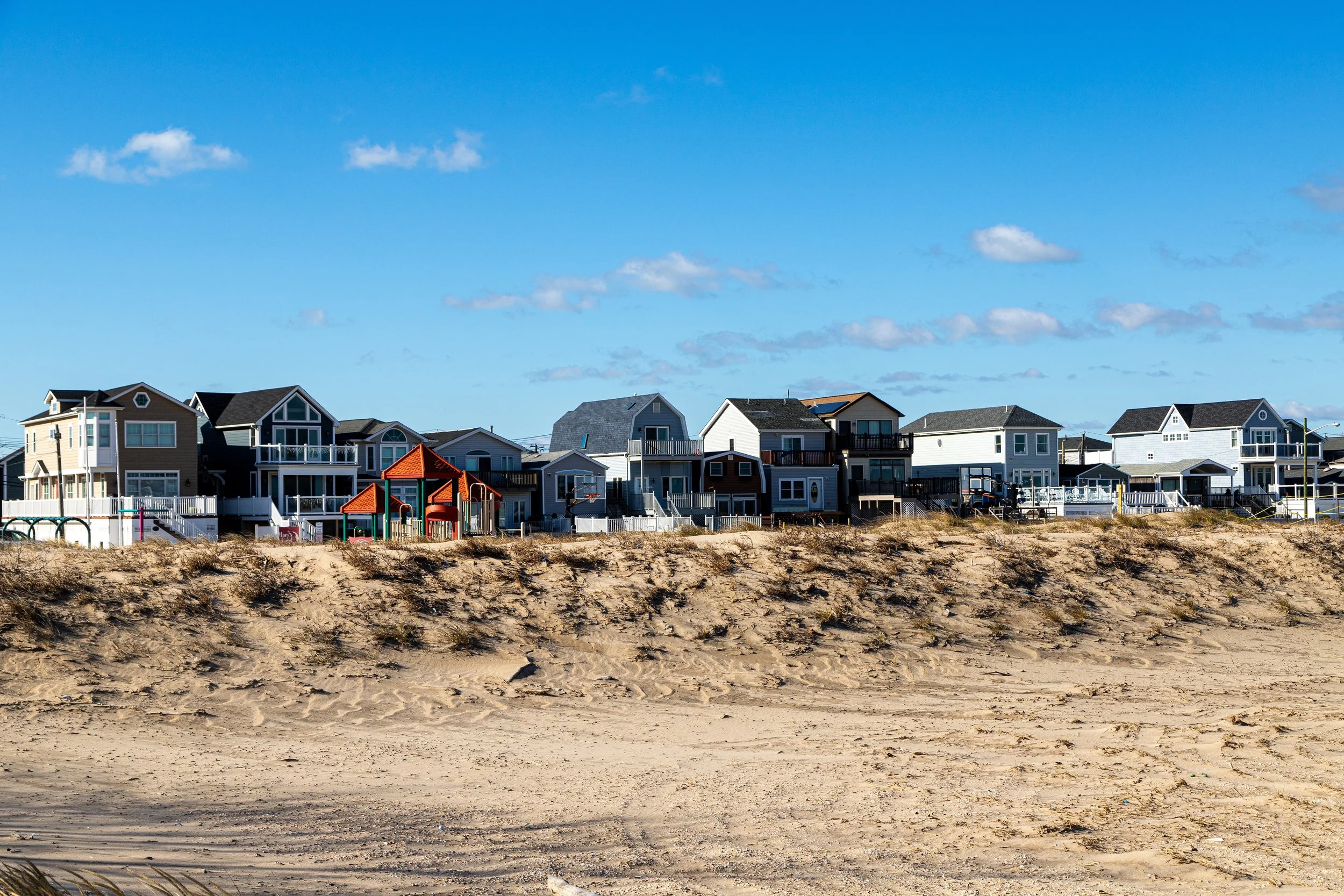
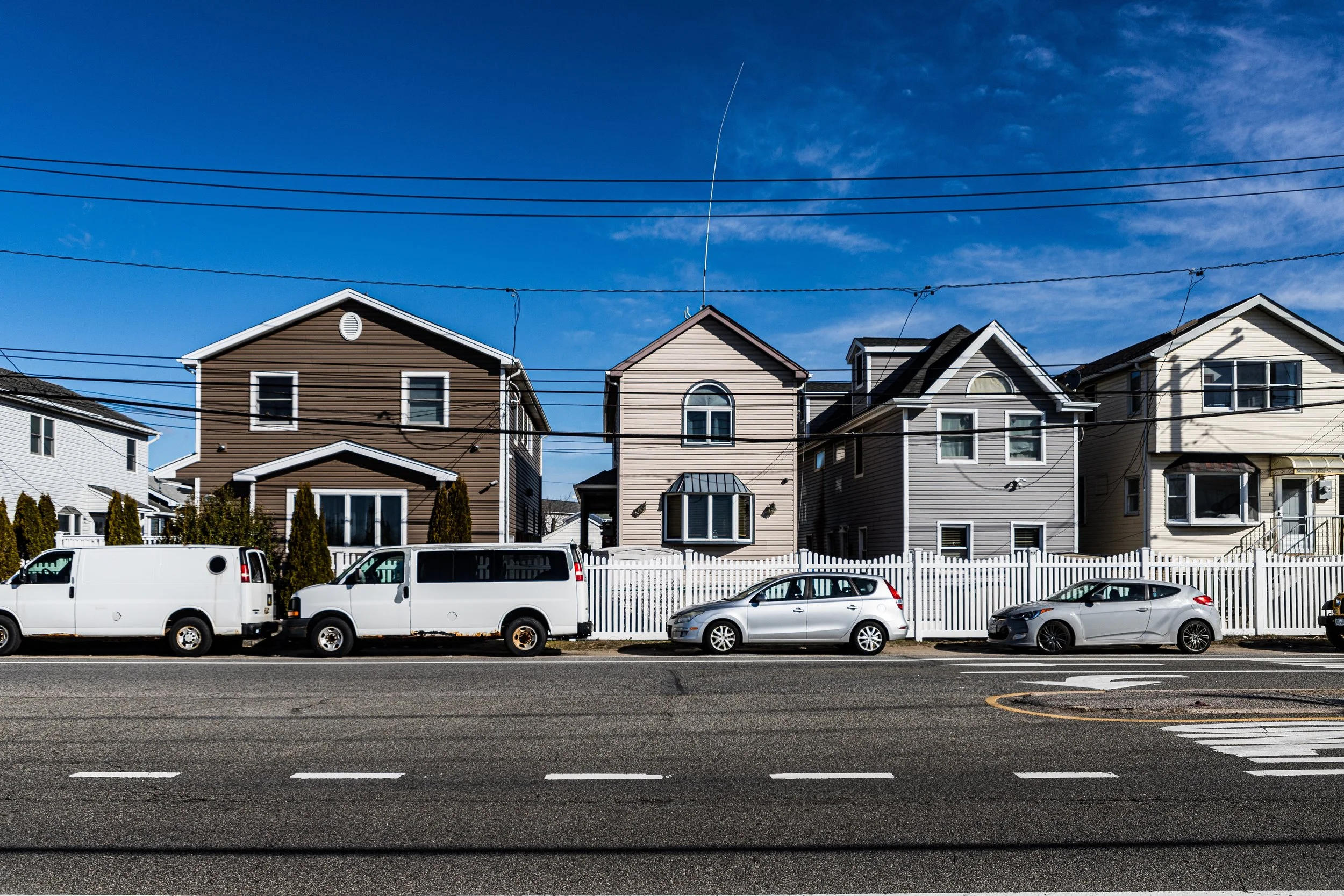
Roxbury’s layout is compact—a few dozen blocks of one-story bungalows and modest homes set close together, many clad in shingles or vinyl siding weathered by salt air. The grid converges around Beach 169th Street and Rockaway Point Boulevard, where the local volunteer firehouse, community hall, and small church form the civic core. To the south, the dunes rise gently toward the ocean; to the north, the calm waters of Jamaica Bay glint beyond the marsh grasses. With its sandy lanes, hand-painted signs, and ever-present sea breeze, Roxbury feels worlds removed from the city around it—an island within an island.
Etymology and Origins
The name “Roxbury” likely echoes Roxbury, Massachusetts, a colonial-era district of Boston, reflecting the New England roots of some of the area’s early visitors. The settlement dates to the early 1900s, when Rockaway Point was still largely undeveloped scrubland dotted with fishing shacks. In 1917, the Roxbury Realty Company subdivided the land into narrow plots and began selling leases for small seasonal cottages, marketing the area as a “breezy haven by the sea.” Its isolation—bounded by military installations at Fort Tilden and the waters of Jamaica Bay—made it a perfect refuge for families seeking simplicity and community.
For much of its early history, Roxbury was reachable only by private road and ferry. Its remoteness fostered self-sufficiency, and its residents—largely Irish and working-class New Yorkers—built their own docks, roads, and fire service. The Roxbury Volunteer Fire Department, established in the 1920s, remains one of the last volunteer companies operating within New York City limits.
The Neighborhood
Early–Mid 20th Century: A Bungalow Colony by the Sea
From the 1920s through the 1940s, Roxbury thrived as a summer colony. Rows of modest wooden bungalows, often just two or three rooms each, filled the sand lots between the bay and ocean. Most were built by hand by their owners, who hauled lumber across bridges or arrived by barge. These cottages, passed down through generations, embodied the working-class vacation dream: affordable, communal, and close to the surf.
The proximity of Fort Tilden, established in 1917 and later expanded during World War II as part of the city’s coastal defense network, gave Roxbury a curious dual character—half seaside village, half military neighbor. The rhythmic sound of artillery drills once echoed across the dunes, and soldiers frequented the local taverns during off-duty hours. After the war, the base remained active through the Cold War before transitioning into parkland under the National Park Service (1974).
Roxbury’s residents—many of them city firefighters, police officers, and transit workers—formed a tightly knit community that prized self-reliance and tradition. Streets bore familiar Irish names, front porches hosted nightly gatherings, and annual block parties stitched the social fabric. The enclave’s small size fostered a sense of mutual caretaking rare even in outer-borough neighborhoods.
Late 20th Century: Permanence and Preservation
By the 1960s and 1970s, as nearby sections of the Rockaways saw large-scale urban renewal and high-rise development, Roxbury remained remarkably unchanged. Many families converted their summer bungalows into year-round homes, insulating and winterizing them while retaining their compact footprint. The community’s cooperative ownership structure—each household holding shares in the Roxbury People’s Cooperative, which collectively leases the land from the city—further reinforced its insularity and stability.
This system, along with geographic isolation and limited access, protected Roxbury from speculative real estate pressures. It also cultivated a strong local identity sometimes described as “small-town Ireland by the sea.” Even as city demographics shifted dramatically in the late 20th century, Roxbury’s population remained consistent, sustained by intergenerational ties and deep-rooted neighborhood institutions such as the Roxbury Catholic Club, the Roxbury Volunteer Fire Department, and the Roxbury Memorial Day Parade, which dates back to the 1940s.
Roxbury Video Coming Soon
21st Century: Survival and Renewal
The new century brought both challenge and reaffirmation. Hurricane Sandy (2012) dealt a devastating blow to Roxbury, flooding nearly every home and destroying the community’s electrical and water systems. Yet the recovery was swift and collective—residents rebuilt their homes, elevated structures, and repaired infrastructure largely through volunteer labor and mutual aid. The sense of solidarity forged in the aftermath became a defining moment in Roxbury’s history.
Today, Roxbury stands rebuilt and revitalized. The bungalows—many now modernized with stilts and new siding—still line sandy lanes that open toward the sea. Community traditions continue unabated: summer barbecues, beach cleanups, and volunteer fire department fundraisers remain calendar highlights. Although part of the Gateway National Recreation Area, Roxbury retains local autonomy in managing its affairs, balancing environmental stewardship with its century-old sense of belonging.
Younger generations, often descendants of the original homeowners, have returned, restoring cottages and sustaining the enclave’s continuity. Meanwhile, the broader Rockaway renaissance—surfing, arts festivals, and boardwalk culture—has brought renewed appreciation for this hidden hamlet’s authenticity.
Roxbury Photo Gallery
Spirit and Legacy
Roxbury’s spirit lies in its constancy—its ability to preserve simplicity in a city defined by change. The sound of waves crashing against the dunes, the sight of American flags fluttering over sun-worn porches, and the glow of porch lights on summer evenings evoke a rhythm older than the metropolis itself. Here, the ideals of self-reliance, neighborliness, and place endure unbroken, carried through generations bound by sea, sand, and memory.
New York City
Use this custom Google map to explore where every neighborhood in all five boroughs of New York City is located.
The Five Boroughs
One of New York City’s unique qualities is its organization in to 5 boroughs: Manhattan, Brooklyn, Queens, The Bronx, and Staten Island. These boroughs are part pragmatic administrative districts, and part vestiges of the region’s past. Each borough is an entire county in New York State - in fact, Brooklyn is, officially, Kings County, while Staten Island is, officially Richmond County. But that’s not the whole story …
Initially, New York City was located on the southern tip of Manhattan (now the Financial District) that was once the Dutch colony of New Amsterdam. Across the East River, another city was rising: Brooklyn. In time, the city planners realized that unification between the rapidly rising cities would create commercial and industrial opportunities - through streamlined administration of the region.
So powerful was the pull of unification between New York and Brooklyn that three more counties were pulled into the unification: The Bronx, Queens, and Staten Island. And on January 1, 1898, the City of New York unified two cities and three counties into one Greater City of New York - containing the five boroughs we know today.
But because each borough developed differently and distinctly until unification, their neighborhoods likewise uniquely developed. Today, there are nearly 390 neighborhoods, each with their own histories, cultures, cuisines, and personalities - and each with residents who are fiercely proud of their corner of The Big Apple.


