
KEW GARDENS
Queens
Part of an ongoing project to walk and photograph every neighborhood in New York City, this page explores Kew Gardens through history, fieldwork, and photography.

Map
Geographic Setting
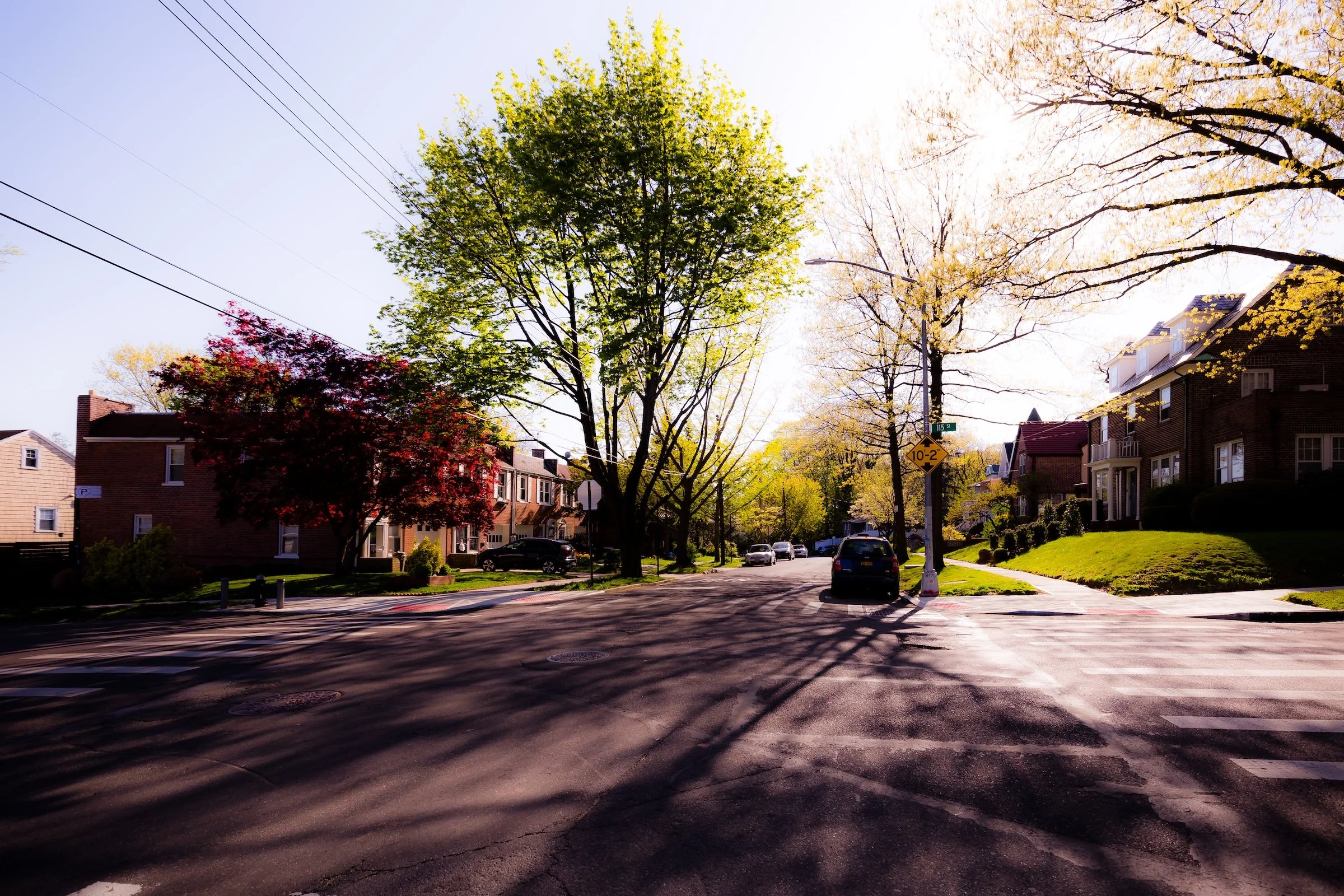
Bounded by the Van Wyck Expressway to the east, Hillside Avenue to the south, Babbage Street to the west, Forest Park to the northwest, and Union Turnpike to the north, Kew Gardens occupies a gently rolling landscape in central Queens—an elegant, self-contained neighborhood shaped by early 20th-century ideals of suburban planning. Set between Jamaica and Forest Hills, it is a place where winding roads, mature trees, and distinctive architecture create a tranquil enclave amid the borough’s urban bustle.
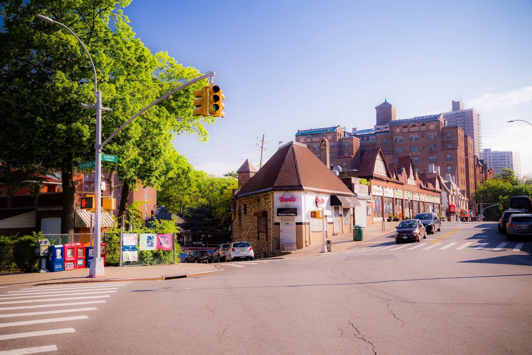
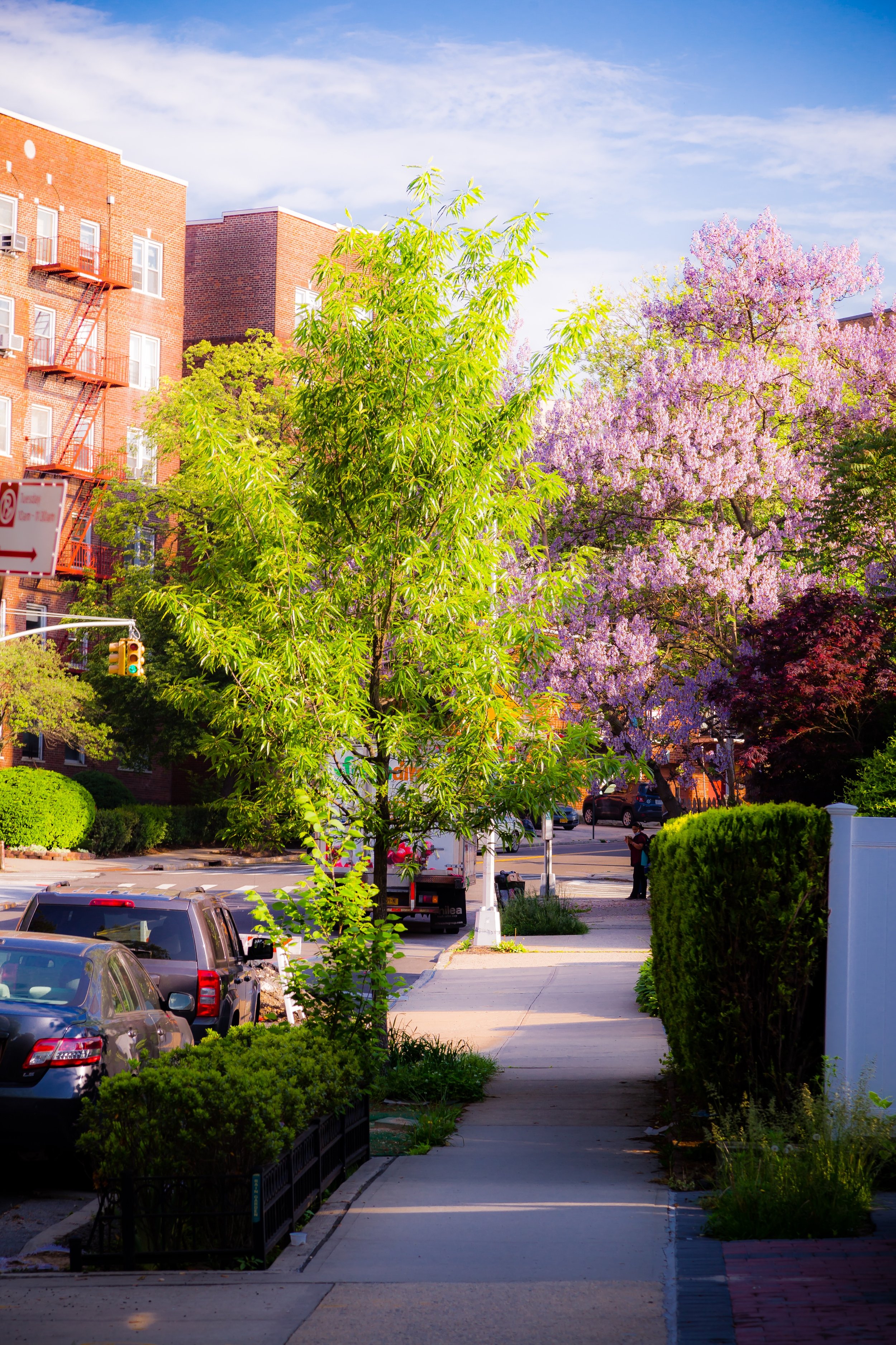
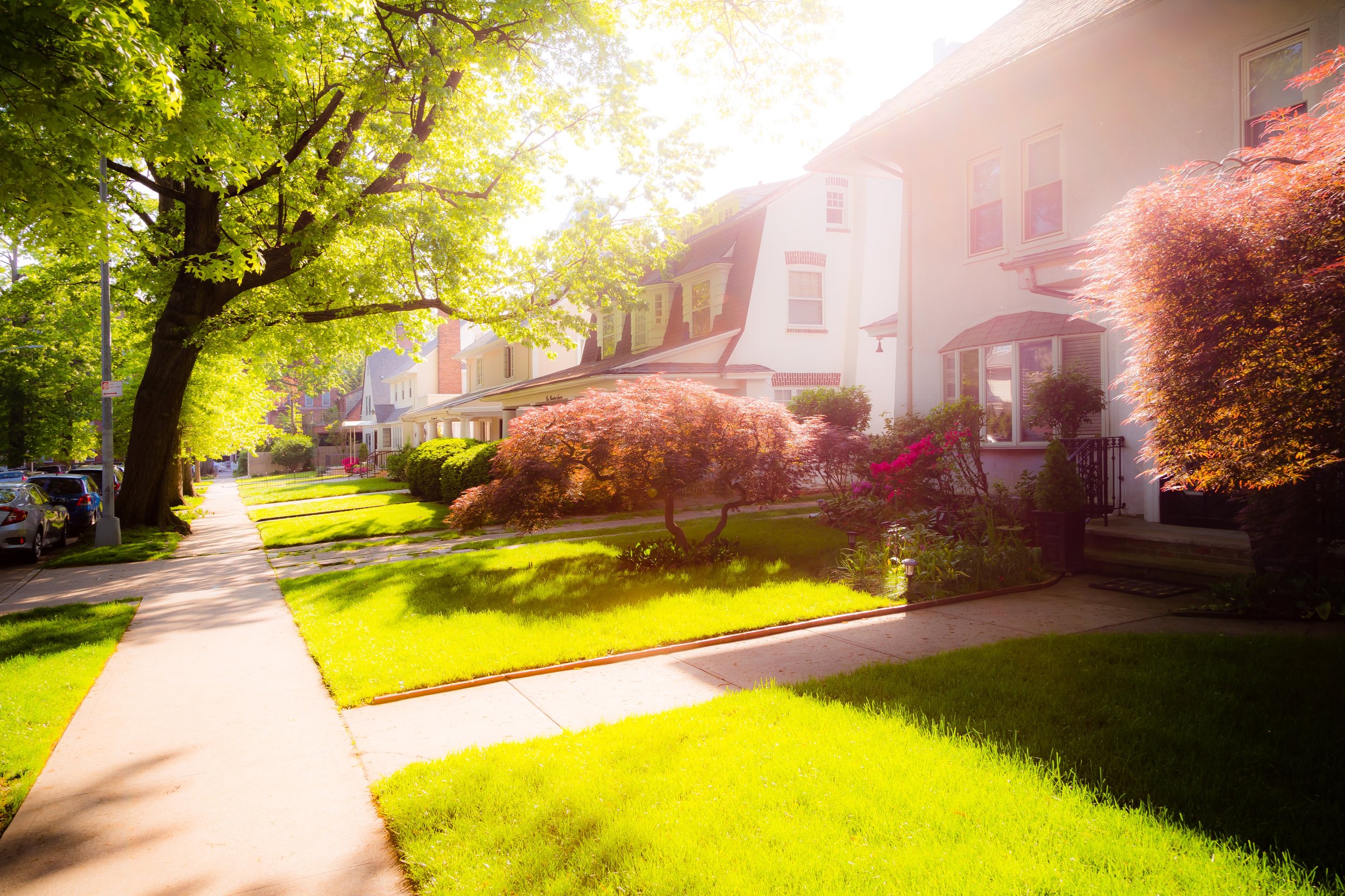
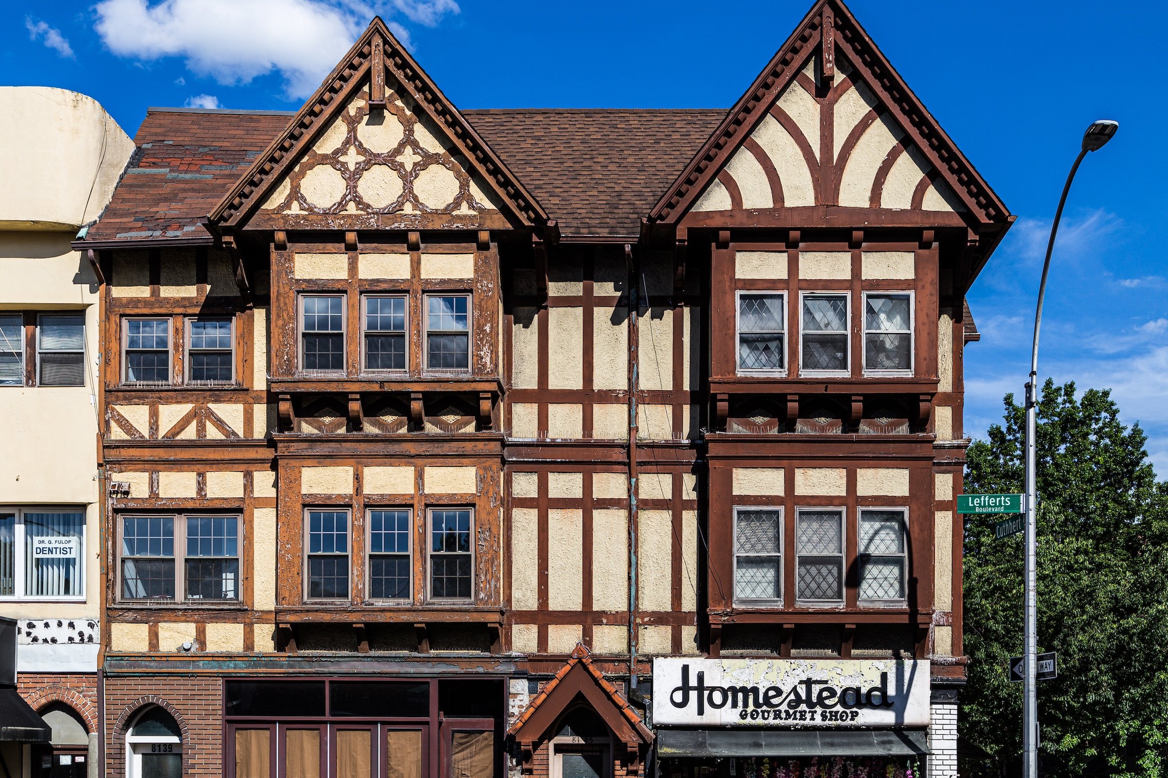
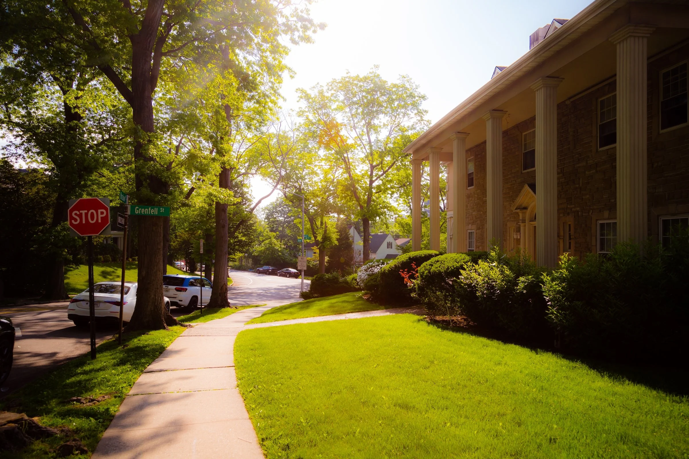
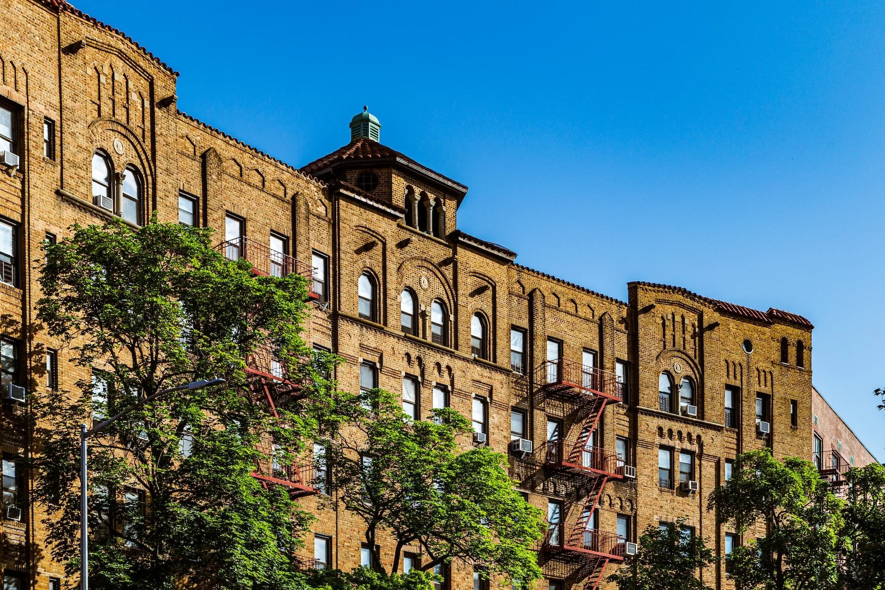
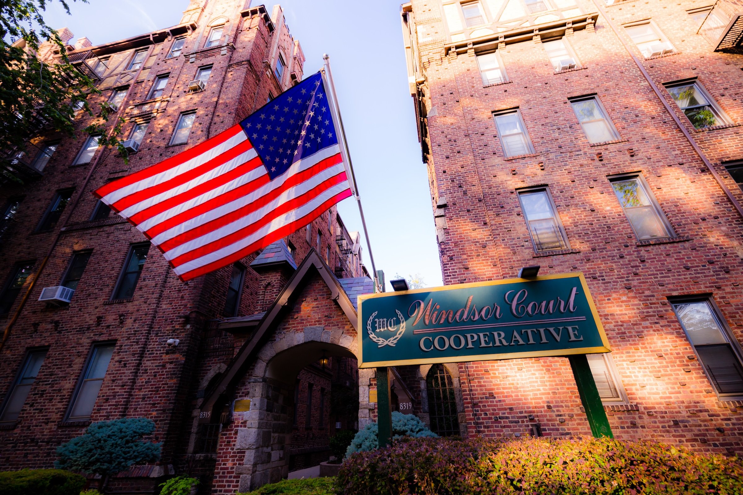
The neighborhood’s internal plan—defined by curving streets such as Metropolitan Avenue, Lefferts Boulevard, and Audley Street—was laid out to follow the area’s natural topography rather than the rigid city grid. Residential blocks of Tudor, Colonial, and Spanish Revival homes are interspersed with low-rise co-op buildings and prewar apartment houses, giving Kew Gardens a village-like scale and diversity of form. Lefferts Boulevard serves as the neighborhood’s main commercial spine, its shops, cafés, and small businesses gathered around the Kew Gardens LIRR Station, a stone-and-timber landmark that anchors the community both physically and historically. To the north, the forested slopes of Forest Park provide green refuge, while Union Turnpike and the Van Wyck Expressway connect Kew Gardens to the city beyond without compromising its residential calm.
Identity
Etymology and Origins
The name “Kew Gardens” was inspired by the famed Royal Botanic Gardens at Kew in London, reflecting the developers’ intention to evoke pastoral beauty and refinement. The neighborhood was founded in 1909 by Alrick Man, a lawyer and developer who envisioned a “garden suburb” for New York’s emerging professional class. His Kew Gardens Corporation purchased more than 500 acres of rolling farmland that had belonged to the Lefferts family—descendants of one of Queens’ oldest Dutch colonial settlers—and began transforming it into a carefully planned community that balanced nature, architecture, and accessibility.
From its inception, Kew Gardens was shaped by the Garden City movement, emphasizing curvilinear streets, landscaped medians, and architectural harmony. Strict deed restrictions governed building height, materials, and setbacks, ensuring that no structure would disrupt the neighborhood’s semi-rural aesthetic. The layout intentionally preserved trees and natural contours, while large lots and cohesive architectural styling created the sense of a unified, park-like district within the expanding metropolis.
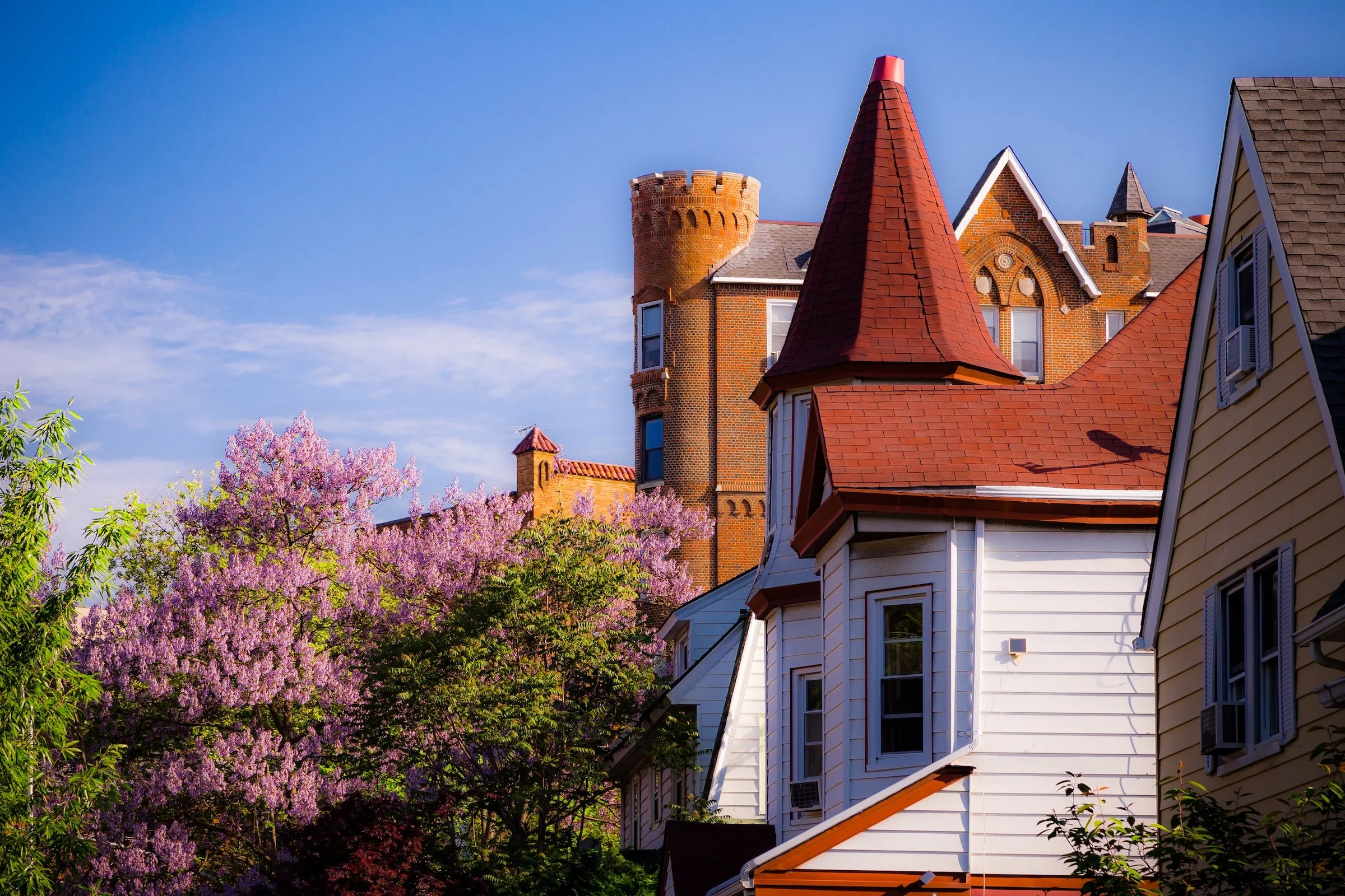
Often described as a "hidden English village," Kew Gardens is a charming, leafy enclave defined by its pre-war apartment houses and quiet, winding mews. Anchored by its historic LIRR station and the expansive greenery of Forest Park, the neighborhood offers a sophisticated, low-key residential atmosphere that prioritizes community quietude and architectural character.
Neighborhood Identity
The Visual Identity of Kew Gardens
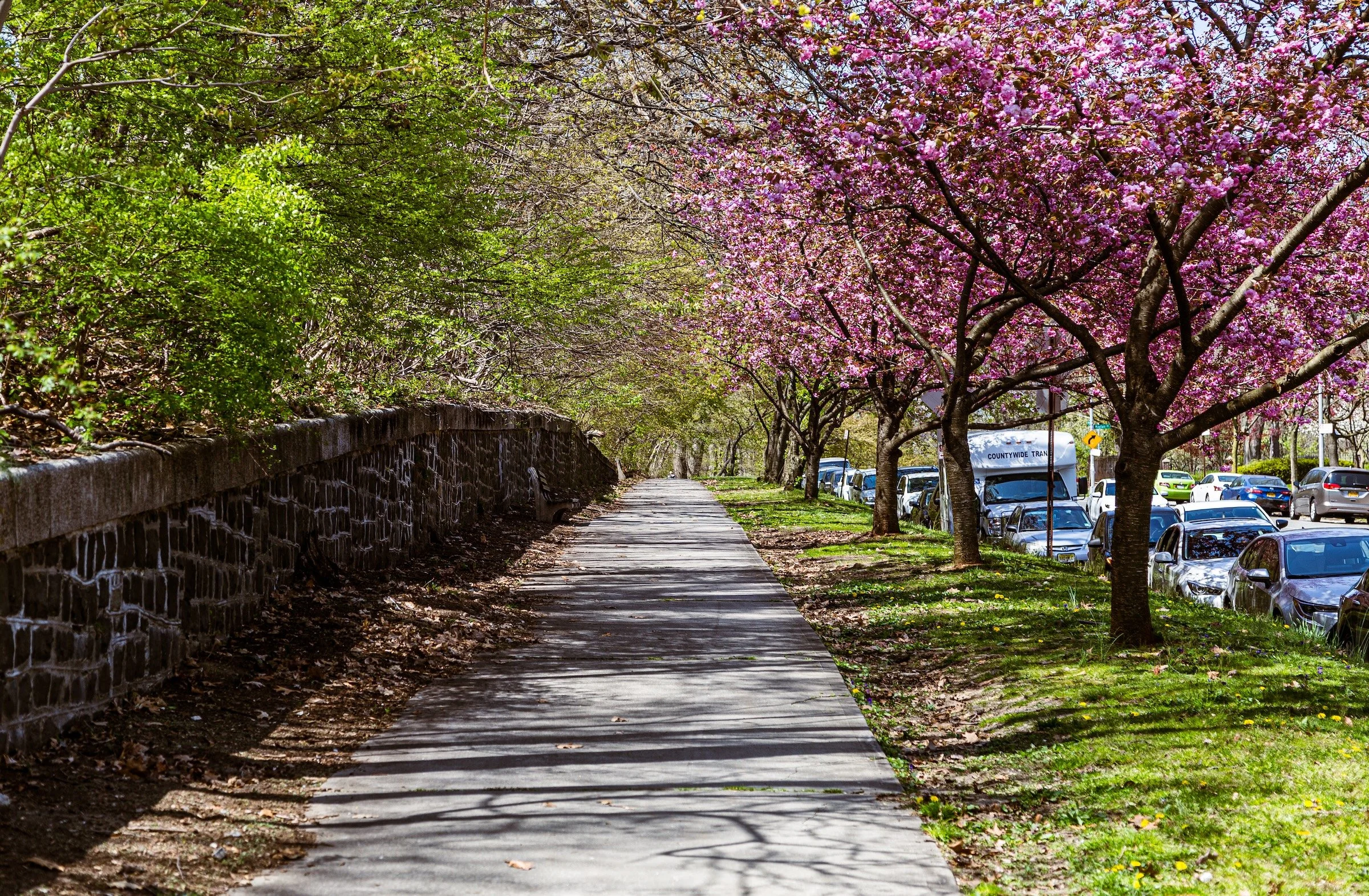
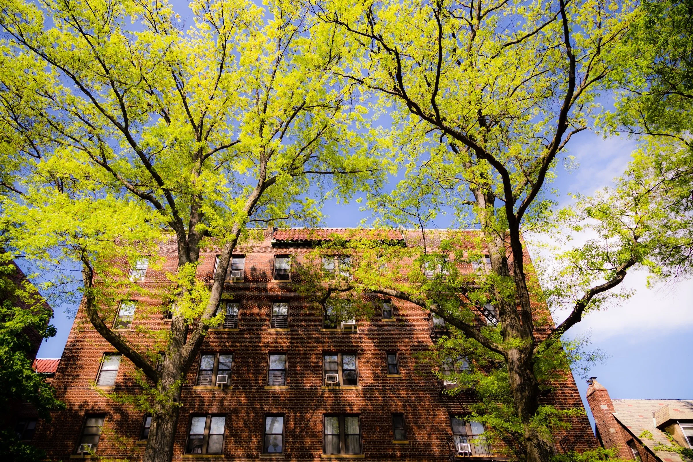
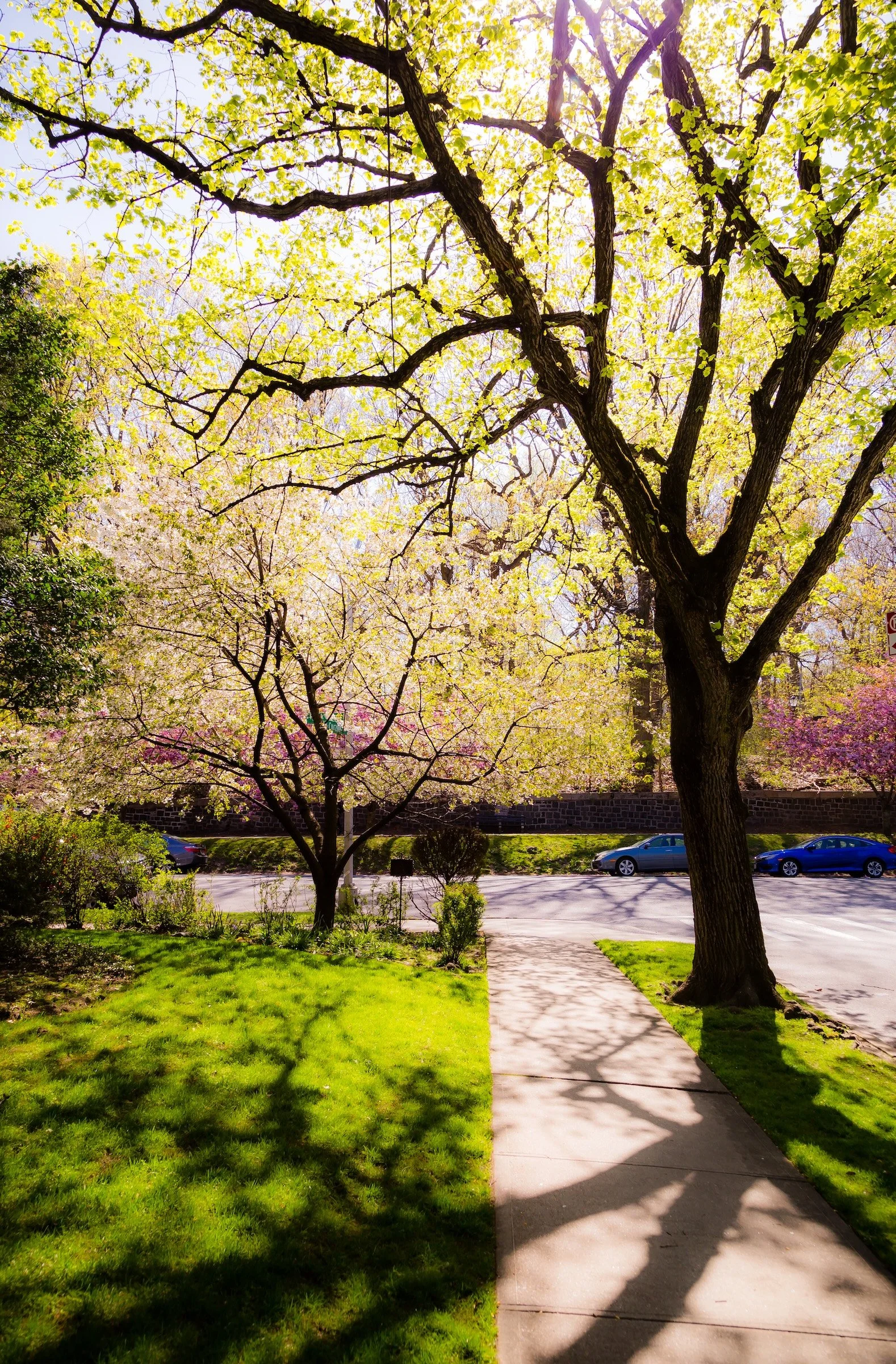
The Kew Gardens visual experience is one of quiet drama and cultivated calm. Light softens brick and greenery into painterly scenes, while bare branches, shifting shadows, and vivid sky create moments of contrast and depth. What makes the neighborhood visually distinctive is the balance it sustains between softness and structure: leafy and architectural, tranquil and alive, intimate yet quietly theatrical.
Throughout the neighborhood, that balance takes form in recurring visual patterns. Sunlight turns walls, roofs, and treetops into fields of color and glow; branches cast shadow-lines that animate sidewalks and lawns; and moments of sharp contrast lend even calm residential streets a surprising sense of intensity. The result is a visual identity shaped not by spectacle, but by atmosphere—by the steady interplay of light, shadow, color, and texture across a neighborhood that reveals its character gradually, and with remarkable grace.
History
18th–19th Century: Rural Interior, Estate Lands, and Early Connections
Long before Kew Gardens emerged as a named residential neighborhood, the area formed part of the wooded and hilly interior of central Queens, lying north of the older settlement corridors that developed along Jamaica Avenue. In the nineteenth century, much of this land came under the control of Albon P. Man, an English-born lawyer and developer whose holdings extended across a broad swath of what would later become Kew Gardens and surrounding areas. While more intensive development took hold farther south, the higher ground to the north remained comparatively open, marked by woods, rolling terrain, and the kind of semi-rural expansiveness that survived in central Queens well into the late nineteenth century.
A major early institutional presence arrived with Maple Grove Cemetery, established in 1875 along what is now Kew Gardens Road. That same year, a Long Island Rail Road stop known as Hopedale was created nearby, initially serving cemetery visitors and mourners. The station took its name from Hopedale Hall, a local hotel at the junction of what are now Queens Boulevard and Union Turnpike. These features gave the area one of its first consistent points of identity and connection, even while it remained far from urbanized. By the 1890s, the executors of the Man estate had also laid out the Queens Bridge Golf Course across the hilly land south of the railroad, signaling an intermediate phase in which the landscape was no longer simply rural, but not yet suburban in the modern sense either.
Early–Mid 20th Century: A Planned Garden Neighborhood Takes Form
The decisive transformation of Kew Gardens came in the early twentieth century. In 1908, the Long Island Rail Road shifted its main line roughly 600 feet south in order to eliminate a curve, a move that changed the physical logic of the area and opened land for more deliberate development. In 1910, property from the old Man estate began to be sold off in pieces, and within a few years streets were extended, land was graded, and water and sewer infrastructure was installed. It was during this period that the district took on the name Kew Gardens, consciously evoking the Royal Botanic Gardens in London and positioning the new community within the broader early-twentieth-century ideal of the planned garden suburb.
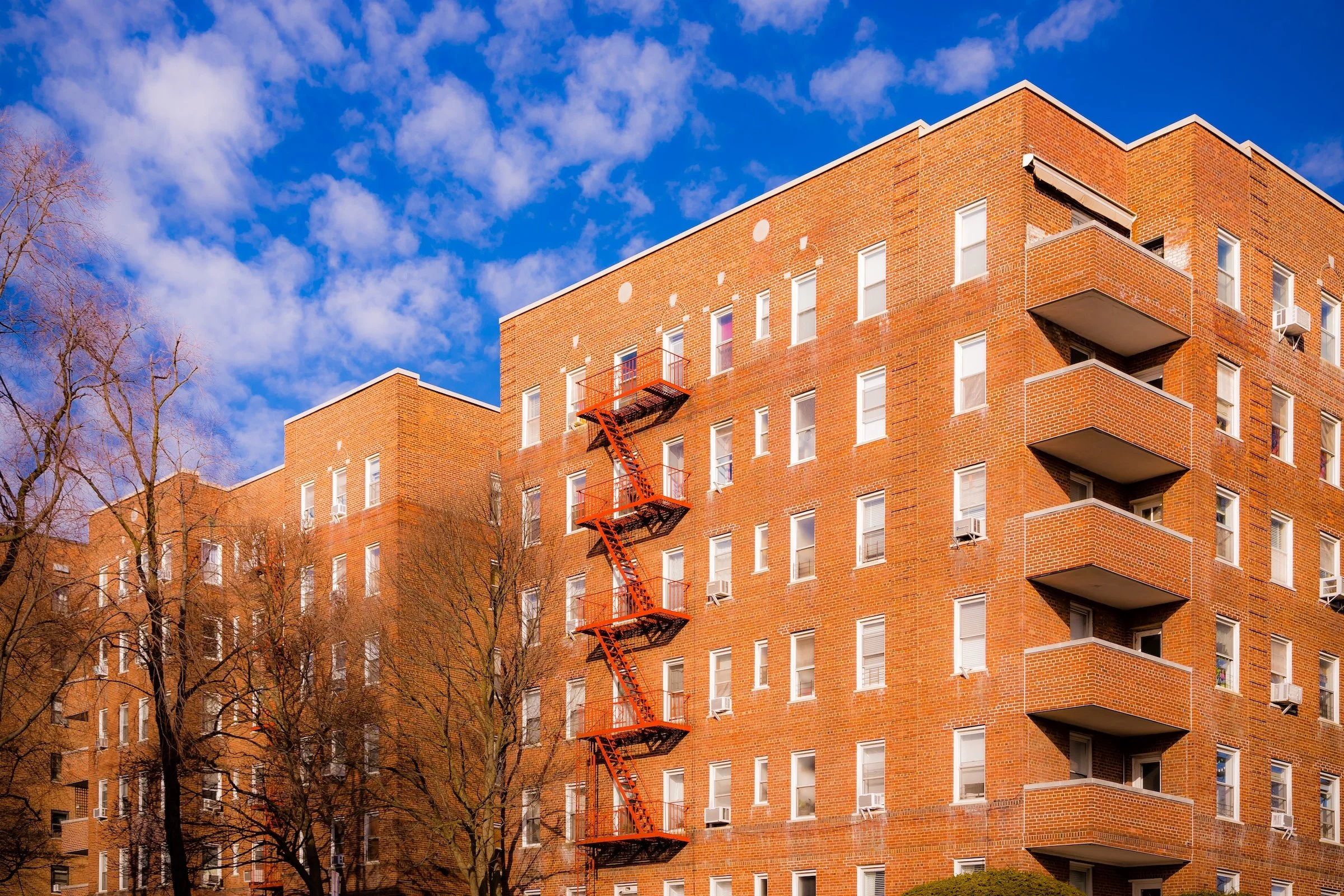
The neighborhood that followed was neither accidental nor generic. Kew Gardens was one of several planned garden communities developed in Queens between the late nineteenth century and the mid-twentieth century, but it acquired a particularly distinctive identity through its architecture and layout. English-inspired and neo-Tudor forms became part of the area’s visual language, and the early decades of growth established many of the buildings that still define its character today. The Kew Bolmer, often cited as the first apartment building in the neighborhood, was erected in 1915 at 80-45 Kew Gardens Road. A clubhouse followed in 1916, the Kew-Forest School opened in 1918, and the Kew Gardens Inn began receiving guests in 1920 near the railroad station. Through the 1920s, detached homes, apartment houses, and residential courts expanded across the neighborhood, giving Kew Gardens the cultivated, somewhat sheltered residential texture that still distinguishes it.
This early suburban vision was reinforced in the 1930s and 1940s by major civic and transportation investments. In 1933, the Grand Central Parkway opened through Kew Gardens toward Nassau County; in 1935, the Interboro Parkway—today’s Jackie Robinson Parkway—followed, linking the area westward toward Brooklyn. The extension of the IND Queens Boulevard subway line to Union Turnpike in 1936 greatly strengthened Kew Gardens’ accessibility and tied it more directly to Manhattan and the rest of the growing city. Just a few years later, Queens Borough Hall opened in 1940 on Queens Boulevard, consolidating borough offices and helping establish Kew Gardens as one of Queens’ principal civic centers, not merely a residential enclave.
Late 20th Century: Civic Presence, Architectural Continuity, and Neighborhood Stability
In the decades after World War II, Kew Gardens matured into one of central Queens’ most stable and recognizable neighborhoods. Unlike areas that were radically remade by high-rise superblocks, industrial clearance, or large-scale postwar redevelopment, Kew Gardens retained much of its earlier architectural fabric and residential scale. Apartment buildings continued to line major corridors, especially near Queens Boulevard and the transit spine, while quieter interior streets near Forest Park preserved a more intimate, leafy, and highly textured residential character. This continuity gave the neighborhood an unusual balance: it was deeply connected to the city’s infrastructure and civic life, yet still carried the atmosphere of a composed, planned enclave.
Its identity in the later twentieth century was shaped not only by physical form but also by public institutions and notable residents. The borough-government presence anchored along Queens Boulevard reinforced the neighborhood’s civic weight, while places like Maple Grove Cemetery and the edges of Forest Park gave it older and greener counterpoints. Kew Gardens also became associated with one of its most important residents, Ralph Bunche, the diplomat, United Nations official, and Nobel Peace Prize laureate, whose house on Grosvenor Road later received landmark designation. Bunche’s residence is significant not only for his personal achievements, but for what it suggests about Kew Gardens itself in the mid-century years: it was a neighborhood able to combine prestige, livability, and a degree of integration and openness that was hardly guaranteed elsewhere in the metropolitan region.
Even as Queens diversified and intensified in the second half of the twentieth century, Kew Gardens did not lose its sense of shape. It remained apartment-rich but not overwhelming, civically important but not impersonal, and architecturally varied without dissolving into visual noise. That steadiness became one of its defining strengths. Rather than depending on spectacle or reinvention, Kew Gardens built its identity through preservation of scale, accumulated streetscape detail, and the persistence of a neighborhood form established decades earlier.
21st Century: Preservation, Pressure, and Enduring Character
In the twenty-first century, Kew Gardens has remained one of the most distinctive neighborhoods in central Queens precisely because it has not surrendered its underlying structure. The neighborhood still combines prewar apartment houses, detached homes, institutional buildings, cemetery edges, park access, and strong rail and subway connections within a relatively compact footprint. Its appeal lies in that unusual mixture: it feels connected without being overrun, urban without being harsh, and residential without drifting into suburbia. The visual and civic framework created in the early twentieth century remains clearly legible today.
At the same time, contemporary Kew Gardens is not frozen in amber. Like many New York neighborhoods with attractive housing stock and convenient transit, it faces the pressures of modernization, redevelopment, and rising land values. Newer residential and hotel construction has appeared in parts of the neighborhood, and some detached homes have been altered or replaced. Yet Kew Gardens continues to hold onto the qualities that made it distinctive in the first place: a carefully modulated streetscape, a strong sense of enclosure and greenery, and an architectural identity rooted in prewar planning rather than disposable fashion.
What defines Kew Gardens today is less reinvention than continuity. Its long history—from estate land and cemetery stop, to planned garden suburb, to civic center, to quietly resilient residential neighborhood—remains visible in its streets, institutions, and atmosphere. That continuity gives Kew Gardens a rare kind of urban grace: it does not announce itself loudly, but it has been shaped carefully enough, and preserved well enough, that its character still reads with unusual clarity.
Spirit and Legacy
Kew Gardens endures not simply as a historic garden suburb, but as a neighborhood where the values of its original design remain visibly intact. Its curving streets, prewar buildings, mature trees, and measured scale still create a sense of composure that feels increasingly rare in the modern city.
What gives Kew Gardens its lasting character is the way history continues to register in everyday experience: in the relationship between architecture and topography, in the quiet rhythm of its residential blocks, and in the balance it maintains between civic presence and domestic calm. It is a neighborhood shaped not by spectacle, but by continuity.
That continuity is part of what makes Kew Gardens so rewarding to photograph. Its identity does not announce itself all at once; it emerges gradually through atmosphere, light, texture, and the subtle persistence of form across streets that still feel carefully made.
Photography
In Kew Gardens the tree-lined streets, pre-war buildings, and village-like feel centered on Metropolitan Avenue and Lefferts Boulevard present a photographer with several opportunities for impactful photos. These are the strategies that have been most successful in helping reveal Kew Gardens Through The Lens.
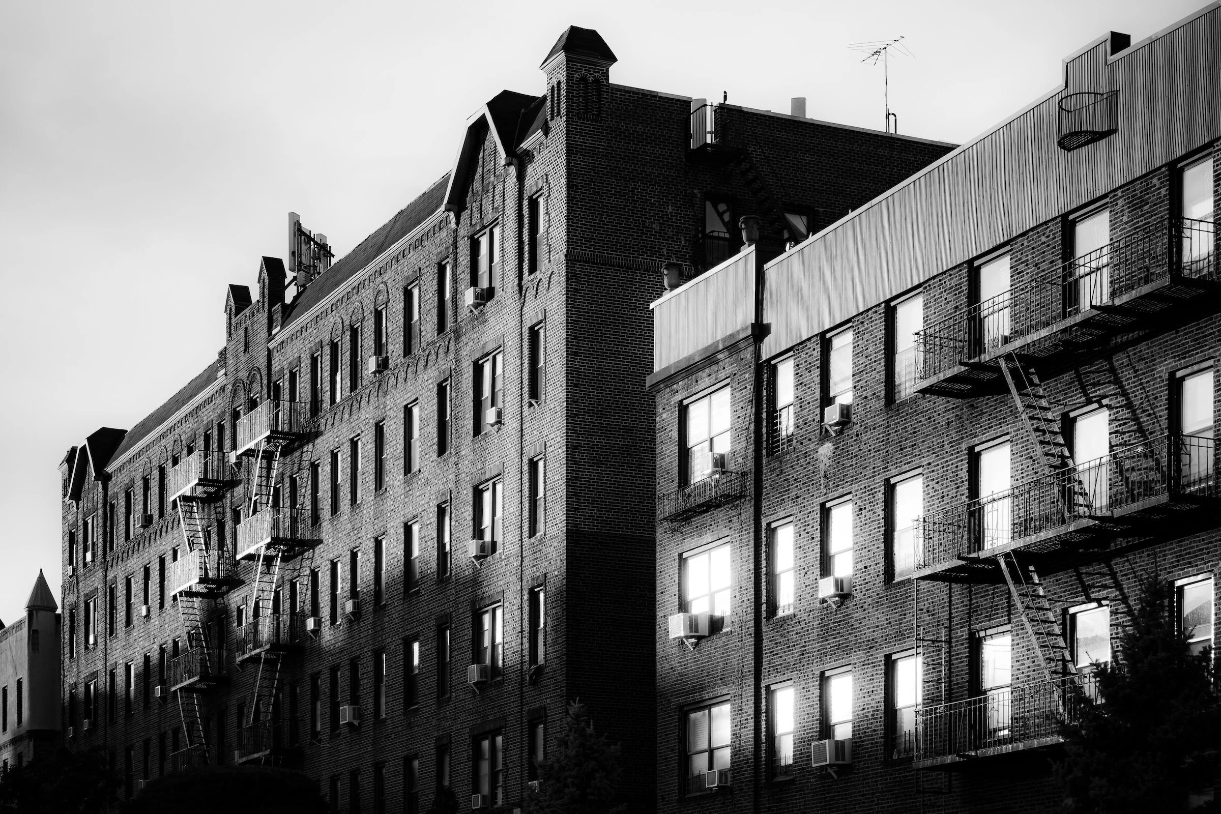
Chiaroscuro (B&W Drama) - Black-and-white photography shaped by bold tonal contrast, where light and shadow give the image its structure and dramatic force.
Chromatic City - Color-driven photography in which saturation, contrast, and hue do the work of organizing the frame.
Painting With Light - A way of seeing in which natural sunlight turns ordinary scenes luminous, atmospheric, and almost painterly.
Shadowroots - Branching shadows, often cast by trees, that form organic patterns resembling roots, veins, or nervous systems.
Sungleams - Direct-light photographs in which the sun enters the frame and reshapes it through rays, flare, halos, or glare.
There is much more to seeing and photographing Kew Gardens, but these strategies can help you get the most out of your time there. Click below to learn more about each of these techniques.

Through The Lens
Kew Gardens Photographic Video
Kew Gardens Photo Gallery
Kew Gardens Field Notes
Built from on-the-ground visits, original photography, and historical research.
-
January 15, 2023 | 3:09pm – 5:02pm
Weather: 38°F (3°C) | Brilliant Blue Sky | Wind: 6 mph W
Conditions: Intense, direct winter sunlight; sharp shadows; high-clarity atmosphere with scattered cumulus clouds.
Field Notes
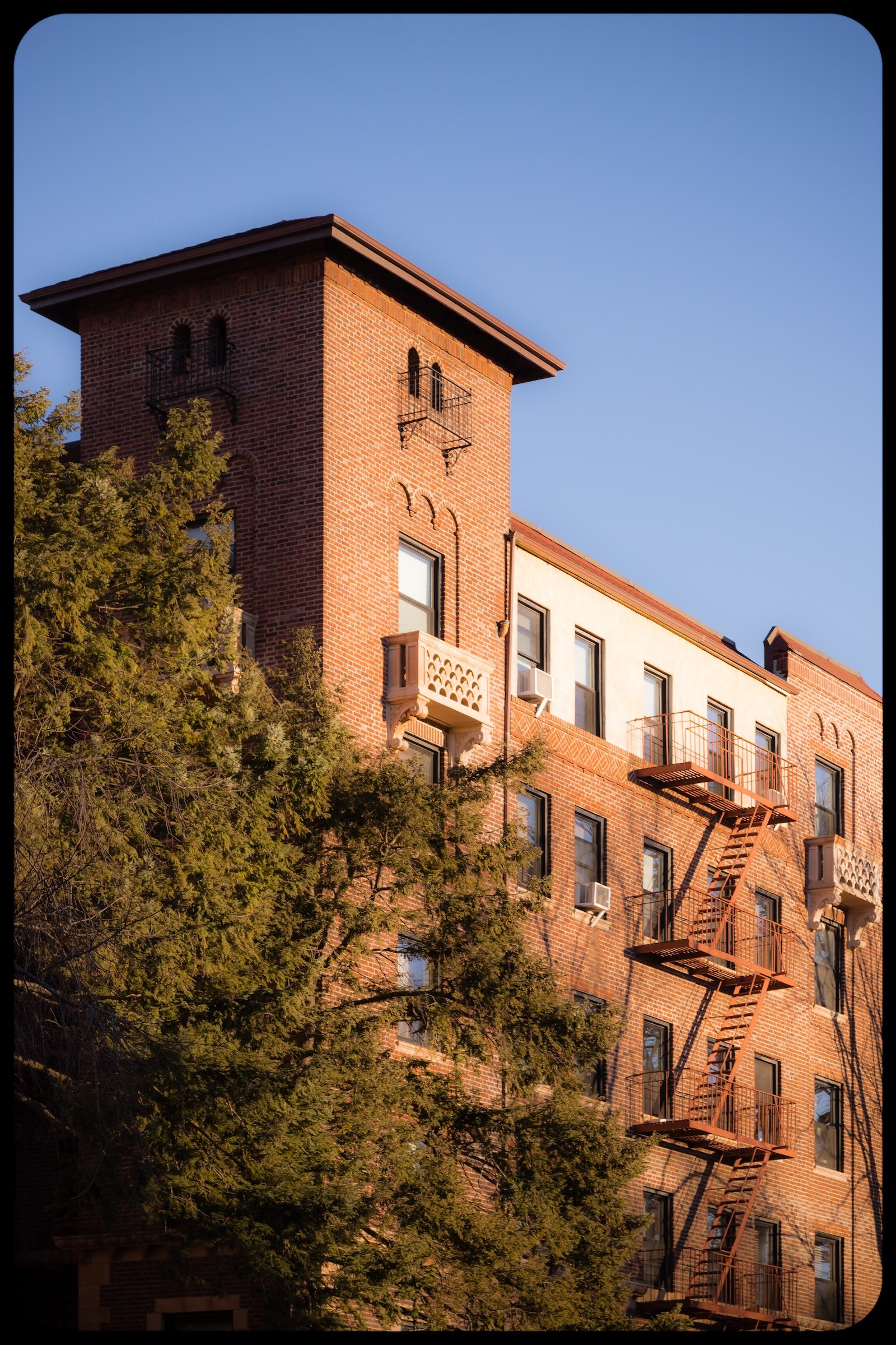
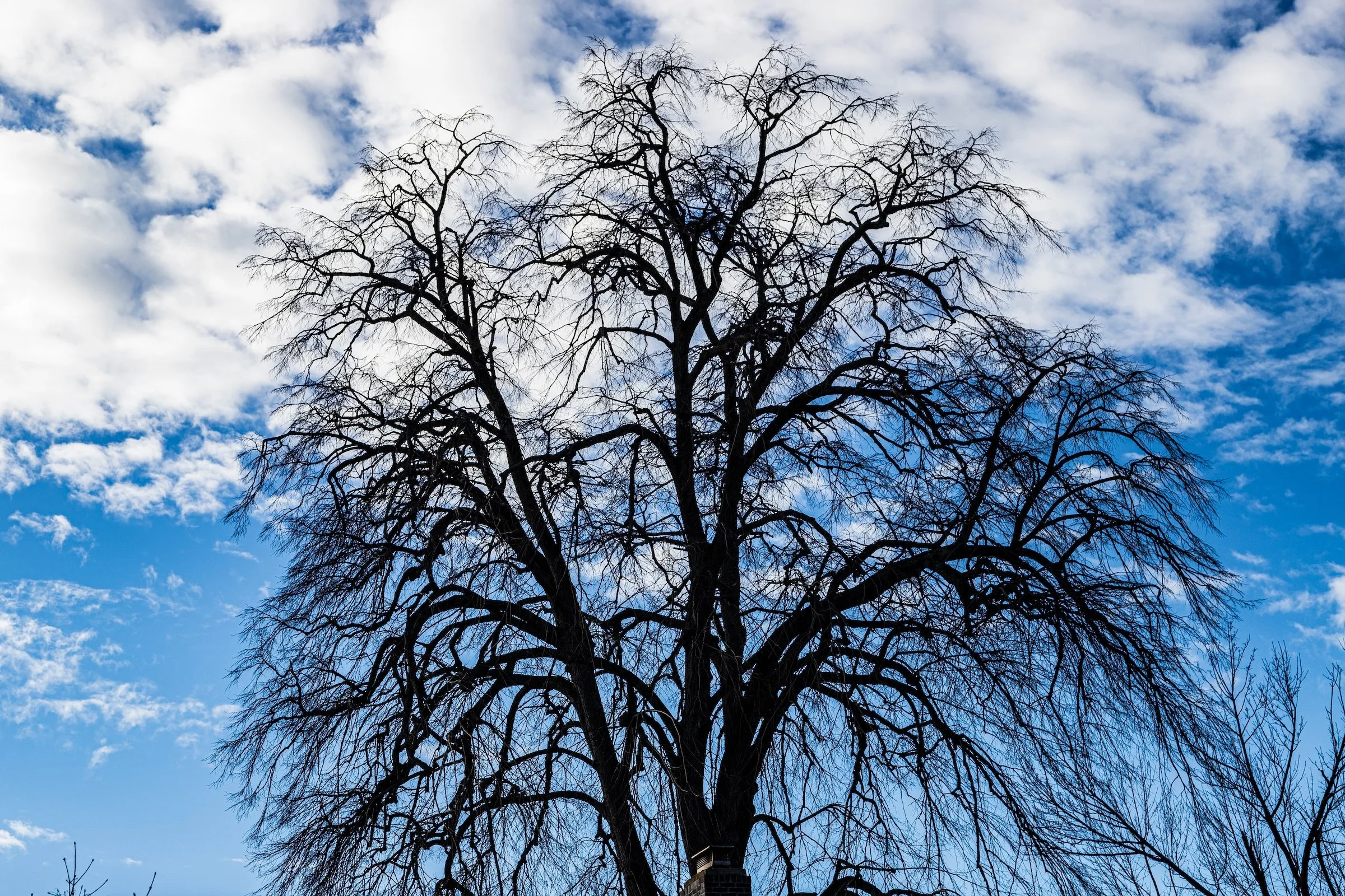
The crispness of this January afternoon was almost tactile. In Kew Gardens, the winter light doesn't just illuminate; it interrogates every texture it touches. I spent the afternoon tracking the way the low sun hit the neighborhood's "aging manors"—Victorian and Tudor-style homes that feel like they belong to a different century entirely.
There’s a beautiful tension here between the organic and the built environment. You have these ancient, naked trees reaching toward a sky that looks almost impossibly blue, while the orange brickwork of the apartment blocks and houses provides a solid, grounding warmth. Walking through the 117th Street Alley, the long shadows and the way the sun catches the upper stories of the brick buildings creates a sense of urban solitude that is quintessential New York.
Other neighborhoods visited:
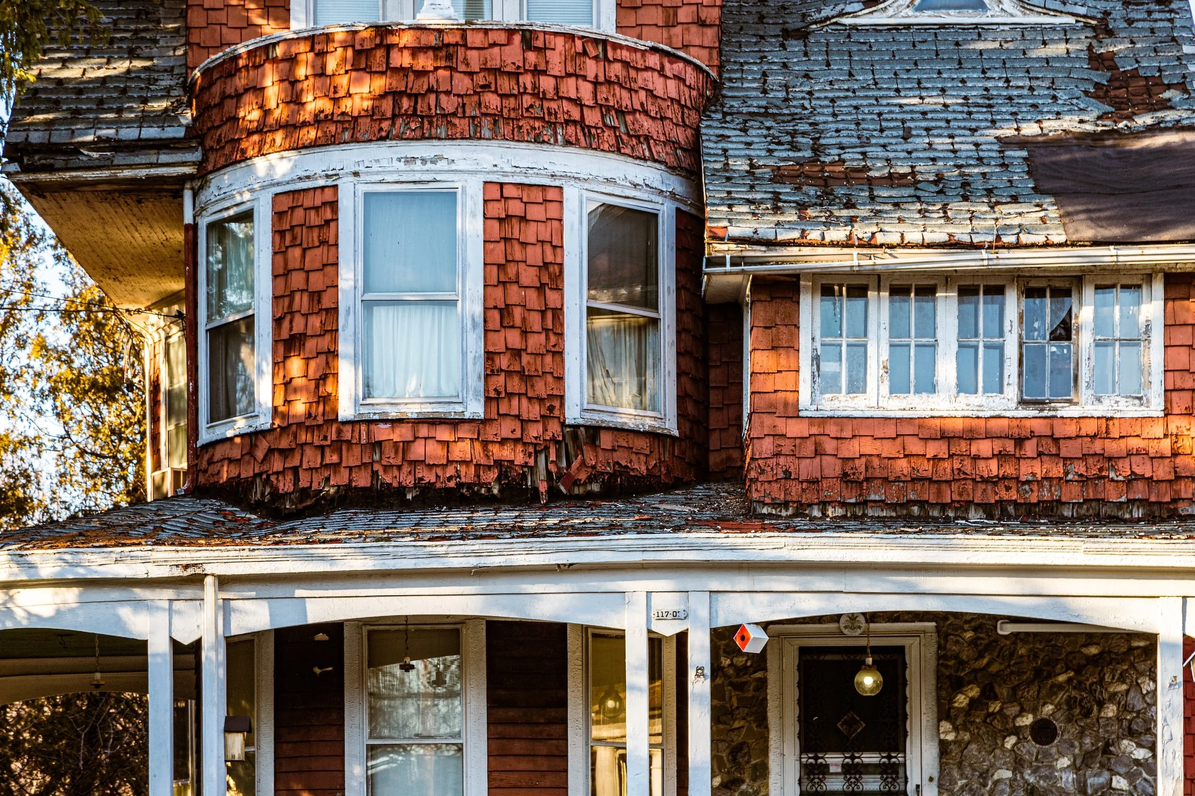
117-03 85th
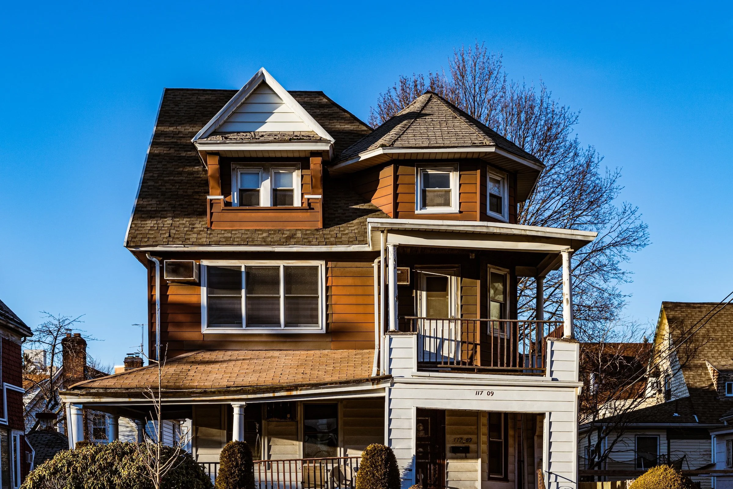
117-09 85th
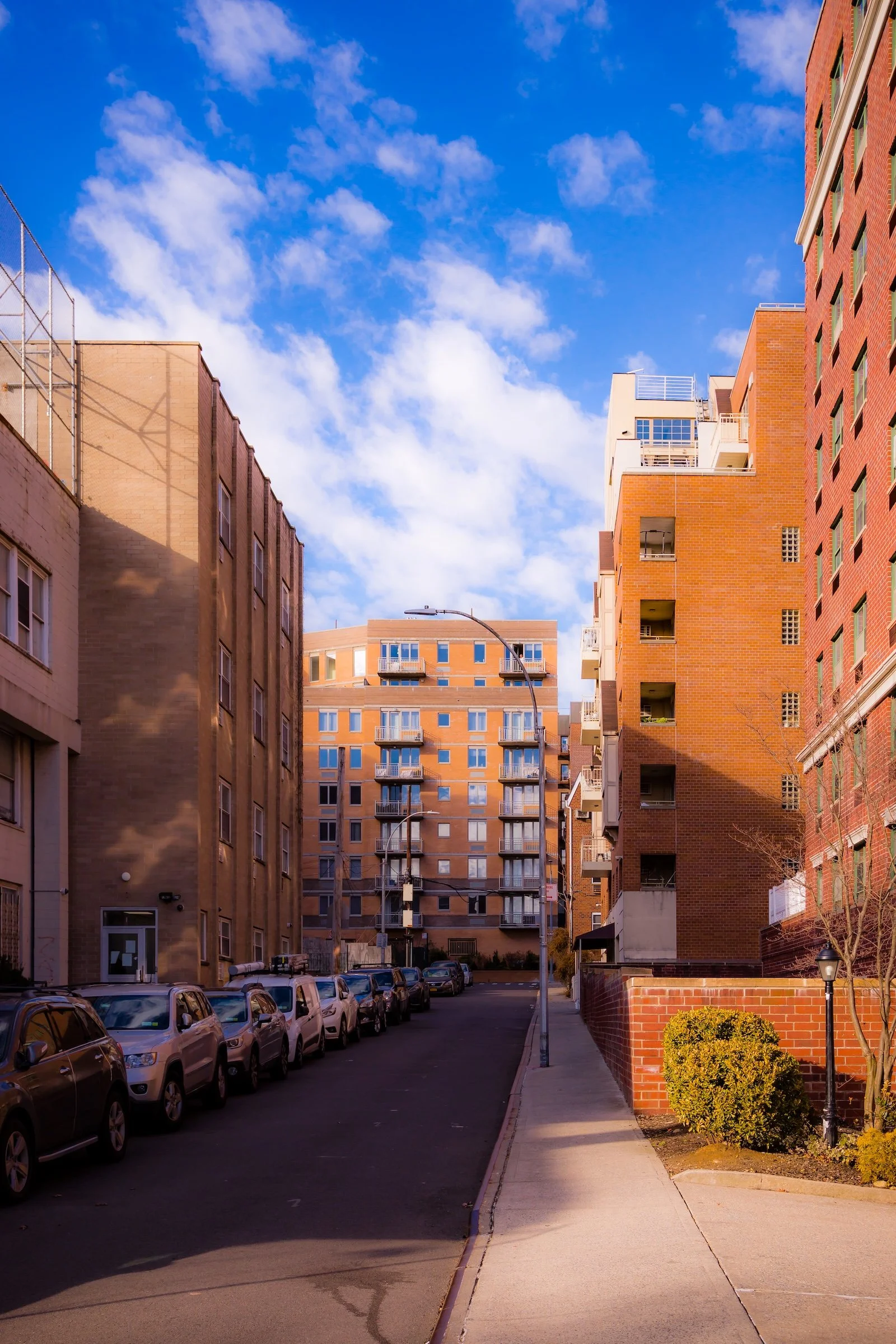
117th Street Alley
Georgian House Terraces
Kew Court
Winter Tree
Use this custom Google map to explore where every neighborhood in all five boroughs of New York City is located.
The Five Boroughs
One of New York City’s unique qualities is its organization in to 5 boroughs: Manhattan, Brooklyn, Queens, The Bronx, and Staten Island. These boroughs are part pragmatic administrative districts, and part vestiges of the region’s past. Each borough is an entire county in New York State - in fact, Brooklyn is, officially, Kings County, while Staten Island is, officially Richmond County. But that’s not the whole story …
Initially, New York City was located on the southern tip of Manhattan (now the Financial District) that was once the Dutch colony of New Amsterdam. Across the East River, another city was rising: Brooklyn. In time, the city planners realized that unification between the rapidly rising cities would create commercial and industrial opportunities - through streamlined administration of the region.
So powerful was the pull of unification between New York and Brooklyn that three more counties were pulled into the unification: The Bronx, Queens, and Staten Island. And on January 1, 1898, the City of New York unified two cities and three counties into one Greater City of New York - containing the five boroughs we know today.
But because each borough developed differently and distinctly until unification, their neighborhoods likewise uniquely developed. Today, there are nearly 390 neighborhoods, each with their own histories, cultures, cuisines, and personalities - and each with residents who are fiercely proud of their corner of The Big Apple.


