GEORGETOWN
Brooklyn
Geographic Setting
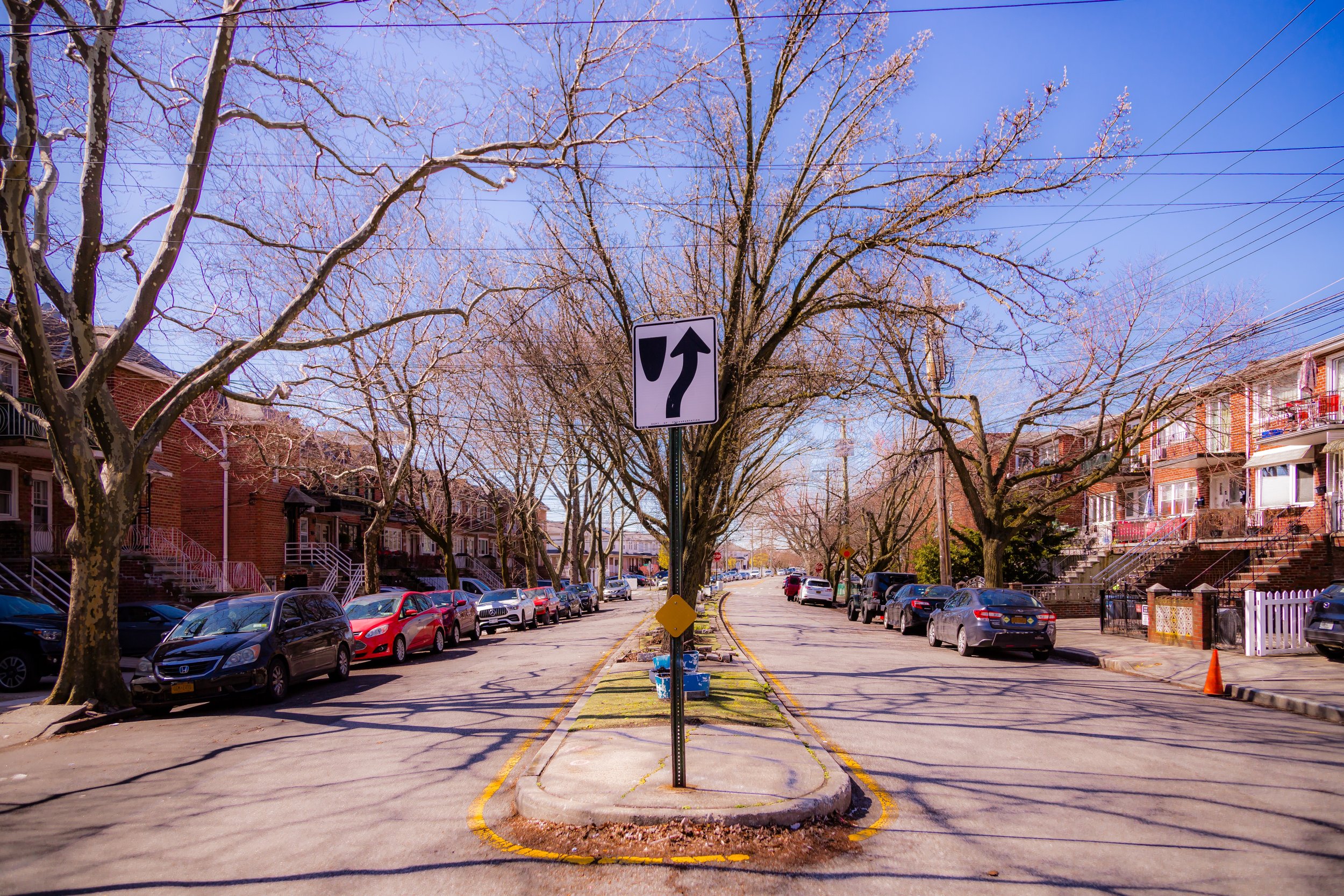
Bounded by Avenue N to the south, Ralph Avenue to the west, and the Paerdegat Basin to the east, Georgetown lies within southeastern Brooklyn’s quiet residential heartland—a compact and relatively young neighborhood nestled between Bergen Beach, Mill Basin, and Flatlands. Its landscape, unlike most of Brooklyn’s older neighborhoods, was not shaped by 19th-century rowhouses or colonial lanes, but by mid-20th-century suburban planning: curved streets, cul-de-sacs, and modern brick homes arranged along reclaimed land near Jamaica Bay’s tidal inlets.
Georgetown’s built environment reflects its origins as one of Brooklyn’s last great postwar developments. Its streets—Ralph Avenue, Avenue K, Avenue L, and Bergen Avenue—form a tidy, low-rise grid bordered by waterways and parkland. Rows of two-family semi-detached brick houses, attached townhomes, and garden-style apartments define its residential core, while Ralph Avenue serves as the neighborhood’s commercial spine, lined with supermarkets, pharmacies, and eateries that form the day-to-day center of community life. Eastward, the shimmering curve of the Paerdegat Basin opens toward Jamaica Bay, its marinas and green buffers providing a rare sense of open space and waterfront air within New York City’s dense sprawl.
Etymology and Origins
Unlike Brooklyn’s older districts named for Dutch farmers or English villages, Georgetown is a product of postwar optimism and marketing invention. Developed primarily in the 1950s and 1960s, its name was chosen to evoke an air of stately suburban respectability, modeled after mid-century real estate trends that favored “colonial” associations—Georgetown in Washington, D.C. being a fashionable reference point at the time.
The land itself, however, has deep colonial roots. In the 17th and 18th centuries, it formed part of Flatlands, one of the original six towns of Kings County, known to the Dutch as Nieuw Amersfoort. For generations, the area consisted of marshes, meadows, and small farms worked by Dutch and English settlers and, tragically, by enslaved laborers. The Paerdegat Basin, whose name derives from the Dutch word paardegat—“horse gate” or “horse passage”—was once a natural tidal creek connecting the farmlands of Flatlands to Jamaica Bay. Its salt meadows provided pasture and hay for livestock long before the first houses of Georgetown were built.
The Neighborhood
19th Century: Farmland and Frontier
Throughout the 1800s, the future Georgetown remained rural, its landscape dominated by creeks, dikes, and low-lying fields belonging to the Bergen, Lott, and Voorhees families—names still found on nearby streets. The flat terrain, fertile but flood-prone, discouraged early urban development even as Flatbush and East New York grew denser. Small clusters of farmhouses dotted Ralph Avenue, then a sandy country road leading south toward Bergen Beach.
As the city expanded in the late 19th century, infrastructure crept slowly toward this corner of Brooklyn. Flatbush Avenue and Kings Highway were paved, and the Brooklyn, Flatbush & Coney Island Railroad (later the Brighton Line) brought more reliable access to the area. Yet Georgetown’s specific footprint remained largely untouched—an unbroken stretch of fields and wetlands through the first half of the 20th century.
Mid 20th Century: Birth of a Neighborhood
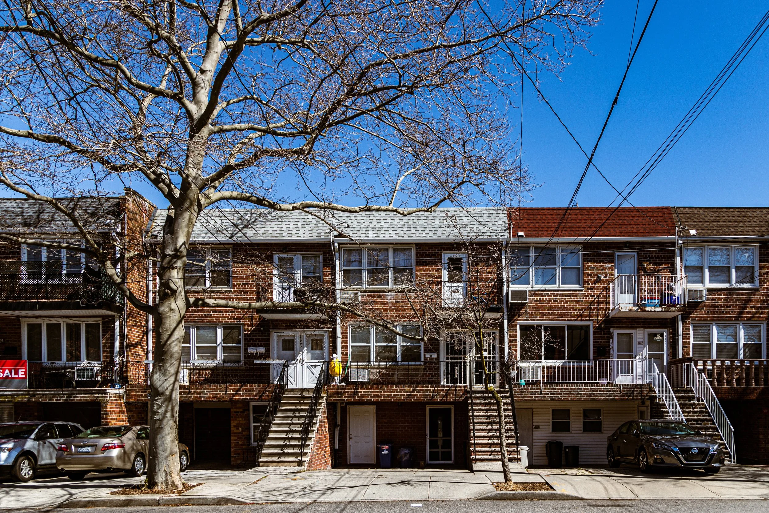
The neighborhood as we know it today was born in the 1950s and 1960s, during one of New York City’s last great waves of suburban-style housing construction. With the postwar demand for single-family homes surging, developers turned to the still-vacant tracts between Flatlands and Mill Basin, filling them with new brick rowhouses and semi-detached homes featuring driveways, lawns, and backyards—a distinct departure from the brownstone density of northern Brooklyn.
Much of Georgetown’s street grid was laid out on reclaimed land, as the city filled in marshy sections of the Paerdegat Basin and improved drainage systems to make large-scale development possible. The construction of the Belt Parkway (1940) and subsequent arterial roads like Ralph Avenue and Avenue N opened the area to automobile access, further enhancing its suburban appeal.
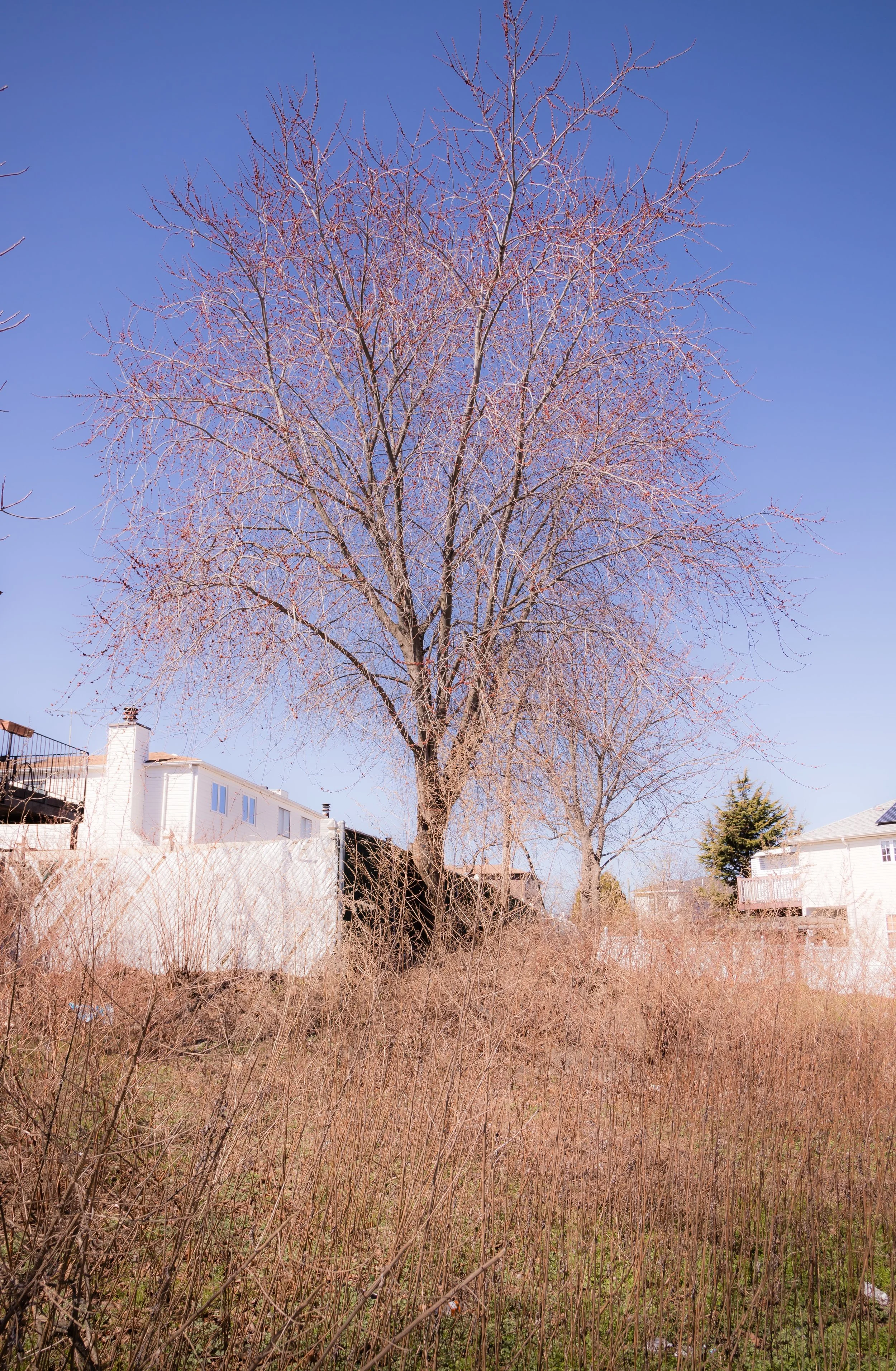
Developers marketed Georgetown as a middle-class enclave for families seeking the comfort of homeownership within city limits. Early residents were largely Jewish, Irish, and Italian-American civil servants, teachers, and tradespeople—many relocating from Crown Heights, Brownsville, or East Flatbush. The neighborhood’s brick-front homes, with picture windows and front gardens, reflected the ideals of stability and aspiration that defined the postwar era.
Georgetown Video Coming Soon
Late 20th Century: Diversity and Continuity
By the 1970s–1980s, Georgetown had matured into a stable, tightly knit community. As New York City faced economic challenges and population shifts, the neighborhood maintained its quiet, residential identity. Homeownership rates remained high, crime rates low, and schools and churches continued to anchor community life.
The Georgetown Shopping Center, established along Ralph Avenue, became a central gathering place—a suburban-style retail strip featuring supermarkets, pharmacies, and restaurants. Small businesses thrived, serving both Georgetown and neighboring Bergen Beach and Canarsie.
As older families retired or moved away, new residents arrived—Caribbean, African American, and later Russian and Middle Eastern families—reflecting Brooklyn’s broader demographic evolution. Churches and community centers adapted accordingly, while civic associations and neighborhood watches helped preserve the area’s clean streets and sense of order.
Though Georgetown was sometimes subsumed under the broader label of “Flatlands,” longtime residents maintained its distinct name and identity, emphasizing its planned character and waterfront proximity.
21st Century: Quiet Stability by the Basin
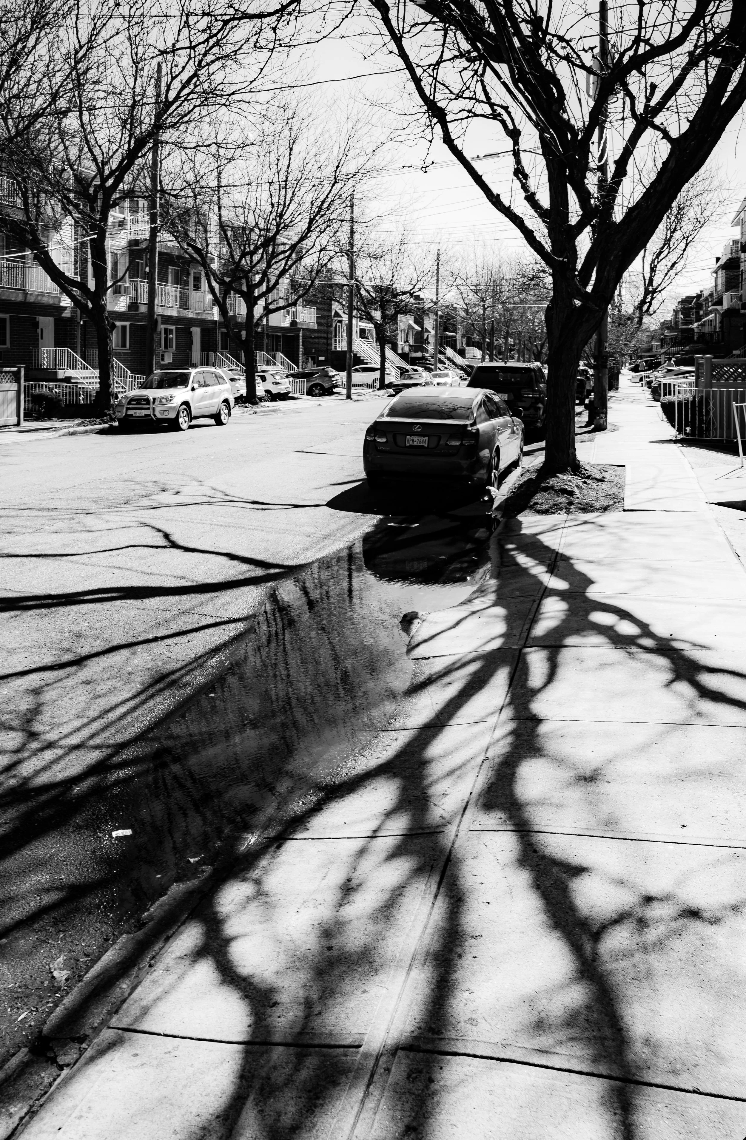
In the 21st century, Georgetown remains one of Brooklyn’s calmest and most suburban-feeling enclaves. Its tree-lined streets and consistent architectural scale have insulated it from the large-scale development seen elsewhere in the borough. The neighborhood’s tidy front lawns, brick façades, and abundance of off-street parking recall mid-century suburbia more than urban Brooklyn.
The Paerdegat Basin, once a neglected industrial channel, has been partially restored through environmental initiatives by the New York City Department of Environmental Protection (DEP). New wetlands and walking paths along the basin’s edge have reconnected Georgetown to its maritime setting. The shimmering waterway, once lined with boatyards and dumping grounds, now reflects the masts of small craft and the wings of herons at dawn.
While nearby neighborhoods like Canarsie and Flatlands have grown denser, Georgetown continues to value its low-rise tranquility. It attracts families seeking quiet, safety, and homeownership—an enduring middle-class dream within New York City. Local schools, churches, and civic groups maintain strong ties, while Ralph Avenue’s commercial strip provides all essentials within walking distance.
Georgetown Photo Gallery
Spirit and Legacy
Georgetown’s legacy is one of planned permanence—a neighborhood conceived in an age of optimism and still defined by its sense of order, community, and understated pride. Unlike Brooklyn’s grand brownstone belts or its industrial loft quarters, Georgetown’s beauty lies in its modest uniformity: the gleam of red brick under afternoon sun, the rhythm of manicured lawns, and the faint salt air drifting from the Paerdegat Basin.
New York City
Use this custom Google map to explore where every neighborhood in all five boroughs of New York City is located.
The Five Boroughs
One of New York City’s unique qualities is its organization in to 5 boroughs: Manhattan, Brooklyn, Queens, The Bronx, and Staten Island. These boroughs are part pragmatic administrative districts, and part vestiges of the region’s past. Each borough is an entire county in New York State - in fact, Brooklyn is, officially, Kings County, while Staten Island is, officially Richmond County. But that’s not the whole story …
Initially, New York City was located on the southern tip of Manhattan (now the Financial District) that was once the Dutch colony of New Amsterdam. Across the East River, another city was rising: Brooklyn. In time, the city planners realized that unification between the rapidly rising cities would create commercial and industrial opportunities - through streamlined administration of the region.
So powerful was the pull of unification between New York and Brooklyn that three more counties were pulled into the unification: The Bronx, Queens, and Staten Island. And on January 1, 1898, the City of New York unified two cities and three counties into one Greater City of New York - containing the five boroughs we know today.
But because each borough developed differently and distinctly until unification, their neighborhoods likewise uniquely developed. Today, there are nearly 390 neighborhoods, each with their own histories, cultures, cuisines, and personalities - and each with residents who are fiercely proud of their corner of The Big Apple.


