
HOLLIS
Queens
Part of an ongoing project to walk and photograph every neighborhood in New York City, this page explores Hollis through history, fieldwork, and photography.

Map
Geographic Setting
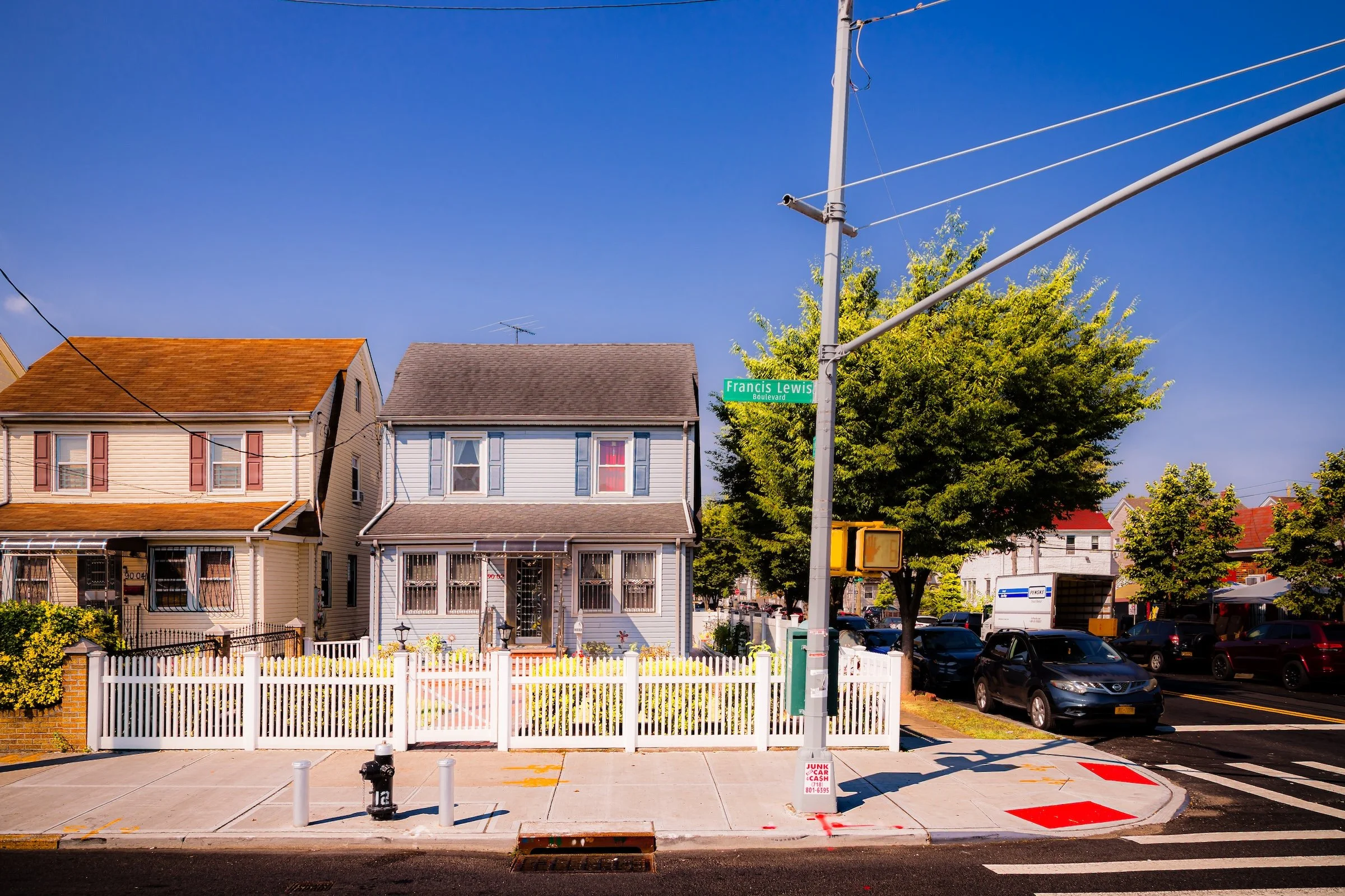
Bounded by Hillside Avenue to the north, Francis Lewis Boulevard to the east, Hollis Avenue and 104th Avenue to the south, and 180th Street to the west, Hollis lies in southeastern Queens—a historic residential enclave whose tidy streets, tree canopies, and civic institutions reflect both the borough’s suburban aspirations and its deep cultural legacy. Nestled between Jamaica, St. Albans, and Queens Village, the neighborhood occupies a gentle slope that rises southward from Hillside Avenue toward the low ridge separating Jamaica from the southern flatlands. Hollis today remains defined by its mix of single-family homes, strong community organizations, and a long tradition of local pride rooted in music, education, and working-class achievement.
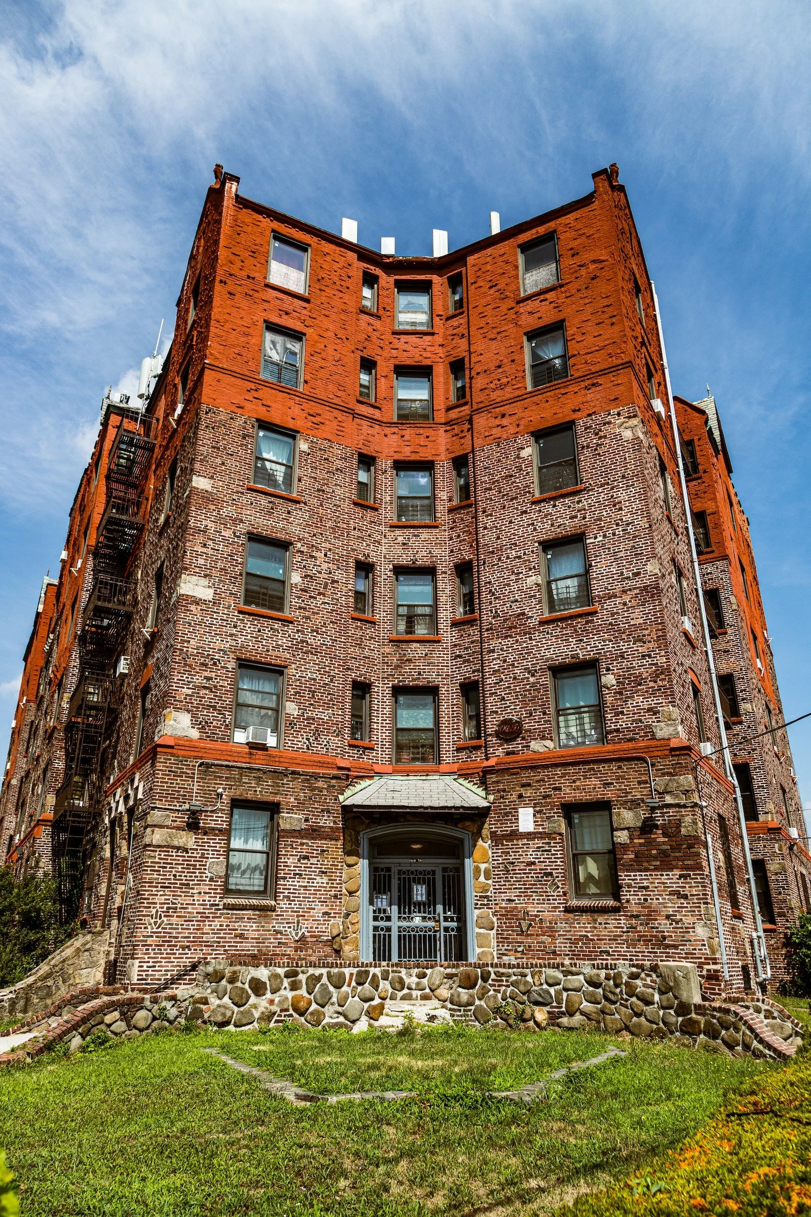
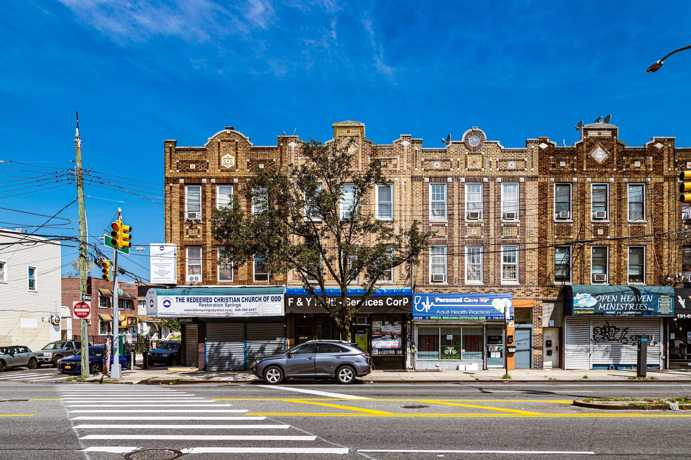
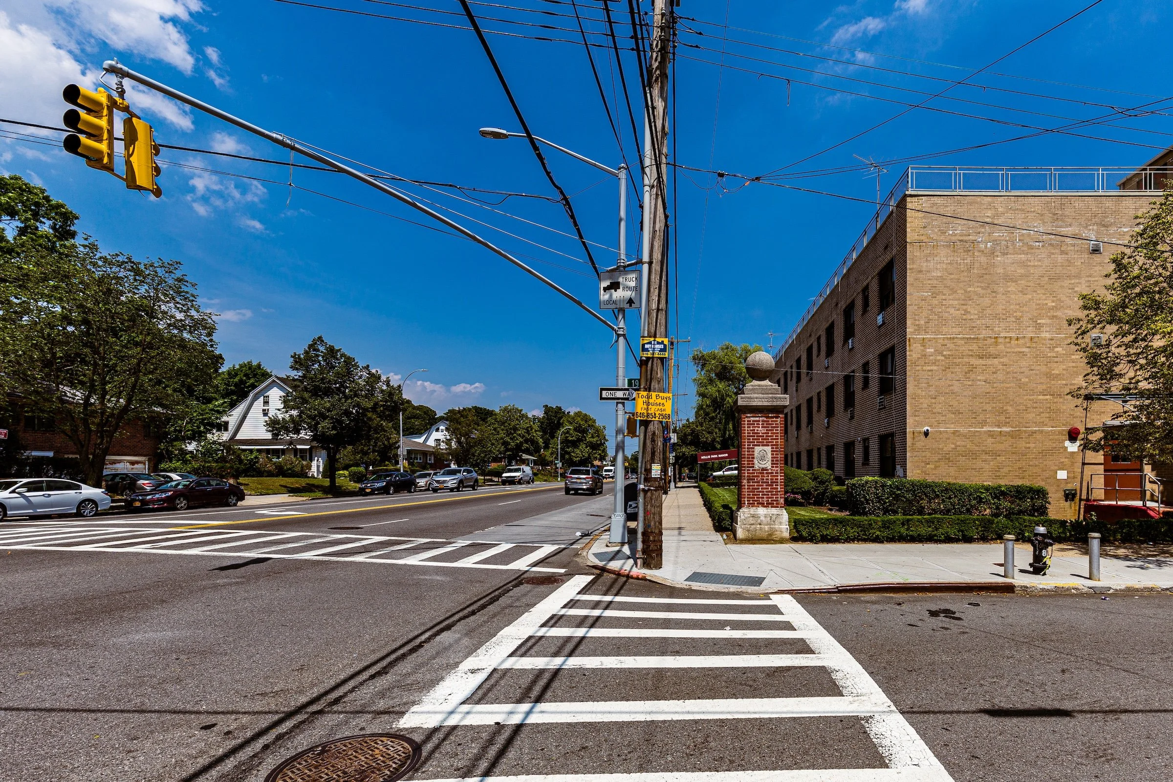
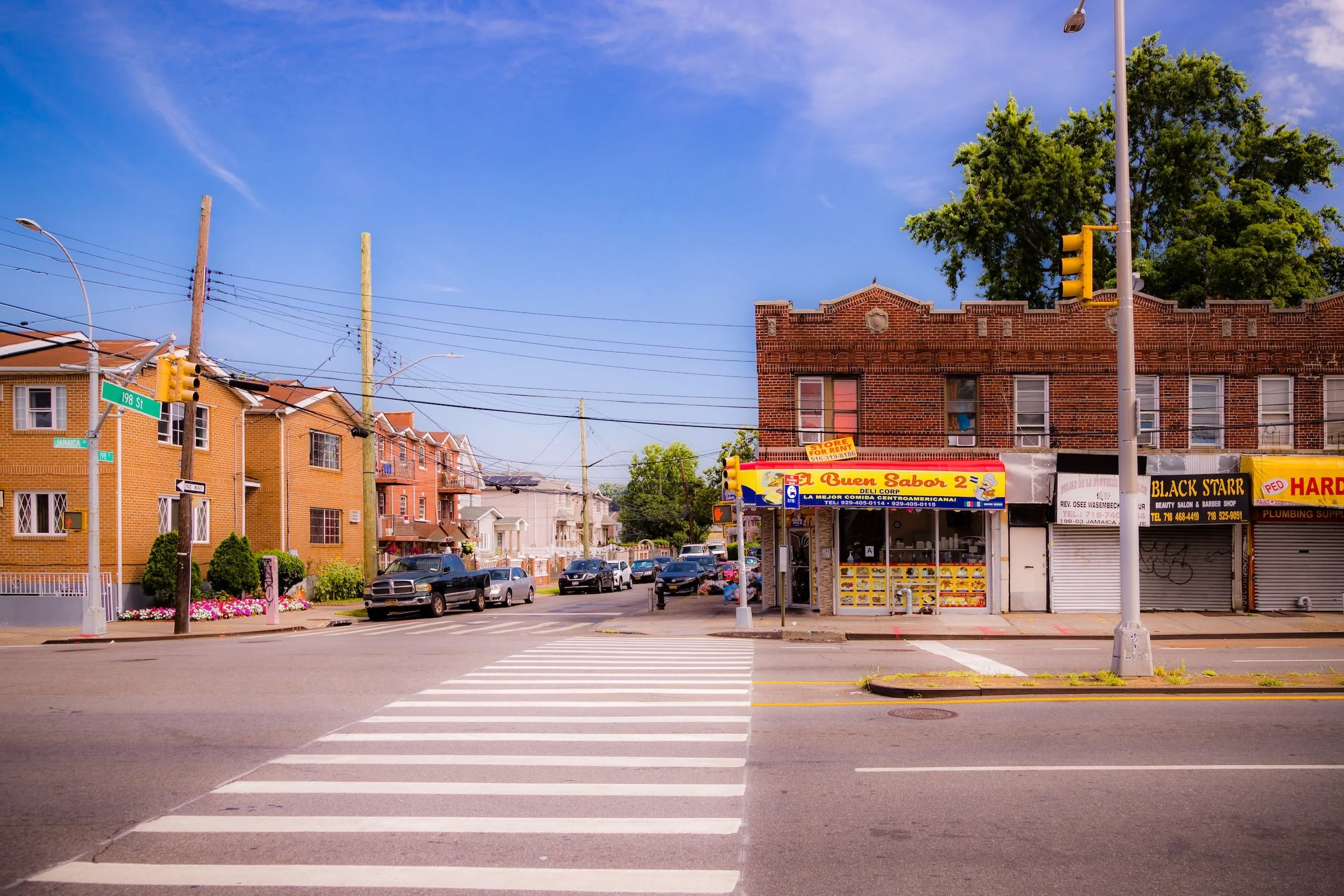
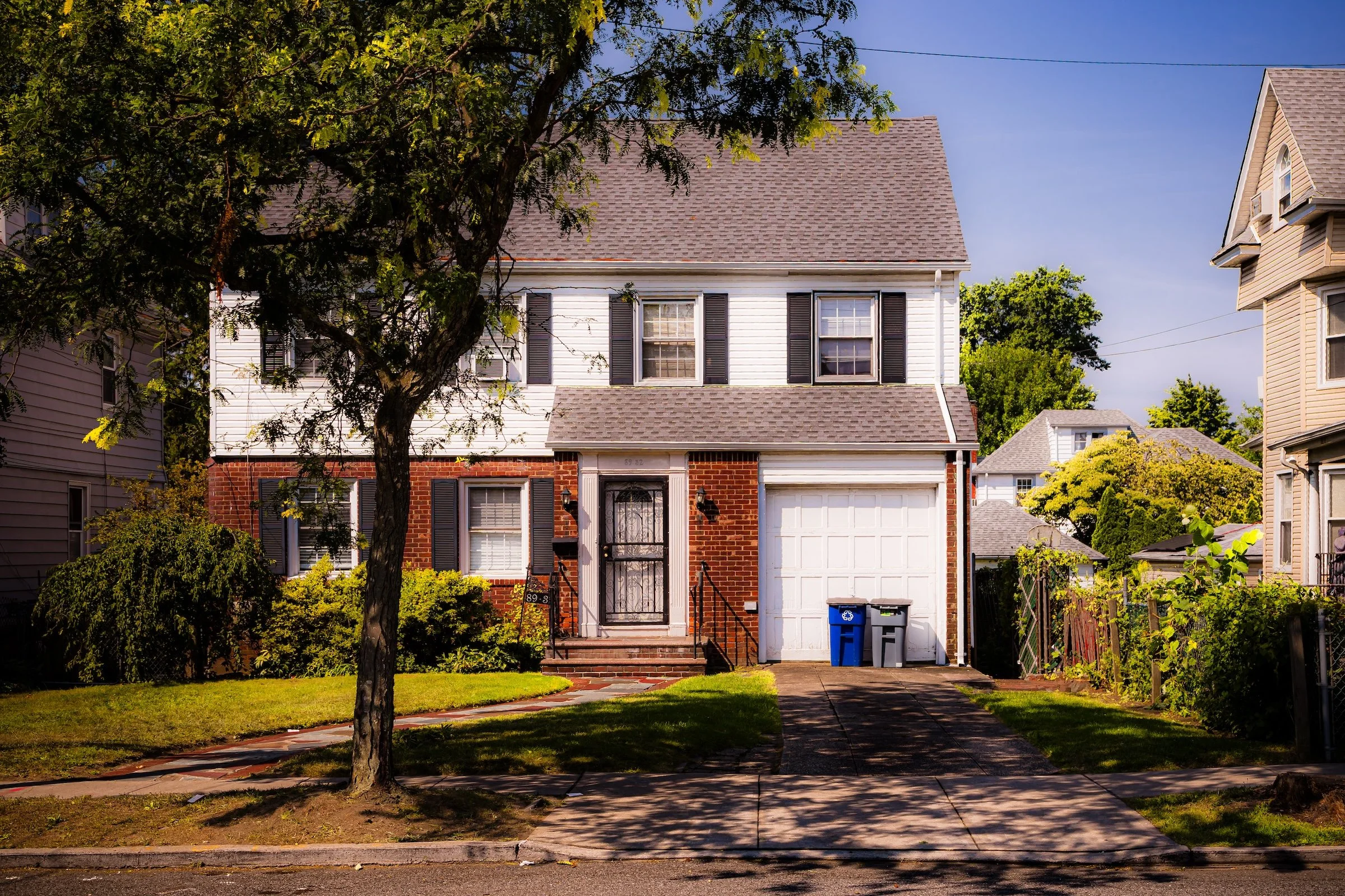
The neighborhood’s primary arteries—Hollis Avenue, Francis Lewis Boulevard, Jamaica Avenue, and Hillside Avenue—carry the pulse of local life, lined with small businesses, churches, schools, and family-owned storefronts. The Long Island Rail Road’s Hollis Station, along Hillside Avenue and 193rd Street, provides direct rail access to Midtown Manhattan, while bus lines connect the area to the Jamaica transit hub. Architecturally, Hollis presents a cohesive suburban landscape: early- and mid-20th-century Colonial, Tudor, and Cape Cod–style homes, many with gardens and driveways, interspersed with modest apartment houses near the commercial corridors. The community’s sense of separation from nearby Jamaica—reinforced by the LIRR tracks—has helped preserve its quiet, residential identity even as the surrounding region urbanized.
Identity
Etymology and Origins
The name “Hollis” was officially adopted in the 1880s by real estate developer Frederick W. Dunton, a nephew of railroad magnate Austin Corbin and an early planner of suburban Queens. The area was part of the colonial Town of Jamaica, settled by English farmers in the 17th century, and remained primarily farmland for nearly two centuries. The name likely derives from the English village of Hollis, New Hampshire, where Dunton had business ties. He chose the name to lend a sense of New England gentility to what he envisioned as a pastoral commuter suburb.
Hollis developed around the Long Island Rail Road, which extended service to the area in 1885, making it one of Queens’ earliest true “railroad suburbs.” Dunton laid out streets, built homes, and marketed the district as a retreat for professionals working in Manhattan and Brooklyn—“country living within the city’s reach.” Early maps show a grid centered on Hollis Avenue and Hillside Avenue, with large lots, tree plantings, and a planned station area designed to evoke small-town order.
Neighborhood Identity
Hollis is one of southeastern Queens’ most storied residential neighborhoods, defined by a rare combination of suburban calm, cultural consequence, and long-rooted community pride. Developed as one of Queens’ early railroad suburbs and later strengthened as a center of Black middle-class homeownership, it has carried forward a strong identity built on stability, self-determination, and neighborhood continuity. Its detached houses, local institutions, family-owned businesses, and historic Long Island Rail Road station all reinforce the sense that Hollis is not simply a pass-through district, but a place with its own durable civic and cultural center of gravity.
What distinguishes Hollis is the way it holds contrasting identities without losing coherence. It is at once a commuter suburb and a cultural landmark, a neighborhood of tidy residential blocks and one of the foundational landscapes of early hip-hop. The commercial corridors along Hollis Avenue, Francis Lewis Boulevard, Jamaica Avenue, and Hillside Avenue bring movement, storefront life, and public energy, while the interior streets remain quieter, greener, and more domestic. That balance gives Hollis a character that feels both grounded and expressive: ordinary in its daily rhythms, but extraordinary in the depth of history and creativity it has produced.
Visual Identity
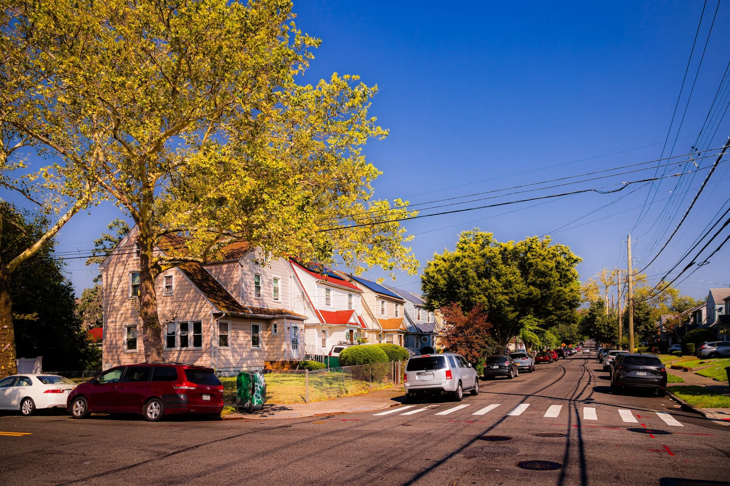
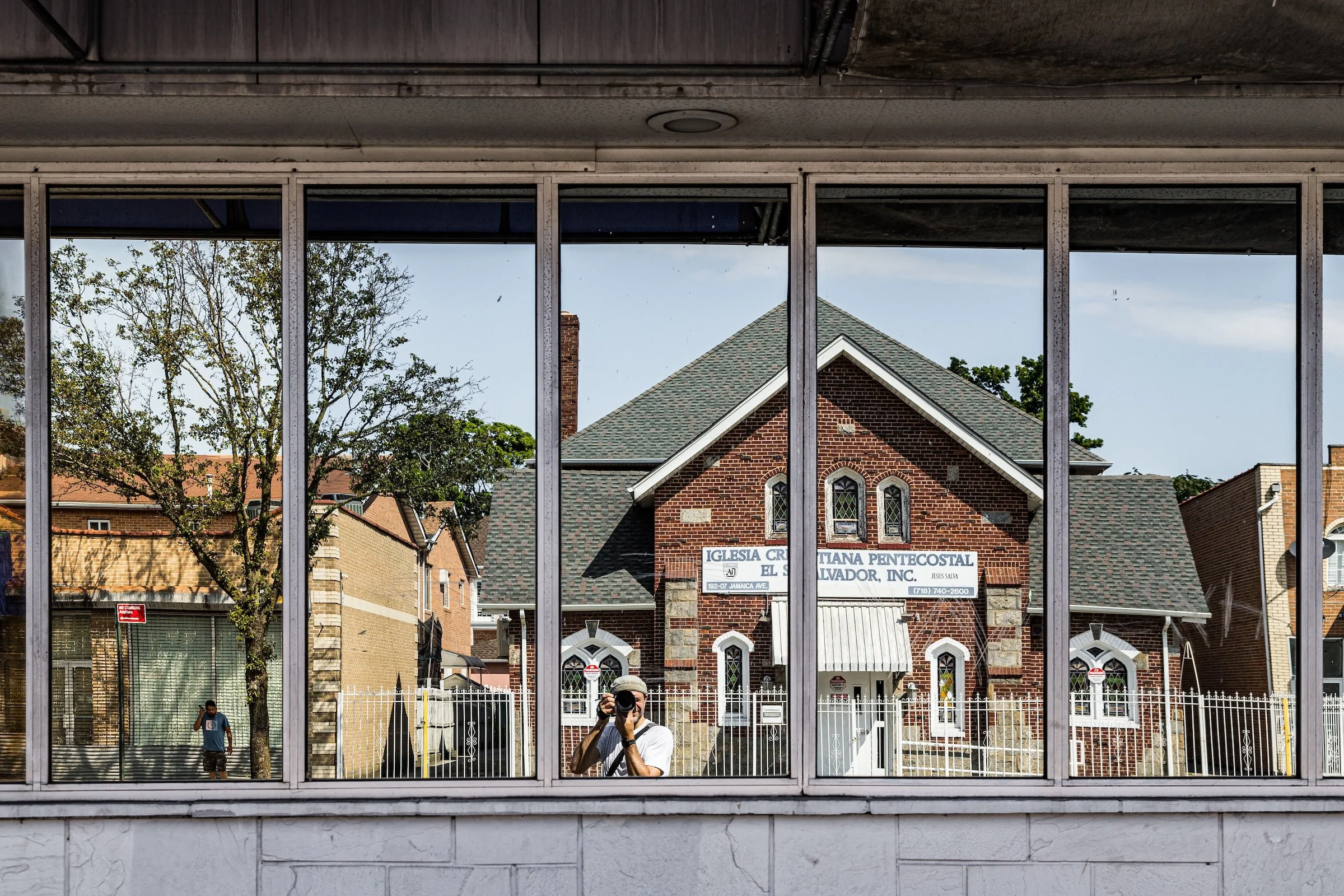
Hollis’ visual identity emerges through contrast, rhythm, and accumulation. The contact sheet shows a neighborhood where commercial strips, brick apartment houses, corner storefronts, murals, institutional facades, modest detached homes, and open residential streets all coexist within the same visual field. What holds these different elements together is a steady sense of scale: low-rise buildings, broad streets, repeated house forms, and a strong canopy of trees give the neighborhood a cohesive physical rhythm even as the architecture and street life shift from block to block. That rhythm is part of what makes Hollis visually memorable.
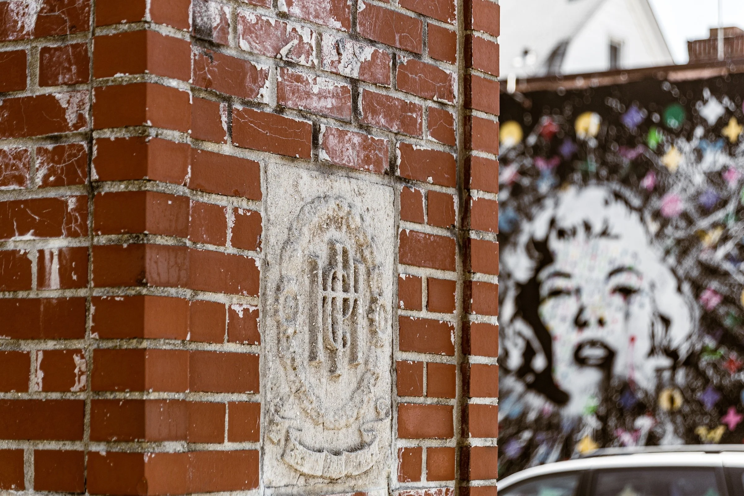
What gives Hollis its particular look is the meeting of urban corridor and pastoral edge. Along the busier streets, the neighborhood reads through signage, storefront repetition, brickwork, transit infrastructure, and the small theatrics of daily commerce. Deeper in the residential blocks, it opens into lawns, pitched roofs, detached and semi-detached homes, picket fences, church spires, and the kind of sunlit tree cover that softens the grid into something almost bucolic. Your contact sheet makes that duality especially clear: murals and industrial textures sit alongside white houses, wide sky, and tidy domestic geometry. Hollis does not have a single dominant visual motif; its identity comes from the way these different vocabularies remain in dialogue rather than conflict.
History
18th–19th Century: Rural Crossroads, Rail Access, and the Beginnings of Suburban Identity
Long before Hollis emerged as a recognizable residential neighborhood, the area formed part of the broad agricultural landscape of southeastern Queens, a region of farms, country lanes, and scattered homesteads tied more closely to Jamaica and the towns of western Nassau than to the dense city that would later surround it. Through much of the eighteenth and nineteenth centuries, this section of Queens remained lightly developed, shaped by open land, small-scale farming, and the gradual extension of roadways eastward from Jamaica. Its location along important inland routes gave it connective value, but for decades it remained more rural than urban, one of the many places in Queens where the city’s future was still only faintly visible.
The decisive change came with the railroad. In 1884, the Long Island Rail Road established Hollis Station, giving the area a more direct and reliable connection to Jamaica, Brooklyn, and Manhattan. That rail access altered the logic of the landscape. Land that had once been valued primarily for agriculture could now be marketed for residential development, especially to commuters seeking more space and quieter surroundings than were available in the denser parts of the city. By the late nineteenth century, Hollis had begun to shift from rural crossroads to early suburb, its future tied increasingly to transportation, domestic development, and the expanding pull of Greater New York.
Even in this transitional phase, Hollis was not simply a blank slate waiting for urbanization. Its appeal rested in the combination of accessibility and openness: close enough to the city to be practical, but spacious enough to feel removed from it. That balance would become one of Hollis’s defining traits. Where Jamaica evolved as a commercial and transportation hub, Hollis developed a more residential identity—one rooted in houses, local institutions, and the quieter rhythms of suburban life.
By the early twentieth century, Hollis had blossomed into a thriving residential district, part of the broader wave of middle-class suburban growth that followed Queens’ consolidation into Greater New York City in 1898. Large plots, rail access, and relative proximity to Jamaica made the neighborhood especially attractive to professionals, tradesmen, and families seeking stable homeownership within commuting distance of Manhattan. Brick and frame houses multiplied along streets such as 188th and 190th, while commercial activity expanded along Hollis Avenue and Francis Lewis Boulevard to serve the growing population.
As the housing stock expanded, so too did the neighborhood’s institutional life. P.S. 35Q, established in 1905, became one of Hollis’s earliest public schools, helping anchor the neighborhood’s family-oriented identity. Churches including St. Gerard Majella Roman Catholic Church, Hollis Presbyterian Church, and Holy Trinity Lutheran Church added spiritual and civic weight, while block groups and local associations promoted beautification, infrastructure improvements, and the general upkeep of the neighborhood. Residents successfully lobbied for better roads, sewers, and streetlights, reinforcing the sense that Hollis was not merely growing, but deliberately shaping itself.
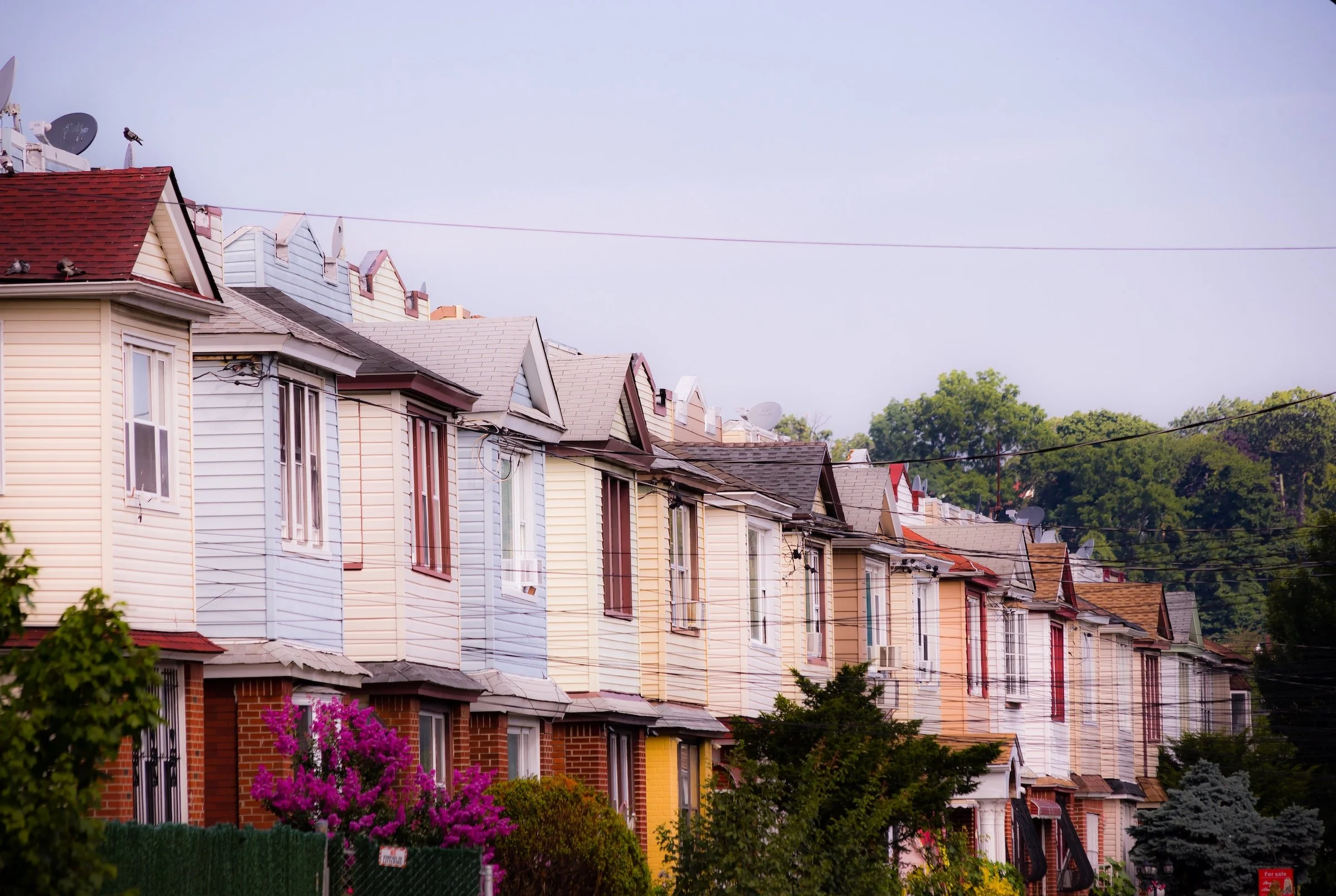
By the 1920s and 1930s, Hollis had become firmly established as a stable, solidly middle-class commuter enclave. The Long Island Rail Road remained central to that identity, allowing residents to maintain a suburban domestic life while remaining connected to the wider metropolis. Architecturally, the neighborhood’s many detached single-family homes—often built by the same developers who were active in nearby Queens Village—gave Hollis a noticeable coherence. Though not as formally planned as some garden-suburb developments elsewhere in Queens, Hollis nonetheless developed a strong visual and social unity through repeated house types, consistent setbacks, and the cumulative effect of homeownership, family life, and civic pride.
What distinguished Hollis in these decades was its steadiness. While Jamaica to the west intensified as a dense commercial center, Hollis retained a quieter residential scale. Its streets were not untouched by the city’s growth, but they were shaped to absorb that growth on domestic terms. That balance between accessibility and suburban calm would remain one of the neighborhood’s great enduring strengths.
Early–Mid 20th Century: Suburban Growth, Homeownership, and Civic Formation
Late 20th Century: Demographic Change, Black Homeownership, and Cultural Influence
The decades following World War II brought significant demographic and cultural change to Hollis, as they did across much of southeastern Queens. New highways and bridges encouraged outward suburban expansion, and many white residents moved farther east into Nassau County. At the same time, African-American families—many of them veterans, professionals, and upwardly mobile middle-class households—began purchasing homes in Hollis and nearby neighborhoods such as St. Albans. By the 1960s, Hollis had become one of the key centers of Black homeownership in Queens, part of a wider transformation that reshaped southeastern Queens into one of New York’s most important landscapes of Black suburban aspiration and community formation.
This transition was not merely demographic. It fundamentally reshaped the civic and cultural identity of the neighborhood. Hollis became a place where Black middle-class life was expressed not only through property ownership, but through schools, churches, local businesses, youth programs, and block associations that maintained neighborhood stability and fostered a strong sense of belonging. Even during the years when New York City faced fiscal crisis, disinvestment, and rising crime, Hollis remained comparatively resilient thanks to these local institutions and the persistence of neighborhood-based stewardship.
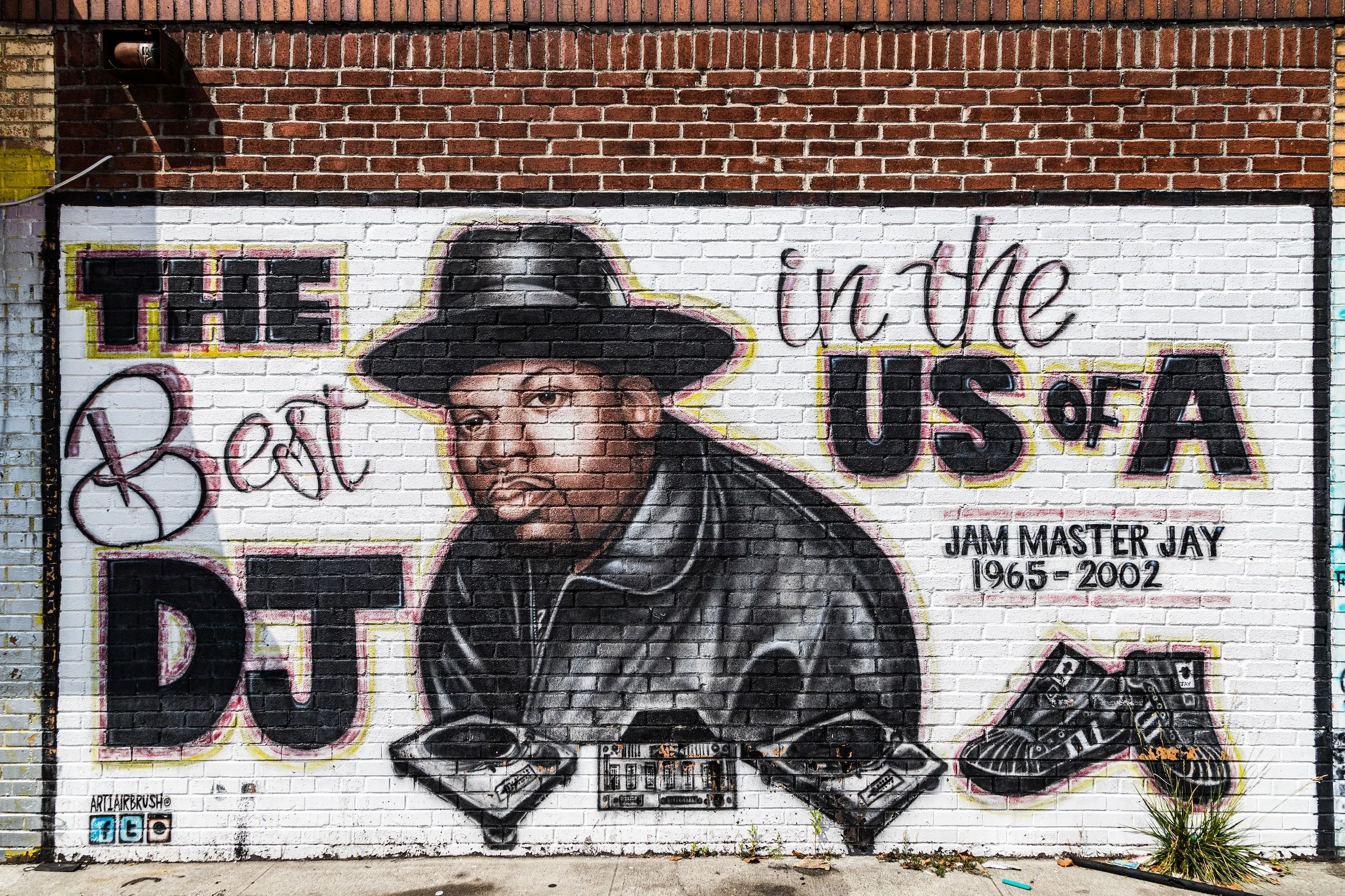
At the same time, Hollis emerged as a place of extraordinary cultural influence. During the 1970s and 1980s, the neighborhood gained national recognition as one of the cradles of hip-hop, home to pioneering artists such as Run-D.M.C., LL Cool J, and later Ja Rule. Their music and public identities helped fix Hollis in the popular imagination, not as a downtown spectacle or urban ruin, but as a neighborhood of houses, streets, parks, schools, and local pride—a place where creativity emerged from the lived experience of Black suburban New York. Hollis Park, schoolyards, barbershops, and the commercial life along Hollis Avenue formed part of the cultural infrastructure from which that music grew.
What makes this legacy especially notable is that it did not replace the neighborhood’s residential character; it emerged from it. Hollis’s cultural renaissance was inseparable from the order and aspiration of its domestic landscape. The same streets that reflected stability and homeownership also produced some of the most influential voices in American music. That dual identity—quietly residential, yet culturally resonant far beyond Queens—became one of the neighborhood’s defining distinctions in the late twentieth century.
21st Century: Diversity, Continuity, and the Persistence of Place
In the twenty-first century, Hollis has evolved into one of southeastern Queens’ most diverse and cohesive neighborhoods. African-American families continue to form a central part of its identity, while growing Caribbean, South Asian, and Latino populations have further enriched the social and commercial life of the area. This newer diversity has not erased the neighborhood’s older character so much as layered onto it, adding new religious institutions, food cultures, businesses, and forms of civic life to a community already shaped by long traditions of homeownership and local pride.
The neighborhood’s physical character has also remained remarkably durable. Hollis continues to be defined largely by one- and two-family homes, tree-lined streets, neighborhood schools, and modest commercial strips along corridors such as Hollis Avenue, Francis Lewis Boulevard, and Jamaica Avenue. Those commercial streets balance continuity and change: long-standing local businesses coexist with newer halal markets, Caribbean bakeries, beauty salons, and small restaurants that reflect the area’s changing population. Schools such as P.S. 118, P.S. 134, and I.S. 192 reflect the multilingual, multiethnic reality of modern Queens, while neighborhood organizations continue to advocate for infrastructure improvements, public safety, and environmental resilience.
Accessibility remains one of Hollis’s great practical advantages. Proximity to the Long Island Rail Road, major bus routes along Hillside Avenue and Jamaica Avenue, and nearby parkways ensures that the neighborhood remains well connected without surrendering its largely residential feel. That balance still matters. Hollis remains neither isolated nor overrun, neither frozen in the past nor stripped of its older form. It continues to operate as a place where domestic life, local commerce, and historical memory remain visibly intertwined.
Recent attention to issues such as stormwater management, green infrastructure, and flood mitigation—especially in lower-lying sections near 104th Avenue—reflects the contemporary pressures facing the neighborhood. Yet even as Hollis adjusts to those challenges, its core identity remains surprisingly intact. Hollis Playground, Latimer Playground, and Hollis Veterans Square continue to serve as neighborhood anchors, hosting the kinds of gatherings, festivals, and everyday encounters that keep local identity tangible.
What defines Hollis today is not reinvention but persistence. Its history as a railroad suburb, a center of Black homeownership, and a landmark of hip-hop culture remains legible not only in memory but in the lived texture of the neighborhood itself. Hollis still feels like a place with a strong internal center of gravity—a neighborhood shaped by continuity, cultural confidence, and the enduring power of community life.
Spirit and Legacy
Hollis endures as a neighborhood where history, culture, and everyday life remain unusually visible in one another. Its legacy begins with its nineteenth-century formation as a railroad suburb and continues through its twentieth-century role as a center of Black homeownership, civic life, and neighborhood aspiration. That history gave Hollis more than demographic change; it gave the neighborhood a powerful sense of authorship over its own character. Churches, schools, block associations, local businesses, and family homes helped sustain a community that remained stable even as the larger city shifted around it.
That same legacy carries a cultural force far beyond Queens. Hollis helped shape the sound, confidence, and mythology of early hip-hop, yet what makes that story compelling is that it emerged not from spectacle, but from an environment of domestic order, local pride, and communal memory. The neighborhood’s spirit still lives in that balance: between calm and expression, between residential continuity and cultural invention, between the quiet assurance of its streets and the outsized influence it has had on New York and beyond. Hollis remains a place where belonging is legible — in the houses, the sidewalks, the trees, the storefronts, and the enduring sense that this is a neighborhood that knows exactly what it is.
Photography
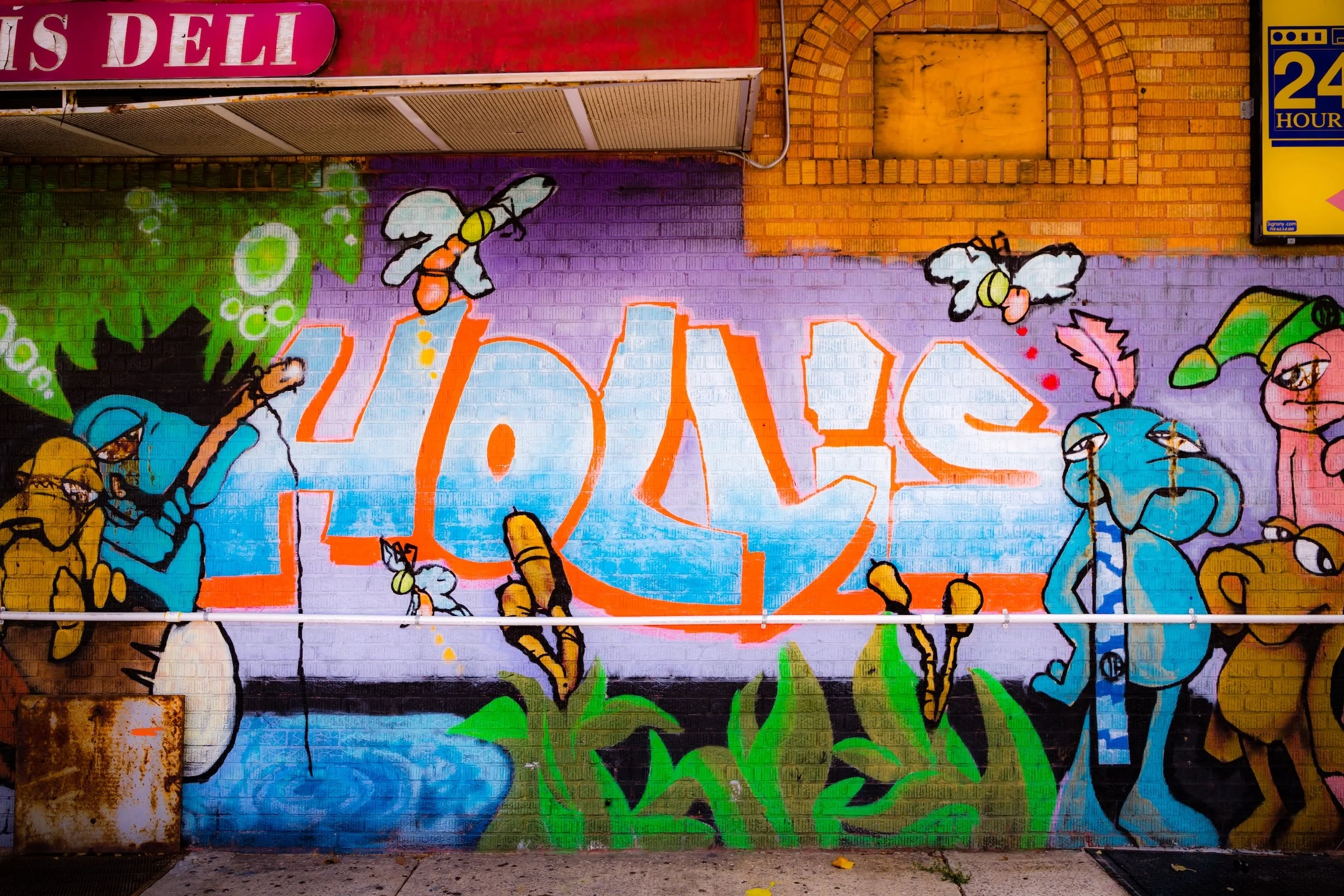
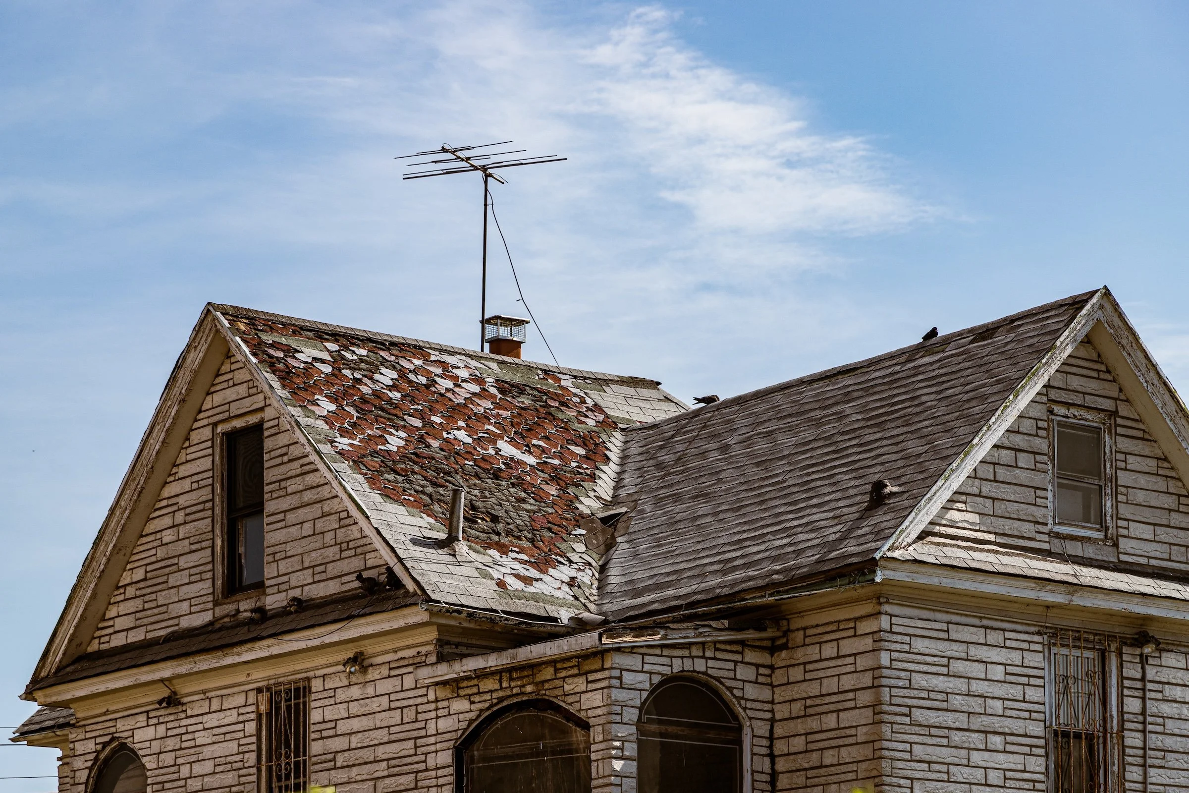
There are three main visual variations in Hollis. First, you have its commercial corridors, centered around major thoroughfares - here you see classic, 2-storey mixed-used rows with commercial storefronts at street level and apartments above. Second, there are wide stretches of bucolic streets with manors and an occasional apartment building. And, finally, there are the sections that are a bit rougher around the edges - vestiges of more uncertain times, punctuated by vibrant and hard-hitting street art. Here are some strategies to help you see it all through the lens:
Photographer's Insight:
Graffiti In Context - Street photography in which crosswalk markings create rhythm, structure, and movement across the frame.
Main Street Portraits - A way of seeing in which natural sunlight turns ordinary scenes luminous, atmospheric, and almost painterly.
The Power of Lines - Photographs shaped by scattered patches of sunlight and shade, where filtered light creates a shifting, mottled pattern across the scene.
Repetitions and Patterns - Direct-light photographs in which the sun enters the frame and reshapes it through rays, flare, halos, or glare.
The Wraparound - Compositions in which a curving or enclosing element, such as a corner, porch, façade, or street edge, draws the eye around the frame and deepens the sense of space.
Of course, these are just the beginning - and hardly the only ways to see Bellaire. I encourage you to experiment and find your own personal Photographic Lexicon.
Through The Lens
If you visit Hollis, these ideas can help inspire your own photography.
Hollis Video Coming Soon
Hollis Photo Gallery
Hollis Field Notes
-
Field Note: August 5, 2023 | 09:50 AM
Conditions: 81°F | Humidity: 51%.
Moving into the more urbanized sections of Hollis, the low humidity ensured that the industrial textures and LIRR infrastructure were captured with documentary precision. The direct afternoon light created sharp, geometric shadows that emphasized the neighborhood's grid-like rhythm.
Hollis presented a landscape of vivid contrasts, where a deep blue sky met the lush, yellow-green canopy of a massive neighborhood tree (“205th Street”). I was struck by the neighborhood's "bucolic" energy—a relaxed, quiet spirit that feels remarkably still despite its proximity to the bustle of the borough.
Other neighborhoods visited:

White Picket At Francis Lewis - Click To Purchase Print

205th Street - Click To Purchase Print
89-32 196th - Click To Purchase Print
Use this custom Google map to explore where every neighborhood in all five boroughs of New York City is located.
The Five Boroughs
One of New York City’s unique qualities is its organization in to 5 boroughs: Manhattan, Brooklyn, Queens, The Bronx, and Staten Island. These boroughs are part pragmatic administrative districts, and part vestiges of the region’s past. Each borough is an entire county in New York State - in fact, Brooklyn is, officially, Kings County, while Staten Island is, officially Richmond County. But that’s not the whole story …
Initially, New York City was located on the southern tip of Manhattan (now the Financial District) that was once the Dutch colony of New Amsterdam. Across the East River, another city was rising: Brooklyn. In time, the city planners realized that unification between the rapidly rising cities would create commercial and industrial opportunities - through streamlined administration of the region.
So powerful was the pull of unification between New York and Brooklyn that three more counties were pulled into the unification: The Bronx, Queens, and Staten Island. And on January 1, 1898, the City of New York unified two cities and three counties into one Greater City of New York - containing the five boroughs we know today.
But because each borough developed differently and distinctly until unification, their neighborhoods likewise uniquely developed. Today, there are nearly 390 neighborhoods, each with their own histories, cultures, cuisines, and personalities - and each with residents who are fiercely proud of their corner of The Big Apple.


