BRONXWOOD
The Bronx
Geographic Setting
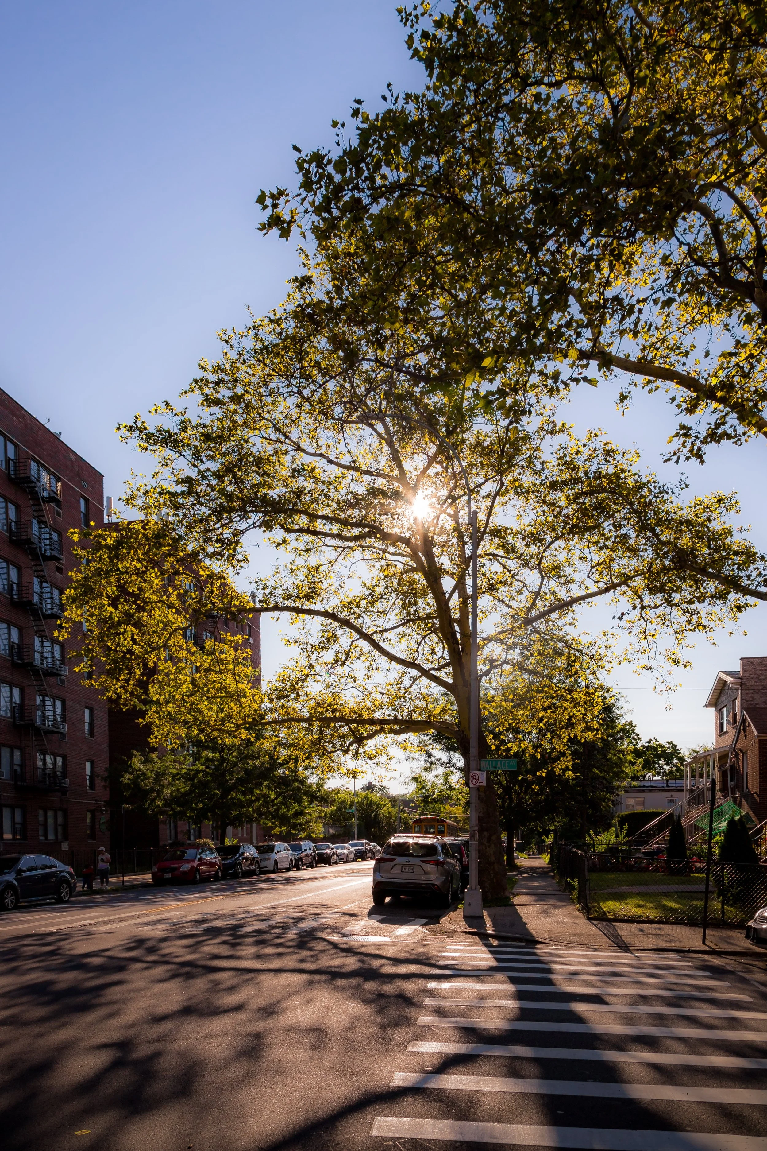
Bounded by Pelham Parkway to the south, Bronx Park East to the west, Waring Avenue to the north, and Williamsbridge Road to the east, Bronxwood forms a compact, residential enclave on the eastern shoulder of the Bronx’s central parkland. Nestled between Bronx Park and the neighborhoods of Allerton and Williamsbridge, it is a place defined by quiet, tree-lined streets and the interplay between nature and urban order. The district’s western boundary runs directly along the green expanse of Bronx Park, giving residents views of woodland and access to paths leading into the Bronx Zoo and the Bronx River Greenway.
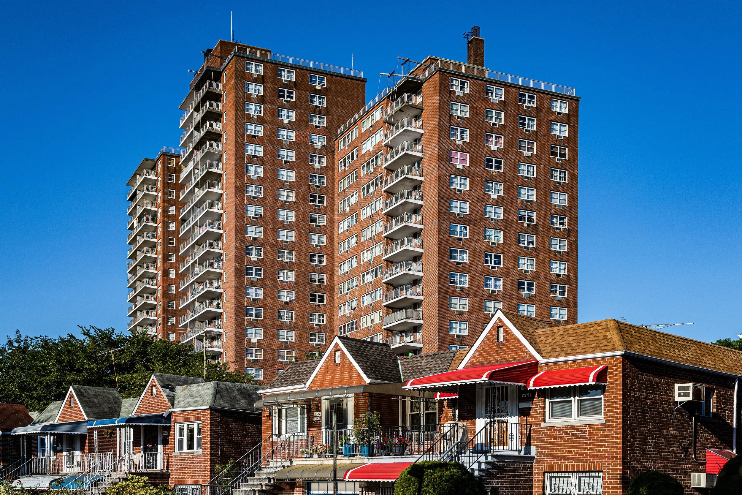
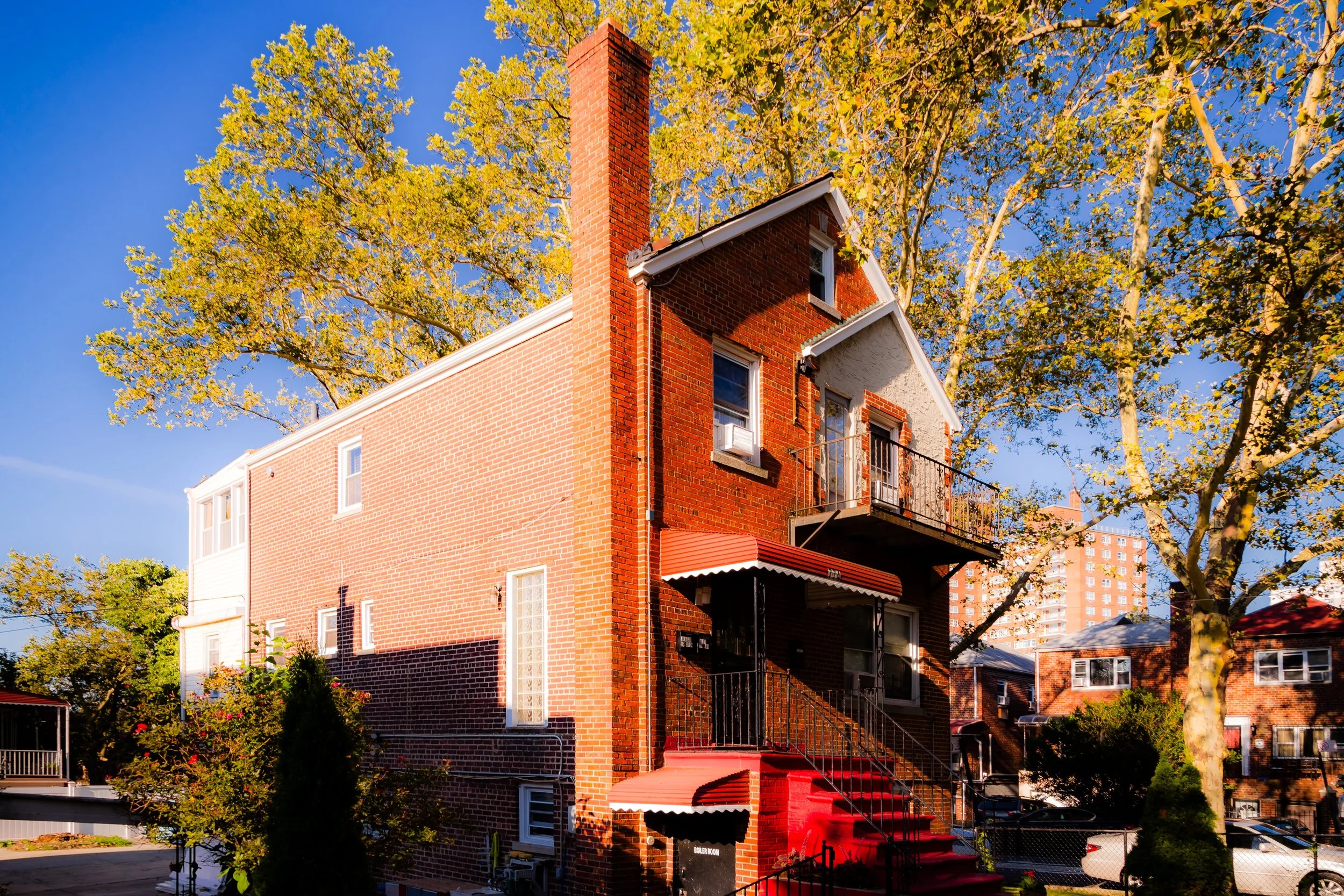
The neighborhood’s internal grid—anchored by Bronxwood Avenue, Paulding Avenue, and Barnes Avenue—is composed primarily of low-rise brick homes, two-family houses, and small apartment buildings, many dating from the early to mid-20th century. Its arteries connect outward to White Plains Road and Boston Road, while Pelham Parkway—a broad, landscaped boulevard designed by the same Olmstedian planners who conceived Central and Bronx Parks—serves as both its southern frame and its greenest link to the rest of the borough. Bronxwood’s geography gives it the rare quality of feeling both enclosed and connected: suburban in rhythm, yet distinctly urban in spirit.
Etymology
The name “Bronxwood” is relatively modern, emerging in the early 20th century as developers sought to market new residential tracts east of Bronx Park. Its etymology combines the borough’s namesake—Jonas Bronck, the 17th-century settler whose homestead lent “The Bronx” its title—with the word “wood,” emphasizing the proximity to the wooded parklands along the Bronx River. The term appeared in property maps and housing advertisements around 1905–1910, appealing to middle-class New Yorkers who desired “modern conveniences in a setting of trees and air.”
While neighboring areas like Williamsbridge and Allerton retained older village names tied to colonial farms and roads, Bronxwood’s name was aspirational—an invented identity rooted in landscape imagery and civic optimism. It signaled both its connection to Bronx Park and its distinction as a planned residential enclave within the borough’s expanding grid.
The Neighborhood
Origins through the 19th Century
Before the arrival of dense housing, the land that became Bronxwood was part of the Town of West Farms, a rural landscape of meadows and woodlots extending eastward from the Bronx River. The Siwanoy, an Algonquian-speaking people, originally inhabited these lands, fishing and farming along the river’s fertile banks.
By the 18th and early 19th centuries, European settlers had divided the territory into farms and estates, linked by primitive dirt roads such as Williamsbridge Road—one of the borough’s oldest thoroughfares, leading north toward the village of Williamsbridge and south toward West Farms. The construction of Bronx Park in 1888, encompassing the Bronx River valley and its surrounding forest, established the western border of the area and preserved its natural backbone. The subsequent introduction of Pelham Parkway (1897) as part of the Bronx’s grand parkway system tied the neighborhood into a visionary green network connecting Bronx Park to Pelham Bay Park.
In this late-19th-century period, Bronxwood remained largely open land—scattered farms, nurseries, and small suburban villas—until the expansion of transit lines and the annexation of the Bronx into New York City (1898) paved the way for residential development.
Early 20th Century: Suburban Ideal in the City
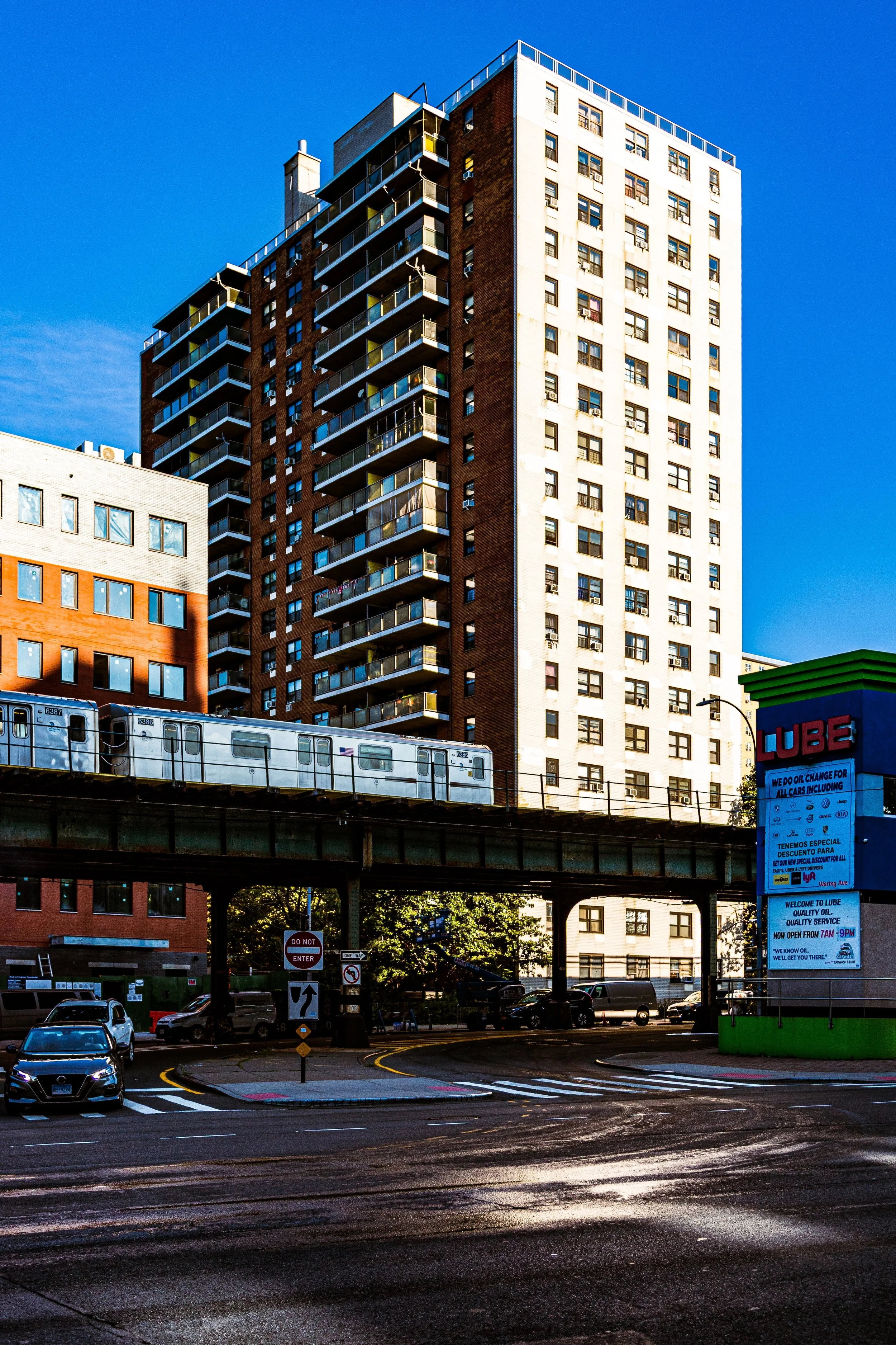
The early 1900s to 1930s marked Bronxwood’s transformation from farmland to a stable, leafy urban neighborhood. Developers subdivided lots along Bronxwood Avenue, Paulding Avenue, and Barnes Avenue, erecting rows of two- and three-story brick houses, many with front gardens and decorative stoops. The extension of the IRT White Plains Road Line (now the 2 and 5 trains) brought convenient access to downtown Manhattan via nearby Allerton Avenue and Burke Avenue stations, spurring population growth.
Bronxwood attracted a diverse mix of middle-income families—Jewish, Italian, and Irish—who sought modern apartments and houses near the parkway and the newly opened Bronx Zoo (1899) and New York Botanical Garden (1891). Schools, synagogues, and small churches soon followed, along with bakeries, groceries, and corner shops that gave each block a self-sustaining rhythm.
The neighborhood’s streetscape, characterized by uniform rows of low-rise homes and narrow lawns, reflected the early 20th-century belief that urban life could be civilized by greenery. Pelham Parkway, with its landscaped malls and tree-lined promenades, became both recreational space and civic statement—a daily reminder that nature and modernity could coexist.
Bronxwood Video Coming Soon
Mid–Late 20th Century: Continuity Amid Urban Upheaval
Through the 1950s and 1960s, Bronxwood remained a pocket of stability even as the broader Bronx underwent dramatic demographic and economic shifts. Many original Jewish and Italian families moved to the suburbs, and new waves of African-American and Puerto Rican residents arrived, drawn by accessible housing and the neighborhood’s reputation for safety and greenery.
During the city’s fiscal crisis of the 1970s, when neighboring districts such as Crotona and Morrisania suffered from arson and abandonment, Bronxwood’s primarily owner-occupied housing stock and strong community networks helped preserve its integrity. Civic associations worked with the Bronx Borough President’s office and local churches to maintain services and resist decline. The opening of new schools and the persistence of local businesses along White Plains Road and Boston Road sustained daily life even in difficult times.
In these decades, Bronxwood quietly exemplified the Bronx’s capacity for adaptation without collapse—its small blocks remained lived-in, its homes cared for, and its parkway a source of pride.
21st Century: Renewal, Diversity, and Livability
Today, Bronxwood thrives as a diverse, middle-class neighborhood whose enduring character lies in its balance between stability and change. The community reflects the full mosaic of the Bronx’s modern population—Caribbean, African-American, Hispanic, South Asian, and Albanian families living side by side in homes passed down or newly purchased.
The Bronx River Greenway and the revitalization of Bronx Park East have reconnected residents to the river that shaped the area’s history, while investments in nearby schools, libraries, and recreation facilities have strengthened neighborhood cohesion. Many early-20th-century homes have been carefully renovated, retaining their brick facades and stoops while gaining modern interiors. Pelham Parkway’s landscaped malls remain both transportation route and outdoor commons, lined with joggers, strollers, and dog walkers on summer evenings.
The neighborhood’s proximity to major Bronx cultural landmarks—the Bronx Zoo, Botanical Garden, and Bronx Park Forest—continues to define its identity as an urban green zone. Bronxwood’s residents enjoy the paradox that defines so much of the Bronx’s best living: a place within the city that still feels like a suburb, where community, greenery, and access coexist in equilibrium.
Bronxwood Photo Gallery
Spirit and Legacy
The spirit of Bronxwood is one of quiet endurance and neighborly pride. It has never sought attention nor required reinvention; instead, it has persisted through change by holding fast to its modest ideals—family, stability, and respect for the green spaces that surround it. The neighborhood’s rhythm, shaped by the parkway’s breezes and the hum of nearby trains, carries the essence of Bronx life at its best: grounded, adaptable, and deeply local.
New York City
Use this custom Google map to explore where every neighborhood in all five boroughs of New York City is located.
The Five Boroughs
One of New York City’s unique qualities is its organization in to 5 boroughs: Manhattan, Brooklyn, Queens, The Bronx, and Staten Island. These boroughs are part pragmatic administrative districts, and part vestiges of the region’s past. Each borough is an entire county in New York State - in fact, Brooklyn is, officially, Kings County, while Staten Island is, officially Richmond County. But that’s not the whole story …
Initially, New York City was located on the southern tip of Manhattan (now the Financial District) that was once the Dutch colony of New Amsterdam. Across the East River, another city was rising: Brooklyn. In time, the city planners realized that unification between the rapidly rising cities would create commercial and industrial opportunities - through streamlined administration of the region.
So powerful was the pull of unification between New York and Brooklyn that three more counties were pulled into the unification: The Bronx, Queens, and Staten Island. And on January 1, 1898, the City of New York unified two cities and three counties into one Greater City of New York - containing the five boroughs we know today.
But because each borough developed differently and distinctly until unification, their neighborhoods likewise uniquely developed. Today, there are nearly 390 neighborhoods, each with their own histories, cultures, cuisines, and personalities - and each with residents who are fiercely proud of their corner of The Big Apple.


