DONGAN HILLS COLONY
Staten Island
Geographic Setting
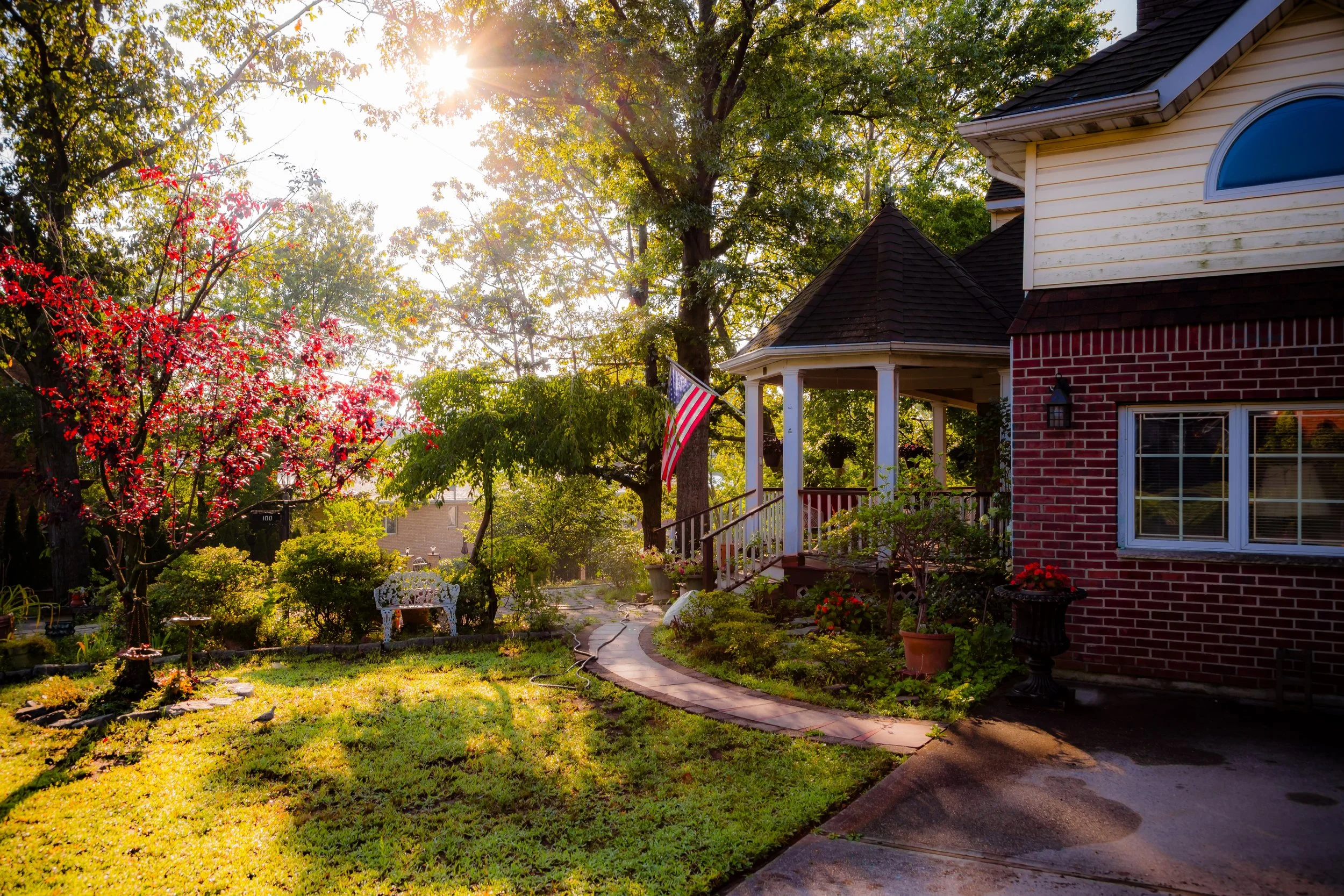
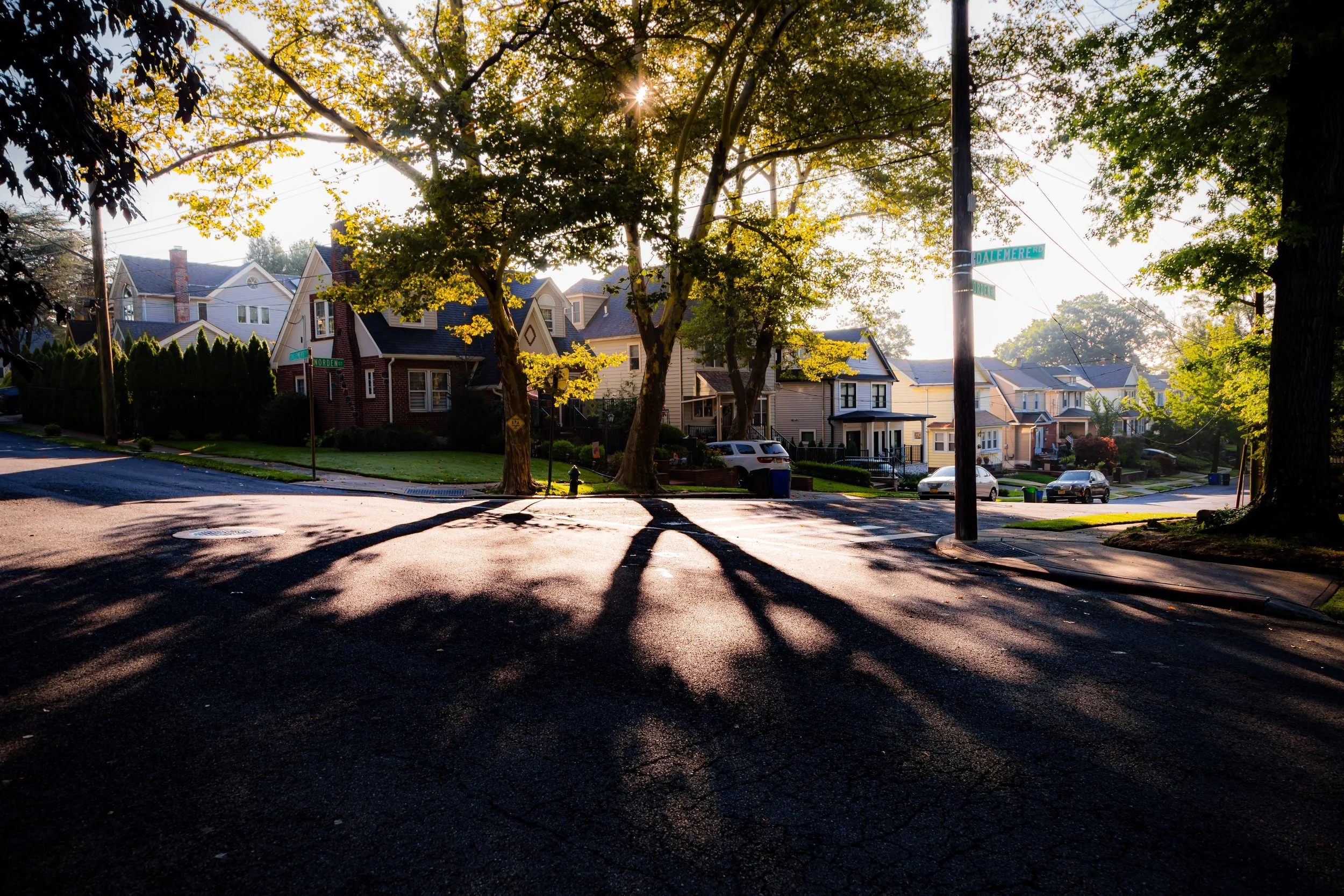
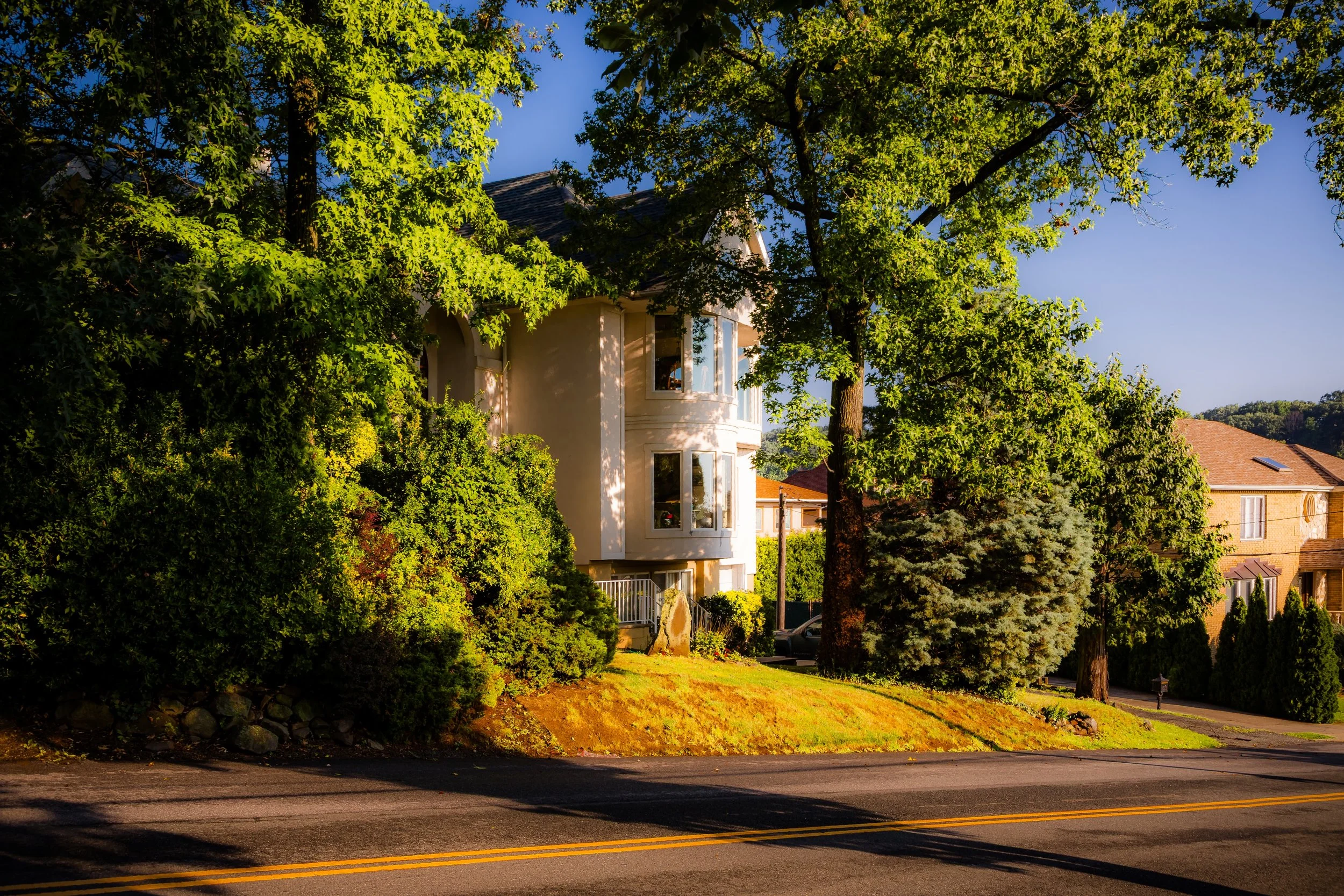
Bounded by Medford Avenue and Rome Avenue to the north, Richmond Road to the east, Gorge Road to the southwest, and Reeds Basket Willow Swamp Park to the west, Dongan Hills Colony occupies one of the most scenic and secluded elevations on Staten Island’s eastern slope. Perched high above the lowlands of Dongan Hills and Old Town, the Colony lies along the lower flank of Todt Hill, offering sweeping views across the island to the Lower New York Bay and, on clear days, the distant skyline of Manhattan. Its curving lanes, old stone walls, and densely wooded lots evoke a quiet, country atmosphere despite being just minutes from the Staten Island Expressway and the Verrazzano-Narrows Bridge.
The neighborhood’s physical setting—rolling terrain framed by mature oaks, tulip trees, and the protected wetlands of Reeds Basket Willow Swamp—creates a distinct sense of retreat. Roads such as Colonial Court, Dalemere Road, and Longfellow Avenue follow the natural contours of the hillside rather than a rigid grid, reflecting the planned, picturesque vision of early 20th-century suburban development. The area’s combination of elevation, greenery, and architectural variety makes Dongan Hills Colony one of Staten Island’s most exclusive and enduringly beautiful residential enclaves.
Etymology
The name Dongan Hills Colony draws from both history and aspiration. “Dongan Hills” honors Thomas Dongan, the 17th-century colonial governor of New York, while the addition of “Colony” reflects early 20th-century marketing language meant to evoke gentility, exclusivity, and a self-contained community. The term suggested an enclave of refined suburban living—a planned “colony” for professionals and city dwellers seeking sanctuary from Manhattan’s congestion.
This naming tradition paralleled similar developments across the New York region, such as Douglaston’s “Colonial Park” or Forest Hills Gardens in Queens. By the 1920s, the phrase “Dongan Hills Colony” signified not just geography but lifestyle: wooded estates, winding roads, and a deliberate contrast to the denser housing developing in the flatter lowlands below.
The Neighborhood
Origins through the 19th Century
Long before its subdivision, the land that would become Dongan Hills Colony was part of the agricultural hinterland of Staten Island’s East Shore. In the 18th and 19th centuries, farms occupied the fertile base of the hills, while the uplands above Richmond Road were left largely forested, crisscrossed by wagon paths and stone fences. These wooded slopes—offering both elevation and drainage—were highly valued by early settlers but remained sparsely populated due to their inaccessibility.
By the mid-19th century, the region formed part of the Town of Southfield, where farming families like the Brittons and the Croakers worked the lower lands and harvested timber from the ridges. The arrival of the Staten Island Railway (1860) and the growing suburban expansion around Old Town began to draw interest toward the high ground. Wealthier New Yorkers, including merchants and professionals, started purchasing tracts for summer residences, finding in the hills a pastoral refuge within ferry distance of Manhattan.
Yet the steep, undeveloped slopes above Richmond Road remained largely untouched into the early 20th century—a green barrier between the working-class village below and the rising estates atop Todt Hill to the west.
Early 20th Century: The Planned Suburban Colony
The modern identity of Dongan Hills Colony emerged in the 1920s, when developers recognized the appeal of the hillside’s vistas and serenity. Taking advantage of improved roads and automobile access, the Dongan Hills Colony Company and similar ventures marketed the area as an elite residential park, offering large wooded lots with restrictive covenants to preserve the area’s aesthetic character. Advertisements from the era promised “country life within the city,” emphasizing paved roads, modern utilities, and views of New York Harbor.
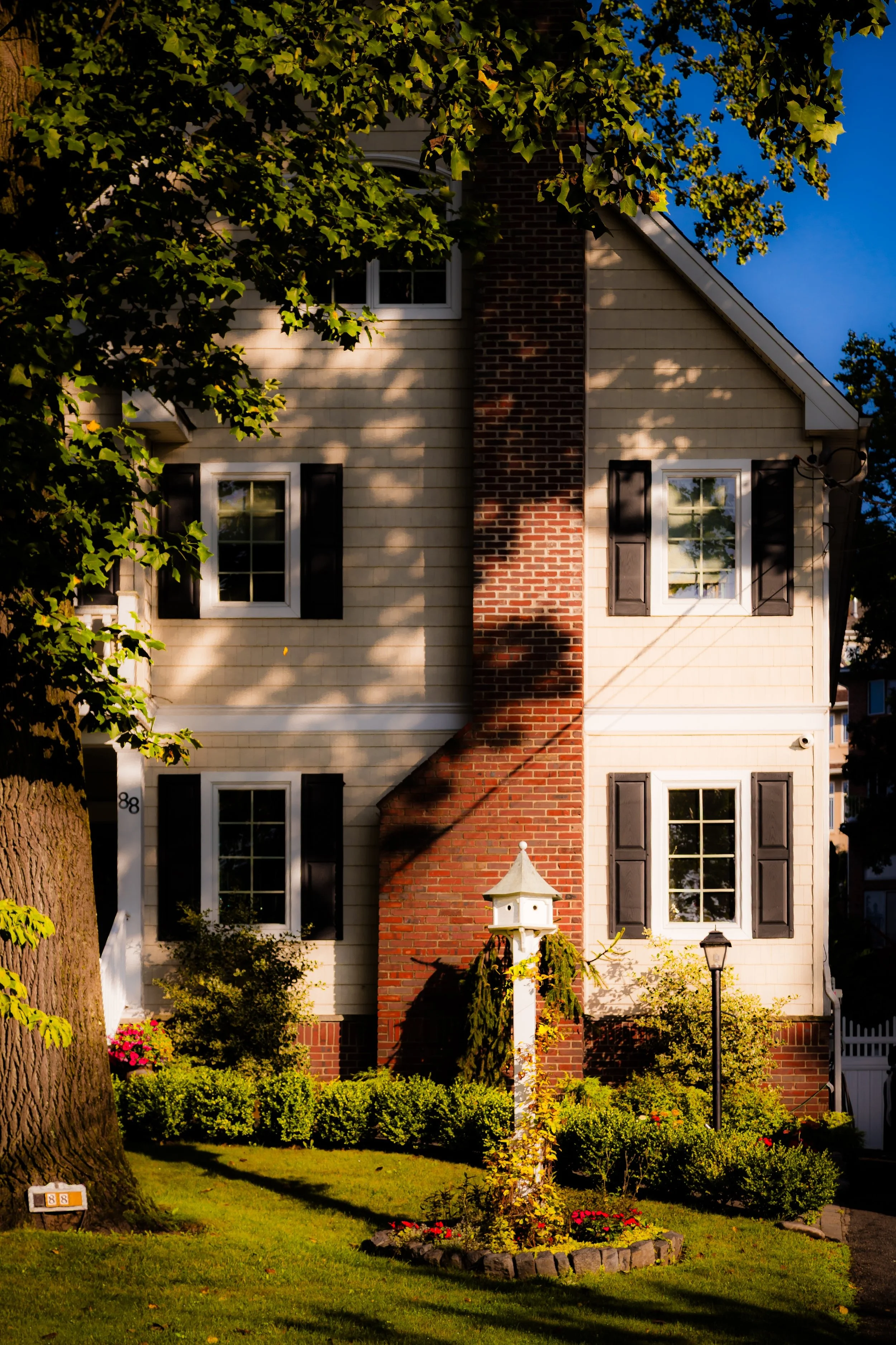
Architecturally, the neighborhood reflected the suburban ideals of its time. Spacious homes in Colonial Revival, Tudor, and Mediterranean styles appeared on curving roads like Reed Avenue, Todt Hill Road, and Milbank Road. Many houses were individually designed, featuring stone facades, slate roofs, and terraced gardens that complemented the natural topography. Developers worked to retain the woodland character, limiting lot subdivision and protecting mature trees—principles that continue to shape the neighborhood’s appearance.
By the 1930s, Dongan Hills Colony had established itself as one of Staten Island’s most desirable addresses—a hillside community of civic leaders, professionals, and artists who prized privacy, architecture, and nature in equal measure.
Dongan Hills Colony Video Coming Soon
Mid–Late 20th Century: Prestige and Preservation
During the postwar suburban boom of the 1950s and 1960s, the lower neighborhoods of Dongan Hills and Midland Beach underwent rapid expansion, but Dongan Hills Colony maintained its exclusivity. The steep terrain and large lot sizes deterred mass development, preserving the early 20th-century layout and architectural diversity.
The construction of the Staten Island Expressway to the north and the Verrazzano-Narrows Bridge (1964) increased accessibility, and some larger estates were subdivided into smaller parcels, but the Colony’s essential landscape—wooded, winding, and elevated—remained intact. Civic groups and homeowners’ associations organized to protect zoning regulations and advocate for environmental preservation, particularly the protection of Reeds Basket Willow Swamp, the wetland forest that borders the community’s western edge.
By the 1970s, as much of Staten Island filled with suburban housing tracts, Dongan Hills Colony stood apart as an enclave of continuity and refinement. Its tree canopy and historic homes attracted writers, architects, and city officials seeking quietude without isolation. The balance of accessibility and seclusion became its defining hallmark.
21st Century: Continuity Amid Change
In the 21st century, Dongan Hills Colony remains one of Staten Island’s most distinctive neighborhoods—an area of deep-rooted stability surrounded by ongoing urban transformation. While nearby Dongan Hills has grown more densely residential, the Colony retains its spacious lots and lush topography. Many of its early 20th-century houses have been meticulously restored, and new construction adheres closely to the neighborhood’s aesthetic standards.
The surrounding parklands—Reeds Basket Willow Swamp Park, Clove Lakes Park, and High Rock Park—form a greenbelt that shields the community from overdevelopment and provides residents with trails, bird habitats, and glimpses of Staten Island’s native landscape. Environmental stewardship remains central to the Colony’s identity, with homeowners’ associations actively involved in flood mitigation and ecological preservation efforts.
Though accessible to downtown Staten Island and Manhattan via nearby expressways, Dongan Hills Colony retains a distinct sense of remove. Its quiet, curving roads, historical homes, and deep green vistas lend it a timeless quality rare within New York City’s boundaries. The neighborhood’s residents—drawn by its natural beauty and architectural grace—embody a continuing commitment to the ideals of harmony, landscape, and heritage upon which the Colony was founded.
Dongan Hills Colony Photo Gallery
Spirit and Legacy
The spirit of Dongan Hills Colony is one of elevation—both literal and cultural. Rising above the lowlands of the East Shore, it represents Staten Island’s aspiration toward planned beauty, community identity, and environmental respect. Its legacy lies not only in its architecture or exclusivity, but in its enduring vision of suburban life defined by landscape rather than density.
New York City
Use this custom Google map to explore where every neighborhood in all five boroughs of New York City is located.
The Five Boroughs
One of New York City’s unique qualities is its organization in to 5 boroughs: Manhattan, Brooklyn, Queens, The Bronx, and Staten Island. These boroughs are part pragmatic administrative districts, and part vestiges of the region’s past. Each borough is an entire county in New York State - in fact, Brooklyn is, officially, Kings County, while Staten Island is, officially Richmond County. But that’s not the whole story …
Initially, New York City was located on the southern tip of Manhattan (now the Financial District) that was once the Dutch colony of New Amsterdam. Across the East River, another city was rising: Brooklyn. In time, the city planners realized that unification between the rapidly rising cities would create commercial and industrial opportunities - through streamlined administration of the region.
So powerful was the pull of unification between New York and Brooklyn that three more counties were pulled into the unification: The Bronx, Queens, and Staten Island. And on January 1, 1898, the City of New York unified two cities and three counties into one Greater City of New York - containing the five boroughs we know today.
But because each borough developed differently and distinctly until unification, their neighborhoods likewise uniquely developed. Today, there are nearly 390 neighborhoods, each with their own histories, cultures, cuisines, and personalities - and each with residents who are fiercely proud of their corner of The Big Apple.


