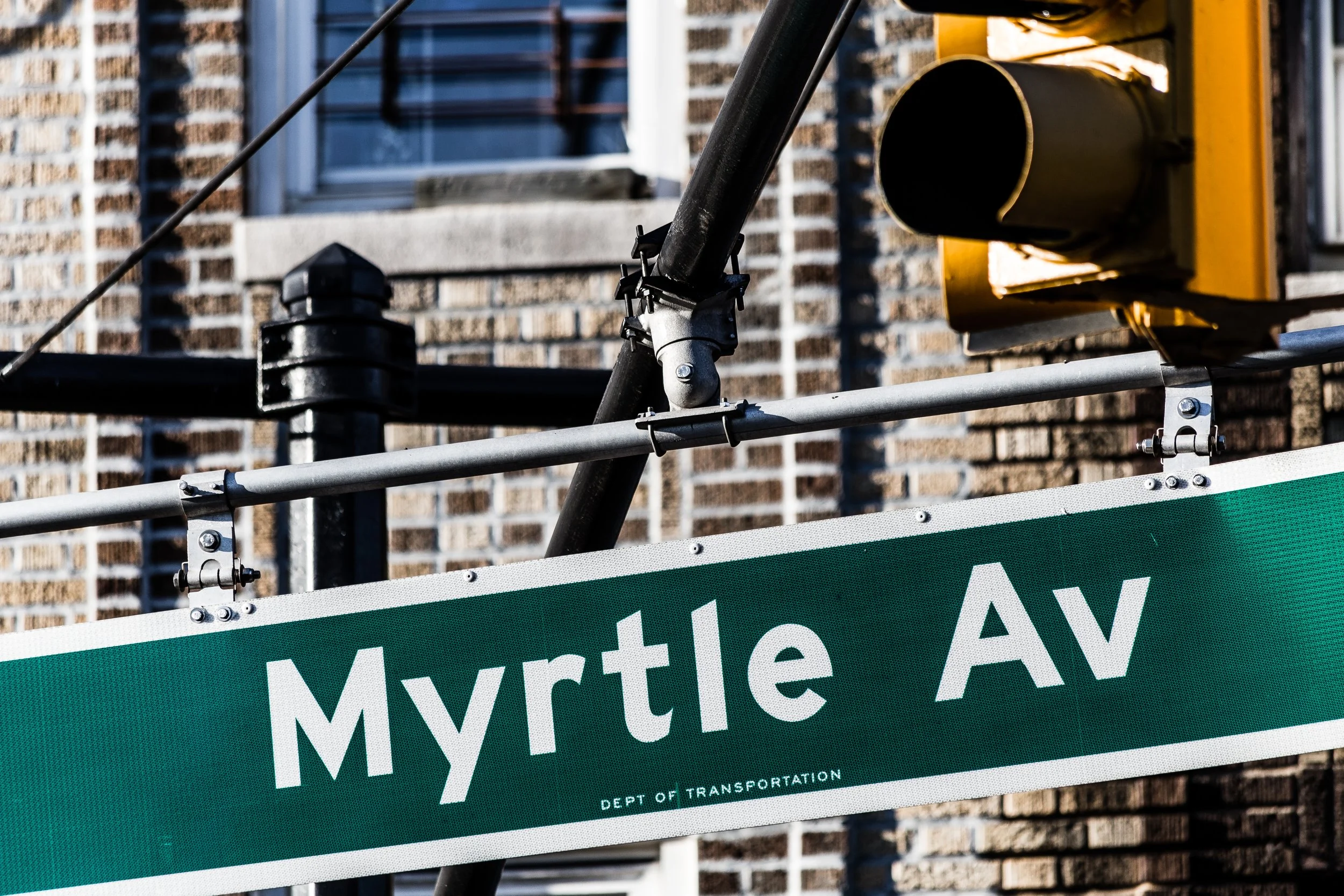
MYRTLE AVENUE
Geographic Setting
Myrtle Avenue runs like a historic current through the heart of Brooklyn and western Queens—an east–west spine stretching nearly 8 miles, from the Brooklyn waterfront in DUMBO to Jamaica Avenue in Richmond Hill. Beginning near Jay Street and Flatbush Avenue Extension, it travels eastward through Fort Greene, Clinton Hill, Bedford-Stuyvesant, Bushwick, and Ridgewood, before crossing into Glendale and Richmond Hill, Queens. Along its route, the avenue weaves together some of New York’s oldest industrial corridors, most architecturally rich brownstone districts, and most culturally dynamic neighborhoods.
Myrtle Avenue’s landscape evolves constantly: in the west, near Fort Greene Park and the Brooklyn Navy Yard, it hums with new restaurants, design studios, and renovated lofts. Through Bed-Stuy and Bushwick, it retains its grit and vibrancy, lined with 19th-century storefronts, rowhouses, murals, and the overhead tracks of the Myrtle Avenue Elevated (the M Line). Further east, in Ridgewood and Glendale, it widens into a suburban-style commercial boulevard of bakeries, hardware stores, and family businesses that trace their roots back generations.
No other street in New York City traverses so many distinct worlds in so short a distance. Myrtle Avenue is, in effect, the boroughs’ living chronicle—an unbroken record of industrial might, working-class struggle, cultural reinvention, and urban resilience.
Etymology
Myrtle Avenue takes its name from the myrtle shrub, a fragrant evergreen plant associated with peace, prosperity, and remembrance—qualities that early developers sought to evoke when laying out the road in the early 19th century. The name also reflected contemporary fashion: plant and flower names (like Magnolia, Willow, and Myrtle) were common in the suburbanizing grids of antebellum Brooklyn.
When the avenue was first opened around 1835, it ran from Fulton Street east toward what is now Bedford-Stuyvesant, providing access to the Wallabout Bay and the Brooklyn Navy Yard. Its pastoral name belied the industrial vigor it would soon embody—a fitting metaphor for Brooklyn itself, where beauty and labor, nature and machinery, coexisted in tension and harmony.
The Avenue
Origins through the 19th Century: From Country Road to Urban Artery
In the early 1800s, the land that Myrtle Avenue would traverse was a patchwork of farmland and country estates lying beyond the limits of old Brooklyn Village. The construction of the Brooklyn Navy Yard (1801) to the north and the expansion of ferry service to Manhattan transformed the area into an industrial hub. Myrtle Avenue was graded and paved in stages through the 1830s and 1840s to provide a direct route from the Navy Yard to the rural settlements of Cripplebush (later Bushwick) and Ridgewood.
By the 1840s, the avenue had become one of Brooklyn’s principal thoroughfares. The western sections near Adelphi Street and Carlton Avenue filled with boarding houses and workshops serving shipwrights, carpenters, and sailors employed at the Navy Yard. Taverns and boardinghouses clustered around what became known as “Sand Street,” the entry point to the yard, giving the neighborhood a rough-edged maritime character.
Eastward, near what is now Bedford-Stuyvesant, the avenue developed as a mixed residential and commercial corridor. The Myrtle Avenue horsecar line, introduced in the 1850s, connected commuters to the Fulton Ferry and downtown Brooklyn, while the expansion of tenements and brownstones reflected the city’s growing middle class. The avenue’s eastern terminus in Ridgewood remained semi-rural well into the late 19th century, marked by German beer gardens, small farms, and the earliest sections of Evergreens Cemetery.
By 1870, Myrtle Avenue was fully integrated into Brooklyn’s street grid—an unbroken line of movement from waterfront to woodlot, stitching together the borough’s urban patchwork.
Early 20th Century: The El, the Working Class, and the Golden Mile
The dawn of the 20th century transformed Myrtle Avenue into one of the busiest corridors in Brooklyn. In 1888, the Myrtle Avenue Elevated Railway opened, running from Adams Street in downtown Brooklyn to Ridgewood, Queens. Elevated steel tracks, rumbling trolleys, and overhead wires defined its skyline, making the avenue both a transit lifeline and an industrial frontier. Beneath its iron canopy, a dense streetscape of markets, tailor shops, and saloons flourished—so lively that locals dubbed sections of it “The Golden Mile.”
The avenue served as the economic artery of working-class Brooklyn. Immigrant families—German, Irish, Jewish, and Italian—lived in the surrounding rowhouses and worked in nearby factories producing furniture, textiles, and machinery. Streetcars clanged, vendors hawked wares, and children played under the elevated’s shadow.
In Fort Greene and Clinton Hill, the avenue took on a more genteel tone, lined with 19th-century brownstones, small theaters, and department stores like Hoffman’s and Liebmann’s Brewery, whose aroma once defined the neighborhood. East of Broadway Junction, Myrtle Avenue’s character became unmistakably blue-collar: a hive of small industry, taverns, and union halls.
By the 1930s, the Myrtle Avenue Elevated connected to both the Brooklyn Bridge trolley terminal and the Queens-bound lines, cementing the avenue’s role as a working-class backbone linking two boroughs in motion.
Mid–Late 20th Century: Decline, Hardship, and Survival
The mid-20th century brought both infrastructure change and economic decline. The postwar exodus to the suburbs, coupled with industrial decommissioning, left many stretches of Myrtle Avenue struggling. The Navy Yard closed in 1966, removing tens of thousands of jobs. Department stores shuttered, and the once-bustling Myrtle Avenue El—criticized for noise and blight—was partially dismantled between 1944 and 1969 (the western section between Jay Street and Broadway).
In neighborhoods like Fort Greene and Bedford-Stuyvesant, disinvestment and redlining deepened poverty. Myrtle Avenue became synonymous with urban decay—its storefronts boarded up, its sidewalks lined with vacant lots. Local residents referred to the most desolate stretch between Navy Street and Classon Avenue as “Murder Avenue,” a grim pun on its decline.
Yet amid hardship, the avenue’s communities endured. Churches, block associations, and storefront organizations worked tirelessly to maintain safety and cohesion. Immigrant and Black-owned businesses emerged as anchors—barbershops, diners, laundromats, and bodegas that served residents when larger chains withdrew. In Ridgewood and Glendale, meanwhile, Myrtle retained its stability, its German and Italian family businesses persisting through the economic turbulence of the 1970s and 1980s.
21st Century: Renaissance, Resilience, and Reinvention
In the 21st century, Myrtle Avenue has reemerged as one of the most emblematic urban corridors in New York’s revival. The western end, once derelict, now hums with creative energy. The Myrtle Avenue Brooklyn Partnership, founded in 1999, led a community-driven revitalization that transformed storefronts, improved lighting, and nurtured small businesses. Fort Greene and Clinton Hill have become cultural centers again, defined by cafés, bookshops, and murals that celebrate the neighborhood’s history of jazz, art, and activism.
In Bedford-Stuyvesant and Bushwick, Myrtle Avenue remains an urban crossroads. Graffiti-covered warehouses have become artist studios and galleries; old tenements now house diverse populations of newcomers and longtime residents. The elevated M train, still running east from Broadway Junction, continues to define the avenue’s rhythm, its iron shadow now part of the street’s gritty aesthetic rather than a symbol of decline.
Eastward into Ridgewood, Glendale, and Middle Village, Myrtle Avenue retains its old-world texture. Bakeries like Rudy’s Pastry Shop and family-owned delis preserve the German-Italian heritage of the area, while newer Dominican, Polish, and South American communities add new flavors to the mix. The avenue’s Queens stretch, with its steady hum of buses, groceries, and diners, stands as a living counterpoint to the gentrified west—a reminder that New York’s soul is most visible in the places that never stopped working.
Today, Myrtle Avenue is once again a place of gathering and movement. It connects universities, housing projects, parks, and cemeteries, serving as a tangible link between the boroughs’ past and future. Urban renewal projects, bike lanes, and public art installations have made it a laboratory for community-based design, while its affordable housing initiatives and small-business networks reflect the push for equitable development.
Spirit and Legacy
The spirit of Myrtle Avenue lies in endurance. It has carried the city’s working classes, artists, and dreamers for nearly two centuries—its iron tracks and cobblestones worn by generations of labor and hope. From the clang of trolleys to the hum of subways, from factory whistles to jazz drifting through Fort Greene windows, its story has never been static.
Its legacy is written in the survival of its neighborhoods: the stoops of Bed-Stuy, the cafés of Clinton Hill, the bakeries of Ridgewood, and the quiet dignity of Glendale. Myrtle Avenue is not merely a street but a microcosm of New York’s capacity for reinvention—a place where history and modernity walk side by side.
New York City
Use this custom Google map to explore where every neighborhood in all five boroughs of New York City is located.
The Five Boroughs
One of New York City’s unique qualities is its organization in to 5 boroughs: Manhattan, Brooklyn, Queens, The Bronx, and Staten Island. These boroughs are part pragmatic administrative districts, and part vestiges of the region’s past. Each borough is an entire county in New York State - in fact, Brooklyn is, officially, Kings County, while Staten Island is, officially Richmond County. But that’s not the whole story …
Initially, New York City was located on the southern tip of Manhattan (now the Financial District) that was once the Dutch colony of New Amsterdam. Across the East River, another city was rising: Brooklyn. In time, the city planners realized that unification between the rapidly rising cities would create commercial and industrial opportunities - through streamlined administration of the region.
So powerful was the pull of unification between New York and Brooklyn that three more counties were pulled into the unification: The Bronx, Queens, and Staten Island. And on January 1, 1898, the City of New York unified two cities and three counties into one Greater City of New York - containing the five boroughs we know today.
But because each borough developed differently and distinctly until unification, their neighborhoods likewise uniquely developed. Today, there are nearly 390 neighborhoods, each with their own histories, cultures, cuisines, and personalities - and each with residents who are fiercely proud of their corner of The Big Apple.
