PRINCE’S BAY
Staten Island
Geographic Setting
Bounded by Drumgoole Road and the Korean War Veterans Parkway to the north, Chisholm Street and Cornelia Avenue to the east, Prince’s Bay to the south, and Woodvale Avenue to the west, Prince’s Bay occupies one of Staten Island’s most picturesque and historically resonant stretches of the South Shore. It lies between Pleasant Plains and Huguenot, where gentle slopes descend from wooded uplands to the tidal coves and marshes that open into Raritan Bay.
The neighborhood’s landscape is a study in contrasts: tree-lined residential streets and spacious homes inland give way to wetlands, salt meadows, and tranquil inlets along the shore. The Staten Island Railway bisects the neighborhood, its Prince’s Bay station forming the heart of local life near Seguine Avenue, a historic thoroughfare that winds toward the water and the grand 19th-century Seguine Mansion. To the south lies the Lemon Creek Park and Marina, a rare ecological jewel where freshwater and saltwater habitats converge beneath wide skies. Within this mosaic of nature and settlement, Prince’s Bay endures as one of Staten Island’s most graceful communities—where history, water, and open space shape both the land and its sense of place.
Etymology
The name Prince’s Bay—sometimes rendered without the apostrophe as Princes Bay—dates to the 18th century, though its precise origin remains uncertain. Local lore suggests it was named for an English or Dutch ship called The Prince that once anchored in the bay’s deep natural harbor. Another theory holds that it honored a British prince or naval officer during the colonial period.
Regardless of its origin, the name reflects the area’s maritime identity and its long relationship with the bay itself. In the 19th century, “Prince’s Bay” was a name of prosperity and reputation, associated with both the thriving oyster industry and the genteel estates that lined its shores. Today, the name continues to evoke that heritage—suggesting both nobility and nature, and reminding residents of their enduring connection to the sea.
The Neighborhood
Origins through the 19th Century
Long before European settlement, the Lenape people fished and gathered shellfish along the tidal flats of Prince’s Bay, drawn to its sheltered coves and abundant marine life. In the late 1600s, Dutch and English settlers established farms and small docks along what would become the South Shore of Staten Island. The region’s fertile soil and access to navigable waters made it ideal for both agriculture and maritime trade.
By the early 19th century, Prince’s Bay had grown into a prosperous coastal village centered on Amboy Road and Seguine Avenue. Farming families—including the Seguine, Poillon, and LaForge clans—owned extensive tracts of land that stretched from the interior fields down to the water’s edge. The opening of the Prince’s Bay Lighthouse (1828) and the deepening of local channels made the bay a hub for shipping and oyster harvesting. By mid-century, Prince’s Bay oysters were internationally famous—renowned for their size, flavor, and purity—and exported as far as Europe.
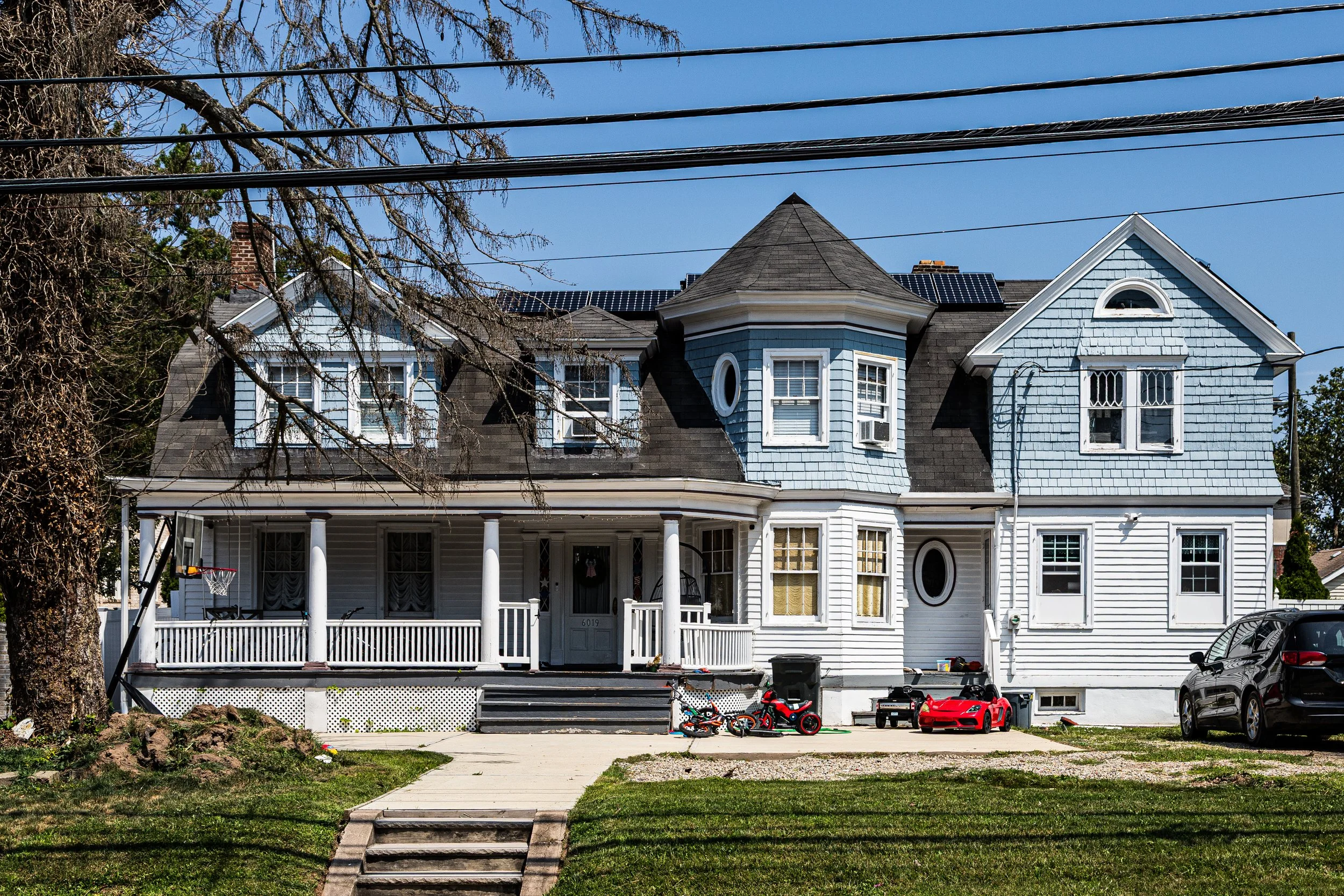
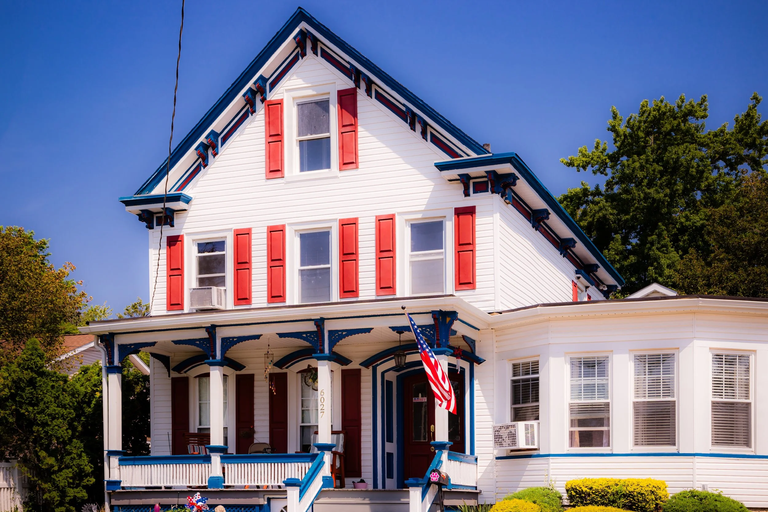
The wealth generated by the oyster industry supported the construction of elegant homes and estates, most notably the Seguine Mansion, built in 1838 by Joseph H. Seguine, a descendant of early French Huguenot settlers. The Greek Revival mansion, with its commanding columns and sweeping views of the bay, symbolized both the prosperity and refinement of the period. Around it, a small but vibrant community grew—complete with wharves, general stores, and churches that served farmers, mariners, and tradesmen alike.
Early 20th Century: A Seaside Village in Transition
At the dawn of the 20th century, Prince’s Bay retained much of its rural charm even as Staten Island urbanized. The arrival of the Staten Island Railway (1860) had transformed access to the South Shore, linking Prince’s Bay residents to St. George and Manhattan ferries in under an hour. This accessibility encouraged the development of summer cottages and boarding houses, and by the 1910s, the area had become a favored seasonal destination for New Yorkers seeking seaside retreat.
The oyster industry declined around the same time, devastated by pollution and overharvesting, but the community adapted. Many oyster families turned to boatbuilding, small commerce, or farming, while others found employment at nearby Mount Loretto, the sprawling Catholic mission and orphanage established by Father John Drumgoole in 1882. The presence of Mount Loretto gave the area both an institutional anchor and a moral center, its farmlands and chapel overlooking the same waters once plied by oyster sloops.
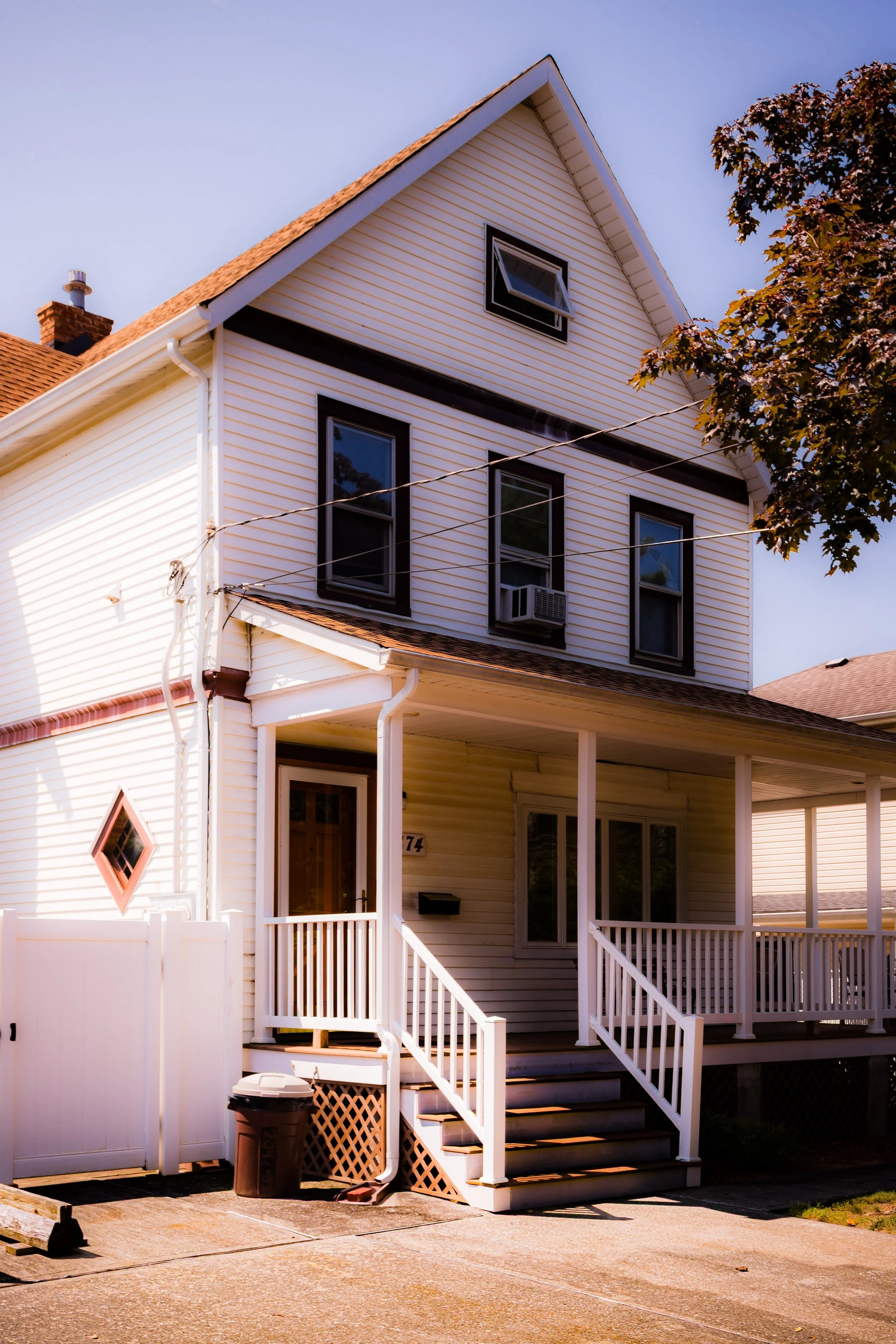
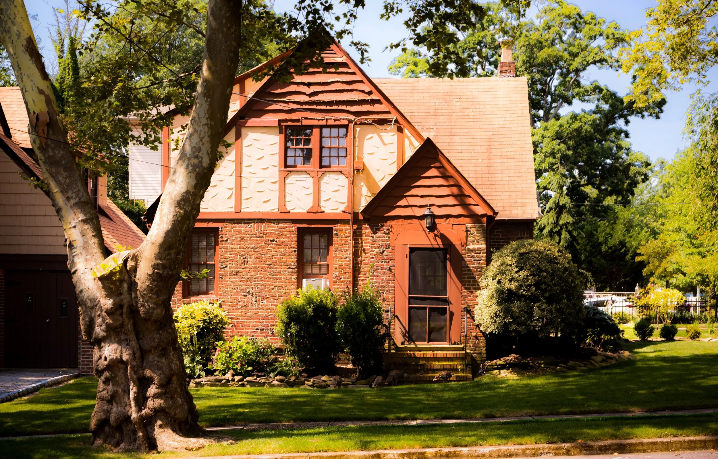
Residential development accelerated modestly between the World Wars, with Craftsman-style homes and bungalows filling former farmland. Yet Prince’s Bay retained a semi-rural character well into the mid-century—its identity shaped as much by its open landscapes and shoreline breezes as by its built environment.
Prince’s Bay Video Coming Soon
Mid–Late 20th Century: Suburban Growth and Preservation
The post–World War II era brought sweeping transformation to Staten Island, and Prince’s Bay was no exception. The opening of the Verrazzano-Narrows Bridge (1964) spurred a wave of suburban migration, and new housing developments spread across the South Shore. Yet Prince’s Bay remained less densely built than its northern neighbors, buffered by wetlands, parklands, and the protective expanse of Mount Loretto Unique Area to the southwest.
The construction of the Korean War Veterans Parkway (1960s–70s) defined the community’s northern boundary and improved access to other parts of the island, while the creation of Lemon Creek Park preserved one of Staten Island’s last intact salt marsh systems. The park’s marina became a beloved community landmark, reflecting the neighborhood’s deep maritime heritage.
During these decades, Prince’s Bay evolved into a stable, middle-class residential neighborhood characterized by single-family homes, quiet streets, and strong civic life. The Prince’s Bay Civic Association and local parishes played central roles in preserving the community’s character and advocating for infrastructure and environmental protection. Through storms and shifting demographics, the area remained a model of suburban serenity—neither urban nor rural, but something distinctively Staten Island.
21st Century: Heritage, Resilience, and Renewal
In the 21st century, Prince’s Bay continues to balance preservation and progress. Its shoreline, once home to oyster docks, is now protected within Lemon Creek Park and Mount Loretto Unique Area, forming part of the Gateway National Recreation Area network. These green spaces serve as vital buffers against coastal flooding and as havens for herons, egrets, and migrating shorebirds.
Residentially, Prince’s Bay has experienced a quiet renaissance. Historic homes, including the Seguine Mansion—restored in the late 20th century and managed by the City of New York as a cultural site—stand alongside newer homes built with sensitivity to the landscape. The Staten Island Railway station continues to provide efficient access to the ferry, ensuring that Prince’s Bay remains connected while maintaining its seclusion.
Demographically, the neighborhood reflects Staten Island’s evolving diversity, with a mix of longtime Italian- and Irish-American families joined by newer residents from across the city and world. The local schools, parks, and waterfront remain central to community life, while environmental stewardship—especially in light of Hurricane Sandy (2012)—has become a defining priority. Ongoing shoreline restoration and wetland conservation projects underscore the neighborhood’s awareness of both its ecological fragility and its natural beauty.
Prince’s Bay Photo Gallery
Spirit and Legacy
The spirit of Prince’s Bay lies in its continuity between past and present—a place where the rhythms of the tide mirror those of the community itself. From the oyster sloops of the 19th century to the commuter trains of today, it has always been a neighborhood shaped by movement, trade, and quiet endurance.
Its legacy is written in both its architecture and its landscape: in the columns of the Seguine Mansion, the marshes of Lemon Creek, and the view from the marina where sky and sea converge. Prince’s Bay remains one of Staten Island’s most storied and serene locales, where the air still carries a hint of salt and history alike.
New York City
Use this custom Google map to explore where every neighborhood in all five boroughs of New York City is located.
The Five Boroughs
One of New York City’s unique qualities is its organization in to 5 boroughs: Manhattan, Brooklyn, Queens, The Bronx, and Staten Island. These boroughs are part pragmatic administrative districts, and part vestiges of the region’s past. Each borough is an entire county in New York State - in fact, Brooklyn is, officially, Kings County, while Staten Island is, officially Richmond County. But that’s not the whole story …
Initially, New York City was located on the southern tip of Manhattan (now the Financial District) that was once the Dutch colony of New Amsterdam. Across the East River, another city was rising: Brooklyn. In time, the city planners realized that unification between the rapidly rising cities would create commercial and industrial opportunities - through streamlined administration of the region.
So powerful was the pull of unification between New York and Brooklyn that three more counties were pulled into the unification: The Bronx, Queens, and Staten Island. And on January 1, 1898, the City of New York unified two cities and three counties into one Greater City of New York - containing the five boroughs we know today.
But because each borough developed differently and distinctly until unification, their neighborhoods likewise uniquely developed. Today, there are nearly 390 neighborhoods, each with their own histories, cultures, cuisines, and personalities - and each with residents who are fiercely proud of their corner of The Big Apple.


