
SILVER BEACH
The Bronx
Geographic Setting
Bounded by Hollywood Avenue to the west, Shurz Avenue and Mullan Place to the north, Hammond Creek to the east, and the East River to the south and southwest, Silver Beach occupies one of the most secluded and picturesque corners of the Bronx—a small, waterfront enclave tucked into the southeastern edge of Throgs Neck. Hidden behind gated entrances and shaded by mature trees, the neighborhood overlooks the meeting point of the East River, Long Island Sound, and the Throgs Neck Bridge, whose massive cables rise just to the east.
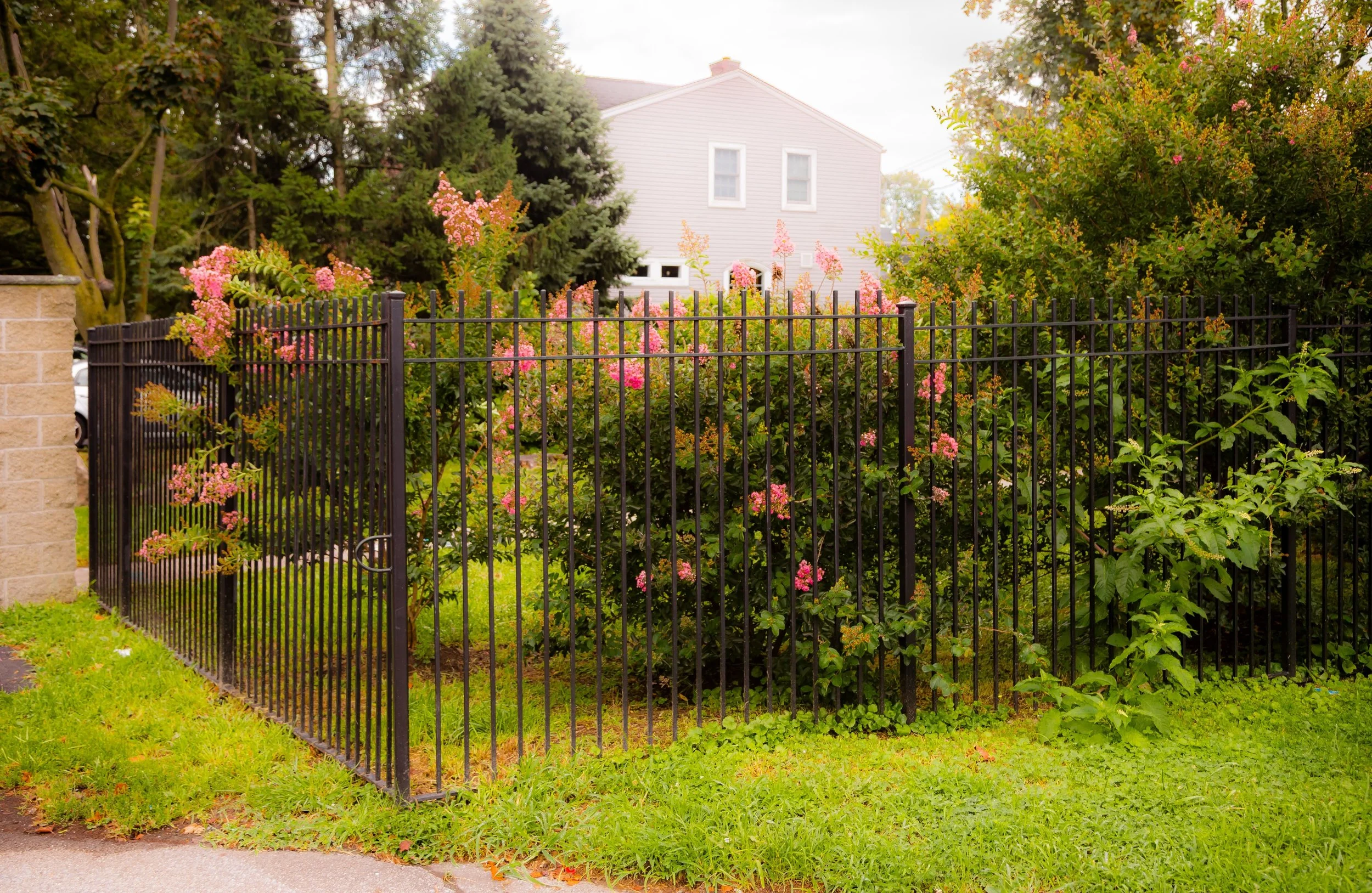
The terrain slopes gently toward the shoreline, where private docks, rocky coves, and narrow lanes create an almost village-like atmosphere. Within its compact boundaries, Silver Beach Gardens Cooperative—established in the early 20th century—dominates the landscape. Small, cottage-style houses, many with porches and gardens, line winding streets such as Clarence Avenue, Crosby Avenue, and Emerson Avenue. The waterfront is visible from nearly every block, and communal greens, playgrounds, and beachfront access points form the heart of daily life. Despite its proximity to major arteries like the Throgs Neck Expressway, Silver Beach feels far removed from the city beyond its gates—a quiet maritime hamlet perched at the edge of New York’s most urban borough.
Etymology
The name “Silver Beach” dates to the early 1900s, when developers sought to attract New Yorkers to a new cooperative community on the East River’s sparkling shore. The “Silver” alludes to the way sunlight glints off the water and sand, especially at sunrise and sunset; the “Beach” evokes both geography and lifestyle—a promise of recreation, refuge, and shoreline living.
This lyrical naming followed a broader trend of coastal branding in early 20th-century Bronx developments, where idyllic English and seaside names—Edgewater Park, Harding Park, Locust Point—were chosen to market working- and middle-class escapes from the dense city. Silver Beach, however, grew into something more enduring than a summer colony: it became a year-round community, shaped by cooperative governance and a profound sense of shared stewardship.
The Neighborhood
Origins through the 19th Century
Before its suburban transformation, the land that became Silver Beach was part of the Throgg (or Throgs) Neck Peninsula, named after John Throckmorton, a 17th-century English settler who received a land patent from Dutch authorities in 1642. For centuries thereafter, the area remained largely rural—its rocky shorelines and salt marshes used for small-scale farming, fishing, and shipbuilding.
By the 19th century, the Throgs Neck coast had become dotted with country estates and summer retreats for New York’s merchant class. The waterfront’s combination of sea breezes and relative isolation made it a desirable location for seasonal cottages and boarding houses. As industrialization and immigration reshaped the Bronx’s inland neighborhoods, the peninsula’s periphery—particularly near Hammond Creek and the East River—remained semi-rural, accessible only by carriage and ferry.
The opening of the Bronx and Pelham Parkway (late 19th century) and the growth of local trolleys gradually made Throgs Neck reachable to city dwellers seeking weekend respite. By the early 1900s, enterprising developers recognized the opportunity to create a cohesive residential enclave on this scenic waterfront—laying the foundations for Silver Beach.
Early 20th Century: Founding of Silver Beach Gardens
The modern neighborhood began with the establishment of Silver Beach Gardens Cooperative in 1920. Conceived as one of New York City’s earliest cooperative housing communities, it was organized under a limited equity model, in which residents owned shares in the collective rather than their individual houses outright—a structure designed to keep housing affordable and ensure community control.
At the time, the area’s isolation from public transit and its proximity to the East River made it ideal for a self-contained community. The cooperative’s founders—many of them Irish and Italian working-class families—constructed bungalows and cottages from repurposed materials, some salvaged from decommissioned buildings and ships. Narrow, curved lanes replaced the Bronx’s grid, creating a European-style village atmosphere unique in New York City.
During the 1920s–1930s, Silver Beach developed a distinct identity: communal yet private, maritime yet metropolitan. Residents built seawalls, gardens, and small docks, and established cooperative rules that governed everything from architecture to community maintenance. The beach itself—small but sandy—became a central gathering place, especially in summer, when families held picnics and fireworks displays overlooking the river.
Silver Beach Video Coming Soon
Mid–Late 20th Century: Stability and Stewardship
Silver Beach weathered the urban upheavals of the mid-20th century with remarkable stability. As nearby areas of the Bronx experienced population turnover and economic decline, the cooperative model ensured collective responsibility and long-term investment. The community maintained its modest homes and green spaces through volunteer committees, sustaining a sense of shared purpose rare in the city’s outer boroughs.
The opening of the Throgs Neck Bridge in 1961, whose Bronx anchorage lies just east of the neighborhood, dramatically altered the surrounding landscape. Yet while traffic and infrastructure transformed Throgs Neck’s main arteries, Silver Beach remained largely untouched—its internal street network deliberately closed to non-residents. The construction of the Bruckner Expressway and Throgs Neck Expressway made the enclave even more insular, but also more self-reliant.
Through the 1970s–1980s, Silver Beach preserved its low-rise, family-oriented identity. Its demographics evolved slowly, with a growing mix of Italian-American, Irish-American, and Puerto Rican families who valued the cooperative’s affordability and community governance. During this era, Silver Beach came to symbolize a successful urban cooperative—proof that shared ownership could foster long-term stability and civic pride.
21st Century: Waterfront Renewal and Preservation
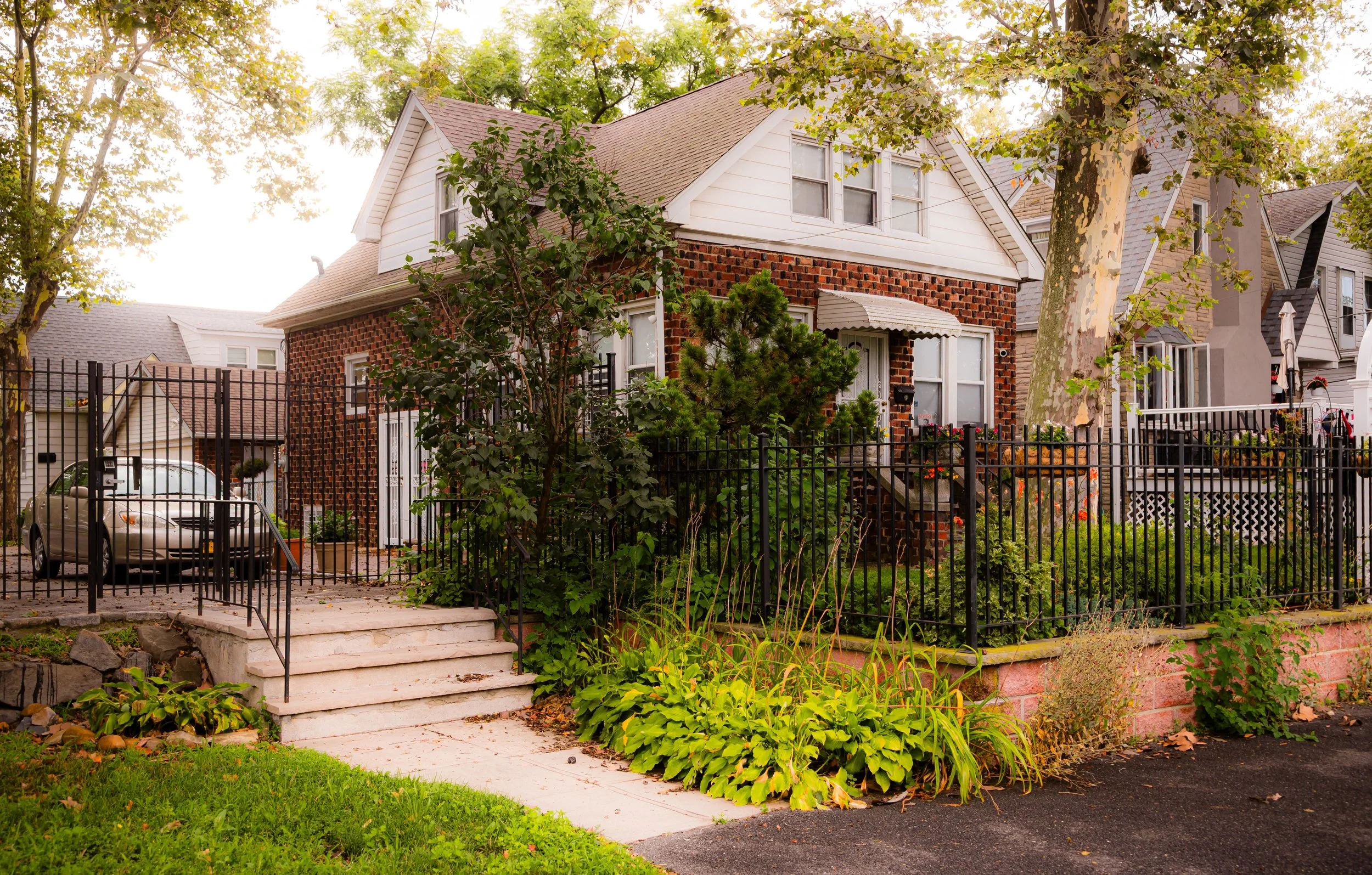
In the 21st century, Silver Beach has maintained its distinct identity while adapting to new realities. As waterfront land across New York City has become increasingly valuable, the community’s model of collective ownership has shielded it from the speculative development seen elsewhere. The houses—once modest summer cottages—have been lovingly renovated, often expanded or modernized while preserving the original scale and charm.
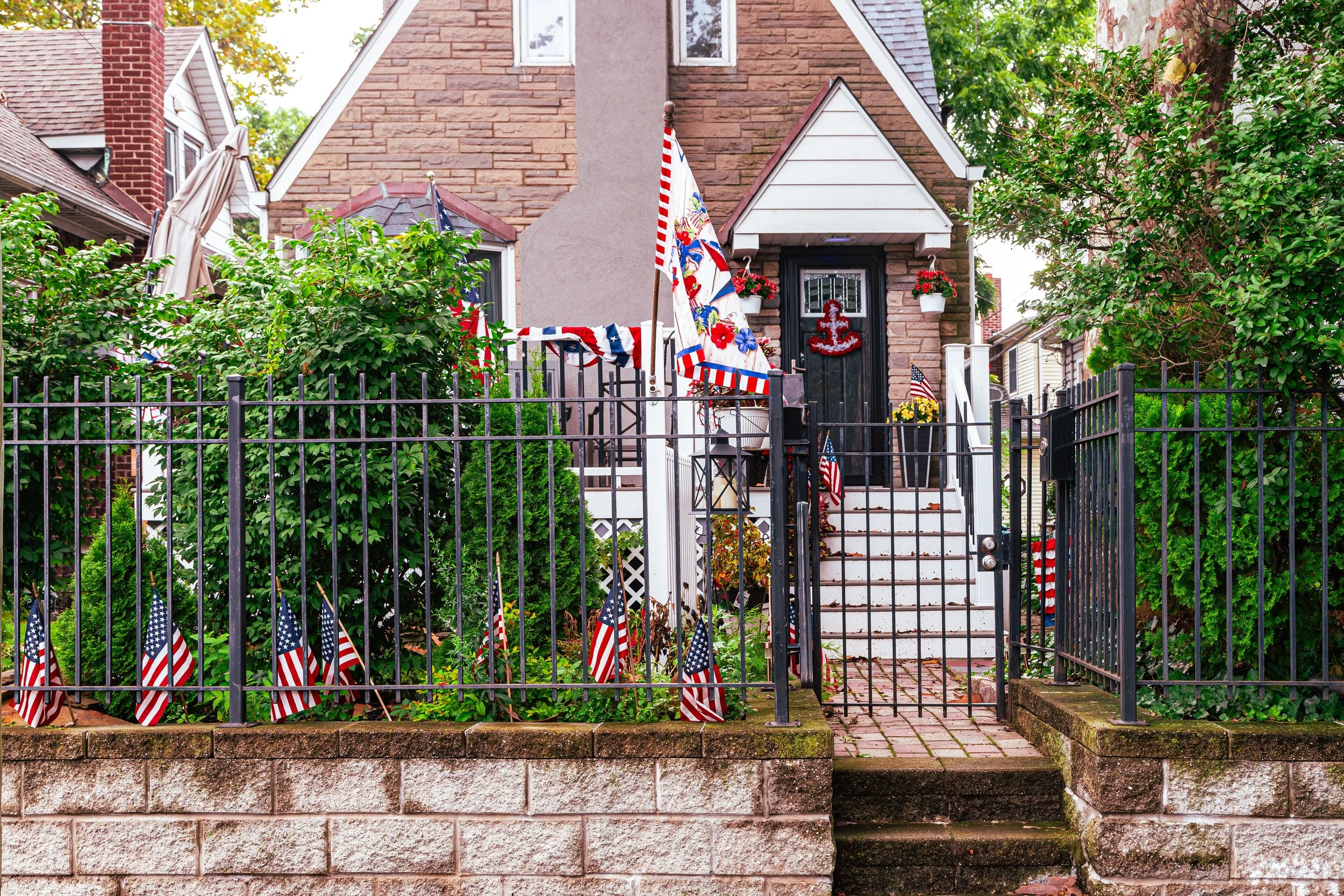
Community efforts have focused on shoreline restoration and flood resilience, with new seawall reinforcements and environmental measures to protect against rising tides and storm surges. The Silver Beach Association continues to manage maintenance, security, and events, while residents gather for annual traditions like the Fourth of July parade and summer barbecues by the water.
The neighborhood remains economically and architecturally distinct: a mix of upgraded cottages and new homes, unified by narrow lanes, shared green spaces, and panoramic views of the East River, Whitestone Bridge, and Queens shoreline. Its proximity to larger retail areas in Throgs Neck allows residents the best of both worlds—privacy and convenience, tradition and modernity.
Silver Beach Photo Gallery
Spirit and Legacy
The spirit of Silver Beach lies in its remarkable continuity—a true coastal village within the city. Its legacy is one of stewardship: residents preserving not just homes, but a way of life grounded in cooperation, respect for the land, and enduring community bonds. Here, the water is not backdrop but identity—the constant presence shaping daily life and collective memory.
New York City
Use this custom Google map to explore where every neighborhood in all five boroughs of New York City is located.
The Five Boroughs
One of New York City’s unique qualities is its organization in to 5 boroughs: Manhattan, Brooklyn, Queens, The Bronx, and Staten Island. These boroughs are part pragmatic administrative districts, and part vestiges of the region’s past. Each borough is an entire county in New York State - in fact, Brooklyn is, officially, Kings County, while Staten Island is, officially Richmond County. But that’s not the whole story …
Initially, New York City was located on the southern tip of Manhattan (now the Financial District) that was once the Dutch colony of New Amsterdam. Across the East River, another city was rising: Brooklyn. In time, the city planners realized that unification between the rapidly rising cities would create commercial and industrial opportunities - through streamlined administration of the region.
So powerful was the pull of unification between New York and Brooklyn that three more counties were pulled into the unification: The Bronx, Queens, and Staten Island. And on January 1, 1898, the City of New York unified two cities and three counties into one Greater City of New York - containing the five boroughs we know today.
But because each borough developed differently and distinctly until unification, their neighborhoods likewise uniquely developed. Today, there are nearly 390 neighborhoods, each with their own histories, cultures, cuisines, and personalities - and each with residents who are fiercely proud of their corner of The Big Apple.


