
MILL BASIN
Brooklyn
Geographic Setting
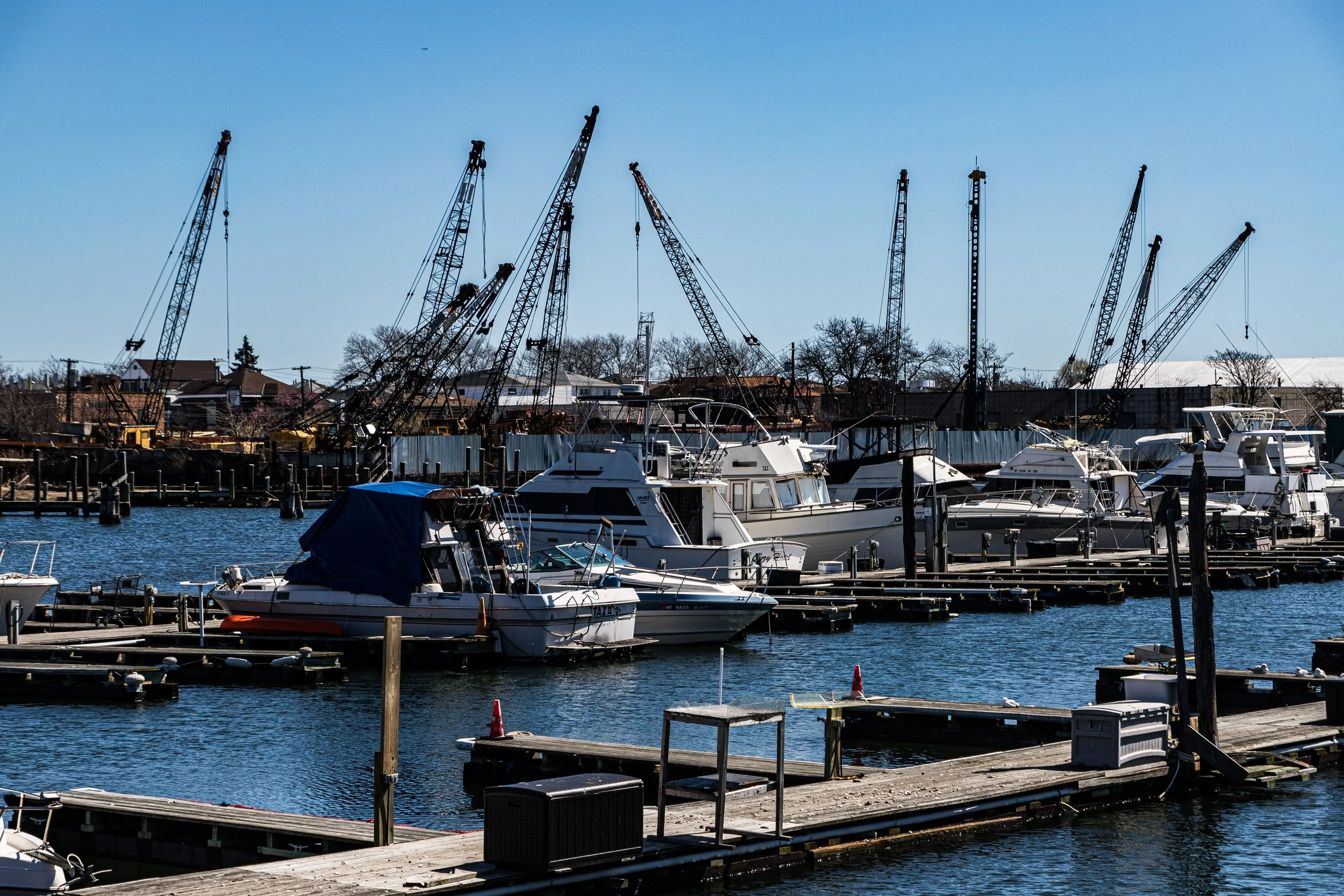
Situated on a low peninsula along Jamaica Bay, Mill Basin occupies one of the most distinctive geographies in New York City: a network of inlets, canals, and man-made peninsulas forming a self-contained enclave of homes by the water. It lies south of Avenue T and east of Marine Park, bordered by Mill Basin Inlet to the west, Jamaica Bay to the south, and Mill Island Channel and Floyd Bennett Field to the east. The neighborhood’s curved streets and shimmering canals reveal its dual nature—half city, half coastal retreat—where pleasure boats moor behind backyards and seabirds glide over salt marshes that predate the borough itself.
Etymology and Origins
Mill Basin takes its name from the 17th-century tidal mill that once operated on the nearby Gerritsen Creek, the same waterway that defined Marine Park’s early history. The “mill” referred to the gristmill built by the Gerritsen family in the 1640s, which harnessed the power of the bay’s tides to grind grain for the Dutch farmers of Flatlands. The term “basin” was adopted later, when engineers dredged and widened the creek and its surrounding marshes in the early 20th century to create deepwater moorings for shipping and, eventually, pleasure craft.
Before European settlement, the area was part of the territory of the Canarsee Lenape, whose seasonal camps dotted the shores of Jamaica Bay. They fished its waters and harvested oysters, establishing the region’s first maritime culture. Dutch colonists claimed the land in the mid-1600s, transforming the wetlands into farms and salt-hay meadows. For the next two centuries, the shoreline remained pastoral and sparsely inhabited—a landscape of reeds, gulls, and windmills.
The Neighborhood
19th Century: Rural Isolation and Early Industry
Through the 1800s, the area that would become Mill Basin remained under the jurisdiction of Flatlands, one of Brooklyn’s six original Dutch towns. The few roads—ancestors of Avenue U and Strickland Avenue—were little more than sandy tracks. The Gerritsen Mill, still operating in diminished form, was surrounded by fields and tidal flats.
By the late 19th century, industrial investors recognized the potential of the area’s deepwater channels. Companies such as National Lead and Atlantic Aviation acquired land for factories, warehouses, and, later, airfield development. The nearby creation of Floyd Bennett Field in the 1930s, the city’s first municipal airport, gave the basin strategic importance, but the surrounding marshlands remained largely undeveloped.
Early 20th Century: Engineering the Peninsula
Modern Mill Basin was largely man-made. In the 1920s and 1930s, engineers dredged canals and filled marshes to create buildable land. The project was ambitious—a coastal grid of curved streets designed around yacht basins and coves. Plans for industrial terminals and luxury housing came and went with the Depression, but the landscape’s essential shape was set: an artificial peninsula reaching into the bay.
After World War II, the city sold much of the reclaimed land to private developers. Builders envisioned a marine suburb within the five boroughs—affordable yet glamorous, accessible by car, and centered around boating. Streets were named for bays and coasts—Strickland, Bergen, Mayfair, National—and the first ranch houses appeared in the 1950s.
Mid-20th Century: Suburban Transformation
The 1950s and 1960s marked Mill Basin’s true birth as a residential neighborhood. Developers such as Fred Trump and Samuel LeFrak, already active elsewhere in Brooklyn and Queens, built rows of single-family brick houses with driveways, basements, and backyards that opened directly to the water. The construction of the Belt Parkway in the 1940s had made the area reachable within minutes from central Brooklyn, attracting upwardly mobile families—mostly Jewish and Italian-American—seeking new homes beyond the city’s older tenement districts.
The result was a uniquely suburban enclave within New York: streets lined with split-level houses, manicured lawns, and private docks. Residents boated in summer, skated on the frozen inlets in winter, and sent children to nearby P.S. 236 and Roy H. Mann Junior High School. The Kings Plaza Shopping Center, opened in 1970 just across the Flatbush Avenue bridge, reinforced the neighborhood’s self-sufficiency and prosperity.
Religious life flourished as well. Temple Sholom, St. Bernard of Clairvaux Church, and later the Chabad of Mill Basin reflected the area’s growing cultural mix. The community’s civic pride found voice in the Mill Basin Civic Association, which remains active in local planning and environmental advocacy.
Mill Basin Photographic Video
Late 20th Century: Preservation and Prestige
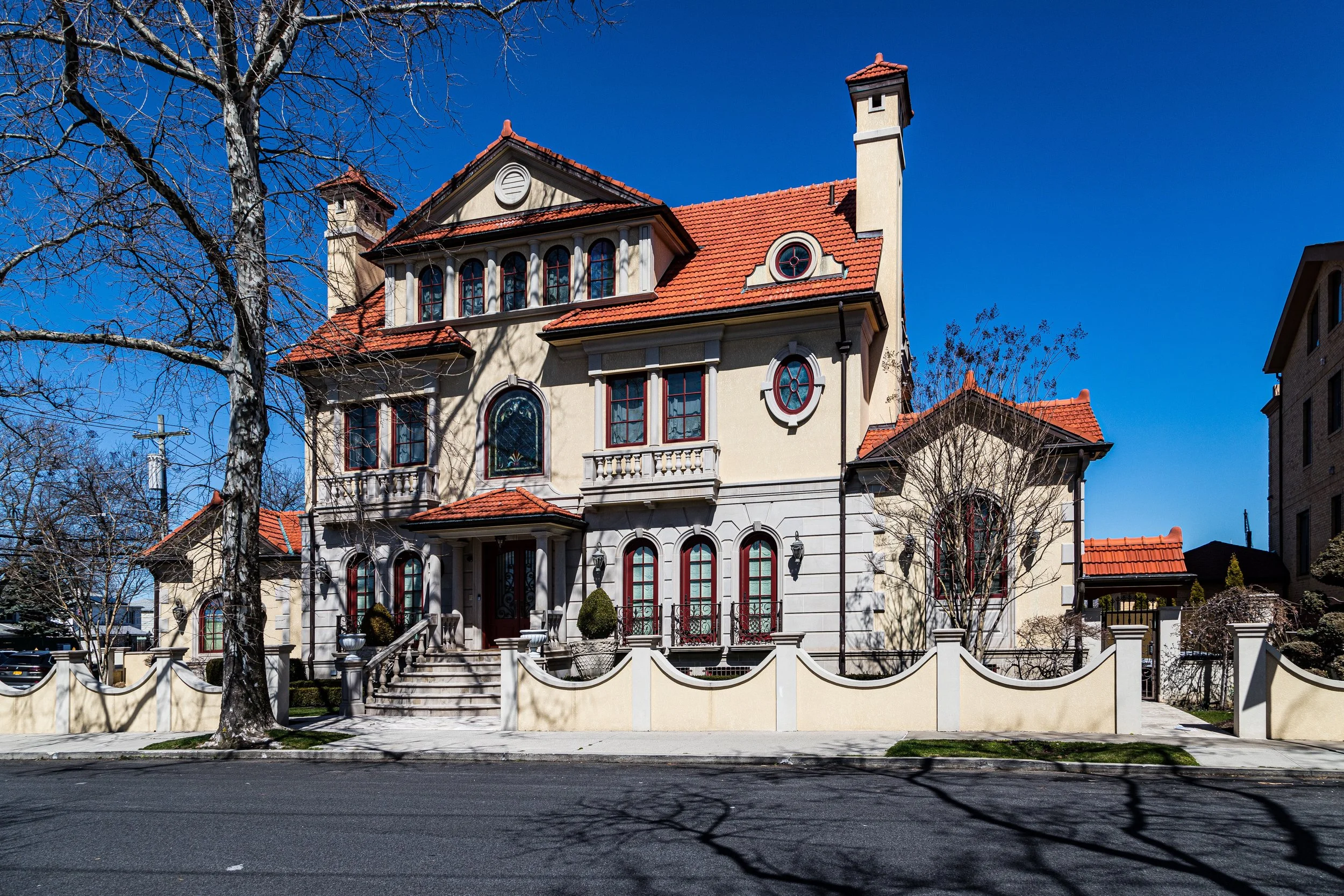
By the 1980s, Mill Basin had become one of Brooklyn’s most desirable addresses for homeowners seeking suburban comfort within city limits. Many of the original postwar houses were expanded or replaced by larger custom homes—brick colonials, stucco villas, and Mediterranean-style mansions with sweeping bay views. Boating culture thrived, and the neighborhood’s private docks were filled with motorboats and sailboats that underscored its affluence.
The demographic landscape broadened in the 1990s and 2000s, as new Russian-Jewish, Caribbean, and Israeli-American families joined long-time residents. Despite cultural shifts, the neighborhood retained its hallmark serenity: quiet streets, civic order, and strong emphasis on family and home ownership.
21st Century: Waterfront Living in an Era of Change
Today, Mill Basin remains a place apart—at once metropolitan and maritime. Its proximity to the bay offers beauty and risk: Hurricane Sandy in 2012 brought devastating floods that tested the community’s resilience. In the years since, residents and the city have invested heavily in flood-mitigation infrastructure, seawalls, and resilient landscaping, ensuring that the neighborhood endures even as tides rise.
The population continues to diversify, blending established Jewish and Italian homeowners with newer Russian, Pakistani, and Caribbean arrivals. The social fabric remains tight: community associations organize cleanups, neighborhood watches, and summer festivals, while local schools and synagogues sustain the area’s small-town intimacy.
Mill Basin Photo Gallery
Architecture and Atmosphere
Architecturally, Mill Basin is defined by its postwar evolution. Early 1950s ranches and split-levels stand beside 1980s brick colonials and 21st-century stucco mansions, their docks lined with boats. The curved streets and waterfront cul-de-sacs depart from Brooklyn’s rigid grid, creating a sense of seclusion. Palms, maples, and hydrangeas border driveways; American flags flutter above front lawns.
The atmosphere is coastal and contemplative. At dawn, the inlets shimmer with light as herons stalk the shallows. By afternoon, the sound of engines and gulls fills the air; by night, the reflections of porch lights dance on the water. Mill Basin feels less like a city district and more like a maritime village suspended within the metropolis.
Spirit and Legacy
Mill Basin’s story is one of invention—land literally created from marsh, a neighborhood engineered into existence. Yet its legacy is human: families who saw in the edge of Brooklyn a place to build permanence by the water.
New York City
Use this custom Google map to explore where every neighborhood in all five boroughs of New York City is located.
The Five Boroughs
One of New York City’s unique qualities is its organization in to 5 boroughs: Manhattan, Brooklyn, Queens, The Bronx, and Staten Island. These boroughs are part pragmatic administrative districts, and part vestiges of the region’s past. Each borough is an entire county in New York State - in fact, Brooklyn is, officially, Kings County, while Staten Island is, officially Richmond County. But that’s not the whole story …
Initially, New York City was located on the southern tip of Manhattan (now the Financial District) that was once the Dutch colony of New Amsterdam. Across the East River, another city was rising: Brooklyn. In time, the city planners realized that unification between the rapidly rising cities would create commercial and industrial opportunities - through streamlined administration of the region.
So powerful was the pull of unification between New York and Brooklyn that three more counties were pulled into the unification: The Bronx, Queens, and Staten Island. And on January 1, 1898, the City of New York unified two cities and three counties into one Greater City of New York - containing the five boroughs we know today.
But because each borough developed differently and distinctly until unification, their neighborhoods likewise uniquely developed. Today, there are nearly 390 neighborhoods, each with their own histories, cultures, cuisines, and personalities - and each with residents who are fiercely proud of their corner of The Big Apple.


