MANHATTAN VALLEY
Manhattan
Geographic Setting
Tucked between 96th and 110th Streets, bounded by Central Park West to the east and Broadway to the west, Manhattan Valley is a quiet, residential enclave that rests within a natural depression in the island’s topography — a gentle bowl descending toward the old course of the Bloomingdale Creek. Nestled between the better-known expanses of the Upper West Side and Morningside Heights, the neighborhood carries an understated charm, defined by tree-lined streets, turn-of-the-century apartment houses, and a diversity that reflects generations of change. Here, the city’s grid softens; the land dips; and the rush of Manhattan gives way to something closer to a neighborhood’s heartbeat.
Etymology and Origins
The name Manhattan Valley derives from the area’s topographical feature — a natural valley carved by the ancient course of a small stream that once flowed westward from Central Park to the Hudson. The stream was filled by the mid-19th century, but its shape remains visible in the gradual incline of the streets from east to west.
In colonial times, this land formed part of the Bloomingdale District, a rural expanse of farms and country estates stretching along what is now Broadway. The area’s isolation — lying north of the early city but south of the high bluffs of Morningside Heights — made it attractive to those seeking retreat and open air.
The Neighborhood
18th–19th Centuries: Farms and Asylums on the Hill
In the late 18th and early 19th centuries, the valley’s rolling fields hosted both pastoral and institutional uses. Along the western ridge stood the Bloomingdale Insane Asylum, established in 1821 on land now occupied by Columbia University. The asylum’s landscaped grounds, orchards, and gardens were designed according to humane Enlightenment ideals — the belief that beauty and nature could heal the mind.
Further south, farms and small homesteads dotted the valley floor. The arrival of the New York and Harlem Railroad in the 1830s began to link the area to the growing metropolis, though it remained largely rural until the late 19th century.
As the city grid advanced northward following the Commissioners’ Plan of 1811, the valley’s natural contours required leveling and infilling — a process that altered but never erased its geography. By the 1870s, new streets and rowhouses were emerging, marking the area’s first urban phase.
Late 19th Century: The Bloomingdale Neighborhood
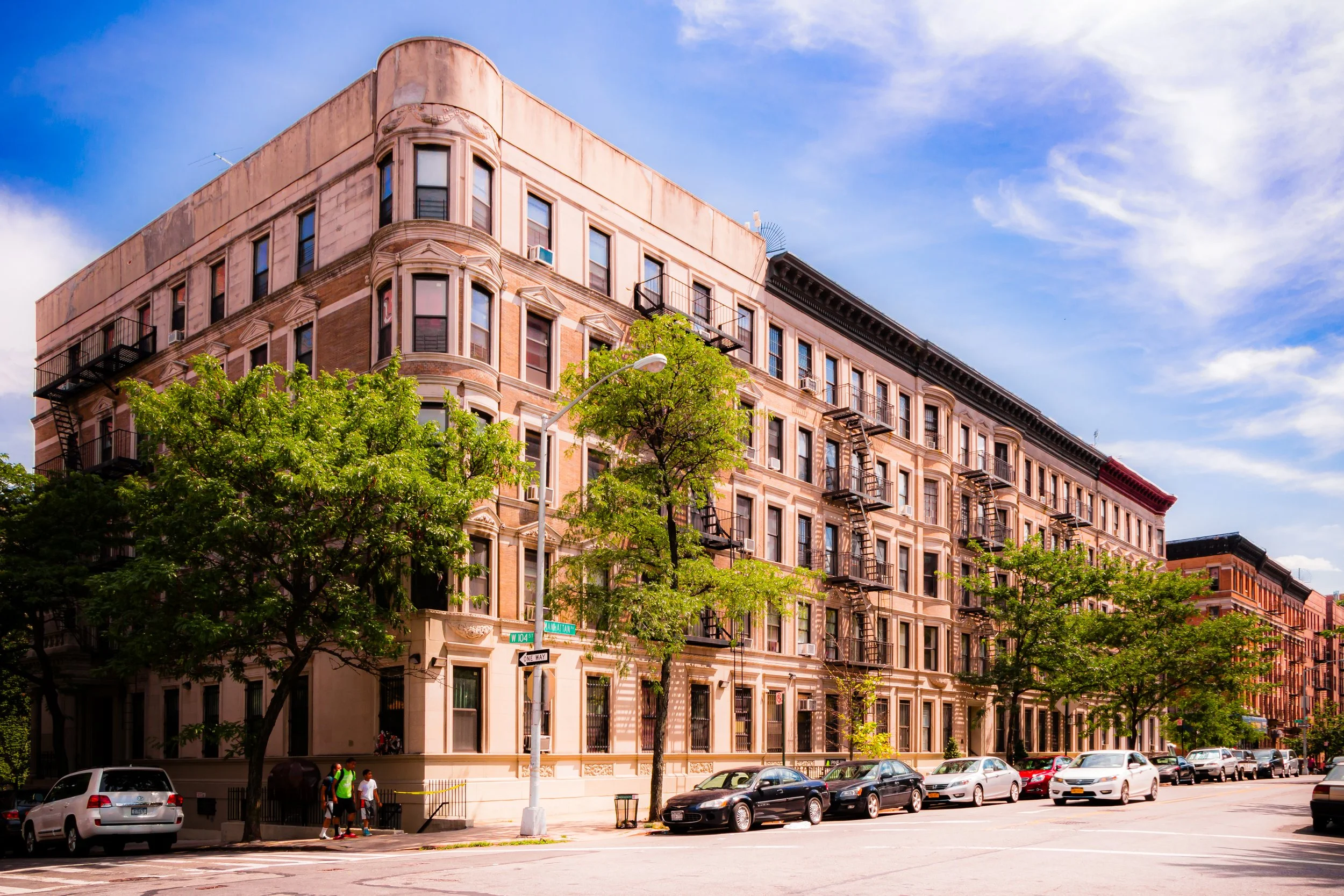
By the Gilded Age, the district was known as Bloomingdale, a name still preserved in local landmarks such as the Bloomingdale School and Bloomingdale Branch Library. Middle-class families, attracted by proximity to the newly opened Central Park (1858) and by improved transit, began populating the area. Rowhouses in Neo-Grec and Renaissance Revival styles filled the side streets, while modest apartment houses rose along Columbus Avenue.
The 1880s brought a wave of urbanization fueled by the extension of the Ninth Avenue Elevated Railway up Columbus Avenue and the opening of the Upper West Side’s Broadway corridor. By 1900, Manhattan Valley had become a stable, mixed-income community — less affluent than the grand avenues east and south, but comfortable and well-built.
Early 20th Century: Immigration and Change
In the early 20th century, the neighborhood’s population diversified with the arrival of Irish, Italian, and Jewish immigrants. The area developed a dense network of tenements, churches, and small businesses that anchored community life.
At the same time, urban reformers and philanthropists introduced progressive housing experiments aimed at improving living conditions. One of the most notable was the Manhattan Valley Apartments (1909) — part of the city’s early model tenement movement — and later the Manhattan Valley Housing Corporation, which helped preserve affordable housing through cooperative ownership.
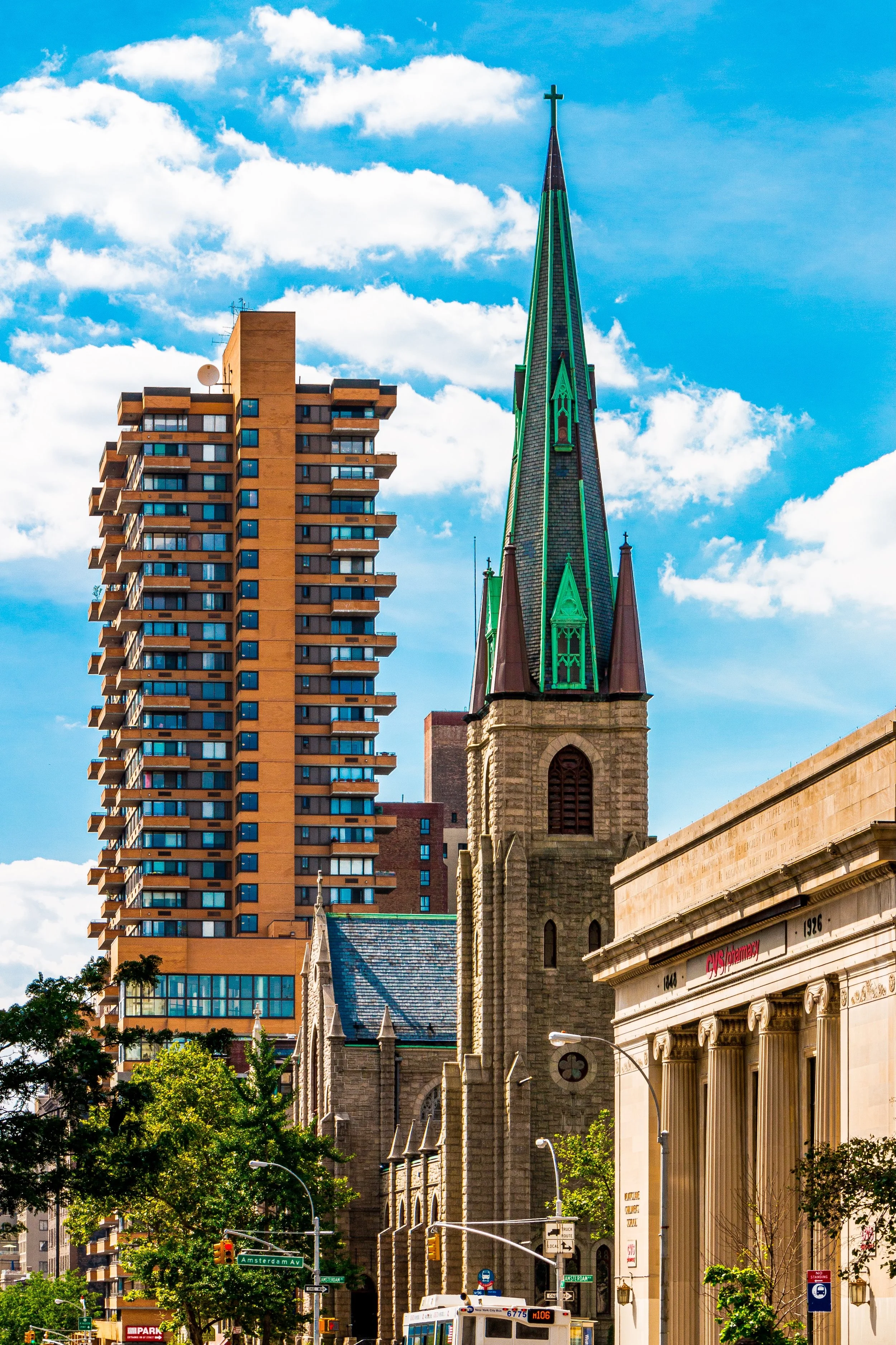
Schools and churches, such as Ascension Church on West 107th Street and Corpus Christi Church on 121st, became vital civic centers. The proximity of Cathedral Parkway (110th Street) — the grand approach to St. John the Divine — lent the area a sense of quiet dignity and architectural grandeur.
Manhattan Valley Photographic Tour
Mid-20th Century: Decline and Resilience
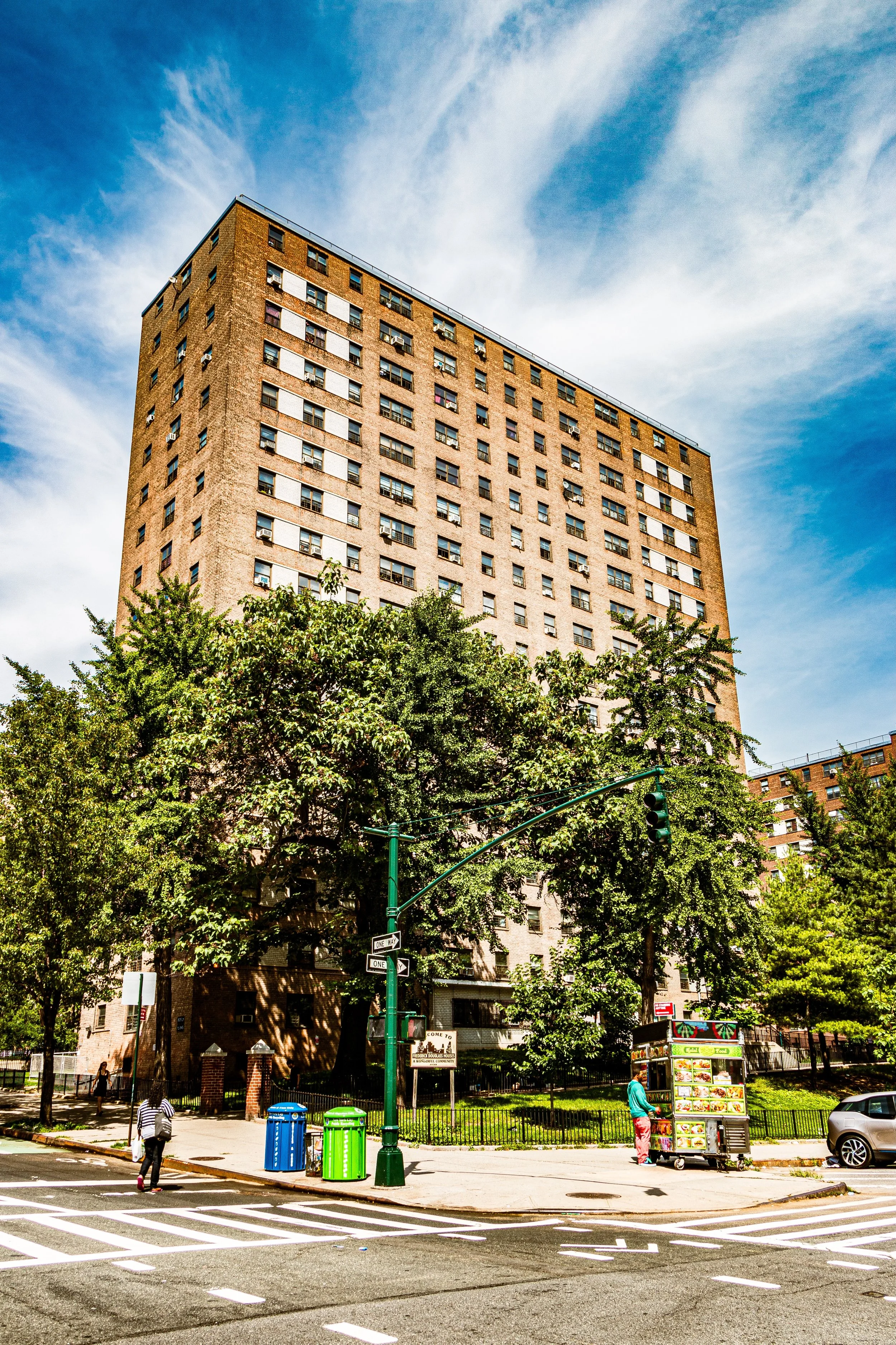
Like much of the Upper West Side, Manhattan Valley faced significant challenges in the mid-20th century. The construction of large public housing developments — including the Frederick Douglass Houses (1958–1965) — brought both renewal and disruption. Older buildings were demolished, displacing residents and altering the neighborhood’s scale.
By the 1960s and 1970s, economic decline, redlining, and disinvestment had taken their toll. Yet even during these difficult years, community organizations and block associations emerged as powerful stabilizing forces. Residents fought to rehabilitate abandoned properties, establish tenant rights, and preserve the neighborhood’s social fabric.
The Manhattan Valley Development Corporation, founded in 1968, became a model for community-based planning, spearheading affordable housing projects and neighborhood improvement initiatives that would help guide the area’s recovery in the decades to come.
Late 20th Century: Recovery and Rediscovery
By the 1980s and 1990s, Manhattan Valley began to experience a steady revival. The Riverside Park and Central Park Conservancies restored the great green spaces flanking the neighborhood, while local activism reduced crime and improved quality of life.
Restoration of the historic brownstones and prewar apartment houses brought renewed pride. The neighborhood’s affordability and proximity to Columbia University and downtown transit attracted a mix of students, professionals, and longtime residents, creating a characteristically Upper West Side blend of diversity and continuity.
21st Century: Stability and Neighborhood Identity
Today, Manhattan Valley maintains its rare balance of calm and vitality. It remains one of the most demographically mixed areas in Manhattan, home to Latino, African-American, Jewish, and new international communities. Family-owned groceries coexist with cafés and small restaurants, many tucked along Amsterdam and Columbus Avenues.
Efforts to preserve affordability and prevent overdevelopment have helped sustain its scale. The neighborhood’s schools, community gardens, and churches continue to anchor local life, while its proximity to both Central Park West and Morningside Park grants it an unusually green, breathable character for Manhattan.
The name “Manhattan Valley,” once nearly forgotten, has regained recognition as residents have embraced it as a badge of local identity — a reminder that the city’s heart still beats strongest in its valleys as well as its towers.
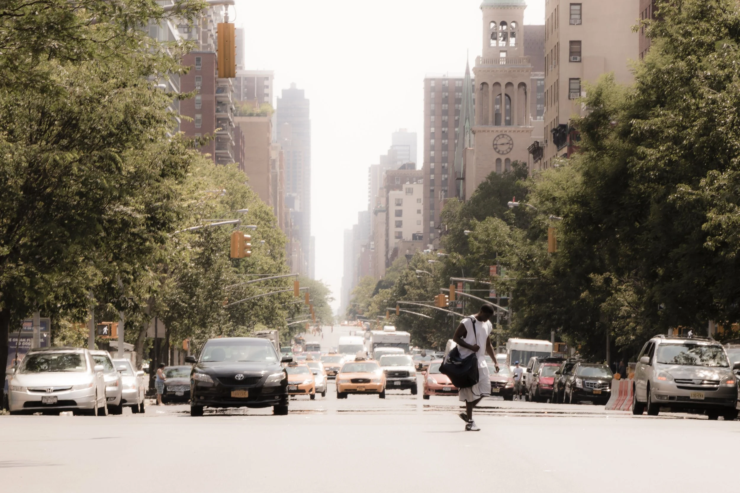
Manhattan Valley Photo Gallery
Architecture and Atmosphere
Architecturally, Manhattan Valley reflects the quiet beauty of prewar urbanism. Rows of Renaissance Revival brownstones, Beaux-Arts apartment buildings, and red-brick tenements define its blocks, while the vertical forms of public housing punctuate the skyline with mid-century geometry. On the higher western edge, Broadway’s grand apartment houses give way to tree-lined side streets where sunlight filters between stoops and fire escapes.
The atmosphere is residential and unhurried. Children play in schoolyards; older residents chat on stoops; church bells and birdsong mingle above the hum of buses. From the hilltops near Morningside Drive, one can glimpse the Hudson glinting between rooftops — a reminder that even in the city’s densest grid, nature and neighborhood remain entwined.
Spirit and Legacy
Manhattan Valley’s legacy is that of resilience through renewal — a neighborhood that has weathered cycles of change without losing its sense of place. Its topography mirrors its history: a lowland that gathers and sustains, where different currents of New York life converge.
Use this custom Google map to explore where every neighborhood in all five boroughs of New York City is located.
The Five Boroughs
One of New York City’s unique qualities is its organization in to 5 boroughs: Manhattan, Brooklyn, Queens, The Bronx, and Staten Island. These boroughs are part pragmatic administrative districts, and part vestiges of the region’s past. Each borough is an entire county in New York State - in fact, Brooklyn is, officially, Kings County, while Staten Island is, officially Richmond County. But that’s not the whole story …
Initially, New York City was located on the southern tip of Manhattan (now the Financial District) that was once the Dutch colony of New Amsterdam. Across the East River, another city was rising: Brooklyn. In time, the city planners realized that unification between the rapidly rising cities would create commercial and industrial opportunities - through streamlined administration of the region.
So powerful was the pull of unification between New York and Brooklyn that three more counties were pulled into the unification: The Bronx, Queens, and Staten Island. And on January 1, 1898, the City of New York unified two cities and three counties into one Greater City of New York - containing the five boroughs we know today.
But because each borough developed differently and distinctly until unification, their neighborhoods likewise uniquely developed. Today, there are nearly 390 neighborhoods, each with their own histories, cultures, cuisines, and personalities - and each with residents who are fiercely proud of their corner of The Big Apple.


