KENSINGTON
Brooklyn
Geographic Setting
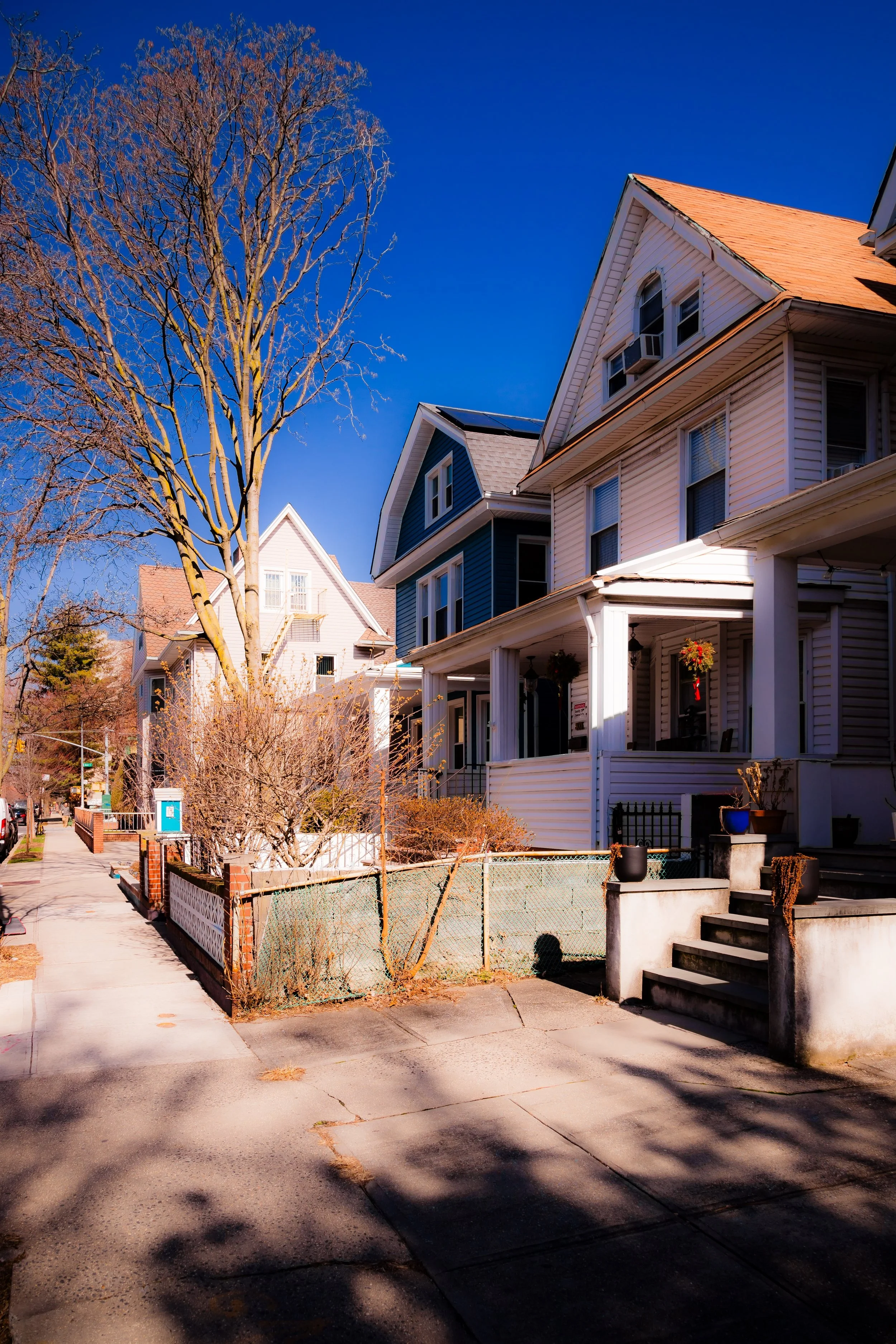
Bounded by Church Avenue to the north, 18th Avenue to the south, Coney Island Avenue to the east, and Dahill Road to the west, Kensington forms a compact, quietly diverse enclave in central Brooklyn—nestled between Windsor Terrace, Borough Park, and Flatbush. Its modest grid of tree-shaded residential streets unfolds south of Prospect Park, where early 20th-century rowhouses, detached Victorians, and prewar apartment buildings mingle in a pattern that feels both urban and suburban.
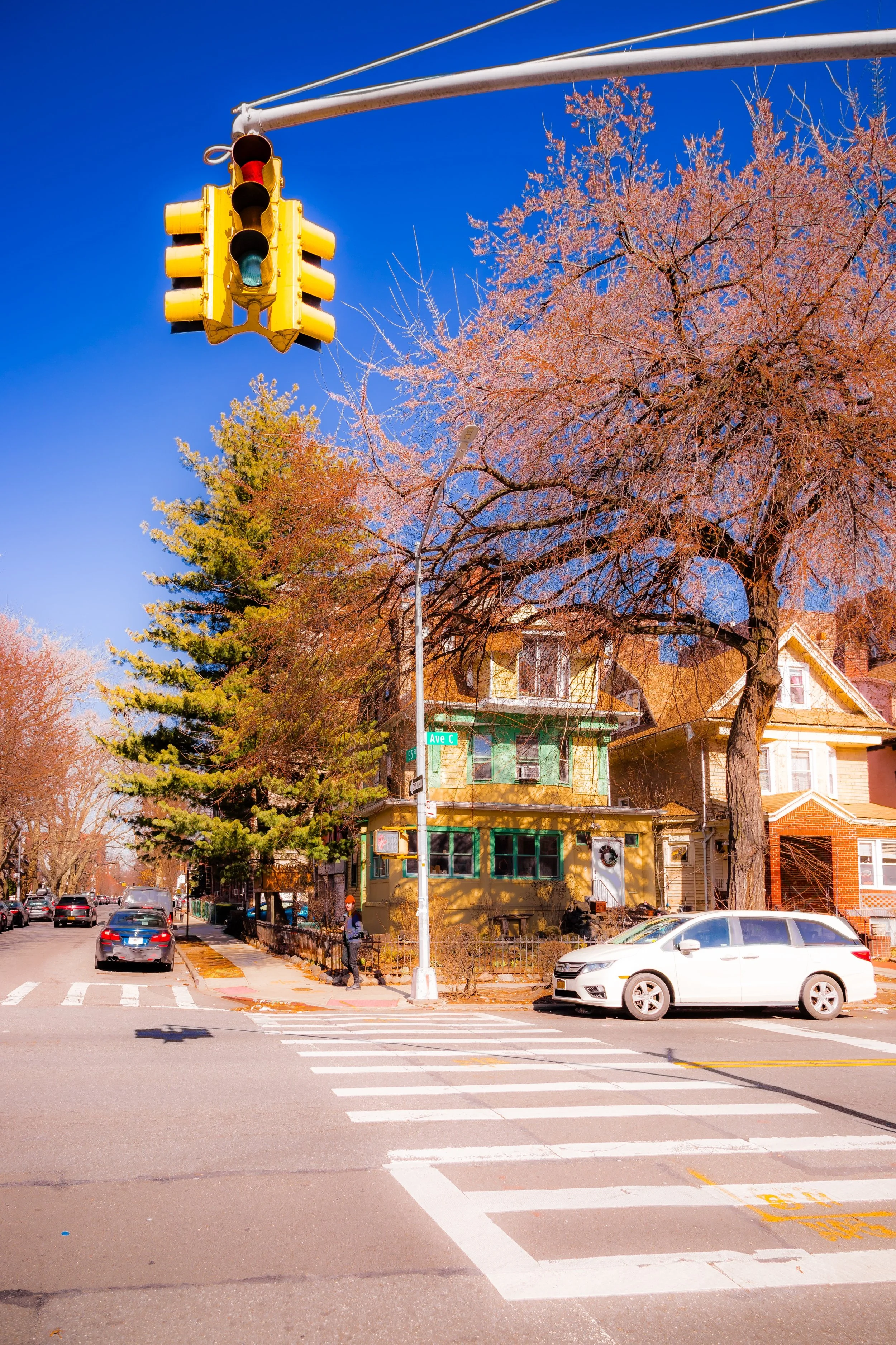
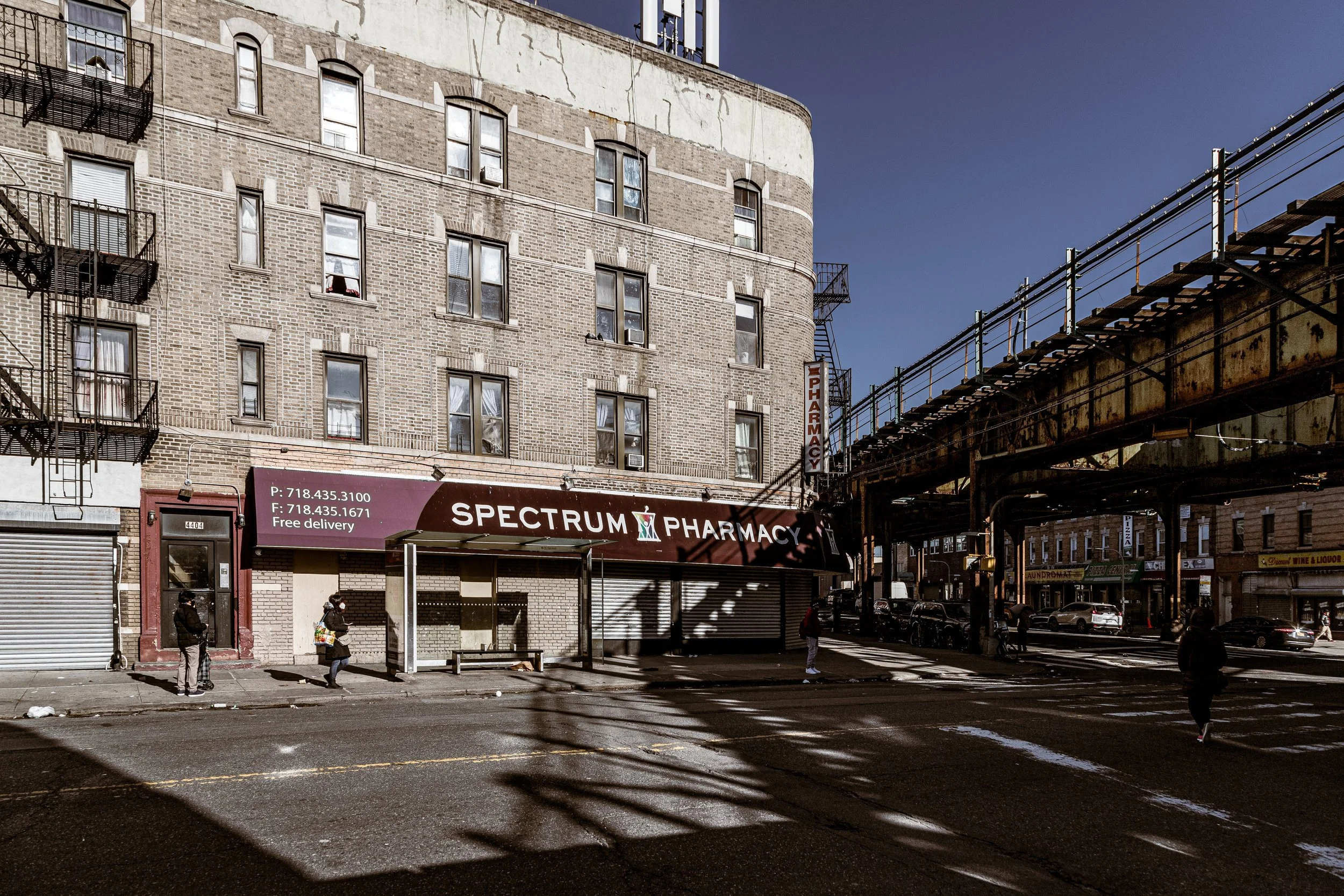
The neighborhood’s geography is defined by gentle elevation: the land slopes southward from the higher ground of Windsor Terrace toward the old Flatlands plain. Major thoroughfares—Church Avenue, Ditmas Avenue, and Beverley Road—carry the rhythm of daily life, lined with groceries, halal butchers, pizzerias, cafés, and discount stores reflecting the neighborhood’s polyglot population. Meanwhile, the quieter interior blocks—East 4th through East 8th Streets, Albemarle Road, and Cortelyou Road—retain a lush, residential tranquility. The F train at Church and Ditmas Avenues links Kensington to downtown Brooklyn and Manhattan, while the proximity of Prospect Park lends the district a breath of green and calm unusual in the city’s core.
Etymology and Origins
The name Kensington was adopted in the late 19th century by speculative developers seeking to evoke the elegance of Kensington, London, a fashionable district of refined townhouses and gardens. The name reflected the aspirations of a new middle-class suburb rising on what had been farmland at the southern edge of Flatbush.
Before development, this land formed part of the Dutch-settled town of Flatbush (Vlacke Bos), granted in the mid-1600s and cultivated for over two centuries. The area’s fertile soil, nourished by nearby creeks and meadows, supported dairy farms and vegetable gardens that supplied Brooklyn’s markets. By the 1870s, the expansion of Ocean Parkway and the opening of Prospect Park to the north began to draw attention to these pastoral outskirts.
The Neighborhood
19th Century: From Farmland to Suburb
In the 1870s–1880s, real estate syndicates saw opportunity in the newly connected hinterlands of Brooklyn. The construction of Ocean Parkway (1874)—designed by Frederick Law Olmsted and Calvert Vaux—linked Prospect Park to Coney Island, turning the surrounding countryside into desirable residential territory. Developers purchased large tracts west of Coney Island Avenue and north of 18th Avenue, subdividing them into building lots.
The earliest houses in Kensington were freestanding wood-frame cottages and villas, marketed to middle-class families seeking clean air and open space within reach of downtown Brooklyn. Advertisements from the 1890s extolled “broad avenues, shade trees, and pure air,” emphasizing Kensington’s suburban qualities while promising easy trolley access to the city. The grid of streets—laid out between Dahill Road and Coney Island Avenue—was narrow but orderly, with small front gardens and tree-lined sidewalks that still characterize the neighborhood today.
Early–Mid 20th Century: The Neighborhood Takes Shape
By the 1910s, Kensington had become a settled community of homeowners and renters, its architecture reflecting the era’s eclectic tastes. Limestone and brick rowhouses, attached two-family homes, and prewar apartment buildings filled the lots once occupied by farms. Ditmas Avenue and Church Avenue developed as bustling commercial corridors, with bakeries, pharmacies, and movie houses serving local families.
The completion of the IND subway’s F line (1933) transformed Kensington’s accessibility, making it an easy commute to downtown Manhattan. The population diversified, drawing Jewish, Irish, and Italian families from other parts of Brooklyn. Churches and synagogues flourished: Immaculate Heart of Mary Church (1903) on Fort Hamilton Parkway became a parish center, while Young Israel of Kensington and smaller congregations reflected the area’s growing Jewish presence.
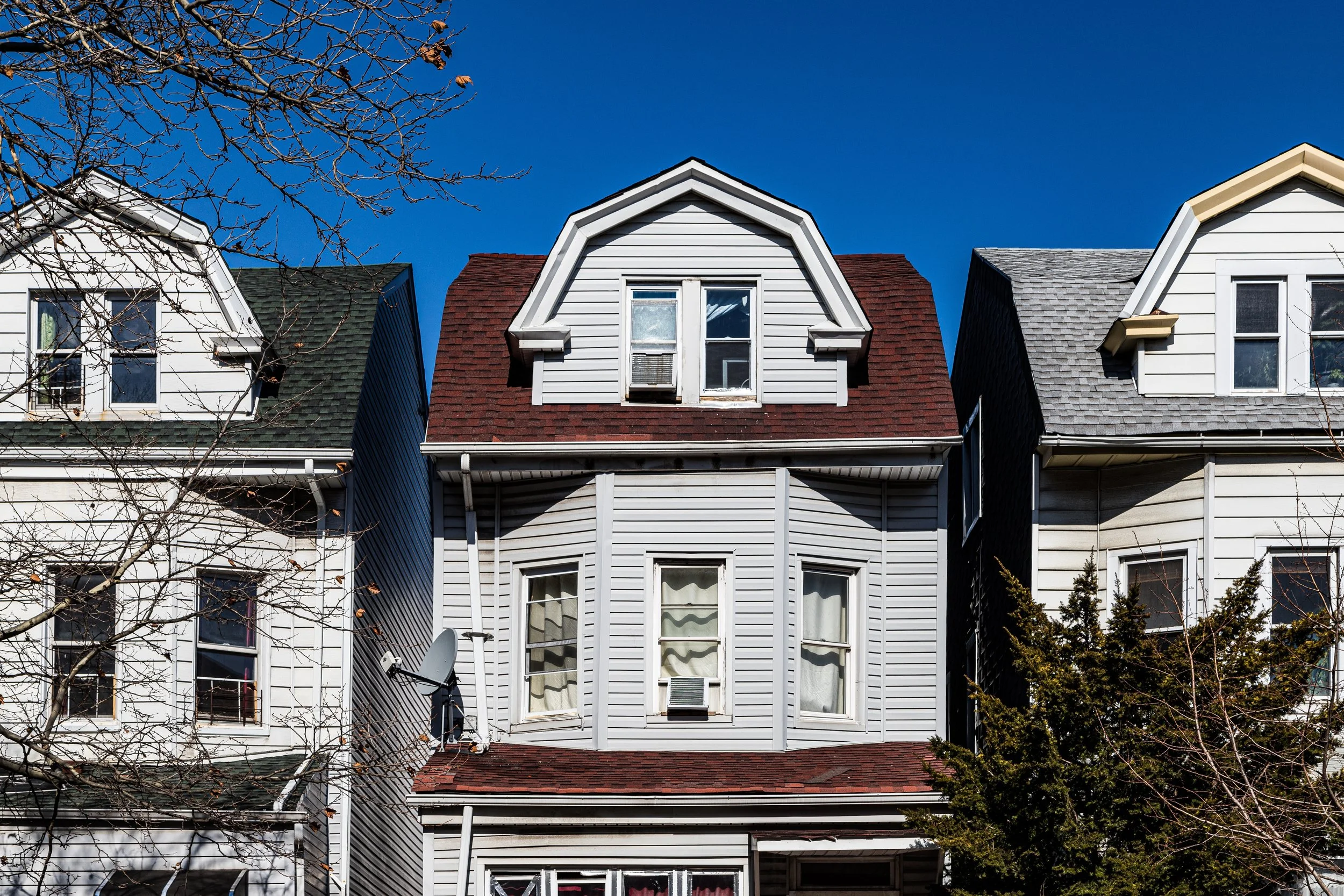
Architecturally, the neighborhood matured into a mosaic of styles—Victorian houses along Albemarle and Beverley Roads, Art Deco apartments near Ocean Parkway, and modest brick rowhouses on the cross streets. Despite density, the atmosphere remained residential and self-contained, buffered by the broad greensward of Ocean Parkway and the slope leading up to Windsor Terrace.
Kensington Photographic Video
Mid–Late 20th Century: Change and Continuity
The decades after World War II brought gradual transition. Some older families moved outward to suburban Long Island or Queens, while new arrivals—Eastern European Jews, Italians, and Irish immigrants—maintained the neighborhood’s middle-class stability. During the 1960s–1980s, Kensington became increasingly multicultural, welcoming immigrants from Pakistan, Bangladesh, Poland, Haiti, and the former Soviet Union.
While nearby neighborhoods such as Flatbush and Borough Park grew denser or more commercialized, Kensington retained its residential balance. Local institutions like P.S. 130, the Kensington Stables (serving riders at Prospect Park), and Kensington Library anchored civic life. Church Avenue, once dotted with butchers and bakeries, evolved into a vibrant international marketplace: halal groceries beside taquerias, South Asian boutiques next to Polish delis.
Despite its proximity to the Gowanus Expressway and elevated subway tracks, the neighborhood preserved an atmosphere of modest calm. Community associations and block groups resisted overdevelopment, protecting the area’s low-rise character and encouraging upkeep of its older homes.
21st Century: Diversity and Quiet Renaissance
In the 21st century, Kensington has emerged as one of Brooklyn’s most quietly diverse neighborhoods—a place where dozens of languages mingle on the same block. Bangladeshi, Pakistani, West Indian, Mexican, and Chinese families now live alongside long-established Jewish and Italian households, making Kensington a microcosm of global Brooklyn. The neighborhood’s institutions reflect this pluralism: mosques, yeshivas, Catholic parishes, and evangelical churches coexist within a few square blocks.
Real estate values have risen since the 2010s, driven by Kensington’s proximity to Prospect Park, relatively affordable housing, and reputation for safety. Yet it remains less commercialized than nearby Park Slope or Ditmas Park. Small restaurants—such as family-run Bengali cafés, kosher bakeries, and Latin eateries—line Church Avenue and Coney Island Avenue, contributing to the neighborhood’s understated vibrancy.
Community initiatives have emphasized sustainability and livability: bike lanes along Ocean Parkway, tree-planting programs, and local efforts to calm traffic on residential streets. The result is a neighborhood that feels lived-in and authentic—busy but not hurried, multicultural but cohesive.
Kensington Photo Gallery
Spirit and Legacy
Kensington’s legacy is one of steadfast balance—between density and space, tradition and renewal, city and suburb. Born from the suburban dreams of turn-of-the-century Brooklyn, it has quietly evolved into one of the borough’s most enduringly livable neighborhoods. Its architecture tells the story: Victorian porches beside limestone stoops, low apartment houses with wrought-iron balconies beside new infill townhomes.
New York City
Use this custom Google map to explore where every neighborhood in all five boroughs of New York City is located.
The Five Boroughs
One of New York City’s unique qualities is its organization in to 5 boroughs: Manhattan, Brooklyn, Queens, The Bronx, and Staten Island. These boroughs are part pragmatic administrative districts, and part vestiges of the region’s past. Each borough is an entire county in New York State - in fact, Brooklyn is, officially, Kings County, while Staten Island is, officially Richmond County. But that’s not the whole story …
Initially, New York City was located on the southern tip of Manhattan (now the Financial District) that was once the Dutch colony of New Amsterdam. Across the East River, another city was rising: Brooklyn. In time, the city planners realized that unification between the rapidly rising cities would create commercial and industrial opportunities - through streamlined administration of the region.
So powerful was the pull of unification between New York and Brooklyn that three more counties were pulled into the unification: The Bronx, Queens, and Staten Island. And on January 1, 1898, the City of New York unified two cities and three counties into one Greater City of New York - containing the five boroughs we know today.
But because each borough developed differently and distinctly until unification, their neighborhoods likewise uniquely developed. Today, there are nearly 390 neighborhoods, each with their own histories, cultures, cuisines, and personalities - and each with residents who are fiercely proud of their corner of The Big Apple.


