CHELSEA
Manhattan
Geographic Setting
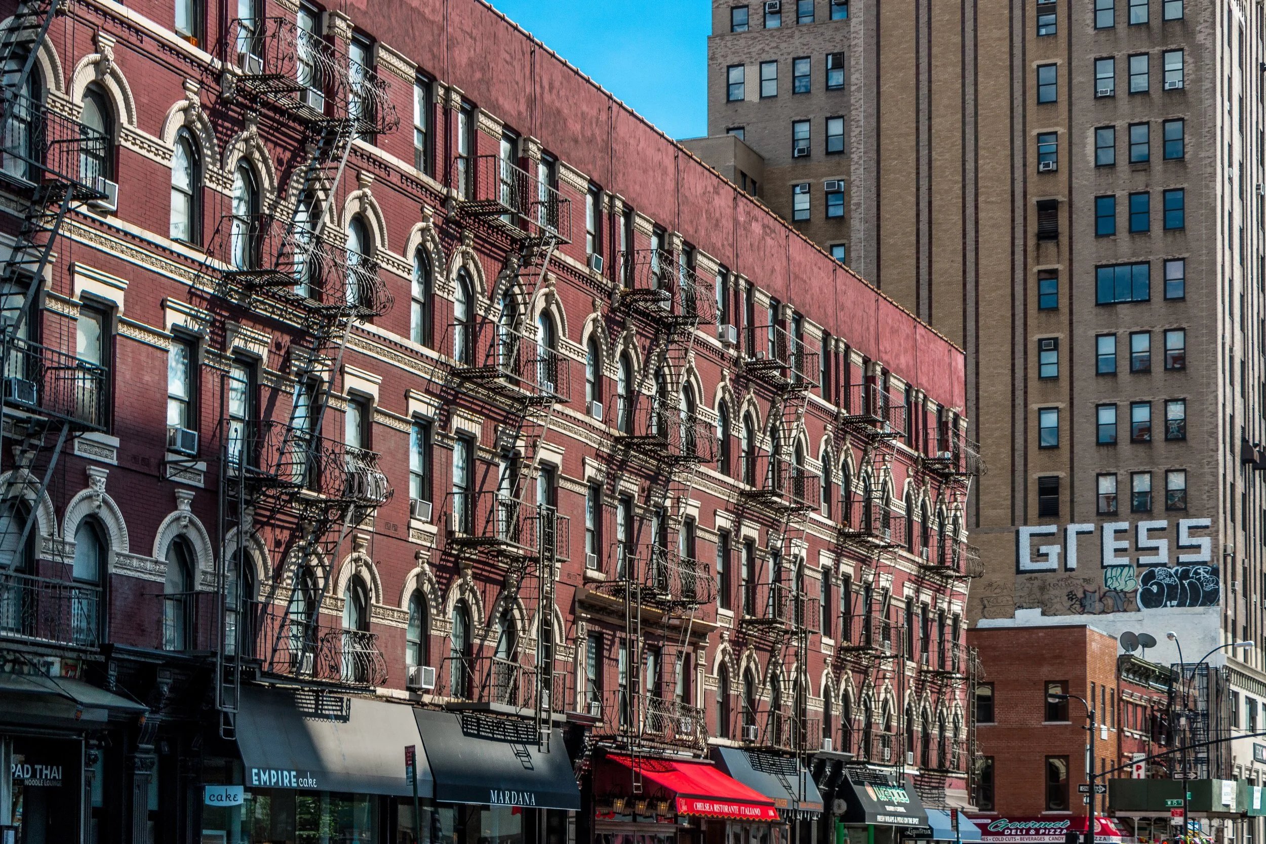
Bounded by 14th Street to the south, 30th Street to the north, Sixth Avenue to the east, and Tenth Avenue to the west, Chelsea occupies a dynamic stretch of Manhattan’s west side—where grid precision meets industrial memory, and the city’s cultural pulse thrives amid cast-iron facades and modern glass towers. Within these boundaries, the neighborhood slopes gently toward the Hudson River, once lined with piers and warehouses, now transformed into the verdant Hudson River Park. To the east, the avenues pulse with commerce—Sixth Avenue’s loft buildings, flower markets, and modern retail corridors—while to the west, the High Line threads through the heart of West Chelsea’s reborn industrial blocks, tracing the evolution from docklands to design capital.
Though its character has shifted dramatically across two centuries—from elite residential enclave to working-class district to artistic heartland—Chelsea’s grid remains remarkably intact. Its narrow cross streets, especially between Eighth and Tenth Avenues, still carry the rhythm of 19th-century New York, with rowhouses, converted warehouses, and hints of the neighborhood’s maritime past all standing within sight of the city’s most modern architecture.
Etymology and Origins
Chelsea takes its name from the estate of Captain Thomas Clarke, a retired British officer who, in 1750, purchased a tract of farmland north of 14th Street and named it “Chelsea” after the Royal Hospital Chelsea in London, a home for retired soldiers. Clarke’s estate stretched westward to the Hudson River and northward nearly to modern 24th Street. Over generations, his descendants subdivided the land into residential plots, shaping the neighborhood’s enduring layout and giving many of its streets their distinctive 18th-century bearings.
The most influential of these heirs, Clement Clarke Moore, a scholar and poet best remembered as the author of “A Visit from St. Nicholas” (“’Twas the Night Before Christmas”), donated much of his family’s land to the Episcopal Church for the construction of General Theological Seminary in 1827. Around it, Moore laid out blocks of refined Greek Revival townhouses—creating one of Manhattan’s earliest planned residential communities.
The Neighborhood
19th Century: From Suburban Estate to Urban Neighborhood
By the 1830s–1850s, Chelsea evolved from rural farmland into a genteel suburb of lower Manhattan. Moore’s grid, oriented north–south between Ninth and Tenth Avenues, became lined with dignified brick and brownstone rowhouses inhabited by merchants, sea captains, and professionals. The London Terrace row, built in 1845 on 23rd Street, exemplified this early affluence.
But Chelsea’s proximity to the waterfront soon drew commerce and industry. By mid-century, its western edges—near Tenth Avenue—filled with lumberyards, freight depots, and factories serving the busy Hudson docks. Irish immigrants arrived in large numbers, working on the Hudson River Railroad (completed 1851) and in nearby warehouses. Churches, taverns, and tenements rose alongside townhouses, giving Chelsea an increasingly mixed social character.
By the late 1800s, the Fulton Houses, Ninth Avenue El, and Ladies’ Mile department stores (stretching from 14th to 23rd Streets along Sixth Avenue) transformed the eastern part of Chelsea into a bustling commercial zone. The district was, by century’s end, both respectable and rough-edged—a place where clergy, laborers, and shopgirls shared the same streets.
Early 20th Century: Industry, Immigration, and Working-Class Life
In the early 20th century, Chelsea’s identity solidified as a working-class, immigrant neighborhood. Warehouses, printing houses, and factories filled its western blocks, while Tenth Avenue’s “Death Avenue” earned its grim nickname from freight trains that ran at street level before the High Line’s construction in the 1930s elevated them. Along Sixth and Seventh Avenues, retail and garment-trade buildings multiplied, and affordable housing drew waves of Irish, Greek, and later Puerto Rican families.
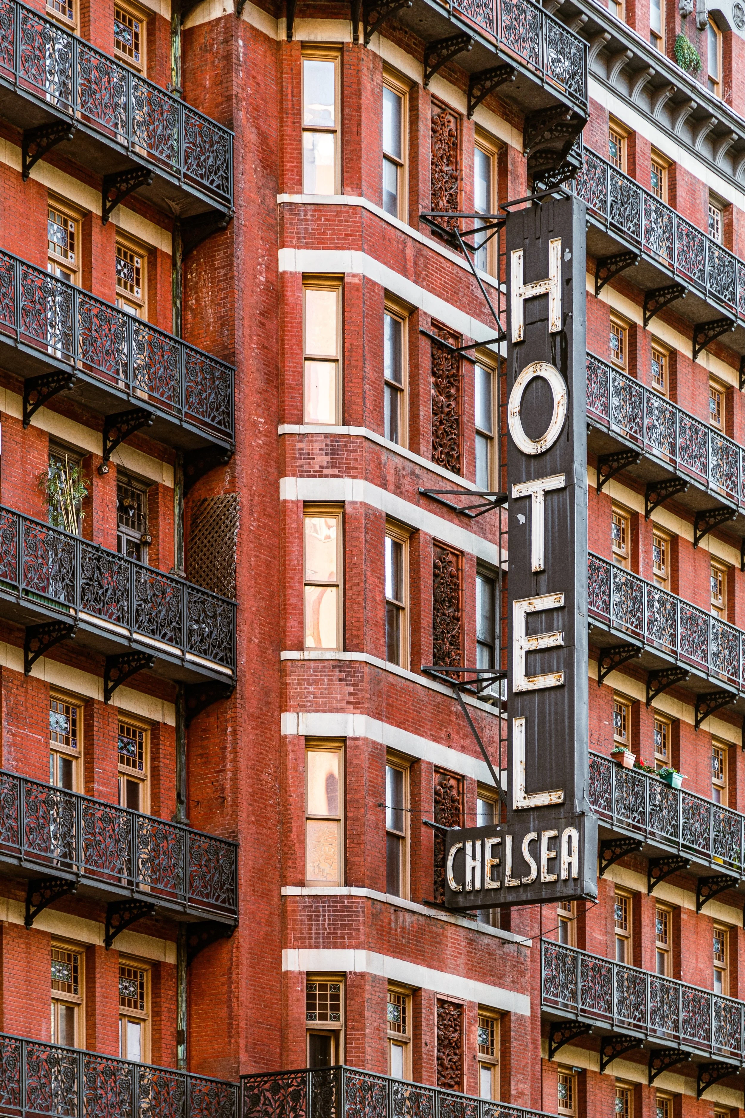
Despite industrial grit, the area fostered strong institutions: parish churches like St. Columba’s (1845), the Fulton Houses (public housing completed in the 1960s), and civic organizations that kept Chelsea’s community tightly woven. Chelsea Piers, completed in 1910 between 17th and 23rd Streets, served as Manhattan’s grand passenger terminal—Titanic’s intended New York destination—and later as the embarkation point for soldiers in both World Wars.
During the Depression, elevated railways and housing reforms reshaped the district, but its spirit remained rooted in labor and neighborhood pride. Rowhouses stood shoulder-to-shoulder with tenements and factories—a layered urbanism typical of Manhattan’s west side.
Chelsea Photographic Video
Late 20th Century: Art, Activism, and Transformation
The decline of shipping and industry after World War II left western Chelsea with vast empty warehouses, soon rediscovered by artists seeking affordable space. By the 1970s–1980s, the area west of Tenth Avenue became home to galleries, studios, and performance spaces. The neighborhood’s mix of affordability, architecture, and tolerance fostered the growth of a vibrant LGBTQ+ community centered along Eighth Avenue, as well as activism in response to the AIDS crisis.
In the 1990s, the construction of the Chelsea Piers Sports Complex and the gradual conversion of industrial buildings into art galleries positioned Chelsea as New York’s premier art district. The High Line, opened in stages between 2009 and 2014, transformed the defunct elevated freight railway into an aerial park that redefined urban design worldwide. As the High Line snaked through former warehouses and factories, Chelsea’s visual identity shifted again—its skyline punctuated by architectural statements from Frank Gehry, Jean Nouvel, and Zaha Hadid, all built within a few blocks of 10th Avenue.
21st Century: Modern Vitality and Enduring Texture
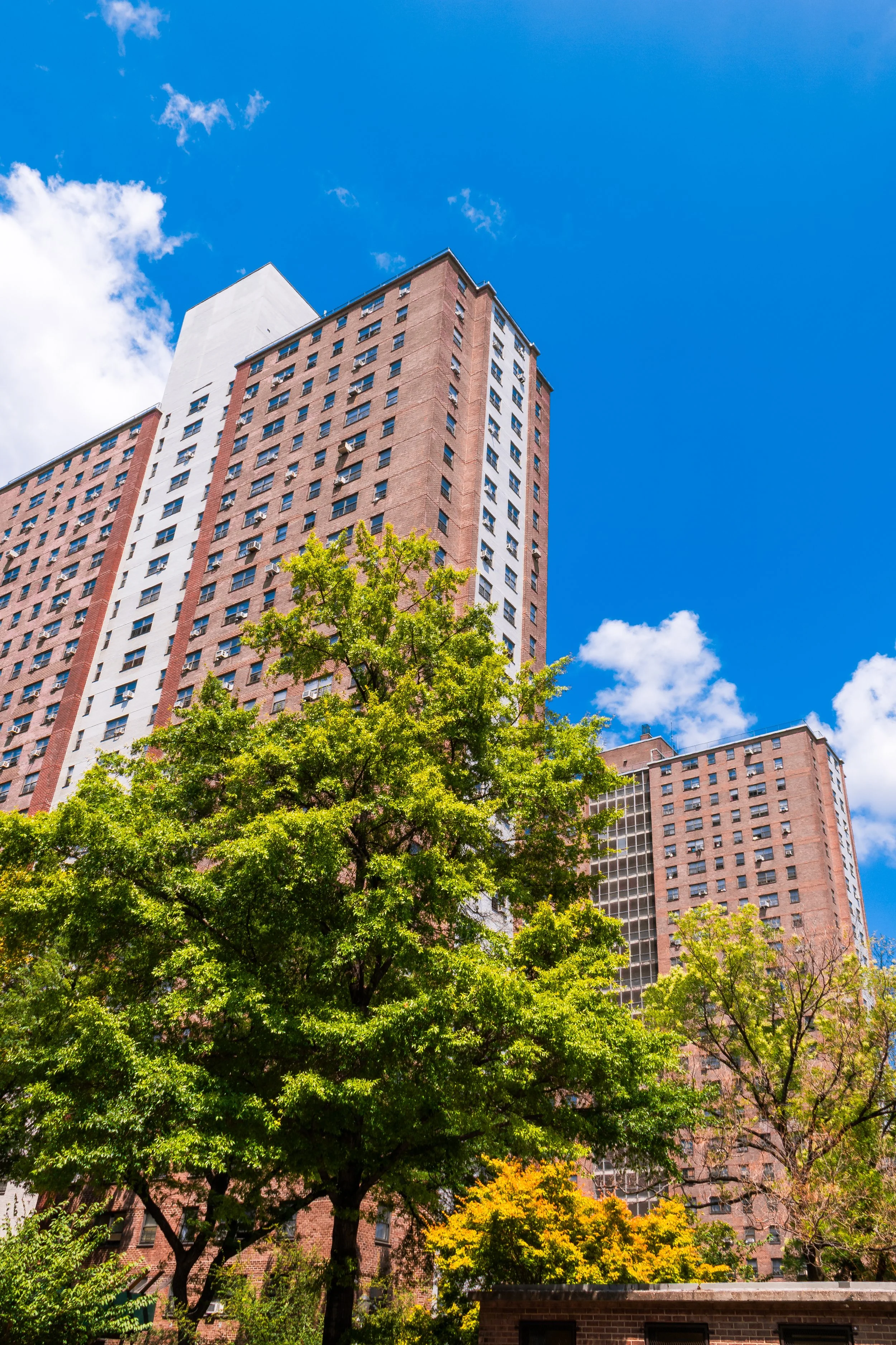
Today, Chelsea balances affluence with authenticity. Luxury condos and glass towers rise near West 23rd Street, yet historic rowhouses and redbrick industrial facades continue to anchor the streetscape. The Chelsea Historic District, designated in 1970, protects much of the 19th-century residential core around General Theological Seminary, whose leafy campus remains a tranquil oasis amid the city’s bustle.
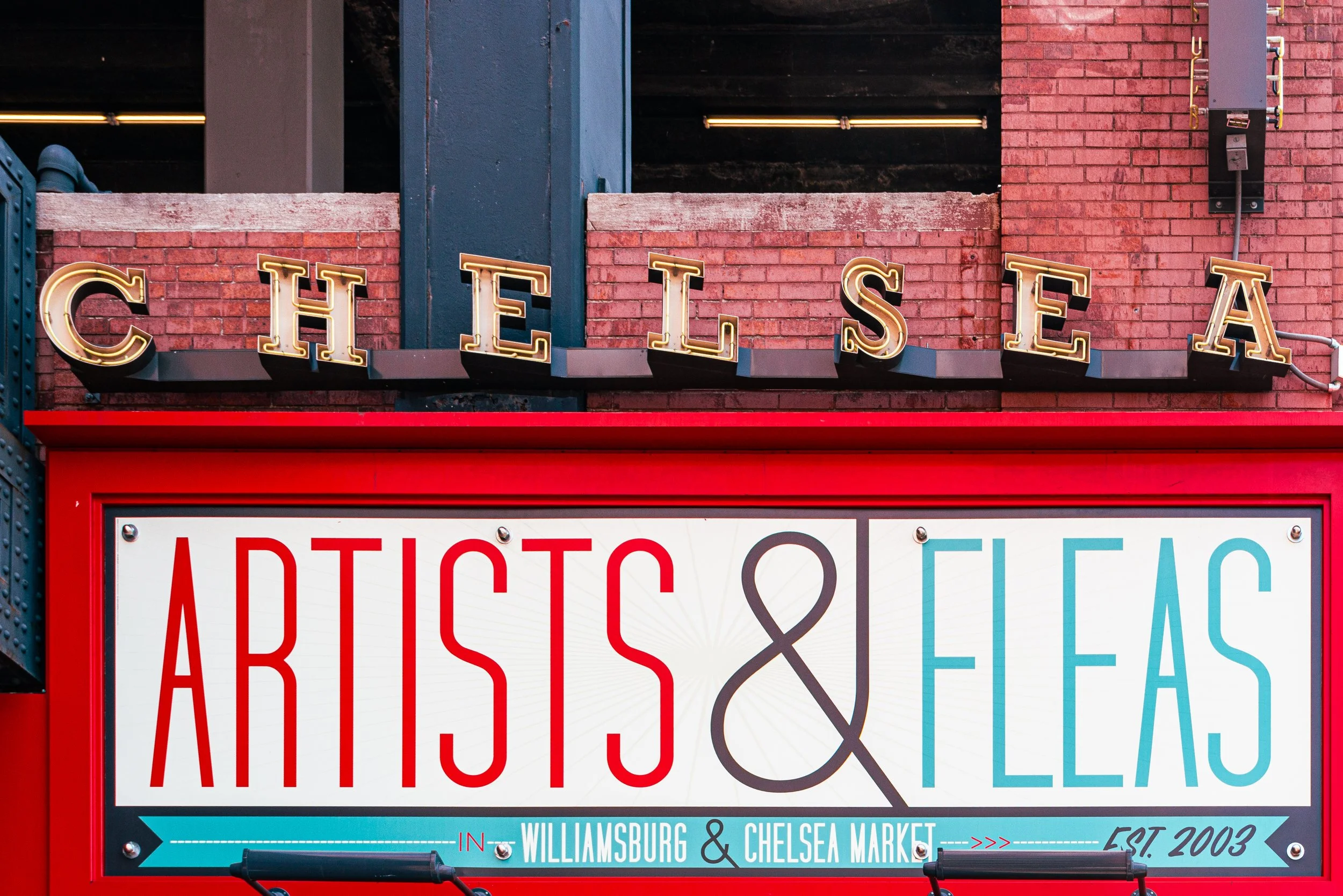
The neighborhood’s diversity—economic, social, and cultural—remains central to its character. Galleries between 19th and 28th Streets, performance venues like The Joyce Theater, and institutions such as The Rubin Museum of Art continue to define Chelsea as an arts hub. Meanwhile, its parks—Hudson River Park, The High Line, and Chelsea Park—draw locals and visitors alike, creating a balance between leisure, landscape, and urban energy that few neighborhoods achieve.
Despite pressures of gentrification, traces of Chelsea’s layered history endure: the rail lines embedded in cobblestones, the Greek Revival lintels of Moore’s original estate, and the faint salt tang of the nearby river.
Chelsea Photo Gallery
Spirit and Legacy
Chelsea’s legacy is one of continual reinvention within continuity. From Captain Clarke’s 18th-century farm to Moore’s planned suburb, from industrial corridor to global art capital, the neighborhood has never ceased adapting while preserving its sense of place. Its boundaries—14th to 30th, Sixth to Tenth—contain not just buildings but the city’s evolving ideals of beauty, labor, and community.
New York City
Use this custom Google map to explore where every neighborhood in all five boroughs of New York City is located.
The Five Boroughs
One of New York City’s unique qualities is its organization in to 5 boroughs: Manhattan, Brooklyn, Queens, The Bronx, and Staten Island. These boroughs are part pragmatic administrative districts, and part vestiges of the region’s past. Each borough is an entire county in New York State - in fact, Brooklyn is, officially, Kings County, while Staten Island is, officially Richmond County. But that’s not the whole story …
Initially, New York City was located on the southern tip of Manhattan (now the Financial District) that was once the Dutch colony of New Amsterdam. Across the East River, another city was rising: Brooklyn. In time, the city planners realized that unification between the rapidly rising cities would create commercial and industrial opportunities - through streamlined administration of the region.
So powerful was the pull of unification between New York and Brooklyn that three more counties were pulled into the unification: The Bronx, Queens, and Staten Island. And on January 1, 1898, the City of New York unified two cities and three counties into one Greater City of New York - containing the five boroughs we know today.
But because each borough developed differently and distinctly until unification, their neighborhoods likewise uniquely developed. Today, there are nearly 390 neighborhoods, each with their own histories, cultures, cuisines, and personalities - and each with residents who are fiercely proud of their corner of The Big Apple.


