WEST VILLAGE
Manhattan
Geographic Setting
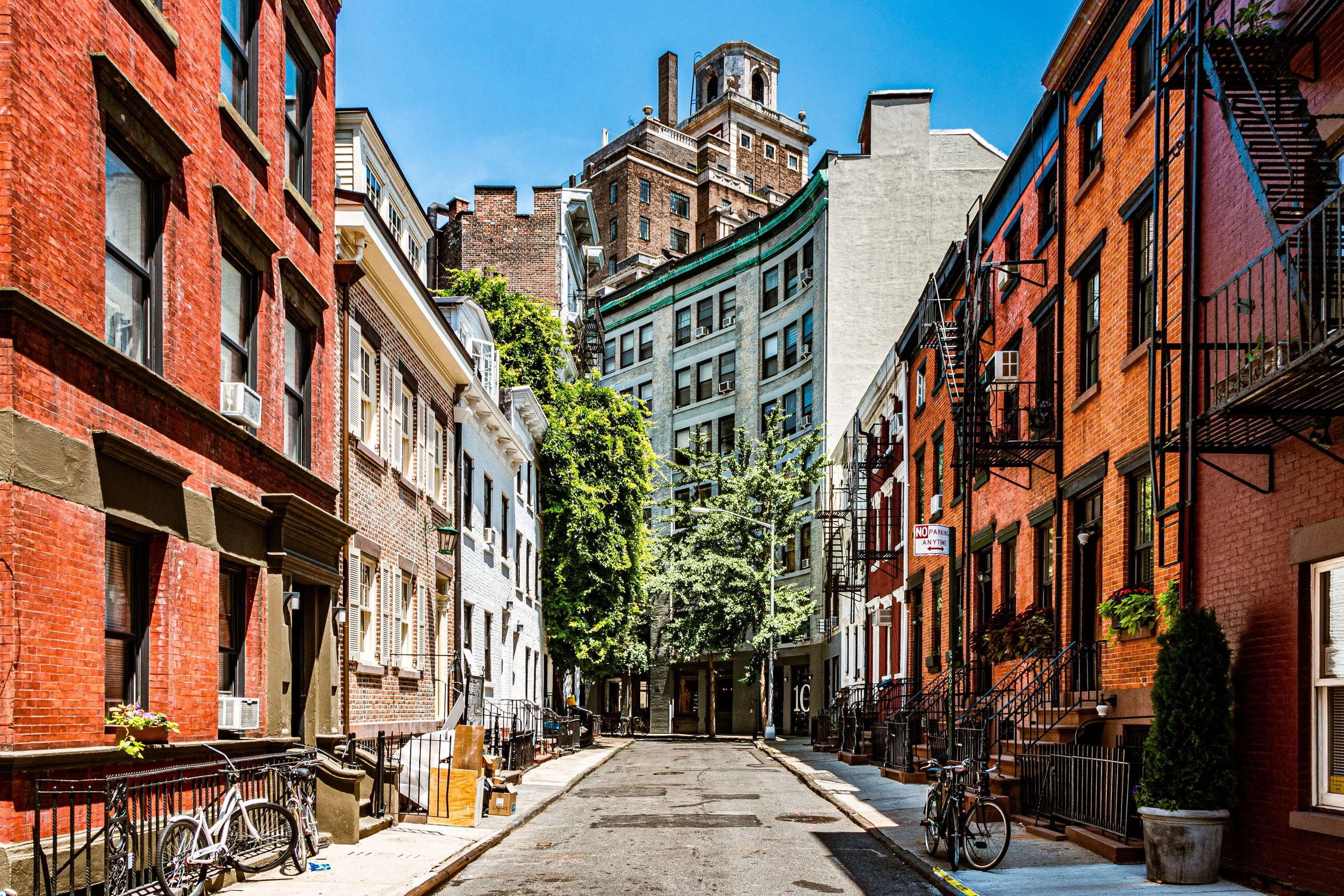
Bounded by the Hudson River to the west, Gansevoort Street to the north, Hudson Street and Sixth Avenue to the east, and Houston Street and Varick Street to the south—with Clarkson Street marking its return to the waterfront—the West Village forms one of Manhattan’s most beloved and idiosyncratic enclaves. Unlike the rigid rectilinear grid that defines most of the island, its streets twist, narrow, and intersect at irregular angles—remnants of the pre-1811 rural road network that once connected the small riverfront village of Greenwich to lower Manhattan. The result is a neighborhood whose geography defies order but exudes intimacy, a tangle of tree-lined lanes, hidden courtyards, and centuries-old rowhouses that have come to embody New York’s idea of urban charm.
To the west, Hudson River Park and its renovated piers form a green edge against the water, offering long views toward the New Jersey Palisades. Inland, Hudson, Bleecker, and Perry Streets weave among some of the city’s finest surviving Federal and Greek Revival rowhouses. West 4th, Waverly Place, and Bank Street cross one another in quiet defiance of the grid, while Greenwich Avenue bisects the district on a diagonal—a memory of colonial paths that once linked farms, shipyards, and taverns along the river.
Etymology and Origins
The West Village occupies part of the original Village of Greenwich, first settled in the 17th century as farmland by the Dutch and later expanded under English rule. The name “Greenwich” likely derives from the English seaport of the same name; the “West” distinction appeared only in the 19th century to differentiate this riverside section from the Greenwich Village core further east.
Before incorporation into New York City’s grid, the area existed as an independent hamlet with winding roads and small cottages. Its isolation proved both a refuge and a liability: during the yellow fever epidemics of 1798 and 1822, residents fled downtown to the “healthy air” of Greenwich Village. The influx of refugees during those crises accelerated development, establishing the district’s identity as a residential enclave distinct from the commercial bustle of the city below Canal Street.
The Neighborhood
18th–19th Centuries: From Village to Urban Quarter
By the early 1800s, the West Village was fully integrated into New York’s urban fabric yet retained its rural irregularity. Elegant brick and brownstone rowhouses rose along Hudson, Barrow, and Commerce Streets, reflecting Federal and Greek Revival styles. St. Luke in the Fields Church (1822), still standing on Hudson Street, served as both spiritual center and social landmark for the growing community.
When the Commissioners’ Plan of 1811 imposed the Manhattan grid, it stopped short of this area, leaving the older pattern of roads intact. As a result, West Village streets such as Grove, Gay, and Bedford preserved their 18th-century alignments—today a living map of Manhattan before modernity.
By the 1840s–1860s, the neighborhood evolved into a mixed district of artisans, sailors, and small merchants, supported by the nearby waterfront docks. Rowhouses were subdivided into boardinghouses; stables and small factories appeared on back lots. The area’s diversity expanded with waves of Irish and German immigrants, many employed in the shipping and garment trades. Yet through these changes, the West Village retained a domestic scale and a web of community institutions that gave it lasting resilience.
Late 19th–Early 20th Century: Bohemia on the Hudson
In the late 1800s, as industry intensified along the Hudson, the West Village became both working-class and quietly artistic. Tenements rose beside rowhouses, while waterfront warehouses, breweries, and printing shops lined West Street and Gansevoort Market. But the neighborhood’s labyrinthine streets and low rents soon attracted a new class of residents: artists, writers, and intellectuals drawn to its human scale and sense of freedom.
By the 1910s–1920s, the West Village was New York’s bohemian capital. Writers such as Edna St. Vincent Millay, Djuna Barnes, and E. E. Cummings lived in its garrets and mews, while radical publishers and theaters flourished along MacDougal and Bleecker Streets. The Provincetown Playhouse premiered Eugene O’Neill’s early works; cafés like the San Remo and Caffè Reggio fostered the Greenwich Village literary renaissance.
The district’s irregular geography reinforced its spirit of independence—artists and reformers could vanish into its crooked lanes, cultivating the myth of the Village as a republic of individualism within the metropolis. The nearby Hudson piers continued to hum with maritime life, while inland, small synagogues, parochial schools, and Italian bakeries testified to the area’s ethnic pluralism.
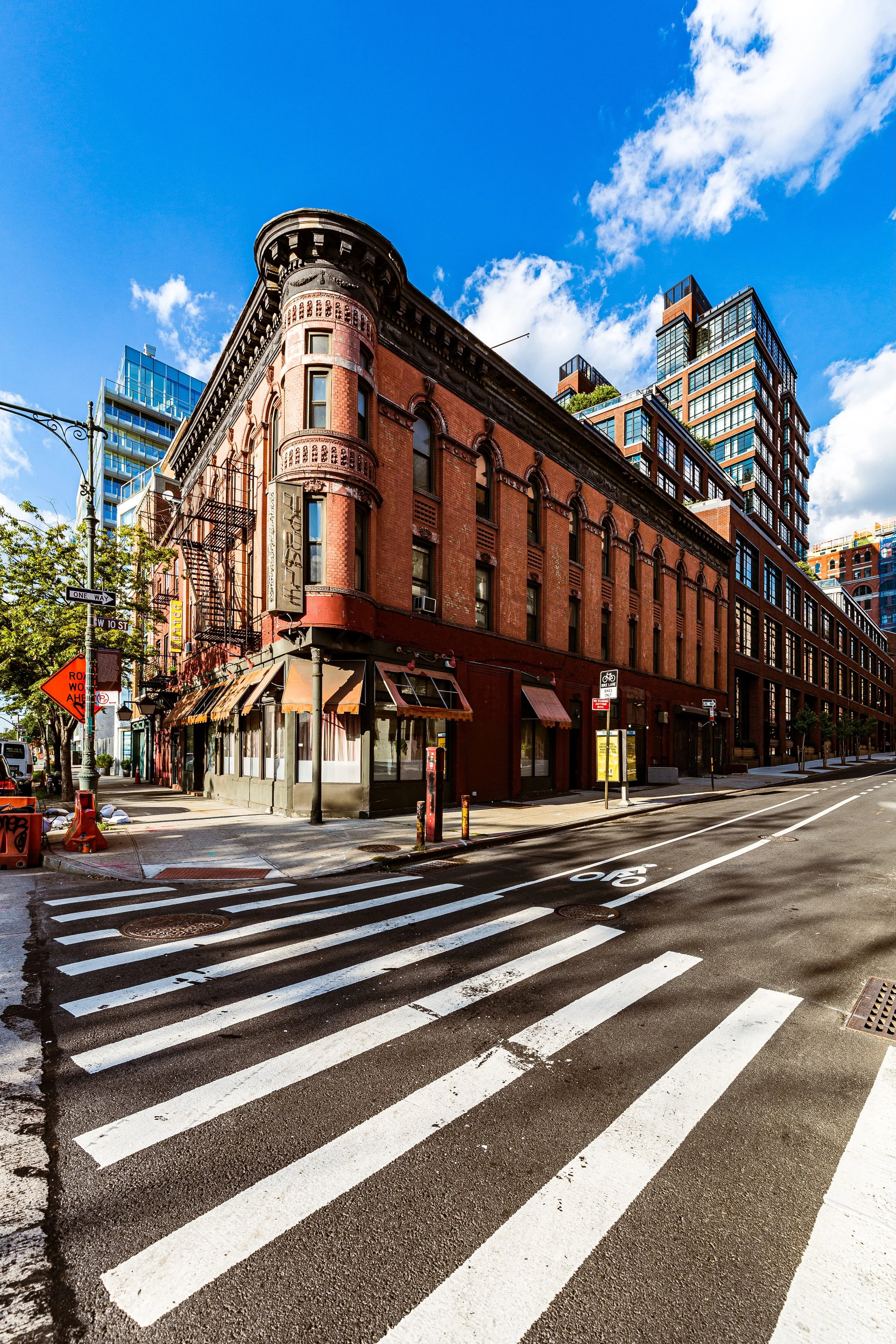
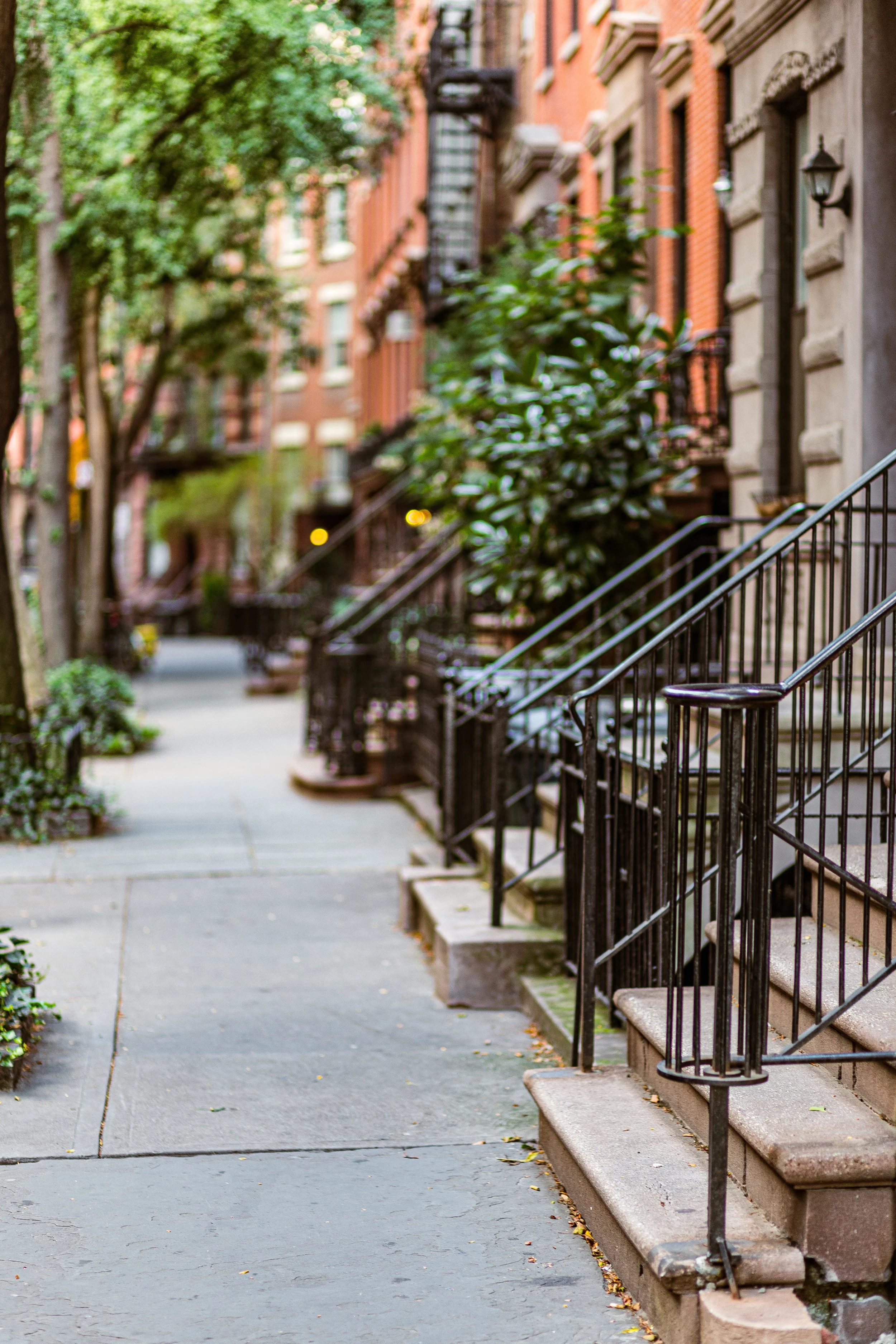
West Village Photographic Tour
Mid–Late 20th Century: Activism, Identity, and Preservation
After World War II, the West Village entered a period of social and political ferment. Though threatened by urban renewal and highway proposals, the neighborhood became a center of resistance and reform. Jane Jacobs, the writer and urbanist, made her home on Hudson Street and led successful campaigns against Robert Moses’ Lower Manhattan Expressway, preserving the West Village’s human-scaled streetscape and setting a national precedent for community-based planning.
At the same time, the district became a crucible of LGBTQ+ identity. The Stonewall Inn, on Christopher Street, was the site of the 1969 Stonewall Uprising, a landmark in the global struggle for gay rights. Christopher Street and its surrounding blocks became symbolic ground—equal parts refuge and rallying place—solidifying the West Village’s status as a nexus of social change.
Preservationists also moved to protect the neighborhood’s architectural heritage. The Greenwich Village Historic District, designated in 1969, encompassed most of the West Village’s core, ensuring that its 19th-century buildings and irregular street pattern would remain intact. Later expansions of the district safeguarded additional blocks to the west, including sections of Weehawken Street and the Gansevoort Market area.
21st Century: Preservation and Transformation on the Waterfront
In the 21st century, the West Village stands as one of New York’s most desirable neighborhoods—its historic charm tempered by contemporary affluence. Former warehouses have become lofts; carriage houses, discreet architectural gems. Along the Hudson, the Gansevoort Peninsula, Pier 57, and Little Island Park have transformed the old industrial shoreline into a continuous green promenade. The High Line’s southern terminus just north of Gansevoort Street links the West Village seamlessly to Chelsea’s new art corridor, while Hudson River Park has reconnected residents to the water for the first time in generations.
Despite rising real estate pressures, the neighborhood retains its essential texture: brick façades under ivy, stoops softened by trees, and the unhurried rhythm of pedestrians over cobblestone. Independent shops and cafés persist beside sleek boutiques, while legacy institutions—like The White Horse Tavern (1880s), Caffè Reggio, and The Village Vanguard—anchor a sense of cultural continuity. The district’s bohemian legacy lives on not in poverty but in principle: a stubborn resistance to conformity and a belief in urban life scaled to the human heart.
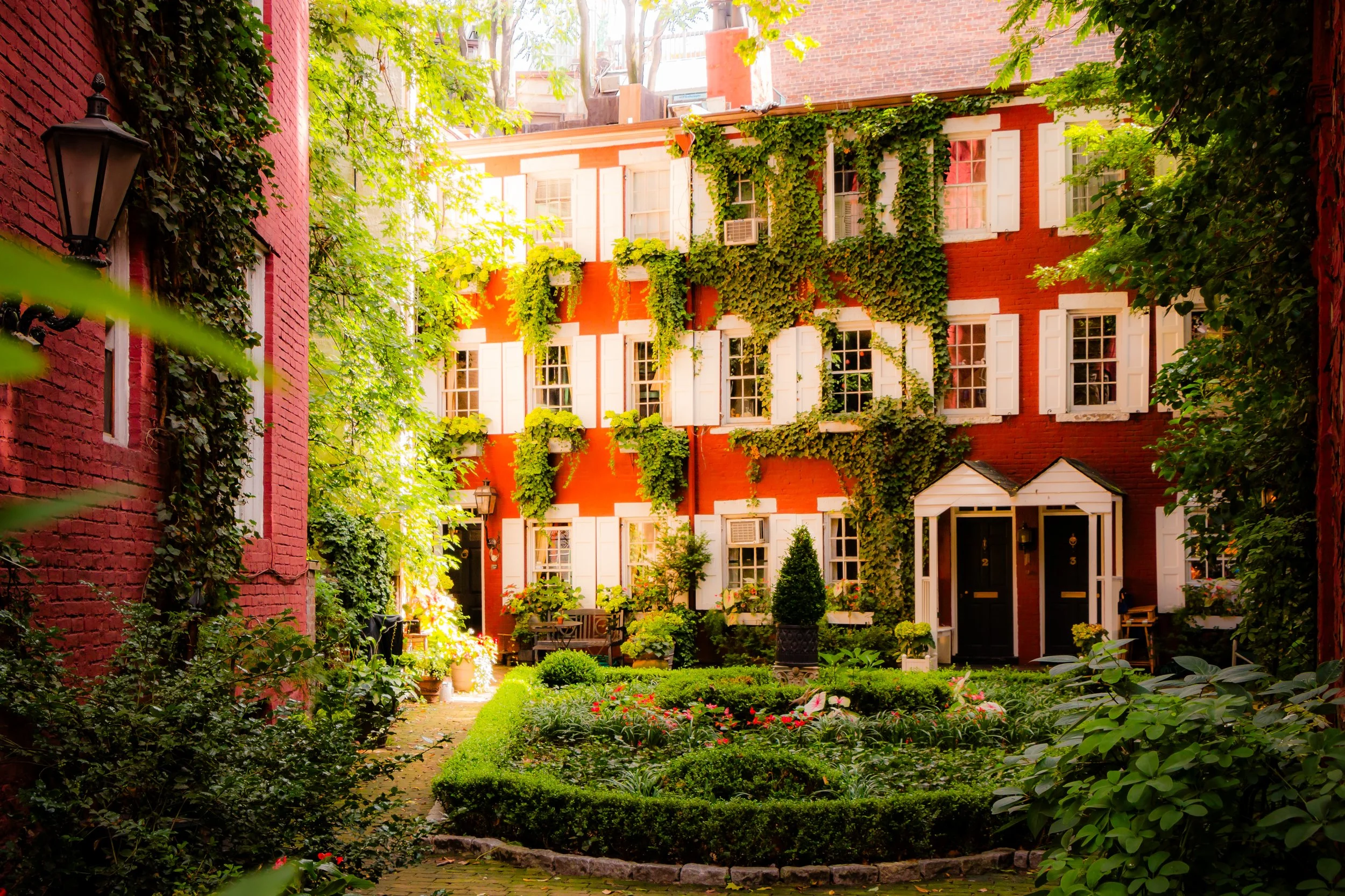
West Village Photo Gallery
Spirit and Legacy
The West Village endures as New York’s most romantic paradox—a neighborhood both ancient and ageless, provincial in scale yet cosmopolitan in spirit. Its crooked streets and centuries-old buildings are not relics but living expressions of the city’s most radical ideals: individuality, creativity, and community. From the sailors and immigrants who built it to the artists and activists who redefined it, the West Village has always belonged to those who cherish freedom—of form, of thought, of identity.
New York City
Use this custom Google map to explore where every neighborhood in all five boroughs of New York City is located.
The Five Boroughs
One of New York City’s unique qualities is its organization in to 5 boroughs: Manhattan, Brooklyn, Queens, The Bronx, and Staten Island. These boroughs are part pragmatic administrative districts, and part vestiges of the region’s past. Each borough is an entire county in New York State - in fact, Brooklyn is, officially, Kings County, while Staten Island is, officially Richmond County. But that’s not the whole story …
Initially, New York City was located on the southern tip of Manhattan (now the Financial District) that was once the Dutch colony of New Amsterdam. Across the East River, another city was rising: Brooklyn. In time, the city planners realized that unification between the rapidly rising cities would create commercial and industrial opportunities - through streamlined administration of the region.
So powerful was the pull of unification between New York and Brooklyn that three more counties were pulled into the unification: The Bronx, Queens, and Staten Island. And on January 1, 1898, the City of New York unified two cities and three counties into one Greater City of New York - containing the five boroughs we know today.
But because each borough developed differently and distinctly until unification, their neighborhoods likewise uniquely developed. Today, there are nearly 390 neighborhoods, each with their own histories, cultures, cuisines, and personalities - and each with residents who are fiercely proud of their corner of The Big Apple.


