
FOREST PARK
Queens
Neighborhood Profile
A 500-acre natural oasis in Central Queens, Forest Park is defined by its rugged, glacier-carved topography and dense, ancient woodlands. The surrounding residential streets enjoy a tranquil, "forest-side" lifestyle, with immediate access to the park’s historic carousel, sprawling golf course, and miles of scenic hiking and bridle trails.
Geographic Setting
Stretching across the center of southwestern Queens, Forest Park spans roughly 538 acres of rolling hills, oak woods, and recreational fields between Kew Gardens, Woodhaven, Richmond Hill, and Glendale. It is bounded by Myrtle Avenue and Union Turnpike on the north, Park Lane South on the south, Woodhaven Boulevard on the east, and Cypress Hills Cemetery on the west—forming the green spine of the borough’s midsection. The park’s hilly terrain, a remnant of the glacial moraine that runs through Long Island, offers one of the most varied natural landscapes in New York City: ridges, kettle ponds, and dense woodlands interspersed with trails and meadows.
At its center lies the George Seuffert Bandshell and the Forest Park Carousel, surrounded by bridle paths and sports fields. The Jackie Robinson Parkway—once the Interboro Parkway—curves through the park’s wooded interior, giving motorists glimpses of its sylvan depths. Forest Park connects to Highland Park and the Cypress Hills Cemetery Ridge to the west, completing a nearly unbroken ribbon of green stretching to Brooklyn.
Etymology and Origins
The name “Forest Park” is as literal as it is poetic—a title chosen in the 1890s to reflect the area’s defining feature: its dense native woods. Before its designation as parkland, the region was known for its towering oaks and tulip trees that shaded old estates and burial grounds. In 1892, as part of the Brooklyn–Queens Parks Commission’s expansion program, the City of Brooklyn (then an independent municipality) began acquiring land here to establish a park comparable in size and purpose to Central and Prospect Parks.
When Queens was consolidated into New York City in 1898, the new park became a key component of the borough’s emerging identity—a natural preserve for a rapidly suburbanizing population.
The Neighborhood
Late 19th–Early 20th Century: Designing a Great Urban Forest
Forest Park’s formal design began in the 1890s under Frederick Law Olmsted Jr. and Samuel Parsons, who sought to preserve its wild topography rather than impose rigid landscaping. They emphasized curving drives, bridle paths, and open meadows, drawing inspiration from English landscape design. Early improvements included Forest Park Drive (1896), which wound from Woodhaven to Myrtle Avenue, and a nine-hole golf course (later expanded to 18 holes), one of the city’s earliest public courses.
The park quickly became a favorite destination for carriage rides and picnics. By 1910, the newly opened Forest Park Carousel, built by master carver Daniel Carl Muller, became a beloved attraction, its hand-carved horses and chariots celebrated for craftsmanship and whimsy. Around the same time, the Richmond Hill Lawn Tennis Club and equestrian facilities along Park Lane South reflected the genteel leisure culture of early 20th-century Queens.
Mid-20th Century: Recreation, Community, and Resilience
During the 1930s, Robert Moses oversaw major improvements that transformed Forest Park into a true multipurpose urban park. New playgrounds, athletic fields, and comfort stations were added, while bridle paths and the golf course were upgraded for public use. The construction of the Interboro Parkway (now Jackie Robinson Parkway) through the park in 1935—though controversial—linked Queens and Brooklyn by automobile, carving dramatic vistas through the wooded slopes.
After World War II, Forest Park became the weekend heart of nearby neighborhoods such as Woodhaven, Glendale, and Richmond Hill. Families flocked to the Seuffert Bandshell, opened in 1928, for free concerts, while ballfields and picnic groves filled each summer. Civic organizations such as the Woodhaven Residents’ Block Association and the Richmond Hill Historical Society championed its upkeep and preservation. Though the city’s fiscal crisis of the 1970s led to neglect, the park’s deep-rooted trees and community affection ensured its survival.
Forest Park Photographic Videos
Late 20th–21st Century: Ecological Restoration and Renewal
By the 1980s, a new wave of environmental consciousness transformed the stewardship of Forest Park. The Natural Areas Conservancy, Partnerships for Parks, and local volunteers undertook reforestation, trail maintenance, and wildlife monitoring projects. The park’s Arbor Day plantings restored sections of its oak–hickory forest, while new walking and biking paths connected it to the Brooklyn–Queens Greenway. The Forest Park Carousel, after years of decline, was beautifully restored and reopened in 2013 as the Forest Park Carousel Amusement Village, earning landmark status for its artistry and cultural significance.
Today, the park hosts everything from outdoor yoga and cross-country meets to nature hikes and the annual Woodhaven Historical Cemetery Tour, which connects the park’s edge to the city’s frontier past. Its golf course, still in operation, continues a tradition of recreation that has endured for more than a century.
Forest Hills Photo Gallery
Through The Lens
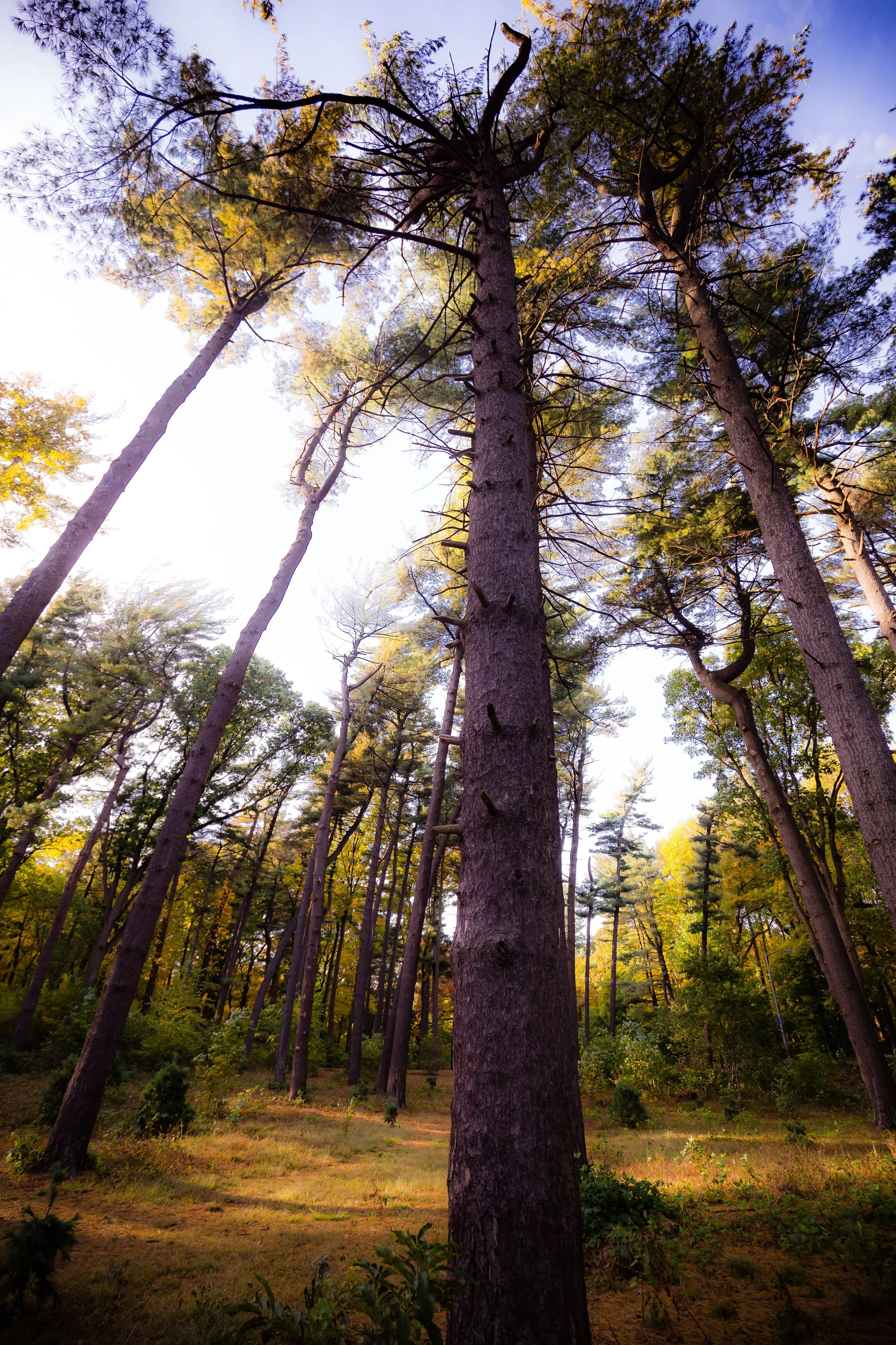
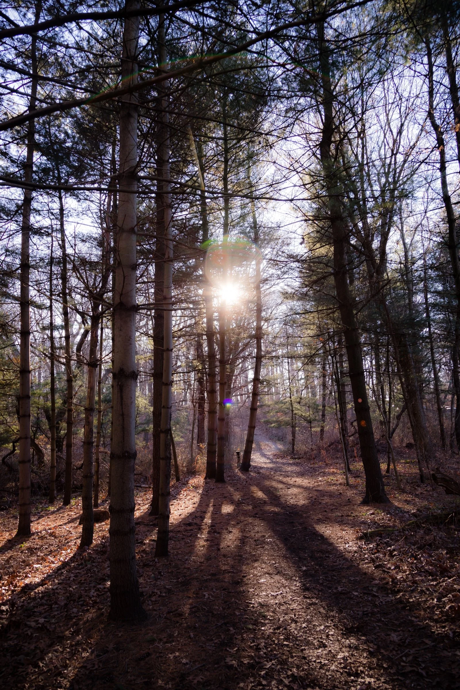
Winter photography is often a lesson in subtraction, but today was all about the geometry of light. Without the canopy of leaves, the trees are reduced to their essential forms—bare branches stretching out like skeletal fingers against the fading blue.
I leaned into the high-contrast environment to play with the interplay of light and shadow. The goal was to capture the "otherworldly" feel by making the shadows as much a subject as the trees themselves.
The Technique: I ignored the standard "sun at your back" rule. By turning the lens directly toward the sun, I was able to capture a dramatic flare and a piercing starburst effect that emphasizes the cold, brilliant intensity of the January light.
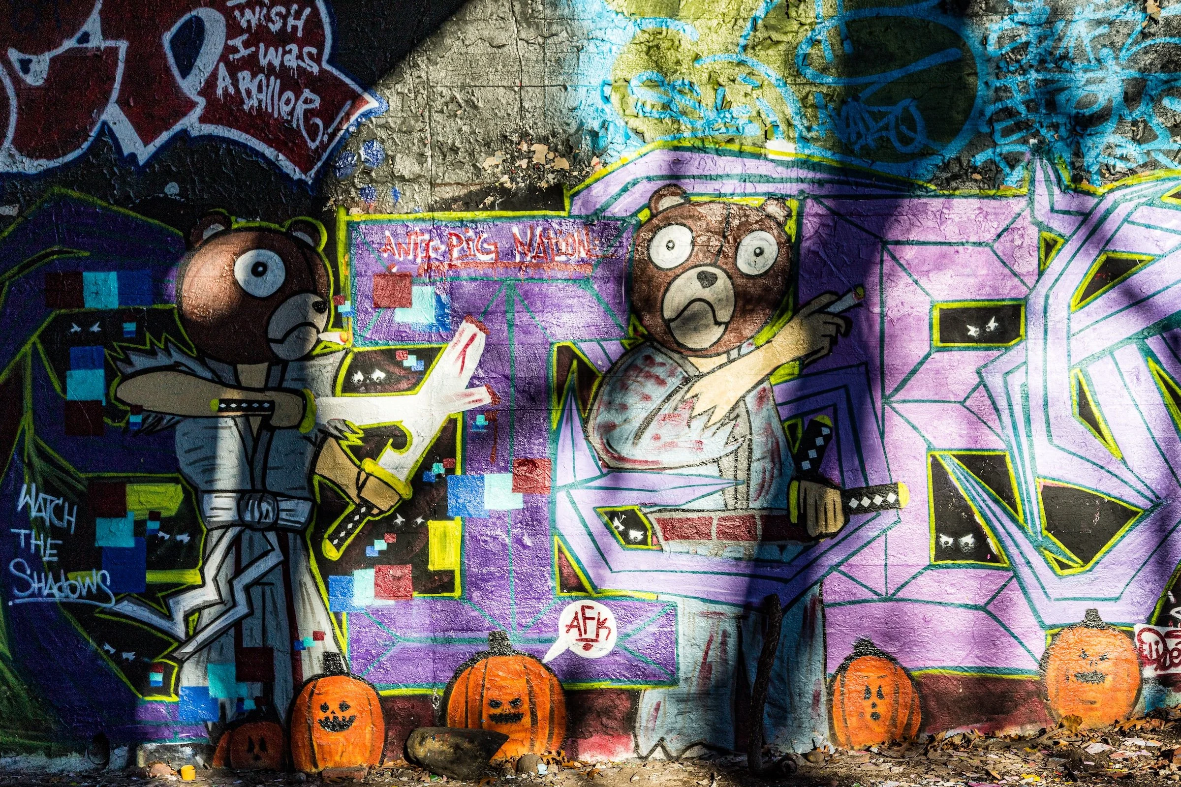
The Result: In In A Pine Grove, the long, rhythmic shadows cast by the trunks create a sense of depth that draws the eye toward the light source, while Watch The Shadows captures the harsh, diagonal cuts of shade across the vibrant graffiti, grounding the urban art in the natural movement of the sun.
Spirit and Legacy
Forest Park remains Queens’ great woodland heart—a living reminder that even in the midst of urban life, the natural landscape endures. Its trails wind through glades that feel centuries removed from the city’s bustle, yet its lawns and bandshell draw families every weekend from blocks away. The park’s enduring charm lies in its balance of wilderness and civility—its ability to host concerts beneath century-old oaks, to cradle playgrounds among hills once shaped by glaciers.
Standing atop the ridge near Overlook Trail, with the hum of the Jackie Robinson Parkway softened by trees and the towers of Queens glimmering beyond, one feels the dual spirit that defines Forest Park: both sanctuary and city, cultivated yet wild. It remains not merely a park, but a living testament to Queens’ capacity to preserve its soul amid growth.
Forest Park Field Notes
-
January 15, 2023 | 15:38 – 16:49
Conditions: 36°F (2°C) | Clear & Crisp | Wind: 7 mph NW
Low-angle winter sun; dry, leaf-strewn forest floor; high contrast between sun-drenched paths and deep shadows.
Field Notes:
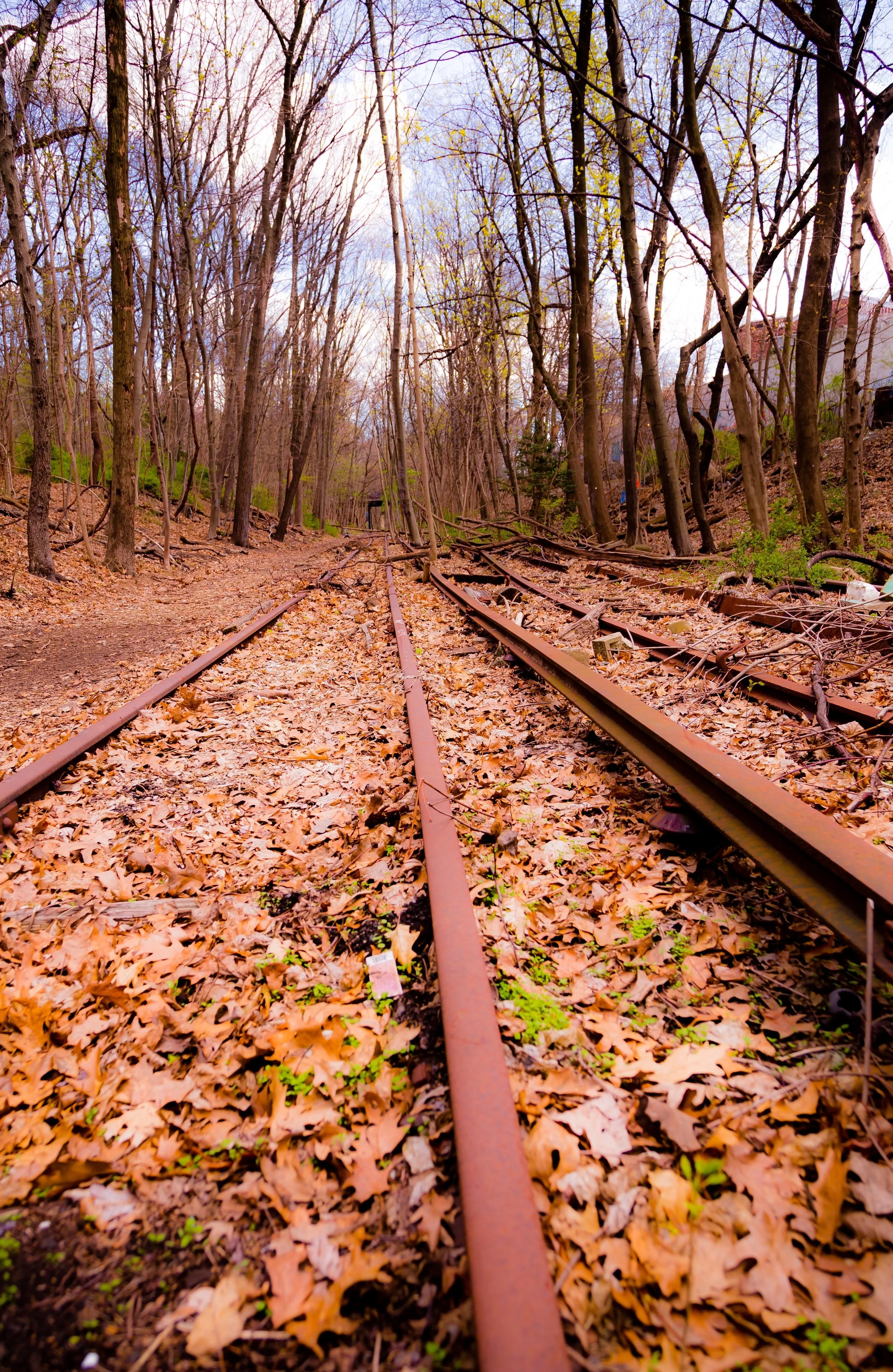
There is a specific kind of magic that happens in Forest Park during the winter "Golden Hour." As the sun dips toward the horizon, the usual suburban hum of Queens fades into an eerie, beautiful silence. Today, the park felt like a portal. One moment I was moving through a quiet, skeletal forest where the air felt still and ancient; the next, I was stumbling upon the rusted remains of abandoned rail lines and concrete underpasses screaming with color.
The graffiti in the underpasses provides a sharp, man-made jolt to the system that feels surprisingly at home against the winter's neutral palette. It’s a landscape of transitions—between nature and decay, silence and visual noise.
Other neighborhoods visited:
In A Pine Grove
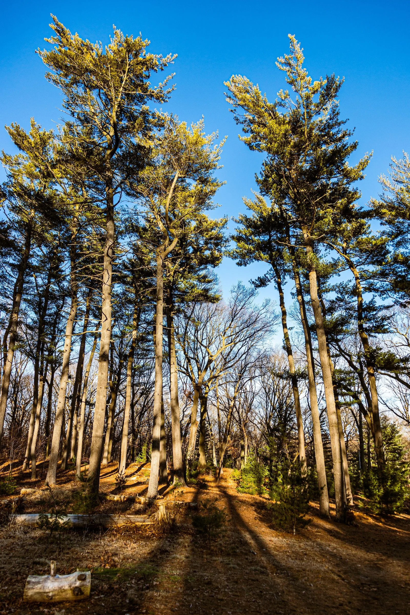
Pine Grove
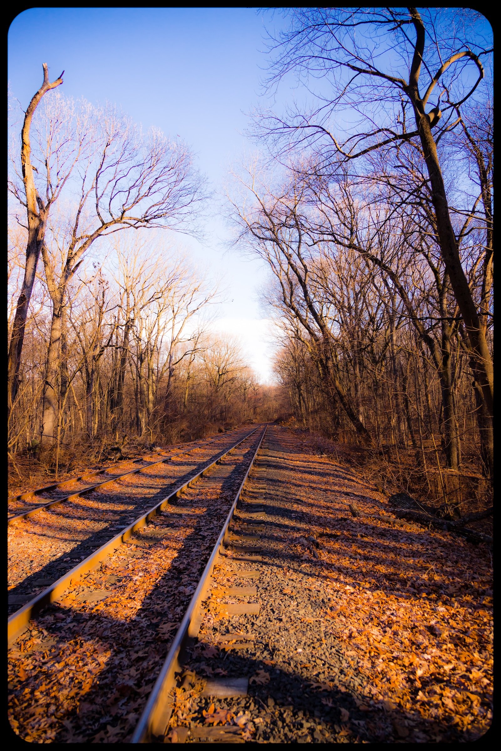
Track Shadows
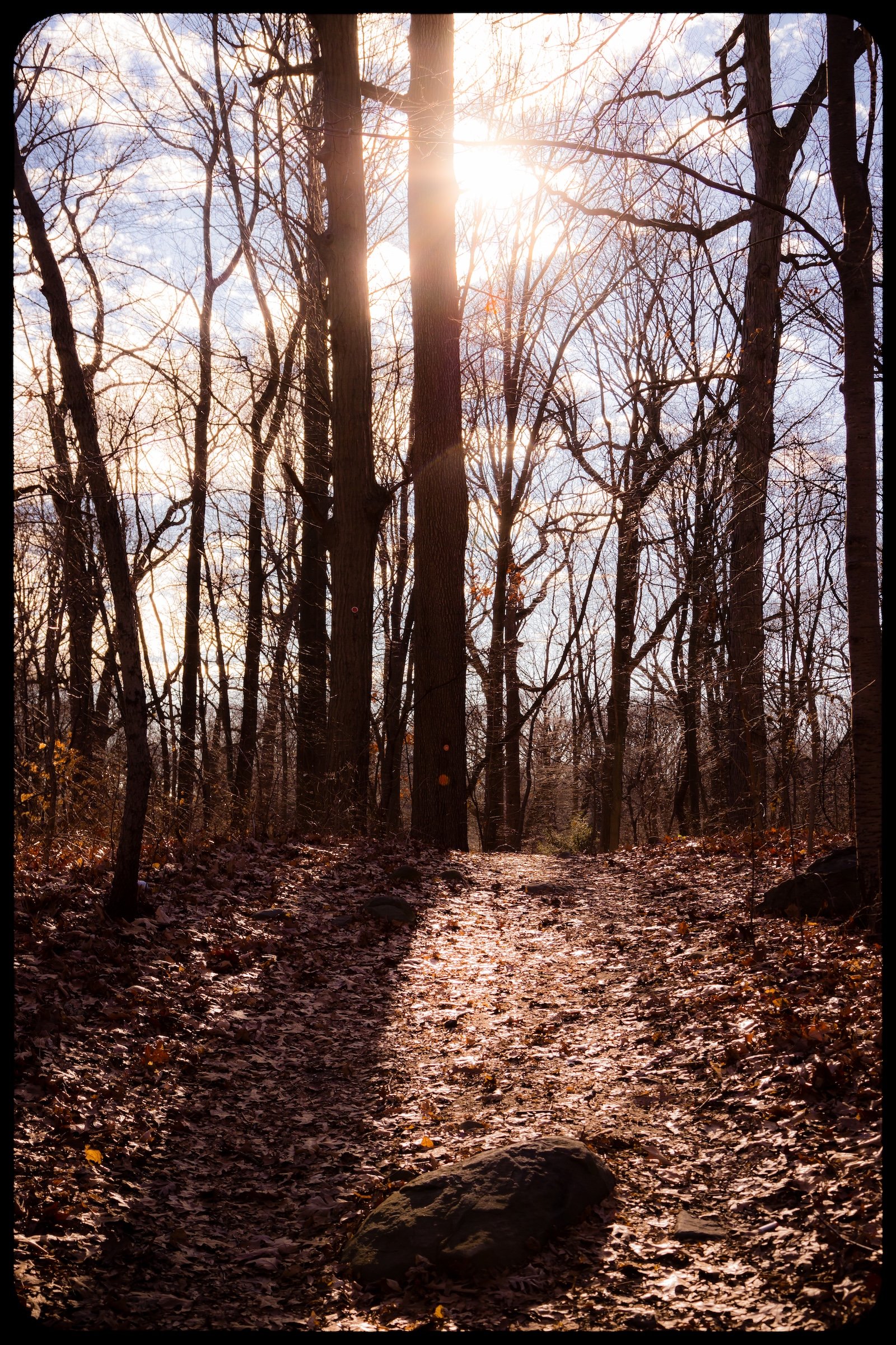
Trees In Winter Sun
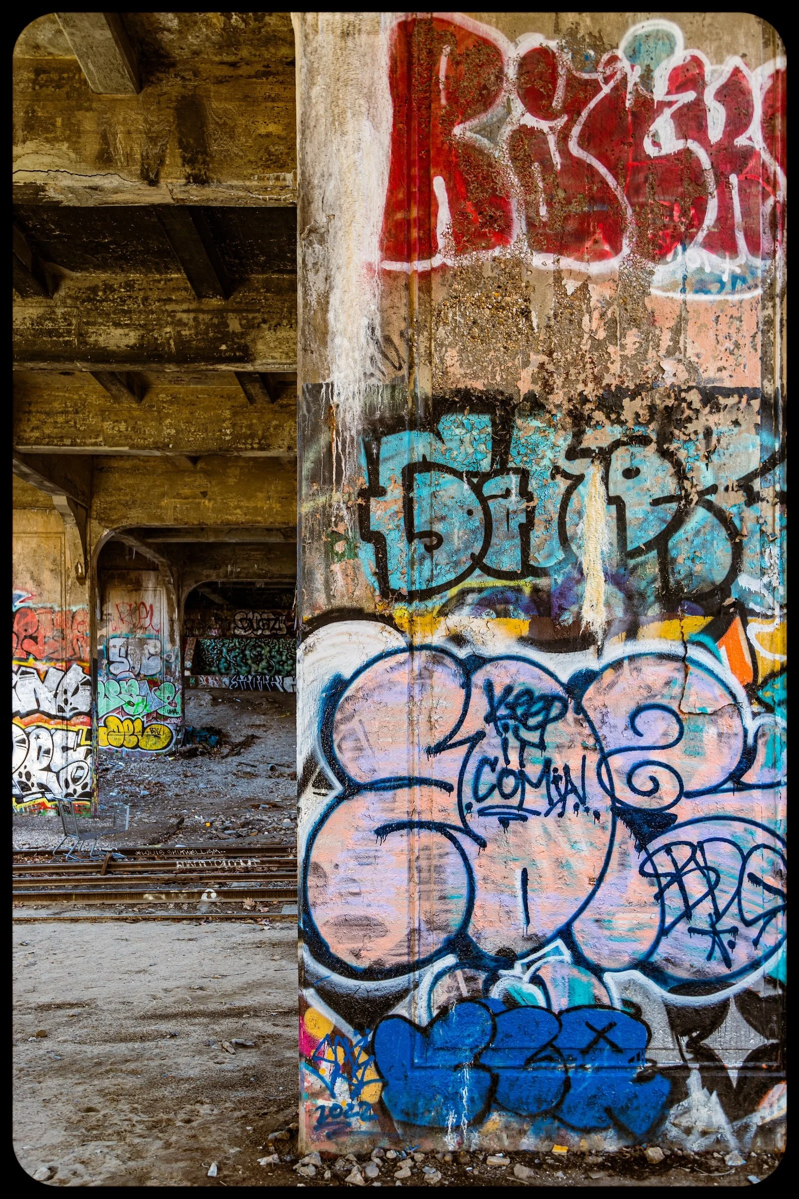
Underpass Perspective
Watch The Shadows
Use this custom Google map to explore where every neighborhood in all five boroughs of New York City is located.
The Five Boroughs
One of New York City’s unique qualities is its organization in to 5 boroughs: Manhattan, Brooklyn, Queens, The Bronx, and Staten Island. These boroughs are part pragmatic administrative districts, and part vestiges of the region’s past. Each borough is an entire county in New York State - in fact, Brooklyn is, officially, Kings County, while Staten Island is, officially Richmond County. But that’s not the whole story …
Initially, New York City was located on the southern tip of Manhattan (now the Financial District) that was once the Dutch colony of New Amsterdam. Across the East River, another city was rising: Brooklyn. In time, the city planners realized that unification between the rapidly rising cities would create commercial and industrial opportunities - through streamlined administration of the region.
So powerful was the pull of unification between New York and Brooklyn that three more counties were pulled into the unification: The Bronx, Queens, and Staten Island. And on January 1, 1898, the City of New York unified two cities and three counties into one Greater City of New York - containing the five boroughs we know today.
But because each borough developed differently and distinctly until unification, their neighborhoods likewise uniquely developed. Today, there are nearly 390 neighborhoods, each with their own histories, cultures, cuisines, and personalities - and each with residents who are fiercely proud of their corner of The Big Apple.


