MASPETH
Queens
Geographic Setting
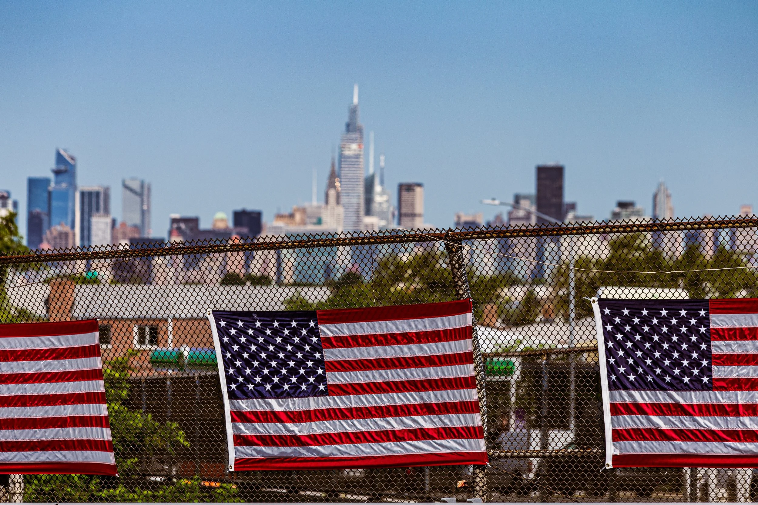
Bounded by the Brooklyn–Queens Expressway (BQE) to the north, the Long Island Rail Road freight lines to the east, Eliot Avenue to the southeast, Metropolitan Avenue to the south, and Newtown Creek and the Brooklyn border to the west, Maspeth sits at the crossroads of western Queens—an industrial and residential community rooted in centuries of continuous settlement. Its landscape, a mix of rowhouses, warehouses, churches, and cobbled industrial lanes, reflects its identity as one of Queens’ oldest European-founded villages and one of its most blue-collar neighborhoods.
The geography of Maspeth is defined by contrasts: to the north and west, the Newtown Creek industrial waterfront, where oil refineries and manufacturing plants once powered the borough’s economy; to the south and east, tidy blocks of brick two-family homes and corner taverns, representing the residential heart of the community. Grand Avenue, running diagonally through the neighborhood from the Brooklyn border to Flushing Avenue, serves as its spine—lined with bakeries, delis, pubs, and small businesses that have catered to generations of working families.
Topographically, Maspeth lies within a low-lying basin that was once a patchwork of tidal marshes and meadows. Although industry has reshaped its waterfront, pockets of the area’s natural contours remain visible in the winding pattern of streets such as 69th Street, Rust Street, and Clinton Avenue, which trace the edges of the old Newtown Creek wetlands. The result is a neighborhood where the rhythms of factory whistles and church bells once intertwined—and where community identity still runs deep beneath the hum of trucks and trains.
Etymology and Origins
The name “Maspeth” derives from the Mespeatches, a sub-tribe of the Lenape (Algonquian-speaking) people who inhabited this region long before European settlement. In their language, Mespeatches roughly means “at the bad water place” or “an overflowing tidal water,” a reference to the wetlands and shifting inlets of Newtown Creek that once covered much of the area.
In 1642, Dutch settlers from New Amsterdam, led by Francis Doughty and Reverend Richard Denton, established the first European settlement here under the charter of New Netherland, making Maspeth one of the earliest colonial villages in Queens. The original settlement, located near present-day 56th Terrace and 58th Street, was destroyed two years later during conflicts with Native inhabitants. It was resettled in 1652 as part of the broader Town of Newtown, which later encompassed today’s Maspeth, Elmhurst, Middle Village, and other western Queens communities.
Throughout the 18th and 19th centuries, Maspeth remained largely rural—its rolling farmland, salt meadows, and creeks supporting dairies, mills, and small family homesteads. The construction of Grand Street (now Grand Avenue) in the early 1800s linked Maspeth directly to Williamsburg and downtown Brooklyn, establishing a trade route that would define the neighborhood’s commercial identity for the next two centuries.
The Neighborhood
19th Century: Industry and Immigration
The Industrial Revolution transformed Maspeth into a center of manufacturing and transport. Its proximity to Newtown Creek—then one of America’s busiest industrial waterways—made it ideal for factories, tanneries, and chemical plants. By the mid-1800s, the creek’s banks were lined with oil refineries, glue works, and copper smelters, while barge traffic carried raw materials to Manhattan and Brooklyn.
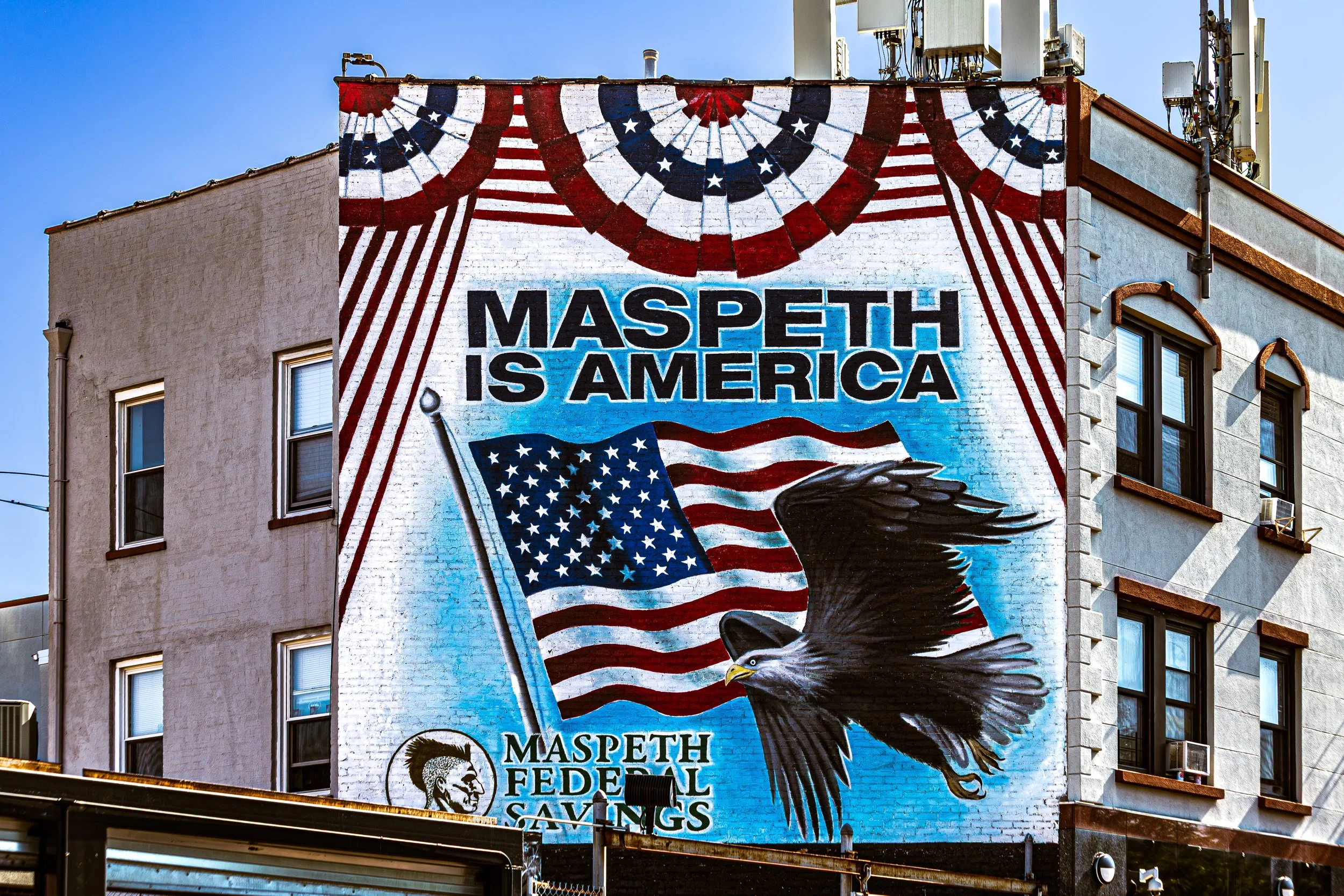
The Maspeth Plank Road Company, established in 1854, paved the way for the neighborhood’s growth, literally—laying down wooden planks along Grand Avenue to ease wagon transport between Queens and Brooklyn. Immigrants from Germany, Poland, Ireland, and later Italy began settling near the road’s commercial corridor, founding the churches and social clubs that would shape community life for generations. Holy Cross Roman Catholic Church (est. 1848) and St. Stanislaus Kostka Church (1891) became parish anchors for German and Polish families respectively, while small breweries and bakeries proliferated along Grand Avenue and Rust Street.
The opening of the Long Island Rail Road’s Montauk Branch brought additional industrial expansion, connecting Maspeth’s warehouses to the city’s broader freight network. Yet, unlike neighboring Long Island City, Maspeth’s residential character persisted, thanks in part to its modest scale and strong parish-centered communities.
Early–Mid 20th Century: A Working-Class Enclave
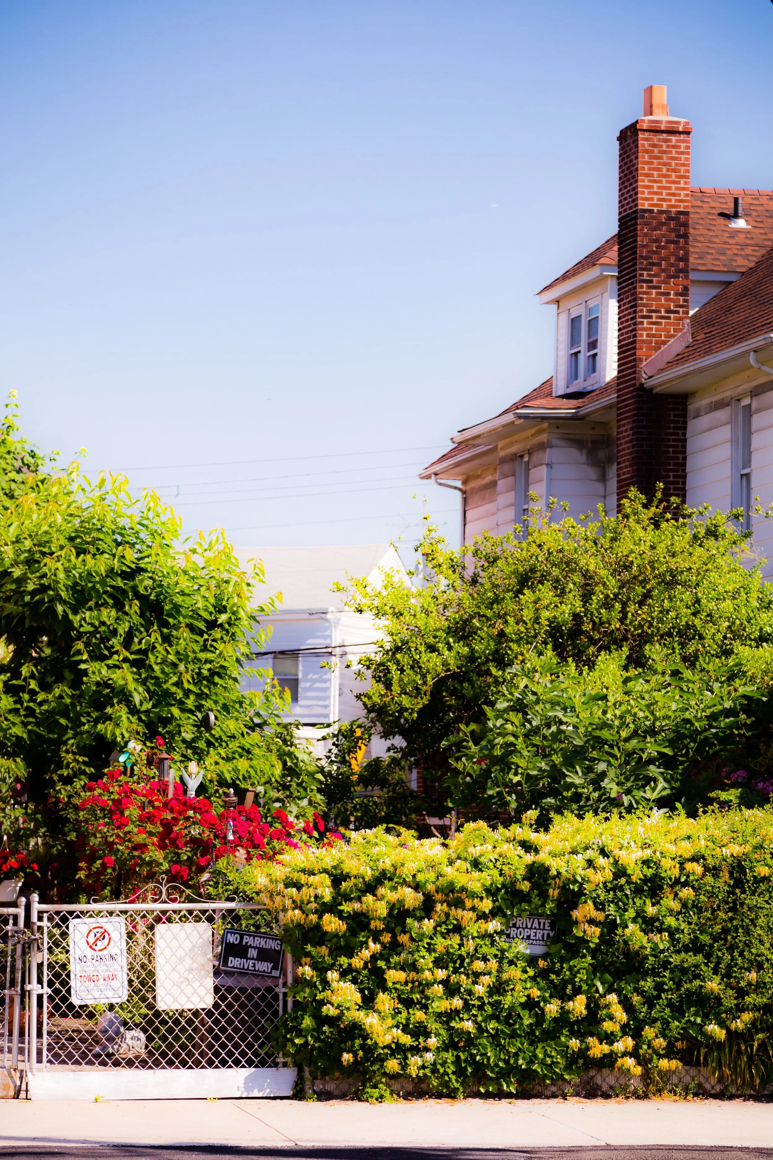
By the early 20th century, Maspeth had become one of Queens’ quintessential working-class neighborhoods, its population dominated by second-generation European immigrants. Rows of attached brick homes, many built between 1910 and 1930, lined side streets such as 58th Avenue, 69th Street, and 58th Road, while small corner stores and taverns punctuated every few blocks.
The construction of the Brooklyn–Queens Expressway (BQE) in the 1930s and 1940s reshaped the northern boundary, dividing industrial and residential zones but also improving connectivity to Manhattan and Brooklyn. Despite these changes, Maspeth retained its small-town feel. Children attended P.S. 58 or Grover Cleveland High School, families shopped along Grand Avenue, and parish picnics filled the calendar.
During the postwar boom, the neighborhood experienced modest suburbanization, with families upgrading to newer brick homes and planting trees along sidewalks. The area’s population—still predominantly Irish, German, and Polish—maintained a high rate of homeownership. Nearby factories provided stable employment, while the Maspeth Industrial Business Zone, encompassing Rust Street and Grand Avenue, continued to anchor the local economy.
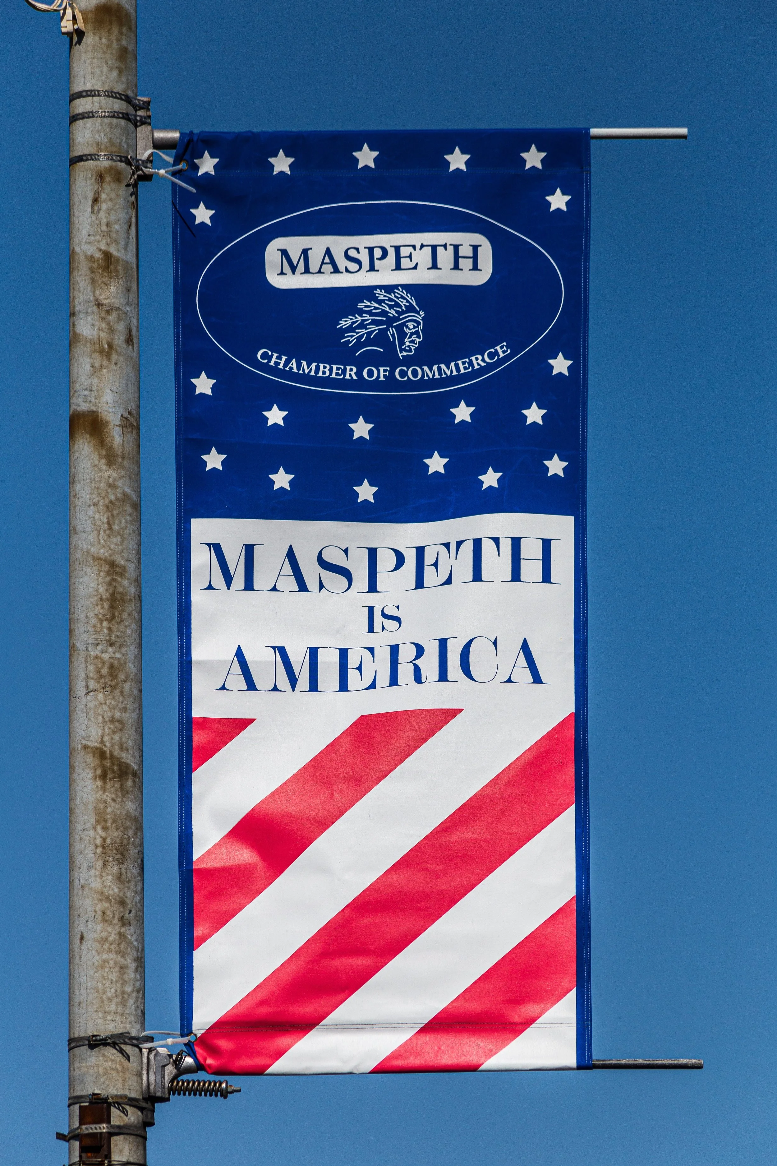
Even as much of New York City experienced waves of decline in the 1960s and 1970s, Maspeth remained remarkably stable. Its strong civic institutions—especially the Maspeth Town Hall Community Center and the Maspeth Chamber of Commerce—played key roles in preserving the neighborhood’s infrastructure and public spaces.
Maspeth Video Coming Soon
Late 20th–21st Century: Tradition Amid Transition
From the 1980s onward, Maspeth began to diversify, welcoming new waves of Latino, South Asian, and Eastern European residents. Yet the neighborhood’s essential rhythms remained unchanged. Grand Avenue continued to function as a self-contained main street, lined with pizzerias, Polish groceries, Irish pubs, and now Colombian bakeries and Ecuadorian cafés—each reflecting the layers of immigration that define Queens itself.
The industrial zone along Newtown Creek experienced both decline and renewal. Some aging factories closed, but others were repurposed for logistics and light manufacturing, taking advantage of the area’s proximity to highways and ports. Environmental restoration projects—most notably the cleanup of Newtown Creek—have begun reclaiming portions of the waterfront once choked by pollution, reviving a connection to the water that had been lost for over a century.
The neighborhood’s civic activism remains vigorous. The Maspeth Industrial Business Association advocates for cleaner infrastructure and truck route reforms, while local groups such as Communities of Maspeth and Elmhurst Together (COMET) promote sustainability and neighborhood pride. Despite the influx of new populations, Maspeth retains one of Queens’ strongest local identities: close-knit, practical, and proud of its working-class roots.
Maspeth Photo Gallery
Spirit and Legacy
Maspeth’s enduring spirit lies in its continuity through change. From its founding as a 17th-century Dutch-English outpost to its evolution into a 20th-century industrial hub and 21st-century multicultural village, it has adapted without losing its sense of belonging. The neighborhood’s low skyline, parish steeples, and factory silhouettes all speak to a history shaped by work, faith, and resilience.
New York City
Use this custom Google map to explore where every neighborhood in all five boroughs of New York City is located.
The Five Boroughs
One of New York City’s unique qualities is its organization in to 5 boroughs: Manhattan, Brooklyn, Queens, The Bronx, and Staten Island. These boroughs are part pragmatic administrative districts, and part vestiges of the region’s past. Each borough is an entire county in New York State - in fact, Brooklyn is, officially, Kings County, while Staten Island is, officially Richmond County. But that’s not the whole story …
Initially, New York City was located on the southern tip of Manhattan (now the Financial District) that was once the Dutch colony of New Amsterdam. Across the East River, another city was rising: Brooklyn. In time, the city planners realized that unification between the rapidly rising cities would create commercial and industrial opportunities - through streamlined administration of the region.
So powerful was the pull of unification between New York and Brooklyn that three more counties were pulled into the unification: The Bronx, Queens, and Staten Island. And on January 1, 1898, the City of New York unified two cities and three counties into one Greater City of New York - containing the five boroughs we know today.
But because each borough developed differently and distinctly until unification, their neighborhoods likewise uniquely developed. Today, there are nearly 390 neighborhoods, each with their own histories, cultures, cuisines, and personalities - and each with residents who are fiercely proud of their corner of The Big Apple.


