LAURELTON
Queens
Geographic Setting
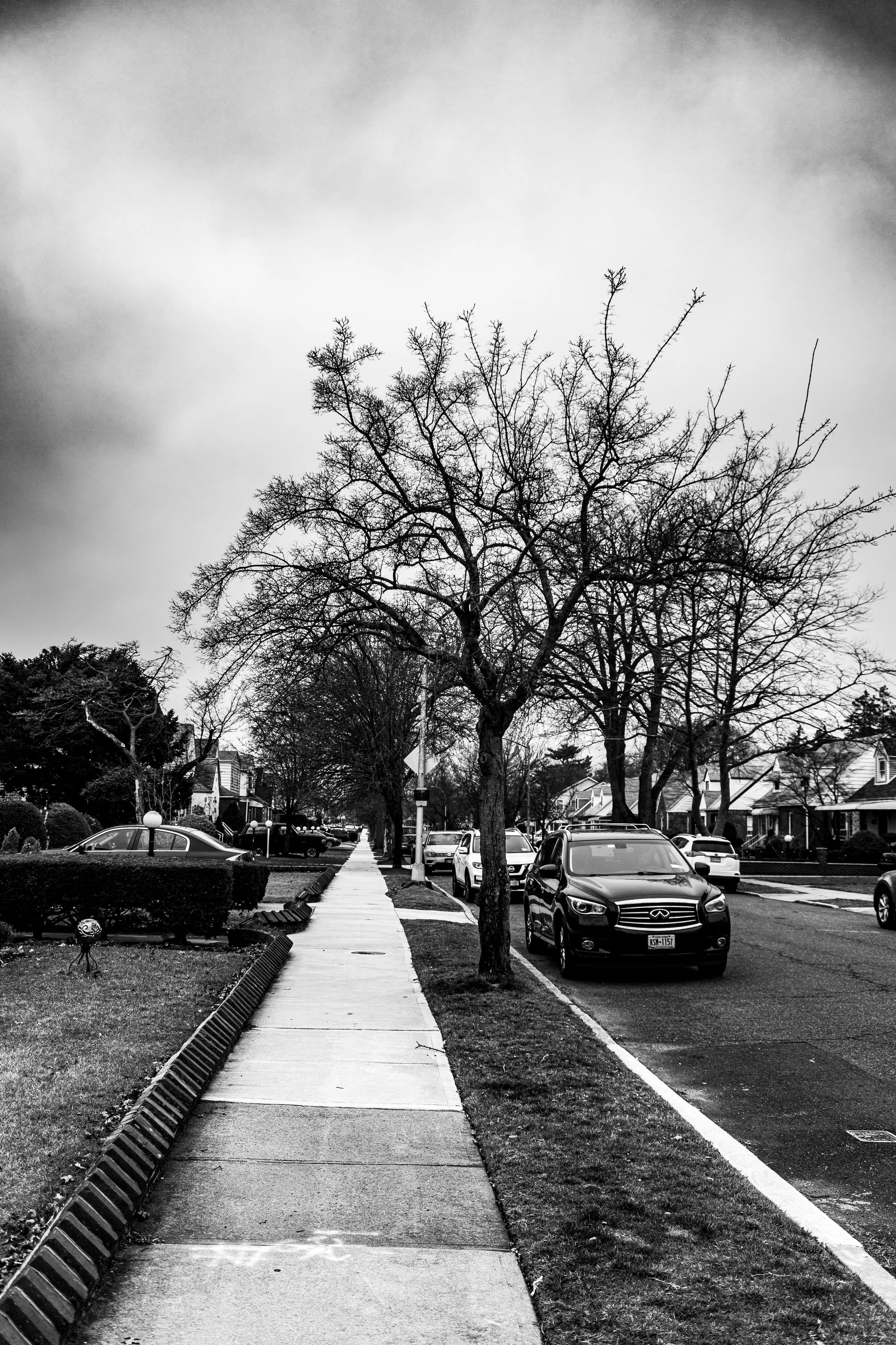
Bounded by the Belt Parkway to the east, Mentone Avenue to the south, Carson Street to the southwest, Springfield Boulevard to the west, and 121st Street to the north, Laurelton occupies the southeastern edge of Queens—a tranquil, tree-lined enclave that blends suburban order with civic pride. Nestled between Rosedale, Springfield Gardens, and Cambria Heights, the neighborhood is distinguished by its curving residential streets, detached homes with lawns, and a canopy of laurel, oak, and sycamore trees that give the area its name and distinctive sense of place.
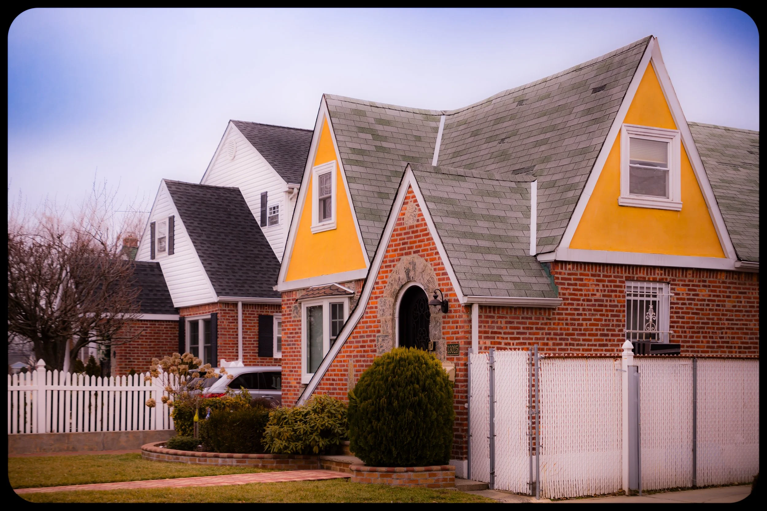
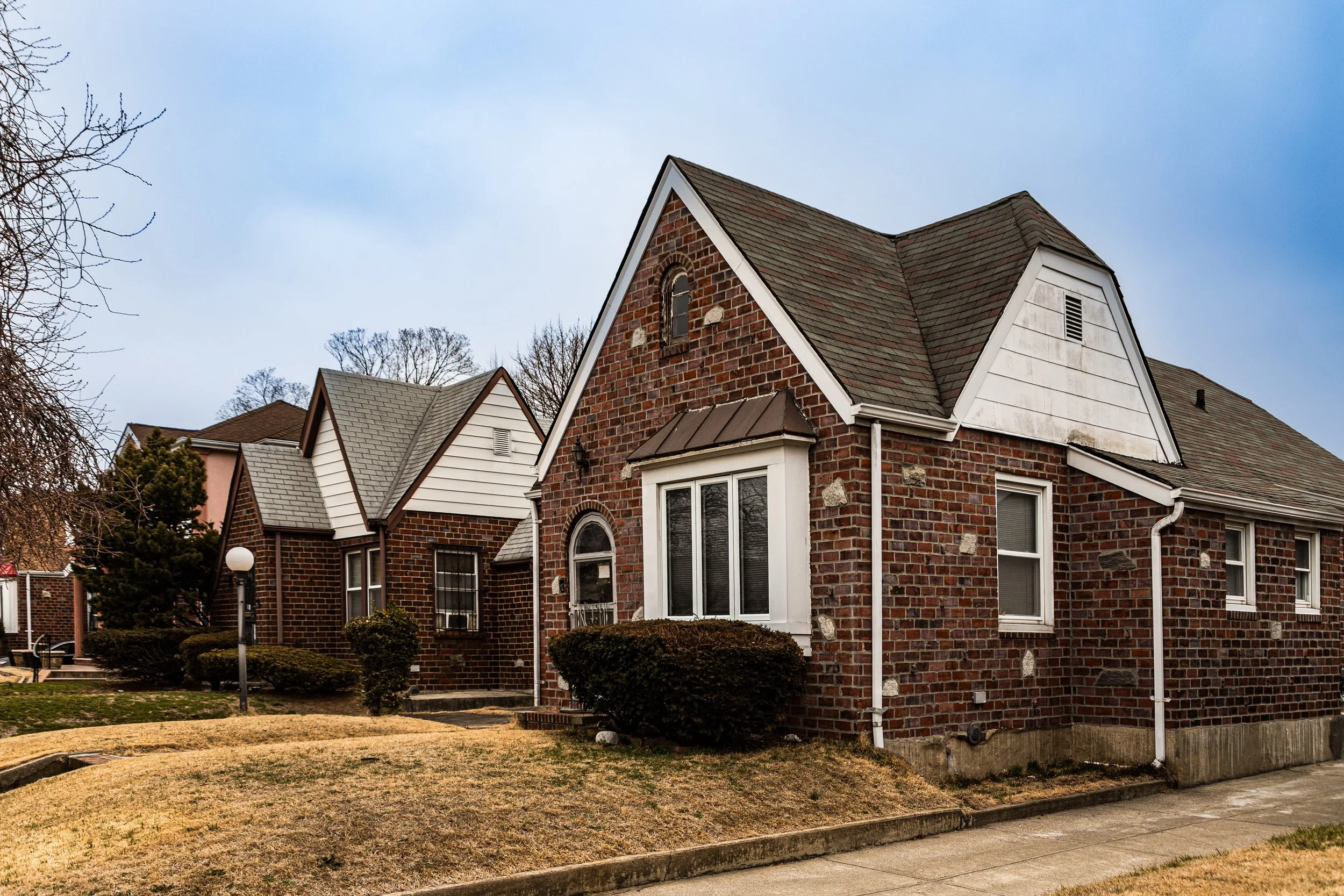
At the heart of Laurelton lies the Laurelton Parkway (now Merrick Boulevard), a landscaped boulevard that runs diagonally through the community, connecting it north to Springfield Gardens and south to Rosedale. The Laurelton Long Island Rail Road station, near 225th Street and 141st Road, provides direct access to Manhattan, linking the neighborhood’s suburban calm to the pulse of the city. The Belt Parkway and Springfield Boulevard frame the area’s eastern and western edges, ensuring mobility while preserving a contained residential core. Architecturally, Laurelton remains a showcase of early-to-mid-20th-century suburban housing—Tudor Revivals, Dutch Colonials, and brick Capes, most built between the 1920s and 1950s—each set back from quiet streets with hedges and driveways. The resulting landscape evokes the ideal of postwar American homeownership, uniquely expressed within New York City’s limits.
Etymology and Origins
The name “Laurelton” was chosen by the Laurelton Land Company, the developer responsible for the area’s early subdivision around 1905–1910. The name references both the natural laurel shrubs native to the area and the company’s desire to evoke elegance and greenery. Prior to its suburban development, the land was part of the Town of Jamaica, composed of farms, woodlots, and salt meadows extending toward Jamaica Bay.
At the turn of the 20th century, as Queens’ farmland began giving way to planned suburbs, the arrival of the Long Island Rail Road (LIRR) along the southern corridor made Laurelton a desirable location for commuters. Developers envisioned a model residential community, drawing on the Garden City ideals popularized in nearby areas like Forest Hills Gardens and Douglaston. Promotional materials described Laurelton as “a suburb of trees, gardens, and homes—half an hour from Broadway,” appealing to middle-class families seeking nature without distance from the metropolis.
The Neighborhood
Early 20th Century: A Planned Suburban Ideal
Laurelton’s initial growth came between 1910 and 1930, coinciding with the suburban expansion of southeastern Queens. Streets were laid out with intentional curves and cul-de-sacs—a departure from the rigid grid that characterized much of New York City. Developers planted laurel, linden, and maple trees along every block, ensuring a verdant environment that matched the community’s name.
The earliest homes were designed in a range of revival styles—Tudor, English Cottage, and Colonial Revival—constructed primarily of brick and stucco, often with steep gables and leaded windows. Large plots and zoning restrictions prohibited industrial use, creating a purely residential district that mirrored the suburban developments of Long Island rather than urban Queens. The Laurelton Station (opened 1907) made commuting practical, while the extension of Merrick Boulevard transformed the once-rural corridor into a landscaped parkway connecting Jamaica to the South Shore.
By the 1920s, Laurelton had established itself as a middle-class haven, home to teachers, shopkeepers, and city workers. Churches such as St. Luke’s Episcopal Church and Laurelton Reformed Church, along with civic organizations like the Laurelton Improvement Association, fostered a sense of close-knit community that remains integral to neighborhood life.
Mid-20th Century: Postwar Prosperity and Social Fabric
The decades following World War II brought a new wave of growth to Laurelton. Returning veterans and their families, aided by the G.I. Bill, purchased homes in the area, solidifying its identity as a stable, owner-occupied community. The construction of the Belt Parkway (1940) and the nearby Laurelton Parkway interchange enhanced accessibility, while neighborhood schools such as P.S. 132, J.H.S. 231, and Springfield Gardens High School became central institutions.
Through the 1950s and 1960s, Laurelton flourished as a symbol of middle-class suburban life within New York City. Tree-lined blocks hosted civic events, block parties, and youth sports leagues. The area’s shopping corridor along Merrick Boulevard and Francis Lewis Boulevard supported local businesses, from delicatessens and bakeries to family-owned hardware stores.
In the late 1960s and early 1970s, Laurelton underwent a profound demographic transformation as African-American and Caribbean-American families—many professionals, educators, and city employees—began moving in from other parts of Queens, Brooklyn, and the Bronx. Unlike many urban neighborhoods experiencing white flight, Laurelton’s transition was remarkably stable. Longtime residents sold homes to families who shared their civic values and commitment to upkeep, ensuring continuity rather than decline.
Laurelton Video Coming Soon
Late 20th Century: Community Pride and Preservation
By the 1980s and 1990s, Laurelton was widely recognized as one of the most well-maintained, middle-class Black neighborhoods in New York City—a community defined by its pride of ownership and intergenerational roots. Organizations such as the Laurelton Civic Association and Springfield Gardens–Laurelton Historical Society worked to preserve the area’s historic housing stock and tree canopy, while advocating for infrastructure improvements.
The neighborhood’s churches—St. Luke’s Episcopal, Allen A.M.E., and Greater Allen Cathedral of New York nearby—continued to serve as pillars of social and spiritual life. Annual street fairs, garden competitions, and school events reinforced the area’s small-town feel within a vast metropolis. Despite challenges such as rising property taxes and traffic congestion, Laurelton remained synonymous with quiet streets, strong families, and educational excellence.
21st Century: Renewal, Diversity, and Enduring Character
In the 21st century, Laurelton retains its reputation as a stable, green, and civically engaged enclave. While its population now reflects a broader mix—including Caribbean, West African, and South Asian-American families—the core values of community participation and neighborhood stewardship remain unchanged. New homeowners have continued to restore and modernize the area’s early 20th-century homes, preserving architectural integrity while adapting to contemporary needs.
Merrick Boulevard remains the neighborhood’s commercial lifeline, lined with small businesses, eateries, and service shops that reflect both heritage and global flavor. The LIRR Laurelton Station continues to connect residents to Manhattan in under 30 minutes, while proximity to the Belt Parkway and JFK International Airport ensures convenient travel. Local parks, including Laurelton Playground and Brookville Park, complement the tree-lined residential streets that define the community’s aesthetic identity.
Environmental initiatives led by civic groups—tree replanting, rain garden installations, and block beautification programs—have strengthened Laurelton’s role as a model for sustainable urban suburbia. Schools remain high-performing, and community activism continues to protect zoning laws that preserve the neighborhood’s single-family scale and residential character.
Laurelton Photo Gallery
Spirit and Legacy
Laurelton’s spirit is rooted in the ideals of home, heritage, and harmony. Conceived as a “suburb within the city,” it has fulfilled that promise for more than a century—first for early 20th-century commuters, then for the generations of professionals and families who made it their enduring home.
New York City
Use this custom Google map to explore where every neighborhood in all five boroughs of New York City is located.
The Five Boroughs
One of New York City’s unique qualities is its organization in to 5 boroughs: Manhattan, Brooklyn, Queens, The Bronx, and Staten Island. These boroughs are part pragmatic administrative districts, and part vestiges of the region’s past. Each borough is an entire county in New York State - in fact, Brooklyn is, officially, Kings County, while Staten Island is, officially Richmond County. But that’s not the whole story …
Initially, New York City was located on the southern tip of Manhattan (now the Financial District) that was once the Dutch colony of New Amsterdam. Across the East River, another city was rising: Brooklyn. In time, the city planners realized that unification between the rapidly rising cities would create commercial and industrial opportunities - through streamlined administration of the region.
So powerful was the pull of unification between New York and Brooklyn that three more counties were pulled into the unification: The Bronx, Queens, and Staten Island. And on January 1, 1898, the City of New York unified two cities and three counties into one Greater City of New York - containing the five boroughs we know today.
But because each borough developed differently and distinctly until unification, their neighborhoods likewise uniquely developed. Today, there are nearly 390 neighborhoods, each with their own histories, cultures, cuisines, and personalities - and each with residents who are fiercely proud of their corner of The Big Apple.


