
ALLEY POND PARK
Queens
Part of an ongoing project to walk and photograph every neighborhood in New York City, this page explores Alley Pond Park through history, fieldwork, and photography.

Map
Geographic Setting
Stretching across the neighborhoods of Douglaston, Bayside, Oakland Gardens, and Hollis Hills, Alley Pond Park occupies the rolling heart of northeastern Queens, bounded generally by Union Turnpike to the south, Winchester Boulevard to the west, Douglaston Parkway to the east, and Northern Boulevard to the north. Encompassing more than 650 acres, it is the second-largest park in Queens—a vast green corridor that bridges the borough’s suburban uplands and the tidal inlets of Little Neck Bay. Its terrain is a mosaic of salt marshes, freshwater ponds, kettle lakes, meadows, forests, and glacial ridges, all remnants of the last Ice Age. This diversity makes Alley Pond Park one of the most ecologically rich landscapes in New York City.
Traversed by the Cross Island Parkway, the park’s geography divides naturally between east and west. The eastern sections—home to Douglaston Park Golf Course and the restored wetlands near Northern Boulevard—slope toward the bay, while the western portions contain dense woodlands and the Alley Pond Environmental Center, an educational and ecological hub along Northern Boulevard. Trails crisscross the park from Cloverdale Boulevard to Springfield Boulevard, linking playgrounds, athletic fields, nature preserves, and the famous Alley Giant, an ancient tulip tree estimated at over 350 years old and believed to be among the oldest living organisms in New York City.
Identity
Etymology and Origins
The name “Alley Pond” derives from the colonial-era “The Alley,” an early road and drainage corridor that ran through a natural valley—or “alley”—formed by glacial action. The “pond” refers to the numerous kettle ponds created when retreating glaciers left behind massive ice blocks that melted into deep basins. These ponds, fed by underground springs, still define the landscape and give the park its name.
Historically, the region was the territory of the Matinecock people, who used its forests and marshes for hunting, fishing, and shellfishing long before Dutch colonists arrived in the 17th century. In 1654, English settler Thomas Hicks acquired much of the land for farming, and the area remained agrarian for nearly 250 years. Creeks, mills, and small homesteads dotted the valley, sustained by freshwater sources like Pond Creek (later called Alley Creek).
The city’s acquisition of the land began in 1929, spearheaded by Parks Commissioner Robert Moses, who envisioned a greenbelt stretching from Flushing Meadows to Little Neck Bay. The construction of the Cross Island Parkway through the park during the late 1930s simultaneously provided access to the waterfront and permanently divided its ecosystems—an enduring symbol of both the city’s park-building ambition and its tension with nature.
Alley Pond Park is defined by the vast natural landscape at its center: a 655-acre preserve of wetlands, woods, meadows, kettle ponds, and tidal creeks that sets it apart from the surrounding neighborhoods of eastern Queens. Rather than taking its character from storefronts, housing stock, or a conventional street grid, the area is shaped by ecology, topography, and the unusual sense of quiet that settles over its trails, picnic grounds, and marsh edges.
What makes Alley Pond Park distinct is the way it feels both deeply embedded in Queens and curiously removed from it. The park sits among residential neighborhoods and major roads, yet its interior spaces often feel hushed, spacious, and unexpectedly ancient, with glacial landforms, old-growth trees, and bird-rich wetlands giving the landscape a character far older than the city around it. Its identity rests not in density or urban rhythm, but in refuge, continuity, and the persistence of open land within an otherwise developed borough.

Neighborhood Identity
Visual Identity
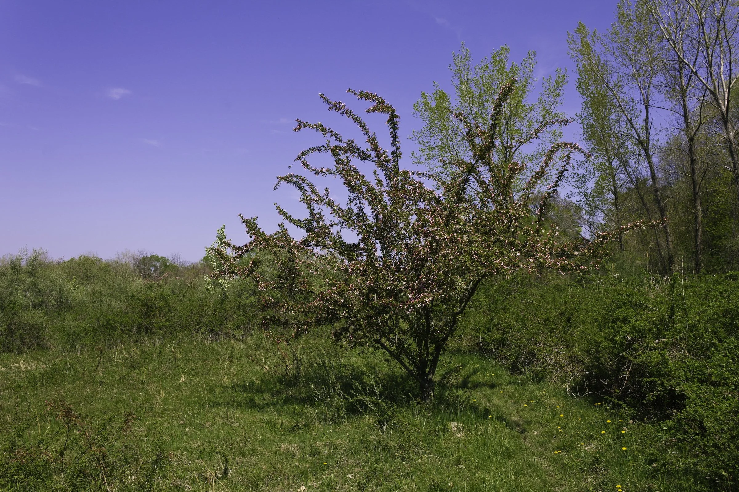
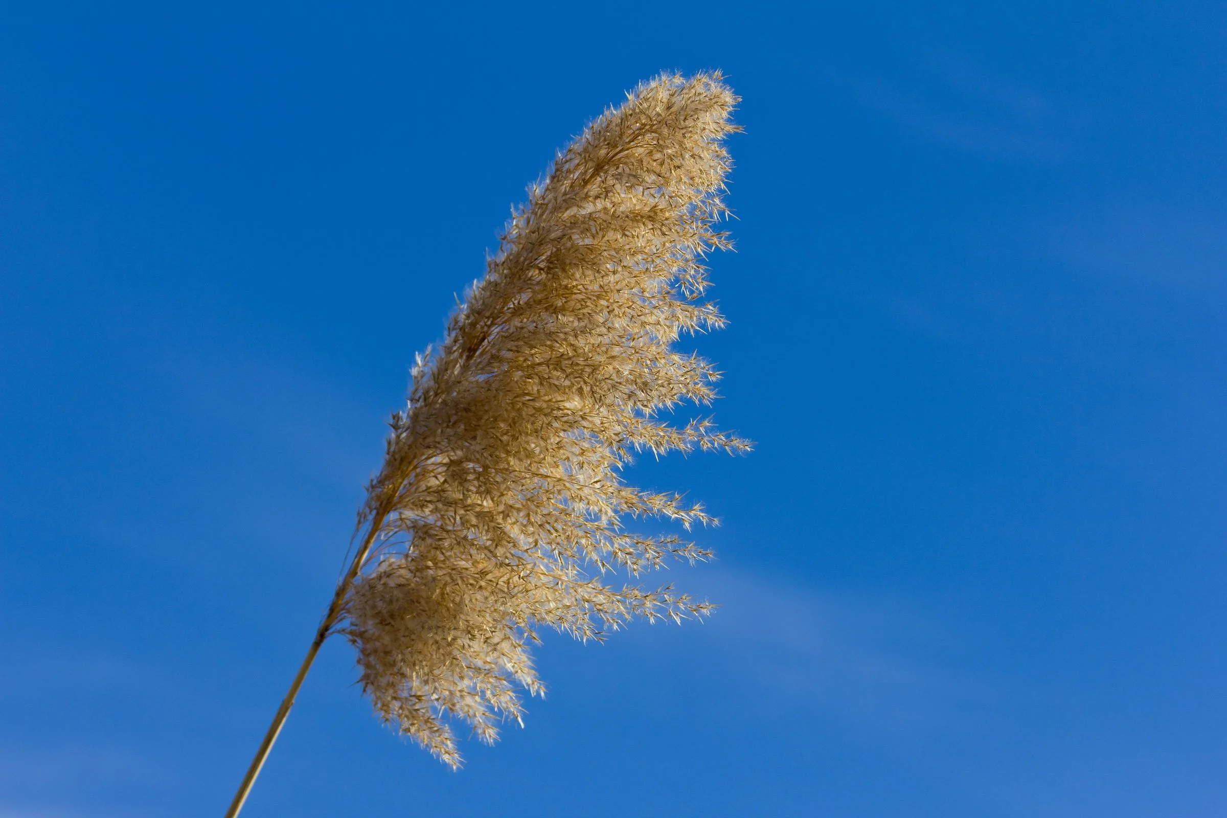
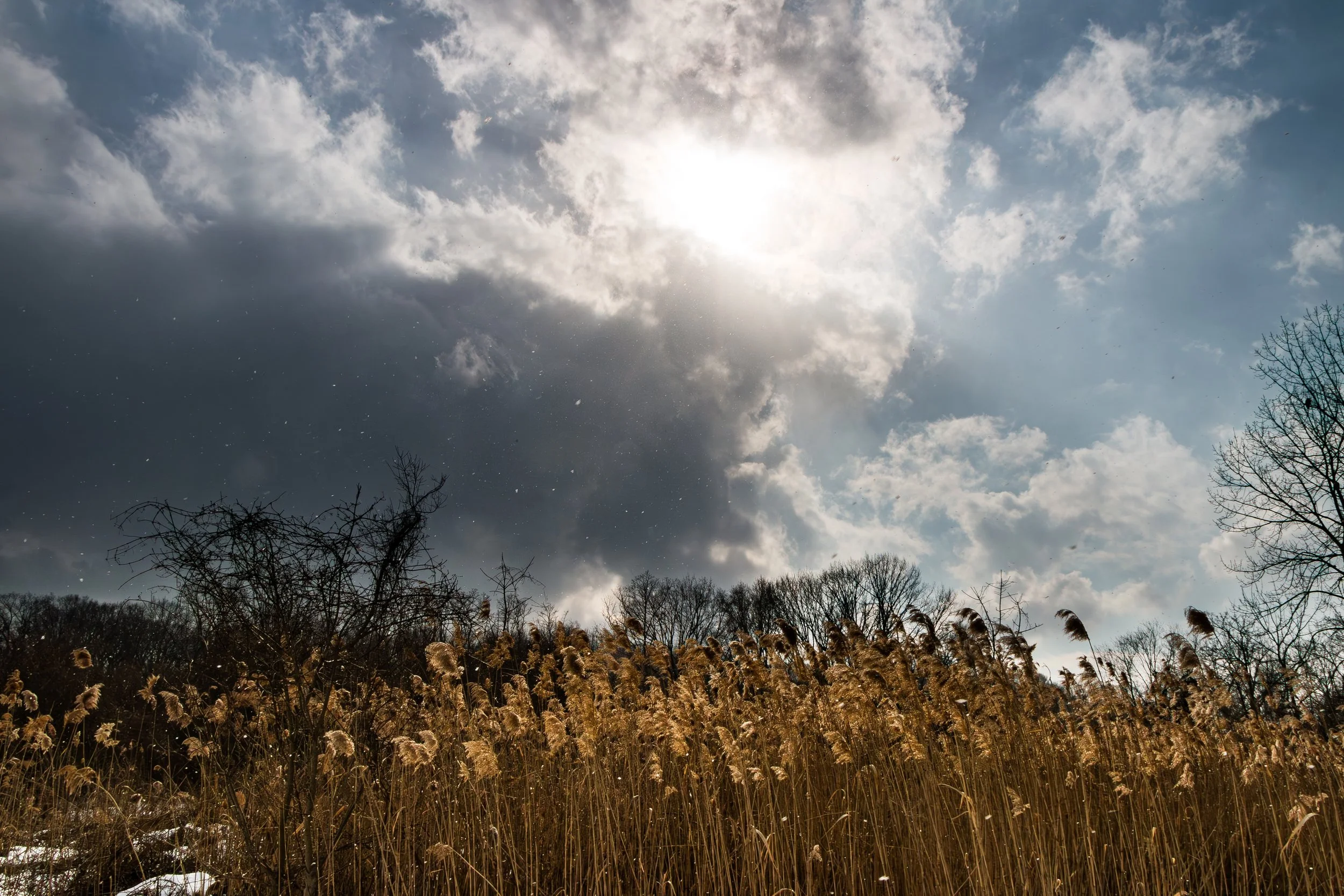
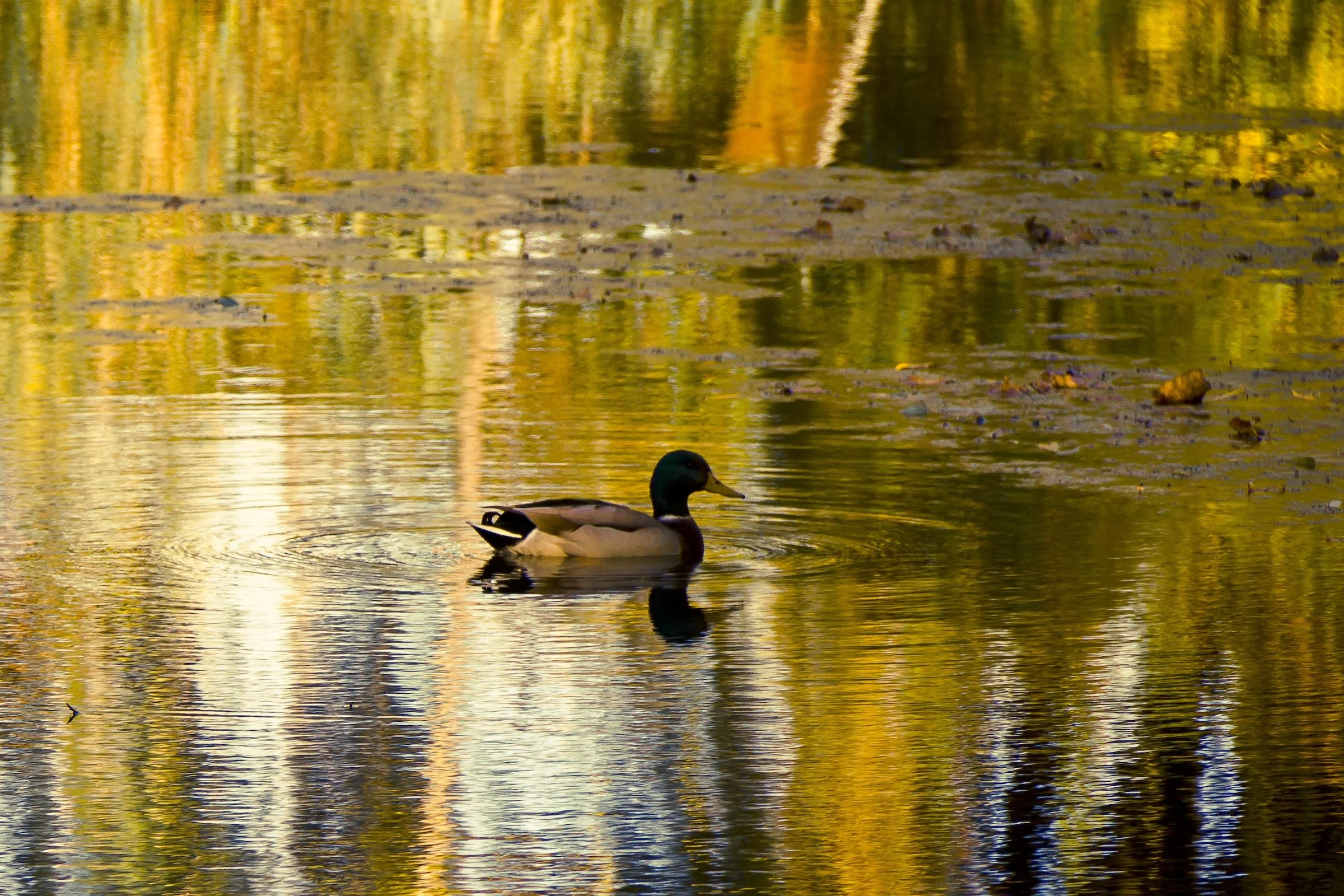
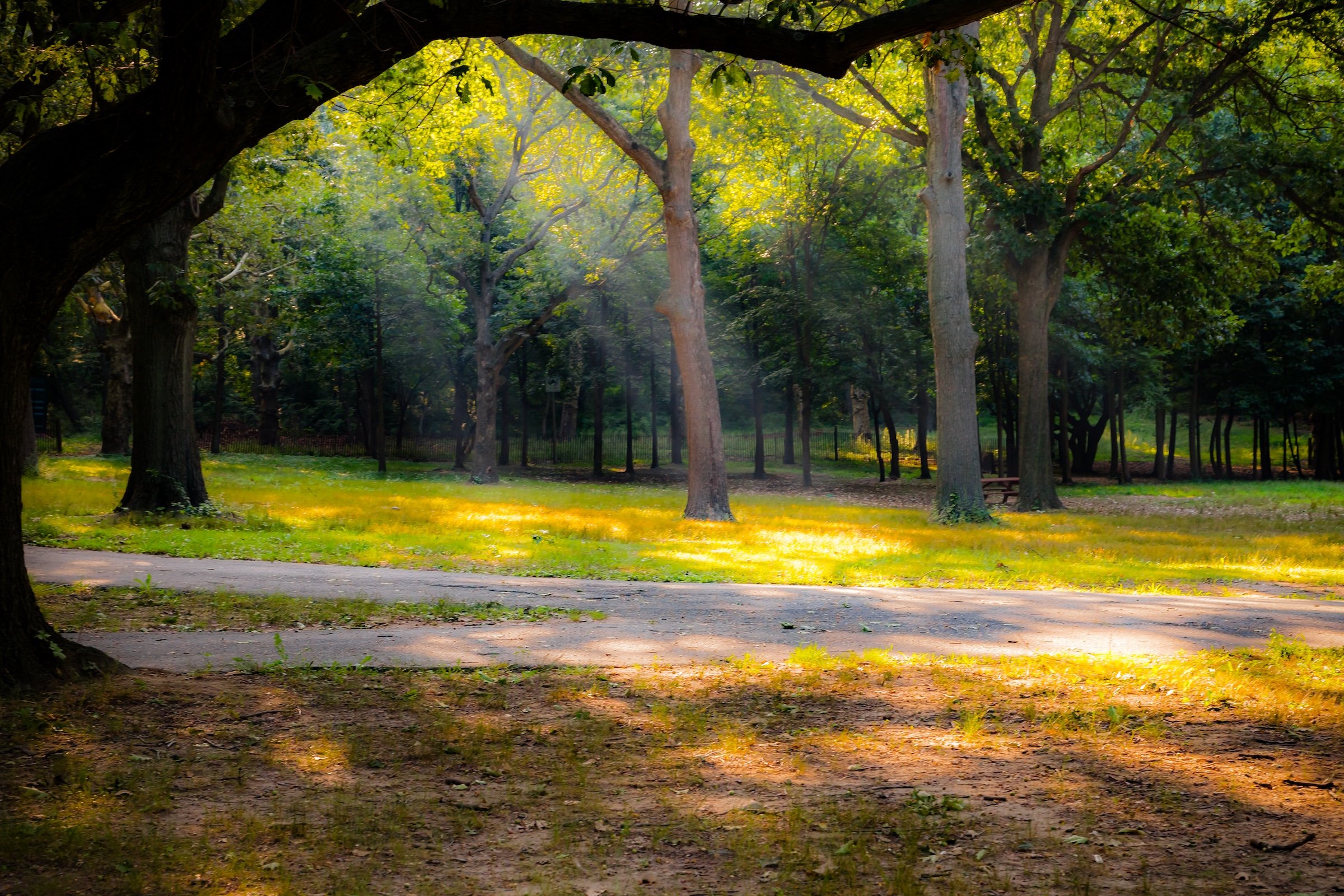
Alley Pond Park is defined less by monument or skyline than by atmosphere: a landscape of wetlands, kettle ponds, meadow edges, and old-growth trees that feels strikingly removed from the surrounding city. Its visual character emerges through transitions — from shaded woodland interiors to open marshland, from reflective water to tall grasses, from dense canopy to broad expanses of sky.
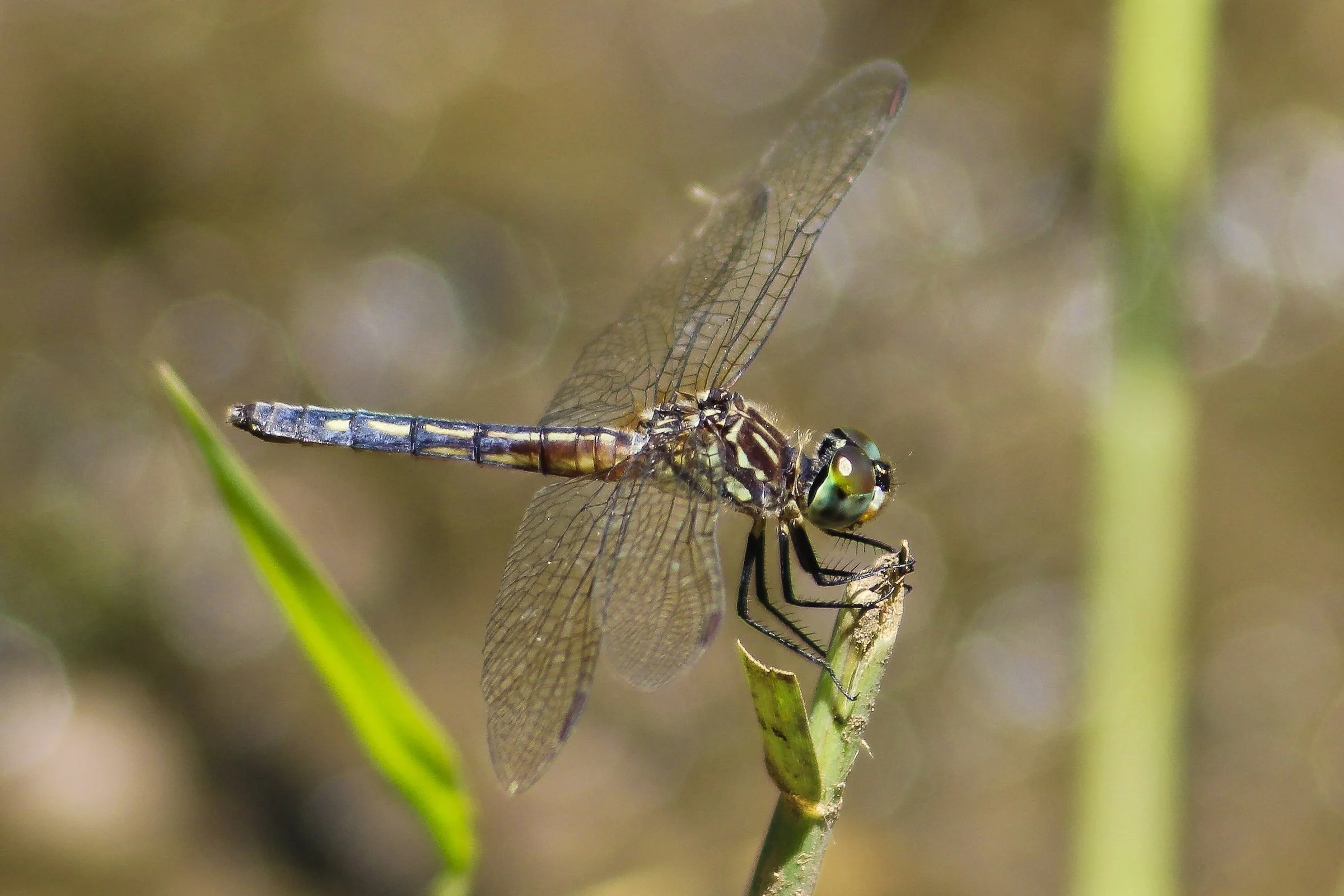
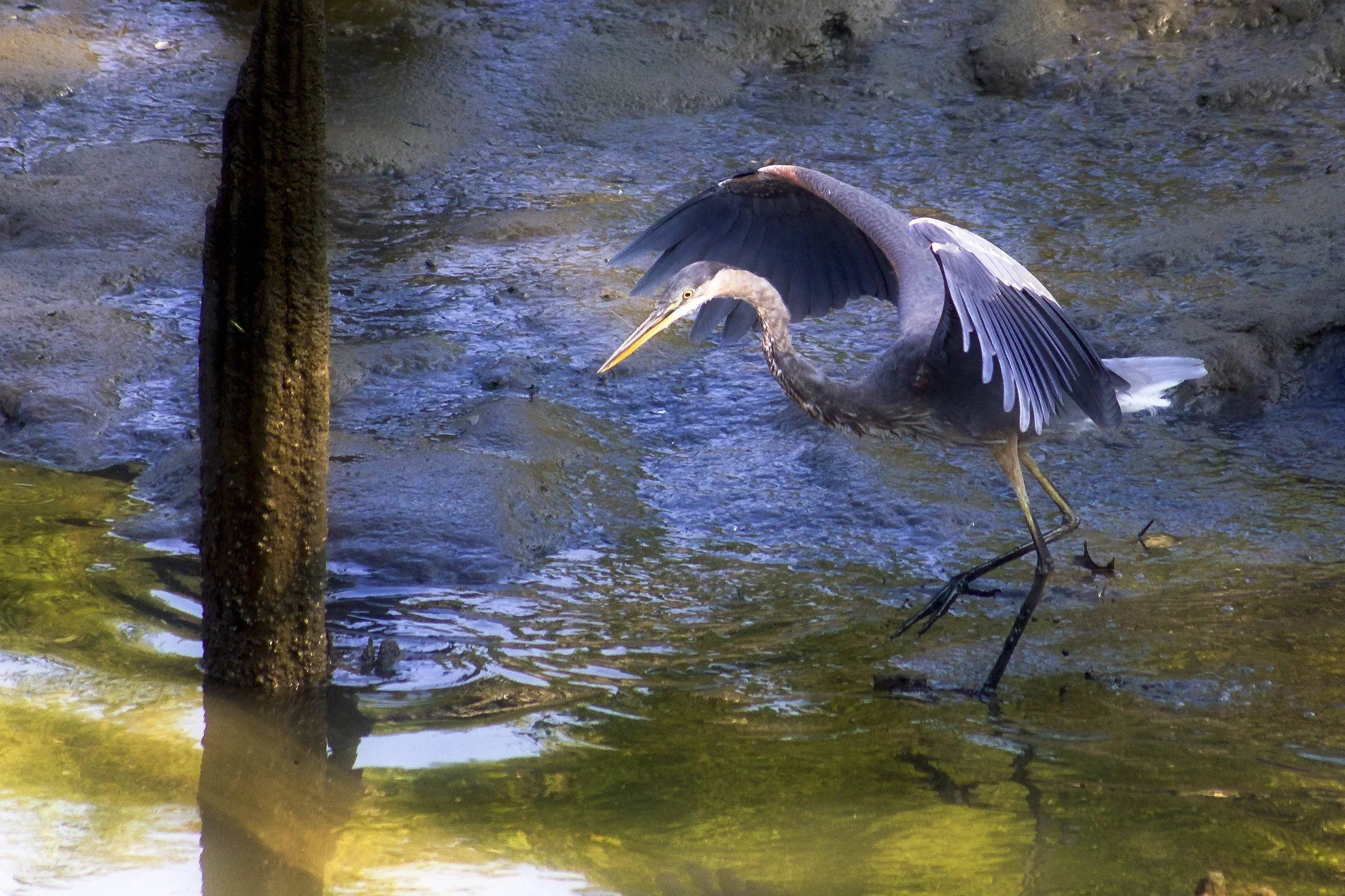
What distinguishes the park most is the softness of its light and the quiet complexity of its natural forms. Bare branches, reeds, and tangled shoreline growth create intricate patterns across the landscape, while seasonal shifts alter the park’s palette from muted winter browns and silvers to vivid spring and summer greens. Waterfowl, marsh edges, and glacial ponds lend the park a sense of stillness and ecological continuity that makes it feel older, deeper, and more elemental than a typical urban green space.
There is also a striking contrast between enclosure and openness throughout Alley Pond Park. In its interior, filtered light and humidity soften the woods into something hushed and almost hazy; at its edges, sky and sunlight widen the scene into something bright, windswept, and expansive. The result is a park whose identity rests not in spectacle, but in a rare combination of quiet, habitat, and geologic memory — a place where Queens briefly gives way to something more ancient and more contemplative.

History
Early History: From Farmland to Public Reserve
Before its transformation into a park, the valley that became Alley Pond was home to a patchwork of farms, mills, and small communities. The Allen family—whose name may have evolved into “Alley”—operated a gristmill along the creek during the 18th century, using the tidal flow of Little Neck Bay to power their operations. Through the 19th century, the area’s freshwater ponds supplied ice to New York City, while its meadows were used for grazing. The ecological diversity of the site, however, made it difficult to fully industrialize, and by the early 20th century the valley remained largely undeveloped.
The 1920s saw rising concern for the city’s vanishing natural areas. Civic groups and naturalists, including the Queens County Bird Club, advocated for preserving Alley Pond as a refuge for wildlife. In 1929, New York City formally dedicated Alley Pond Park, integrating the area into its expanding park system. Moses’ later vision connected it with the Belt Parkway System, positioning the park as both a recreational amenity and a scenic corridor for drivers.
Following its creation, Alley Pond Park became one of Queens’ principal recreational landscapes. The Long Island Motor Parkway, one of America’s earliest private automobile roadways built by William K. Vanderbilt Jr. in 1908, ran through the park’s southern section and later became a pedestrian and cycling trail. Playgrounds, baseball fields, and picnic areas were established near Winchester Boulevard and Springfield Boulevard, while the central wetlands remained largely untouched.
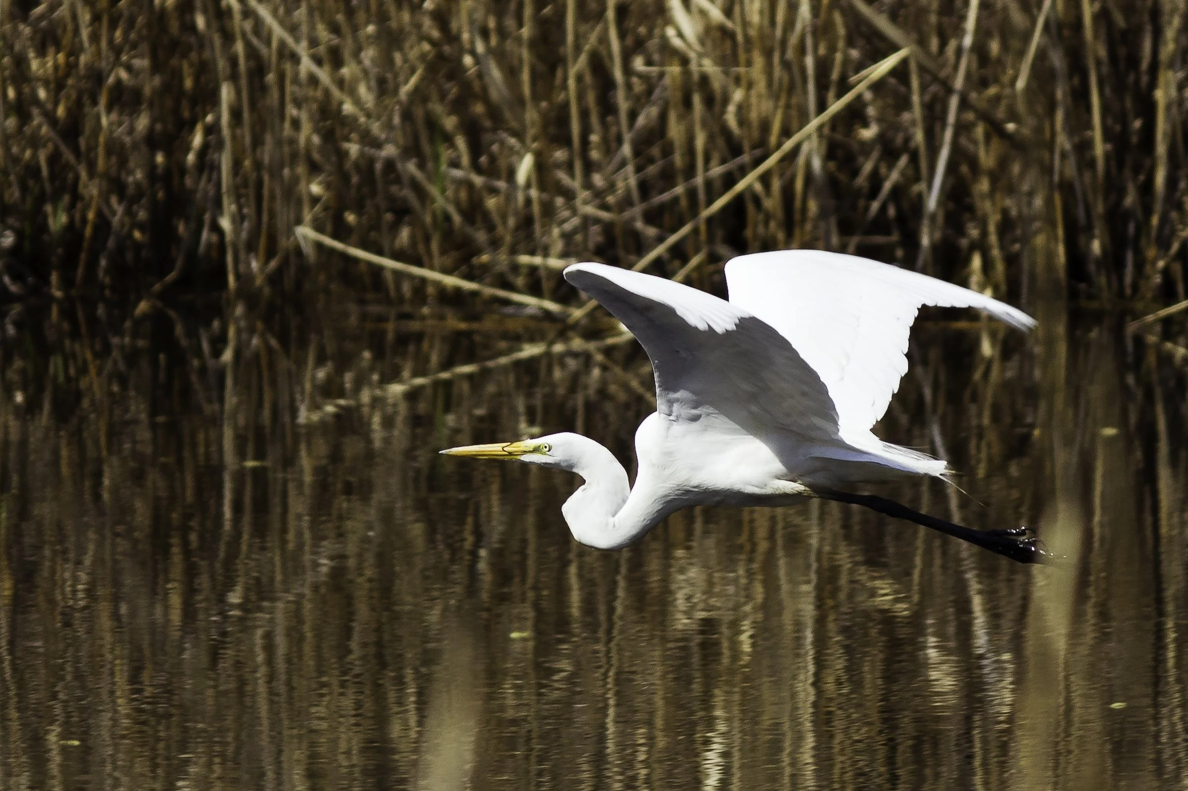
During the 1950s–1970s, urbanization around the park intensified. The construction of the Long Island Expressway and the expansion of nearby residential neighborhoods—Bayside Hills, Hollis Hills, and Douglaston—brought new users to the park but also environmental strain. Dumping, invasive species, and neglect took a toll on its wetlands and ponds. Nevertheless, its size and variety of habitats made it indispensable for local wildlife; herons, egrets, and migratory birds continued to find refuge in its marshes, even as highways roared overhead.
Mid-20th Century: Recreation and Infrastructure
Late 20th Century: Conservation and Environmental Education
By the late 1970s, community activists and educators recognized the park’s unique ecological importance and mobilized to restore it. The founding of the Alley Pond Environmental Center (APEC) in 1972 marked a turning point. Established in partnership with the New York City Department of Parks & Recreation, APEC transformed a former Parks Department building into a learning center dedicated to environmental education and conservation. Its programs introduced generations of schoolchildren to the park’s ecosystems, from freshwater marshes and forests to saltwater wetlands.
Throughout the 1980s and 1990s, city and state agencies worked with local groups to restore degraded habitats, remove invasive vegetation, and improve water quality in Alley Creek and its ponds. The park became a model for urban ecological management. Wetland restoration projects reconnected tidal flows, expanded bird habitats, and protected the park from further encroachment. The rediscovery and preservation of the Alley Giant Tulip Tree, now a protected natural landmark, underscored the park’s role as a living archive of precolonial nature within the modern city.
In the 2000s and 2010s, Alley Pond Park entered a new era of investment and renewal. The Alley Creek Restoration Project, undertaken jointly by the U.S. Army Corps of Engineers and the city, revitalized salt marshes, improved tidal exchange, and established new stormwater controls to enhance water quality in Little Neck Bay. The Northeast Queens Greenway, connecting Joe Michael’s Mile on the waterfront to Cunningham Park, integrated Alley Pond into a continuous corridor for cyclists and pedestrians.
The new APEC building, completed in 2021, embodies the park’s forward-looking spirit: a sustainably designed education and visitor center powered by renewable energy and surrounded by restored wetlands. Its classrooms and trails draw visitors from across the city to study ecology, wildlife, and environmental stewardship. The park’s diverse ecosystems—oak-hickory forests, kettle ponds like Oakland Lake, and the salt marshes of Alley Creek—remain critical habitats amid the dense urban matrix.
Today, Alley Pond Park stands not only as a recreational oasis but as a crucial ecological buffer in an age of climate change. Its wetlands absorb floodwaters from coastal storms, its trees filter air for surrounding neighborhoods, and its trails offer a refuge from urban life. The park embodies the balance between nature and city that has defined Queens for more than a century.
21st Century: Renewal, Connectivity, and Climate Resilience
Spirit and Legacy
Alley Pond Park endures as one of Queens’ most quietly distinctive landscapes, not because it imposes itself on the borough, but because it preserves something older beneath it. Its wetlands, kettle ponds, woodlands, and meadow edges still carry the logic of glacial terrain, giving the park a physical character that feels shaped as much by deep time as by modern planning. In a borough defined by neighborhoods, roads, and steady development, Alley Pond remains a place where land, water, and habitat still speak with unusual clarity.
What gives the park its lasting character is this sense of ecological continuity. Birdlife, reeds, reflective water, old trees, and shifting light do more than create scenery; they sustain the impression that this is a living landscape rather than simply a designed amenity. Even where paths, picnic grounds, and the Environmental Center make the park accessible and legible to the public, its identity is never reduced to recreation alone. The natural systems remain visible, and that visibility gives Alley Pond Park a rare depth within the city.
That enduring depth is part of what makes the park so compelling photographically. Its character does not depend on spectacle or singular landmarks, but on atmosphere, transition, and the subtle persistence of form: branches against sky, light across wet grass, birds moving through still water, shade giving way to open marsh. Alley Pond Park reveals itself gradually, and in doing so, it offers a different kind of legacy — one rooted not only in preservation, but in sustained attention.
Photography
Through The Lens
There are three distinct sections of Alley Pond Park that warrant attention: Alley Pond Environmental Center and its nature trails, the forested walkways and picnic areas of the main park, and the historic Vanderbilt Motor Parkway. As you explore and capture the sights, keep these photographic strategies in mind:
Nature As Stage - Photography in which trees, reeds, water, and other natural elements create a setting that frames, highlights, or theatrically presents the subject.
Painting With Light - A way of seeing in which natural sunlight turns ordinary scenes luminous, atmospheric, and almost painterly.
Sky Dramatic - Images in which the sky becomes the dominant expressive force of the frame through cloud, light, weather, or atmospheric scale.
Sun Dapples - Photographs shaped by scattered patches of sunlight and shade, where filtered light creates a shifting, mottled pattern across the scene.
Sungleams - Direct-light photographs in which the sun enters the frame and reshapes it through rays, flare, halos, or glare.
Of course, these are just the beginning - and hardly the only ways to see Alley Pond Park. I encourage you to experiment and find your own personal Photographic Lexicon.
If you visit Alley Pond Park, these ideas can help inspire your own photography.

Alley Pond Park Video Coming Soon
Alley Pond Park Photo Gallery
Alley Pond Park Field Notes
-
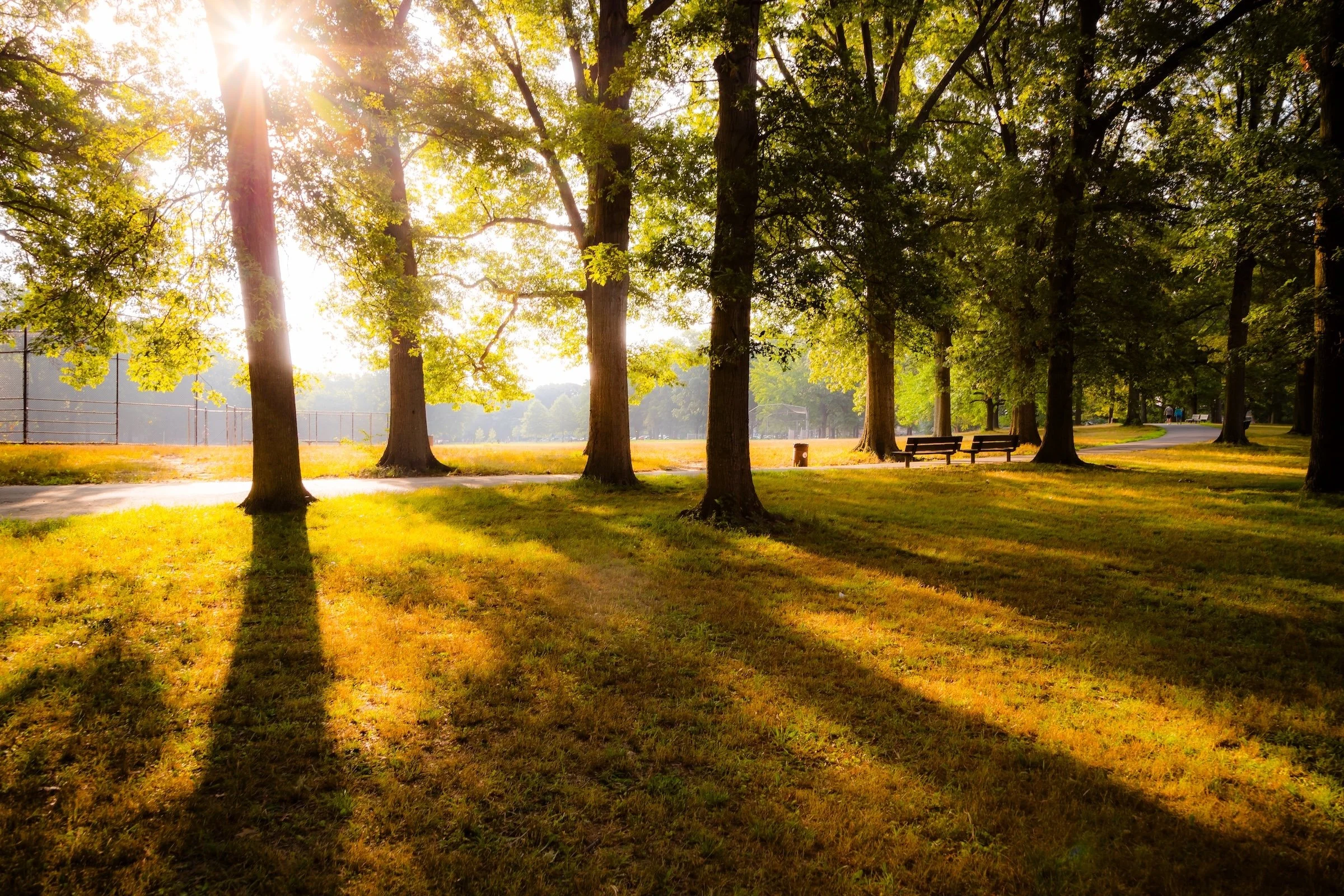
Field Note: August 5, 2023 | 07:58 AM
Conditions: 73°F | Humidity: 72%.
Within the park's interior, the glacial kettle ponds acted as humidity traps, creating a soft, hazy light that filtered through the old-growth oaks. The transition from the park's dense shade to the sun-drenched edges of Oakland Gardens highlighted the day's exceptional "picture-perfect" clarity.
There is a fleeting window in Queens where the humidity of August hasn't yet heavy-set, and the morning sun hits the canopy of Alley Pond Park at a perfect oblique angle. Arriving just before 8:00 AM, I watched the light break through the oaks and tulip trees, casting long, dramatic shadows across the wet grass. It’s in these quiet, golden moments that the park feels less like a city escape and more like the ancient glacial valley it actually is.
Other neighborhoods visited:
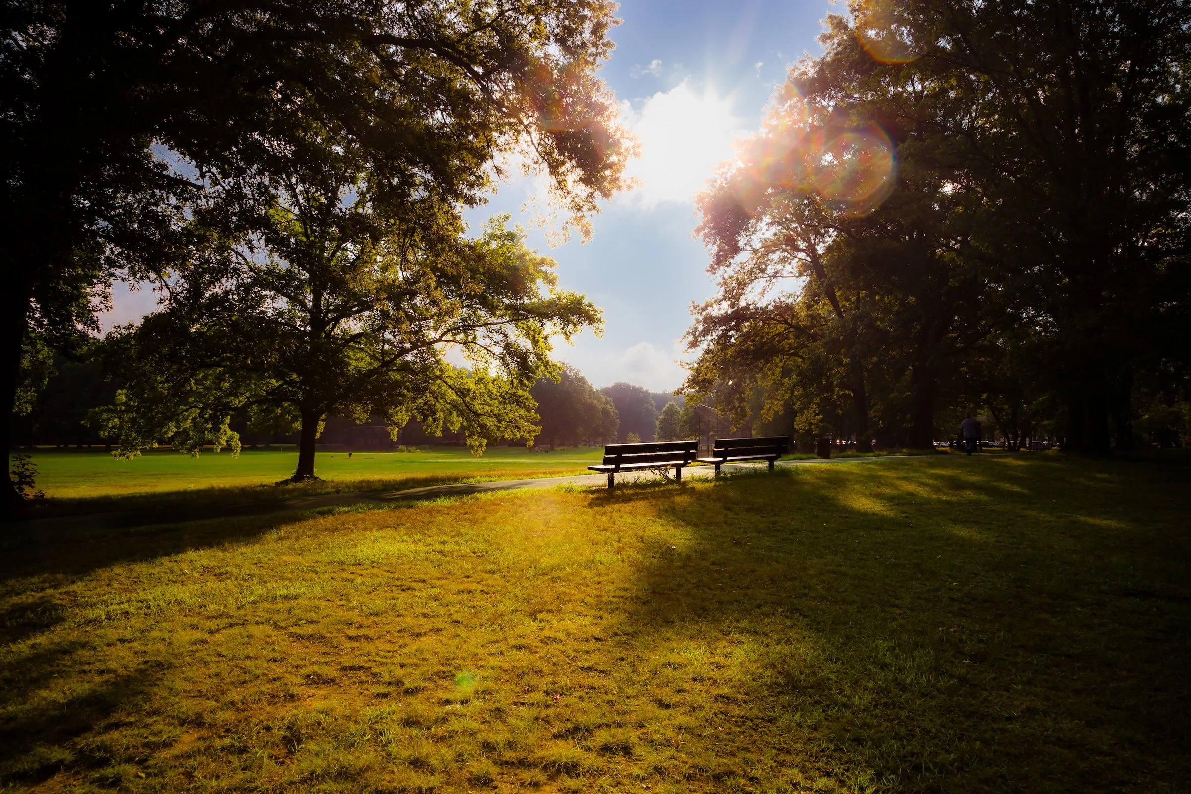
Morning Benches - Click To Purchase Print
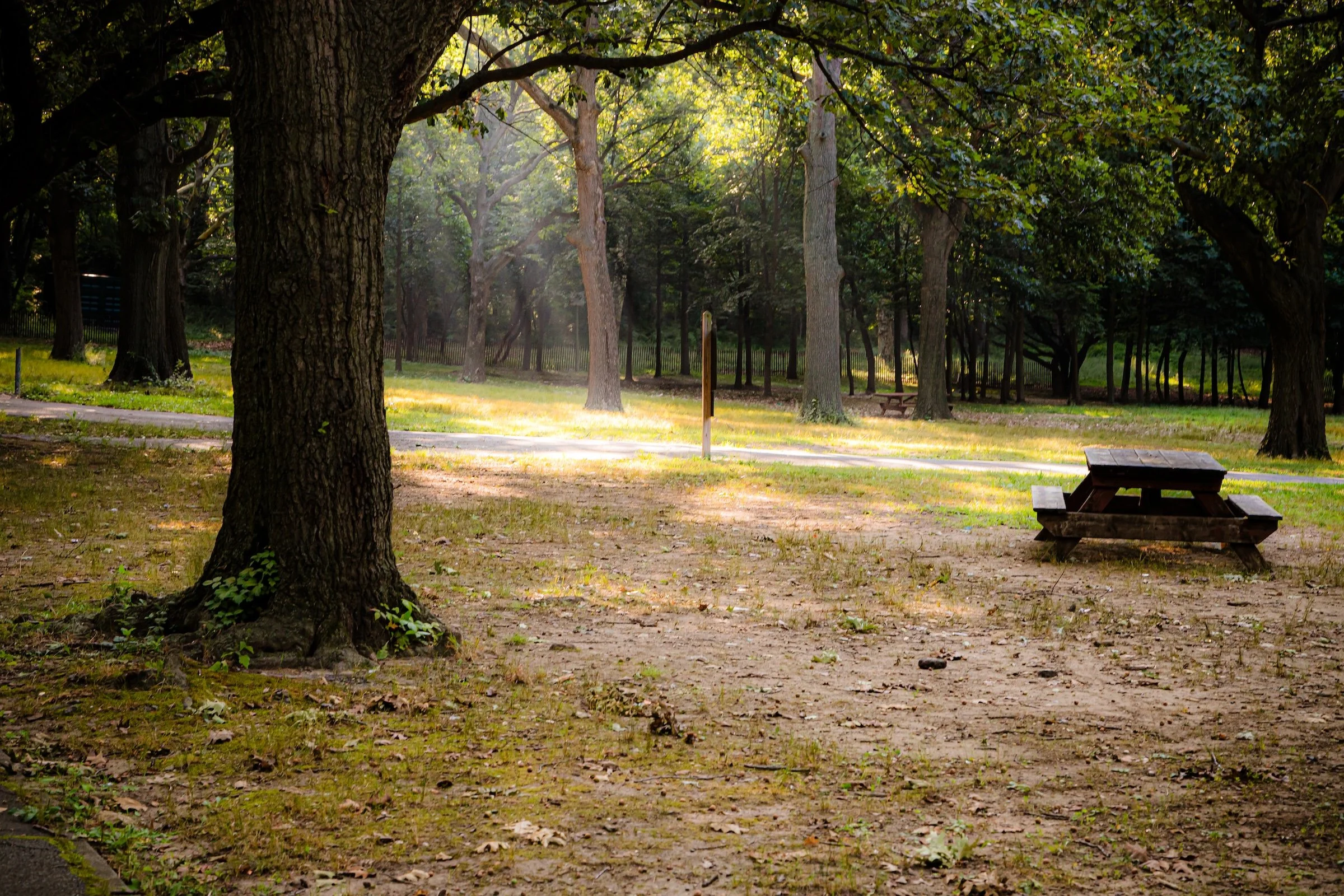
Morning Glade - Click To Purchase Print
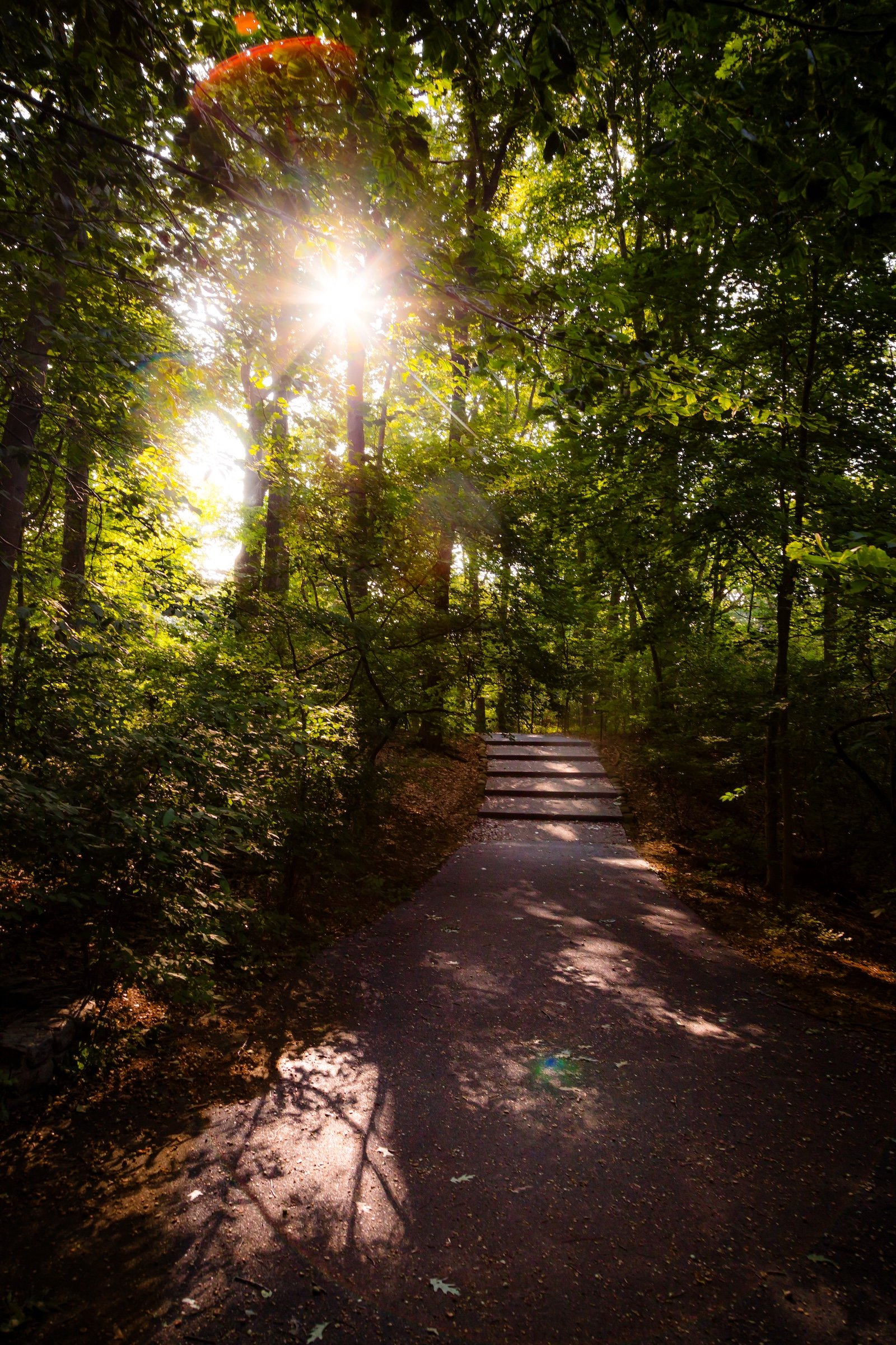
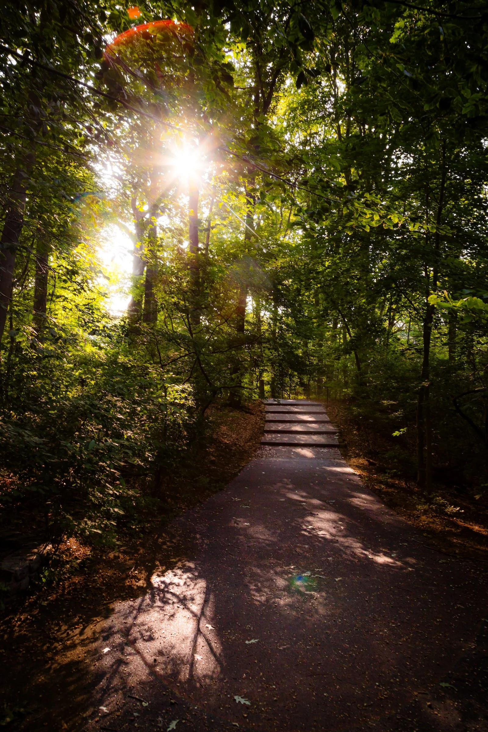
Steps Sunburst - Click To Purchase Print
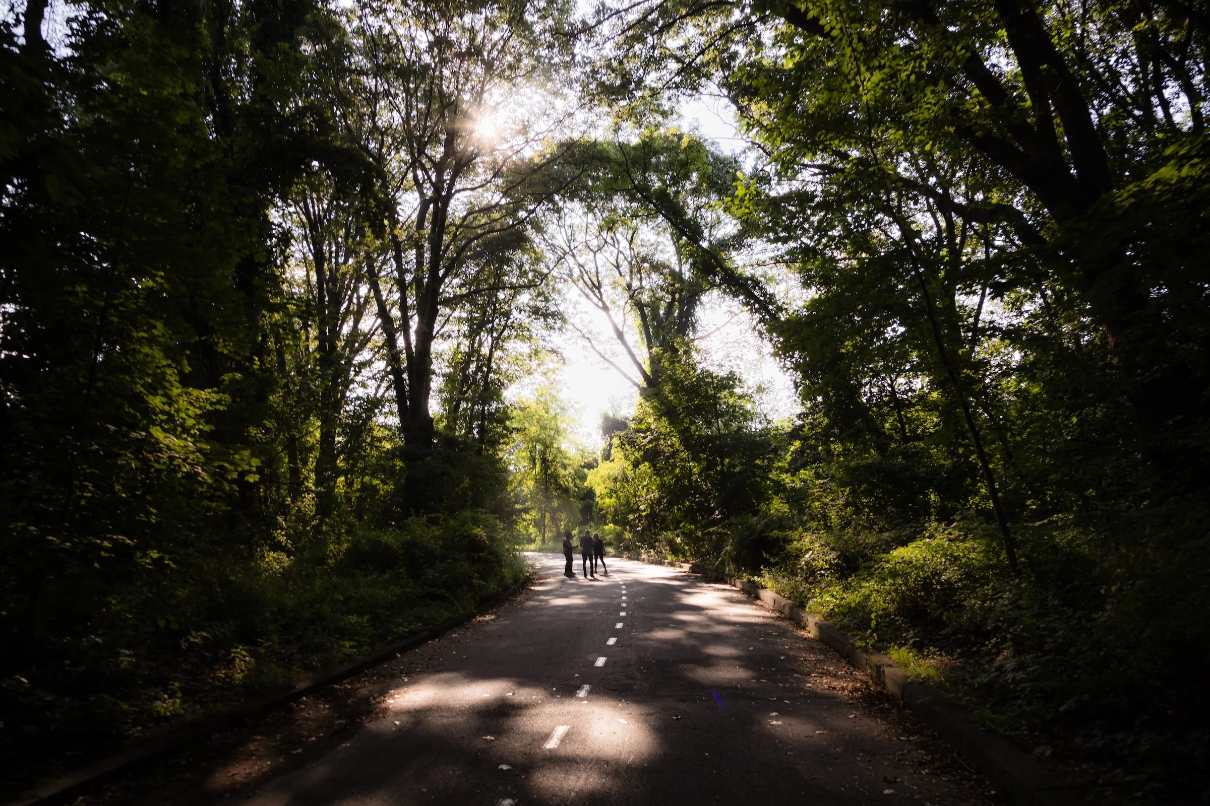
Standing In The Light - Click To Purchase Print
Use this custom Google map to explore where every neighborhood in all five boroughs of New York City is located.
The Five Boroughs
One of New York City’s unique qualities is its organization in to 5 boroughs: Manhattan, Brooklyn, Queens, The Bronx, and Staten Island. These boroughs are part pragmatic administrative districts, and part vestiges of the region’s past. Each borough is an entire county in New York State - in fact, Brooklyn is, officially, Kings County, while Staten Island is, officially Richmond County. But that’s not the whole story …
Initially, New York City was located on the southern tip of Manhattan (now the Financial District) that was once the Dutch colony of New Amsterdam. Across the East River, another city was rising: Brooklyn. In time, the city planners realized that unification between the rapidly rising cities would create commercial and industrial opportunities - through streamlined administration of the region.
So powerful was the pull of unification between New York and Brooklyn that three more counties were pulled into the unification: The Bronx, Queens, and Staten Island. And on January 1, 1898, the City of New York unified two cities and three counties into one Greater City of New York - containing the five boroughs we know today.
But because each borough developed differently and distinctly until unification, their neighborhoods likewise uniquely developed. Today, there are nearly 390 neighborhoods, each with their own histories, cultures, cuisines, and personalities - and each with residents who are fiercely proud of their corner of The Big Apple.


